My apologies that I’ve been very quiet here on Georneys recently. My travel and work schedule were extremely hectic during the past month… plus I was working on a couple of scientific papers related to my PhD thesis research. However, life is a bit calmer now, so hopefully I’ll catch up on some blogging soon! I want to share some more pictures from my trip to Australia, amongst other things.
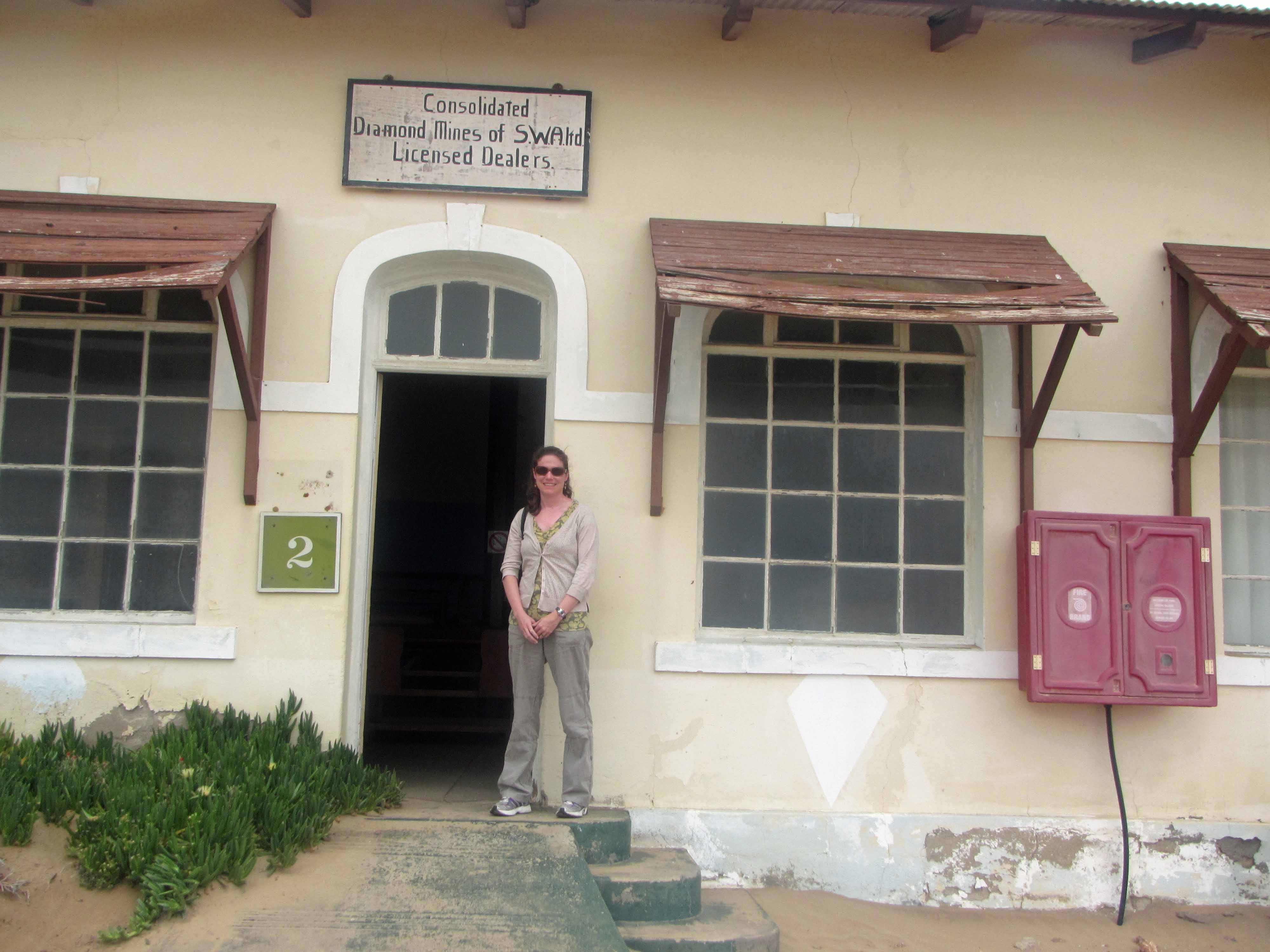
I’ll start with a few pictures from my recent trip to Namibia. Recently, I had the good fortune to spend a couple of weeks in the Sperrgebiet in Namibia doing some fieldwork on behalf of De Beers. I do not blog about my industry work here on Georneys (unless the work is published and thus in the open domain), so I can’t share the details of my trip. However, I can share a few pictures of some of the “tourist attractions” that I saw during my field work.
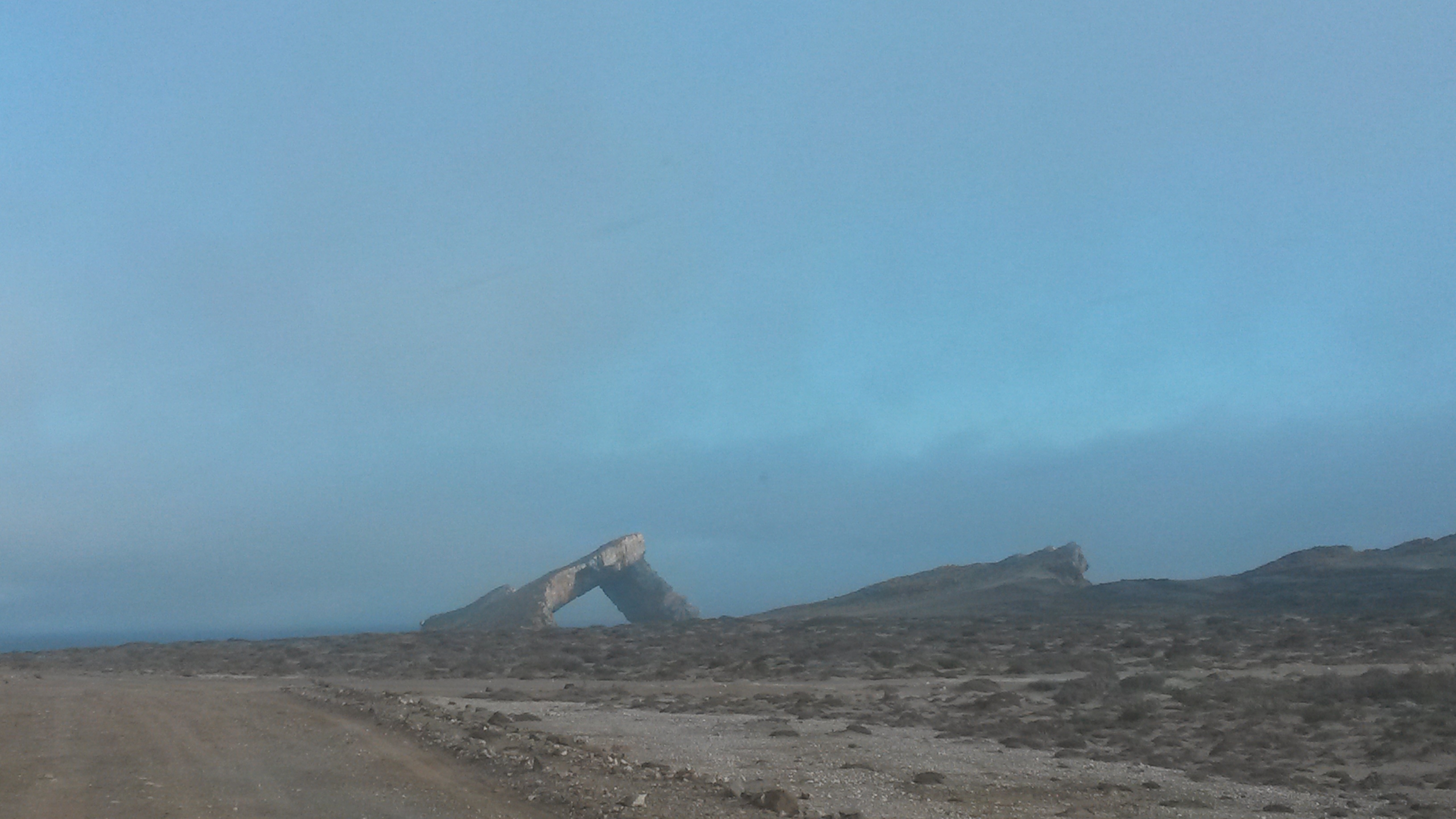
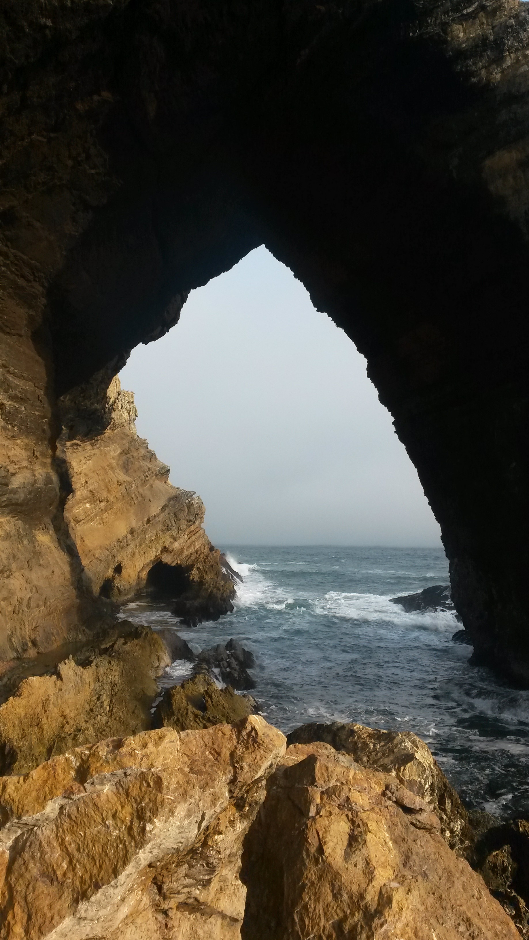
Sperrgebiet means “Prohibited Area” in German (the Germans colonized Namibia, so some German words and town names are still found in the country). The Sperrgebiet is an area in southern Namibia (stretching between Lüderitz and Oranjemund) where very rich placer diamond deposits are found. Since the early 1900s, access to this area has been highly restricted. Even for De Beers employees, special police clearances and permits are required to enter the area, and security remains strict. However, for those who do have access, the Sperrgebiet is a fascinating and magical place. Aside from the fantastic hard rock and sedimentary geology (and wildlife!) that one can see, the area contains a number of historical and archaeological sites. There are a number of abandoned diamond mining “Ghost Towns” that are weathering away in the desert, pretty much undisturbed (by humans, anyway) since they were abandoned tens of years to more than a hundred years ago. For the general public, it is extremely difficult to enter the Sperrgebiet. However, there is one tour company that operates a day trip (from Lüderitz) to Pamona, one of the abandoned diamond mining towns, and the Bogenfels Rock Arch, which is the subject of today’s post. If you ever find yourself in southern Namibia, I highly recommend the tour although you must remember to submit paperwork for the tour well in advance. Even tourists require a permit to enter the Sperrgebiet!
Without further ado, I present a few more pictures of the impressive Bogenfels Rock Arch below. From what I understand “Bogenfels” actually means “Rock Arch” in German. Certainly, the arch is an impressive feature located right on the coastline.
Bogenfels Rock Arch #2 – from a distance.Bogenfels Rock Arch #3.Bogenfels Rock Arch #4.
That’s all for now… stay tuned for a few more pictures from Namibia!
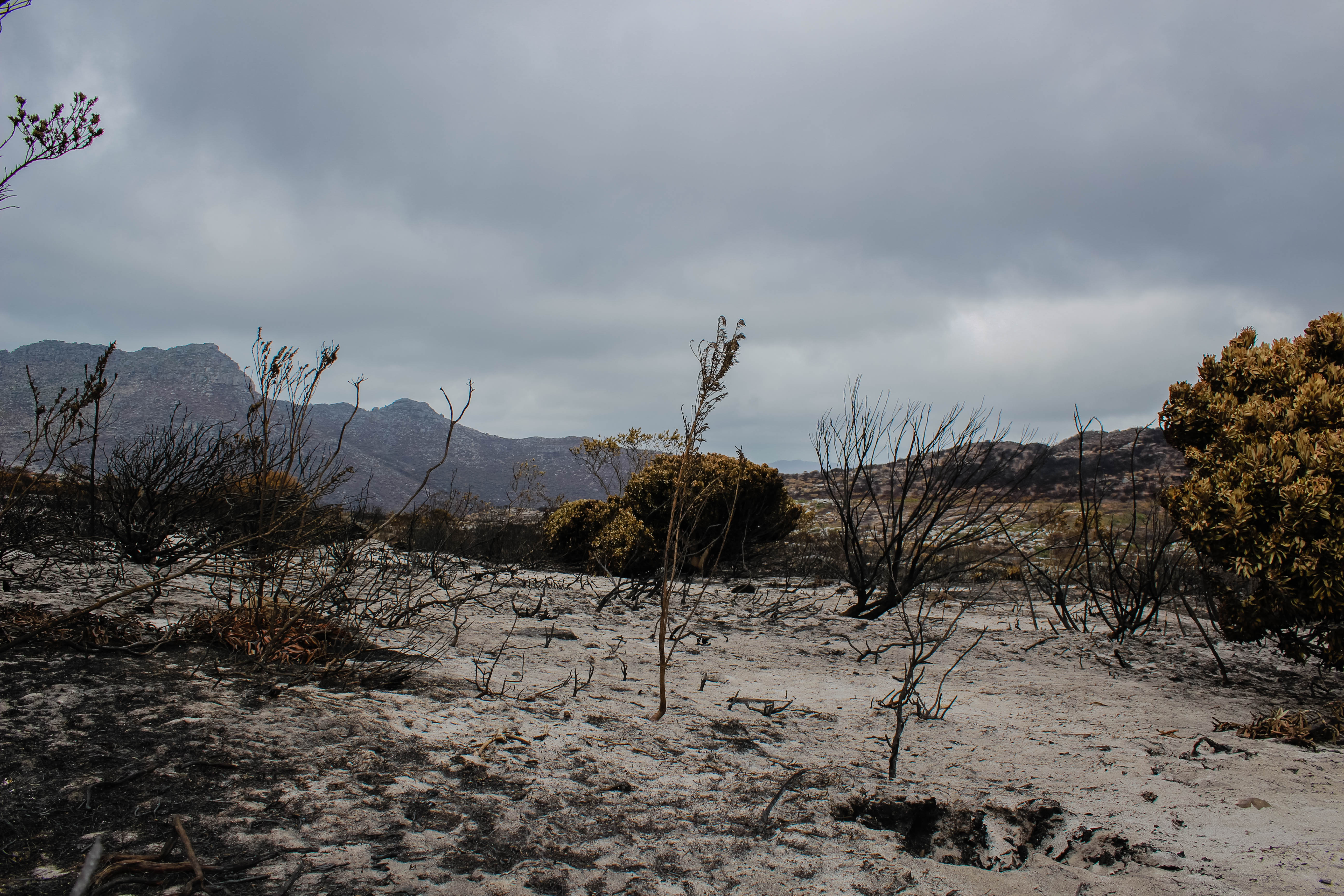
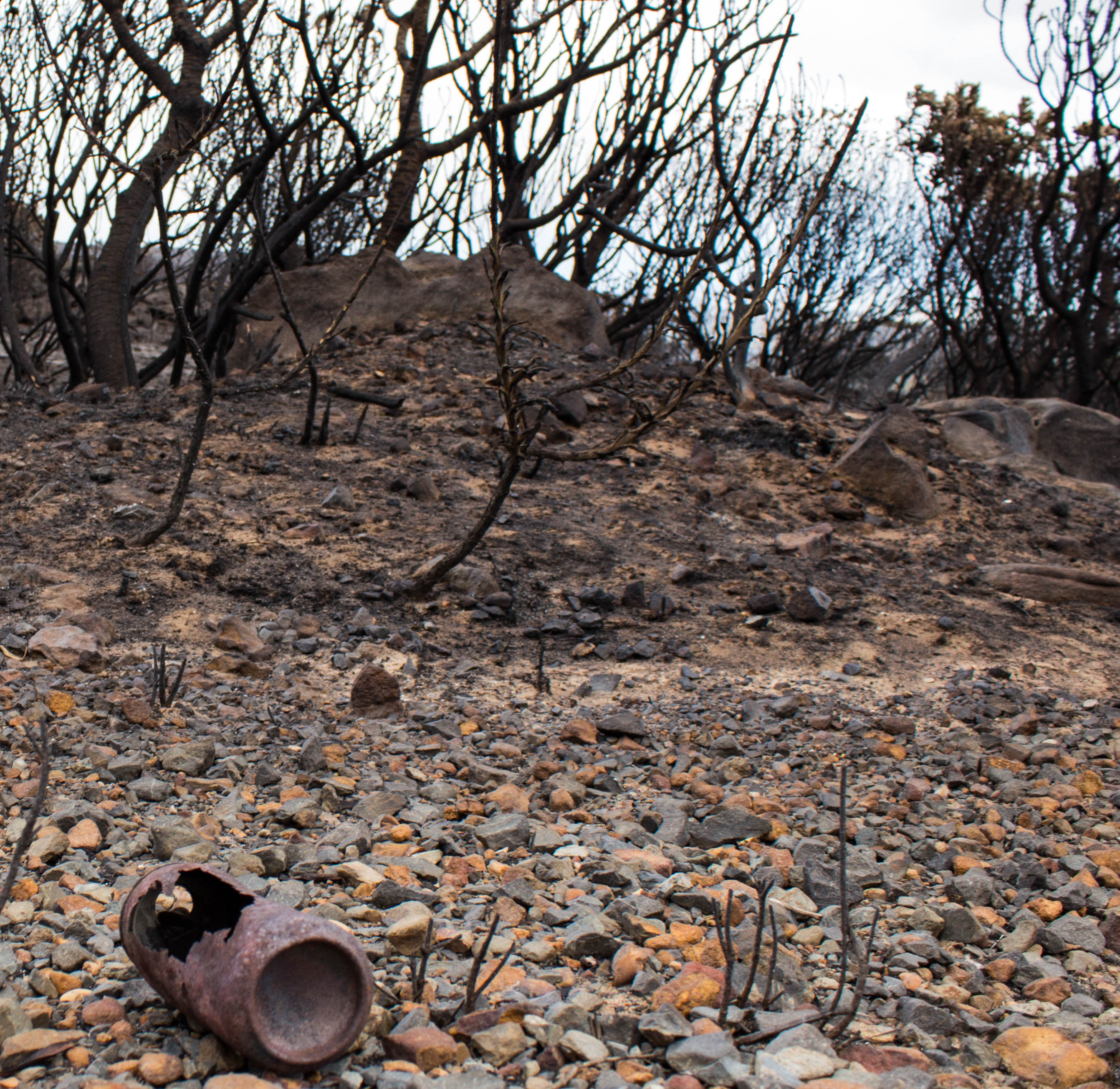
Earlier today I wrote up a post about the recent fire on the Cape Peninsula, nearby my home city of Cape Town, South Africa. I also shared some pictures of the fire raging near the town of Hout Bay. In this post, I’d like to share some pictures of the landscape that the fire left behind. This afternoon my husband and I spent a few hours hiking in the Silvermine Nature Reserve, which was burned by the fire just a few days ago. Before the fire, Silvermine was covered in fairly thick, lush, green fynbos vegetation, sprinkled here and there with colorful flowers. However, when we walked through Silvermine today the landscape was barely recognizable. Much of the vegetation had been burned away completely, and many of the plants and trees that remained had been charred black. In between the roasted remains of the vegetation, we saw bare soil, often singed black, or accumulations of white ash. Remarkably, every now and then we would pass a patch of vegetation that had been largely spared from the fire. For example, we occasionally passed patches of bright green succulents or brilliant protea bushes, remnants of the landscape that existed before the fire. When we hiked down a small valley, we reached the edge of the fire damage. For awhile, we followed the sharp boundary that separated charred soil from vibrant vegetation. The difference between the two sides – one burned, one green – was remarkable. It was fascinating wandering through the recently-burned landscape, which at times felt like a moonscape or perhaps a view from Mars or some other planet.
Without further ado, here are some pictures of the recently-burned Silvermine landscape:
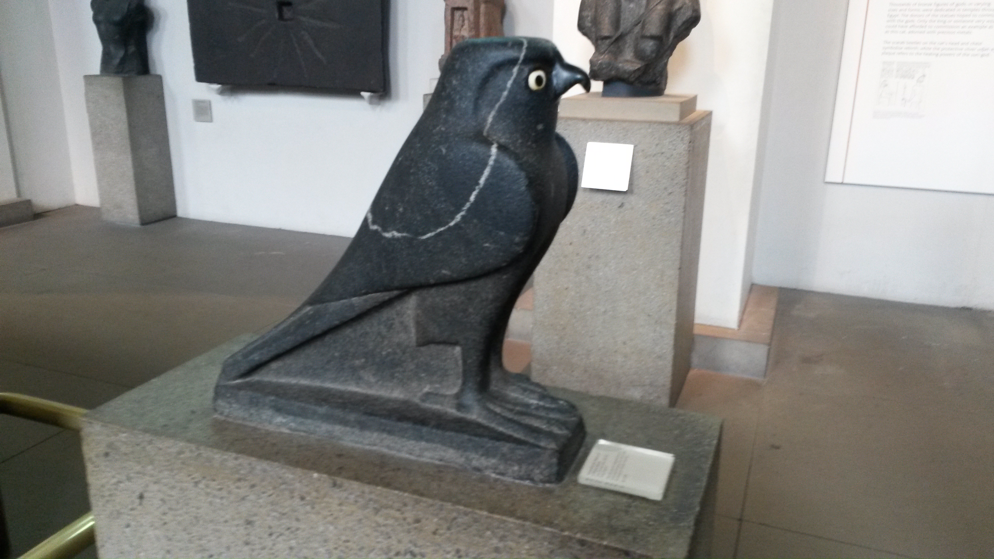
An ancient Egyptian Horus statue, The British Museum, November 2014.
For this week’s “Monday Geology Picture” I thought that I would share a couple more pictures that I took during my recent visit to The British Museum. When I was in one of the exhibits with ancient Egyptian artefacts, I was struck by a beautiful dark-colored Horus statue with a light-colored vein running through it. According to the museum sign, the statue was carved out of granodiorite. The vein is probably quartz.
Here is the museum sign about the statue:
Museum sign. Click to enlarge.
And here is a view of the statue from the front:
The Horus statue viewed from the front. Apologies that the picture is slightly blurry.
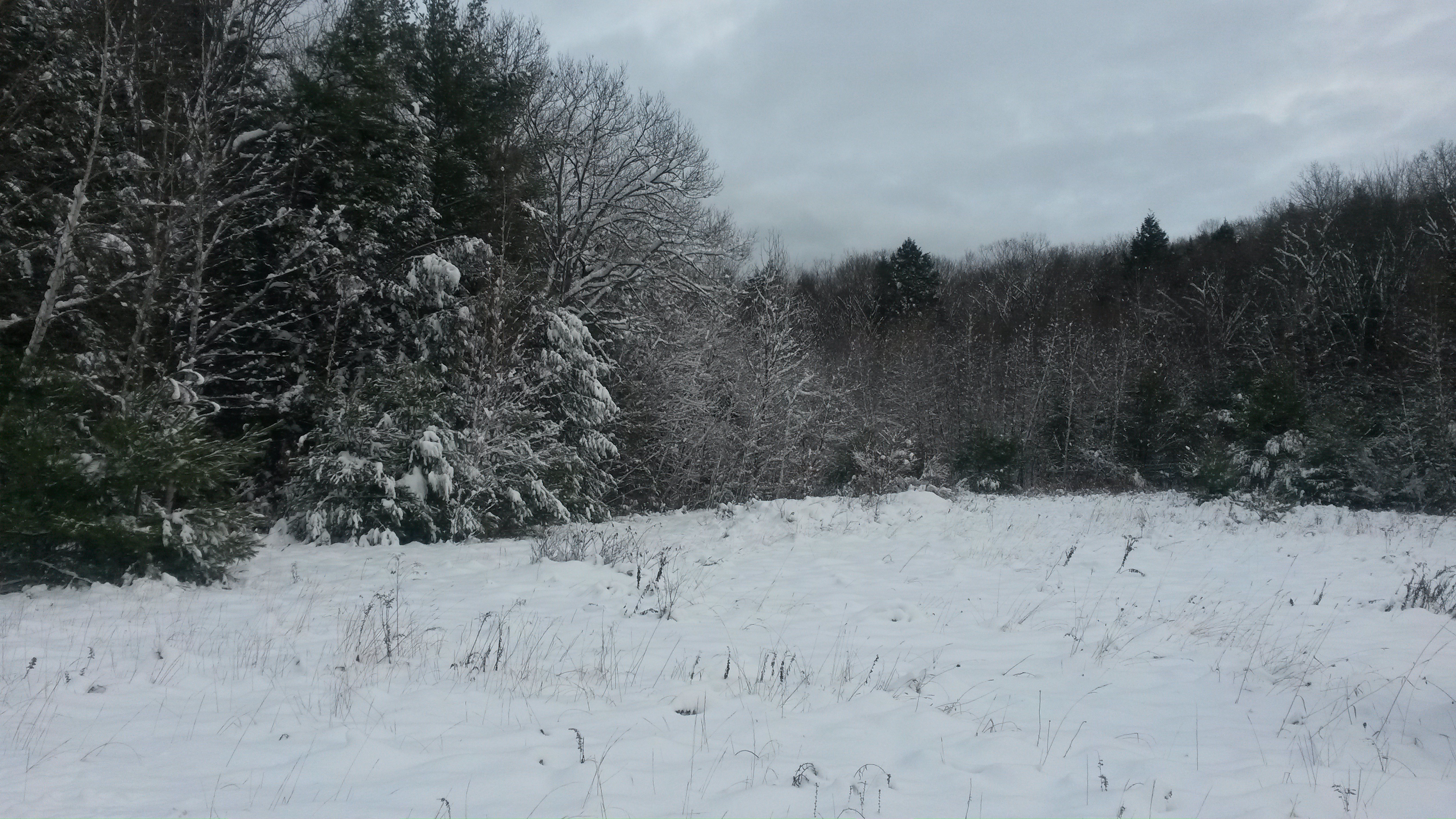
Ice on a partially-frozen wetland pond, New Hampshire, November 2014.
def. Ice:
Water (H2O) in a solid state. When naturally occurring, ice is considered a mineral. There are many forms of ice: lake ice, river ice, sea ice, snow, glaciers, ice caps, ice sheets, and frozen ground (such as permafrost).
If you ask a geologist what he or she considers to be Earth’s most important mineral, you will probably hear many different answers, depending on the person. Some might choose a common mineral, perhaps olivine or quartz or feldspar. Others might choose a rare, economically valuable mineral, perhaps gold or tantalite or monazite. Others might choose a mineral that is important for understanding the geological history of the Earth, perhaps zircon or spinel or serpentine or maybe even jimthompsonite. However, if you ask me what I consider to be Earth’s most important mineral, I think that I would reply that it is ice.
After all, how many minerals have an entire field of geology devoted to them? Glaciology is a very important field of geology that is devoted to the study of glaciers and, more generally, ice in all its forms.
And how many minerals cover vast expanses of the Earth? Sure, much of the mantle consists of olivine and much of the core consists of metal alloys, but no other mineral can compete with ice when it comes to Earth’s surface. Ice covers much of the Earth’s land and ocean surface, and the portions of the Earth that are covered with ice comprise the cryosphere. Some scientists even believe that during particularly cold time periods in the past, the entire Earth, a so-called “Snowball Earth”, was covered with ice, an all-encompassing cryosphere.
And how many minerals play such an important role in Earth’s climate? The formation of ice is a key aspect of Earth’s climate system. Very simply, there is more ice when Earth is colder and there is less ice when Earth is warmer. However, the transition from water to ice and ice to water can be complex. For example, the light color of ice creates an ice-albedo feedback loop. Climatologists are still working to unravel the details of the roles that ice plays in global climate.
And how many minerals are less dense than their liquid counterparts? The lower density of ice relative to water enables it to float on top of water, and this physical arrangement has a profound impact on the nature of the hydrosphere and biosphere. If ice did not float on top of water, then many natural bodies of water might freeze completely, never fully thawing in the heat of summer. The lower density and greater volume of ice (compared to water) also plays a role in geomorphology. The expansion of water when it freezes into ice contributes to the physical weathering of rocks. The freezing and thawing of water breaks up rocks and is also responsible for other geomoprhological processes, such as solifluction.
I’m sure that there are many other reasons why ice is an important mineral. However, I think that the ones I’ve listed above are sufficient to convince me. If anyone asks me what I consider to be Earth’s most important mineral, I will answer ice… although since I currently work as a diamond geologist I might broaden the definition to include both frozen water and the sparkly gemstones I study at work.
But what would you answer? What is Earth’s most important mineral? What about Earth’s second most important mineral?
I have to admit, until I gave some thought to this week’s geology word I don’t think that I would have answered ice. I probably would have answered olivine, since I like mantle geology. However, that’s because I don’t generally think of ice when I think of minerals. I guess that ice is so common, and also so unusual (compared to other minerals), that it doesn’t fit into my standard “this is a mineral” box. There’s no doubt about it, though: ice is a mineral, and it is an important one.
Of course, not all ice is a mineral. The ice that you find in ice cubes in your drink is technically not a mineral since minerals must be naturally occurring by definition. My husband, who grew up in South Africa and only saw snow for the first time in his 20s, has a nice way of categorizing ice: he calls the ice that you find in your refrigerator “domesticated ice” and ice that you find out in nature “wild ice”. Growing up in a landscape without ice, my husband finds the “wild ice” of New Hampshire, where I come from, fascinating. And I suppose he should. For while a frozen puddle on the street, a line of icicles on a rooftop, and a dusting of snow on the driveway may seem quite ordinary to someone who grew up in a cold climate, they are small pieces of a quite extraordinary cryosphere that is an integral part of the planet we call home.
Snowy New Hampshire scenery, November 2014.Snow and glacier covered Denali in Alaska, 2013.
A simple 10x power folding hand lens, typical of the ones geologists carry into the field.
I’ve decided to bring back the long-lost “Geology Word of the Week” posts in 2015. For those of you who don’t know, for a few years I regularly posted about a geological word every week. These posts included a brief definition (written by me) of the word and then some additional information and pictures. However, starting in 2012 I stopped posting these words regularly. I was quite busy in 2012 because I defended my Ph.D. and then started working as an industry geologist. Then, for the past two years, my industry work has kept me extremely busy, and I’ve spent quite a bit of time in the field, far from home.
However, now that I’ve settled into a new industry job and will be spending a little more time in the office, I’ve decided that it’s time to revive the “Geology Word of the Week”. I will endeavor to post about a geological word every week. However, I may sometimes (perhaps more often than not, depending on how much time I have) keep the posts very short. For some words, I may just provide the definition and a picture or two. Regardless, I think that such posts will be interesting and informative and will help both amateur and professional geologists (including myself!) improve their geological vocabulary. Also, depending on my work schedule, I may occasionally have to skip a week or two. I’ll try not to skip too many, though!
For the “Geology Word of the Week” posts I go through the alphabet from A to Z to select my words. I made my way through two alphabet cycles before I stalled at G is for Glacial Erratic. I’m picking up the alphabet where I left off, so this week’s word starts with H. By the way, you can browse all of the previous geological words here.
Without further ado, here is this week’s geology word:
def. Hand Lens:
A small magnifying glass used by geologists to take a closer look at rocks. Commonly, hand lenses have 10x magnification power and fold into protective metal cases. Geologists use hand lenses to help identify minerals and fossils in rocks and also to take a closer look at rock textures and structures. Hand lenses can also be used to take a closer look at soft rocks such as soils and sand grains. A hand lens is an essential part of a geologist’s field equipment, and many geologists wear a hand lens on a string around their neck when they venture out into the field. Hand lenses are also useful for looking at rocks, sediment cores, and other geological samples in a laboratory.
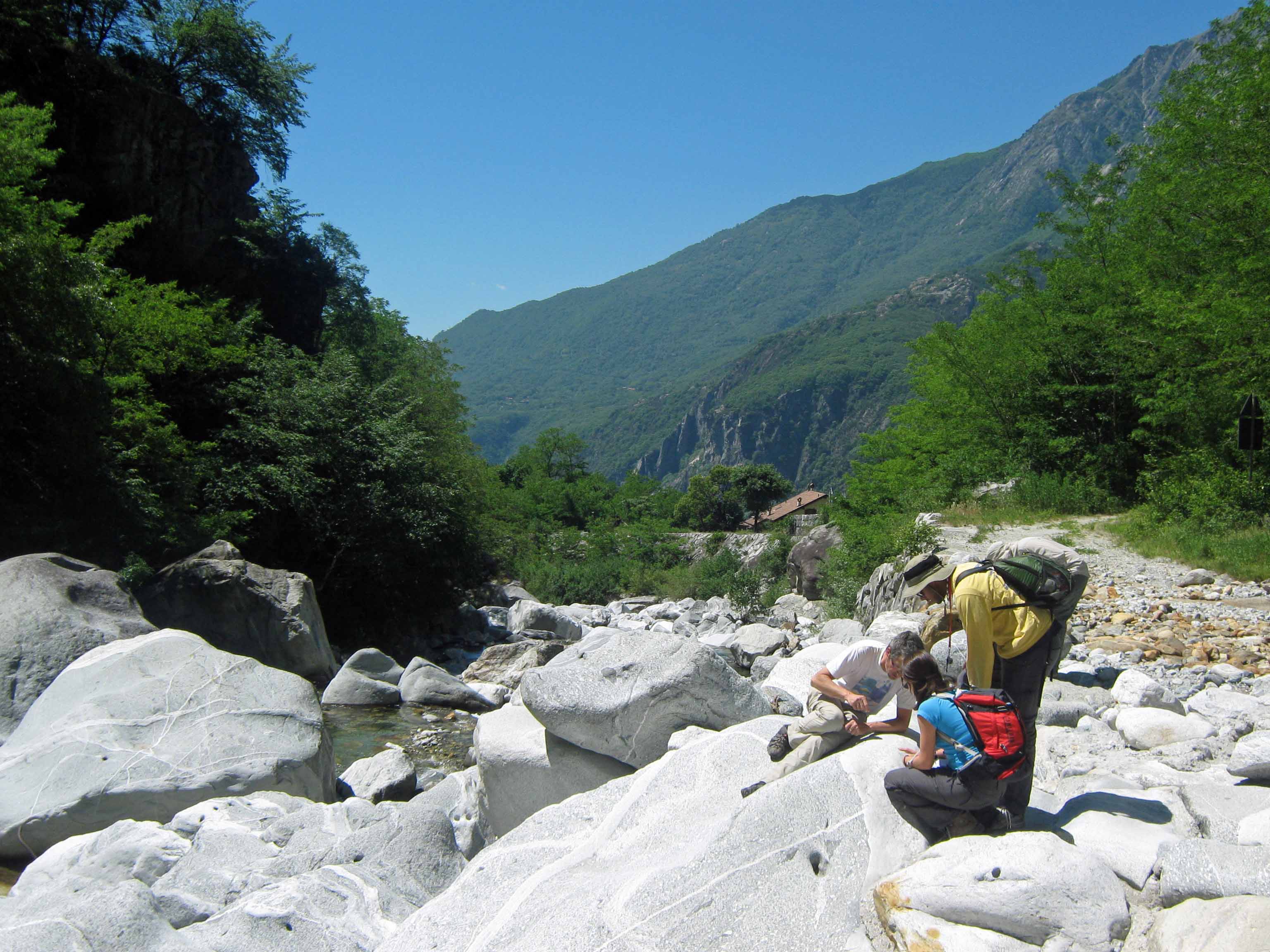
Here are a few pictures of geologists using hand lenses in the field:
Three geologists taking a close look a boulder with their hand lenses.A geologist taking a good look through a hand lens.A geologist preparing to take a good look at a mineral grain through a hand lens.
That’s it for this week’s geology word… stay tuned for next week!
The gift guide author (yours truly) getting into the holiday spirit during a recent snowstorm in New Hampshire. I’m back in sunny South Africa now, but I’m still in holiday mode!
Well, it’s that time of year again… it’s time for the annual Georneys “What to Buy a Geologist for Christmas” (or Chanukah or Newtonmas, etc.) list! Do you have a geologist (or several) in your family? Then check out the list below for some holiday gift ideas. Also be sure to also check out the 2010 (Part I and Part II), 2011, 2012, and 2013 lists. I apologize that some of the pictures and links in the previous lists are now broken. The ideas are still good!
Happy holidays!
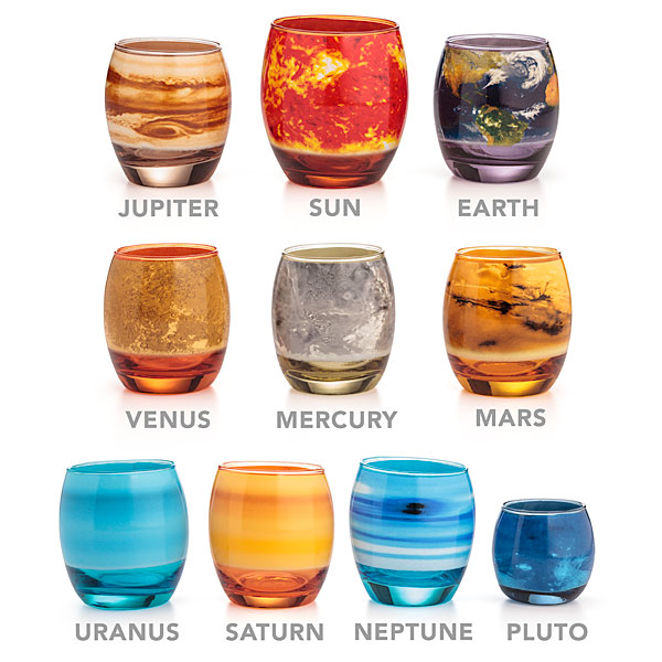
Gift #1: Set of Planetary Glasses
Set of beautiful planetary glasses. Image from ThinkGeek.com.
The planetary scientist in your family definitely needs this set of planetary glasses. Actually, these glasses are so awesome that I think all geologists need a set! The glasses are actually so popular that they are currently sold out, but you could order them for your geologist family member and promise delivery in February.
Cost: $49.99
Gift #2: Cosmos: A Spacetime Odyssey DVD
Cosmos: A Spacetime Odyssey DVD. Image from NationalGeographic.com.
I really enjoyed watching the new Cosmos TV series, which was hosted by Neil deGrasse Tyson and aired earlier this year. Why not buy this TV series for the geologist in your family? The DVD for this TV series is currently on sale at Amazon here. You can also buy the DVD for Carl Sagan’s original Cosmos TV series here.
Cost: $24.99 (on sale) or $49.98 (regular price)
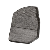
Gift #3: Rosetta Stone Paperweight
Rosetta Stone Paperweight. Image from The British Museum website.
Do you have a geoarchaeologist in the family? Then you should consider buying a Rosetta Stone themed gift from The British Museum. There are many choices in the museum shop here. You can buy a Rosetta Stone themed paperweight (shown above) or an iPad case or a bag or a puzzle or even a replica of the stone.
Cost: £6.99 for the paperweight
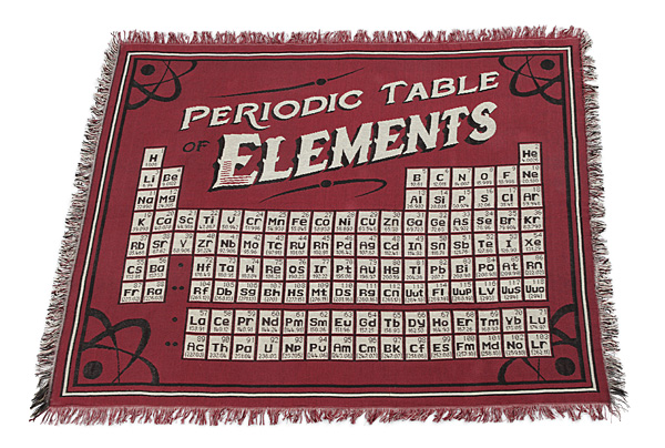
Gift #4: Periodic Table Blanket
Periodic Table of the Elements Blanket. Image from ThinkGeek.com.
The economic geologist in your family will love a gold pan for Christmas. I spent a couple of years working in gold exploration, and one thing I learned is that panning for gold in streams and on beaches is great fun! I also learned that you can never have too many gold pans. You can buy gold pans from many places, such as from the Garrett online shop.
Cost: About $10
Gift #6: A Geological Dictionary
A Dictionary of Geological Terms. Image from Amazon.com.
Like all sciences, geology is full of terminology. Why not buy the geologist in your family a geological dictionary to help them remember all of the jargon? There are a few good geological dictionaries out there, such as this one.
Cost: About $15
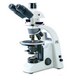
Gift #7: A Microscope
A basic polarizing microscope. Image from MicroscopeWorld.com.
Geologists can tell a great amount about rocks from outcrops and hand samples, but sometimes they need to take a close look at rocks and rock slices using a microscope. You can buy geological microscopes from several websites, such as UKGE, Microscope World, and Zeiss.
Cost: Variable from about $100 to several thousand dollars
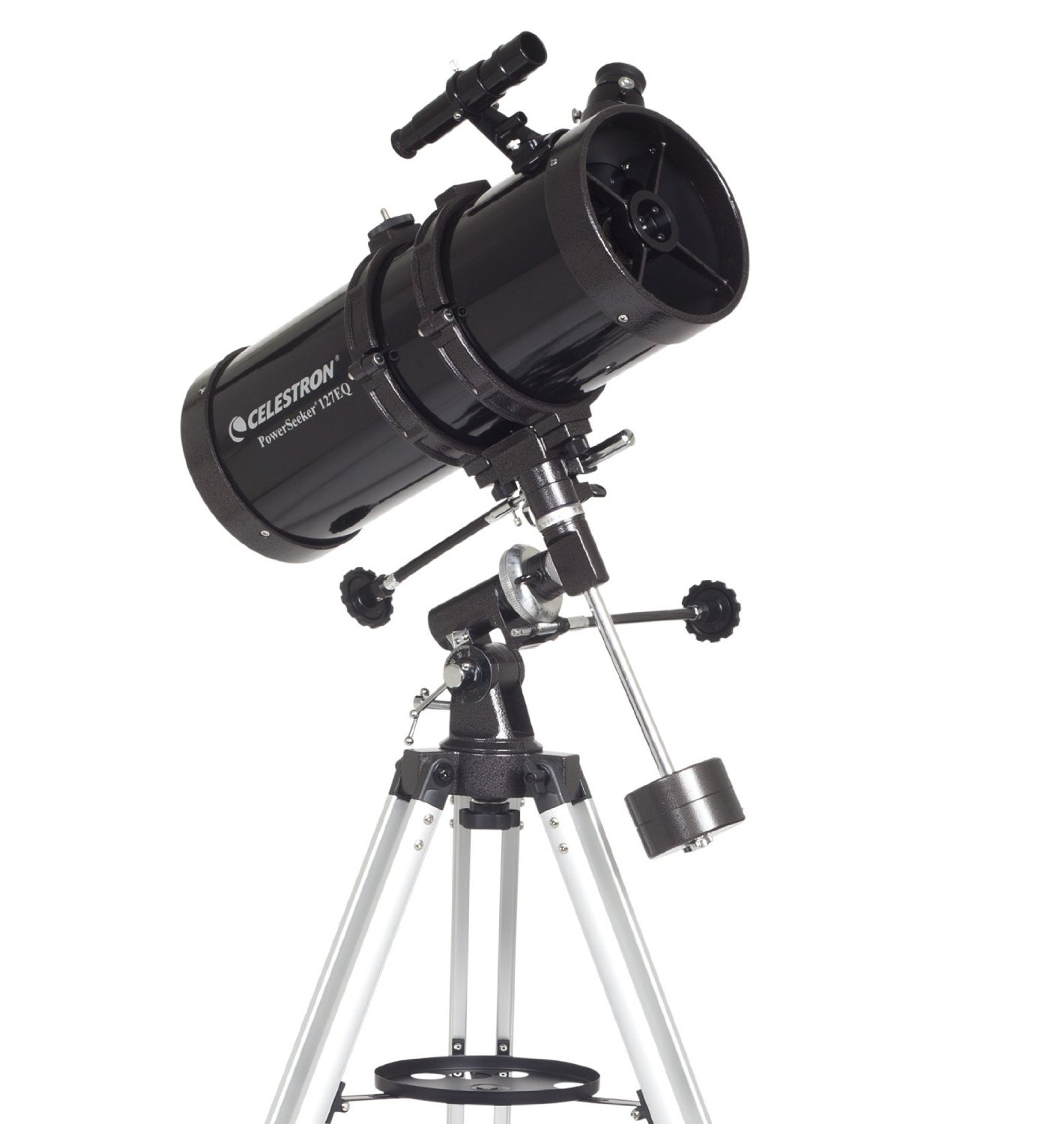
Gift #8: A Telescope
A Celestron telescope. Image from Amazon.com.
Geology is a science that takes place on many scales. Sometimes geologists need to look closely at rocks using a microscope and other times they need to look out at very big space rocks using a telescope. Even if the geologist in your family is not a planetary scientist, they will probably appreciate the gift of a telescope. I know that I certainly enjoy looking at the moon using a telescope. If you can’t afford a telescope, then perhaps buy a pair of binoculars, which can be used for looking at the moon (a poor man’s telescope) and which can also be used during geological field work.
Cost: Variable from about $100 to many, many thousands of dollars
Gift #9: A Jar of Sand
A collection of glass vials of sand given to me as a gift. What a great gift!
Geologists love sand, which is just small bits of rock. So, if you want a gift for the geologist in your family, visit a beautiful beach (one with beautiful white sand or red sand or maybe even black sand) and collect some of the sand. Put the sand in a pretty jar and then write a note explaining where and when the sand was collected. The geologist in your family will enjoy this thoughtful (and affordable!) gift.
Cost: $5 to $15 for the jar. The sand is free!
Gift #10: A Donation to a Geological Charity
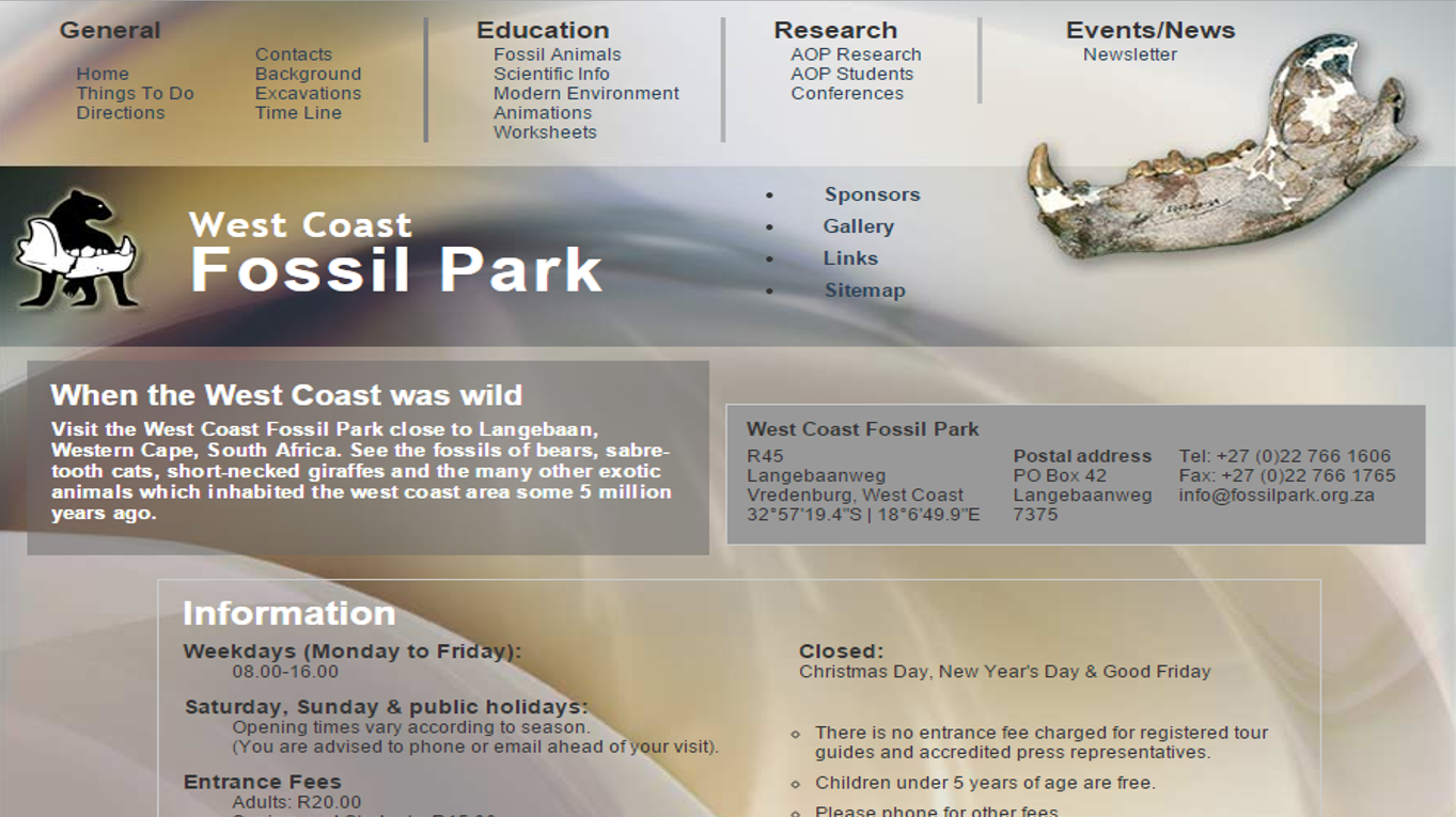
West Coast Fossil Park website front page.
If the geologist in your family already has too many things (as many scientists do…) then why not consider making a donation to a geological charity in their name? You can donate money to a local geology department to support a student fund or you can donate to a geological park. For example, here in South Africa I would recommend donating to the West Coast Fossil Park in Langebaan in the Western Cape. This park, which is funded through donations and ticket sales, preserves a world class fossil site and runs wonderful educational tours and other activities.
Cost: Whatever you want! $25 could be a good donation amount.
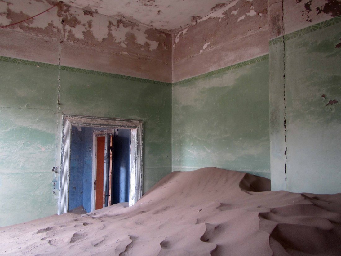
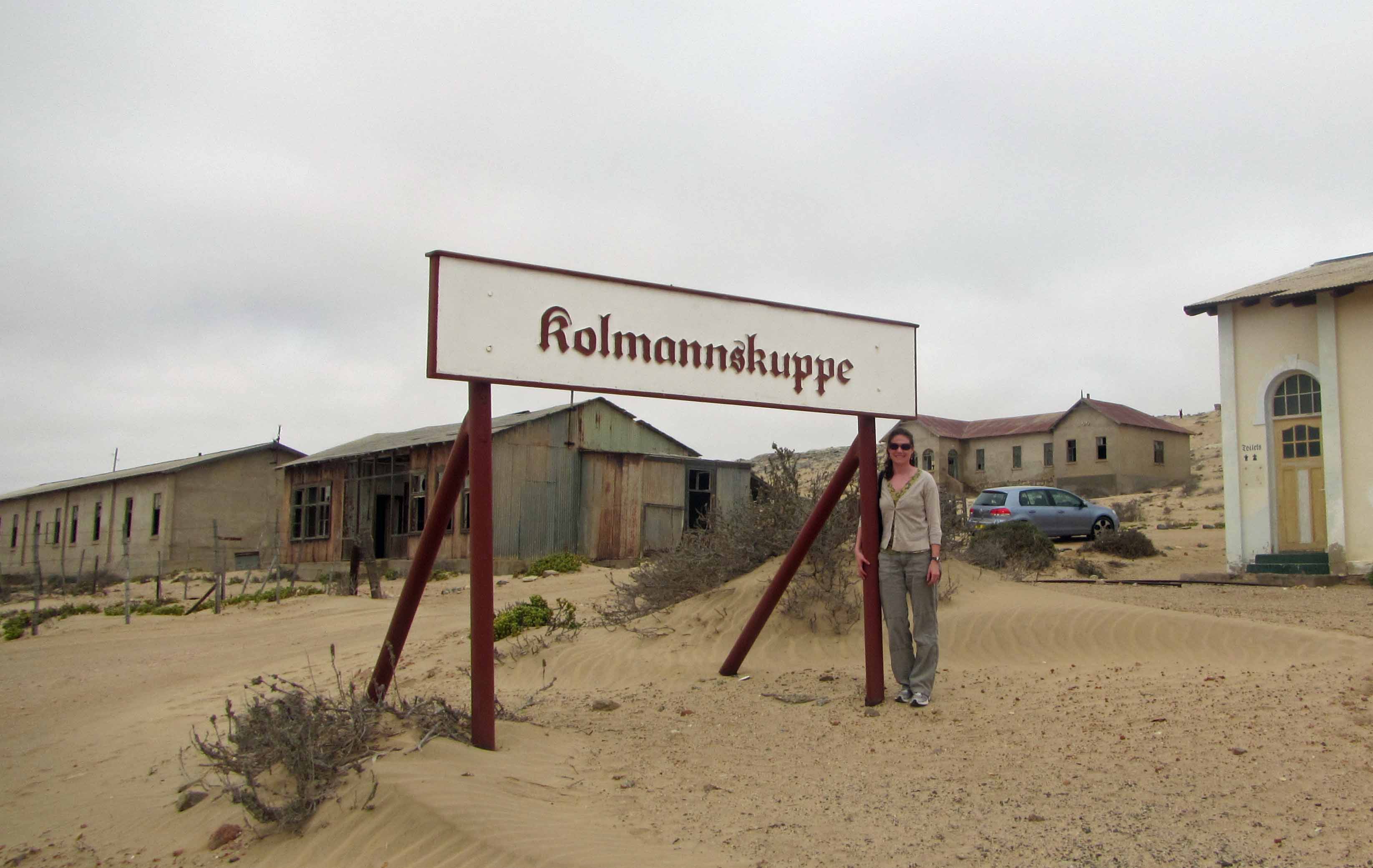
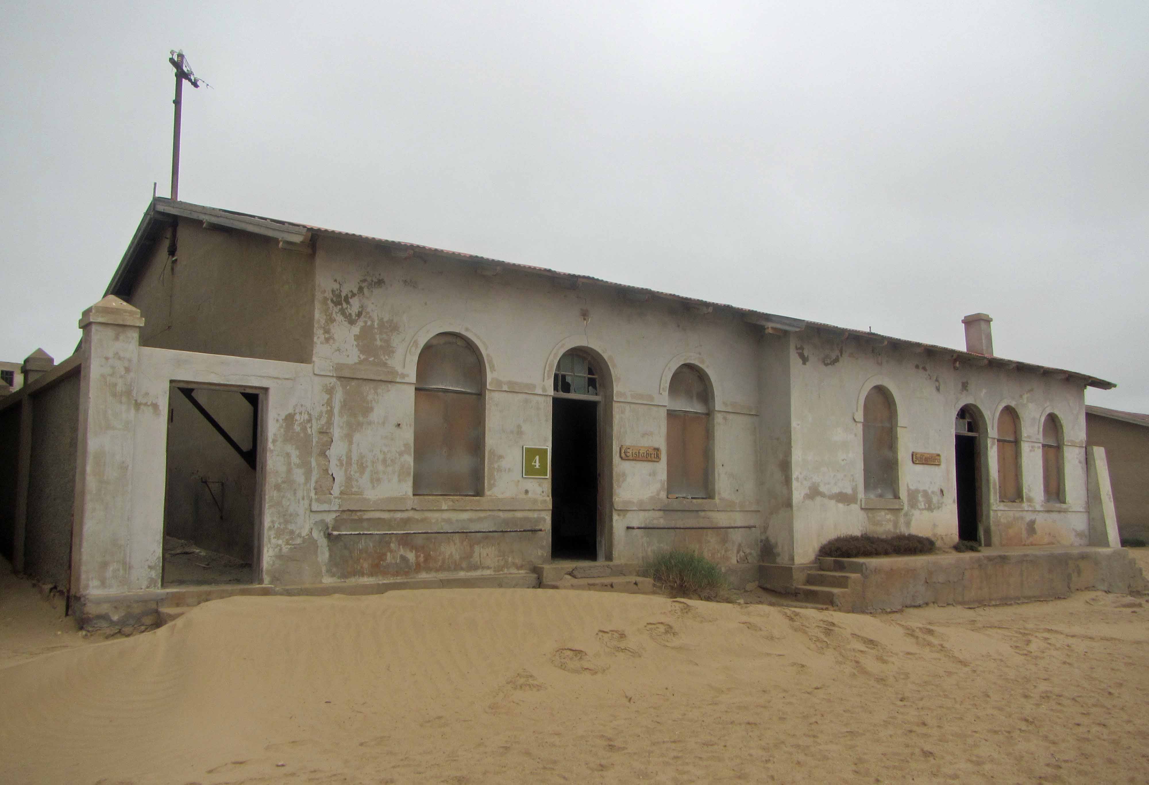
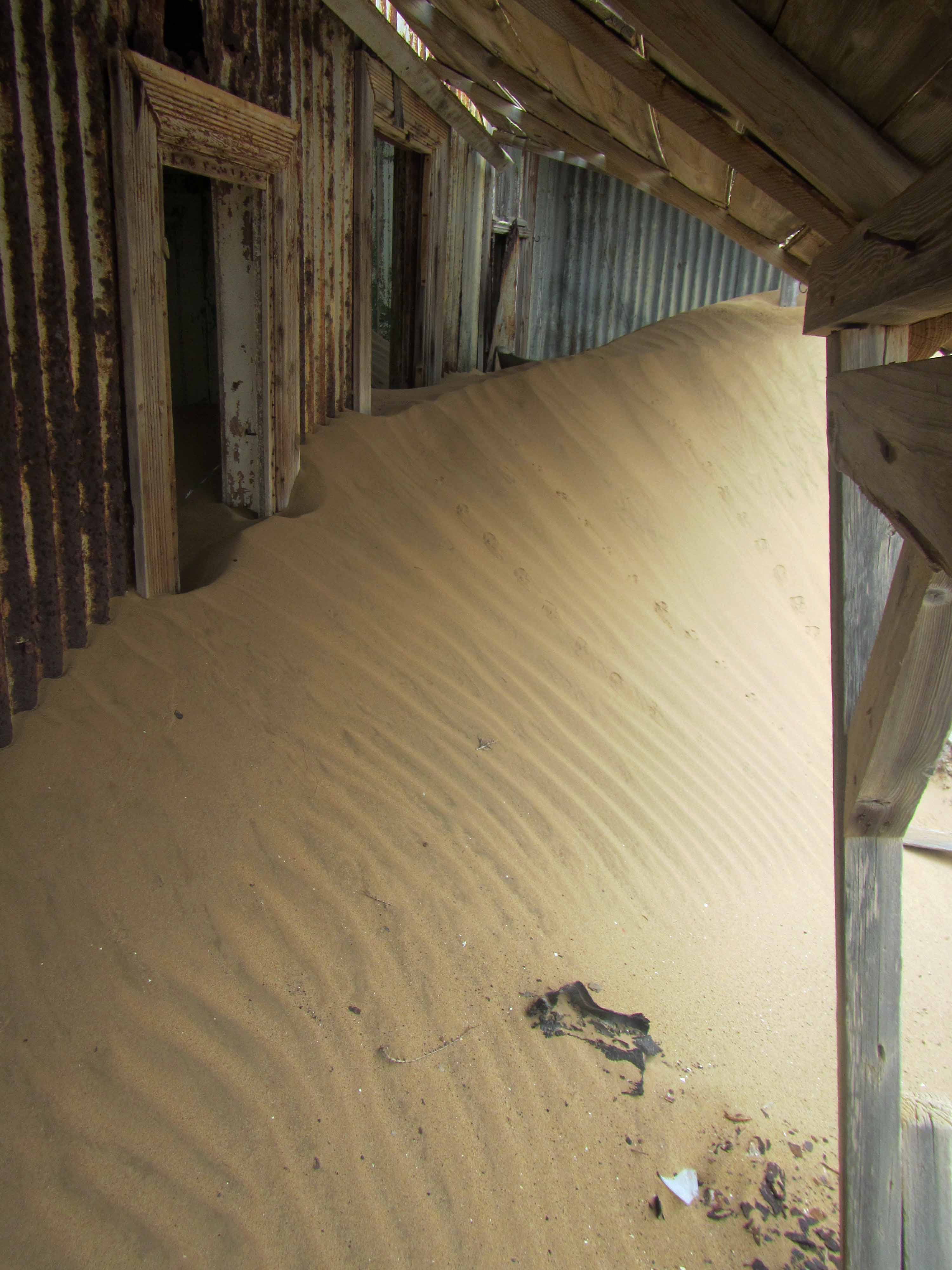
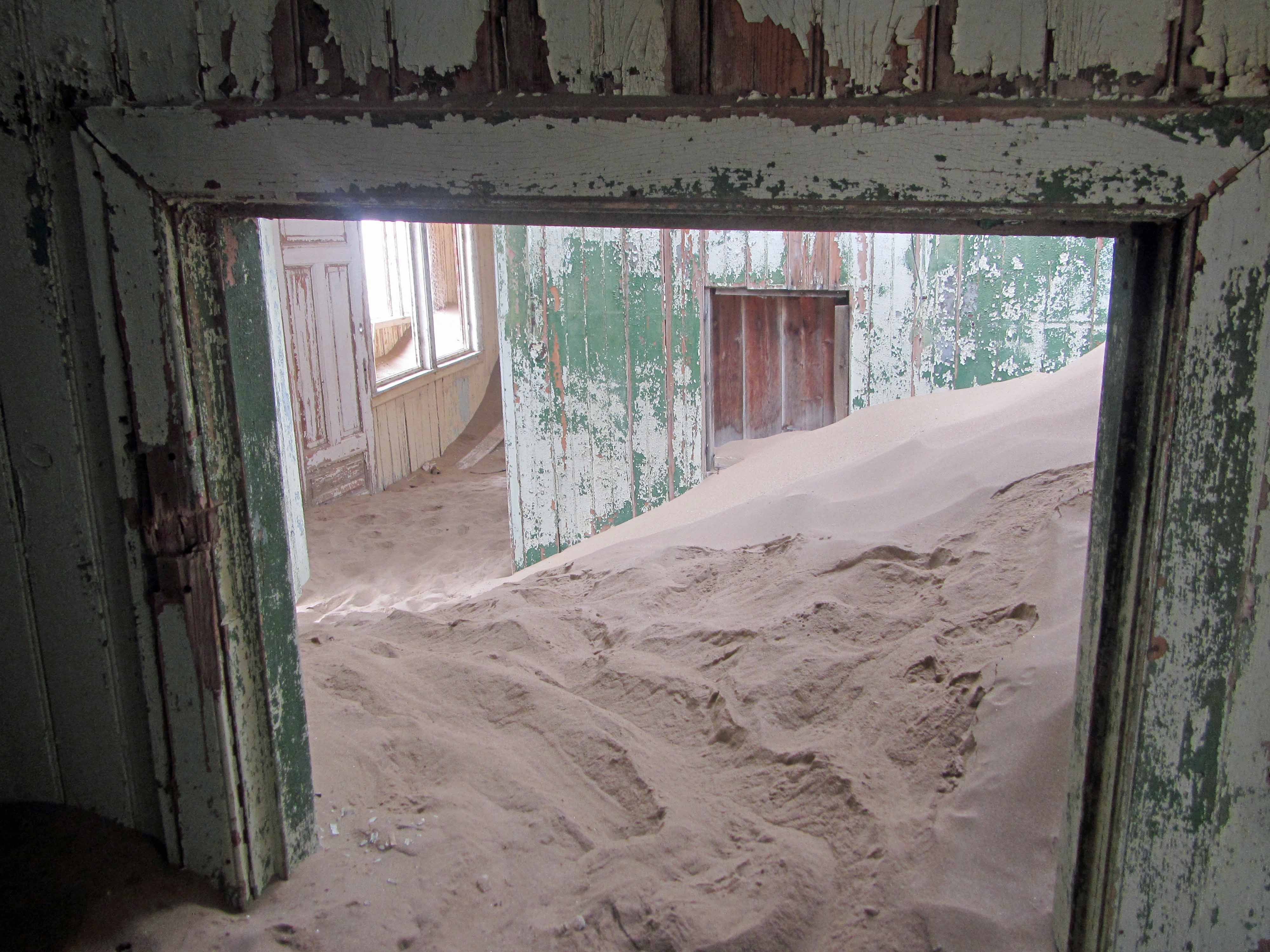
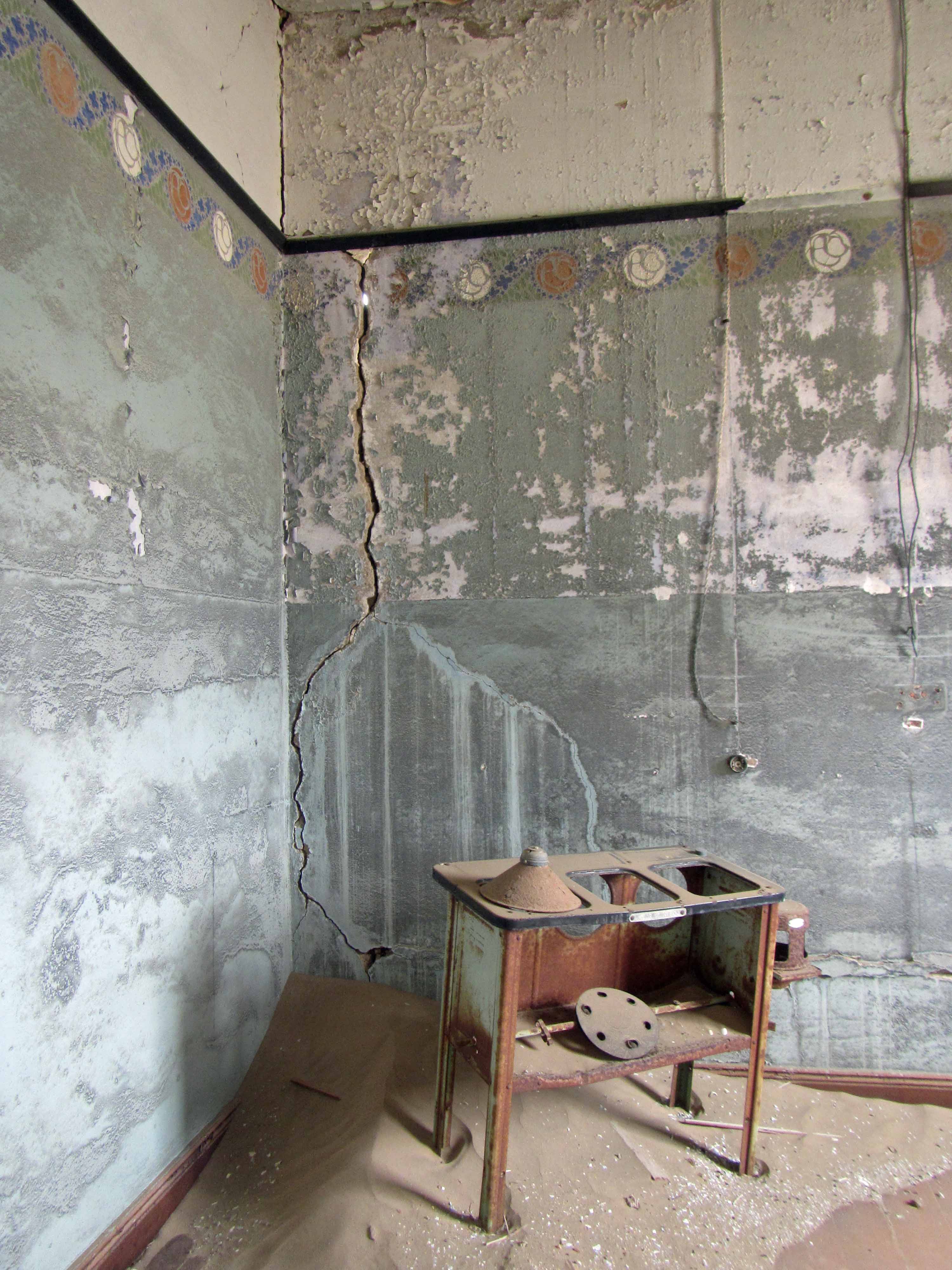
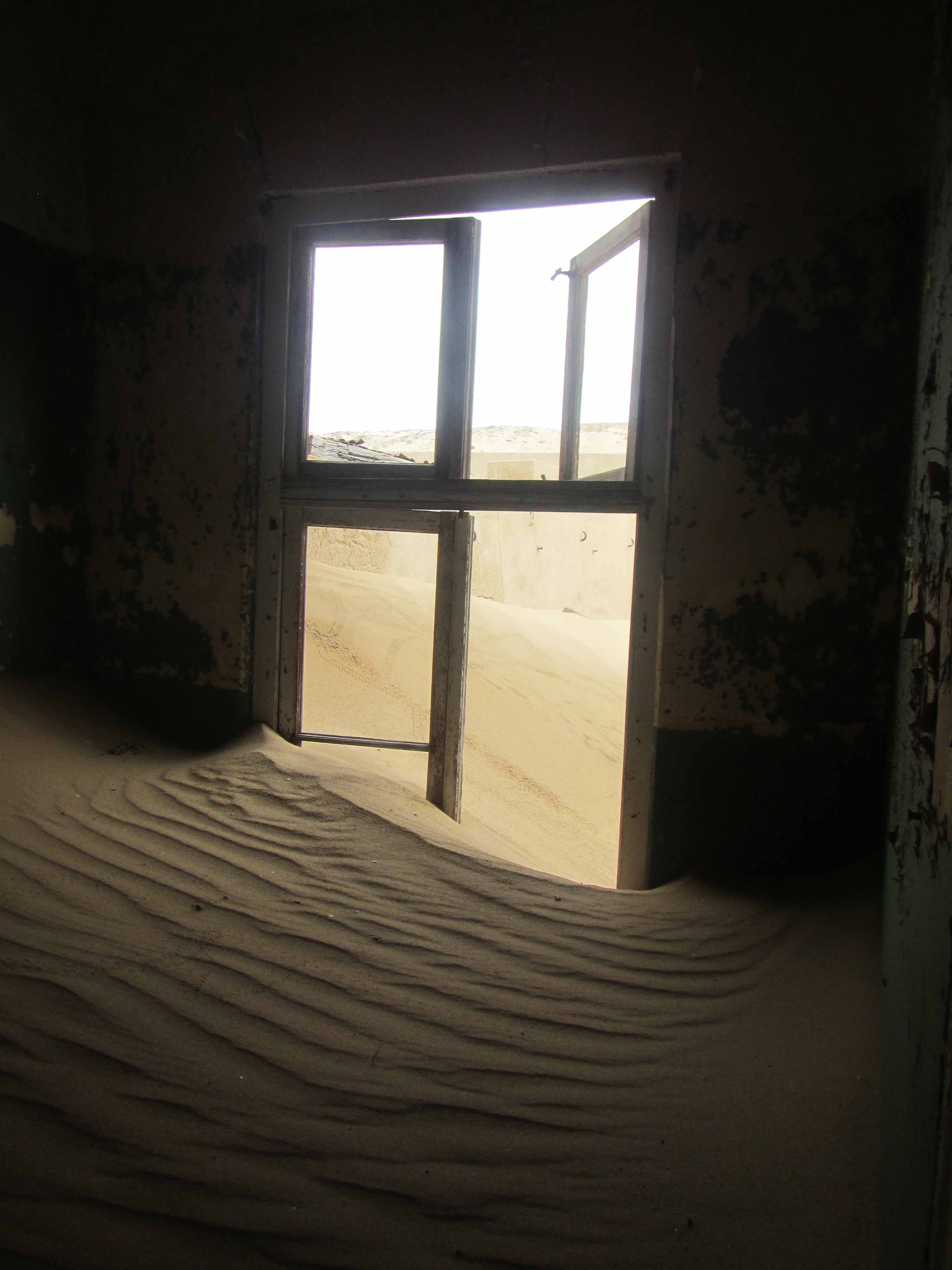
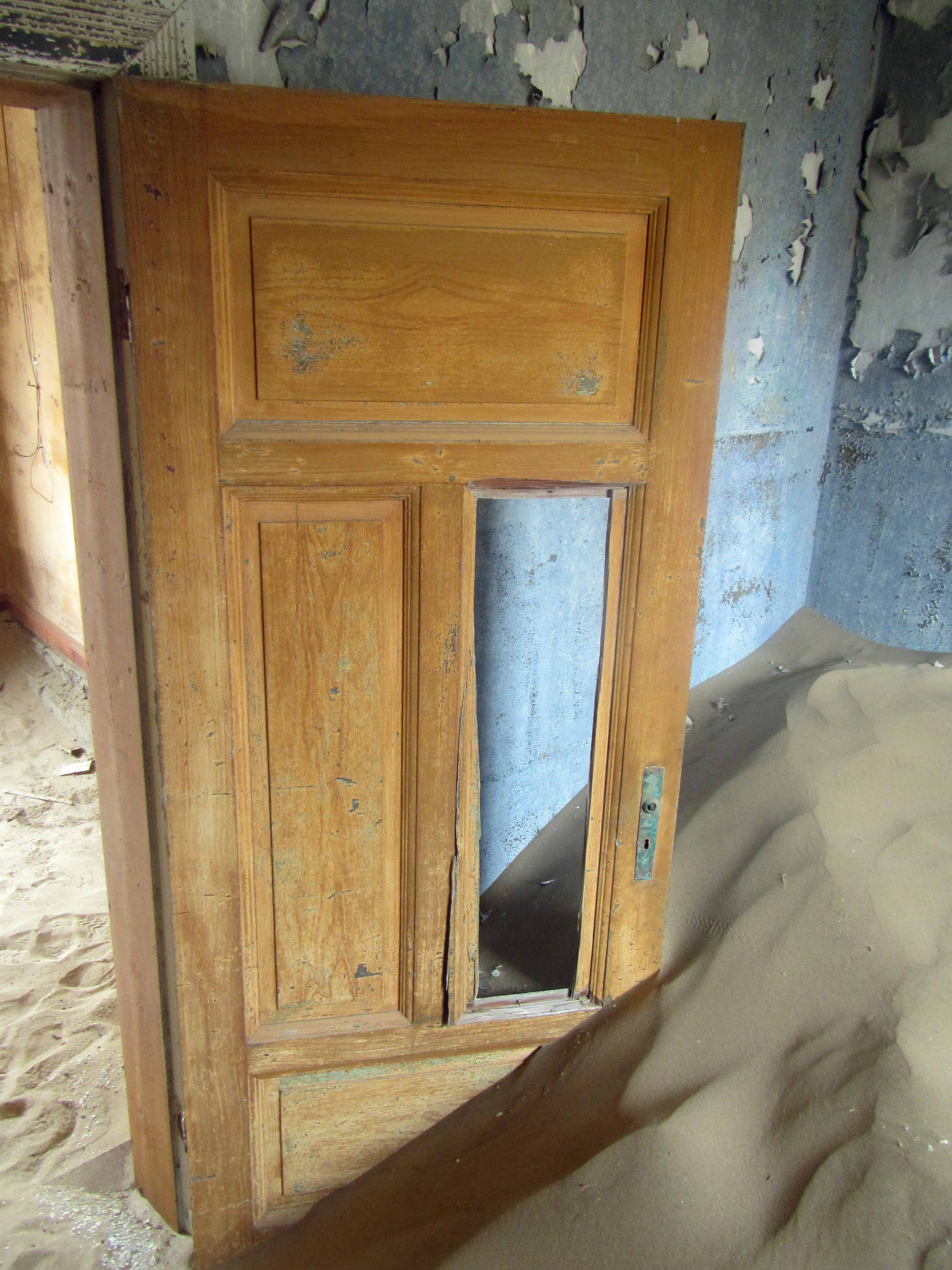
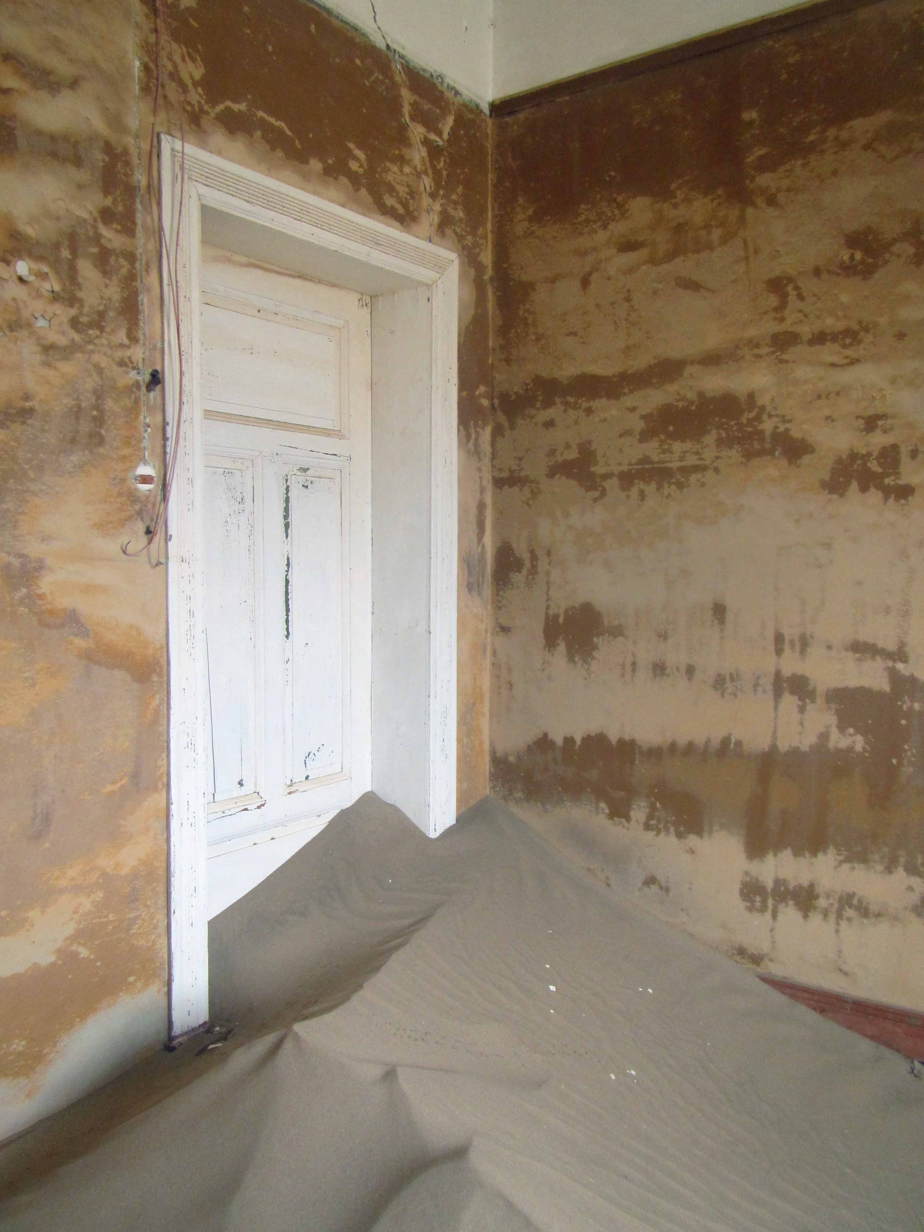
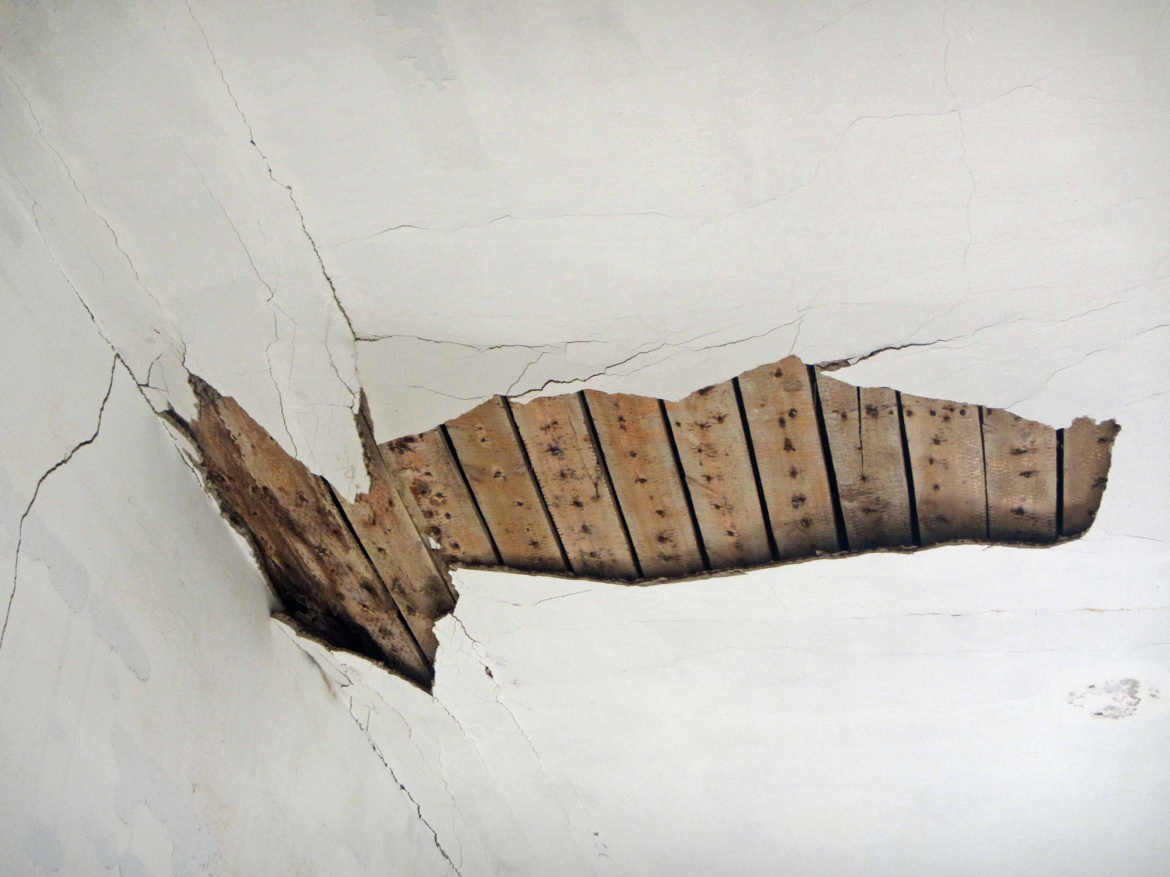
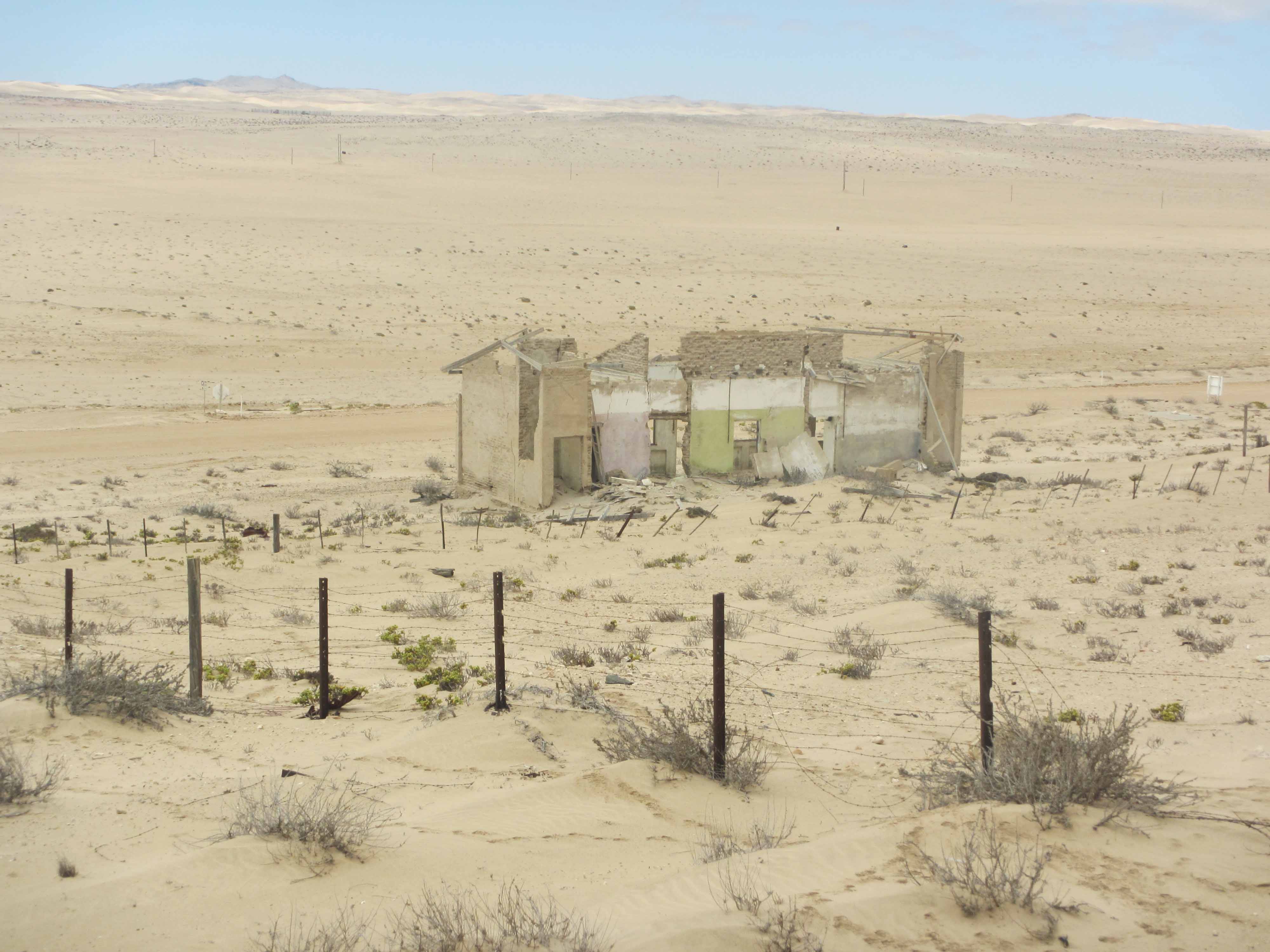
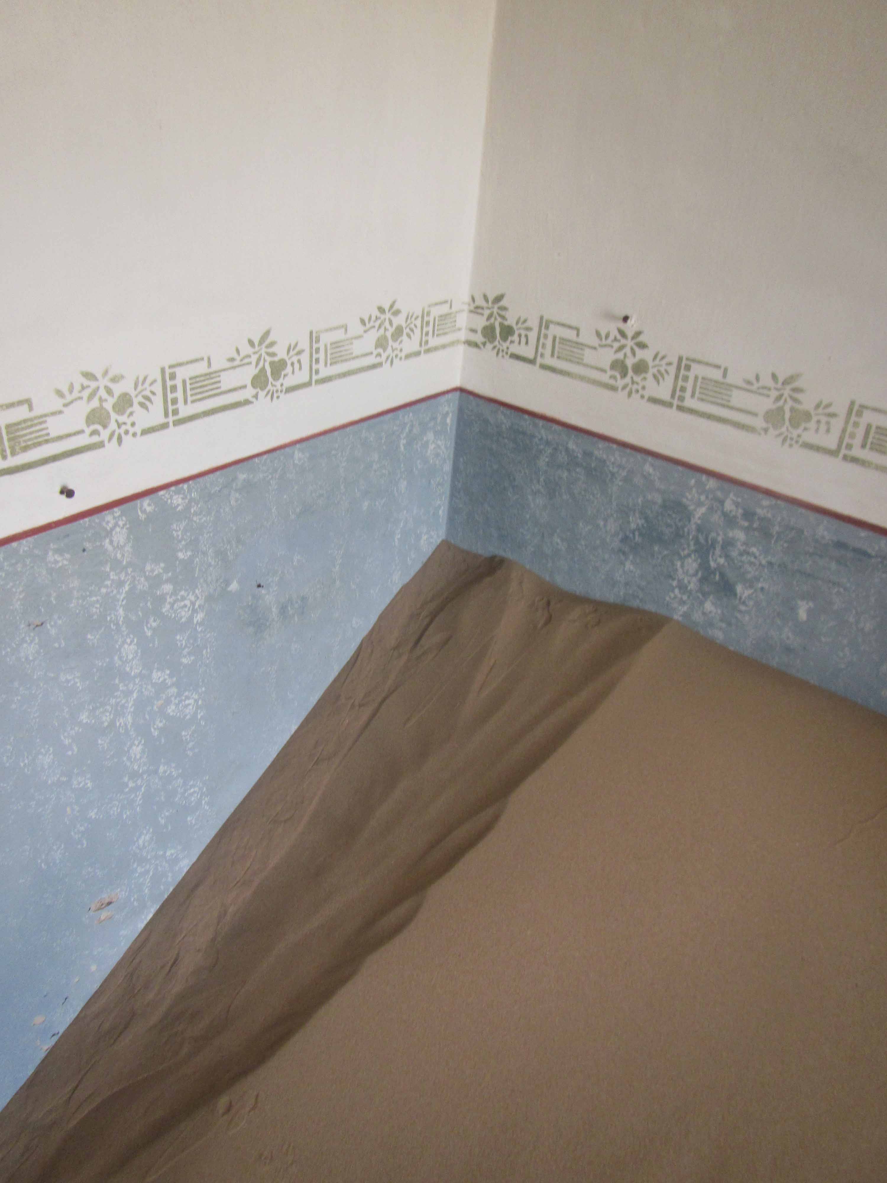
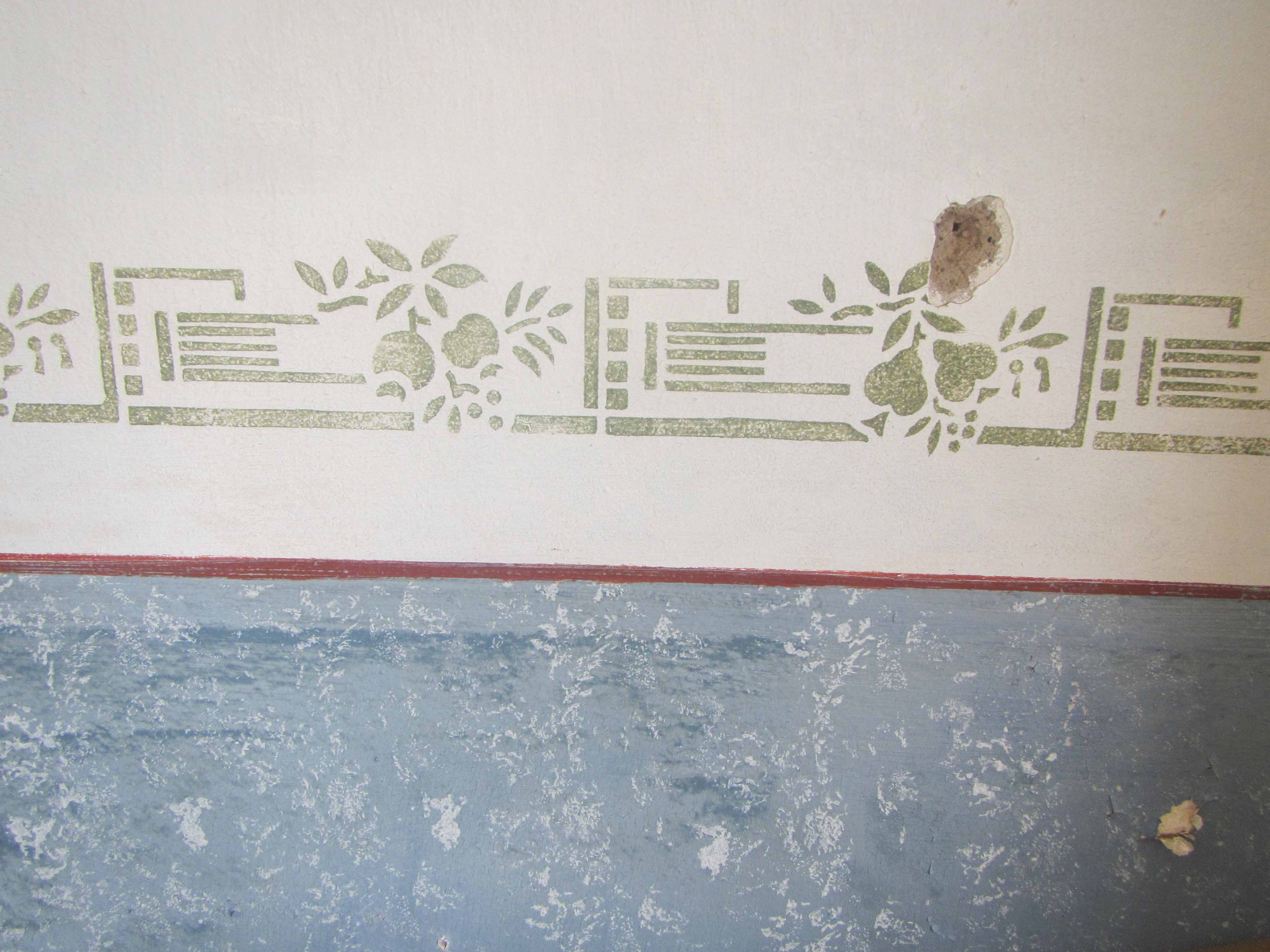
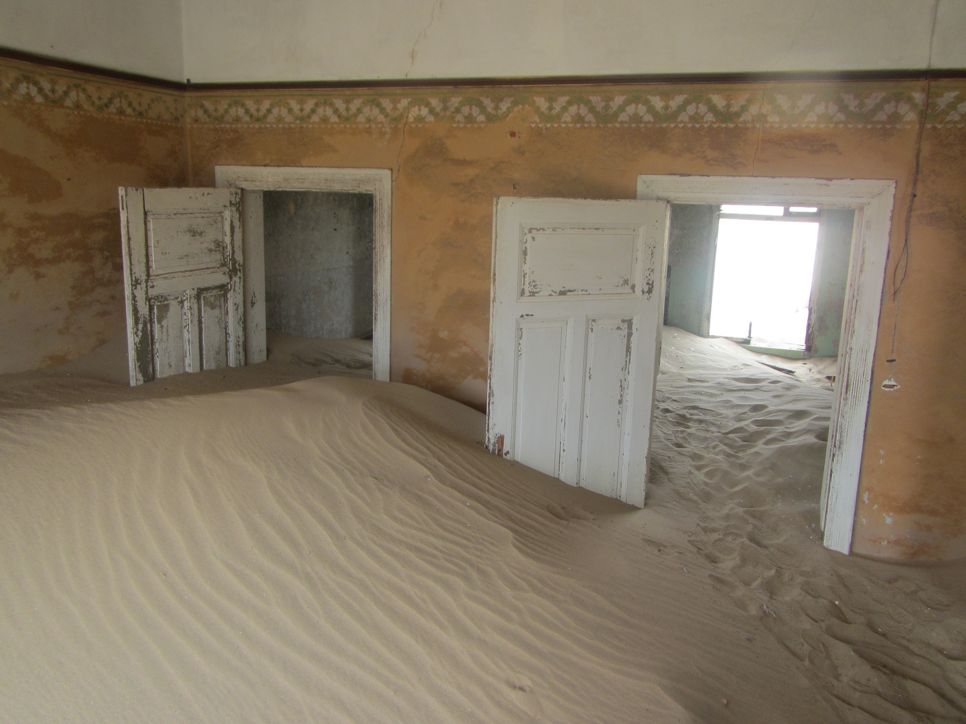
Kolmanskop #1. Sitting on some sand in one of the abandoned houses.
Last month I spent some time in Namibia for work. During one of my days off, I was able to spend some time visiting Kolmanskop. Located in the Namib Desert a few miles outside of the seaside town of Lüderitz, Kolmanskop is a “Ghost Town” that is the remains of a former diamond mining town. Kolmanskop was founded shortly after diamonds were discovered in the region in 1908 and was abandoned to the elements in 1954, after the diamond supply was depleted. Over the last sixty years, Kolmanskop has been decaying in the desert, battered by the wind and swept over with sand. Today, many of the buildings are half-filled with sand. The discarded possessions of the town’s former inhabitants are either slowly disintegrating in the open air or are precariously protected by glass display cases. The town of Kolmanskop is managed as a tourist attraction by the diamond mining company Namdeb. Tourists can pay a fee to visit the town during certain hours. At their own risk, tourists can wander through the abandoned buildings.
Visiting Kolmanskop was a fascinating and surreal experience. As I explored the ghostly town, I felt keenly aware of the insignificance and ephemeral nature of my life. I wondered if, one day years from now, a young woman will wander through the decaying remains of my home… or perhaps come across a former possession of mine– maybe a book, with my name written on the front cover, dusty in the corner of an antique shop– and wonder, just for a moment, about the object’s former owner. Wandering through Kolmanskop, I found myself thinking about one of my favorite Carl Sagan quotations, from the book Pale Blue Dot:
Look again at that dot. That’s here. That’s home. That’s us. On it everyone you love, everyone you know, everyone you ever heard of, every human being who ever was, lived out their lives. The aggregate of our joy and suffering, thousands of confident religions, ideologies, and economic doctrines, every hunter and forager, every hero and coward, every creator and destroyer of civilization, every king and peasant, every young couple in love, every mother and father, hopeful child, inventor and explorer, every teacher of morals, every corrupt politician, every “superstar,” every “supreme leader,” every saint and sinner in the history of our species lived there- on a mote of dust suspended in a sunbeam.
The Earth is a very small stage in a vast cosmic arena. Think of the endless cruelties visited by the inhabitants of one corner of this pixel on the scarcely distinguishable inhabitants of some other corner, how frequent their misunderstandings, how eager they are to kill one another, how fervent their hatreds. Think of the rivers of blood spilled by all those generals and emperors so that, in glory and triumph, they could become the momentary masters of a fraction of a dot.
Our posturings, our imagined self-importance, the delusion that we have some privileged position in the Universe, are challenged by this point of pale light. Our planet is a lonely speck in the great enveloping cosmic dark. In our obscurity, in all this vastness, there is no hint that help will come from elsewhere to save us from ourselves.
The Earth is the only world known so far to harbor life. There is nowhere else, at least in the near future, to which our species could migrate. Visit, yes. Settle, not yet. Like it or not, for the moment the Earth is where we make our stand.
It has been said that astronomy is a humbling and character-building experience. There is perhaps no better demonstration of the folly of human conceits than this distant image of our tiny world. To me, it underscores our responsibility to deal more kindly with one another, and to preserve and cherish the pale blue dot, the only home we’ve ever known.
With that quotation in mind, enjoy my pictures from Kolmanskop:
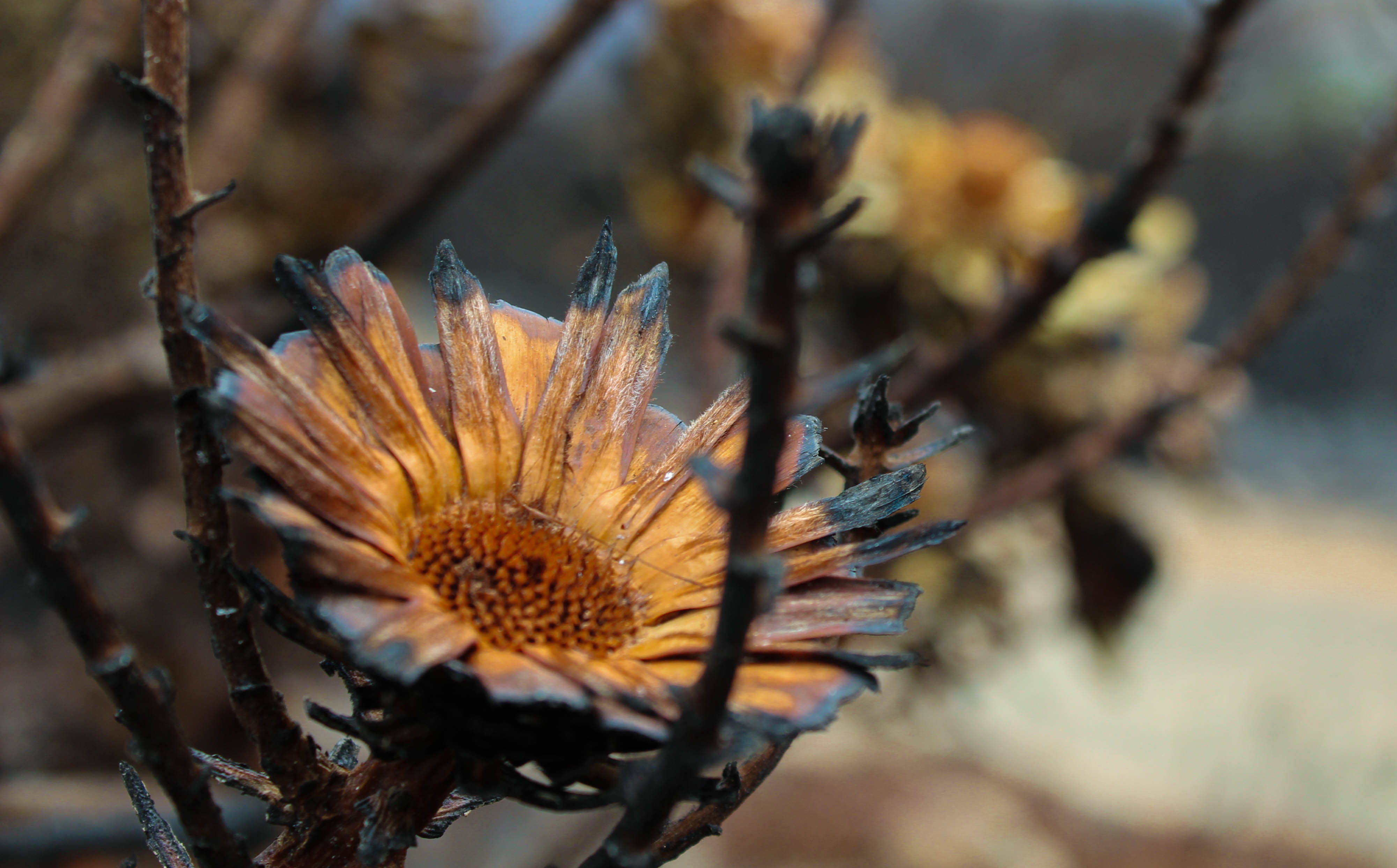
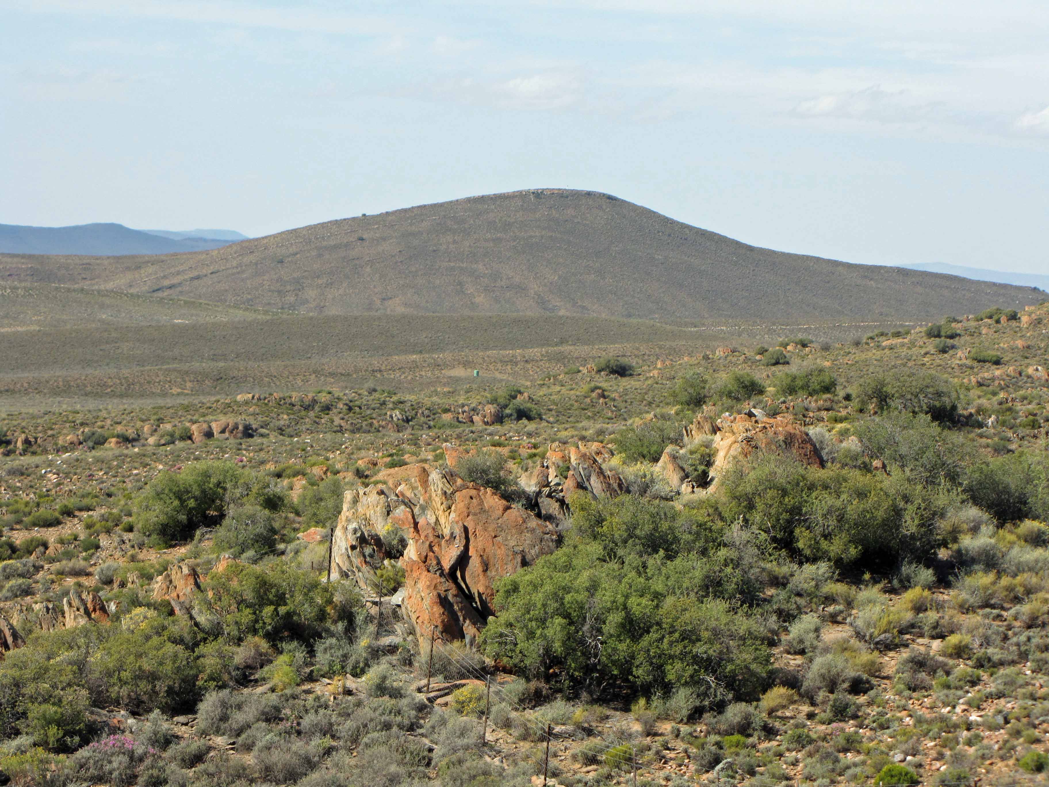
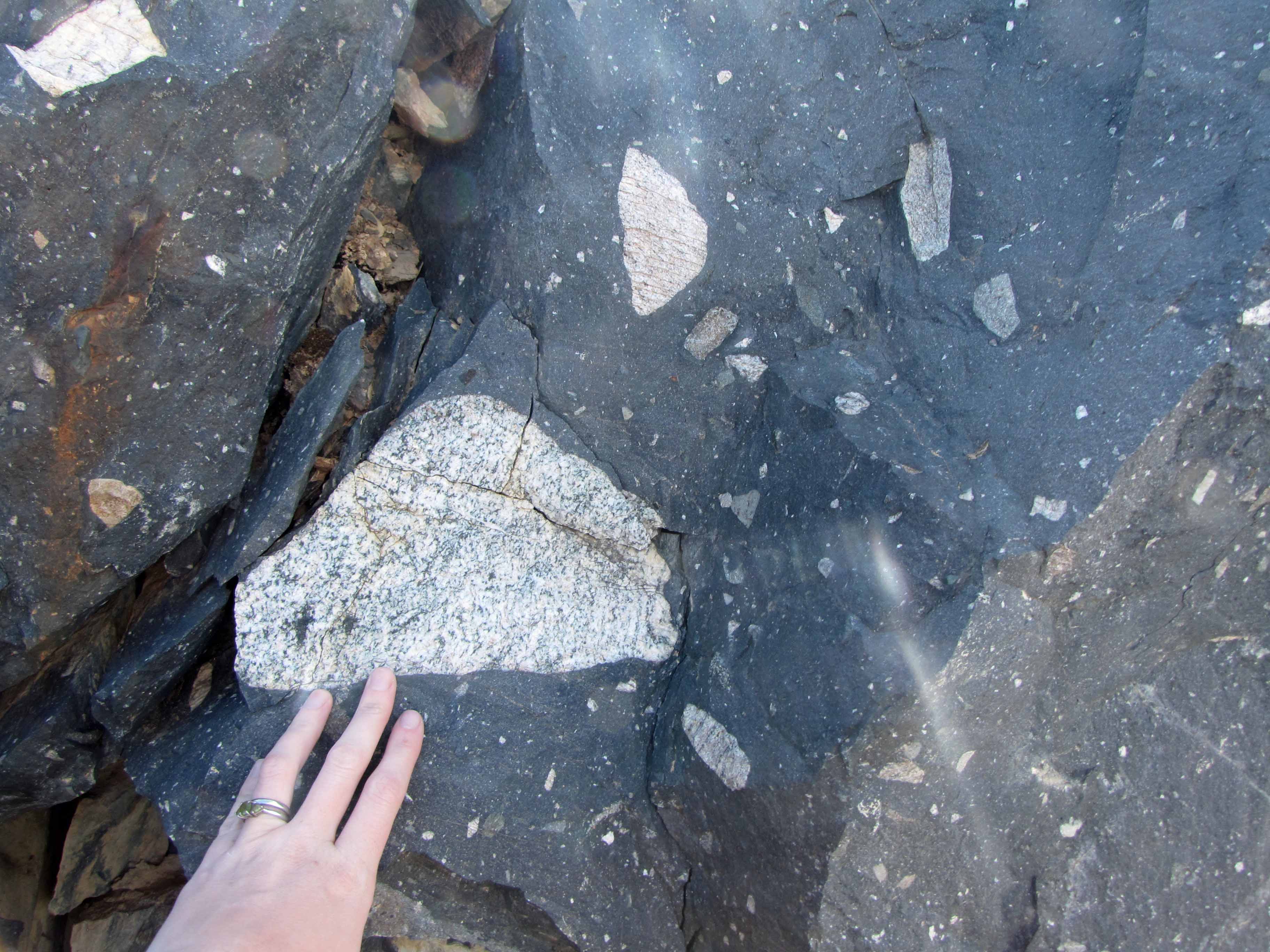
Dwyka diamictite can be recognised from a distance by its typical “tombstone” appearance, which forms during weathering.
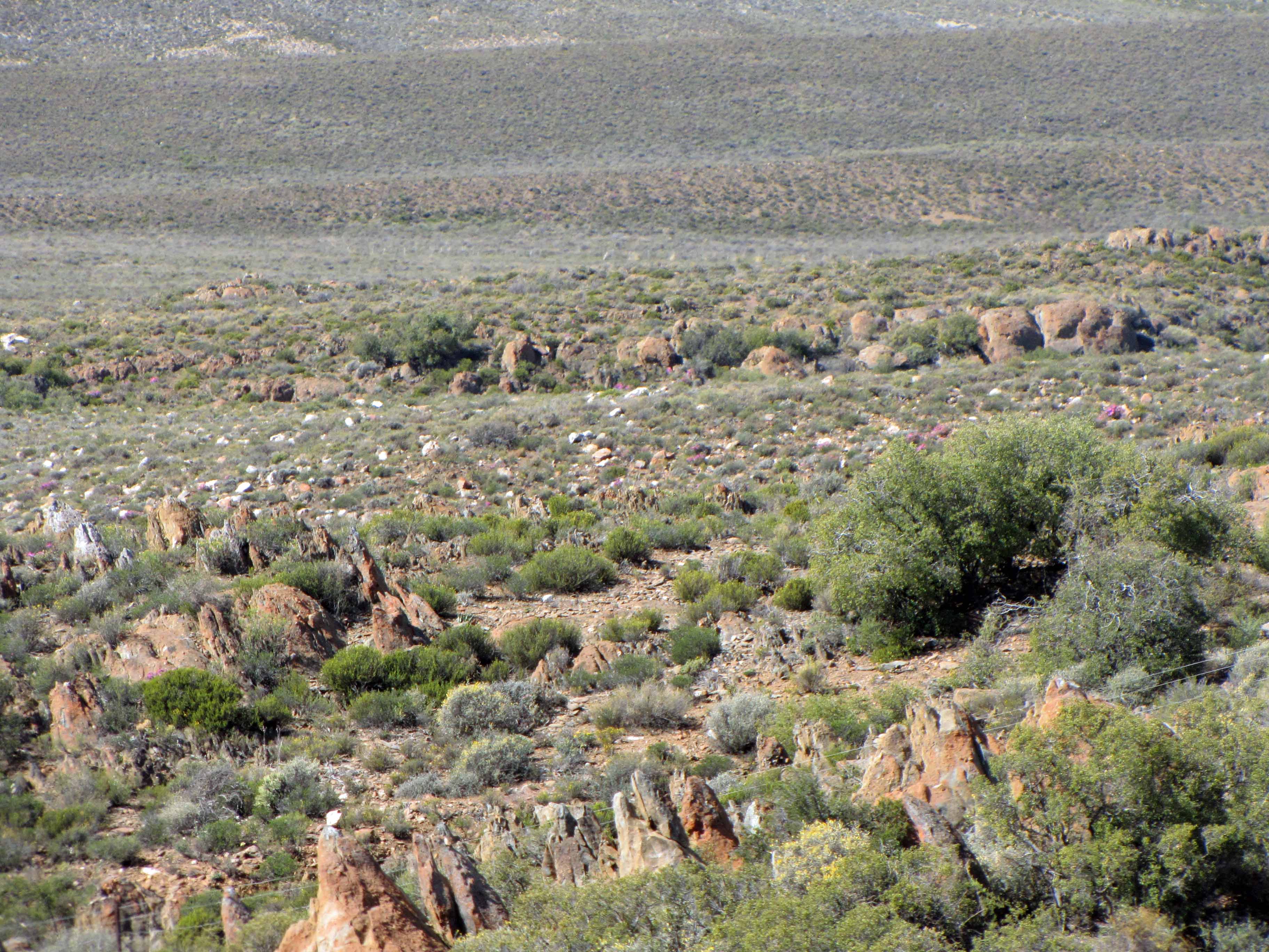
At long last, I’m finishing up my series of posts about my October 2013 visit to the small town of Sutherland in South Africa’s Northern Cape province. Sutherland is home to a South African Astronomical Observatory (SAAO) research station that contains many telescopes, including the Southern African Large Telescope (SALT). You can read Part I of this series here, Part II of this series here, Part III of this series here, Part IV of this series here, and Part V of this series here. In my previous posts, I blogged about the astronomical observatory. In the last couple of posts, I’d like to blog about some of the geology that I observed on the drive from Cape Town to Sutherland.
On the drive to Sutherland, we stopped at some fantastic roadcut exposures of Dwyka Group glacial sedimentary rock. Specifically, we stopped to look at some Dwyka diamictite, a term used to describe a poorly sorted sedimentary rock, commonly one deposited by a glacier. Dwyka glacial sediments are often referred to as “Dwyka tillite”. However, tillite is a specific term that refers to poorly-sorted sediments deposited directly underneath a glacier. Since there is evidence that many of the Dwyka glacial sediments were deposited in a glaciomarine environment, the term “Dwyka diamictite” is more accurate… and also has pleasing alliteration! Dwyka diamictite is Carboniferous in age and was left behind by a large glacier that covered southern Gondwana. Thus, Dwyka diamictite can be found on several continents and provides evidence that the supercontinent of Gondwana once existed.
Dwyka diamictite can easily be recognized from a distance by its distinctive “tombstone” appearance:
More “tombstone” weathering of Dwyka diamictite.
For some reason (perhaps one of my geomorphologist readers knows why?), the Dwyka tends to weather into “tombstone” shapes.
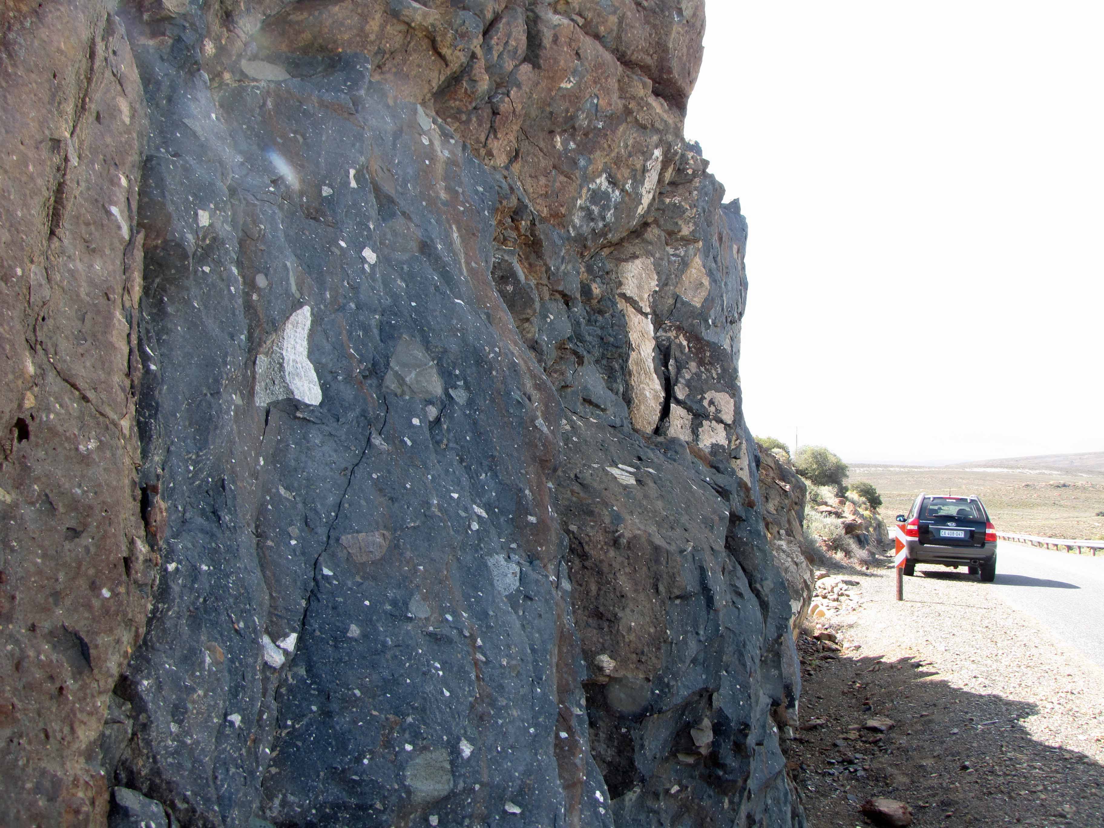
Dwyka diamictite is generally is covered in a reddish-brown oxidation rim. A fresh surface of Dwyka consists of a dark gray matrix (finer-grained glacial sediment) that contains clasts of all sizes, shapes, and rock types.
Here’s a look at a fresh roadcut surface of Dwyka diamictite:
Dwyka diamictite roadcut, with 4×4 for scale.Another view of the Dwyka diamictite outcrop.
I was really excited to take a look at such a beautiful roadcut of Dwyka diamictite:
Look! Dwyka diamictite!After several “Vanna White” shots, my husband made me take a “calmer” picture with the Dwyka diamictite outcrop.
Here are some pictures of some of the interesting clasts I saw in the Dwyka diamictite outcrop:
Dwyka diamictite clasts #1.Dwyka diamictite clasts #2.Dwyka diamictite clasts #3.Dwyka diamictite clasts #4.Dwyka diamictite clasts #5. That black and white clast is worth a closer look.Dwyka diamictite clasts #6.
How many of the above clasts can you identify? I see some igneous rocks, some sedimentary rocks, some metamorphic rocks… all sorts of rocks!
Well, that’s all for this “Sutherland Sky” post. Next I’ll share some pictures of some rocks I saw as we drove through the Cape Fold Belt on our way from Cape Town to Sutherland.
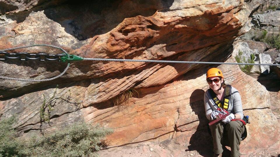
Posing with some pretty sandstone cross-bedding in the Cape Fold Belt, Ceres, South Africa.
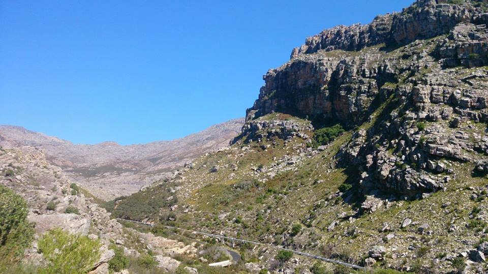
Soon, I’ll continue with sharing more pictures from my geological wanderings in Mauritius earlier this year. However, for this week’s “Monday Geology Picture” I want to share some pictures from my recent visit to the little town of Ceres in the Western Cape of South Africa. Last Friday, I went to Ceres for the day with my husband and two friends visiting from America. Ceres is about an hour and a half north of Cape Town by car and is located in a geologic feature known as the Cape Fold Belt. In the Cape Fold Belt, sandstones and other sedimentary rocks have been extensively uplifted and folded. However, there are still many places where you can glimpse some primary sedimentary structures, such as the sandstone cross-bedding shown in the picture above. I posed with this cross-bedding when I was on a zipline adventure at Ceres Zip Slide Tours. If you like beautiful views of sedimentary rocks and aren’t afraid of heights, I highly recommend ziplining in Ceres. We had a great time!
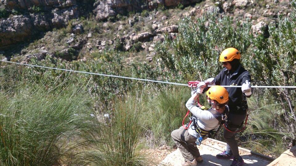
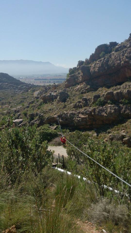
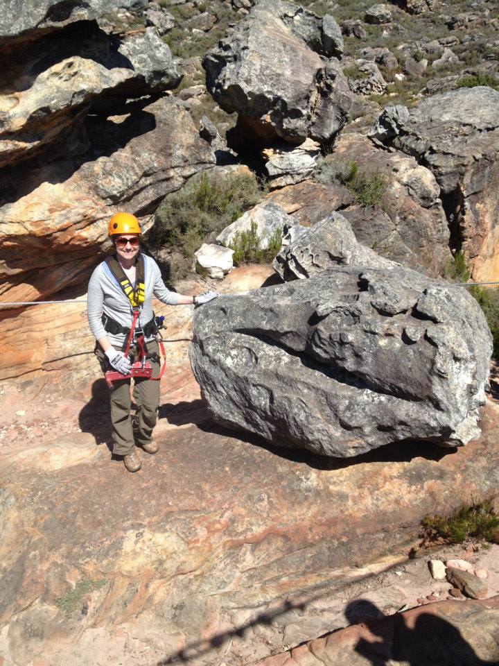
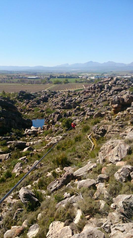
Here are some more pictures from our ziplining adventure in Ceres:
Nervously preparing to launch myself on the first zipline of the day.One of my friends on the first zipline. You can see some vineyards in the background.On another zipline. What a view! What a great way to look at some uplifted sedimentary rocks!Stunning sedimentary scenery.More stunning scenery.Yet more stunning scenery.A friend on another zipline. This was a long one!Posing with an interesting rock that resembles a dinosaur head.Another stunning zipline view.Having fun… I think I’m (mostly) over my nervousness here.On one of the last ziplines.
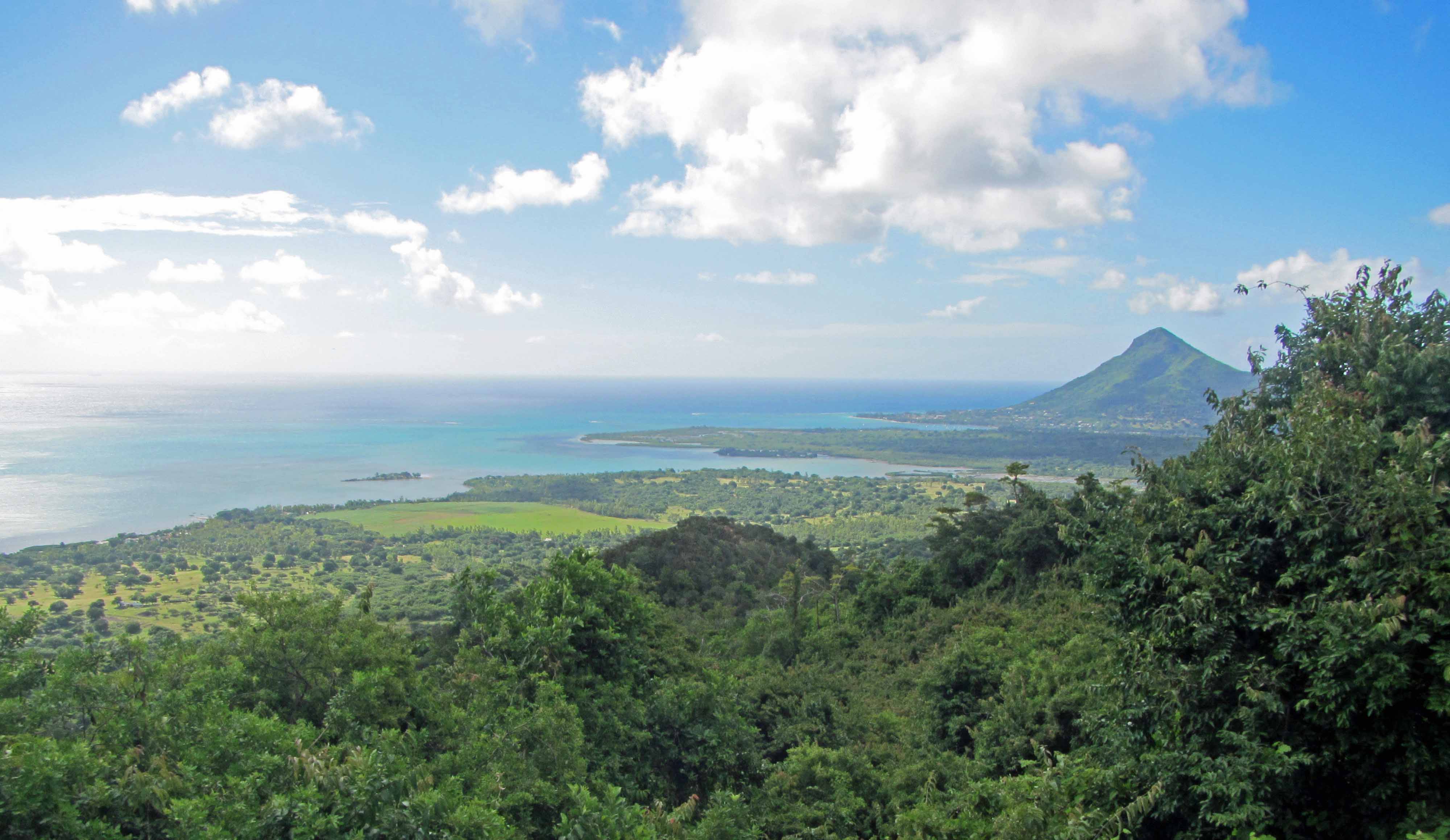
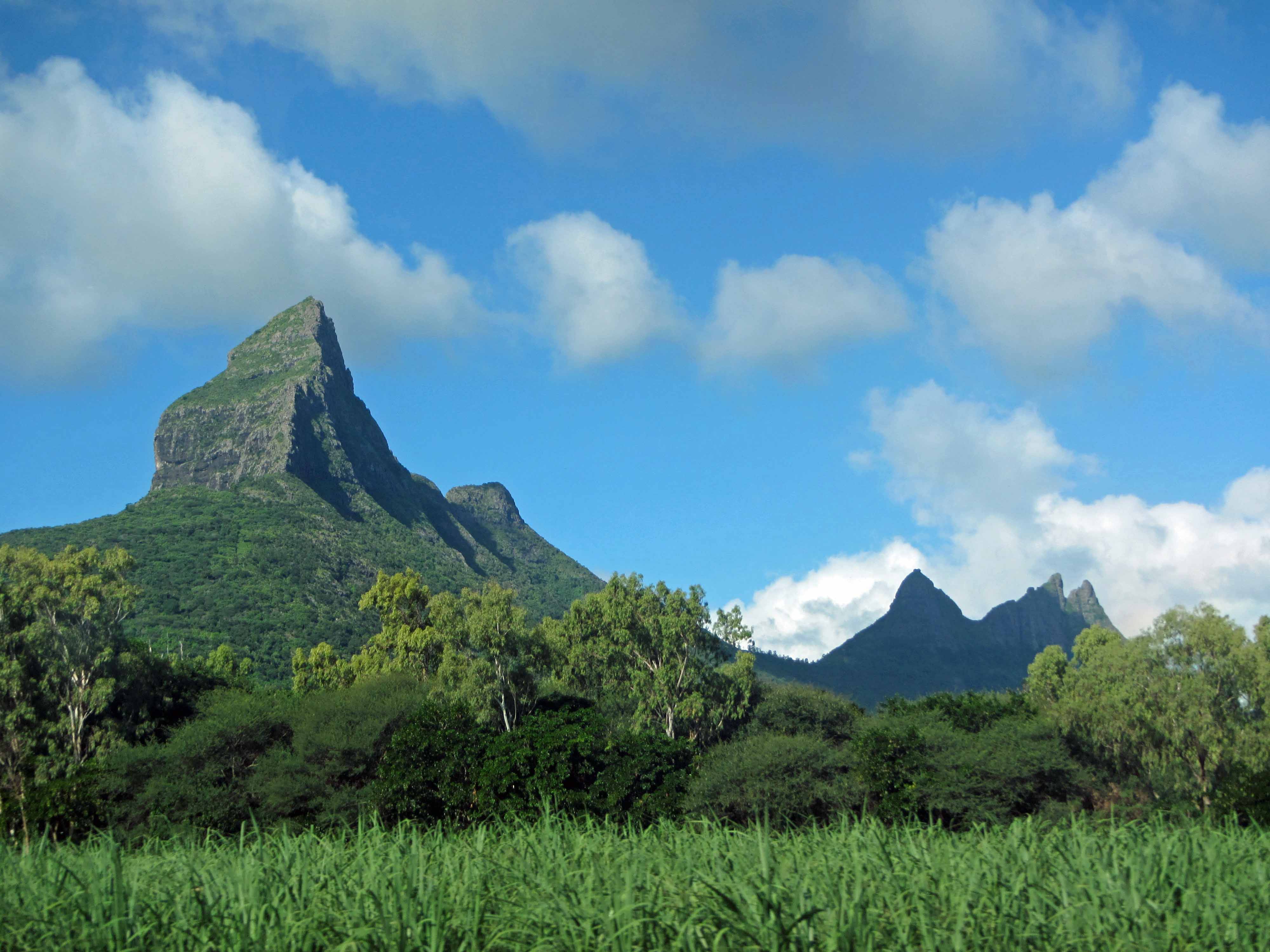
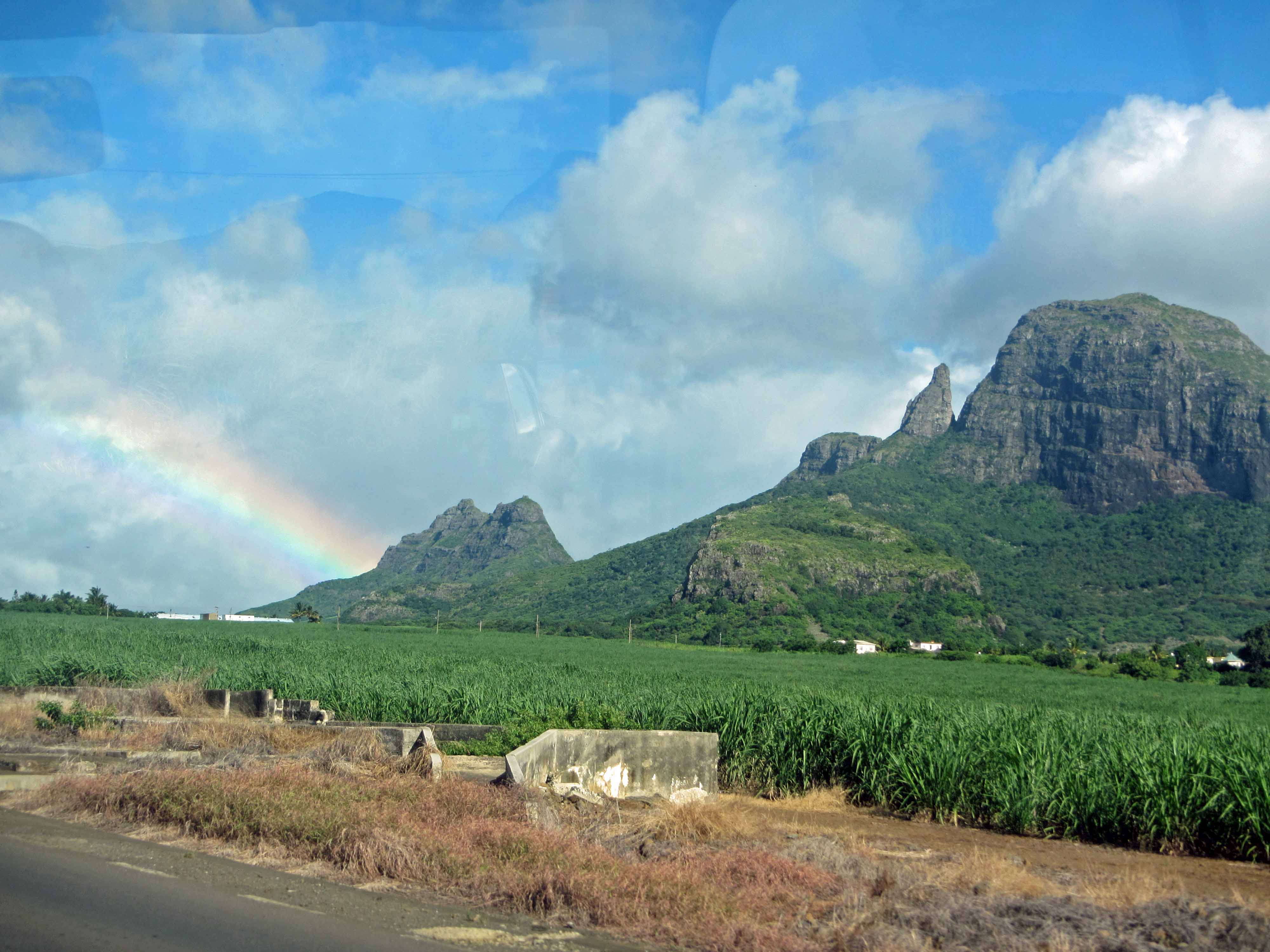
Rugged, young volcanic terrain in Mauritius. This picture shows the dramatically perched boulder on Pieter Both Mountain, which has an elevation of ~820 meters.
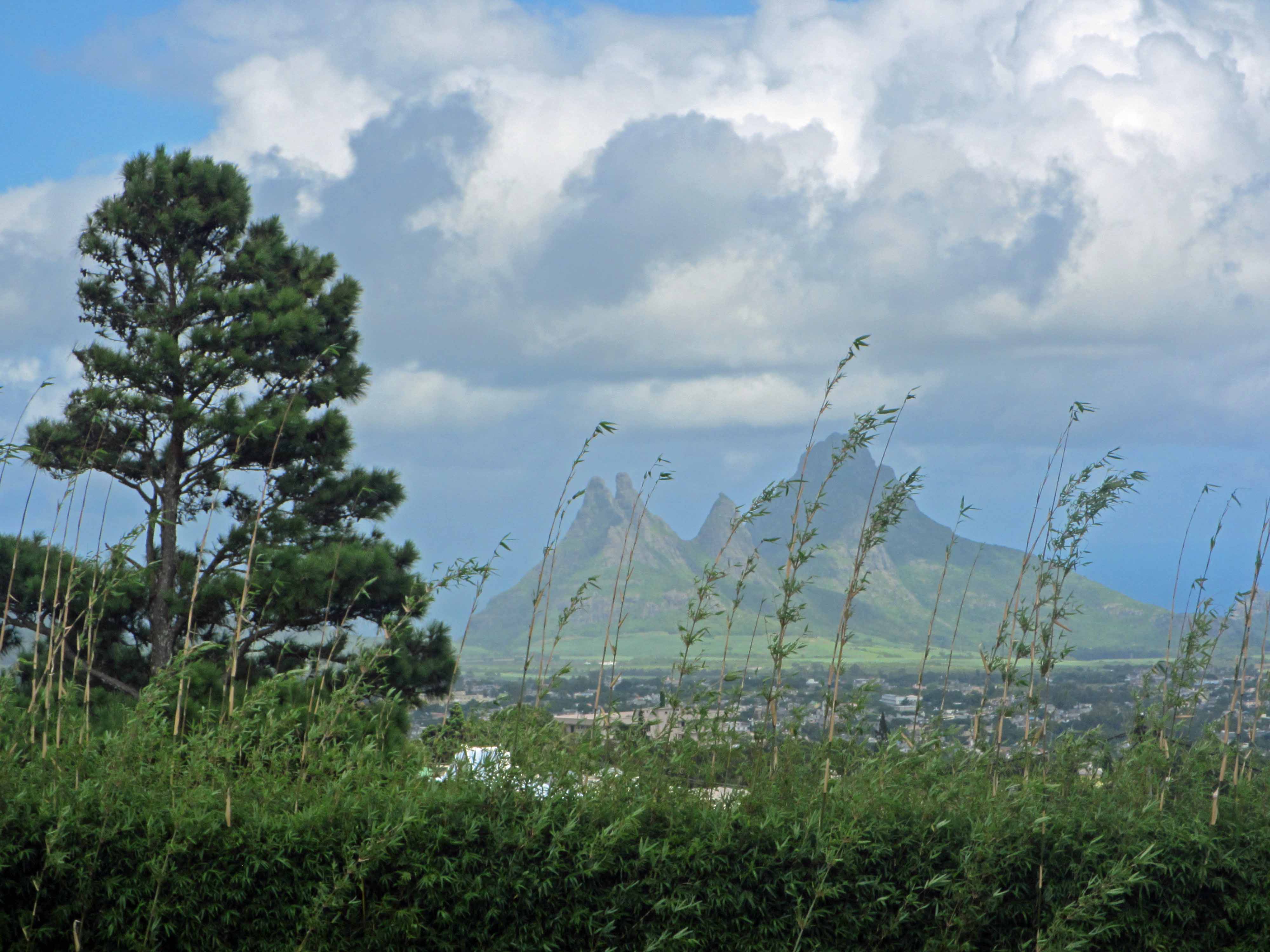
For the next little while, I will be blogging about my recent (March 2014) vacation to Mauritius, a young volcanic island in the Indian Ocean. I recently shared a couple of pictures of volcanic basalt in Mauritius for my “Monday Geology Picture” posts here and here. In future posts, I’ll write a little more about the volcanic history of Mauritius. In brief, Mauritius is believed to have been formed by a mantle hotspot that is now located underneath the volcanically active island of Réunion. Geologically speaking, the island of Mauritius is very young. The oldest lavas on Mauritius are approximately 8 million years old; the youngest are approximately 200,000 years old (see this publication for more on Mauritian lavas over time). There has not been very much time for the volcanic rocks of the island to erode– that is, there has not been very much time for them to be worn down and smoothed by various physical, chemical, and biological weathering processes. Thus, the landscape of Mauritius is dominated by steep, rugged hills and mountains comprised predominantly of young, dark-colored lava rocks. However, the rocks are certainly eroding. Mauritius has a wet, humid climate and is covered in vegetation, so chemical and biological weathering are breaking down the rocks at a fairly fast rate. On the tops of some of the mountains, boulders and rock slabs are perched precariously and will one day, not all that far in the future, come crashing down into the valleys during dramatic displays of physical weathering.
Below are some more pictures of the young volcanic landscape of Mauritius. Enjoy!
Another view of Pieter Both mountain and the famous perched boulder.A slightly closer view of the boulder on top of Pieter Both Mountain.Another view of Pieter Both Mountain and surrounds.One last view of Pieter Both Mountain.More rugged mountains, with some vegetation in the foreground. Mauritius is covered in lush vegetation, so it’s sometimes difficult to take pictures of landscapes and rocks.Another view of the rugged mountains… with slightly less foreground vegetation.Another landscape picture… and some more foreground vegetation.Vegetation, valley, mountains, sky #1.Vegetation, valley, mountains, sky #2.Another rugged mountain view.Steep hill at the sea.Yours truly posing with the steep hill and the sea.More rugged mountains.Another view of some rugged mountains.Some more rugged mountains… and a rainbow.Rainbow meets mountains.One last pretty shot.
Stay tuned for more posts on the geology of Mauritius!