Geology Word of the Week: I is for Ice

Ice on a partially-frozen wetland pond, New Hampshire, November 2014.

def. Ice:
Water (H2O) in a solid state. When naturally occurring, ice is considered a mineral. There are many forms of ice: lake ice, river ice, sea ice, snow, glaciers, ice caps, ice sheets, and frozen ground (such as permafrost).


If you ask a geologist what he or she considers to be Earth’s most important mineral, you will probably hear many different answers, depending on the person. Some might choose a common mineral, perhaps olivine or quartz or feldspar. Others might choose a rare, economically valuable mineral, perhaps gold or tantalite or monazite. Others might choose a mineral that is important for understanding the geological history of the Earth, perhaps zircon or spinel or serpentine or maybe even jimthompsonite. However, if you ask me what I consider to be Earth’s most important mineral, I think that I would reply that it is ice.

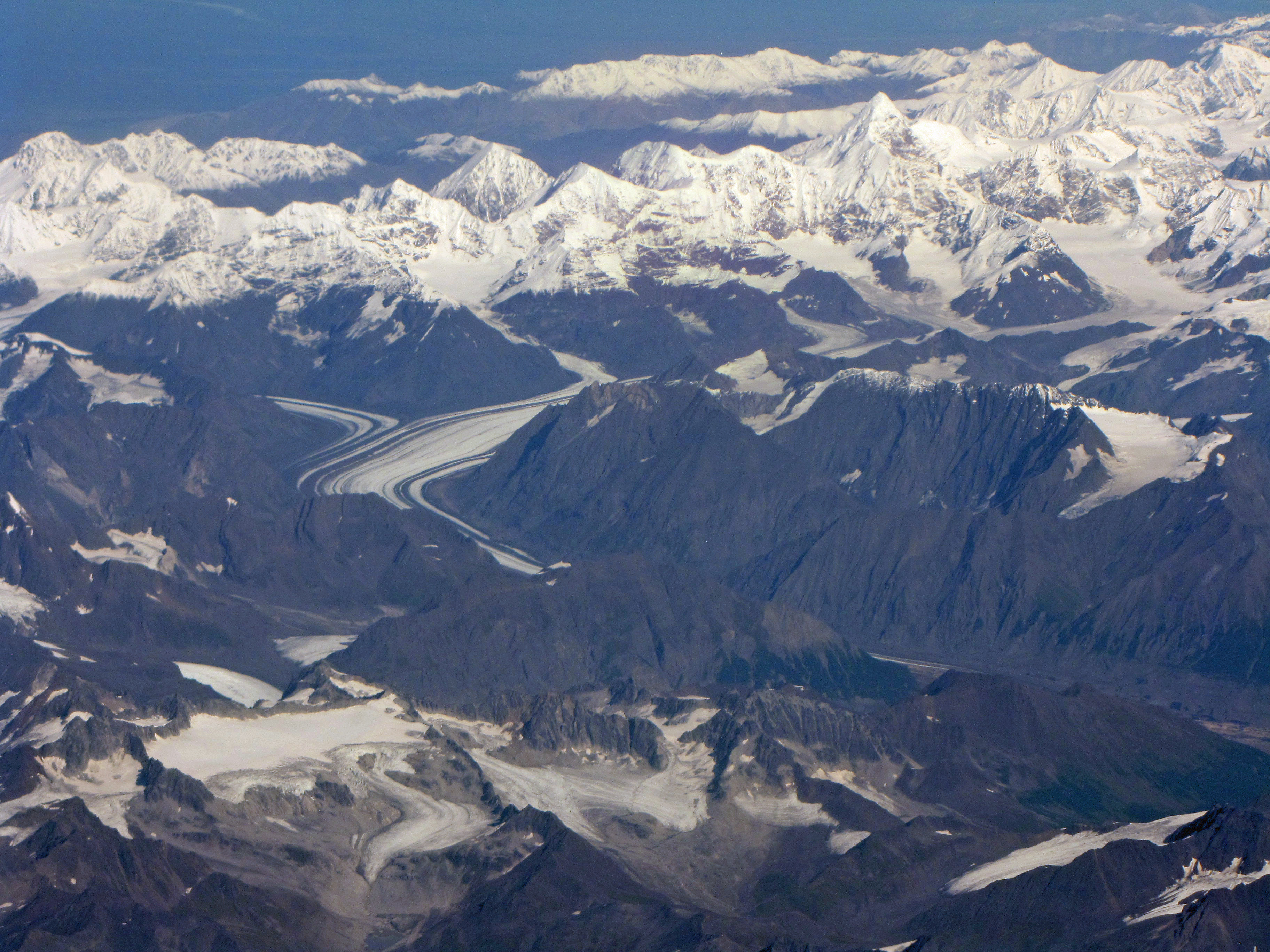
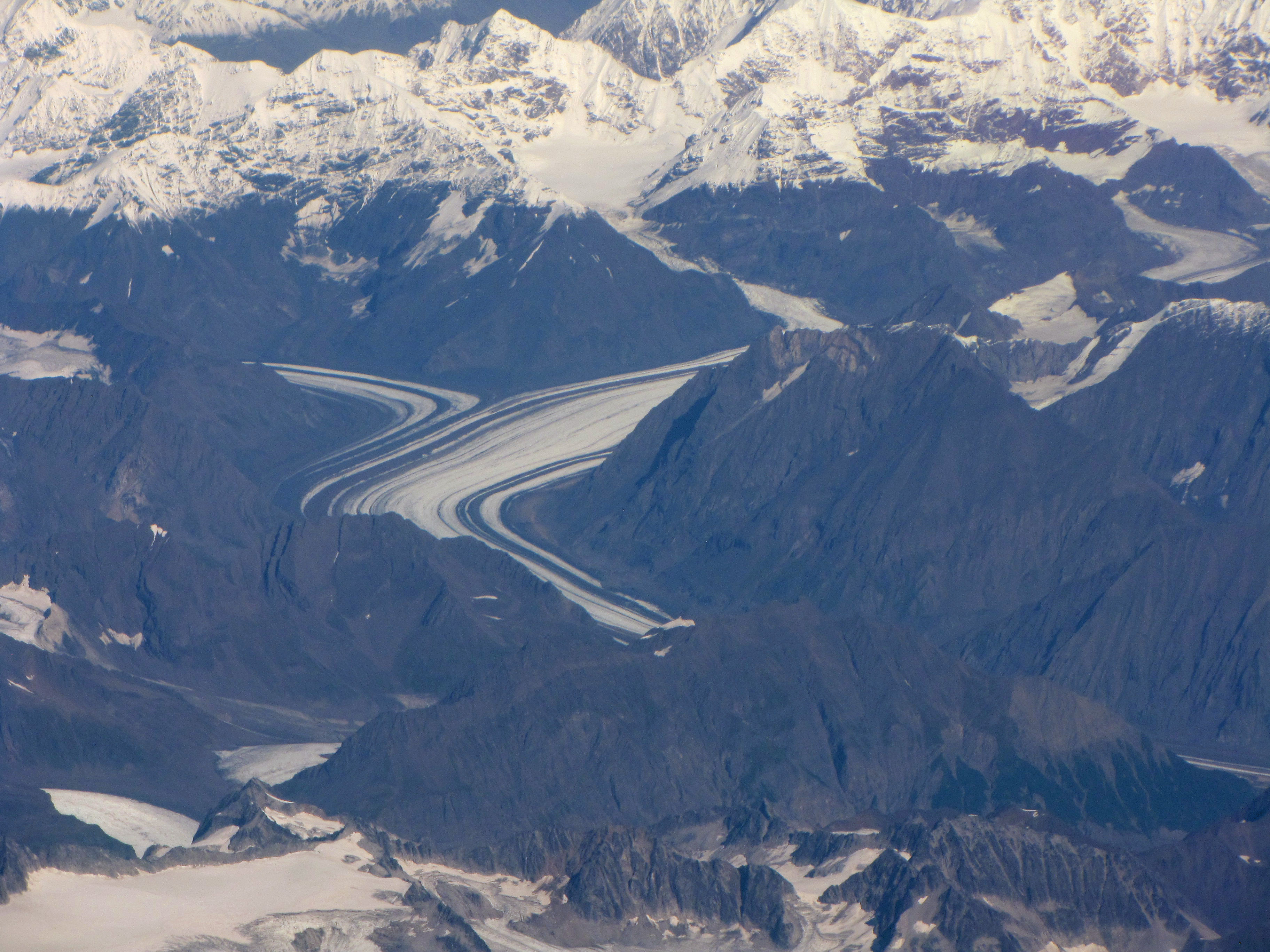
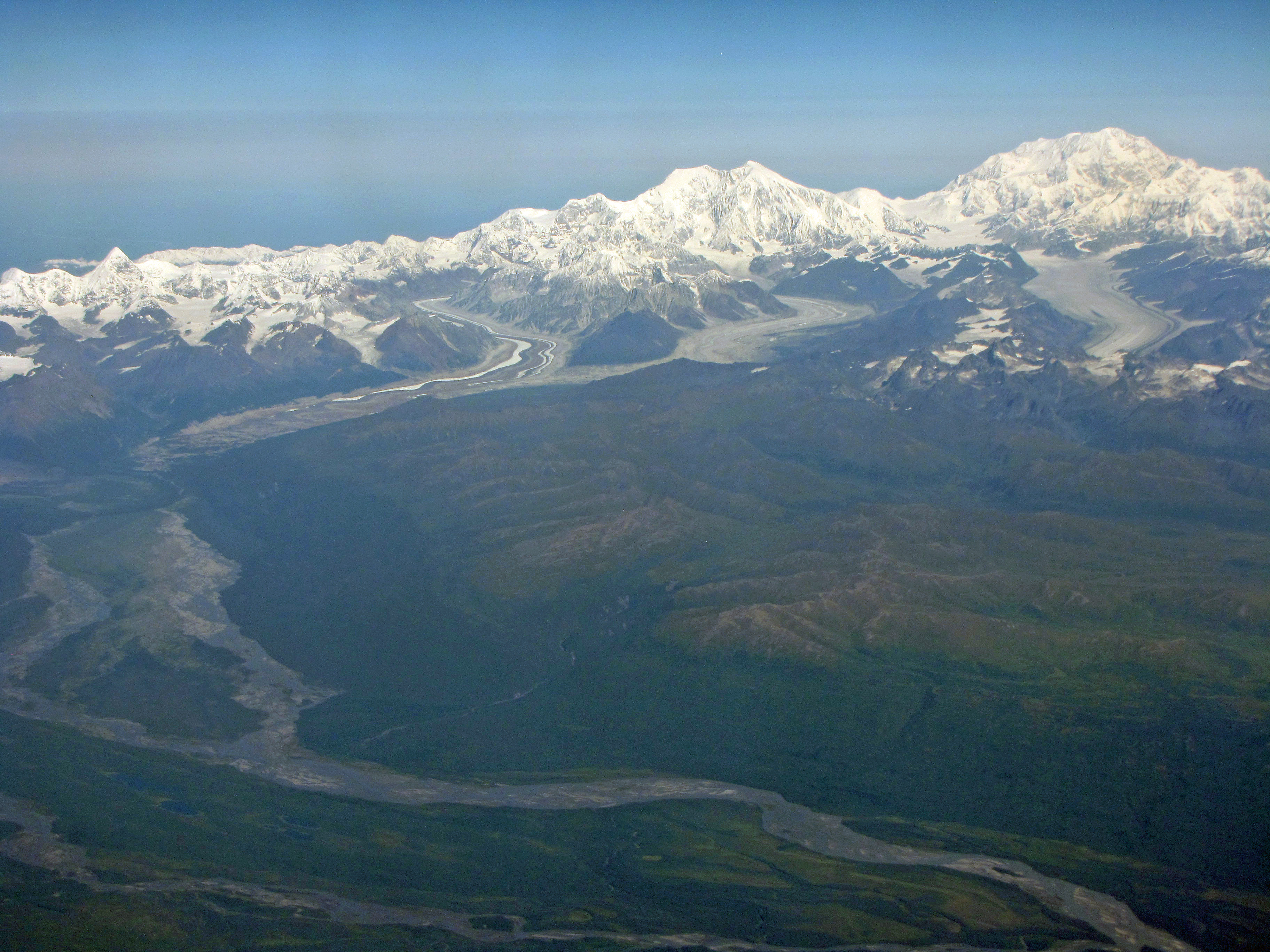
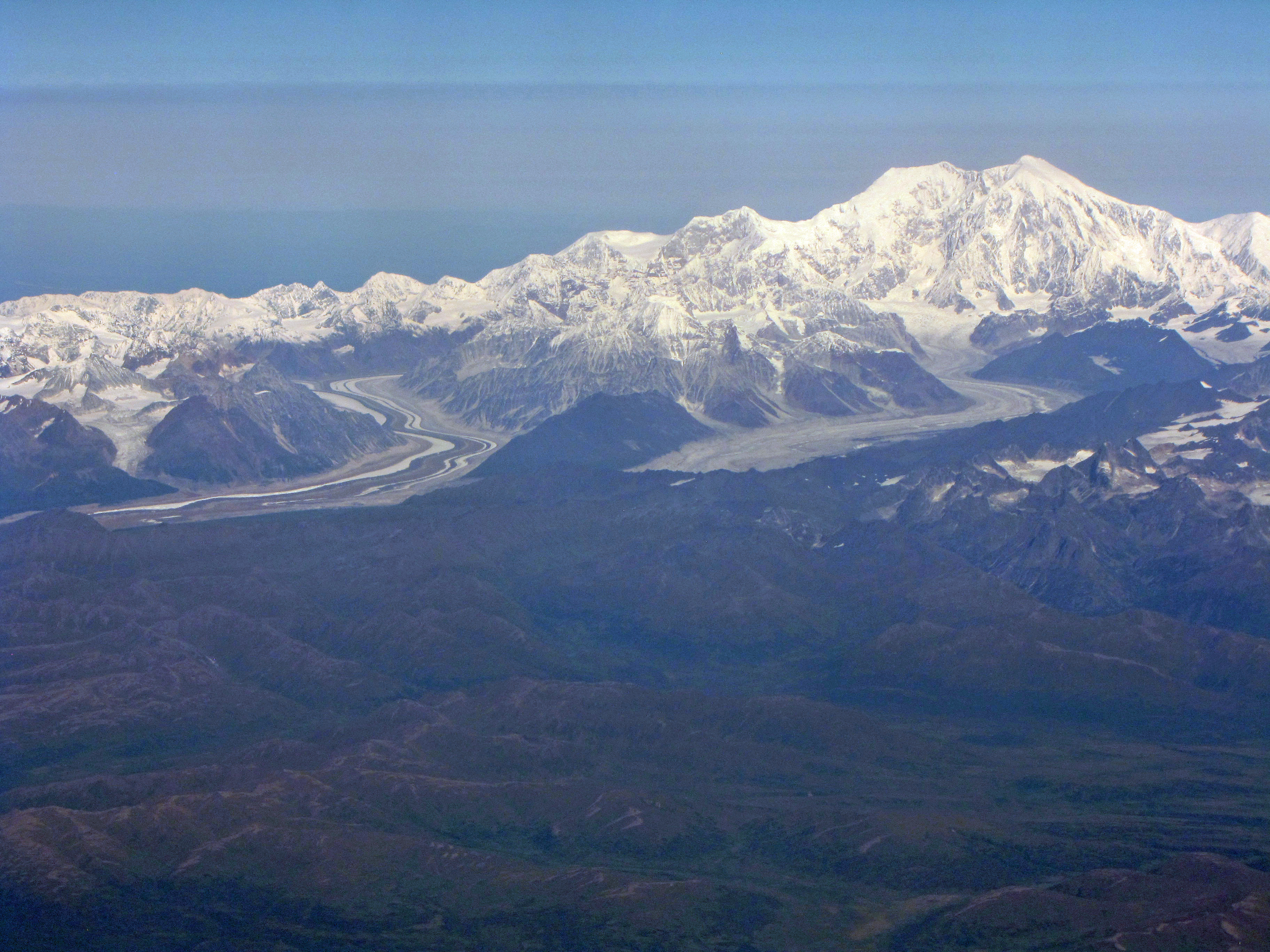
After all, how many minerals have an entire field of geology devoted to them? Glaciology is a very important field of geology that is devoted to the study of glaciers and, more generally, ice in all its forms.

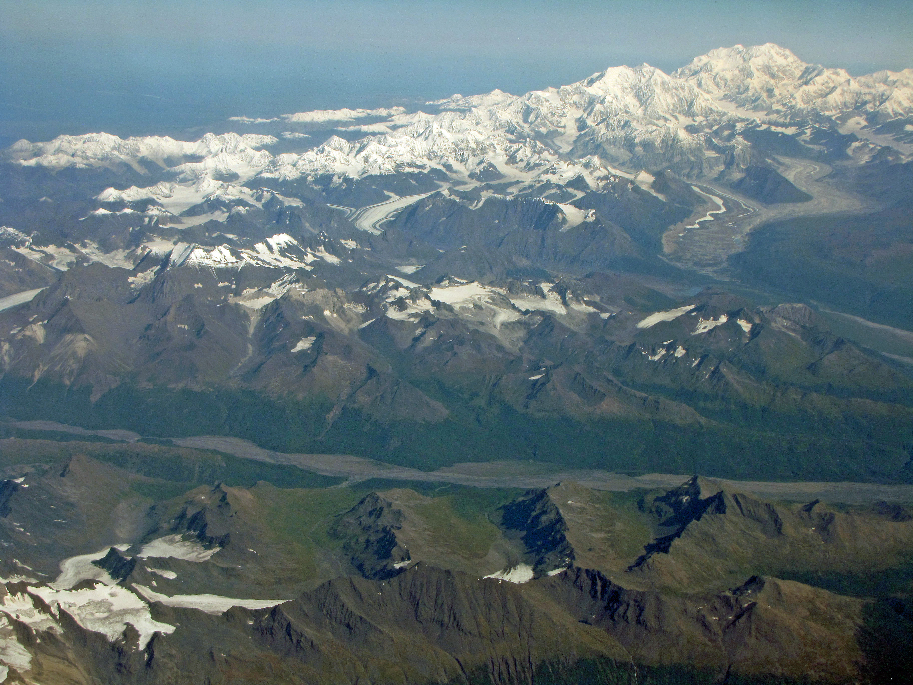
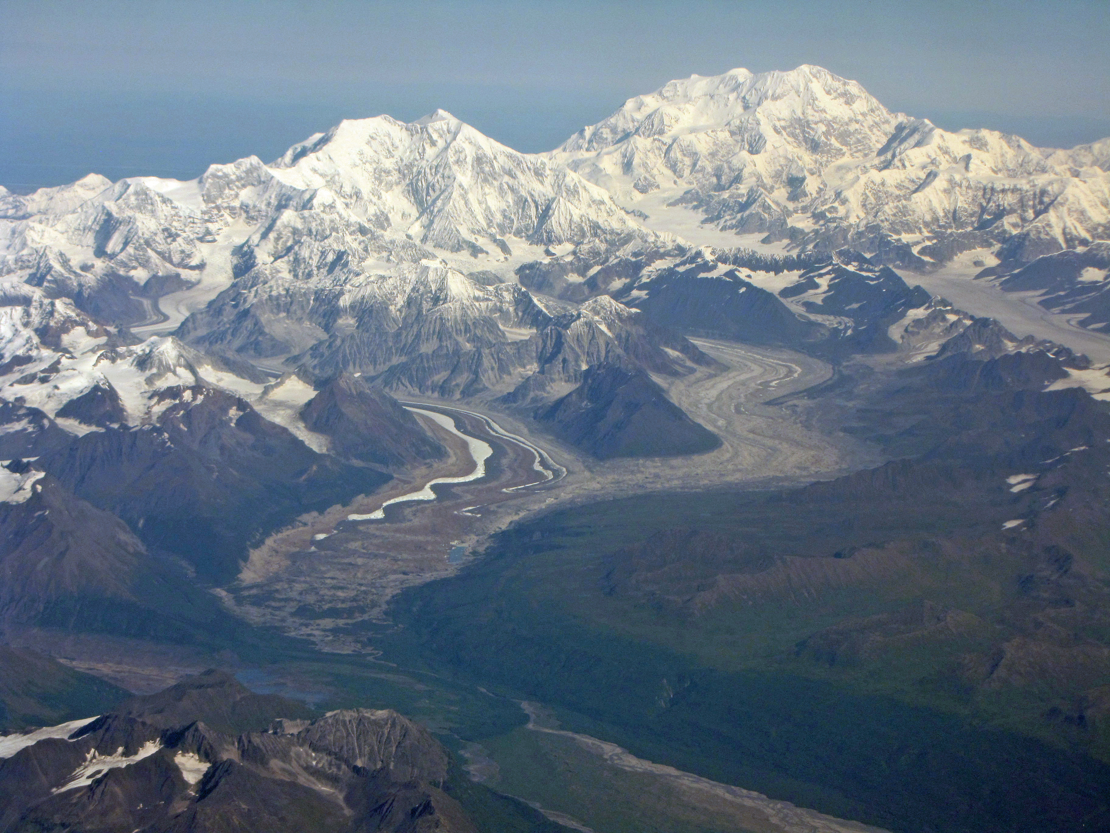
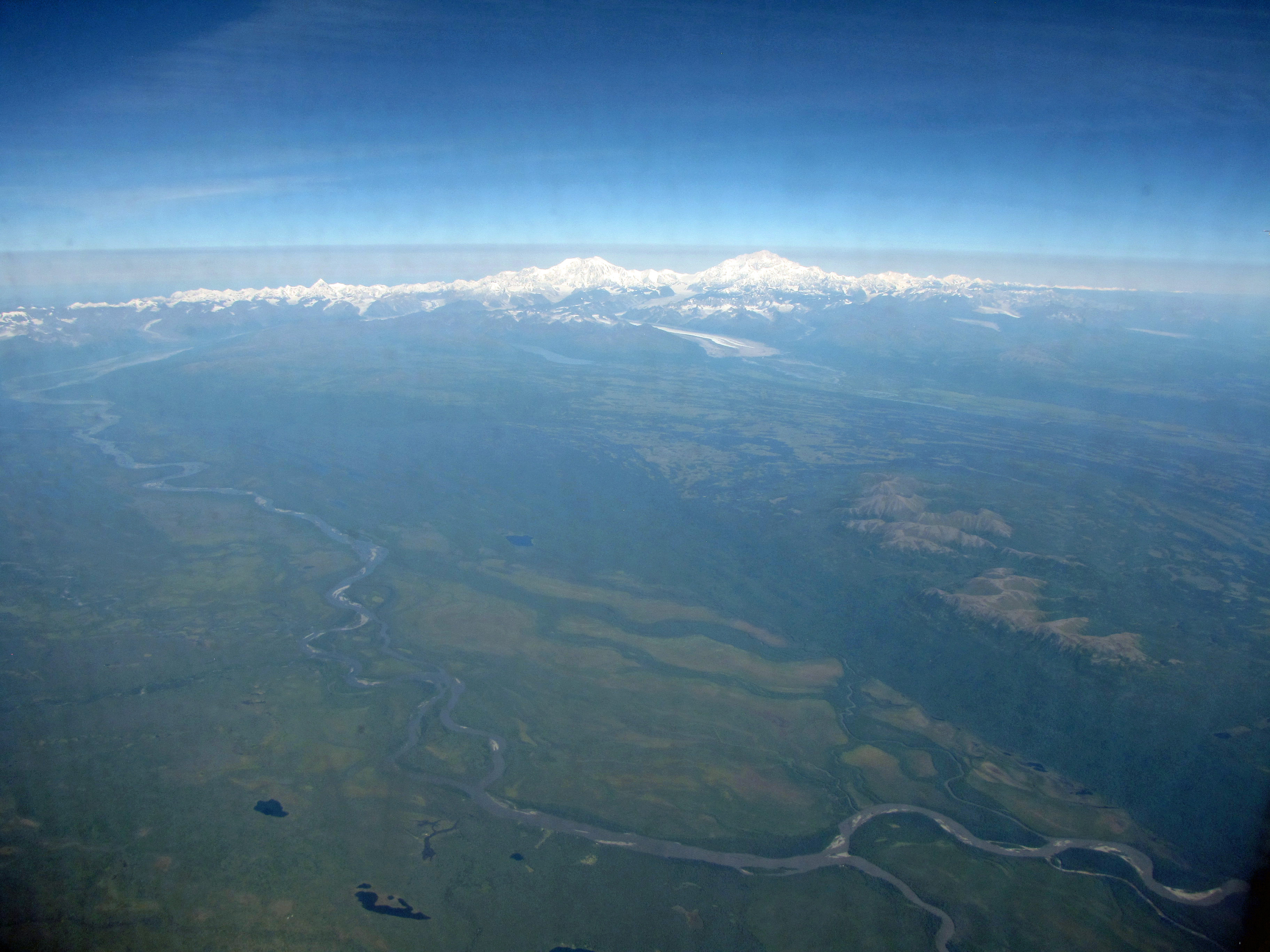
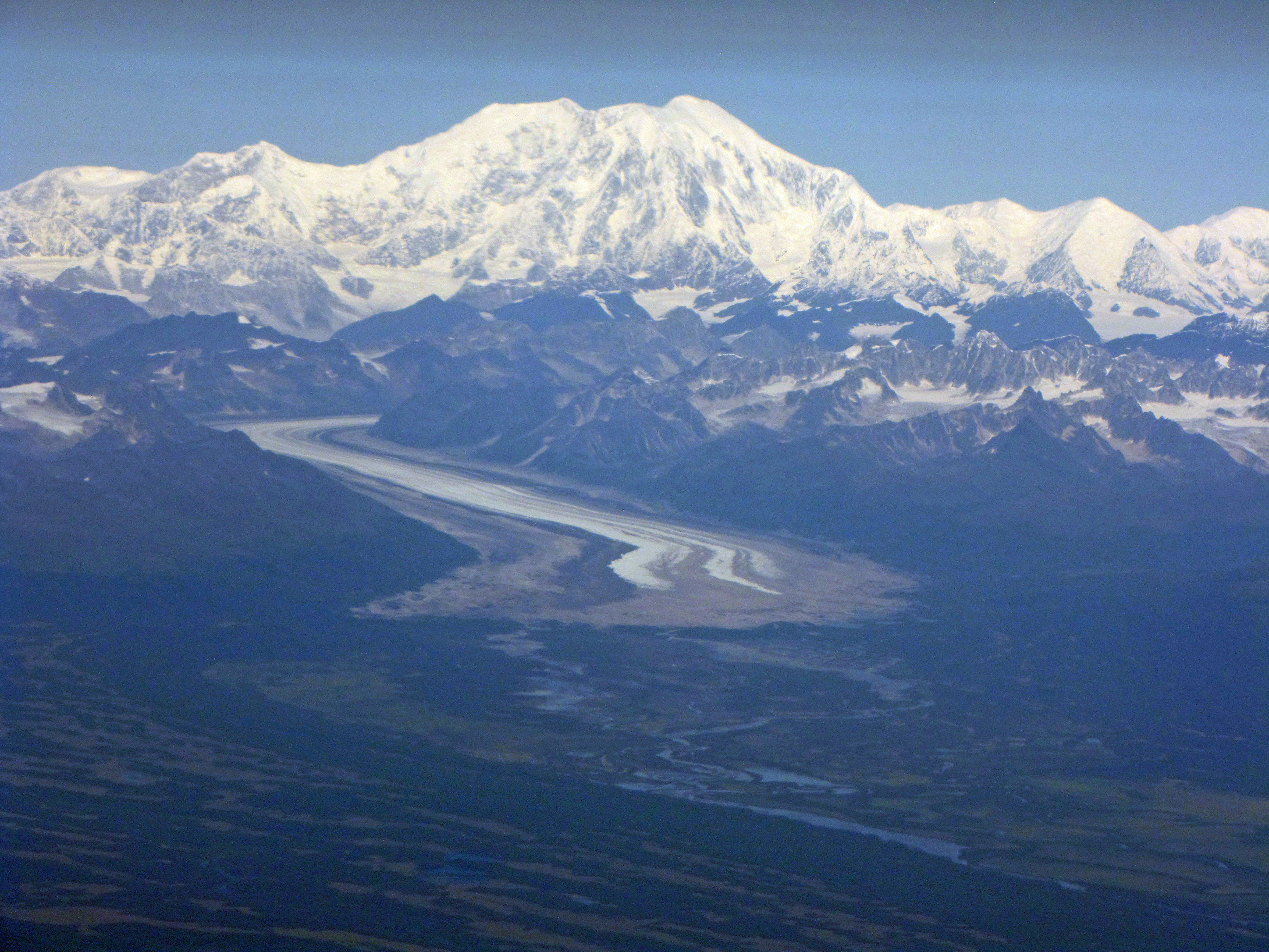
And how many minerals cover vast expanses of the Earth? Sure, much of the mantle consists of olivine and much of the core consists of metal alloys, but no other mineral can compete with ice when it comes to Earth’s surface. Ice covers much of the Earth’s land and ocean surface, and the portions of the Earth that are covered with ice comprise the cryosphere. Some scientists even believe that during particularly cold time periods in the past, the entire Earth, a so-called “Snowball Earth”, was covered with ice, an all-encompassing cryosphere.

And how many minerals play such an important role in Earth’s climate? The formation of ice is a key aspect of Earth’s climate system. Very simply, there is more ice when Earth is colder and there is less ice when Earth is warmer. However, the transition from water to ice and ice to water can be complex. For example, the light color of ice creates an ice-albedo feedback loop. Climatologists are still working to unravel the details of the roles that ice plays in global climate.

And how many minerals are less dense than their liquid counterparts? The lower density of ice relative to water enables it to float on top of water, and this physical arrangement has a profound impact on the nature of the hydrosphere and biosphere. If ice did not float on top of water, then many natural bodies of water might freeze completely, never fully thawing in the heat of summer. The lower density and greater volume of ice (compared to water) also plays a role in geomorphology. The expansion of water when it freezes into ice contributes to the physical weathering of rocks. The freezing and thawing of water breaks up rocks and is also responsible for other geomoprhological processes, such as solifluction.

I’m sure that there are many other reasons why ice is an important mineral. However, I think that the ones I’ve listed above are sufficient to convince me. If anyone asks me what I consider to be Earth’s most important mineral, I will answer ice… although since I currently work as a diamond geologist I might broaden the definition to include both frozen water and the sparkly gemstones I study at work.

But what would you answer? What is Earth’s most important mineral? What about Earth’s second most important mineral?

I have to admit, until I gave some thought to this week’s geology word I don’t think that I would have answered ice. I probably would have answered olivine, since I like mantle geology. However, that’s because I don’t generally think of ice when I think of minerals. I guess that ice is so common, and also so unusual (compared to other minerals), that it doesn’t fit into my standard “this is a mineral” box. There’s no doubt about it, though: ice is a mineral, and it is an important one.

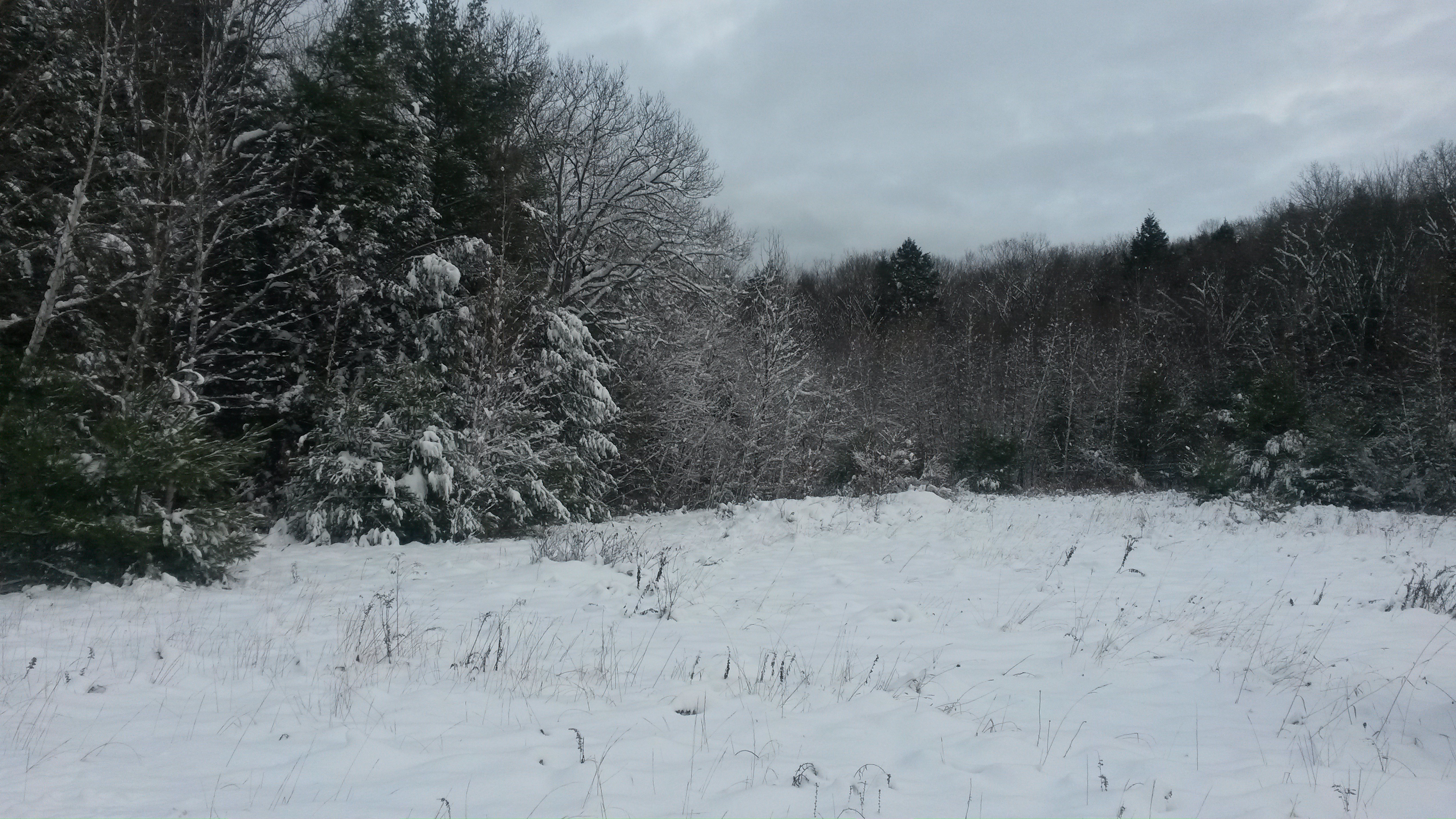
Of course, not all ice is a mineral. The ice that you find in ice cubes in your drink is technically not a mineral since minerals must be naturally occurring by definition. My husband, who grew up in South Africa and only saw snow for the first time in his 20s, has a nice way of categorizing ice: he calls the ice that you find in your refrigerator “domesticated ice” and ice that you find out in nature “wild ice”. Growing up in a landscape without ice, my husband finds the “wild ice” of New Hampshire, where I come from, fascinating. And I suppose he should. For while a frozen puddle on the street, a line of icicles on a rooftop, and a dusting of snow on the driveway may seem quite ordinary to someone who grew up in a cold climate, they are small pieces of a quite extraordinary cryosphere that is an integral part of the planet we call home.

Snowy New Hampshire scenery, November 2014.
A glacier on Denali in Alaska, 2013.
Snow and glacier covered Denali in Alaska, 2013.

Monday Geology Picture: A Glacial Erratic in the New Hampshire Woods

A glacial erratic in the woods near the Mervine Family Cabin in New Hampshire.

I spent the last two weeks of November visiting my family in New Hampshire. While I was in the US, I went on some long jogs and walks and took pictures of some glacial erratics, which can be found all around the Mervine Family Cabin in southern New Hampshire. This week’s “Monday Geology Picture” features a glacial erratic in the woods just down the road from the cabin. This large, angular rock was deposited during the retreat of the last ice age.

Plane Views: Denali

Denali #1.
Denali #1.

Three out of the four times that I flew between Anchorage and Nome, Alaska, the weather was overcast and clouds covered much of the landscape below. However, when I flew from Nome to Anchorage in August 2013 I was fortunate enough to fly on a day when skies were clear. I was thrilled to obtain a spectacular view of Denali, also known as Mt. McKinley, the highest peak in North America. Denali towers an impressive 20,237 feet above sea level. Flying over the Denali mountain range was a beautiful, humbling, thought-provoking experience. The landscape is certainly breathtaking. Rugged white mountain peaks are flanked by immense brown-and-white striped glaciers that snake down the slopes before melting into sediment-laden rivers that rush through green valleys then meander across the flat, pale green plain far below the mountain peaks. I found the glaciers particularly beautiful and fascinating. I also wondered and worried about what the glaciers will look like in 10 years, in 20 years, in 50 years, in 100 years– blinks of an eye in geologic time but significant periods in human time. Will the glaciers have shrunk due to warming climate? Will they be there at all? The immensity, and also the fragility, of the lofty landscape humbled me. So, too, did the thought that I was flying high above Denali, traveling in a little metal airplane built by little men (and women, I hope). I likely will never have the skill or guts or determination to climb a mountain such as Denali, but thanks to modern technology and some good weather conditions I was able to, for a little while at least, appreciate Denali’s beauty from a great height.

Below are some more plane views of Denali and the surrounding landscape. Enjoy! Please feel free to point out features on these pictures if you are familiar with the terrain. The National Park Service provides some information about the geology of Denali here.

Denali #2.
Denali #2.
Denali #3.
Denali #3.
Denali #4.
Denali #4.
Denali #5.
Denali #5.
Denali #6.
Denali #6.
Denali #7.
Denali #7.
Denali #8.
Denali #8.
Denali #9.
Denali #9.
Denali #10.
Denali #10.
Denali #11.
Denali #11.
Denali #12.
Denali #12.
Denali #13.
Denali #13.
Denali #14.
Denali #14.
Denali #15.
Denali #15.
Denali #16.
Denali #16.
Denali #17.
Denali #17.
Denali18
Denali #18.
Denali #19.
Denali #19.
Denali #20.
Denali #20.
Denali #21.
Denali #21.
Denali #22.
Denali #22.
Denali #23.
Denali #23.
Denali #24.
Denali #24.

Monday Geology Picture: Sunbathing by My Favorite Glacial Erratic

Sunbathing by my favorite glacial erratic. Franklin Pierce Lake, June 2013. Photograph by Jackie Gauntlett.

Happy Labor Day to all of my American readers! I hope that you all enjoy the holiday. Weather permitting, I plan on spending some time sunbathing by my favorite glacial erratic. I’m currently on vacation in New Hampshire and Cape Cod for about a week. I just finished up six weeks of field work in Alaska. My husband and I also visited New Hampshire for a couple of days on our way to Alaska back in July. After spending most of the past year in South Africa and six weeks in chilly northern Alaska, it’s nice to be home for a visit. And I’m always happy to visit my favorite glacial erratic!

Monday Geology Picture(s): My Favorite Glacial Erratic

The glacial erratic in front of my parents' lakeside cabin.

New England is full of glacial erratics: rocks which were transported and dropped by glaciers and which have a different lithology from the rocks upon which they have been deposited. Often, erratic rocks have an angular shape because they were broken off of bedrock by glaciers and have not yet had time to be weathered and rounded by water, wind, and other erosional forces. Glacial erratics can range in size from very small pebbles to very large boulders, but usually it is the boulders which are noticed since these stand out in the landscape and are not easily transported away.

I remember becoming interested in geology as a child when I began noticing large boulders in the middle of fields and the forest around my native New Hampshire. I asked my science teacher about these boulders, and he told me they were called glacial erratics and taught me a little about ice ages. Most of the erratic boulders seen throughout New England today were deposited during the last ice age, which reached a maximum around ~22,000 years ago and which ended ~10,000 years ago.

My favorite glacial erratic, which is shown in this week’s geology picture, sits on a small island in front of my parents’ lakeside cabin on Franklin Pierce Lake in New Hampshire. My parents purchased the cabin about 5 1/2 years ago, and although I had long moved away from home when they bought the cabin, I quickly fell in love with it (and its erratic island!) and try to visit regularly. Every year, my husband and I spend at least a couple of weeks at the cabin. Back in May, the cabin served as a geologist lair when my fellow geoblogger Dana Hunter visited for a few days. If you are brave, you can swim or kayak to the little island from my parents’ cabin and jump off the erratic.

An erratic jump! This picture gives you a better sense of the scale of this enormous erratic boulder.

Does anyone else have a favorite glacial erratic to share?