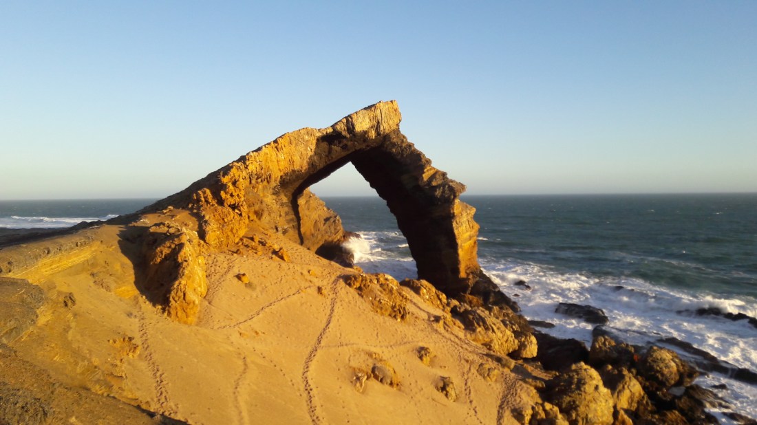
I’m up in Namibia this week, so I thought it would be appropriate to share a picture that I took over the weekend of Bogenfels Rock Arch, which is located in the Sperrgebiet region of Namibia.
I previously posted a similar picture back in 2015. See that post for some more information on the arch and the Sperrgebiet.
Yours truly on top of a rock arch, Wadi Rum, Jordan, circa 2007.
Ever wonder about the lovely artwork that is featured in my blog title? That artwork was inspired by a real picture, which I’ve decided to feature in this week’s “Monday Geology Picture” post. The above picture was taken in Wadi Rum, Jordan back in 2007. Wadi Rum is a magical place. You can see some more of my pictures of Wadi Rum here.
My apologies that I’ve been very quiet here on Georneys recently. My travel and work schedule were extremely hectic during the past month… plus I was working on a couple of scientific papers related to my PhD thesis research. However, life is a bit calmer now, so hopefully I’ll catch up on some blogging soon! I want to share some more pictures from my trip to Australia, amongst other things.
I’ll start with a few pictures from my recent trip to Namibia. Recently, I had the good fortune to spend a couple of weeks in the Sperrgebiet in Namibia doing some fieldwork on behalf of De Beers. I do not blog about my industry work here on Georneys (unless the work is published and thus in the open domain), so I can’t share the details of my trip. However, I can share a few pictures of some of the “tourist attractions” that I saw during my field work.
Sperrgebiet means “Prohibited Area” in German (the Germans colonized Namibia, so some German words and town names are still found in the country). The Sperrgebiet is an area in southern Namibia (stretching between Lüderitz and Oranjemund) where very rich placer diamond deposits are found. Since the early 1900s, access to this area has been highly restricted. Even for De Beers employees, special police clearances and permits are required to enter the area, and security remains strict. However, for those who do have access, the Sperrgebiet is a fascinating and magical place. Aside from the fantastic hard rock and sedimentary geology (and wildlife!) that one can see, the area contains a number of historical and archaeological sites. There are a number of abandoned diamond mining “Ghost Towns” that are weathering away in the desert, pretty much undisturbed (by humans, anyway) since they were abandoned tens of years to more than a hundred years ago. For the general public, it is extremely difficult to enter the Sperrgebiet. However, there is one tour company that operates a day trip (from Lüderitz) to Pamona, one of the abandoned diamond mining towns, and the Bogenfels Rock Arch, which is the subject of today’s post. If you ever find yourself in southern Namibia, I highly recommend the tour although you must remember to submit paperwork for the tour well in advance. Even tourists require a permit to enter the Sperrgebiet!
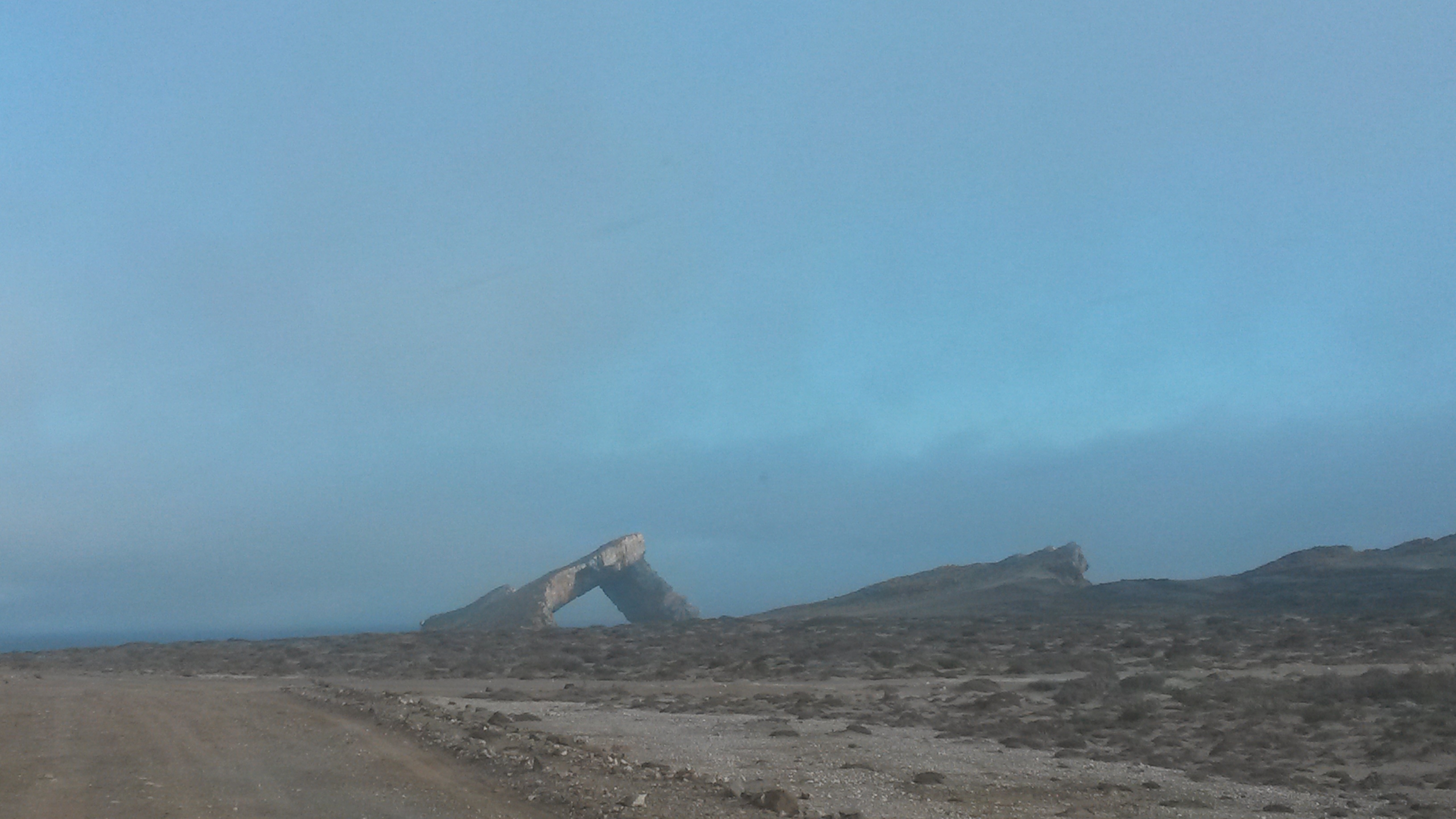
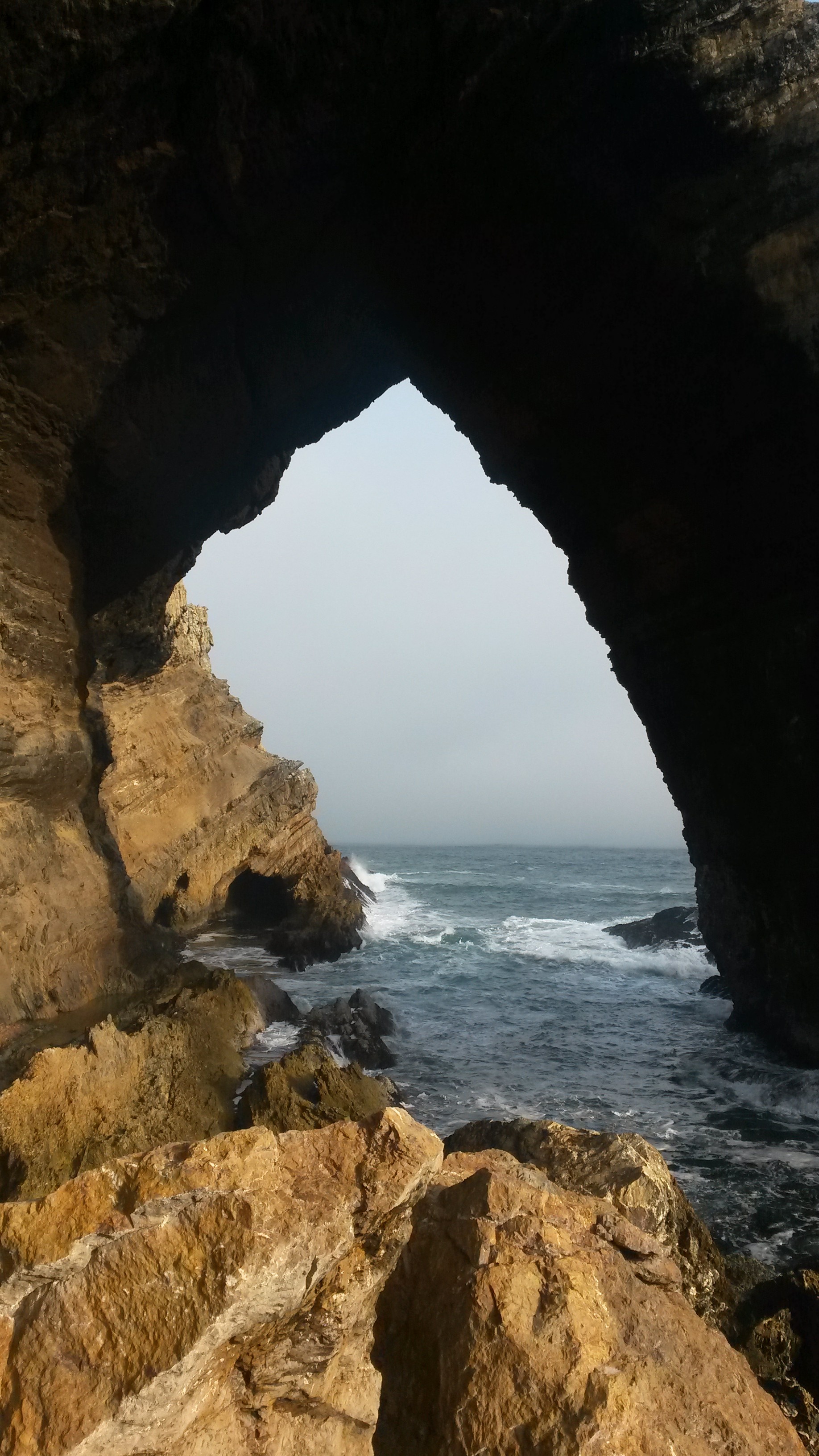
Without further ado, I present a few more pictures of the impressive Bogenfels Rock Arch below. From what I understand “Bogenfels” actually means “Rock Arch” in German. Certainly, the arch is an impressive feature located right on the coastline.
Bogenfels Rock Arch #2 – from a distance.Bogenfels Rock Arch #3.Bogenfels Rock Arch #4.
That’s all for now… stay tuned for a few more pictures from Namibia!
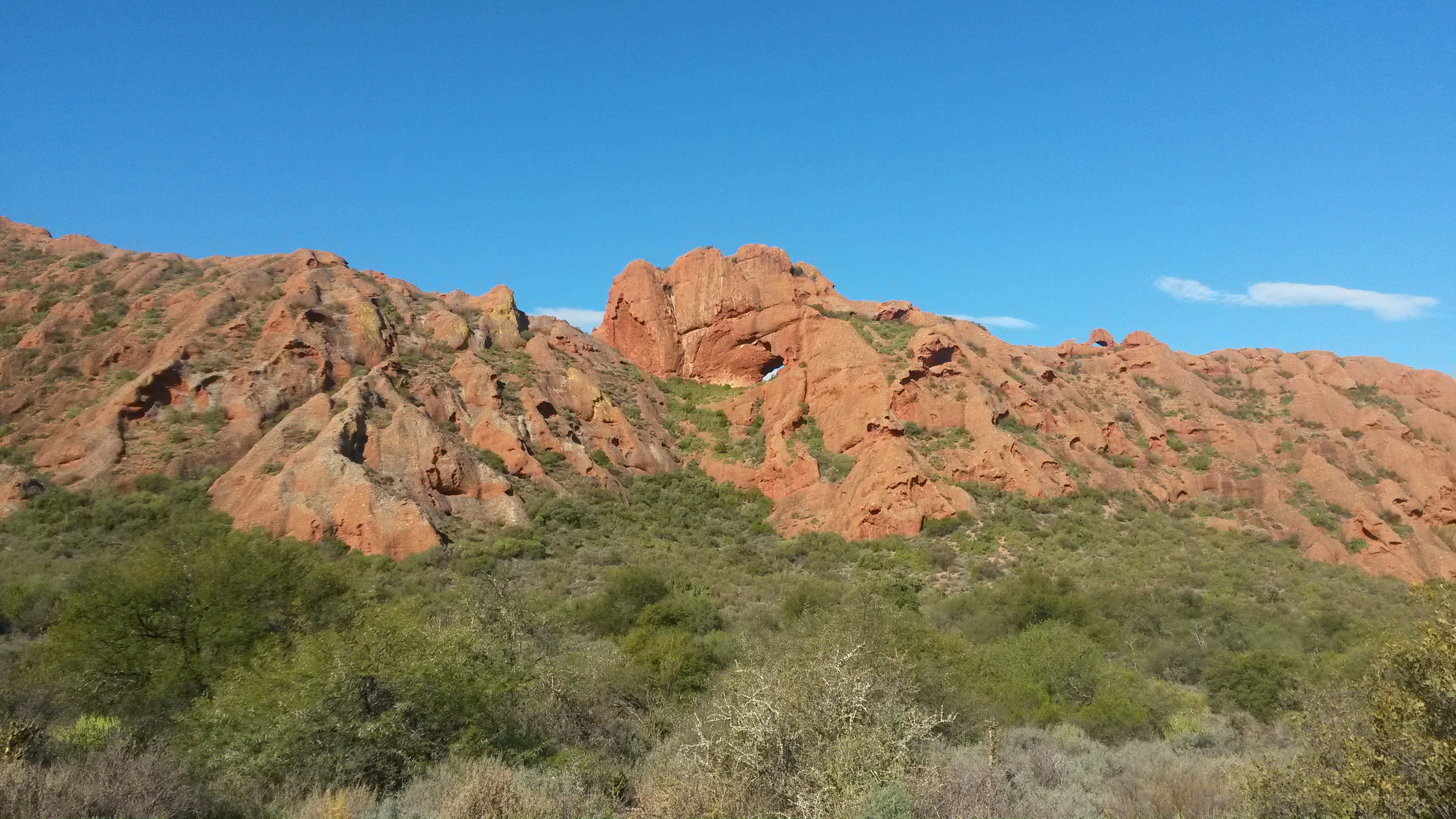
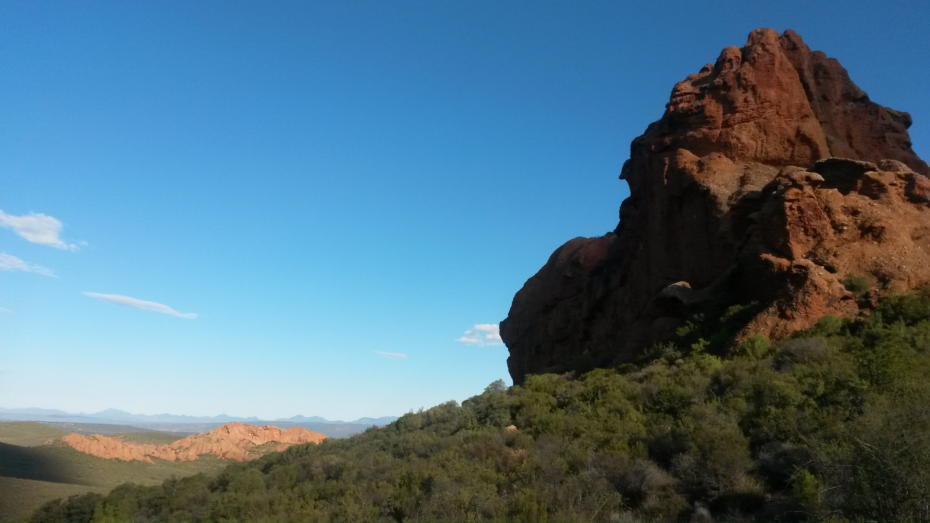
On Monday I shared a picture of a pretty conglomerate that I recently walked across. Today I thought that I would share a few more pictures of this conglomerate formation and also tell you a little more about it. Although in Monday’s picture the conglomerate looks somewhat dull-colored, the conglomerate formation is actually impressively red in color in many places, so much so that hills made of the conglomerate are known as “the red hills” or “the red stone hills”.
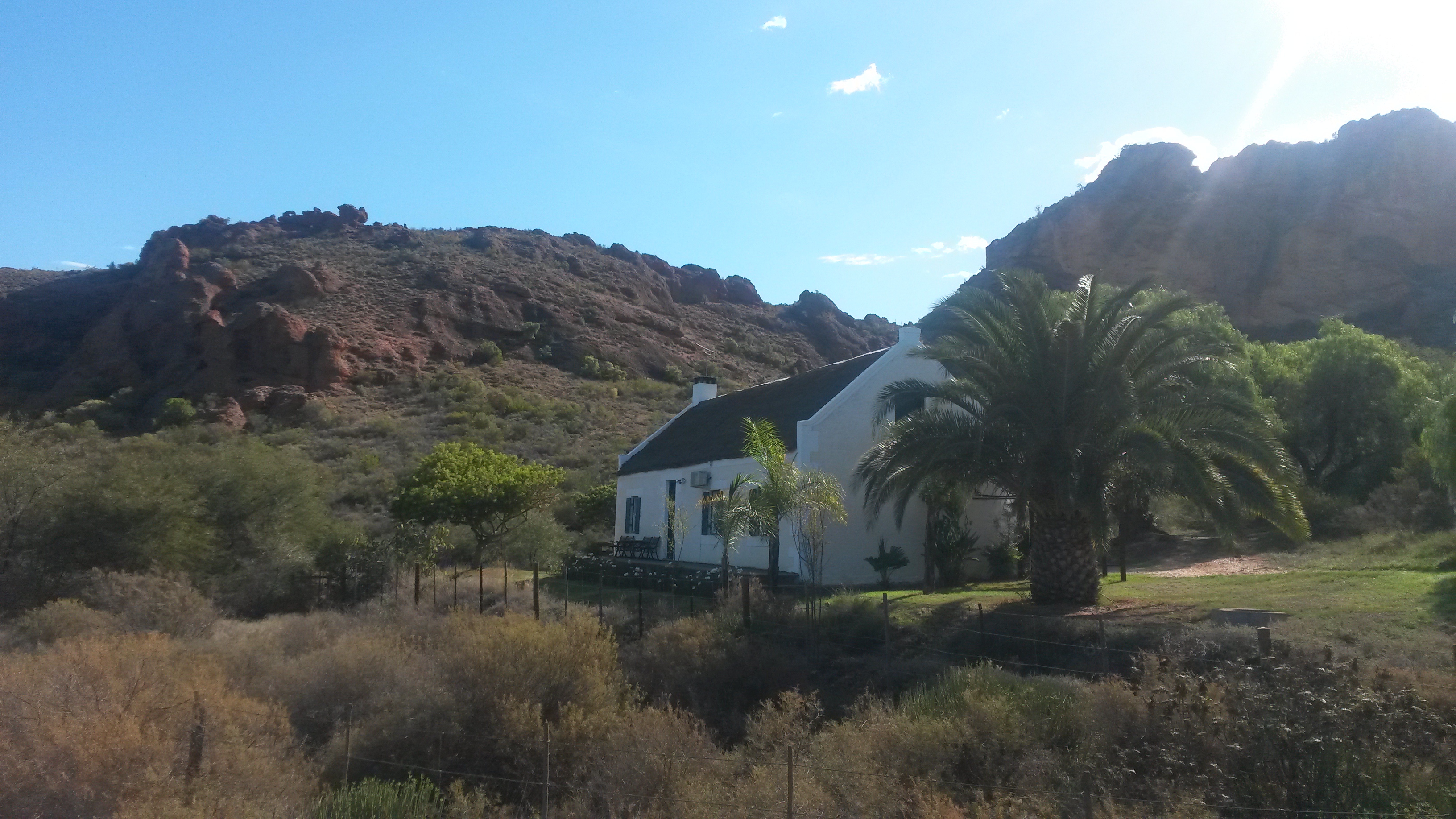
My husband and I hiked amongst the red conglomerate rocks during a recent stay at a wonderful holiday farm known as the Red Stone Hills, named in honor of the local geology, of course! The farm is located a few miles outside of Oudtshoorn, South Africa, a town known for ostrich breeding… so you pass fields of ostriches on your way to the farm! We also stayed at the farm a couple of years ago although I neglected to share pictures of that visit here on Georneys. Around the farm there are several hills of the striking red conglomerate rock. On some of the hills, impressive rock arches have formed. During our previous visit, we hiked up to one of the rock arches and took some pictures. The climb was quite strenuous, however. We only had a few hours for hiking on our recent visit, so we kept mostly to the valleys and observed the rock arches from a distance.
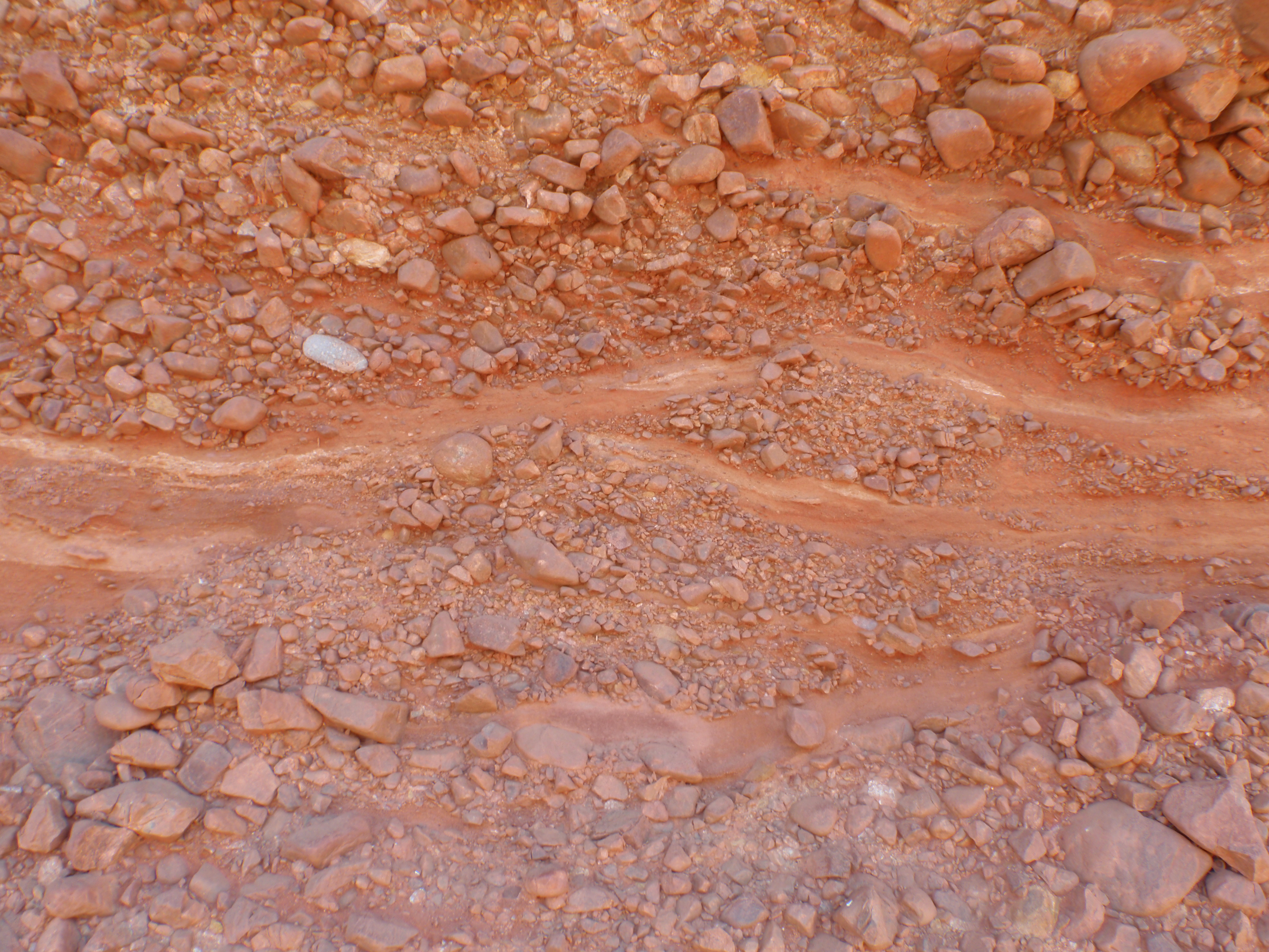
Geologically, the red conglomerates are part of the Buffelskloof Formation. This formation has also been called Enon in the past, so some people still refer to the red rocks as the Enon Conglomerates. The Buffelskloof Formation also contains breccias. The conglomerates and breccias were deposited in a large, land-locked basin in the early Cretaceous. The conglomerates were deposited by rivers and streams while the breccias represent scree deposits. The precise age of the Buffelskloof Formation is not known very well because of poor fossil preservation, most likely due to the sediments being emplaced in an oxidizing environment. Oxidation is also responsible for the reddish color of the rocks. The red color results from oxidation of iron in the matrix of the conglomerate/breccia rocks.
Without further ado, here are some more pictures of the pretty red conglomerates:
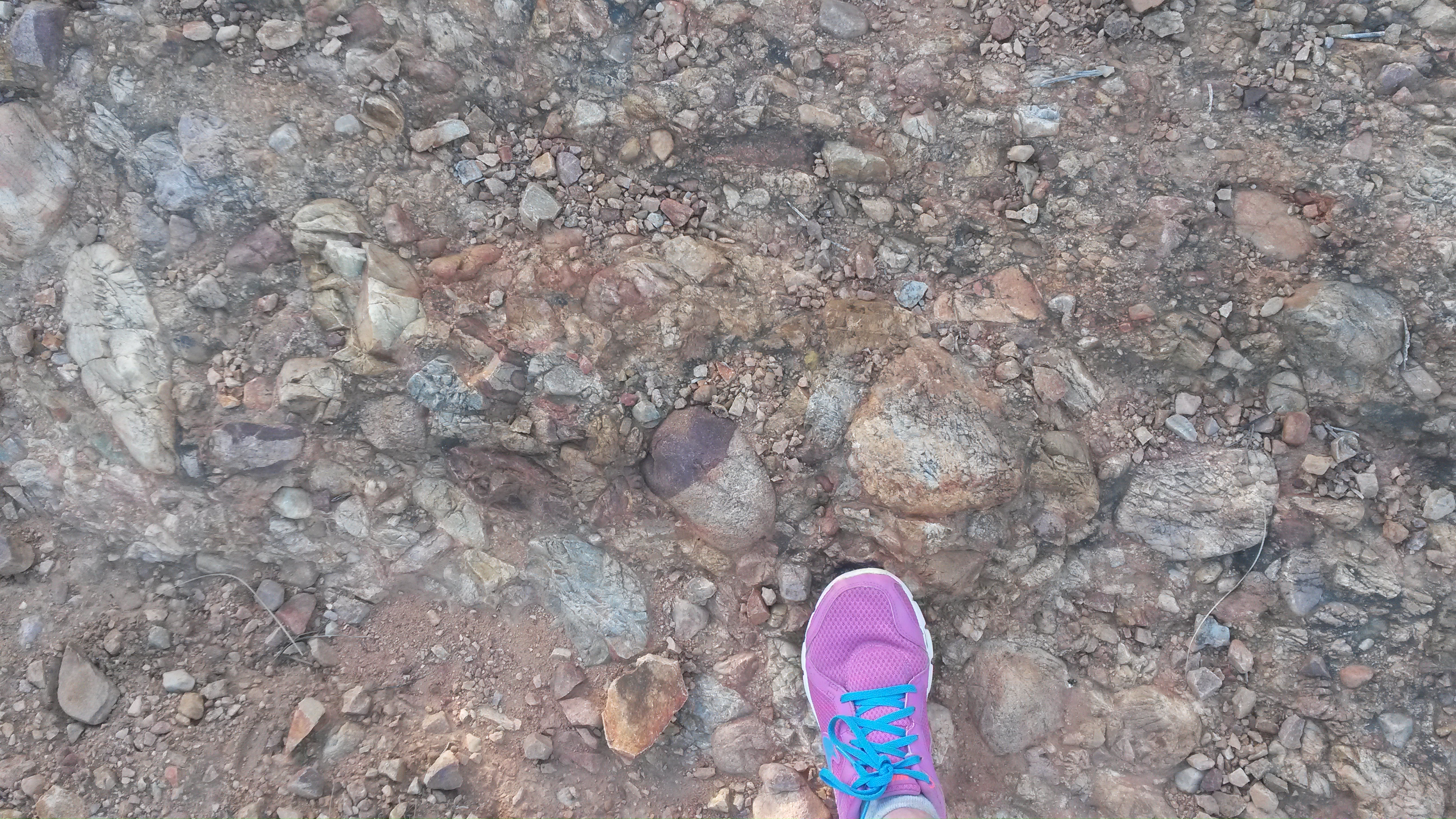
The lovely guest cottage where we stayed, nestled at the foot of one of the red conglomerate hills.Another one of the lovely guest cottages on the farm.The start to our walk amongst the red conglomerate hills.Red conglomerate hills with intriguing weathering patterns.Red conglomerate hills in the foreground and distance.A closer view of the conglomerate texture.Hiking across a conglomerate path.Red conglomerate hills and impressive aloes.
I managed to find my pictures from our last visit to the Red Stone Hills farm, so here are some closer images of one of the impressive rock arches:
Conglomerate rock arch.Standing in the conglomerate rock arch. For scale, my husband is about 6’2″ tall.Another view through the arch.Looking through the arch to more conglomerate hills.A close-up view of some conglomerate texture near the arch.Another view of conglomerate texture.Conglomerate texture, with husband for scale.
If you ever find yourself near Oudtshoorn, be sure to visit these impressive red conglomerate rocks!
A delightful juxtaposition of rock arches and blue sky, Arches National Park, Utah, Fall 2005.
For this week’s “Monday Geology Picture” post I thought I’d share a picture that I took in Arches National Park in Utah back in 2005. This picture shows a rock feature known as “The Double Arch”. Stunning, isn’t it?
I apologize that blogging has been somewhat light recently. Work and a few other matters have been keeping me quite busy. However, I have a few more substantive posts in the works. There are a few things that I would like to post before the end of the year– more soon!