Lovely pillow basalt, with my hand for scale. The shiny polished surface of the decorative slab made photography a little difficult. Photo taken April 2019.
For this week’s post, here’s a picture showing a lovely example of Pele’s Hair, which is a type of volcanic glass that consists of fibers or thin strands.
Although I’ve visited many volcanoes (including a few active ones) over the years, I’ve never seen Pele’s Hair in the field. So, I was quite happy to see this excellent example in the volcano museum on Réunion Island. I visited the museum during my vacation to the island last year. If you ever find yourself on the island, visiting the museum is a must. There are all sorts of wonderful displays and examples of different lava types, including this fantastic Pele’s Hair sample.
Lovely fresh pahoehoe flow on Réunion Island with my hand for scale.
For this week’s picture, here’s another lovely shot of pahoehoebasalt that I took during a March 2017 vacation to Réunion Island. I previously shared a picture of some Réunion pahoehoe here.
Olivine crystals (little yellow-green particles) weathering out of a young basaltic surface.
For this week’s picture, here’s an image of a relatively young basaltic surface weathering. You can see yellow-green olivine crystals weathering out of the dark matrix. Olivine is one of the first minerals to weather out of rocks, so you can tell that these basalts must be young. Older basalts generally don’t contain fresh olivine, at least not any crystals that you can easily identify with the naked eye. I took this picture back in March on Réunion Island, a young volcanic island in the Indian Ocean.
For this week’s geology picture, here’s a shot that I took last year when I visited Sani Pass, which is one of the ways to enter Lesotho. The country of Lesotho is located high up in basaltic mountains, entirely above 1,000 m. You can see basaltic cliffs on either side of this picture. The basalts erupted approximately 180 million years ago and are part of the KarooLarge Igneous Province.
I’ll share some more pictures from Lesotho, including of the fantastic basaltic rocks, in another post.
If you ever have a chance to visit Lesotho via Sani Pass, I highly recommend the trip. The scenery is stunning. I recommend hiring a guide, especially if you don’t have a big vehicle. Note that only 4x4s are permitted to go up the pass.
Taking a break from hiking on a pahoehoe lava flow. I’m about 9 weeks pregnant in this picture and was already struggling with severe morning sickness. However, that didn’t stop me from (slowly) hiking along some fantastic lava flows during my vacation.
First of all, for this week’s “Monday Geology Picture” enjoy this fantastic picture of me sitting on some pahoehoe lava earlier this year, when I visited Réunion Island back in March.
Second of all, let me provide a little explanation about why I have been terribly negligent of this blog over the past few months, despite my best intentions at the beginning of the year. In January I fully intended to read one science book every month (and write a review), post weekly geology pictures, and blog about some geologically-themed aspects of some recent vacations… and maybe even revive the Geology Word of the Week. Instead, I’ve barely posted at all this year!
My excuse is, however, a happy one: I am expecting a baby boy any day now. Why did my pregnancy lead to such a terrible lapse in my blogging? Well, I have had over 8 months of terrible morning sickness so far. I am unfortunately one of those rare women who have morning sickness for the whole pregnancy, and it’s been really debilitating. Even on strong medication, I feel seasick for many hours every day — often all day and all night. I haven’t read a science book in months because reading generally makes me feel more seasick and gives me a headache. Writing is similarly challenging. With an abundance of medication, careful eating, and days off to rest I’ve managed to (mostly) keep up with my day job and home life, but I just haven’t had anything extra in me for blogging. Fortunately, other than the morning sickness my pregnancy has gone well and baby is healthy. He’s full term now, so he could come at any time!
Now that I’m about to start my maternity leave I thought that I should revive this blog. I’ll start with setting up some weekly geology pictures to auto-post over the next few weeks. Then, once I’m settled somewhat with baby, I hope to add some other blogging. I know that I’ll be very busy and sleep deprived, but I think I should be able to carve out a little time for blogging. Also, I think that I’ll feel more like blogging again, since my doctor assures me that as soon as baby is born the seasickness should quickly go away. Maybe, if baby lets me, I’ll even read a science book now and then!
Anyway, thanks for your patience with my absence… and stay tuned for some good content coming soon!
Pahoehoe lava flow on Piton de la Fournaise volcano. Photo taken March 2017.
For this week’s “Monday Geology Picture” here’s a stunning example of a pahoehoe lava flow. I took this picture back in March when I visited Piton de la Fournaise volcano on Réunion Island. I’ll be sharing more pictures from Réunion soon – stay tuned!
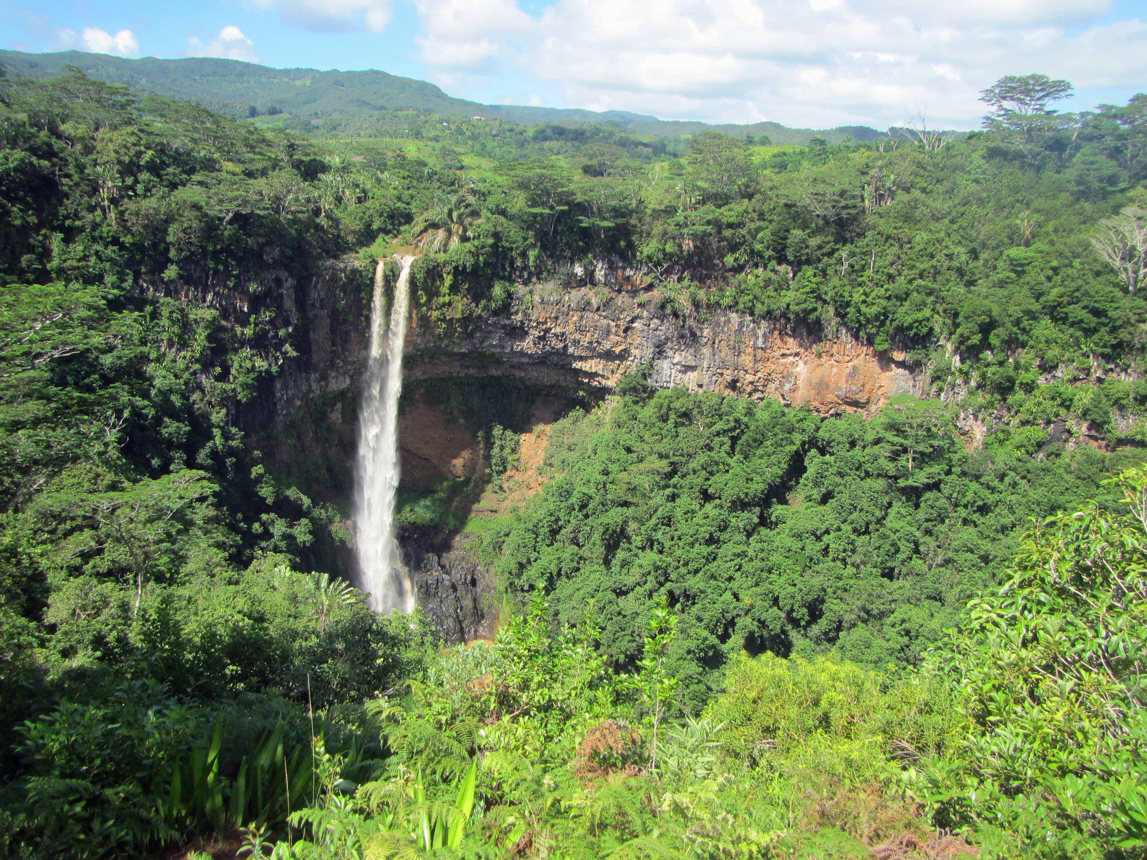
Today I’m continuing with sharing some pictures from my March 2014 trip to the volcanic island of Mauritius. You can see some of my previous posts on Mauritius here, here, and here. Mauritius is a tropical island, so in many places the lava rocks, particularly the older ones, are covered by thick green vegetation. However, there are some places where you can see the lavas well. One of those places is Chamarel, a popular tourist destination that consists of Chamarel Waterfall as well as a geologic attraction known as the Seven Coloured Earth— I’ll blog about the Seven Coloured Earth in another post. Today, I’d like to share some pictures of Chamarel Waterfall, a tall waterfall about the same height (~100 meters) as the Statue of Liberty. At the waterfall, two units of volcanic rocks are exposed. The first unit is approximately 8-10 million years in age and thus represents some of the oldest lavas of Mauritius. The second unit is approximately 1.7-3.5 million years in age.
Here’s an informational sign about the waterfall and the lavas:
Informational sign about Chamarel Waterfall.A closer view of the informational sign.
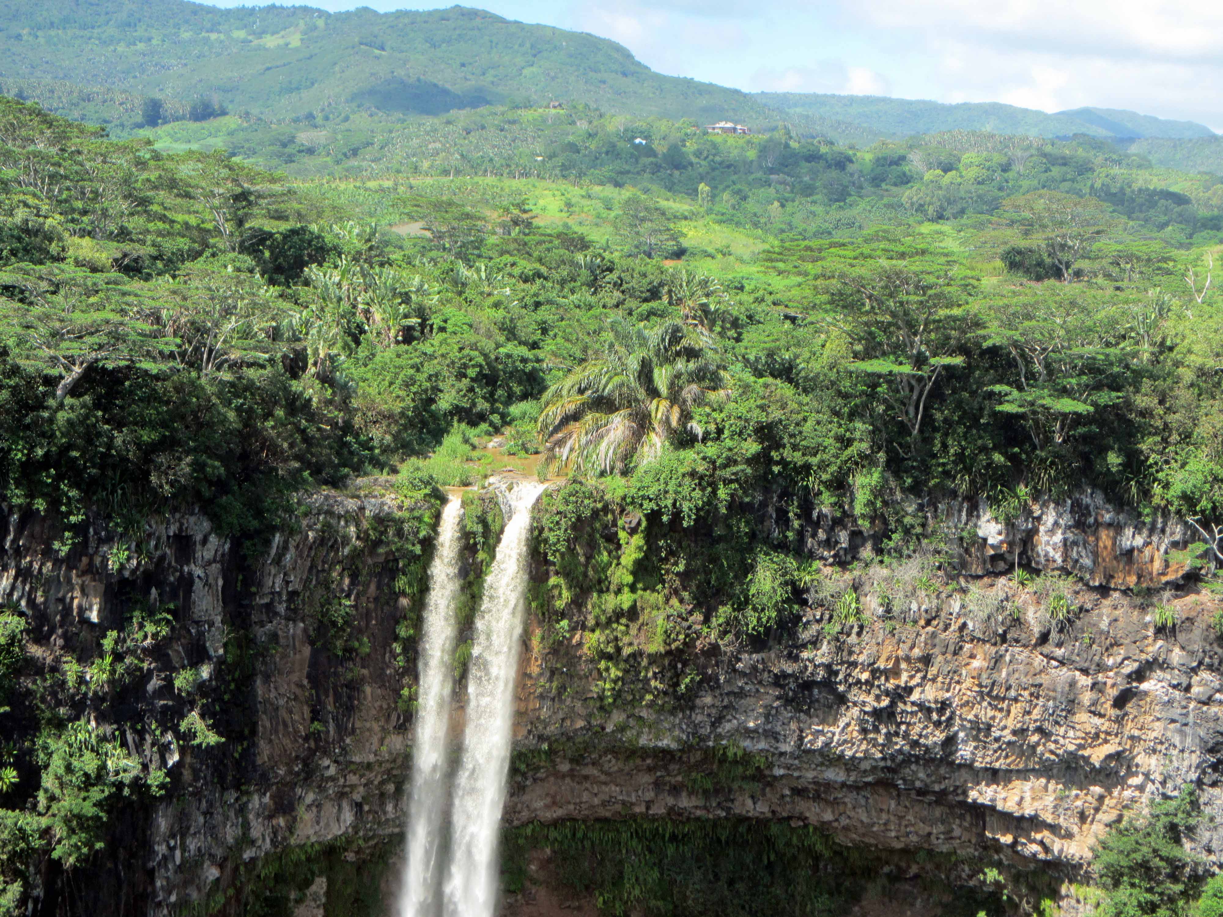
Here are a couple more pictures of the waterfall:
Waterfall… and lava flows!A closer view of the younger lava flow.
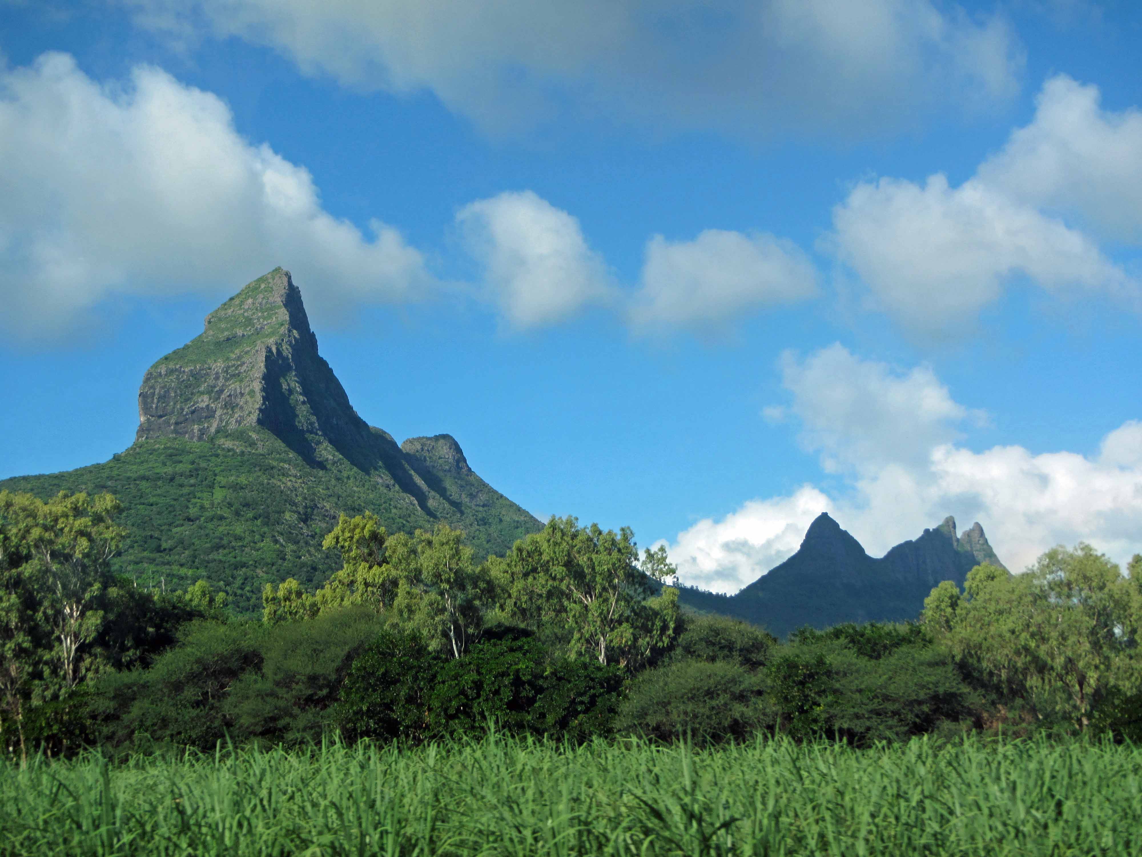
Rugged, young volcanic terrain in Mauritius. This picture shows the dramatically perched boulder on Pieter Both Mountain, which has an elevation of ~820 meters.
For the next little while, I will be blogging about my recent (March 2014) vacation to Mauritius, a young volcanic island in the Indian Ocean. I recently shared a couple of pictures of volcanic basalt in Mauritius for my “Monday Geology Picture” posts here and here. In future posts, I’ll write a little more about the volcanic history of Mauritius. In brief, Mauritius is believed to have been formed by a mantle hotspot that is now located underneath the volcanically active island of Réunion. Geologically speaking, the island of Mauritius is very young. The oldest lavas on Mauritius are approximately 8 million years old; the youngest are approximately 200,000 years old (see this publication for more on Mauritian lavas over time). There has not been very much time for the volcanic rocks of the island to erode– that is, there has not been very much time for them to be worn down and smoothed by various physical, chemical, and biological weathering processes. Thus, the landscape of Mauritius is dominated by steep, rugged hills and mountains comprised predominantly of young, dark-colored lava rocks. However, the rocks are certainly eroding. Mauritius has a wet, humid climate and is covered in vegetation, so chemical and biological weathering are breaking down the rocks at a fairly fast rate. On the tops of some of the mountains, boulders and rock slabs are perched precariously and will one day, not all that far in the future, come crashing down into the valleys during dramatic displays of physical weathering.
Below are some more pictures of the young volcanic landscape of Mauritius. Enjoy!
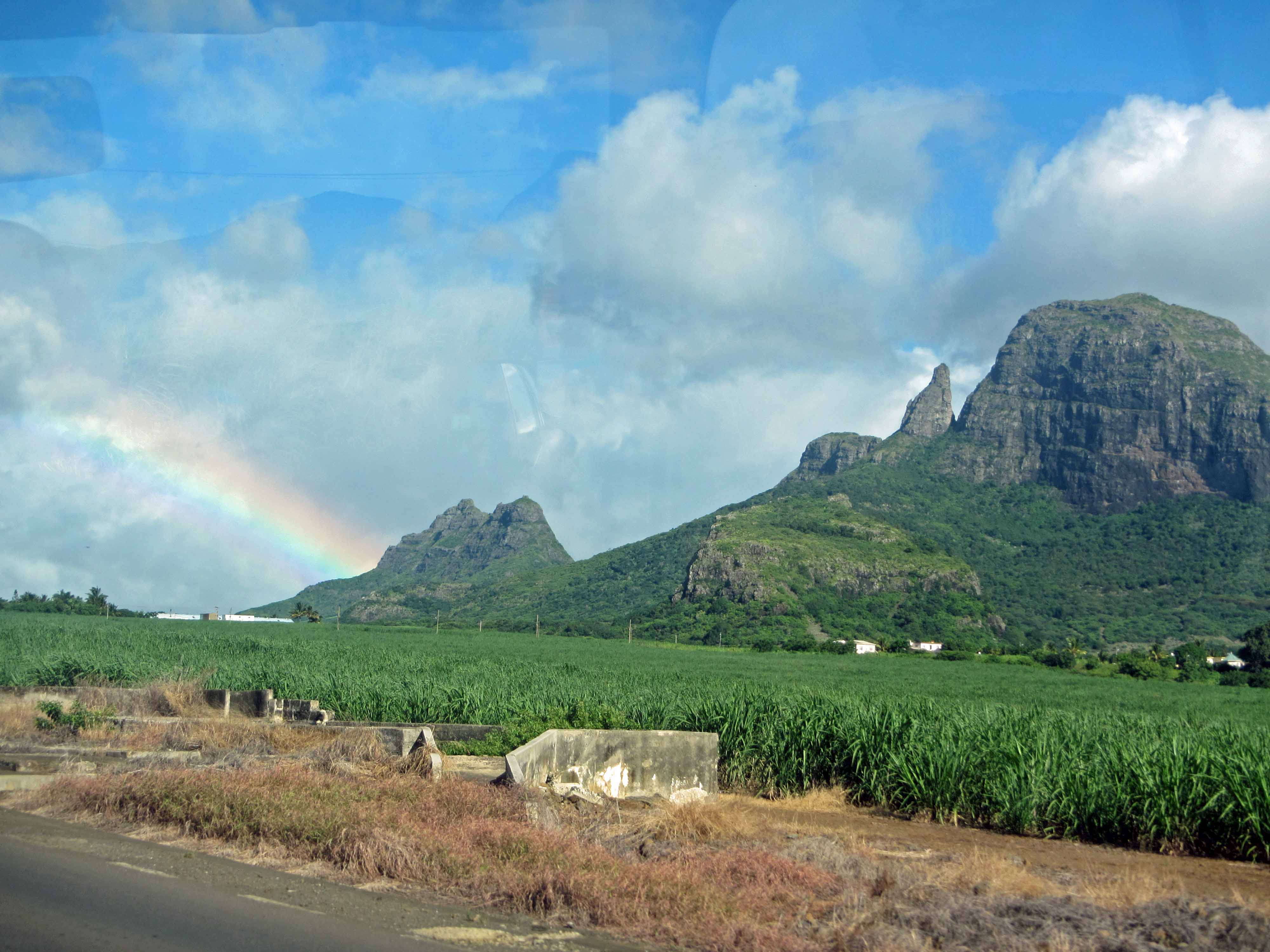
Another view of Pieter Both mountain and the famous perched boulder.A slightly closer view of the boulder on top of Pieter Both Mountain.Another view of Pieter Both Mountain and surrounds.One last view of Pieter Both Mountain.More rugged mountains, with some vegetation in the foreground. Mauritius is covered in lush vegetation, so it’s sometimes difficult to take pictures of landscapes and rocks.Another view of the rugged mountains… with slightly less foreground vegetation.Another landscape picture… and some more foreground vegetation.Vegetation, valley, mountains, sky #1.Vegetation, valley, mountains, sky #2.Another rugged mountain view.Steep hill at the sea.Yours truly posing with the steep hill and the sea.More rugged mountains.Another view of some rugged mountains.Some more rugged mountains… and a rainbow.Rainbow meets mountains.One last pretty shot.
Stay tuned for more posts on the geology of Mauritius!
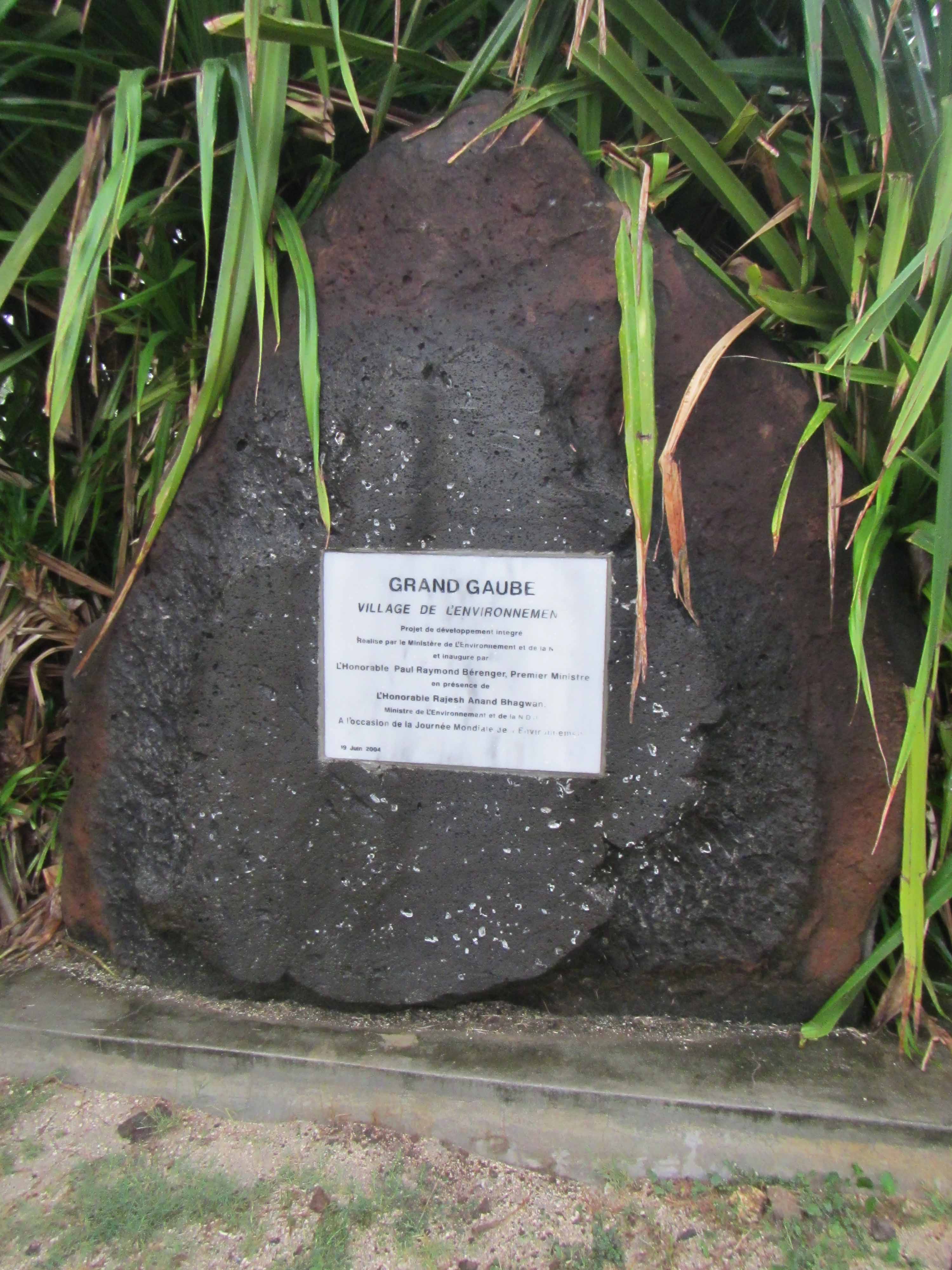
Grand Gaube sign on a large boulder of vesicular basalt, northern Mauritius.
Continuing with some pictures from my trip to Mauritius back in March, for this week’s “Monday Geology Picture” post I am sharing some pictures of a large boulder of vesicularbasalt. This particular boulder is located in the town of Grand Gaube in northern Mauritius and is used as a decorative stone on which a plaque has been mounted.
Vesicular basalt is a dark-colored volcanic rock that contains many small holes, more properly known as vesicles. A vesicle is a small cavity in a volcanic rock that was formed by the expansion of a bubble of gas that was trapped inside the lava. Sometimes, vesicles can become filled in with secondary minerals, such as calcite, quartz, or zeolites. When vesicles are filled with such minerals, they are called amygdales. The vesicular basalt boulder featured in this post contains some amygdales. Some of the vesicles in the boulder are filled with a clear to white mineral, possibly calcite.
The boulder featured in this post also has a notable reddish-brown weathering rind. A fresh (and beautiful!) surface of the basalt boulder was exposed when the boulder was cut to make a flat surface for displaying the plaque.
Here are a few more pictures of the vesicular (or amygdaloidal) basalt boulder:
Another view of the vesicular basalt boulder.A closer view of the vesicular basalt boulder.Another close-up view of the vesicular basalt boulder.
The boulder almost certainly originates from a local source since basalt is abundant on the young volcanic island of Mauritius. Basaltic rocks can be found all over the town of Grand Gaube. For example, basaltic rocks are commonly seen on Grand Gaube’s beautiful beaches. I shared one picture of a basalt-covered beach in Grand Gaube last week.
Below is another picture of basalt on the beach in Grande Gaube; this picture was taken at the resort where my husband and I stayed:
A beautiful basaltic beach, Grand Gaube, Mauritius.