Over the past couple of weeks, I posted pictures of pillow basalts and sheeted dikes in the Samail Ophiolite, Oman. To round out the crustal ophiolite sequence, I thought I would post a couple of pictures of mantle peridotite in the Samail Ophiolite. As you can see in the below pictures, mantle peridotite in the Samail Ophiolite is generally highly-weathered and a dullish brown color. Harzburgite tends to be a darker red-brown color while dunite is a lighter tan (or “dun”, hence the name) color.
Hiking through a wadi (ephemeral stream) in mantle peridotite, Samail Ophiolite, Oman, January 2012.Gorgeous hills of mantle peridotite. In the distant hills the lighter brown color is dunite while the darker color is harzburgite. The bright white color in the valley is salt left by an evaporated ephemeral stream. Samail Ophiolite, Oman, January 2012.
An old overturned truck near the sheeted dike outrcop, Samail Ophiolite, Oman, January 2012. Sheeted dikes are exposed in the foreground of the picture.
Last week I posted a picture of pillow basalts in the Samail Ophiolite, Oman. I recently visited Oman for a geology conference, and I was fortunate enough to see pillow basalts and many other wonderful geological sights in the Oman mountains and beyond. When I posted the picture of pillow basalts, geoblogger Ron Schott asked if I also had some pictures of sheeted dikes with chill margins. Good news, Ron. I do! Unfortunately, these aren’t the best pictures since they were taken in near-darkness with a flash. However, you can still see some of the dike features, including some classic chill margins.
For those of you who don’t know why ophiolites and sheeted dikes are really, really neat geologic features, I suggest reading an old post of mine titled O is for Ophiolite.
Here are the sheeted dike pictures:
Sheeted dikes 1. Samail Ophiolite, Oman, January 2012.Sheeted dikes 2. Samail Ophiolite, Oman, January 2012.Sheeted dikes 3. Samail Ophiolite, Oman, January 2012.
A gneiss staircase outside the Emirates Palace Hotel, Abu Dhabi, United Arab Emirates, January 2012.
I am currently spending the long weekend in Abu Dhabi, United Arab Emirates. I’m visiting some good friends after spending about ten days in Oman to attend the International Conference on the Geology of the Arabian Plate and the Oman Mountains.
Yesterday my friend Karima and I visited the luxurious Emirates Palace Hotel here in Abu Dhabi. We paid far too much money for a deliciously gaudy lunch, which included a chocolate dessert with genuine 24-carat gold flakes on top!
After lunch we wandered around the hotel a little bit, and I spent most of my time admiring the various ornamental stones which were used in the construction of the hotel. For example, the stairs in front of the hotel are made from a combination of gneiss and K-feldspar granite. I thought it was neat to see the gneiss and the K-feldspar granite (a possible protolith rock for the gneiss) in juxtaposition.
Here’s another view of the staircase:
A closer view of the staircase-- gneiss and granite!
And here’s a picture of our gold-coated dessert. Yes, we ate gold!
Pillow basalts in Oman... with pencil for scale. Samail Ophiolite, January 2012.
I’m currently in Oman for a geology conference, so today’s geology picture is one I recently took here in the Samail Ophiolite. The picture shows some weathered and fractured pillow basalts with a pencil for scale. These are not the best-looking pillow basalts in the ophiolite. The freshest ones are found in the Geotimes sequence up in the northern part of the ophiolite whereas these weathered ones are the best ones you can observe close to Muscat, the capital city of Oman. I apologize that this picture is a bit dark. Unfortunately, we arrived at the pillow basalt outcrop just as darkness was falling. So, I took this picture using my camera flash. Still… spectacular, isn’t it? Seafloor pillow basalts on land, in the middle of the desert!
Bear track, with a Rite-in-the-Rain Geological Field Notebook for Scale, Montana, Fall 2005.
Often, geology fieldwork can be a little bit dangerous. During some undergraduate field mapping in Montana, my classmates and I encountered some bear tracks in the snow. The above picture shows one of those bear tracks with a geological field notebook for scale. For the rest of the day, we kept a careful watch out for bears and tried not to stray too far from the field vans.
The “Year of Travel” meme has started upagain, so I thought I’d join the fun and recollect my travels over the past year. This has actually been a very busy year. For the first part of the year, I spent many, many hours in lab working on data collection for my PhD. For the second part of the year, I worked on data analysis, thesis chapter writing, and also had a few big events in my personal life– I moved to Cape Town, South Africa, and I was married. Later in the year, I’ll return to Cape Cod for a couple of months to defend my thesis. However, after four years of maintaining a long-distance relationship between Cape Cod and Cape Town, I’m very happy to be living with my partner (mostly) full-time.
Without further ado, here are a few pictures my year of travels:
I spent most of January-June in Cape Cod, mired in labwork. Fortunately, Cape Cod isn’t such a bad place to live:
A sailboat off Martha's Vineyard, 2008.
In April I took a two week break from my thesis to visit my then-fiance in South Africa. While I was there, we spent a few days hiking in the gorgeous Cederberg Mountains:
The Maltese Cross in the Cederberg Mountains, April 2011.
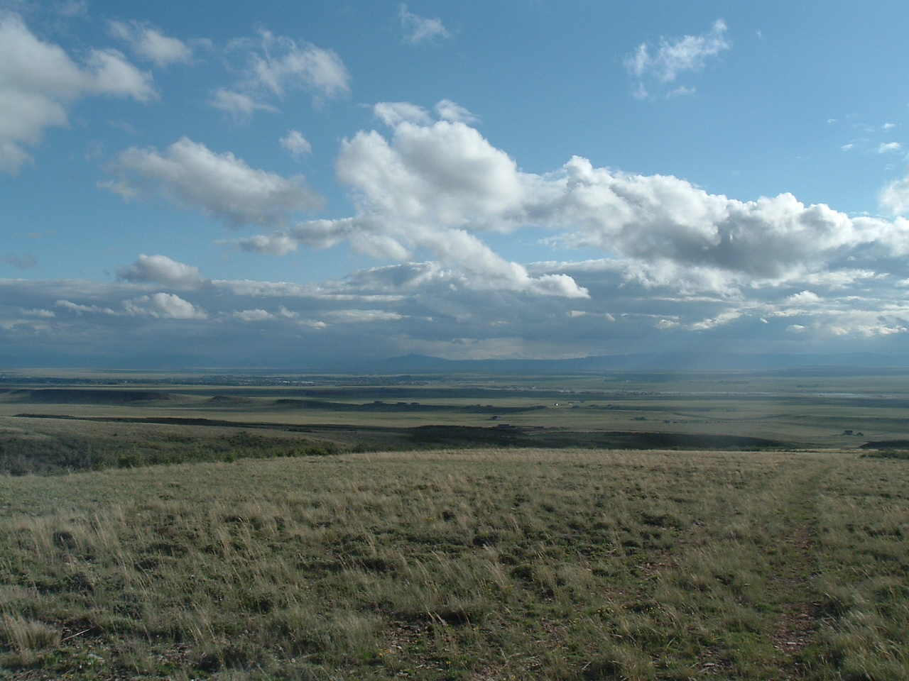
In June I moved to Laramie, Wyoming for the summer to work on data interpretation with one of my thesis supervisors. I was too busy working on my thesis to spend much time outdoors, but I did go on a few wonderful trail runs under the big Wyoming sky:
Big Wyoming Sky, Summer 2011.
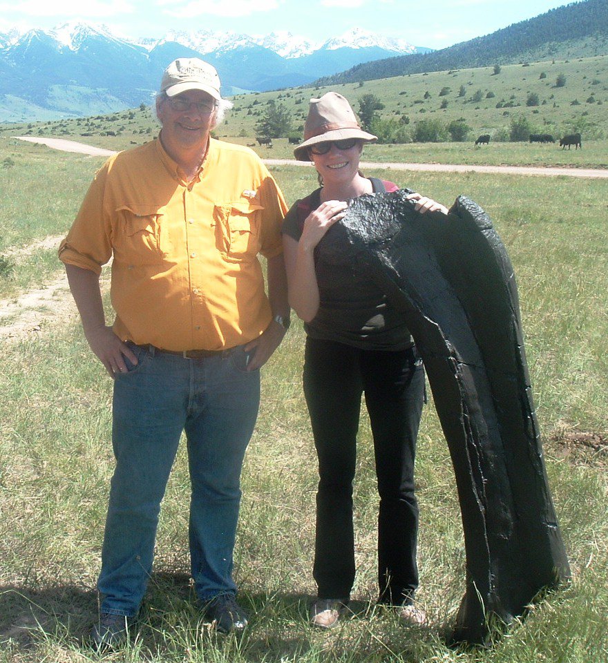
Over the summer, I also managed to take two quick weekend trips. The first was to Bozeman, Montana where I had the honor of meeting Jack Horner:
Jack Horner, a fake sauropod bone, and I in Montana, June 2011.
The second trip was to The Amaz!ng Meeting 9 in Las Vegas where I saw my good friend James “The Amazing” Randi and also took a quick trip out to Red Rock Canyon:
Red, red Las Vegas rocks, July 2011.
In late August I moved to gorgeous Cape Town, South Africa. I’m really grateful that my thesis supervisors have allowed me to do my last few months of thesis writing (mostly) from overseas. Thank goodness for Skype! However, after my move I did have two trips back to Cape Cod: one in late September for a committee meeting and one in late November to finish up the very last little bit of labwork for my thesis. The trip between Cape Town and Cape Cod is fairly long and exhausting… although you do accumulate some serious frequent flyer miles! Fortunately, I just have one (longer) visit to Cape Cod ahead of me until I (fingers crossed!) defend my thesis later this year. I’m really loving my new home here in Cape Town. I’m looking forward to wrapping up my PhD this year and settling down more permanently, hopefully finding work as a geologist in the Cape Town area.
Gorgeous Cape Town, April 2011.
In October my husband and I were married in the South African winelands near the town of Robertson:
A wedding in the winelands, October 2011. Photograph by Christine Watters Photography.
For those of you who remember the interviews about the Fukushima Daiichi Nuclear Power Plant disaster that I conducted with my father earlier this year, here’s a picture of my father and I just before the wedding ceremony:
My father and I, October 2011. Photograph by Christine Watters Photography.
Since the wedding, I’ve been trying to keep busy writing this thesis of mine. These last few months are tough and tiresome, but I’ll persevere and (hopefully!) finish this darn PhD of mine!
I have a busy few months ahead of me, but I’m looking forward to a little bit of travel in the near future. The day after tomorrow I fly to Muscat, Oman for the International Conference on the Geology of the Arabian Plate and the Oman Mountains. After the conference, I’m going to spend a weekend with good friends of mine in Abu Dhabi, United Arab Emirates. I really enjoy visiting Oman, and I’ve never been to Abu Dhabi, so I’m looking forward to the trip.
Hope everyone had a happy, travel-filled 2011. Best wishes for 2012.
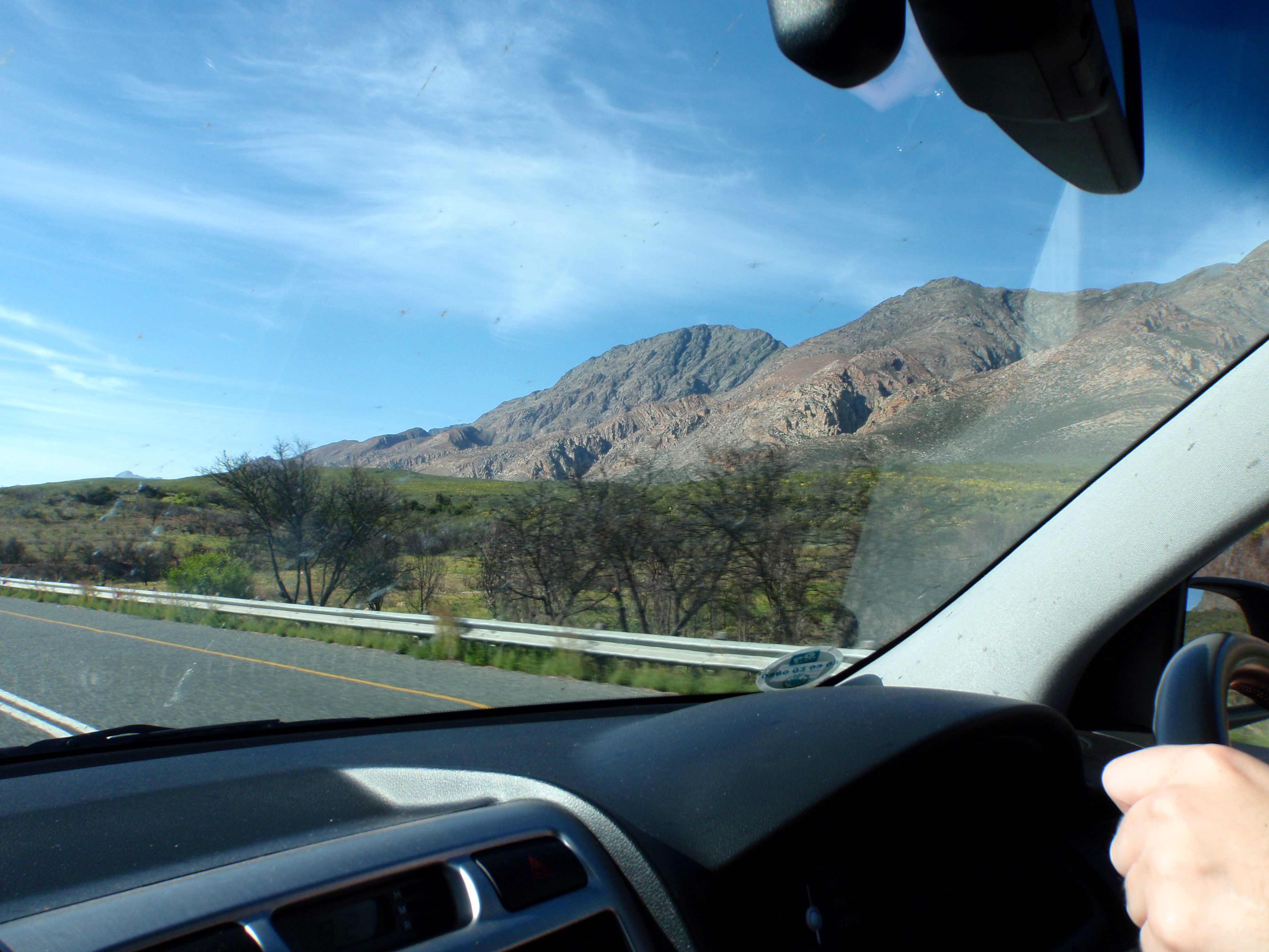
South Africa's Cape Fold Belt viewed through a car window, September 2011.
This week’s Monday Geology Picture shows some geology viewed through a car window. Specifically, the picture shows a glimpse of the magnificently folded and twisted sandstones of the Cape Fold Belt in South Africa. I snapped this picture as my husband and I drove along the N1 road on our way from Cape Town to Oudtshoorn for a long weekend trip. One of my favorite things to do is drive around South Africa with my husband. We often encounter interesting rocks, animals, and plants along the way… and we often stop to take a closer look at them. Even when we don’t stop, I often take pictures through the car windows, such as the picture above. The only reason we didn’t stop for a picture at that moment was that I had already snapped a few dozen roadside pictures of similar rocks. However, I couldn’t resist a quick shot through the window.
One of the things I’m really looking forward to after I finally finish up this PhD of mine is a roadtrip across South Africa. Sometime next year, my husband and I plan to take a couple of weeks vacation and drive from Cape Town to KwaZulu-Natal, where we plan to visit some friends who live in the Drakensberg (note that Drakensberg means “Dragon Mountains”– how could I not want to visit there?). We plan to stop plenty along the way, investigating some local geology of course! I imagine I will also snap many more pictures through car windows.
To celebrate, here’s a very big Christmas rock– Christmas Island, which is located in the Indian Ocean south of Indonesia.
Christmas Island from Google Earth.
The island was dubbed “Christmas Island” by Captain William Mynors of the East India Ship Company, who arrived at the island on Christmas Day, 25th December, 1643. Geologically, the island consists of basalt (originating from a submarine volcano) on which limestone (made primarily from coral and other marine critters) has developed. The island also has rich phosphorite deposits, which are believed to have formed as lagoonal (shallow, quiet water) sediments.
In addition to some interesting geology, Christmas Island also has some fantastic wildlife, including a unique and diverse bird population. There’s very few people on the island, and there are some gorgeous beaches. Sounds like an ideal vacation spot– maybe I’ll try to spend a Christmas there one day… although I imagine that must be a busy time of year for the island.
I haven’t posted a mystery rock in awhile, and I have some catching up to do!
A little over a month ago I received an email from Liz, who is a Middle School teacher in the Boston area.
Liz wrote,
Once you have a moment and are not too busy with post-wedding stuff, could you take a look at the rock pics I have attached? The 8th grader I work with wants to know where the two parallel white lines came from. Any theories? I would really appreciate it!!
And she sent me the two following pictures:
Mystery Rock #5, Picture #1. Mystery Rock #5, Picture #2.
There’s no scale in the above pictures, but Liz indicated to me by email that the rock is approximately 3 feet across.
First of all, great question Liz (and Liz’s student). However, before I talk about the white lines in the rock and how I think they formed, let me first talk a little bit about the rock itself. My first task is to identify the rock.
Let me work through my basic identification questions:
Is the rock natural or manmade?
Since I can’t see the field context and the rock doesn’t seem to be in situ (i.e. attached to bedrock), there’s a slim chance that this rock is manmade concrete rather than a natural rock, but the morphology and weathering of the rock as well as the presence of the white lines (I’ll explain more in a minute) suggests to me that this is a natural rock. Liz also mentioned to me that there are similar rocks nearby, so perhaps there’s an outcrop in the vicinity.
Is the rock igneous, sedimentary, or metamorphic?
The rock is composed of pieces of other rocks which have been cemented together, so the rock is sedimentary.
So, what is the rock?
The rock appears to be a coarse, poorly-sorted conglomerate. A conglomerate is a type of sedimentary rock that consists of rounded clasts (rock fragments) which have been cemented together. The clasts are generally rounded from transport in water, such as in a stream. The cement composition varies, but is often composed of calcium carbonate or silica-rich material. I’m not sure about the matrix composition for this rock– Liz tried (and failed) to break off a piece of the rock, so it might be a harder silica-rich matrix. However, I know from my work with travertines that calcium carbonates can also be quite hard and difficult to break. A simple way to identify the matrix material is to pour some dilute acid on the rock– if the rock fizzes, the matrix is calcium carbonate. This conglomerate is coarse because it contains fairly large clasts (based on the rock size of ~3 feet). This conglomerate is poorly-sorted because the clasts are of different sizes. That is, some of the clasts are very large and some are very small. Coarse, poorly-sorted conglomerates tend to form in high-energy environments, such as a turbulent streambed. Because of the weathering of the conglomerate, I can’t tell the composition of the clasts– they are likely of variable composition.
Now that I’ve identified the rock, let me move on to the two parallel white lines. Those two white lines are called veins. A vein is a secondary, sheetlike mineral deposit that forms within a pre-existing rock. Those two veins are actually pretty neat! Let me answer some questions about them:
How did the two white veins form?
The two white veins formed when fluids permeated the conglomerate and a secondary mineral was precipitated (fell out of solution). The veins either formed along a pre-existing fracture in the rock or formed when the veins created their own fracture path as the fluids moved along a preferred fluid flowpath.
When did the two white veins form?
Since they cross through the cobbles of the conglomerate (especially the uppermost vein), the two white veins must have formed after the conglomerate was cemented together. Veins actually always form after the primary rock. However, multiple generations of veins can cross-cut each other. Veins are a very useful tool for geologists trying to understand cross-cutting relations— something that helps geologist determine the order in which a sequence of geological deposits were emplaced.
What are the two white veins made of?
My guess is that the veins consist of quartz, but they could also possibly be calcite.
Why are the two white veins parallel to each other?
Well, veins tend to form along weaker or more permeable parts of a rock. Weakness or permeability within a rock is often oriented in a particular direction or directions. This is because of stress (in a particular direction) that a rock has experienced or a result of the rock’s structure, which may be different in different directions. Thus, veins within a rock often form parallel to each other.
I hope the above answers a few questions about the mystery rock. If you have any ideas about this rock, please feel free to add some comments below. Also, if you want to see my previous mystery rock posts, you can find them here.
Salt Flat Mirror, Badwater Basin, Death Valley, California, Fall 2005.
Well, I still haven’t had time to write up a substantial blog post. I spent this past weekend writing my thesis, wrapping Christmas gifts (how can it possibly be Christmas next weekend?), writing Christmas cards (and wedding thank-you cards! Finally!), and spending some time with my husband, who arrived home unexpectedly yesterday. He’s been at sea on a sampling campaign, but there’s some trouble with the ship, so he’s home early… and in time for Christmas! Although it makes my husband’s job more stressful, I must say I’m not too dismayed that his ship is having troubles. Even if I have to keep working on my thesis, my husband can at least bring me some Christmas dinner. Also, I’m sending him to the post office today to mail all those Christmas gifts and cards.
Anyway, my poor blog has been neglected once again. However, as promised, here’s the inaugural Monday Geology Picture, which was inspired by last week’s geology pictures. Even when other obligations keep me from blogging regularly over the next few months, I’ll do my best to post this weekly geology picture.
This week’s picture is from the Badwater Basin in Death Valley, California. The Badwater Basin has very little rainfall and contains vast salt flats. In the picture above, a bright white salt flat acts like a mirror, reflecting the landscape. Notably, the Badwater Basin contains the lowest point in North America: 282 feet (82 m) below sea level.