Kolmanskop in Pictures

Kolmanskop #1. Sitting on some sand in one of the abandoned houses.

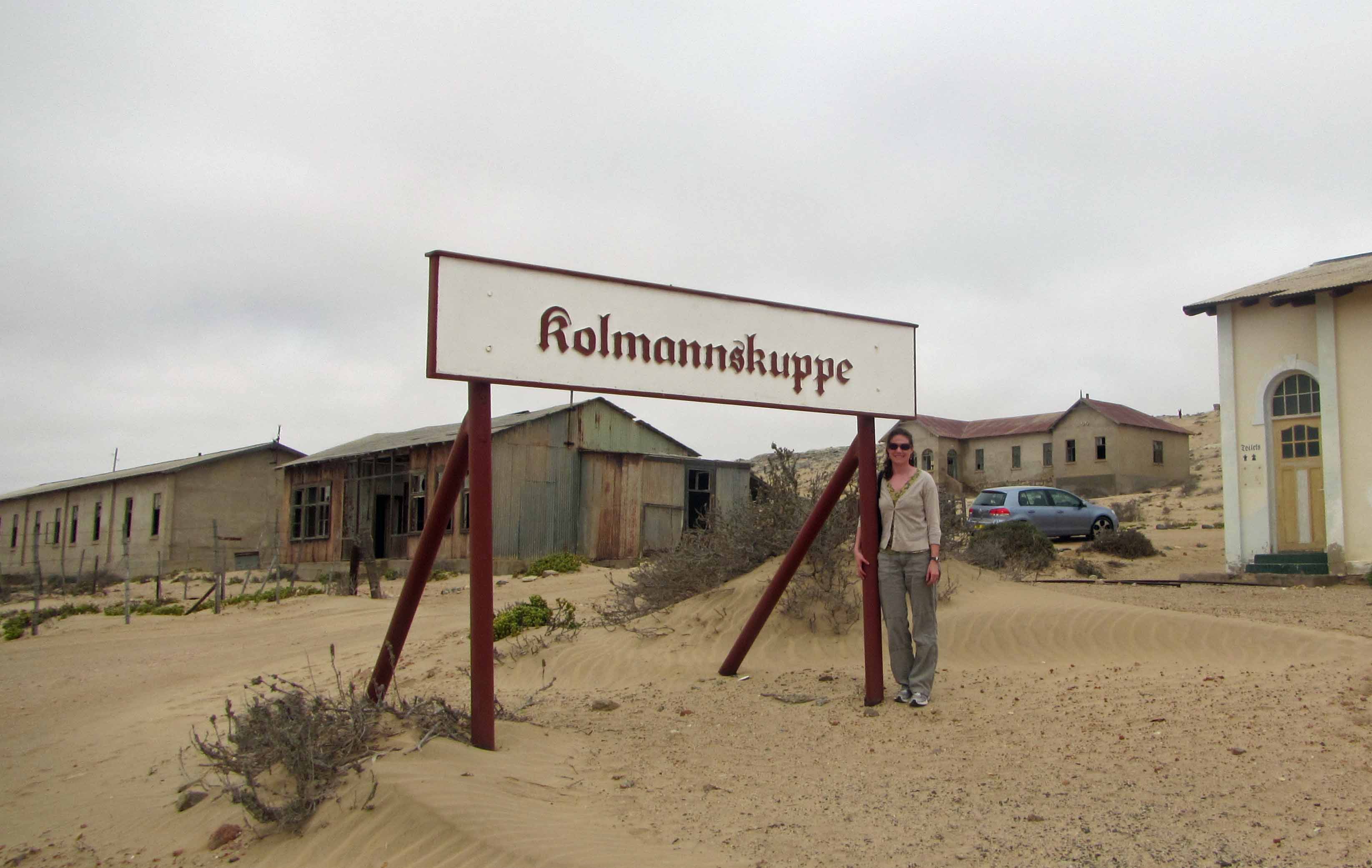
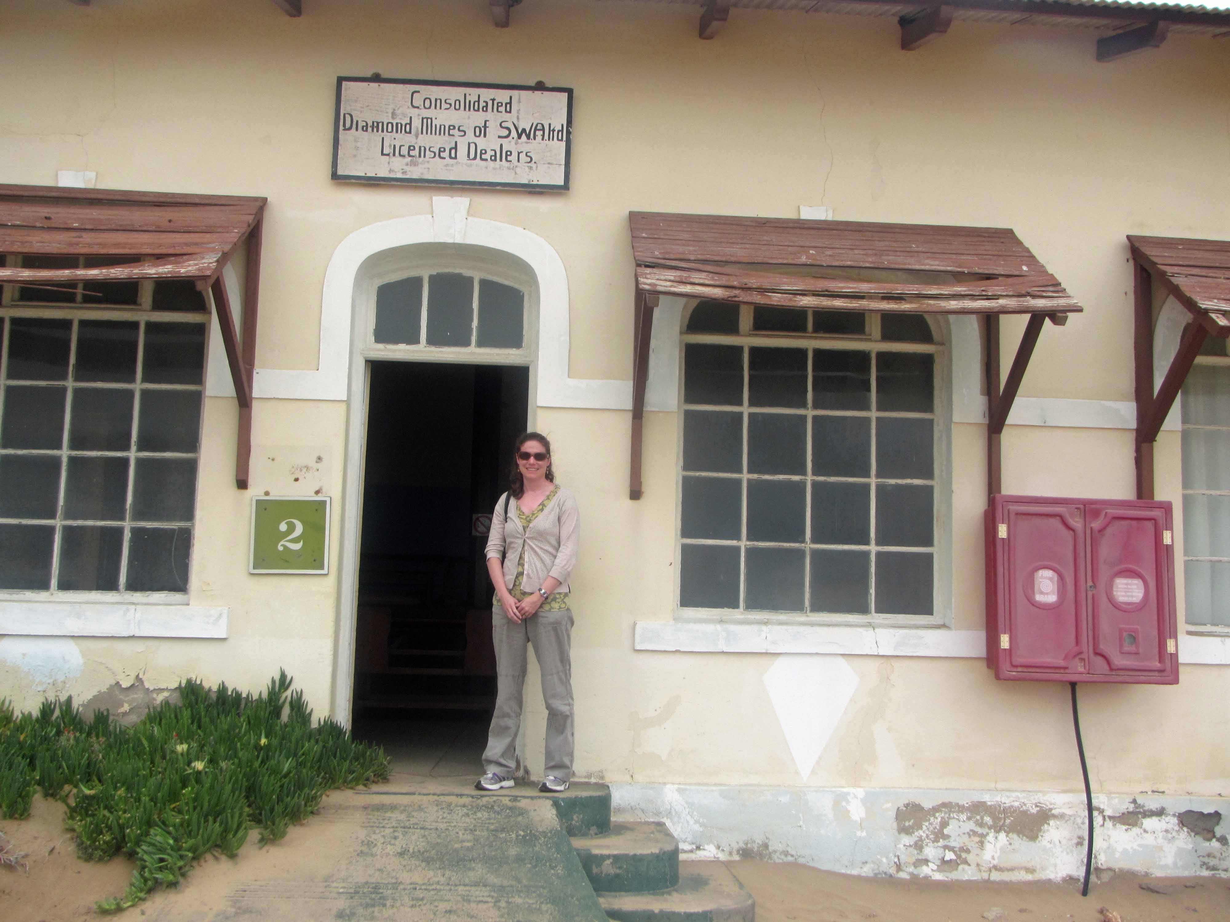
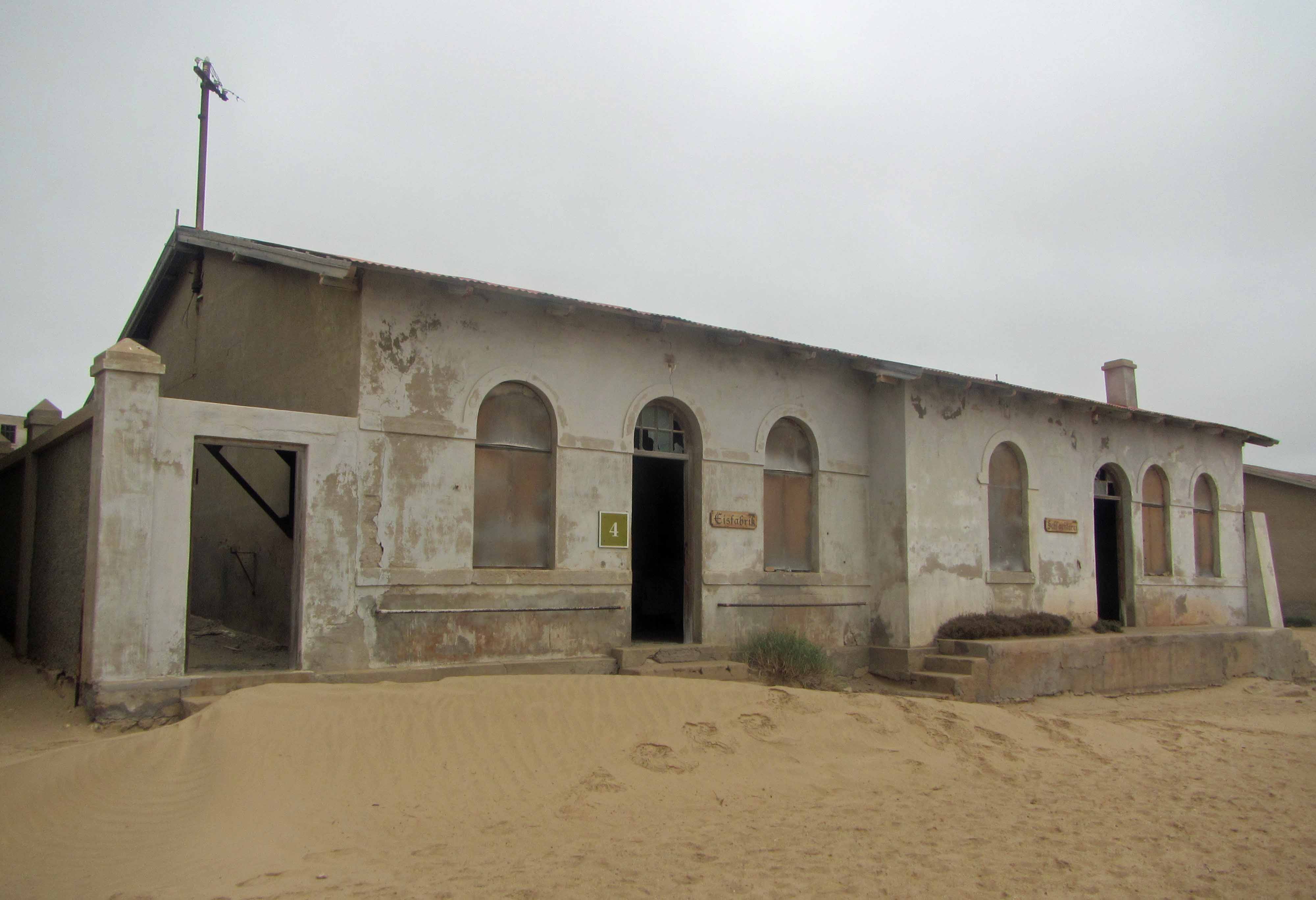
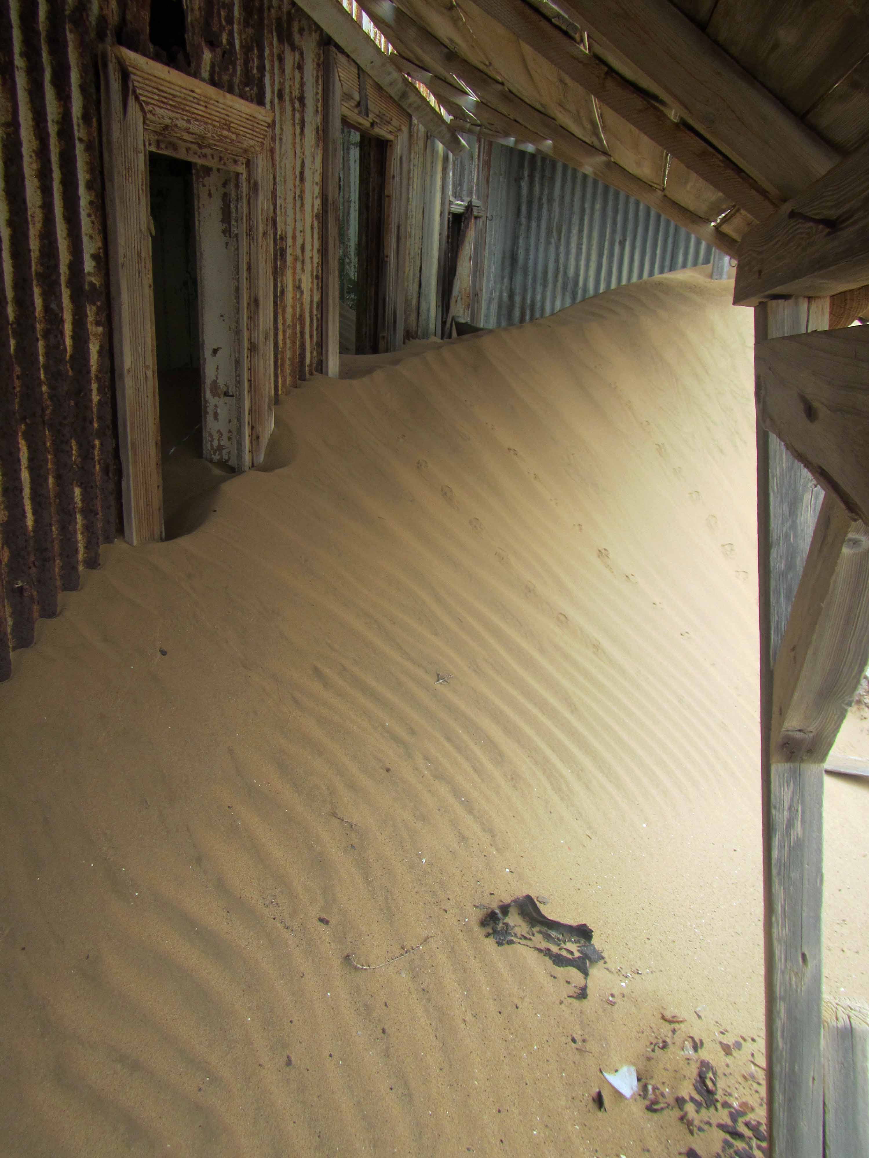
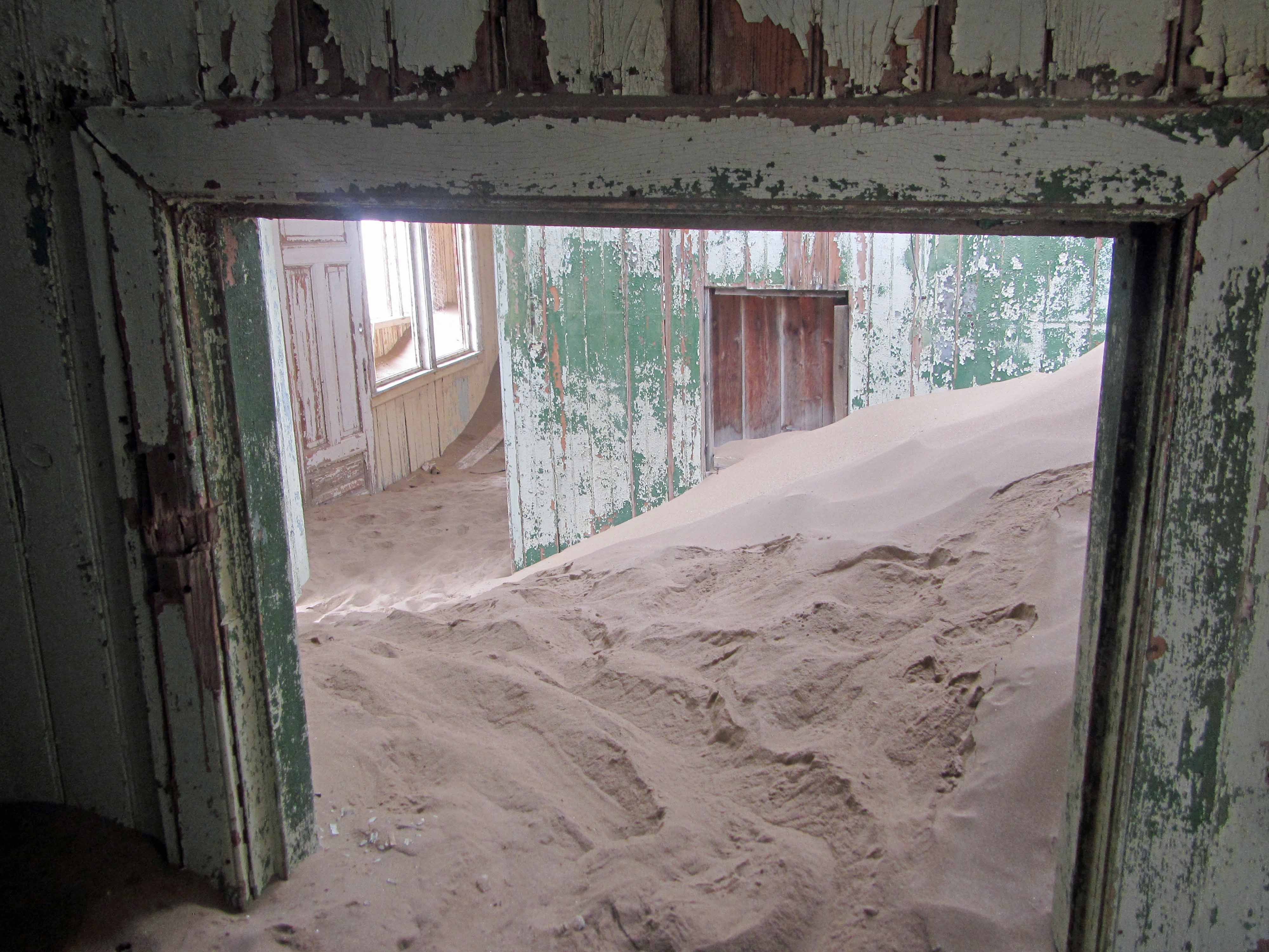
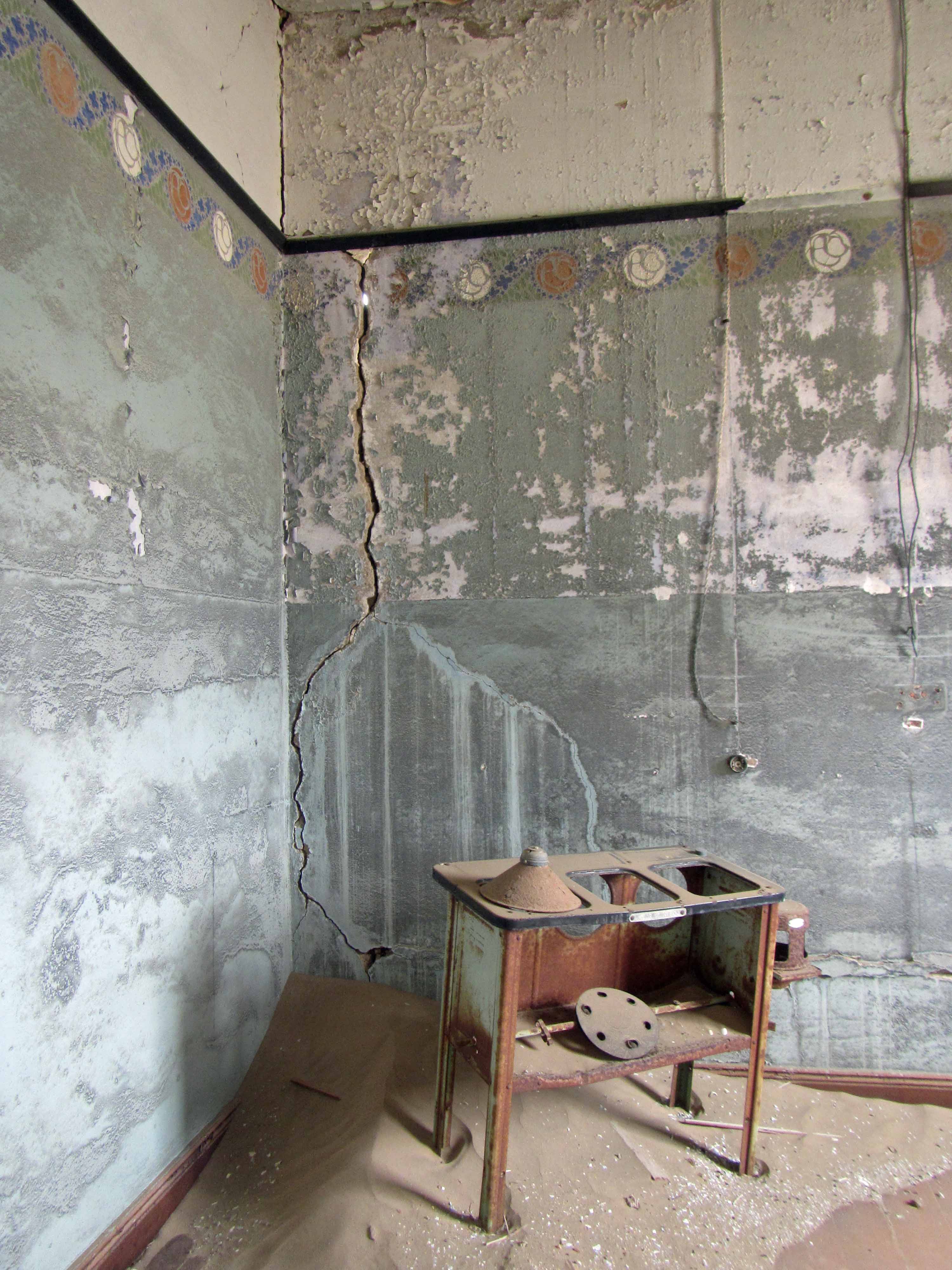
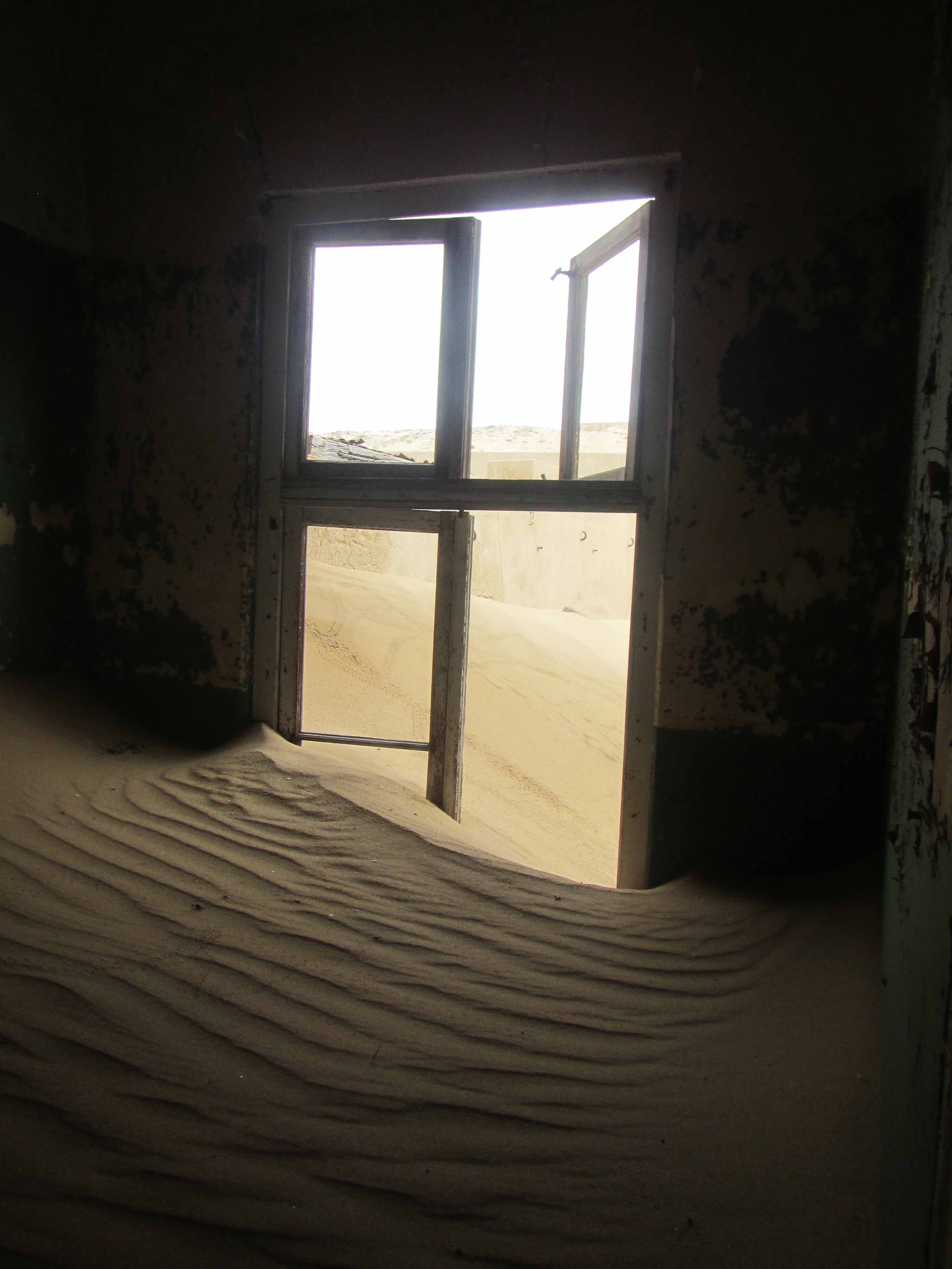
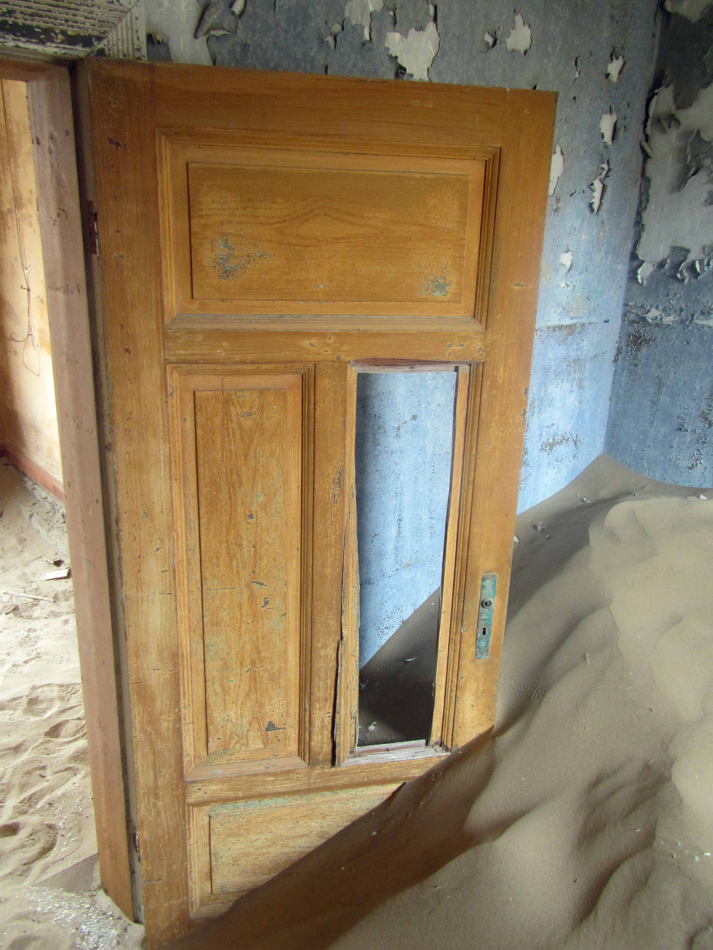
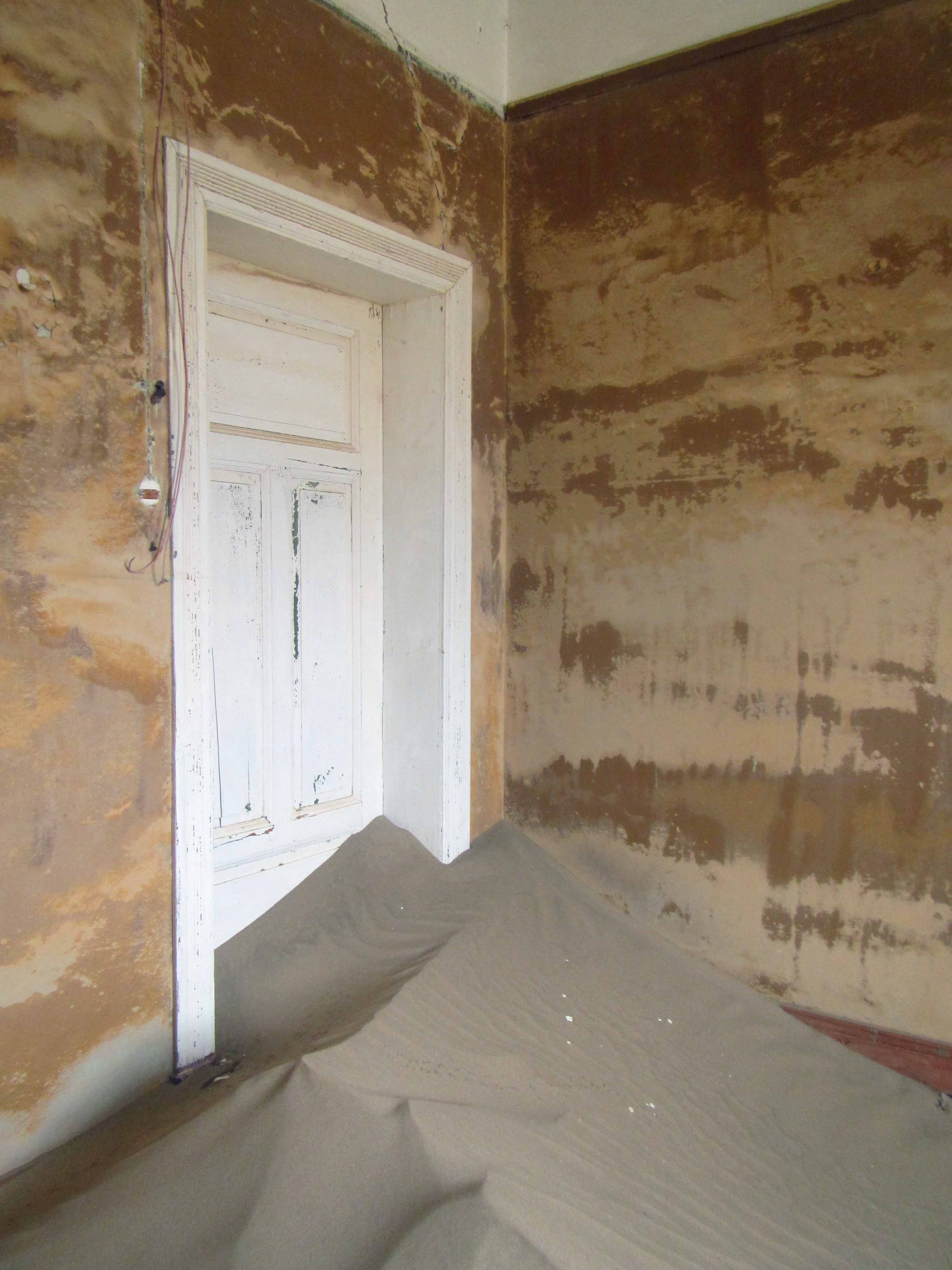
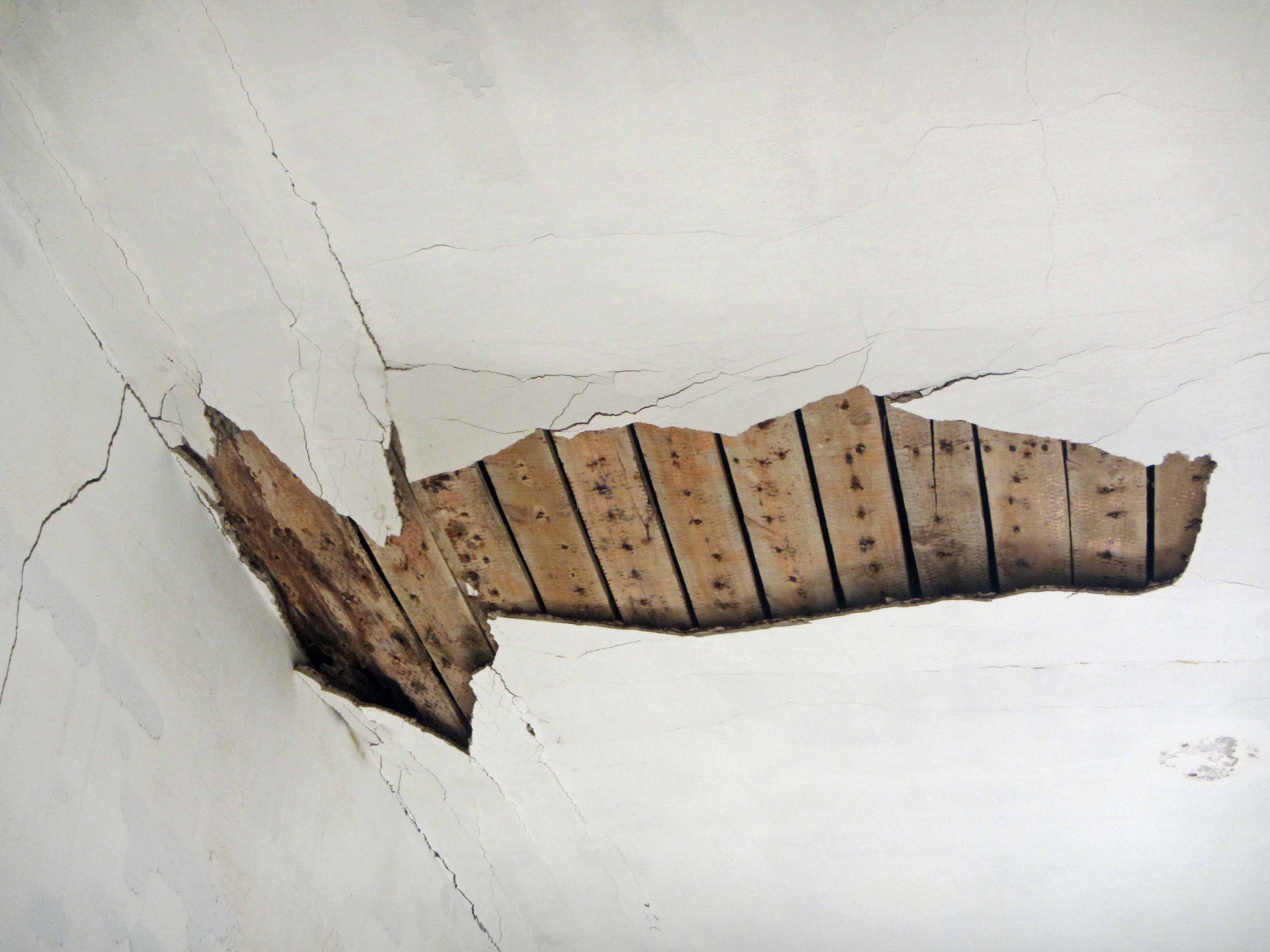
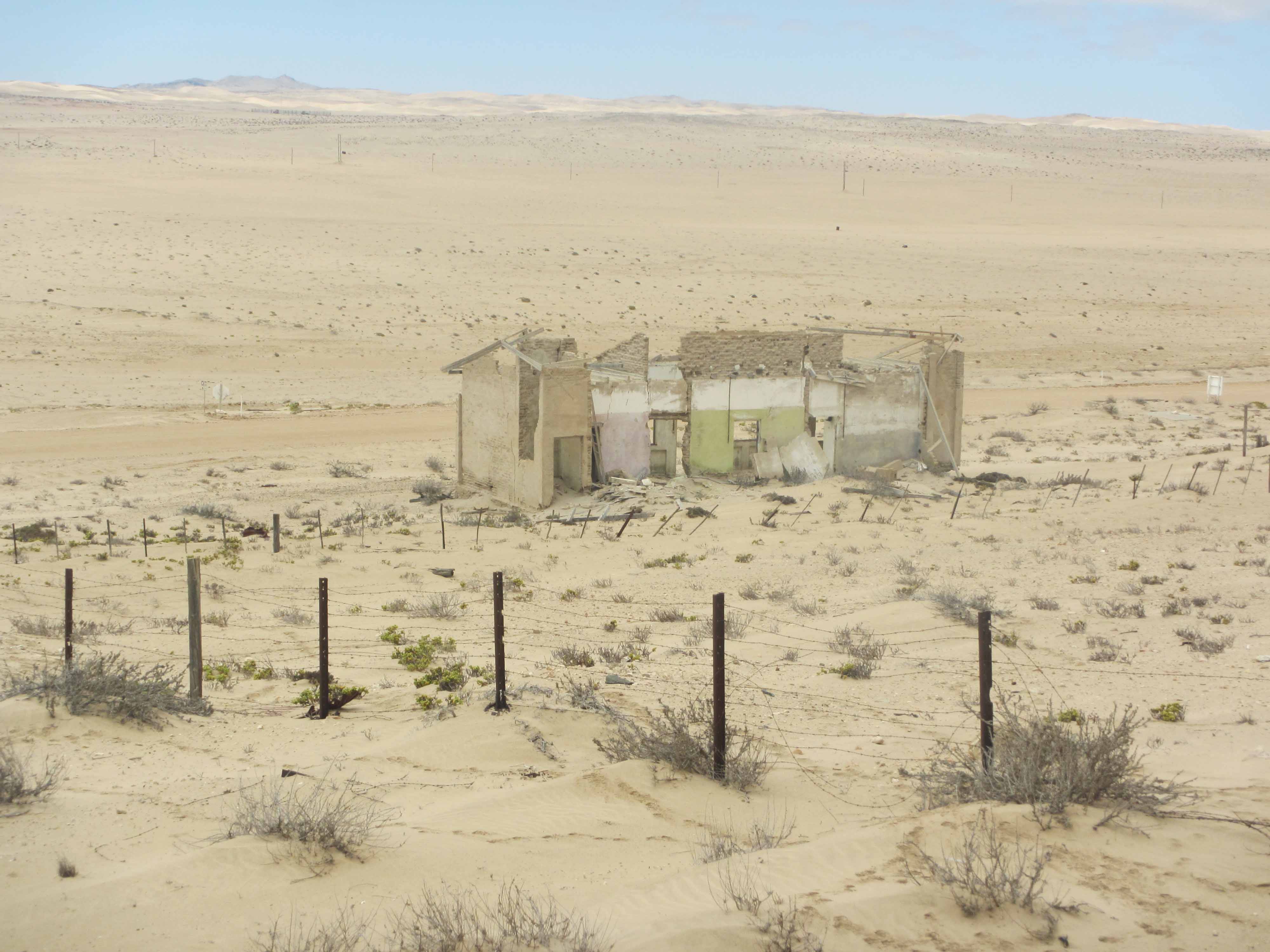
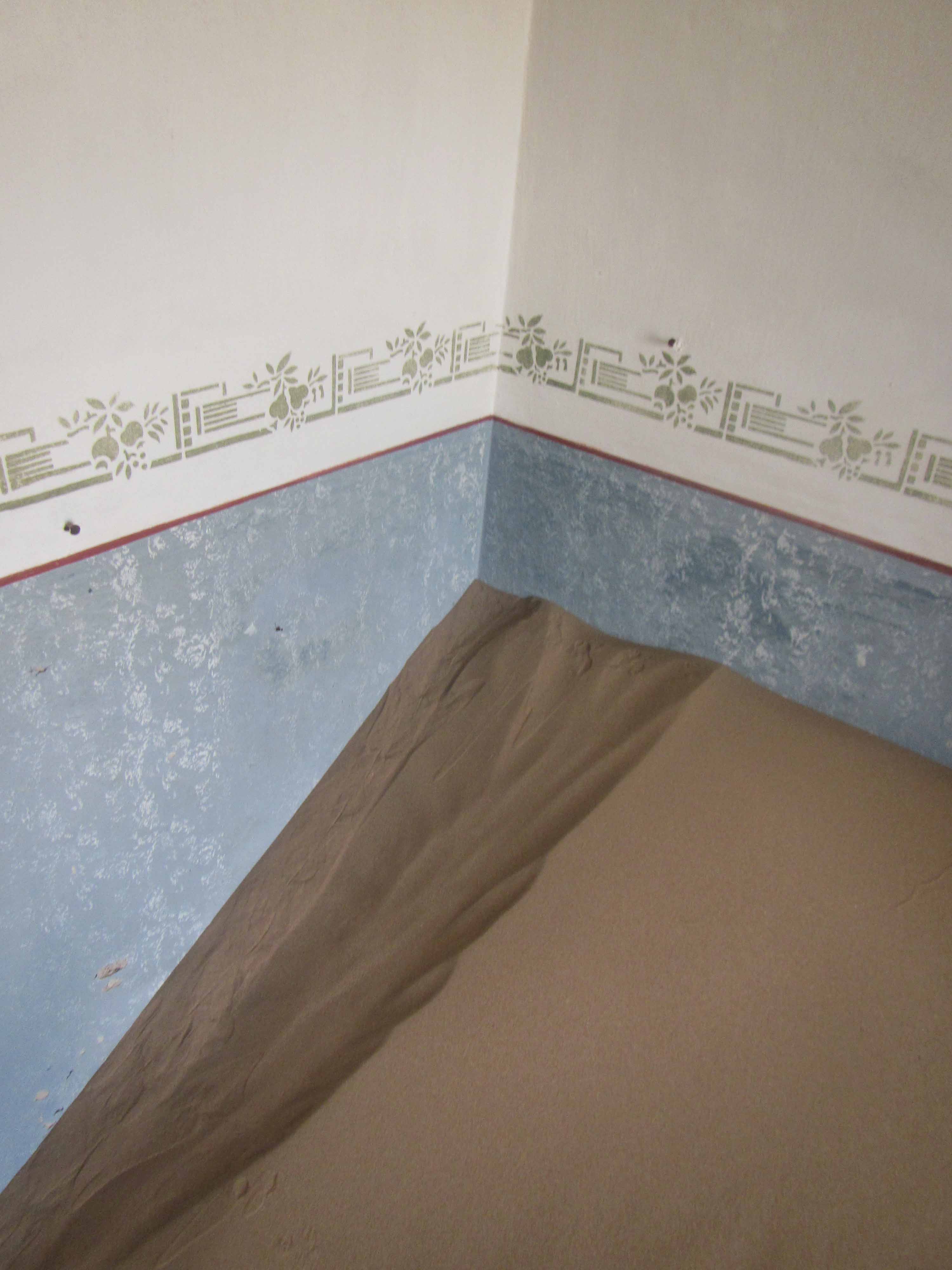
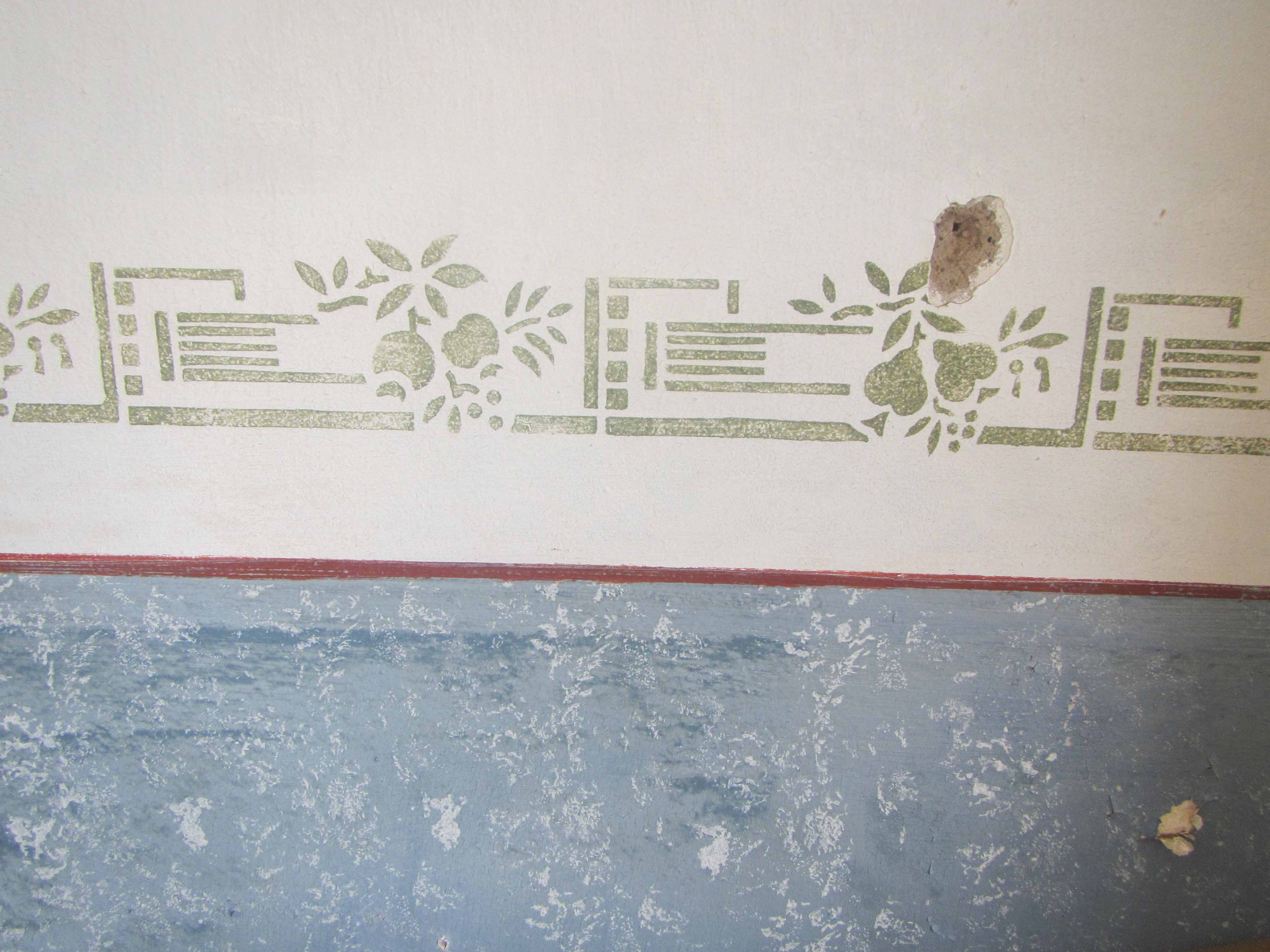
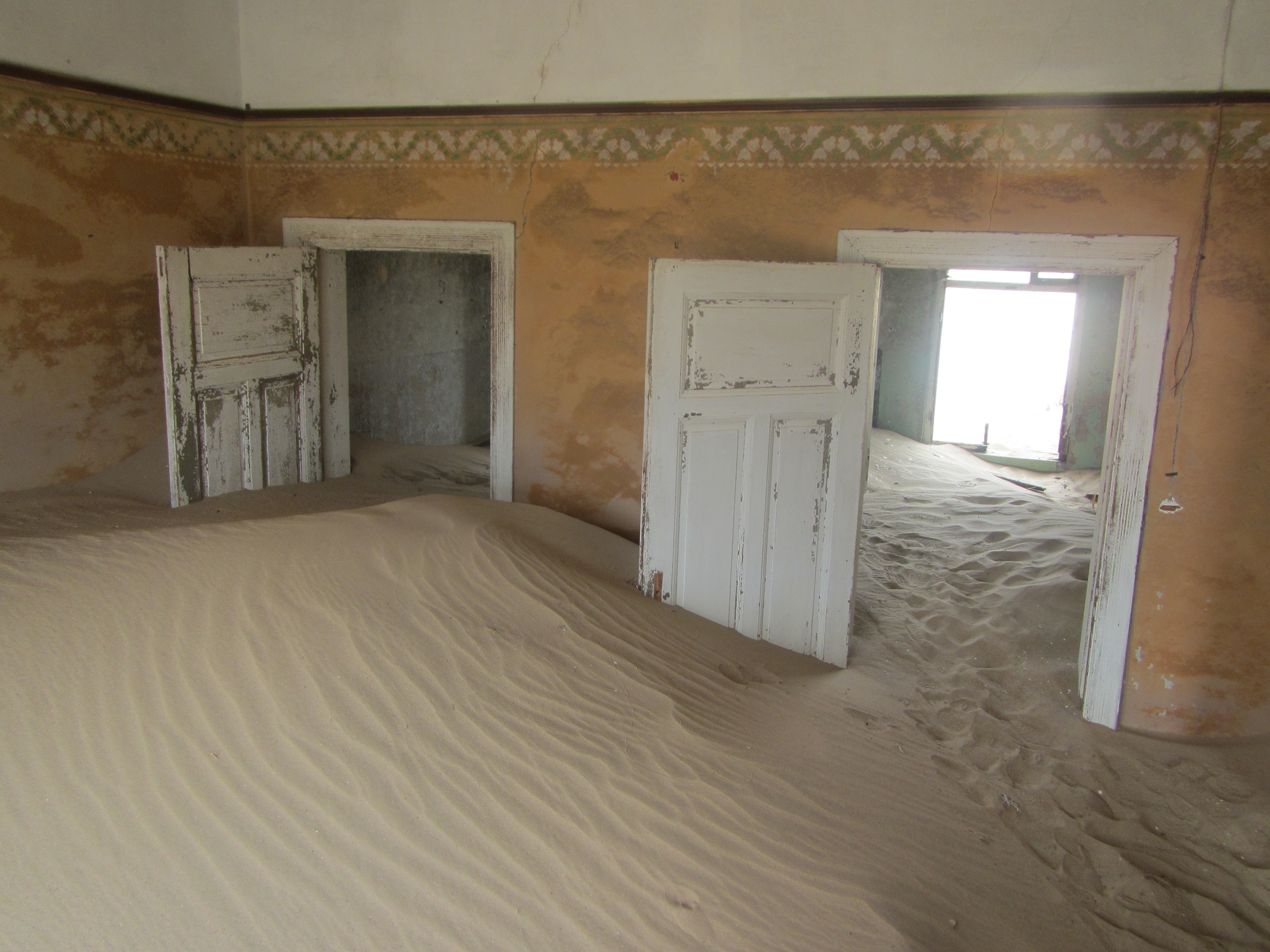
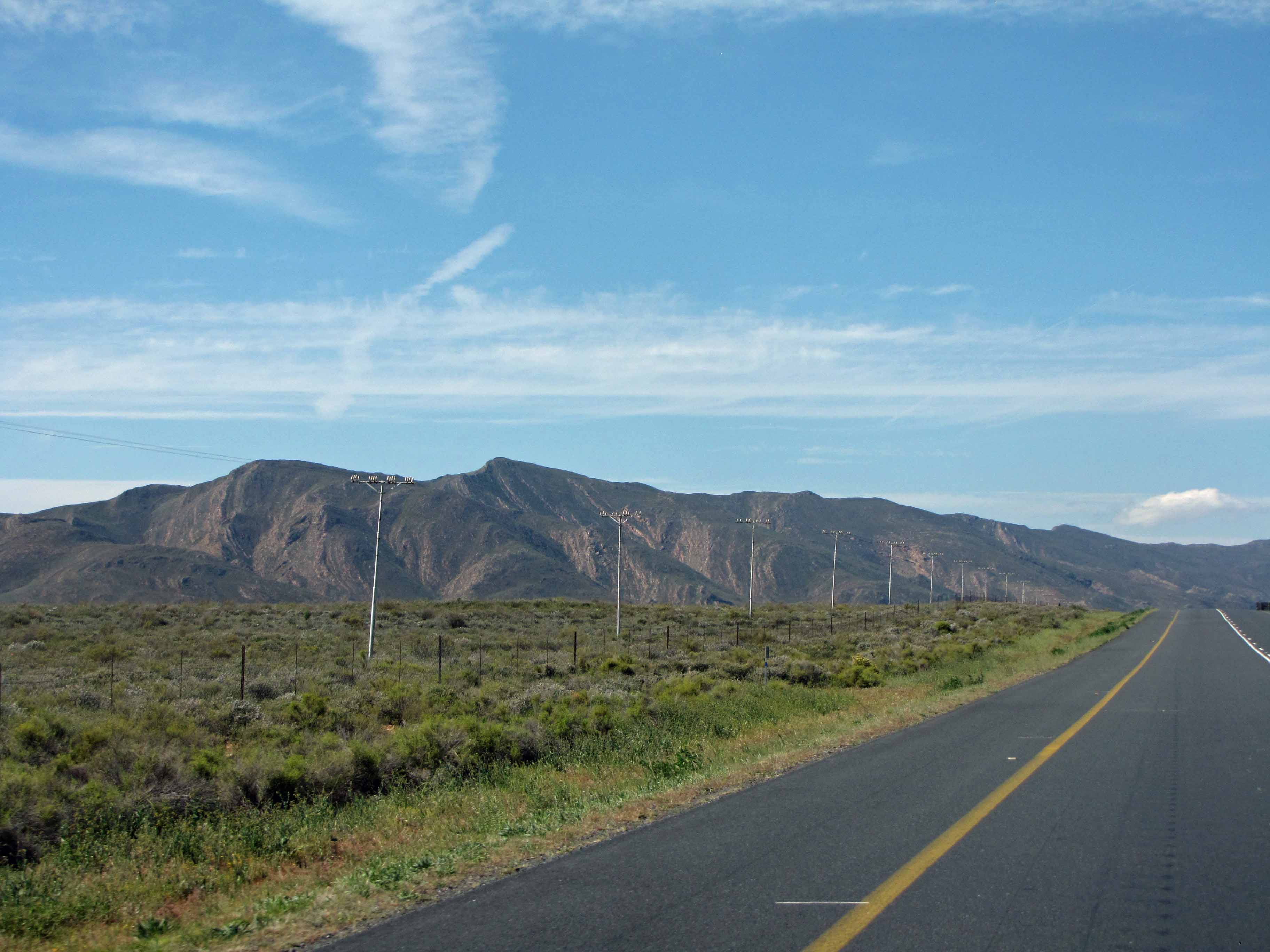
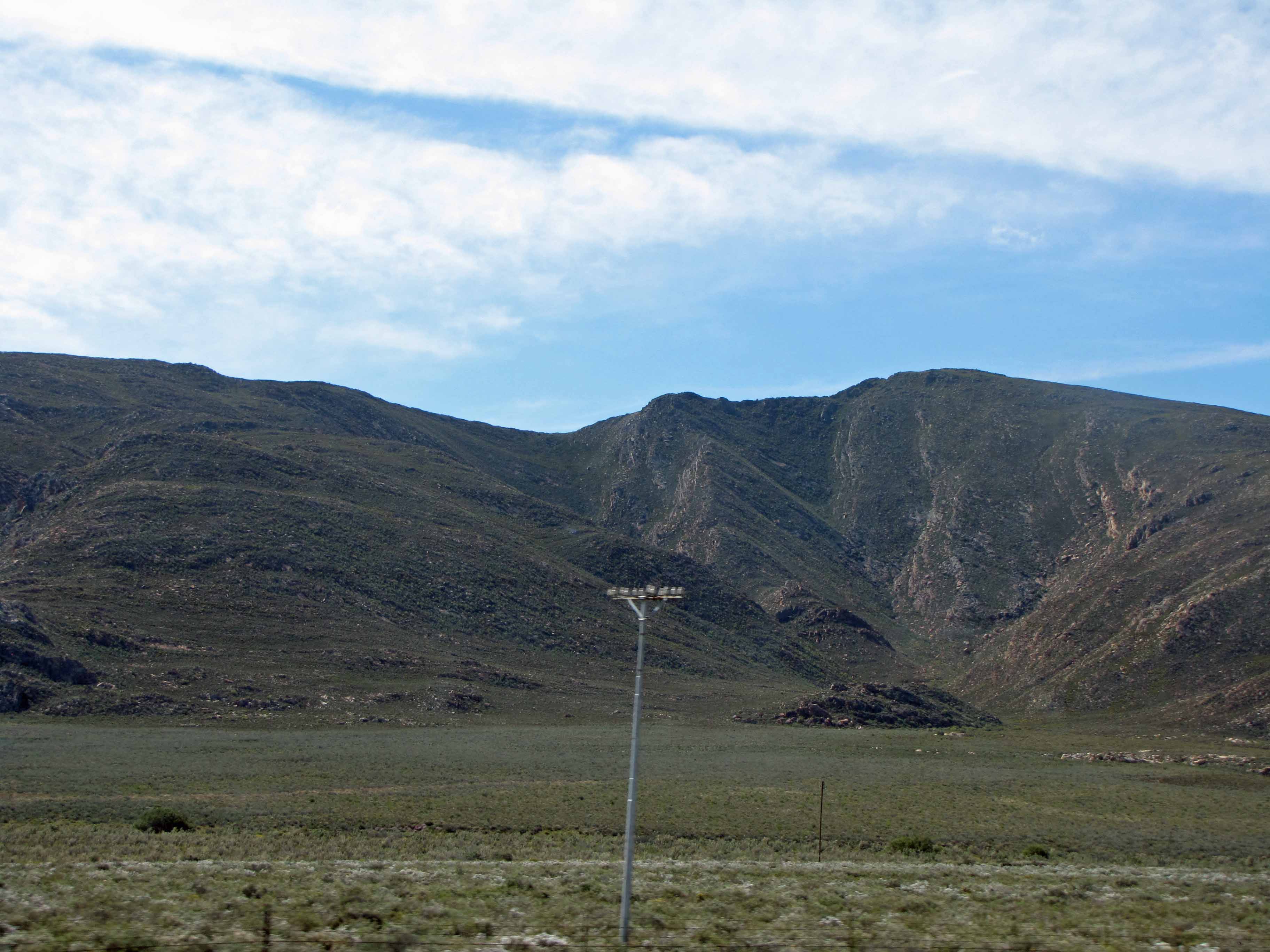
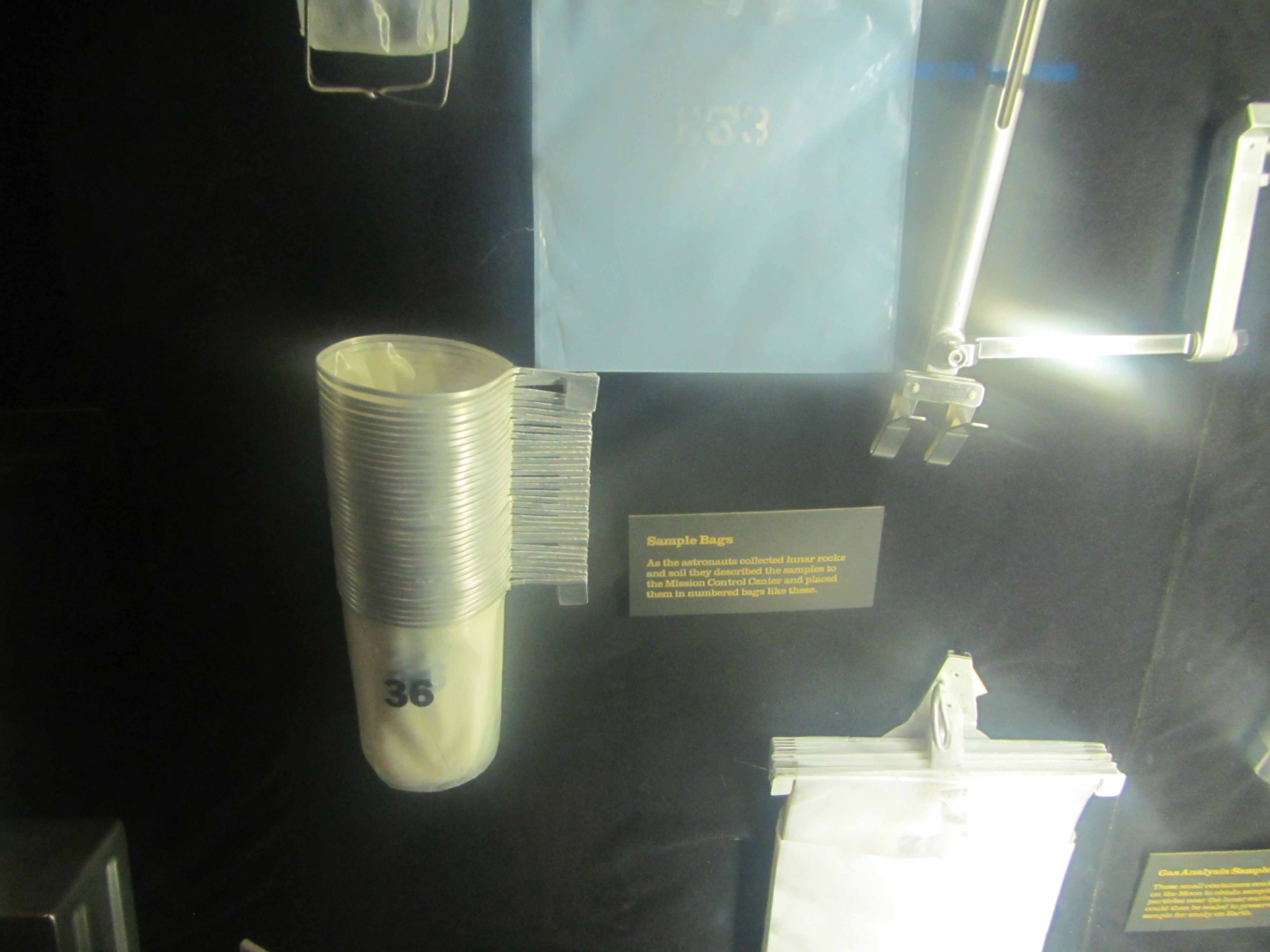
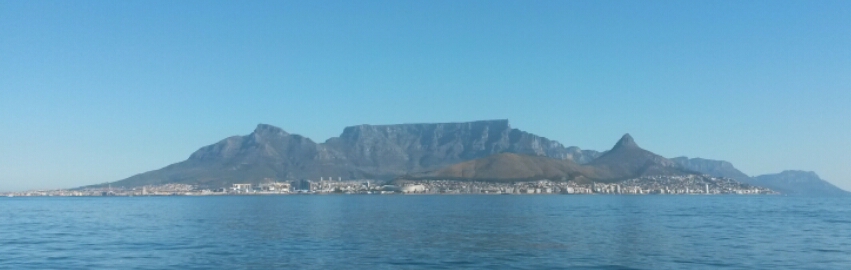
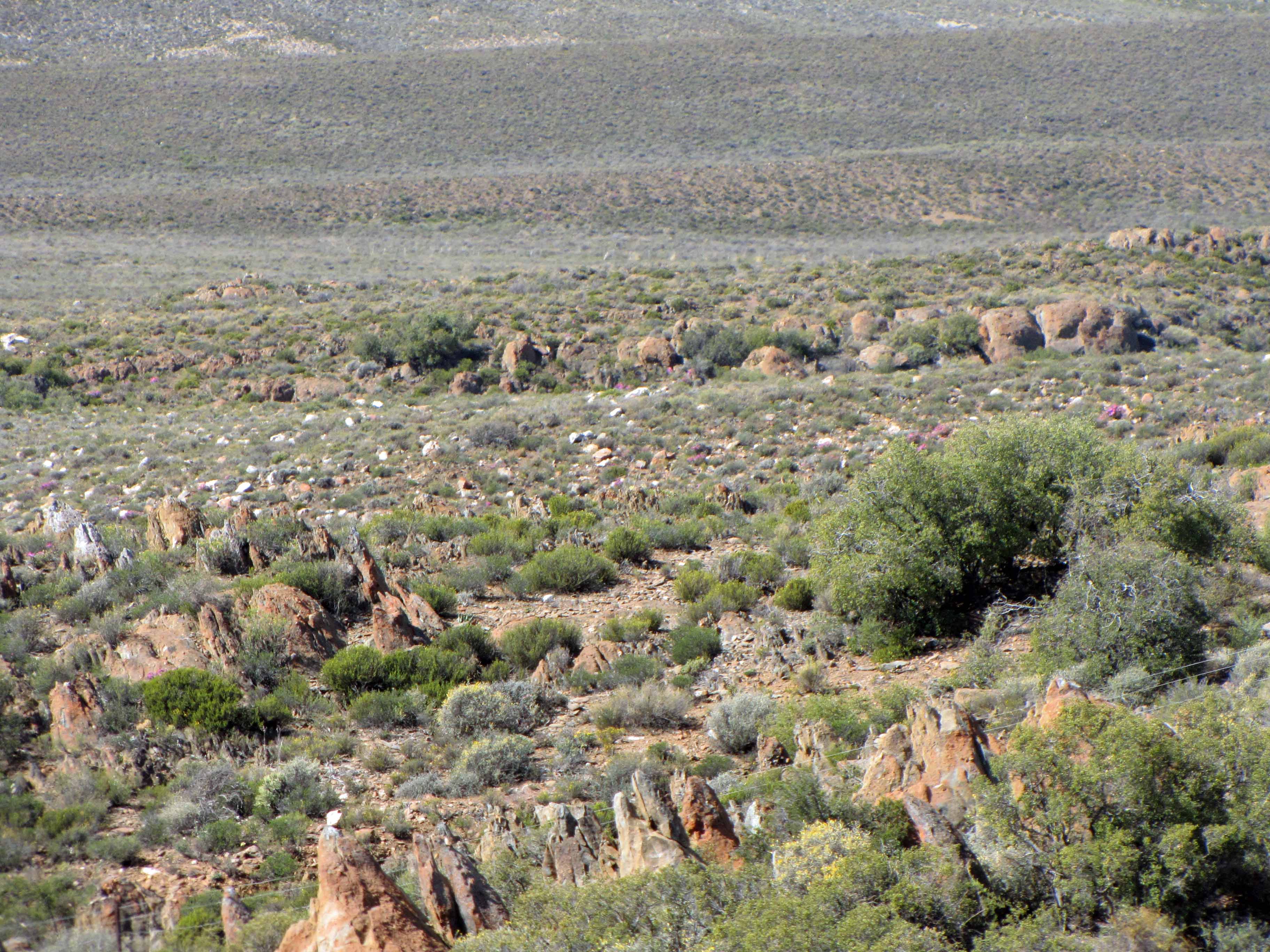
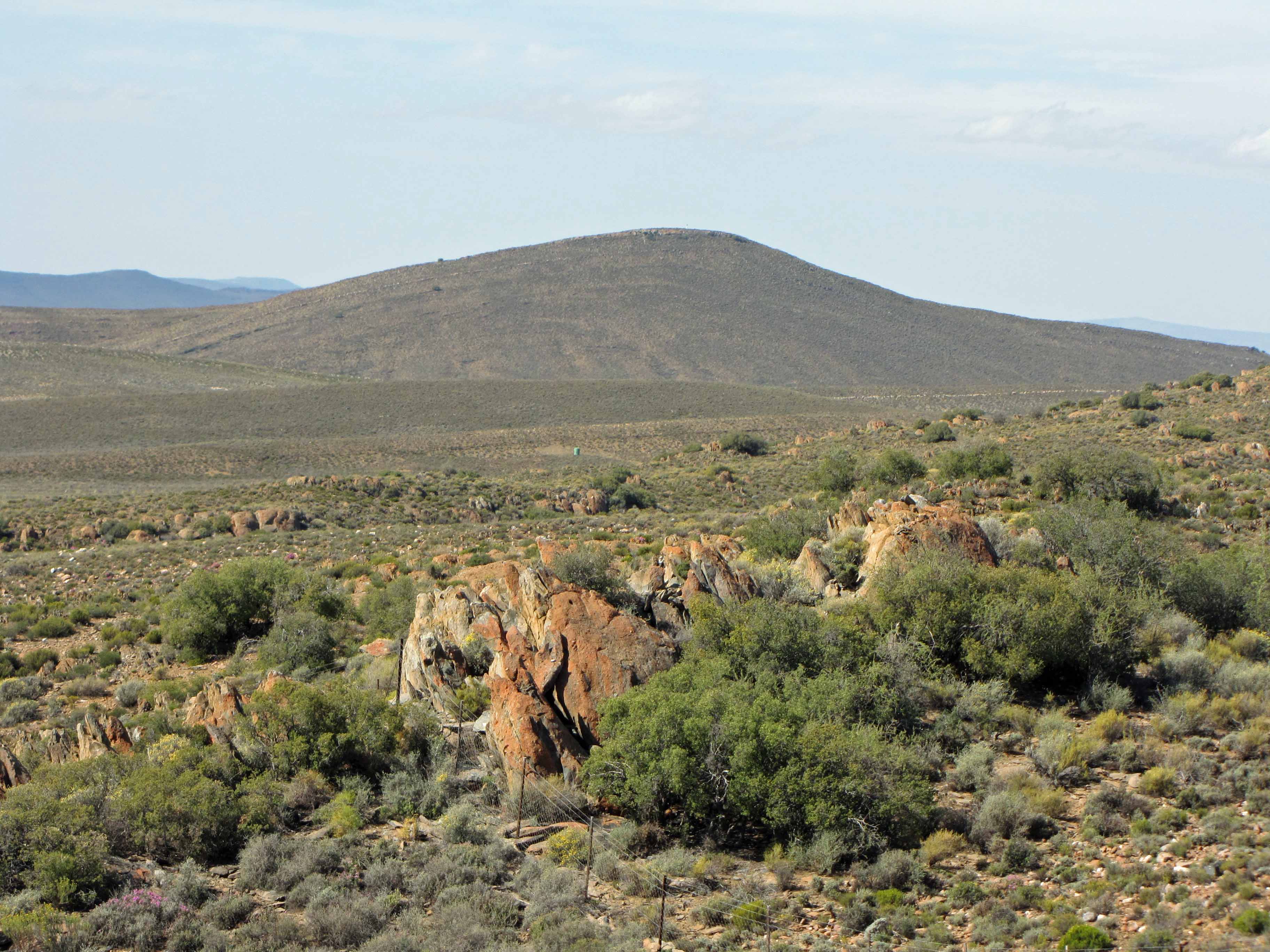
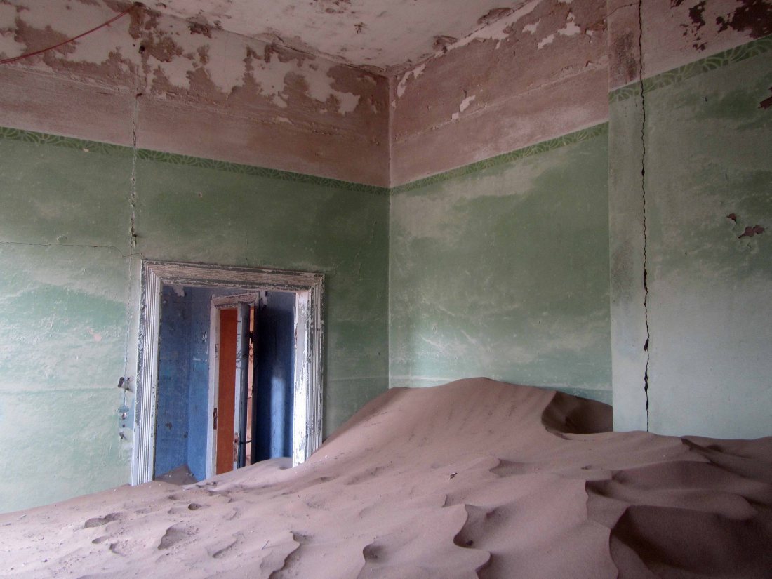
Last month I spent some time in Namibia for work. During one of my days off, I was able to spend some time visiting Kolmanskop. Located in the Namib Desert a few miles outside of the seaside town of Lüderitz, Kolmanskop is a “Ghost Town” that is the remains of a former diamond mining town. Kolmanskop was founded shortly after diamonds were discovered in the region in 1908 and was abandoned to the elements in 1954, after the diamond supply was depleted. Over the last sixty years, Kolmanskop has been decaying in the desert, battered by the wind and swept over with sand. Today, many of the buildings are half-filled with sand. The discarded possessions of the town’s former inhabitants are either slowly disintegrating in the open air or are precariously protected by glass display cases. The town of Kolmanskop is managed as a tourist attraction by the diamond mining company Namdeb. Tourists can pay a fee to visit the town during certain hours. At their own risk, tourists can wander through the abandoned buildings.

Visiting Kolmanskop was a fascinating and surreal experience. As I explored the ghostly town, I felt keenly aware of the insignificance and ephemeral nature of my life. I wondered if, one day years from now, a young woman will wander through the decaying remains of my home… or perhaps come across a former possession of mine– maybe a book, with my name written on the front cover, dusty in the corner of an antique shop– and wonder, just for a moment, about the object’s former owner.  Wandering through Kolmanskop, I found myself thinking about one of my favorite Carl Sagan quotations, from the book Pale Blue Dot:

Look again at that dot. That’s here. That’s home. That’s us. On it everyone you love, everyone you know, everyone you ever heard of, every human being who ever was, lived out their lives. The aggregate of our joy and suffering, thousands of confident religions, ideologies, and economic doctrines, every hunter and forager, every hero and coward, every creator and destroyer of civilization, every king and peasant, every young couple in love, every mother and father, hopeful child, inventor and explorer, every teacher of morals, every corrupt politician, every “superstar,” every “supreme leader,” every saint and sinner in the history of our species lived there- on a mote of dust suspended in a sunbeam.

The Earth is a very small stage in a vast cosmic arena. Think of the endless cruelties visited by the inhabitants of one corner of this pixel on the scarcely distinguishable inhabitants of some other corner, how frequent their misunderstandings, how eager they are to kill one another, how fervent their hatreds. Think of the rivers of blood spilled by all those generals and emperors so that, in glory and triumph, they could become the momentary masters of a fraction of a dot.

Our posturings, our imagined self-importance, the delusion that we have some privileged position in the Universe, are challenged by this point of pale light. Our planet is a lonely speck in the great enveloping cosmic dark. In our obscurity, in all this vastness, there is no hint that help will come from elsewhere to save us from ourselves.

The Earth is the only world known so far to harbor life. There is nowhere else, at least in the near future, to which our species could migrate. Visit, yes. Settle, not yet. Like it or not, for the moment the Earth is where we make our stand.

It has been said that astronomy is a humbling and character-building experience. There is perhaps no better demonstration of the folly of human conceits than this distant image of our tiny world. To me, it underscores our responsibility to deal more kindly with one another, and to preserve and cherish the pale blue dot, the only home we’ve ever known.

With that quotation in mind, enjoy my pictures from Kolmanskop:

Kolmanskop #2.
Kolmanskop #2.
Kolmanskop #3.
Kolmanskop #3.
Kolmanskop #4.
Kolmanskop #4.
Kolmanskop #5.
Kolmanskop #5.
Kolmanskop #6.
Kolmanskop #6.
Kolmanskop #7.
Kolmanskop #7.
Kolmanskop #8.
Kolmanskop #8.
Kolmanskop #9.
Kolmanskop #9.
Kolmanskop #10.
Kolmanskop #10.
Kolmanskop #11.
Kolmanskop #11.
Kolmanskop #12.
Kolmanskop #12.
Kolmanskop #14.
Kolmanskop #13.
Kolmanskop #14.
Kolmanskop #14.
Kolmanskop #15.
Kolmanskop #15.
Kolmanskop #16.
Kolmanskop #16.
Kolmanskop #17.
Kolmanskop #17.
Kolmanskop #18.
Kolmanskop #18.
Kolmanskop #19.
Kolmanskop #19.
Kolmanskop #20.
Kolmanskop #20.
Kolmanskop #21.
Kolmanskop #21.
Kolmanskop #22.
Kolmanskop #22.
Kolmanskop #23.
Kolmanskop #23.
Kolmanskop #24.
Kolmanskop #24.
Kolmanskop #25.
Kolmanskop #25.
Kolmanskop #26.
Kolmanskop #26.
Kolmanskop #27.
Kolmanskop #27.
Kolmanskop #28.
Kolmanskop #28.
Kolmanskop #29.
Kolmanskop #29.
Kolmanskop #30.
Kolmanskop #30.
Kolmanskop #31.
Kolmanskop #31.
Kolmanskop #32.
Kolmanskop #32.
Kolmanskop #33.
Kolmanskop #33.
Kolmanskop #34.
Kolmanskop #34.
Kolmanskop #35.
Kolmanskop #35.
Kolmanskop #36.
Kolmanskop #36.
Kolmanskop #37.
Kolmanskop #37.
Kolmanskop #38.
Kolmanskop #38.
Kolmanskop #39.
Kolmanskop #39.
Kolmanskop #40.
Kolmanskop #40.
Kolmanskop #41.
Kolmanskop #41.
Kolmanskop #42.
Kolmanskop #42.
Kolmanskop #43.
Kolmanskop #43.
Kolmanskop #44.
Kolmanskop #44.
Kolmanskop #45.
Kolmanskop #45.
Kolmanskop #46.
Kolmanskop #46.
Kolmanskop #47.
Kolmanskop #47.
Kolmanskop #48.
Kolmanskop #48.
Kolmanskop #49.
Kolmanskop #49.
Kolmanskop #50.
Kolmanskop #50.

Sutherland Sky: Part VII – Scenes from the Cape Fold Belt

Cape Fold Belt #1.
Cape Fold Belt #1. Approaching the belt from Cape Town.

At long last, I’m finishing up my series of posts about my October 2013 visit to the small town of Sutherland in South Africa’s Northern Cape province. Sutherland is home to a South African Astronomical Observatory (SAAO) research station that contains many telescopes, including the Southern African Large Telescope (SALT). You can read Part I of this series here, Part II of this series here, Part III of this series here, Part IV of this series here, Part V of this series here, and Part VI of this series here. In my previous posts, I blogged about the astronomical observatory, and I also discussed the Dwyka Diamictite rock that I observed along the road to Sutherland. In this final post, I’d like to share some views of the stunning Cape Fold Belt, which we drove through on our way from Cape Town to Sutherland.

I can’t believe that it’s taken me over a year to finish up this series of posts. I’ve certainly been neglecting my geology blogging this year! However, I’ve had an extremely busy year. I started a new job then 8 months later I was promoted into another new job. So, I’ve been trying to find my feet in my new work environment. I also spent 10 weeks working at sea and was busy with other travel, both for work and for personal reasons. In any case, I’m hoping that the rest of the year will be a little quieter so that I can catch up on my blogging backlog. Then, in the New Year, I’d like to resurrect the Geology Word of the Week. 

For now, though, enjoy these beautiful views of the Cape Fold Belt:

Cape Fold Belt #2. Driving into the belt.
Cape Fold Belt #2. Driving into the belt and looking back at some winelands.
Cape Fold Belt #3. The Huegonot Tunnel through one of the belt's mountains.
Cape Fold Belt #3. The Huguenot Tunnel through the Du Toitskloof Mountains.
Cape Fold Belt #4.
Cape Fold Belt #4.
Cape Fold Belt #5.
Cape Fold Belt #5. There’s some folding!
Cape Fold Belt #6. Emerging into the winelands near Robertson.
Cape Fold Belt #7. Vines and misty mountains.
Cape Fold Belt #8.
Cape Fold Belt #8.
Cape Fold Belt #9. Uplift!
Cape Fold Belt #9. Stunning tilted mountains.
Cape Fold Belt #10.
Cape Fold Belt #10. A roadcut through tilted rocks.
Cape Fold Belt #11.
Cape Fold Belt #11. More beautiful winelands.
Cape Fold Belt #12.
Cape Fold Belt #12.
Cape Fold Belt #13.
Cape Fold Belt #13.
Cape Fold Belt #14.
Cape Fold Belt #14.
Cape Fold Belt #15.
Cape Fold Belt #15.
Cape Fold Belt #16.
Cape Fold Belt #16.
Cape Fold Belt #17.
Cape Fold Belt #17.
Cape Fold Belt #19.
Cape Fold Belt #18.
Cape Fold Belt #19.
Cape Fold Belt #19.
Cape Fold Belt #20.
Cape Fold Belt #20.
Cape Fold Belt #21.
Cape Fold Belt #21.

Monday Geology Picture: A Few Fossils

A few fossils on display at a booth at the Gilsum Rock Swap in New Hampshire in June 2014.

My work schedule is still keeping me quite busy, but some more in depth blogging will be coming soon… I’ve put in a couple of weeks of leave for later in November and December. In the meantime, here’s another “Monday Geology Picture” to tide my readers over. I snapped this picture of a few fossils at a booth at the Gilsum Rock Swap in New Hampshire in June 2014.

Monday Geology Picture: Peridot at the Smithsonian

Pretty peridot on display at the Smithsonian, June 2014.

For this week’s “Monday Geology Picture” I thought that I would share another image from my recent (June 2014) trip to the Smithsonian Natural History MuseumPeridot is my favorite gemstone, and I saw some truly stunning peridot gemstones on display at the Smithsonian. Aren’t they lovely?

Here’s a closer view of some of the pretty peridot gems:

A closer view of some of the pretty peridot gemstones.
Five pretty peridots.

I’m still in the field, but when I’m back home in a few days I hope to catch up on some blogging… stay tuned!

Monday Geology Picture(s): Geological Sampling on the Moon

Lunar geological sampling tools #1.

If you think that regular geological field work and sampling can be challenging, try doing those tasks in a spacesuit. During my recent (June 2014) trip to Washington, DC, I visited the Smithsonian Air and Space Museum. Among many wonderful things, I saw a display that included some sampling tools that astronauts in spacesuits used to help them collect samples from the lunar surface during the Apollo missions. You can read more about these sampling tools here, and you can read more about the geology of the moon here.

Below are a few more pictures of the lunar geological sampling tools. My apologies for the poor quality of the images The displays were difficult to photograph with my point-and-shoot camera.

Lunar sampling #2.
Lunar geological sampling tools #2.
Lunar geological sampling tools #3.
Lunar geological sampling tools #4.
Lunar geological sampling tools #5.

Monday Geology Picture: A Mineral Rainbow at the Smithsonian

MineralRainbow
A mineral rainbow on display at the Smithsonian Natural History Museum, June 2014.

Minerals come in a rainbow of colors. Sometimes, mineral color is a result of the mineral’s composition. For example, azurite is always blue. Other times, mineral color is a result of small quantities of trace elements or structural defects in the mineral. For example, quartz, one of the most common minerals, is most often clear or white but can be other colors such as rose pink, yellow, purple, and even brown. The rose pink color, for example, is a result of trace amounts of titanium, iron, or manganese. Thus, it can be difficult to impossible to identify minerals by color alone. Other physical attributes, such as hardness, density, shape, and luster, must also be considered to properly identify a mineral.

I visited the Smithsonian Natural History Museum in Washington, DC, back in June 2014. The museum has very impressive displays of rocks, minerals, and gemstones. I spent a few hours looking at the displays although I unfortunately found myself in the midst of throngs of summer visitors. Despite the crowds, I enjoyed looking at all of the mineral displays, and I even managed to take a few halfway decent snapshots. However, the displays are much more impressive in real life.

This week’s “Monday Geology Picture” shows a mineral rainbow display at the Smithsonian Natural History Museum. What a wonderful display of red-orange-yellow-green-indigo-violet minerals!

Monday Geology Picture: Cape Town from the Sea

Table Mountain viewed from the sea. Bon Voyage, Cape Town!

On Saturday, I unexpectedly had to hop on a ship for a month for a work trip. So, blogging may be a little bit light over the next month. I’ll try to post when I can, but I’ll be limited by the slow shipboard internet.

As the ship was leaving Cape Town on Saturday afternoon, I enjoyed some stunning views of Cape Town from the sea. The picture above shows a beautiful view of Table Mountain with the city of Cape Town in front of it.

Monday Geology Picture: U-Shaped Glacial Valley, Seward Peninsula, Alaska

A U-shaped glacial valley on the Seward Peninsula outside of Nome, Alaska. Picture taken Summer 2013.

When glaciers erode landscapes, they often leave behind characteristic U-shaped valleys. This week’s Monday Geology Picture shows a U-shaped glacial valley on the Seward Peninsula in Alaska. This valley is located just outside of the gold mining town of Nome.

Does anyone else have good pictures of U-shaped valleys?

Sutherland Sky: Part VI – Dwyka Diamictite

Dwyka diamictite can be recognised from a distance by its typical "tombstone" appearance during weathering.
Dwyka diamictite can be recognised from a distance by its typical “tombstone” appearance, which forms during weathering.

At long last, I’m finishing up my series of posts about my October 2013 visit to the small town of Sutherland in South Africa’s Northern Cape province. Sutherland is home to a South African Astronomical Observatory (SAAO) research station that contains many telescopes, including the Southern African Large Telescope (SALT). You can read Part I of this series here, Part II of this series here, Part III of this series here, Part IV of this series here, and Part V of this series here. In my previous posts, I blogged about the astronomical observatory. In the last couple of posts, I’d like to blog about some of the geology that I observed on the drive from Cape Town to Sutherland. 

On the drive to Sutherland, we stopped at some fantastic roadcut exposures of Dwyka Group glacial sedimentary rock. Specifically, we stopped to look at some Dwyka diamictite, a term used to describe a poorly sorted sedimentary rock, commonly one deposited by a glacier. Dwyka glacial sediments are often referred to as “Dwyka tillite”. However, tillite is a specific term that refers to poorly-sorted sediments deposited directly underneath a glacier. Since there is evidence that many of the Dwyka glacial sediments were deposited in a glaciomarine environment, the term “Dwyka diamictite” is more accurate… and also has pleasing alliteration! Dwyka diamictite is Carboniferous in age and was left behind by a large glacier that covered southern Gondwana. Thus, Dwyka diamictite can be found on several continents and provides evidence that the supercontinent of Gondwana once existed.

Dwyka diamictite can easily be recognized from a distance by its distinctive “tombstone” appearance:

More "tombstone" weathering of Dwyka diamictite.
More “tombstone” weathering of Dwyka diamictite.

For some reason (perhaps one of my geomorphologist readers knows why?), the Dwyka tends to weather into “tombstone” shapes.

Dwyka diamictite is generally is covered in a reddish-brown oxidation rim. A fresh surface of Dwyka consists of a dark gray matrix (finer-grained glacial sediment) that contains clasts of all sizes, shapes, and rock types.

Here’s a look at a fresh roadcut surface of Dwyka diamictite:

Dwyka diamictite roadcut, with car for scale.
Dwyka diamictite roadcut, with 4×4 for scale.
Another view of the Dwyka diamictite outcrop.

I was really excited to take a look at such a beautiful roadcut of Dwyka diamictite:

Look! Dwyka diamictite!
Posing with Dwyka diamictite.
After several “Vanna White” shots, my husband made me take a “calmer” picture with the Dwyka diamictite outcrop.

Here are some pictures of some of the interesting clasts I saw in the Dwyka diamictite outcrop:

Dwyka diamictite clasts #1.
Dwyka diamictite clasts #2.
Dwyka diamictite clasts #3.
Dwyka diamictite clasts #4.
Dwyka diamictite clasts #5. That black and white clast is worth a closer look.
Dwyka diamictite clasts #6.

How many of the above clasts can you identify? I see some igneous rocks, some sedimentary rocks, some metamorphic rocks… all sorts of rocks!

Well, that’s all for this “Sutherland Sky” post. Next I’ll share some pictures of some rocks I saw as we drove through the Cape Fold Belt on our way from Cape Town to Sutherland.

Monday Geology Picture(s): Two Views from the Top of Table Mountain

My two American geologist friends, with whom I went ziplining amidst some sedimentary rocks a little over a week ago, left on Saturday. Before they left on their evening flight, we decided to go up Cape Town’s beautiful Table Mountain. We took the cable car up the mountain, hiked around on the top for a couple of hours, and then took the cable car back down. Saturday was a beautiful sunny day with good visibility, so we saw some stunning views from the top of the mountain. Here are two of them:

Table Mountain, sloping down to the city of Cape Town below.
Another view from the top of Table Mountain, this time looking towards the inselberg Lion's Head (the knob of rock) and Robbin Island.
Another view from the top of Table Mountain, this time looking towards the inselberg Lion’s Head (the knob of rock) and Robbin Island.

Table Mountain is comprised of the same sandstone rocks that we saw when we went ziplining in the Cape Fold Belt. However, the sandstone rocks of Table Mountain are relatively flat and unfolded, their preservation a result of the mountain’s granite core. Here’s a figure, taken from Prof. John Compton’s book The Rocks and Mountains of Cape Town, that explains the geological relationship:

Geology of the greater Cape Town area, showing how the Table Mountain Group sedimentary rocks are related to uplifted rocks in the Cape Fold Belt. Image taken from  Compton (2004).
Geology of the greater Cape Town area, showing how the Table Mountain Group sedimentary rocks are related to uplifted rocks in the Cape Fold Belt. Image taken from Compton (2004). Click image to enlarge.