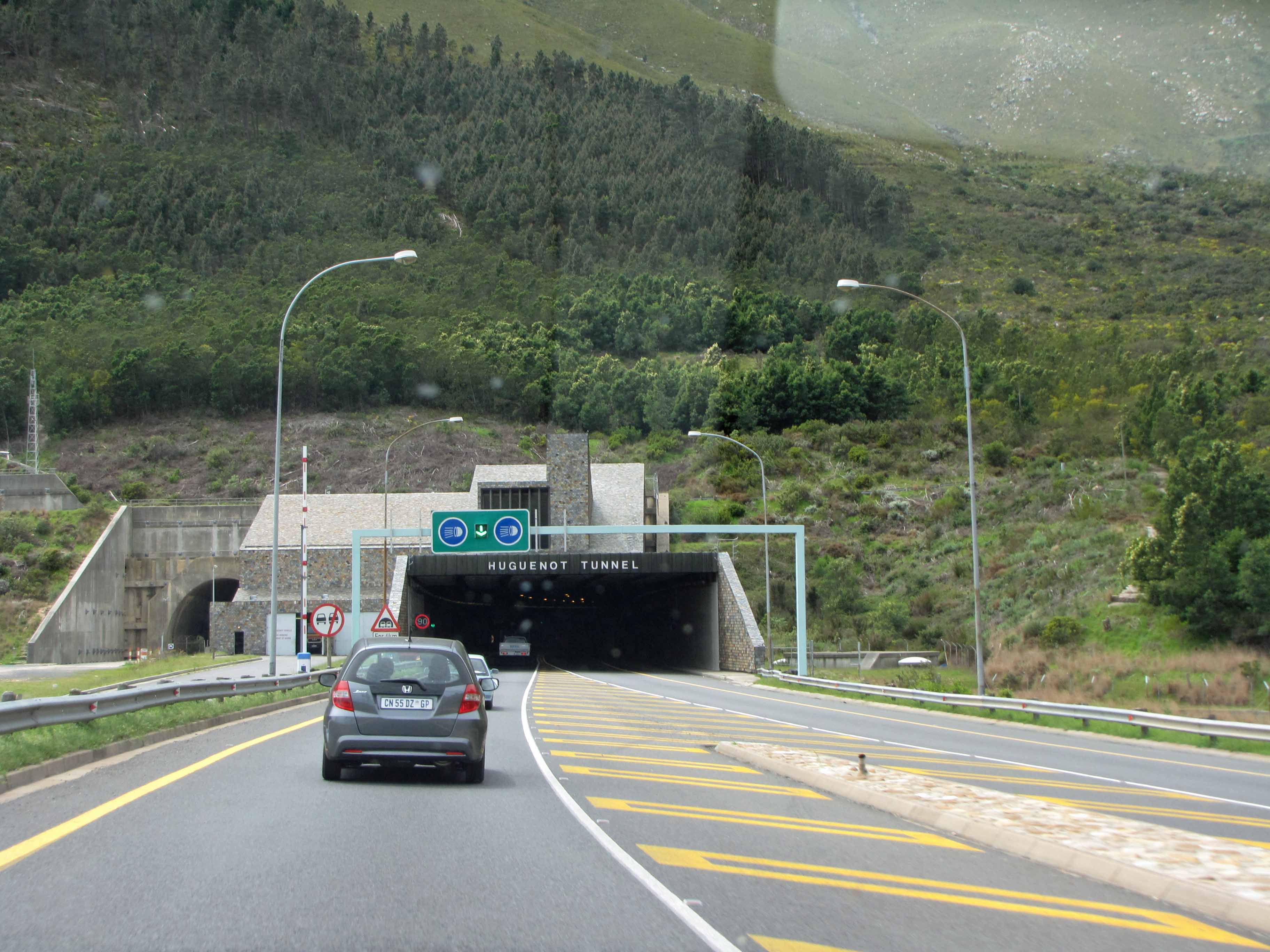
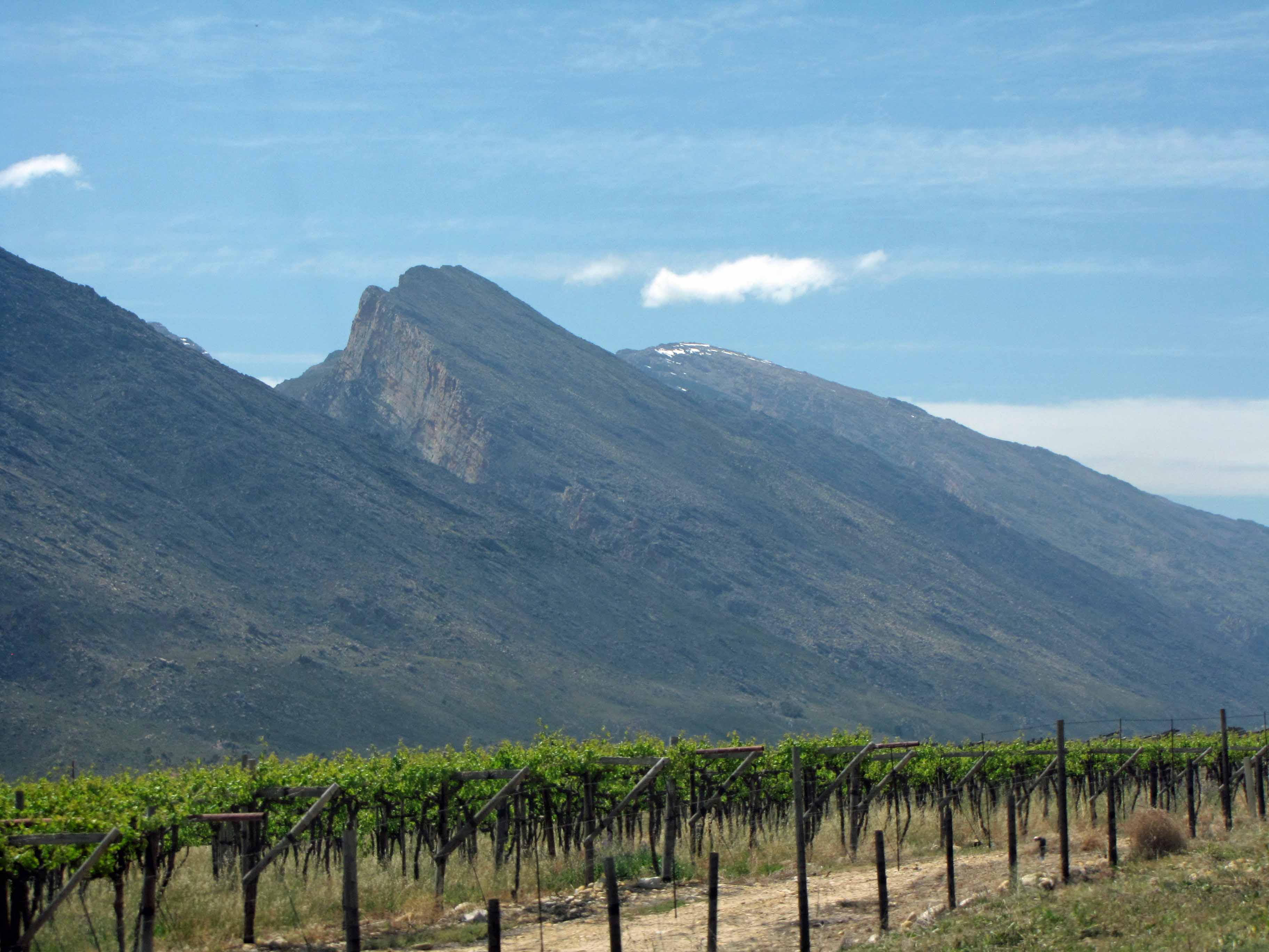
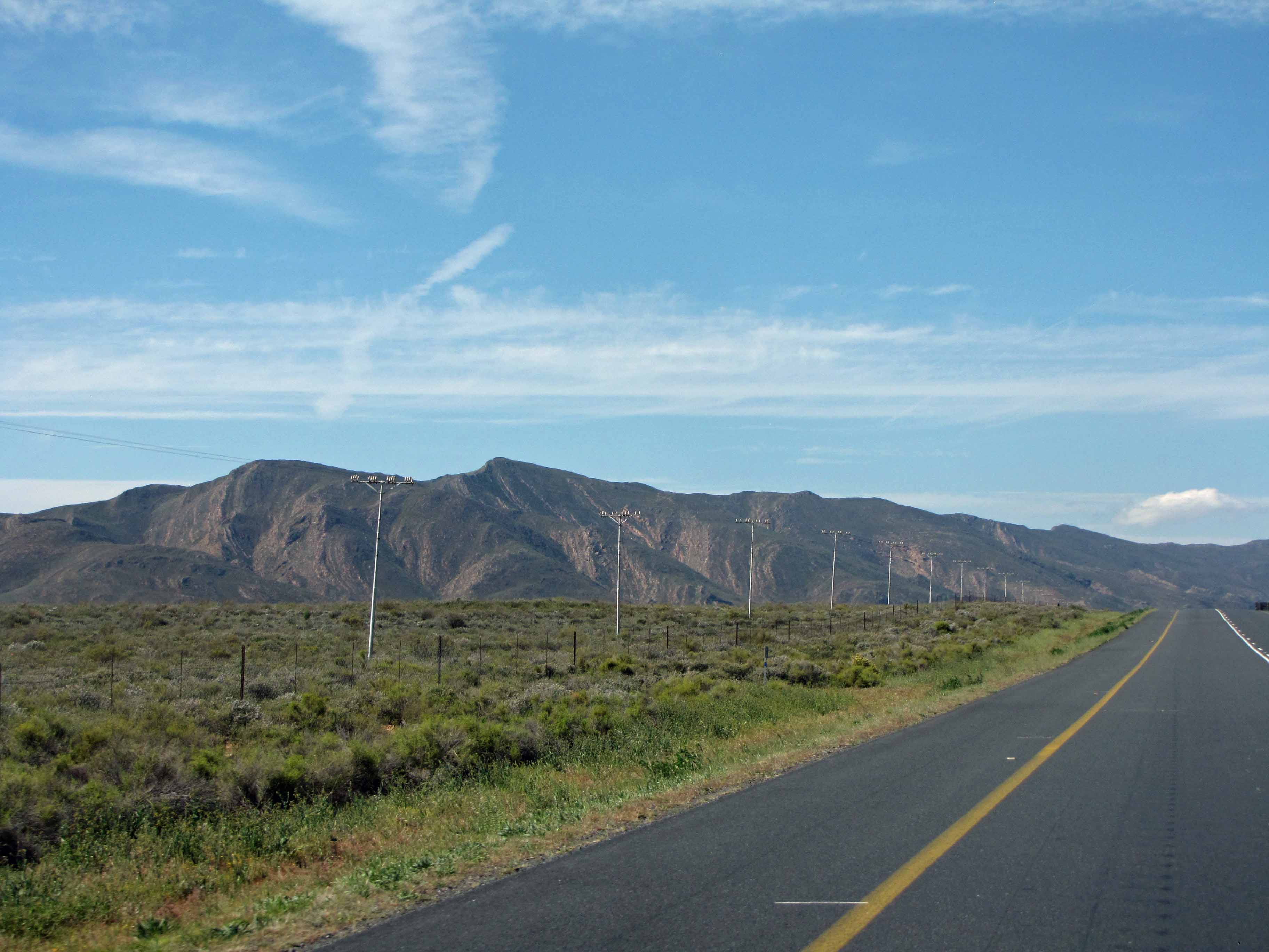
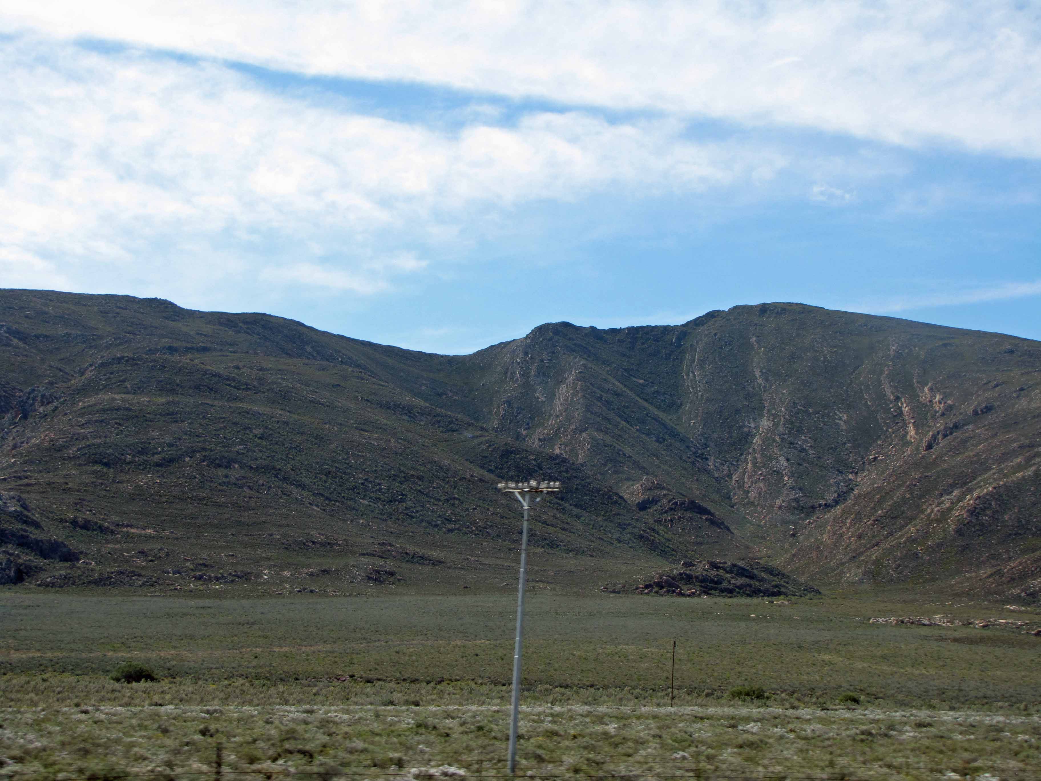
Cape Fold Belt #1. Approaching the belt from Cape Town.
At long last, I’m finishing up my series of posts about my October 2013 visit to the small town of Sutherland in South Africa’s Northern Cape province. Sutherland is home to a South African Astronomical Observatory (SAAO) research station that contains many telescopes, including the Southern African Large Telescope (SALT). You can read Part I of this series here, Part II of this series here, Part III of this series here, Part IV of this series here, Part V of this series here, and Part VI of this series here. In my previous posts, I blogged about the astronomical observatory, and I also discussed the Dwyka Diamictite rock that I observed along the road to Sutherland. In this final post, I’d like to share some views of the stunning Cape Fold Belt, which we drove through on our way from Cape Town to Sutherland.
I can’t believe that it’s taken me over a year to finish up this series of posts. I’ve certainly been neglecting my geology blogging this year! However, I’ve had an extremely busy year. I started a new job then 8 months later I was promoted into another new job. So, I’ve been trying to find my feet in my new work environment. I also spent 10 weeks working at sea and was busy with other travel, both for work and for personal reasons. In any case, I’m hoping that the rest of the year will be a little quieter so that I can catch up on my blogging backlog. Then, in the New Year, I’d like to resurrect the Geology Word of the Week.
For now, though, enjoy these beautiful views of the Cape Fold Belt:
Cape Fold Belt #2. Driving into the belt and looking back at some winelands.Cape Fold Belt #3. The Huguenot Tunnel through the Du Toitskloof Mountains.Cape Fold Belt #4.Cape Fold Belt #5. There’s some folding!Cape Fold Belt #6. Emerging into the winelands near Robertson.Cape Fold Belt #7. Vines and misty mountains.Cape Fold Belt #8.Cape Fold Belt #9. Stunning tilted mountains.Cape Fold Belt #10. A roadcut through tilted rocks.Cape Fold Belt #11. More beautiful winelands.Cape Fold Belt #12.Cape Fold Belt #13.Cape Fold Belt #14.Cape Fold Belt #15.Cape Fold Belt #16.Cape Fold Belt #17.Cape Fold Belt #18.Cape Fold Belt #19.Cape Fold Belt #20.Cape Fold Belt #21.
A syncline exposed in a roadcut at Hancock, Maryland. Photo courtesy of Ron Schott.
Finally, the Geology Word of the Week has returned! I took about six weeks off because I was very busy with my wedding and thesis. Six weeks ago, I had announced that the next Geology Word of the Week would be S is for Schist. However, I kept trying (and failing) to write the schist post. Schist is such an important and fun geology word, and I want to take the time to write up the post properly. When the letter “S” rolls around in 26 weeks, I should be finished with my thesis (fingers crossed) and have plenty of time to write up a proper post. So, schist has been moved to the next alphabet. For now, I present… S is for Syncline!
Note: I modified the definitions below after some discussion in the geoblogosphere.
def. Syncline:
A fold in a sequence of rock layers in which the younger rock layers are found in the center (along the axis) of the fold. Syncline is closely related to the word anticline, which is a fold in a sequence of rock layers in which the older rock layers are found in the center (along the axis) of the fold.
def. Synform:
A concave upward (U-shaped) fold in a sequence of rock layers. The lower (and generally younger) rock layers are found at the center (along the axis) of the fold. Synform is closely related to the word antiform, which is a convex upward (upside-down U) fold in which the upper (and generally older) are found at the center (along the axis) of the fold. In the field, many synforms are also synclines. An overturned syncline is called an “antiformal syncline.”
The easiest way to understand synclines and anticlines is to look at a diagram, such as the one below:
Beginner geologists often confuse synclines and anticlines. Remember: A syn makes you grin!
Like many geological structures, synclines and anticlines form at various scales in the field. They can form over vast regions or within a single outcrop or hand sample. Sometimes, small folds are called “synclinal folds” rather than synclines.
Here’s a few more pictures of synclines:
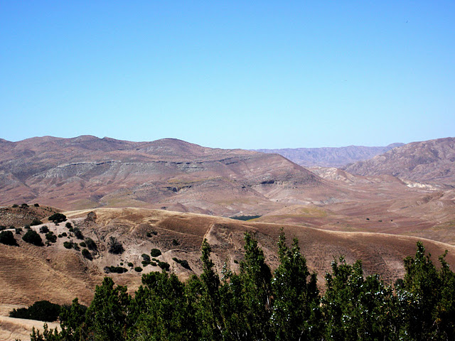
A syncline in Calico, California. Photo courtesy of Ron Schott. A syncline in San Bernadino County, California. Photo courtesy of Ron Schott.A syncline in Fair Haven, Vermont. Photo courtesy of Ron Schott. The Vallecitos Syncline, central California. Photo courtesy of Timothy Sherry.A syncline in Torres del Paine National Park in Chile. The lake in the foreground is Lago Nordenskjöld. Photo courtesy of Ryan Anderson.
And here’s an anticline:
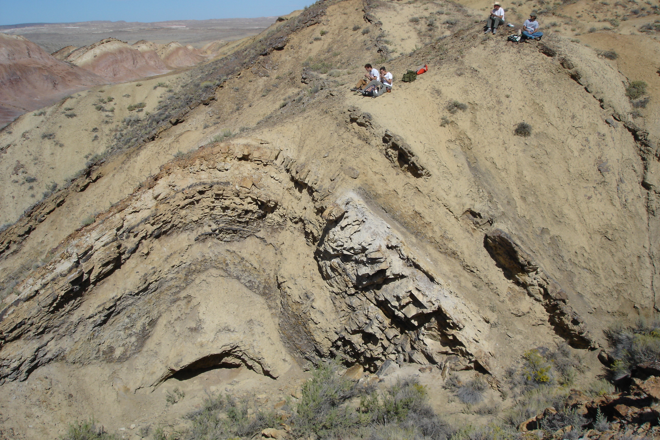
An anticline in Wyoming.
Finally, I have a question for the geoblogosphere: What is more important for distinguishing anticline vs. syncline: the general shape (right-side-up U or upside-down U) or the age of the rocks? What if there’s been overturn so that folds are forming in a sequence where the younger rocks are the lower layers and the older rocks are the upper layers? Please feel free to discuss this topic in the comments below.
Question answered. But please feel free to continue the discussion below.


