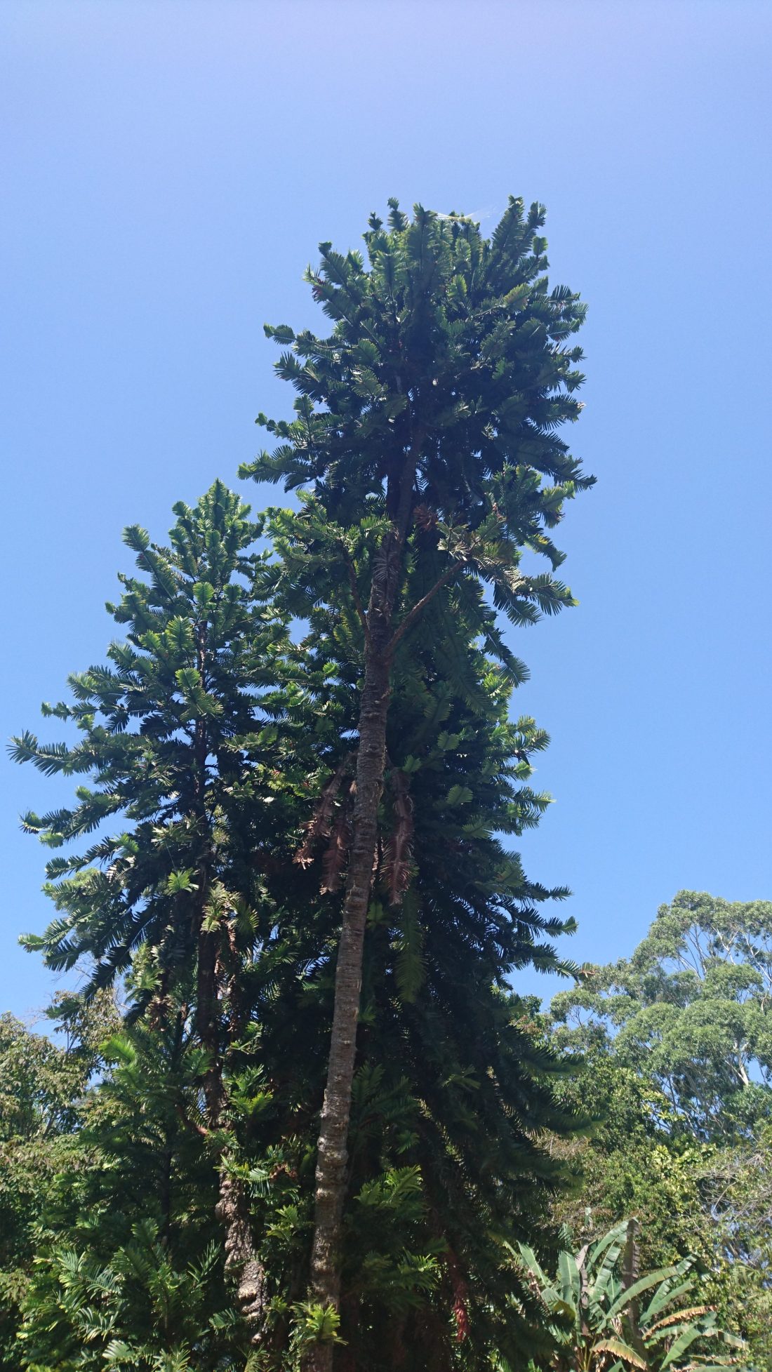
The majestic Wollemi Pine — it certainly looks like a tree that grew during the time of the dinosaurs! And it did grow at that time!
Today is my last day in Australia. Today, my family, some friends, and I spent a few hours exploring the Royal Botanic Garden in Sydney. There are many beautiful and amazing plants in the garden. However, one plant in particular caught my eye: the Wollemi Pine, which is considered a living fossil because until the tree was discovered in the 1990s it was only known from the fossil record. The Wollemi Pine is critically endangered, with only few wild trees remaining in remote sandstone gorges located about 150 km outside of Sydney. While wild trees are uncommon, cultivated trees have become fairly common. In fact, you can buy your very own Wollemi Pine tree in the garden gift shop. I didn’t buy one because I live in South Africa, but if you’re in Australia you should consider buying one to add to your garden.
Here’s a sign board with a little more information about the tree:
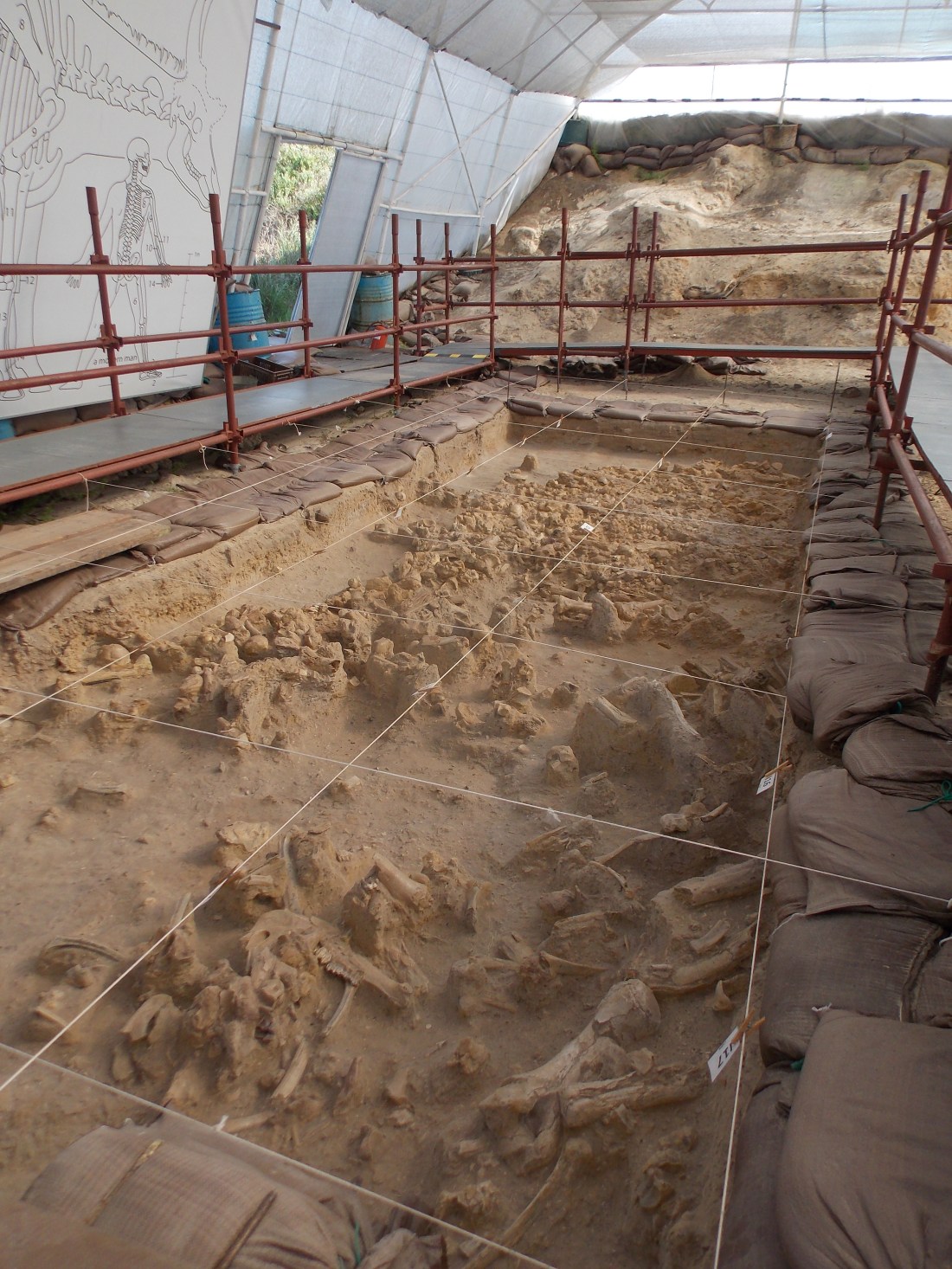
Today I’m sharing a picture of some Pleistocene age fossils that are on display at the West Coast Fossil Park, which is located about an hour’s drive north of Cape Town, South Africa. If you ever find yourself in the area I highly recommend a visit to the park.
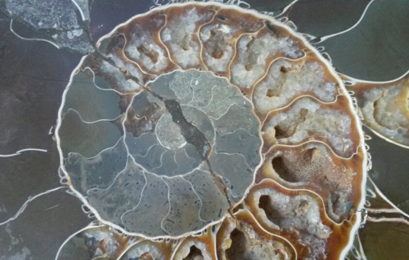
For this week’s Monday Geology Picture, here’s a close-up of an ammonite fossil. This particular ammonite fossil was a wedding gift and decorates our living room… along with quite a few other rocks! Apologies for the lack of scale – I didn’t want to spoil the pretty picture. I’ll have to share some more pictures of our rock collection shelf, which includes this fossil, in another post.
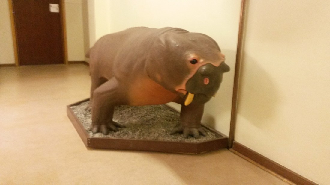
Aulacephalodon selfie…. because who doesn’t want to pose with this delightful model?
This week’s Monday Geology Picture is an aulacephalodon selfie that I took with the aulacephalodon model that is on display in the Geology Department at Rhodes University in Grahamstown, South Africa. Try saying that three times fast: aulacephalodon selfie, aulocephalodon selfie, aulacephalodon selfie! Can you say it without stumbling? I certainly can’t!
So, what is an aulacephalodon?
Here’s a description from the information sign next to the sculpture:
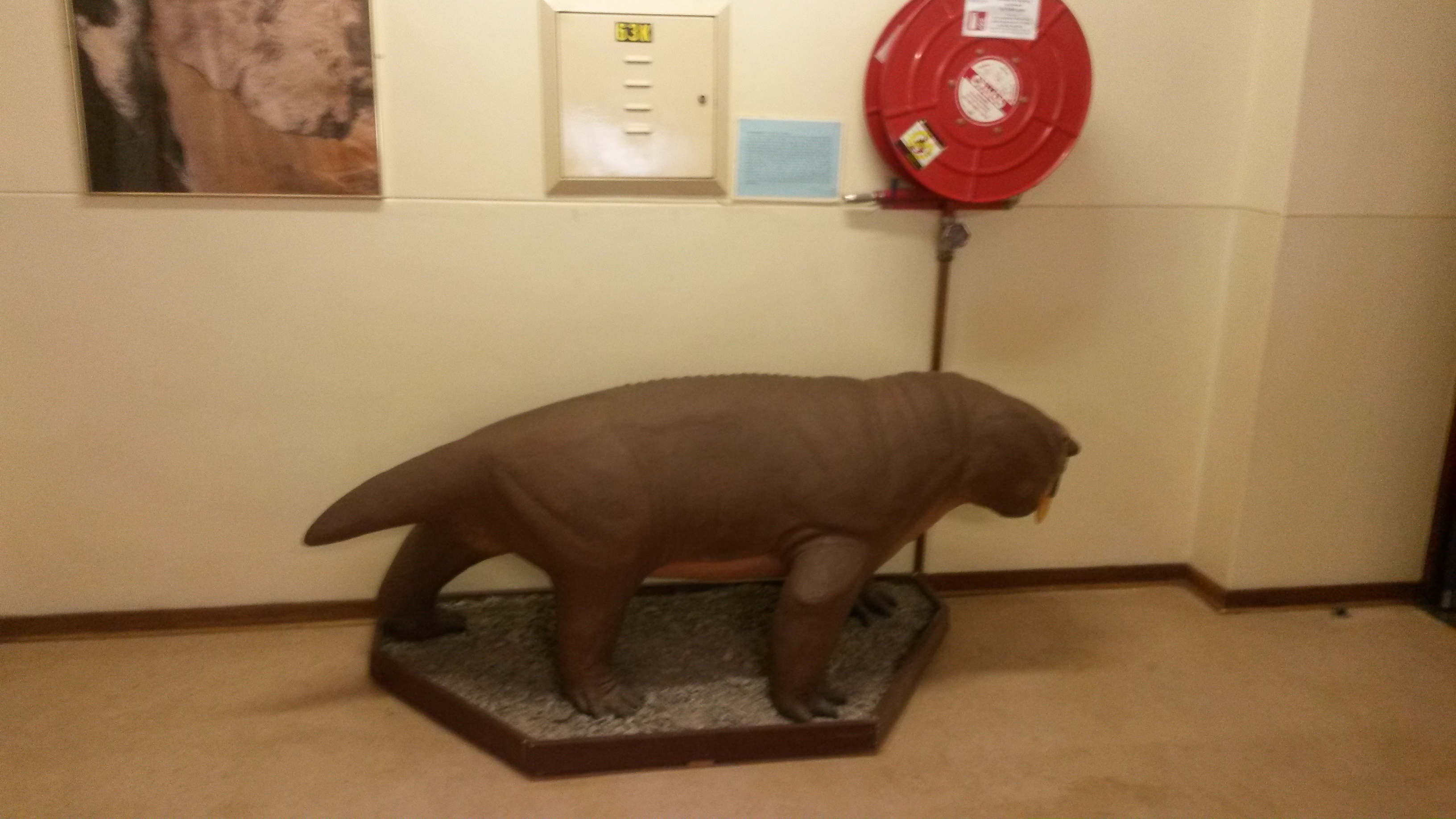
Aulacephalodon was a relatively large, plant-eating (herbivorous) dicynodont that lived during the Late Permian [~250 million years ago]. Like most other dicynodonts, Aulacephalodon had a beak for biting, grinding, and cutting plants. The animals also had a pair of prominent tusks, possibly for digging, sexual display, and defence [that’s how the South Africans spell “defense”]. The larger, and therefore older, specimens have distinctive bony knobs on the snout above the nasal openings. This feature is not seen in small juvenile skulls. These “nasal bosses” were either only developed in older animals, or they formed to mark either the male or female of the species. Note the prominent “hole” in the top of the skull – a structure known as the pineal foramen, common to all therapsids (mammal-like reptiles). This hole in the skull housed part of a sense organ which was capbale of sensing light and may have regulated the day/night cycle of the animals. Fossil footprints tell us that Aulacephalodon lived in family groups. This model reconstruction is based on the numerous fossil skulls and skeletal remains of Aulacephalodon that have been found in the Cistecephalus Biozone of the Karoo basin. The stance of the model is based on the footprints preserved in the ancient paleosurface (mudflat) that has been exposed in the “Asante Sana” valley, east of Graaf-Reinet.
Here are a few more pictures of Mr. (or Ms.? I’m not sure how to tell…) Aulacephalodon:
The aulacephalodon model, from the front.The aulacephalodon model, from the side.Another picture of yours truly and the aulacephalodon model.
The aulacephalodon model is fantastic, both for selfies and as a sort of department mascot. I hope that the geology students sometimes dress up the model for holidays and such! I can just imagine this guy (or lady?) dressed up with a scarf and hat in the wintertime!
Pleistocene dig site at the West Coast Fossil Park, South Africa.
For this week’s “Monday Geology Picture” I’m sharing a picture of some bones from a Pleistocene age fossil site located about an hour’s drive from Cape Town, South Africa. I took this picture last year during a visit to the West Coast Fossil Park. If you ever find yourself in the Cape Town area, I highly recommend a visit to the fossil site. You can tour the dig site, and there’s a great little museum and educational center nearby as well. Later this week, I’ll share some more pictures from the fossil park and will tell you a little more about it. For today, enjoy this preview picture.
Update November 11th, 2015: I realize that I still have gotten around to sharing some more pictures and information. I’m busy working on a post, so stay tuned!
A few fossils on display at a booth at the Gilsum Rock Swap in New Hampshire in June 2014.
My work schedule is still keeping me quite busy, but some more in depth blogging will be coming soon… I’ve put in a couple of weeks of leave for later in November and December. In the meantime, here’s another “Monday Geology Picture” to tide my readers over. I snapped this picture of a few fossils at a booth at the Gilsum Rock Swap in New Hampshire in June 2014.
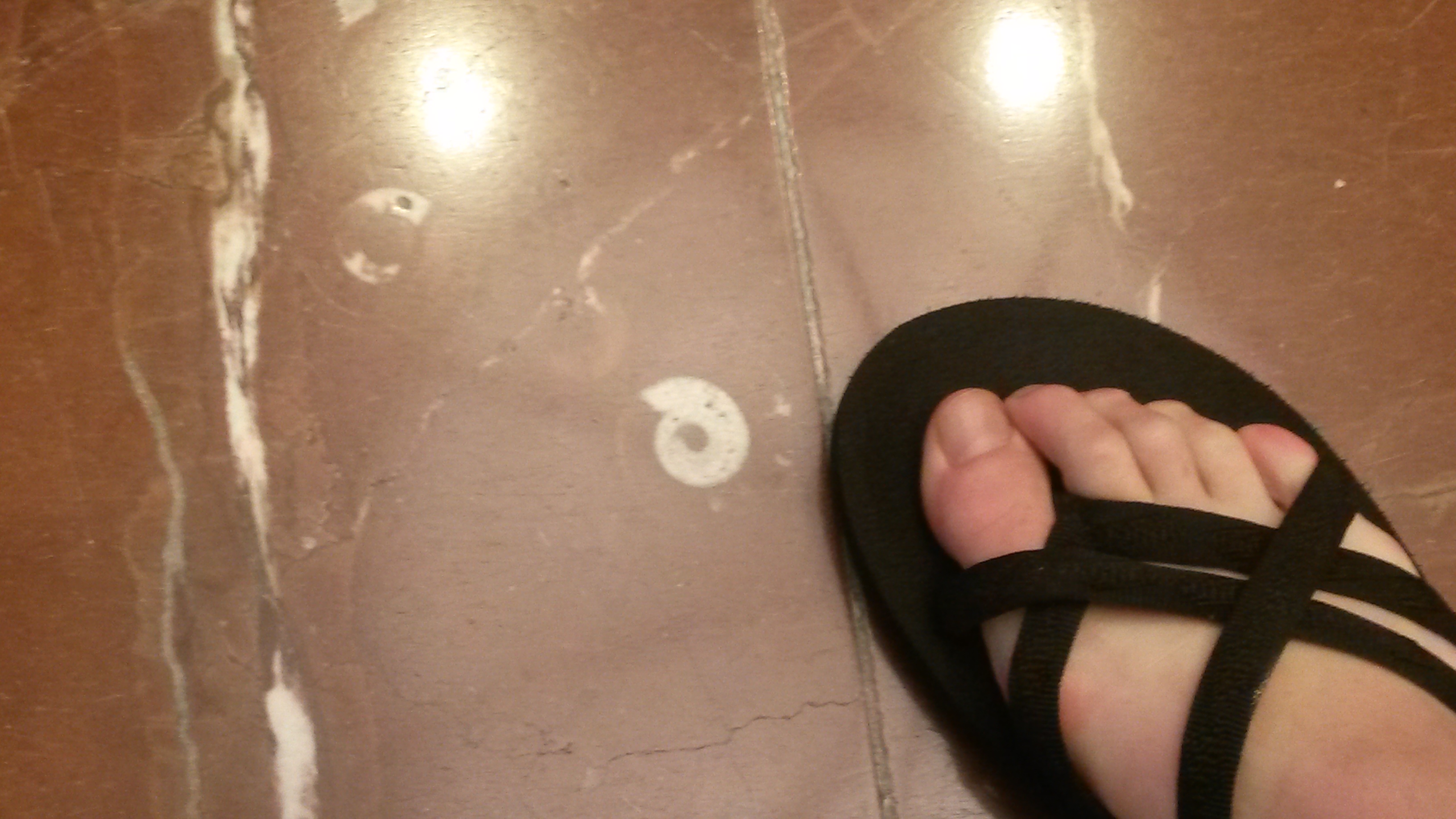
My husband and I are travelling in the US at the moment. A little over a week ago we attended an event at the Hynes Convention Center in Boston, and I noticed some interesting fossils in some beautiful building stones on the floor of a hallway connecting the center with an adjacent hotel. I snapped a few pictures of the fossils. Can anyone identify them? Does anyone know where the building stones come from?
Here are a few more pictures:
A wider view of the pretty building stones on the floor.Here’s a close-up view of one of the fossils, with my foot for scale.
Today I’m going to share some pictures from our visit to the SAAO Visitor Centre, which has several museum-like displays. We started our official tour of SAAO / SALT by visiting the Visitor Centre and watching a 20 minute or so video about the universe. Then we went and toured several of the telescopes, which I’ll write about in my next post in this series. After touring the telescopes, we had an opportunity to look around the Visitor Centre displays, which included several astronomy displays and also a geology display that included a meteorite (I believe) and many interesting fossils. I spent some time looking through the astronomy displays, but I spent most of my time checking out the geology display. Thus, most of my pictures are of the geology display! Don’t worry, though… there will be plenty of astronomical telescope pictures in the next blog post in this series.
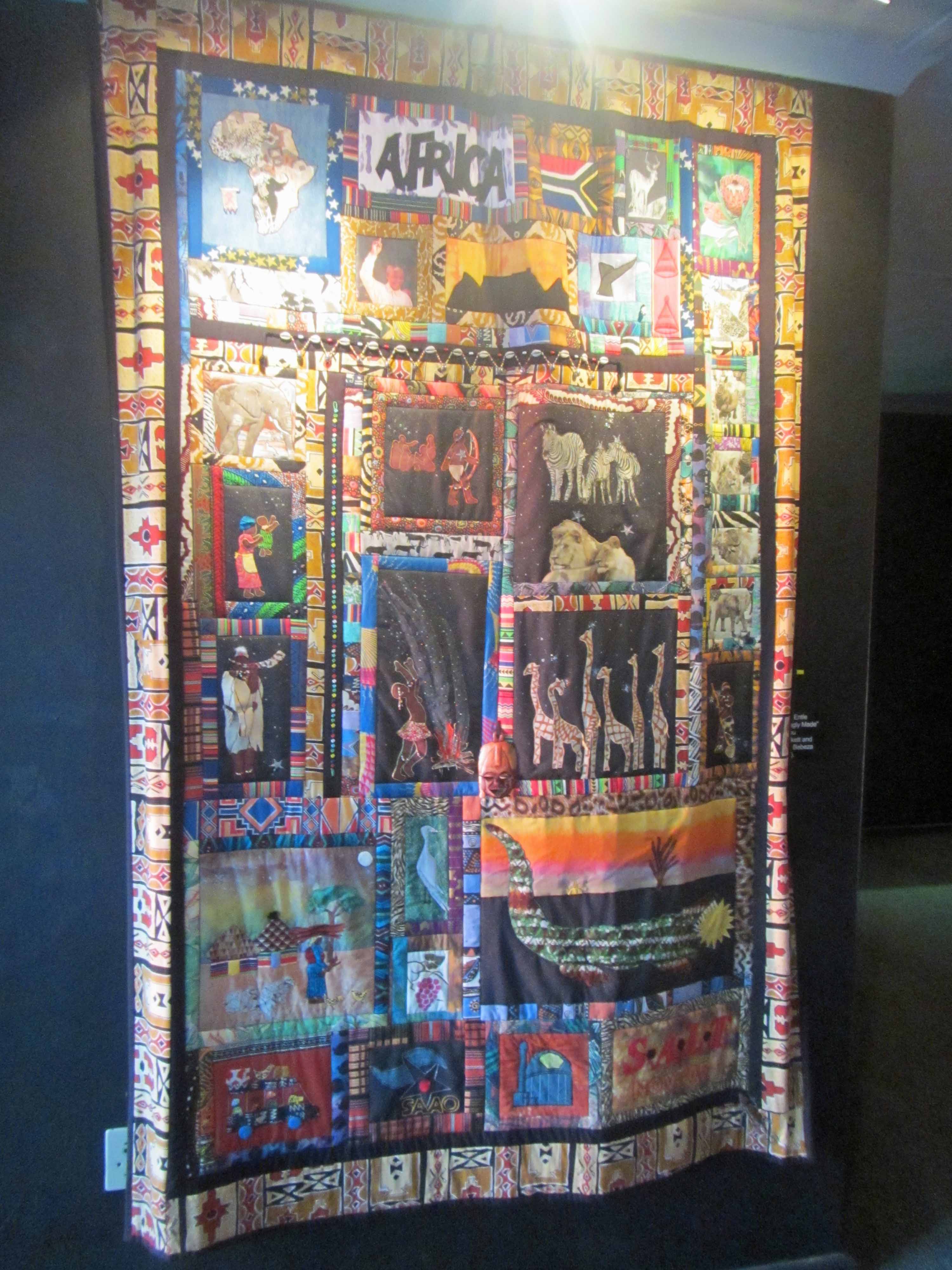
A pretty quilt– with a telescope on it!– in the lobby of the SAAO museum.
In the entrance to the geology display, there was a fairly big iron meteorite– at least, I assume that’s what it was, since I didn’t see any explanation card. I took a picture with the presumed meteorite:
Posing with a presumed meteorite.
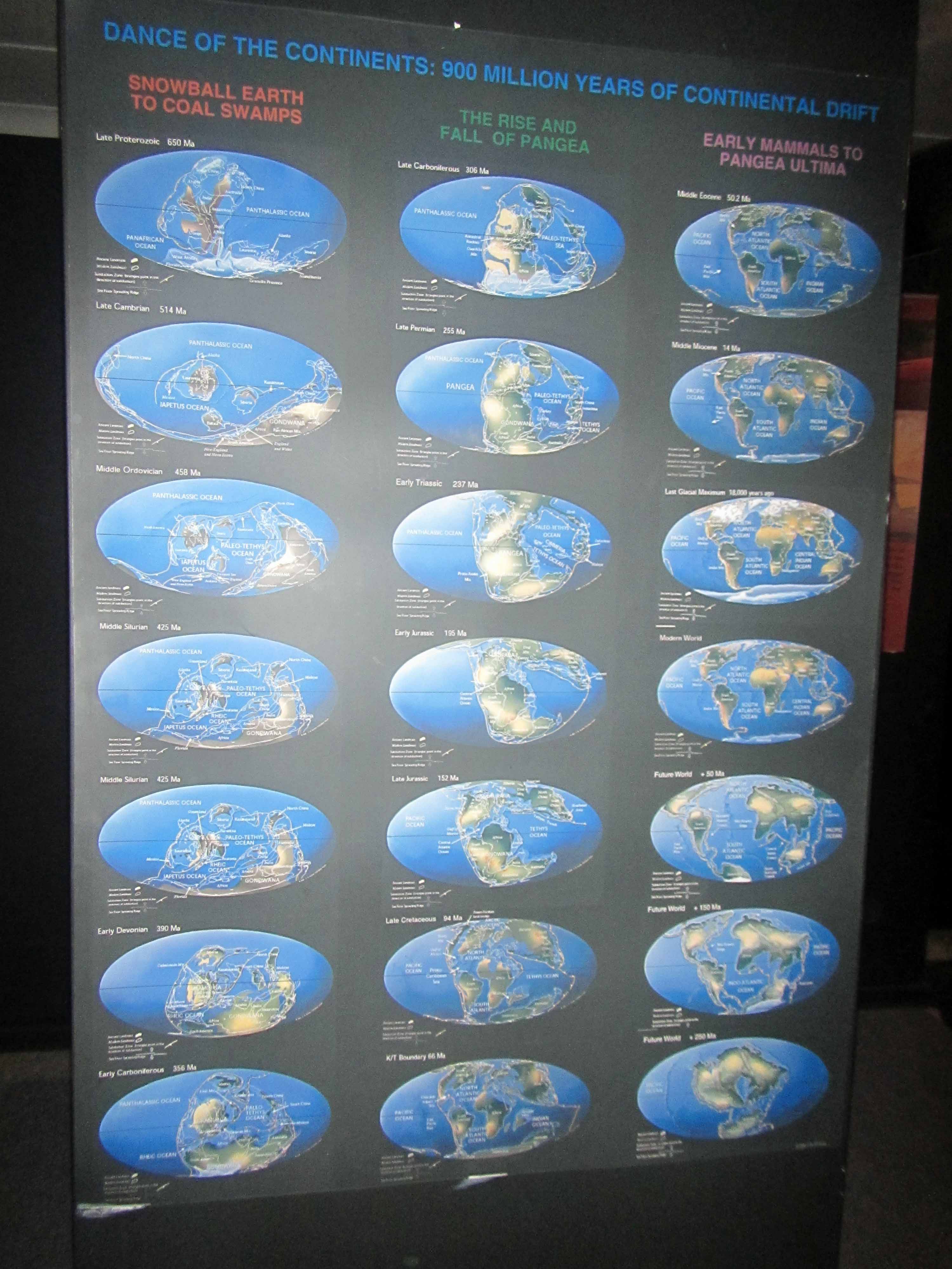
The geology display had many fossils and bits and pieces of information organized by geologic time. The display included this neat poster showing continental reconstructions (“continental drift”) over the past 900 million years:
A poster of continental reconstructions over the past 900 million years. Click to enlarge.
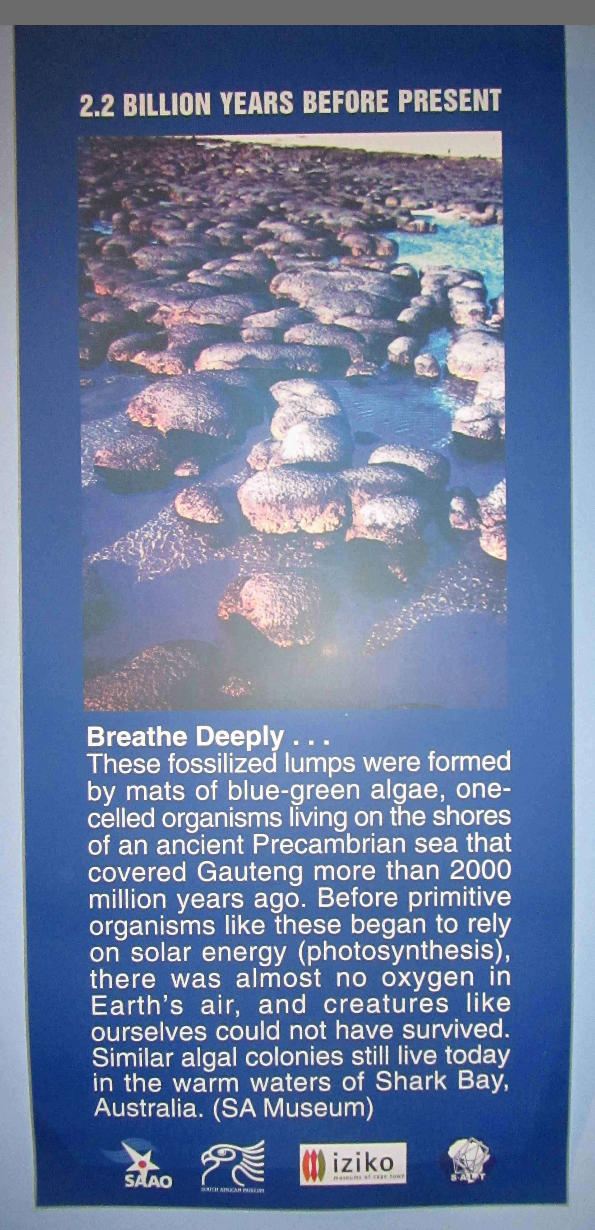
Many of the other geologic information signs had a little continental reconstruction on the bottom of them, reminding the viewers of the state of the continents at that particular geologic time. The display highlighted various fossils, primarily from the nearby Karoo region, from different geologic times. The oldest of these fossils were the stromatolite fossils:
Informational sign about the stromatolite fossils on display at the SAAO Visitor Centre. These stromatolites are from Gauteng (a province of South Africa; the city of Johannesburg is located in this province).Stromatolite fossils!
Stromatalites are pretty neat. They are layered, accretionary, sedimentary structures formed by biofilms of micro-organisms, such as blue-green algae. Stromatalites were formed billions of years ago by some of the earliest lifeforms on Earth, and they are still formed by micro-organisms at several places on Earth today. Stromatalite fossils may not look like much, but as a geologist I find myself awestruck every time I see them.
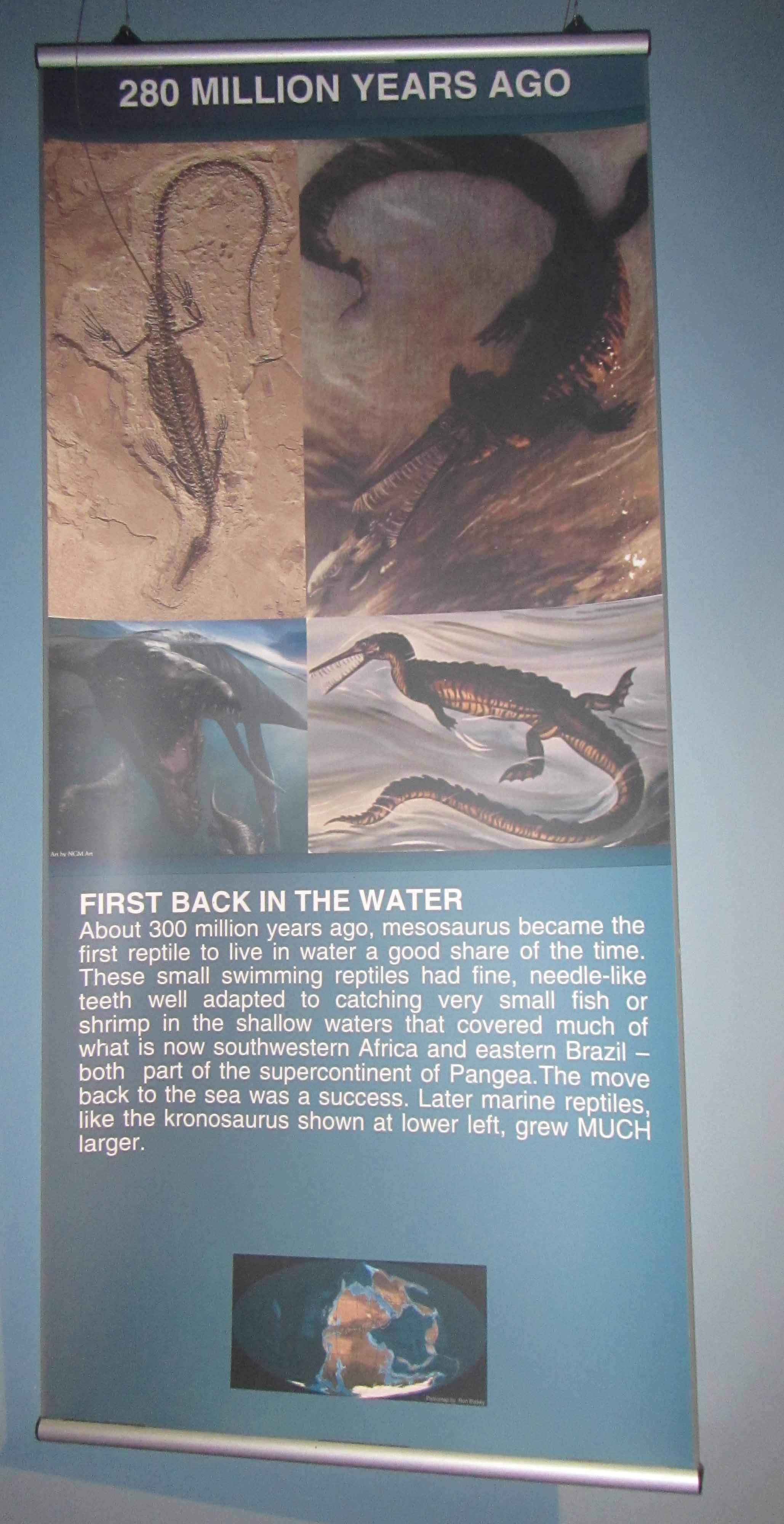
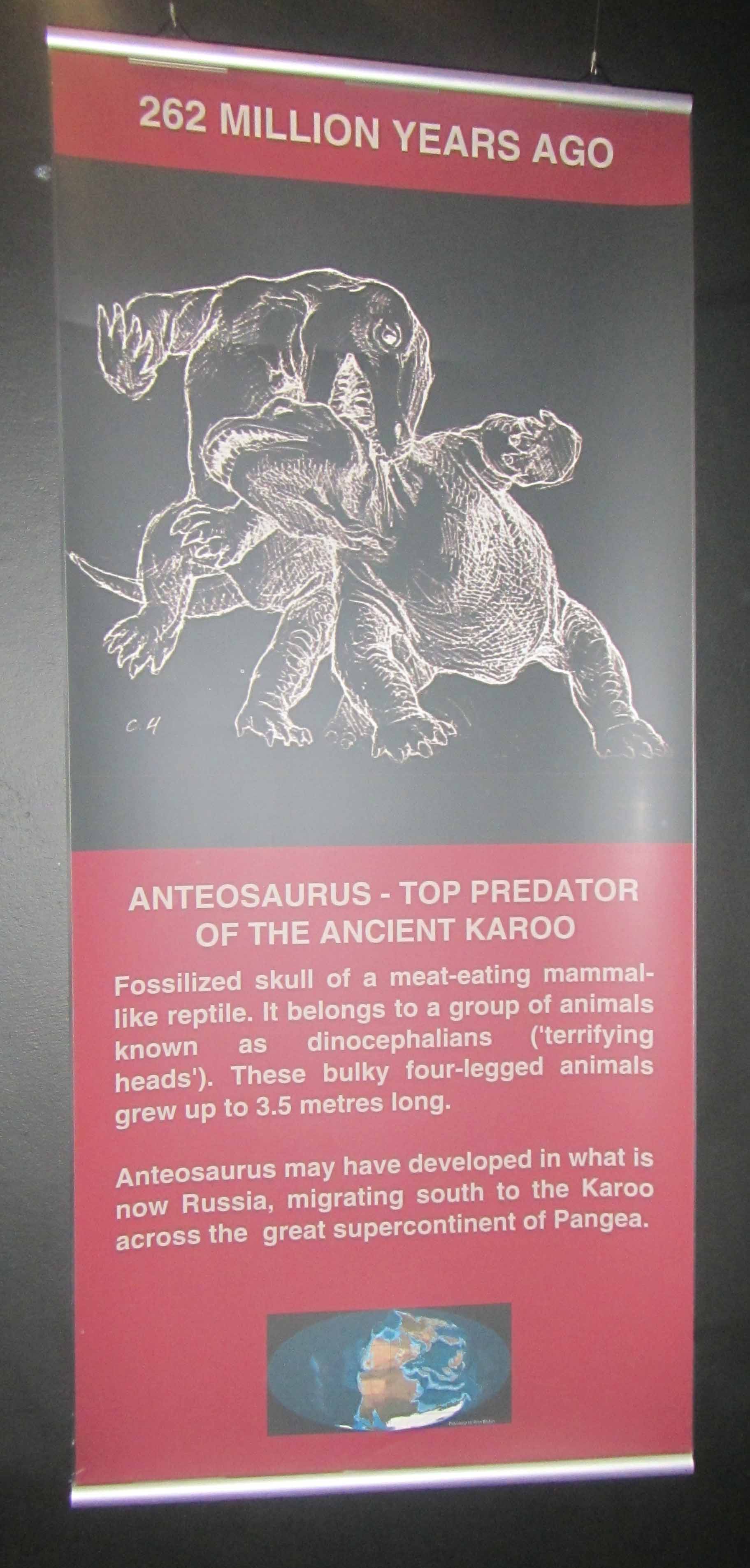
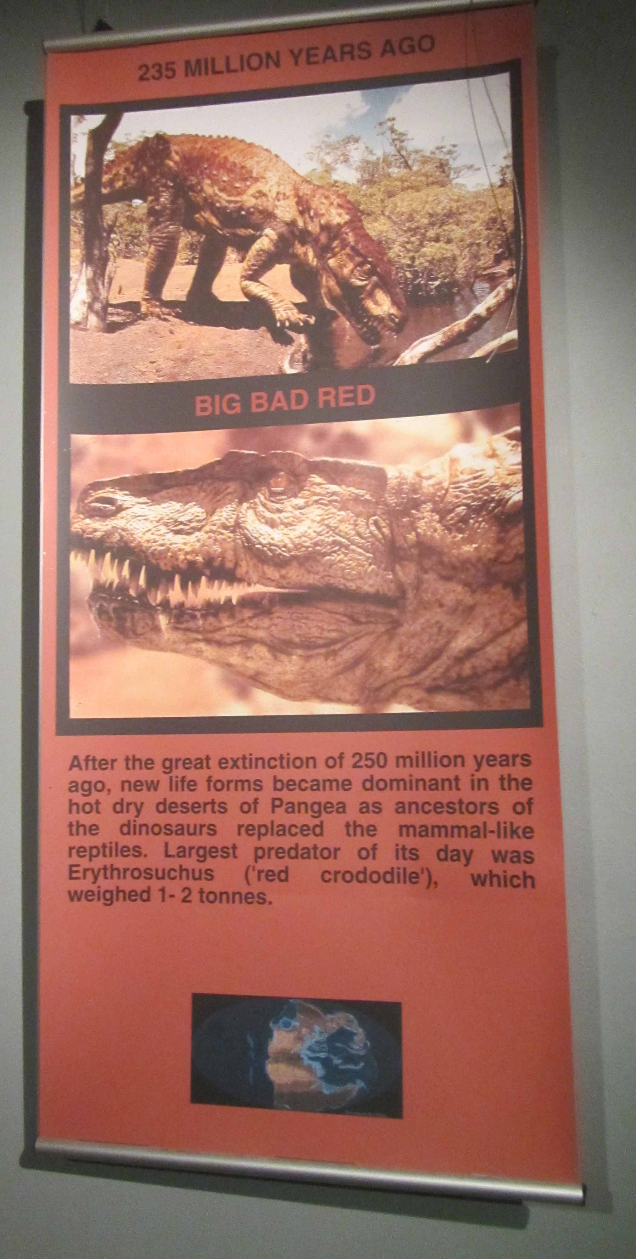
Here are a few other informational signs and fossils for different periods of geologic time:
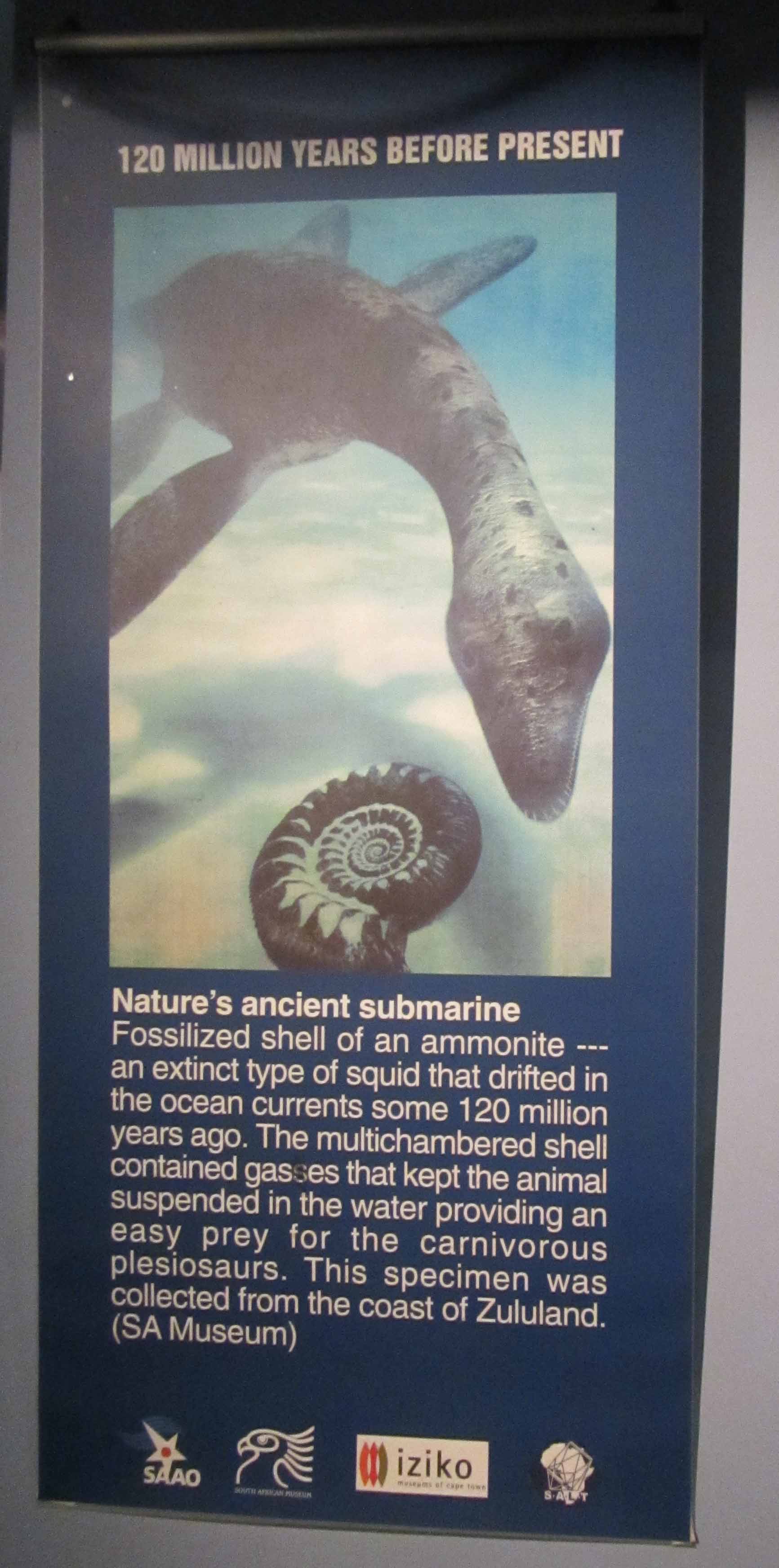
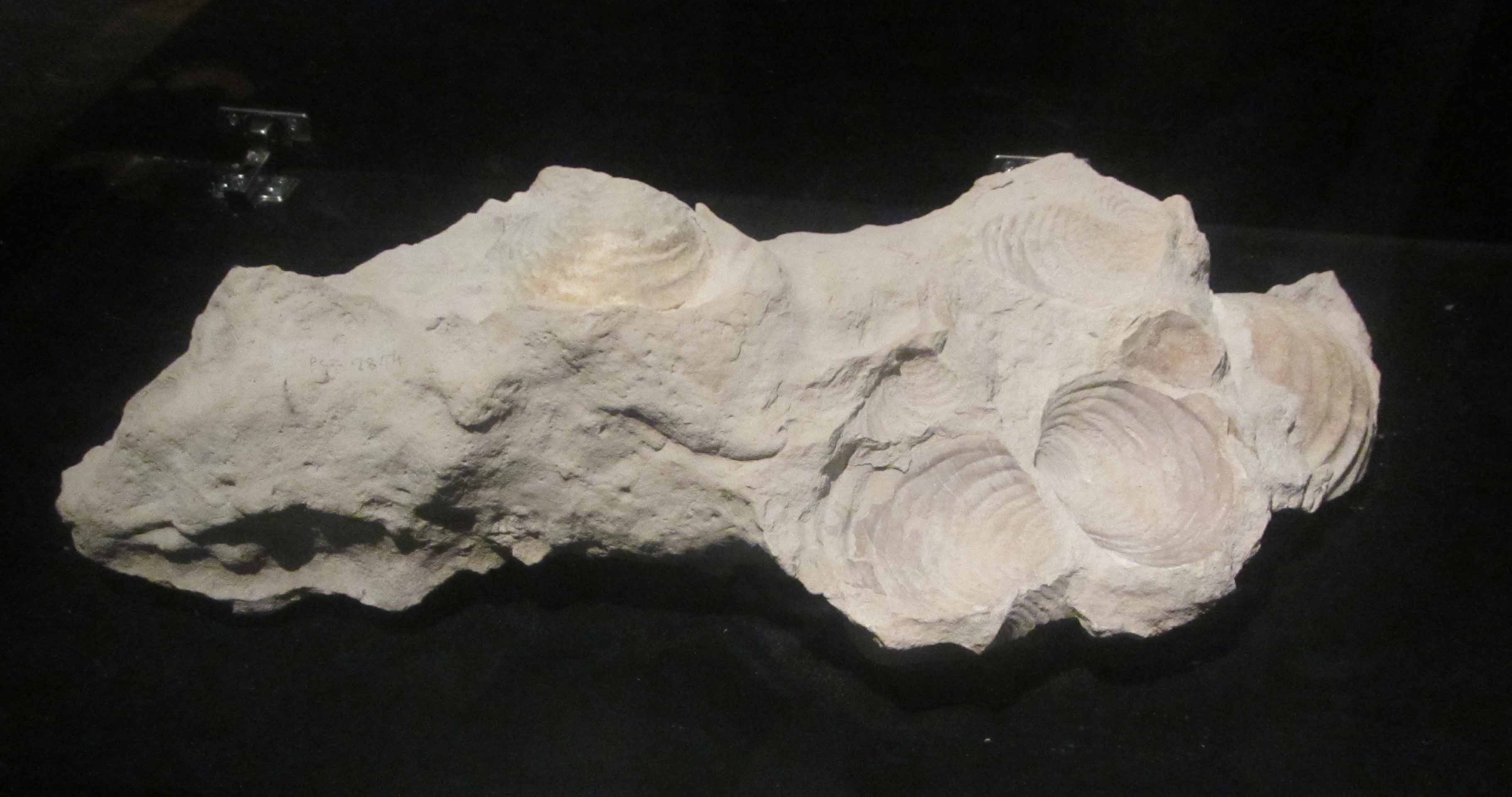
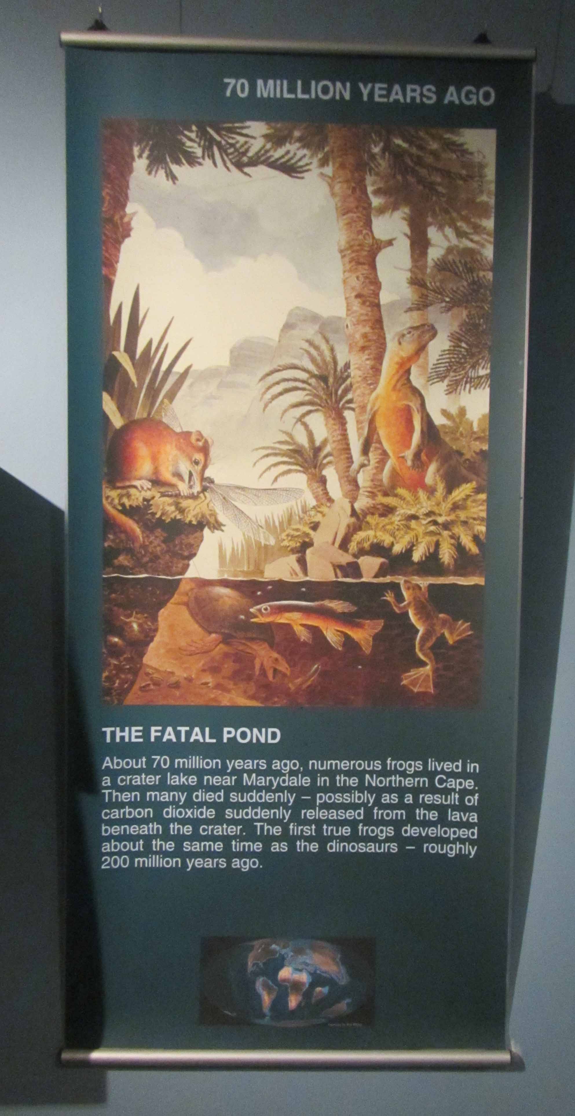
Informational sign for 400 million years ago… it was a trilobite world!Some trilobite and other fossils.Informational sign for 280 million years ago… Mesosaurus roams.I think that this is a Mesosaurus fossil? Well, it was near the Mesosaurus geological sign 🙂Informational sign for the Anteosaurus, a large reptile that was a top Karoo predator 280 million years ago.Anteosaurus skull. Pretty neat!Neat painitng… I think this painting shows Anteosaurus roaming the ancient Karoo.Informational sign for 235 million years ago… the time of the “red crocodile” in the Karoo.“Red crocodile” skull.Informational sign for 120 million years before present… ammonites are found in the oceans.A stunning ammonite fossil. Just beautiful!Informational sign for 70-80 million years ago… some clams died out.Gorgeous clam fossils.More gorgeous clam fossils.Informational sign for a sudden extinction event approximately 70 million years ago that created some stunning frog fossils.Frog fossils!Informational sign for more recent geological time a mere 5 million years ago… the time of the megatooth shark!Megatooth shark tooth. That’s quite a big tooth!
Last but not least, I want to share two pictures of a plaque titled “Pangea Reunited”. I really liked this little plaque. The inscriptions on the plaque read:
PANGEA REUNITED
Pangea is the name given to the single continent which existed about 200 million years ago. Evidence for this has been discovered in rocks and fossils in Africa and other continents of the world. Sediments and rocks associated with Pangea have been assembled from all continents of the world, symbolically reuniting Pangea at the beginning of the African Renaissance and the dawn of a new millennium.
and:
KAROO ROCK
This Permian rock, representing part of the Pangean super-continent, was excavated a the groundbreaking ceremony associated with the Southern African Large Telescope on September 1, 2000.
Pangea reunited.
I think it’s really wonderful that the SAAO museum contains so much geology information and that the SALT ground-breaking ceremony paid tribute to Pangea. The SAAO telescopes, including SALT, are located in a remarkable geological location– I’ll be sharing some more information and pictures about the geology of the Karoo region in future posts in this series. I think that it is wonderful, and very important, that the researchers using the SAAO telescopes to study other interesting parts of the universe– perhaps other little rocky planets where, perhaps, there may also be life– are reminded of the wonderful little rocky planet on which their telescopes are perched. At Sutherland, there is much to see by looking up into the sky… but there is also much to see by looking down toward one’s feet.
Speaking of looking up into the sky, stay tuned for the next post in this series… I’ll be sharing some pictures of some of the SAAO telescopes!
Yours truly posing with some shell fossils near Kalander Hut.
Today, I’m continuing with my posts about my recent backpacking trip along the Tsitsikamma Trail in South Africa with my husband Jackie and five of our friends. Earlier today, I realized that blogging about my Tsitsikamma Trail trip this week is appropriate since this is Earth Science Week and The Geological Society is encouraging people to participate in what they are calling, “The Great Geology Walk”. This event is aimed at getting, “as many people as possible will take notice of the geology all around them during this year’s Earth Science Week.” The Geological Society is encouraging people to share pictures of the geology they observe around them and also encouraging people to participate in organized and self-guided geology walks. This week I’m pretty busy with my day job and also with paper revisions in the evenings, so I guess my geology walk will be virtual. I’ll relive (and share with my blog readers) my Tsitsikamma Trail hike. Perhaps on Friday afternoon or Saturday I can escape for a real-life geology walk as well!
Today I’ll be blogging about Day #2 of the Tsitsikamma Trail hike. On Day #2 we hiked approximately 17 km from Kalander Hut to Blaauwkrans Hut. The trail website says that the hike is 13.5 km, but the trail website is out-of-date. The day’s hike has been re-routed and lengthened to about 17 km, making the hike long and challenging. We didn’t realize that the trail had been re-routed until after we were more than halfway done with the hike. I think that was actually a good thing! Once we were more than halfway done, we decided that we may as well carry on to the next hut!
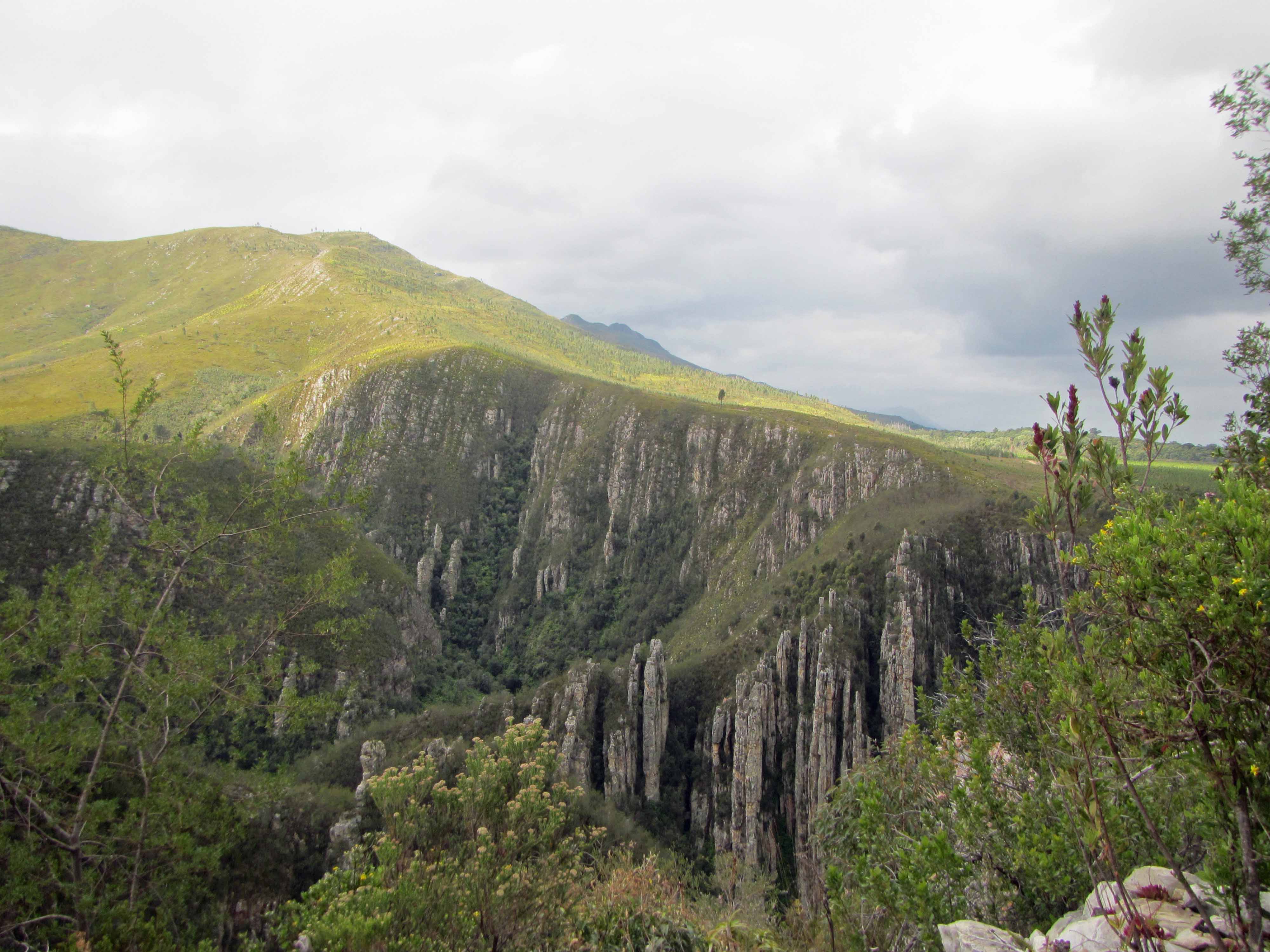
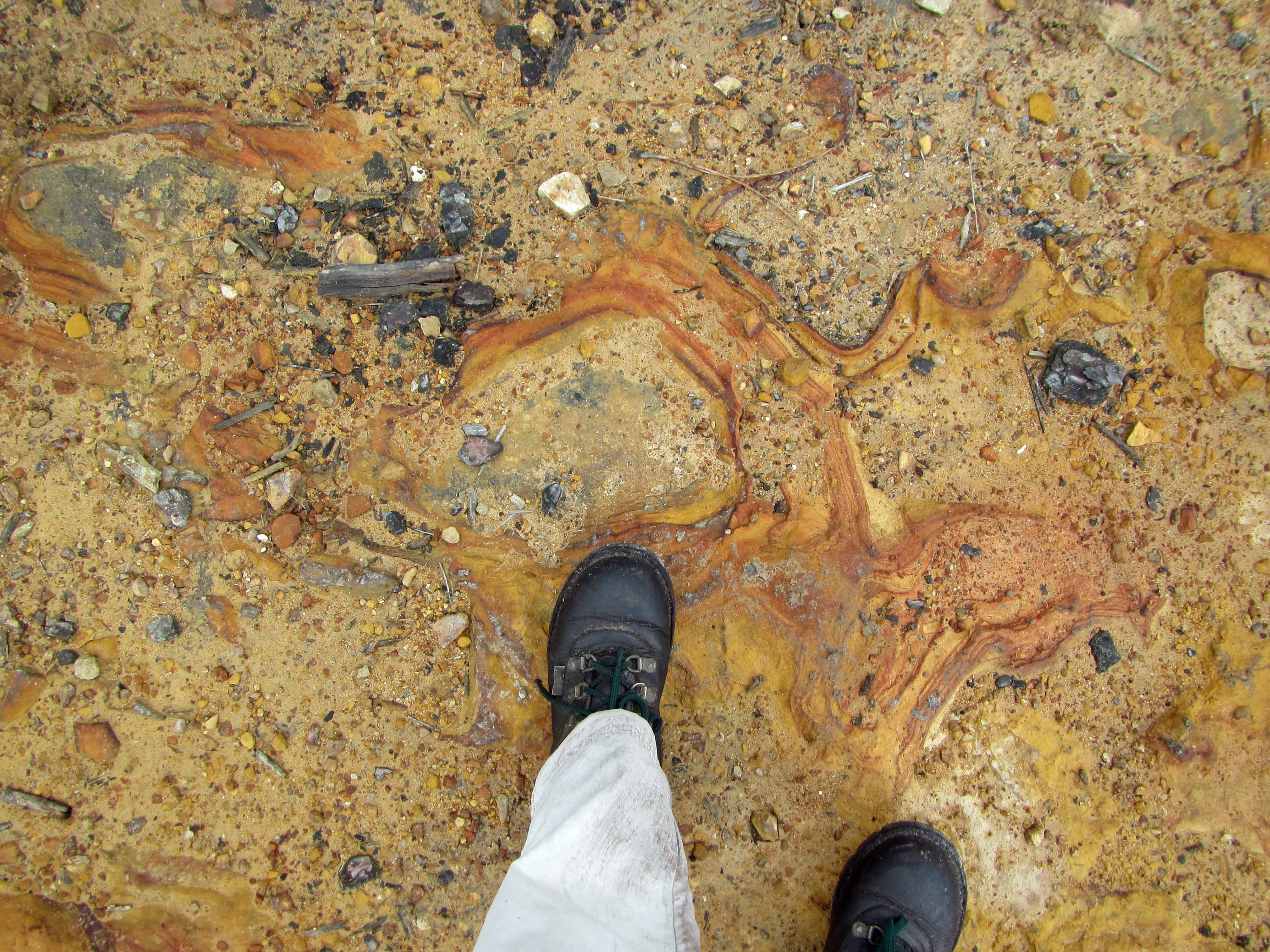
In any case, although we were exhausted, very hungry, and quite sore when we finally arrived at Blaauwkrans Hut in the late afternoon, the hike was well worth the effort and the little aches and pains. The trail wound its way from the beach, up a steep escarpment, across mountain fynbos, and through indigenous afromontane forest. Along the way, we saw fossils; tilted Table Mountain sandstones; rusty red, coca-cola colored streams and waterfalls; giant protea flowers and tall, tall yellowwood trees; various animal footprints; a large land snail; and many other wonderful sights. At the end of the 17 km hike, we arrived at the hut, which is in a truly breathtakingly beautiful location. The hut is perched on the edge of a deep ravine and overlooks a double waterfall.
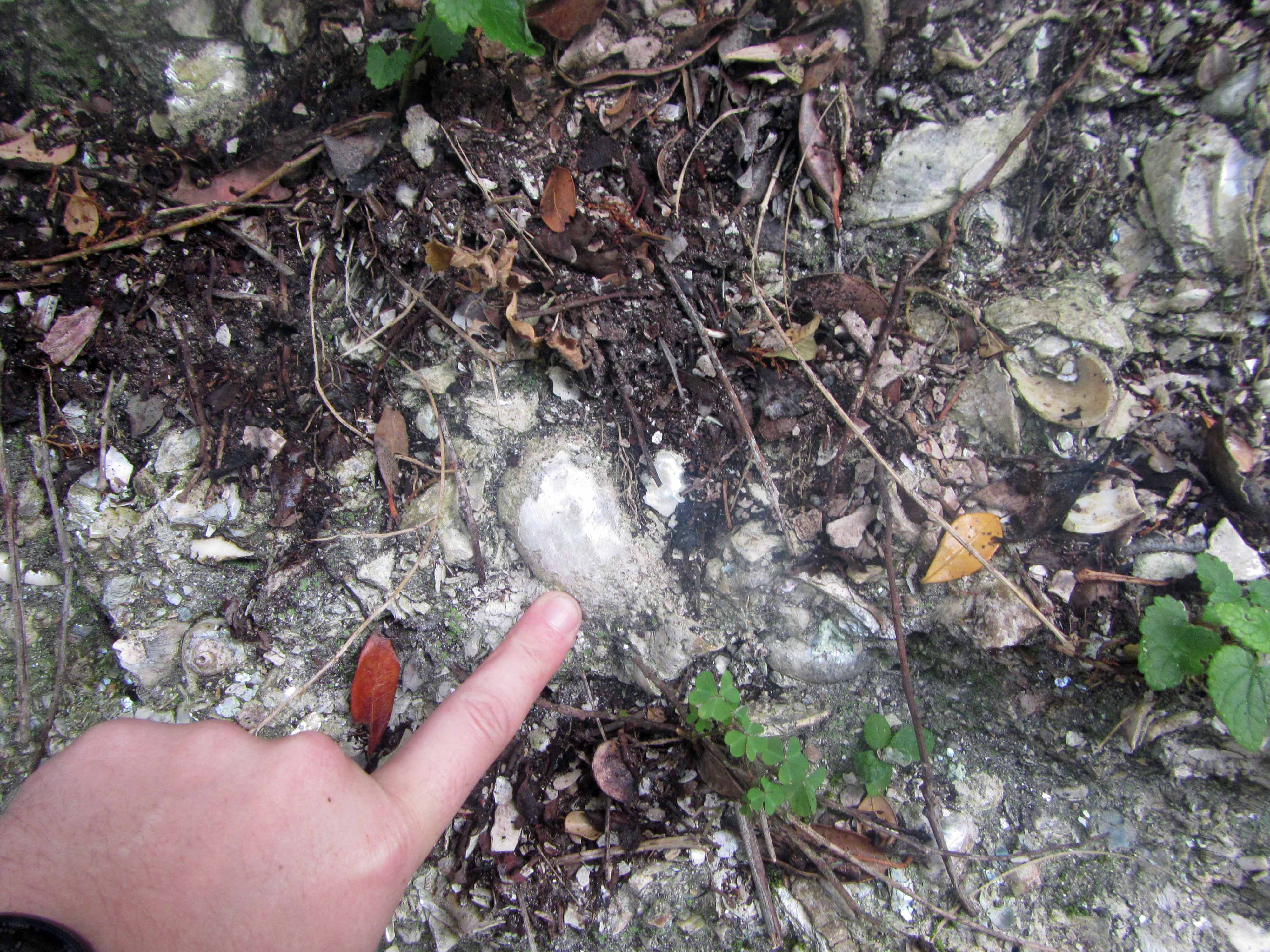
The hike started out by passing an outcrop with fossils, which made me quite happy:
Shell fossils exposed in outcrop near Kalander Hut.Another view of the shell fossil outcrop, with finger for scale.
The fossil outcrop is located just a few minutes’ walk from the Kalander Hut. I wasn’t able to find (in a quick Google search, at least) any information about the fossils, but they look like fairly young shell fossils in loosely-consolidated sediments of a vegetation-covered beach dune. If anyone knows any more about the fossils near Kalander Hut, please let me know. I’d love to learn more about them.
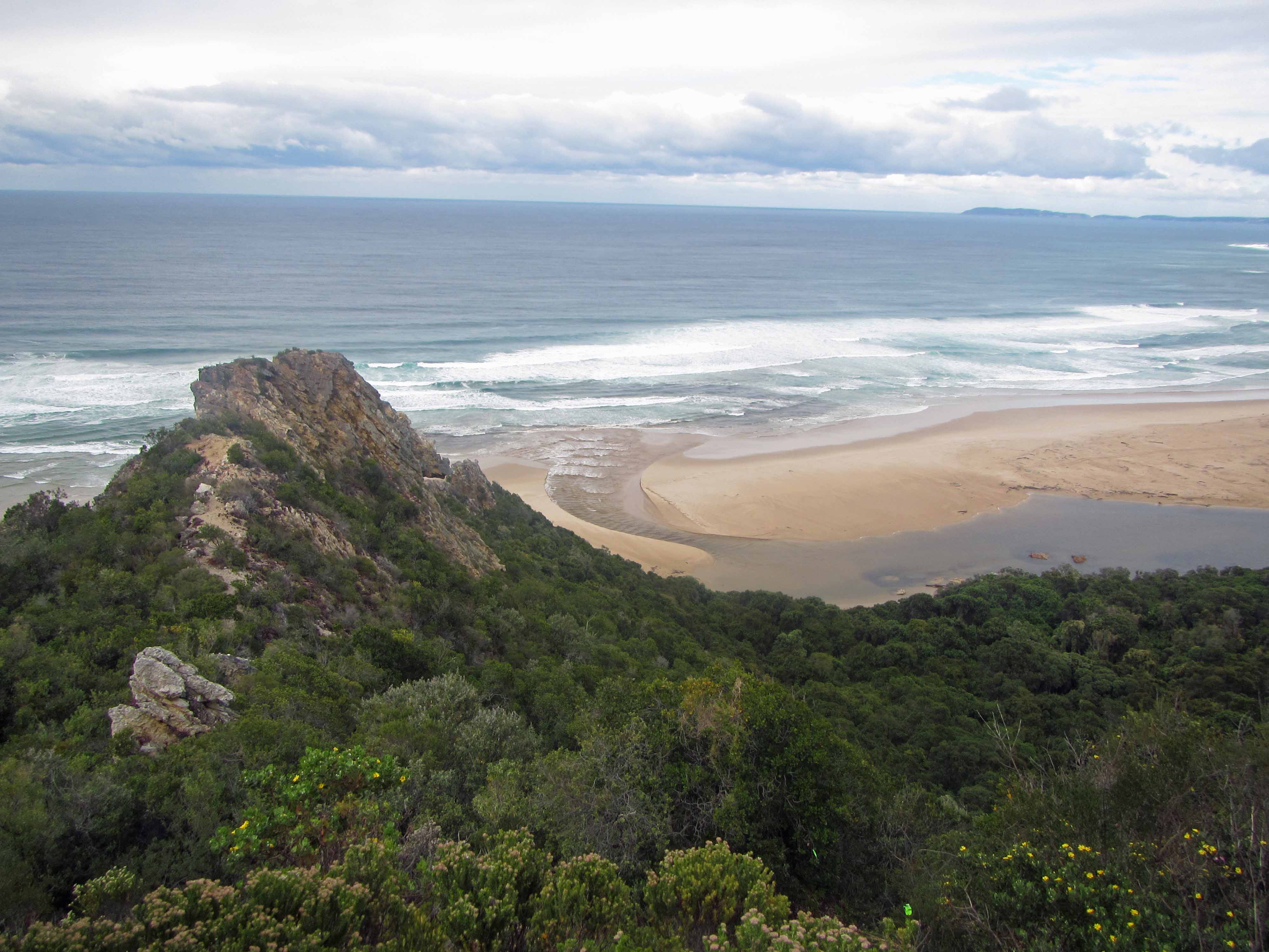
After the group dragged me away from the fossil outcrop, we started the steep hike up the escarpment and into the Tsitsikamma Mountains. After we finished huffing and puffing our way up onto the escarpment, we were rewarded with a beautiful view of the Nature’s Valley beach below:
The beach at Nature’s Valley, viewed from above.Another view of the Nature’s Valley beach.Yet another view of the Nature’s Valley beach. That’s mountain fynbos in the foreground.Jackie and I posing with the beach in the background.
After we recovered from the steep start to the hike, we continued along the trail, which cut through rich mountain fynbos vegetation:
The trail leading through the fynbos.
Here’s a pretty protea plant we saw:
A lovely red protea.
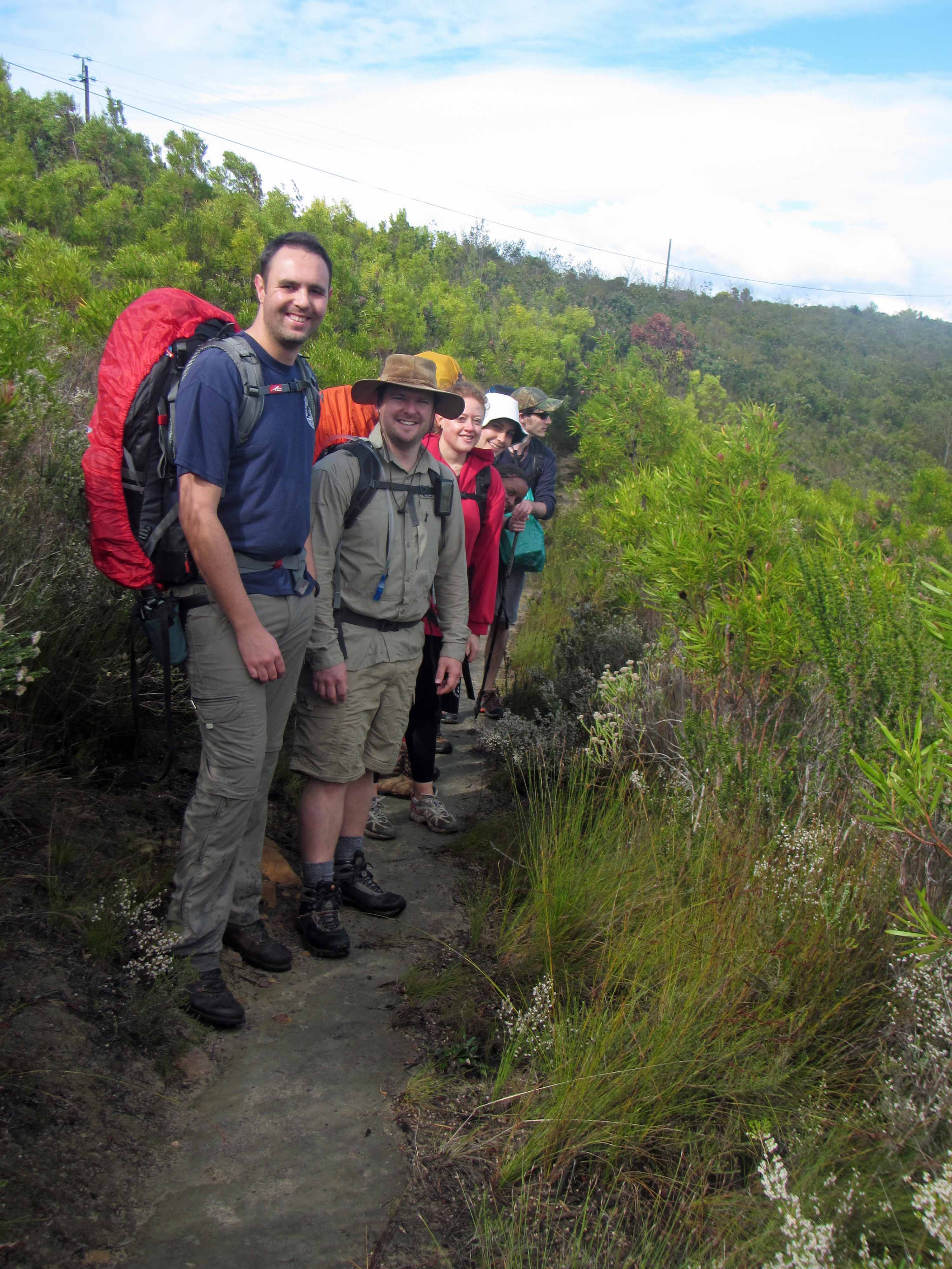
Here’s the group on the trail:
Hanging out amongst the fynbos. We don’t look too tired yet.
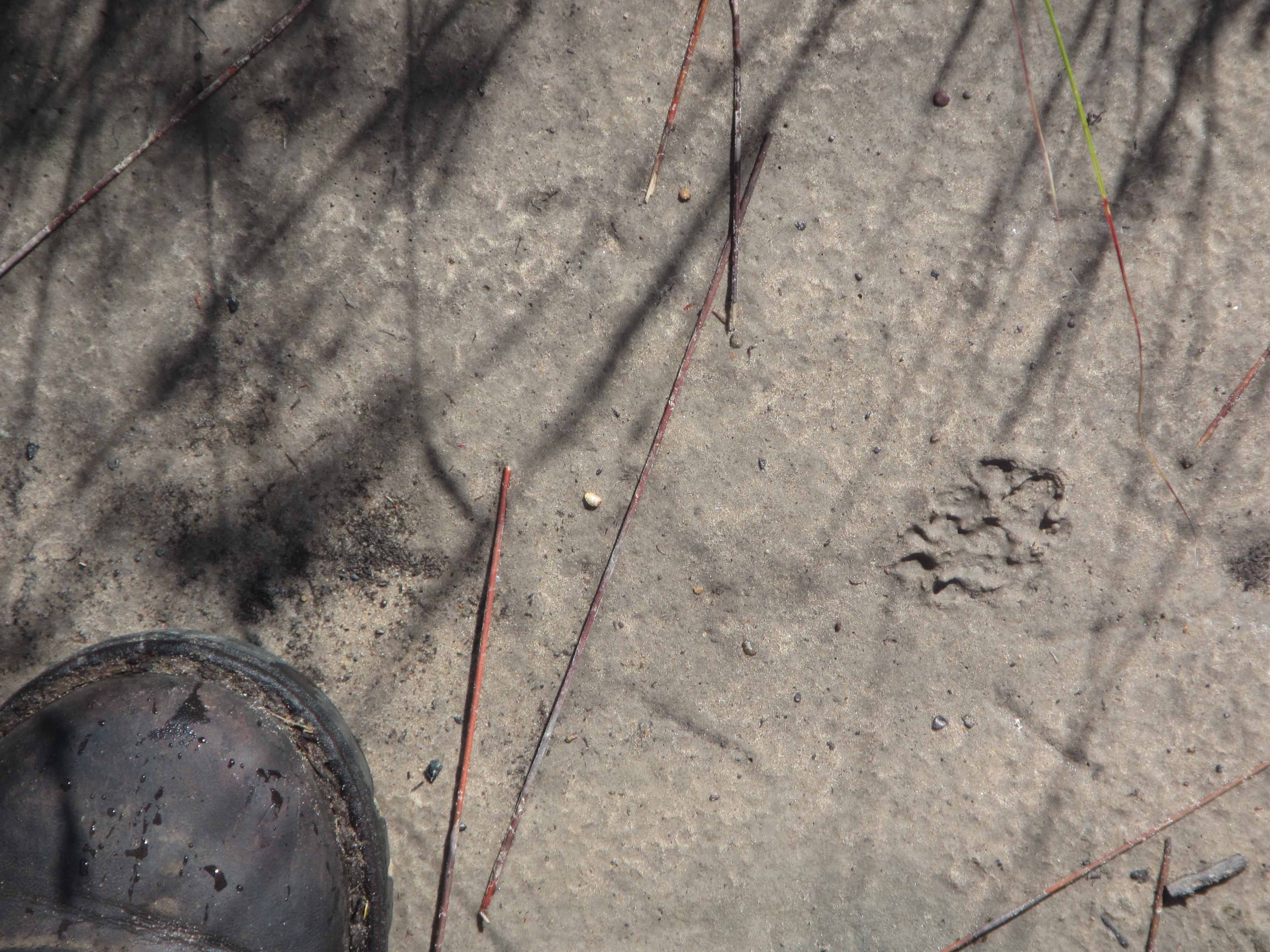
We didn’t encounter many animals along the trail, but we did observe many animal tracks. Here are a couple of the tracks we saw:
Animal tracks #1.Animal tracks #2.
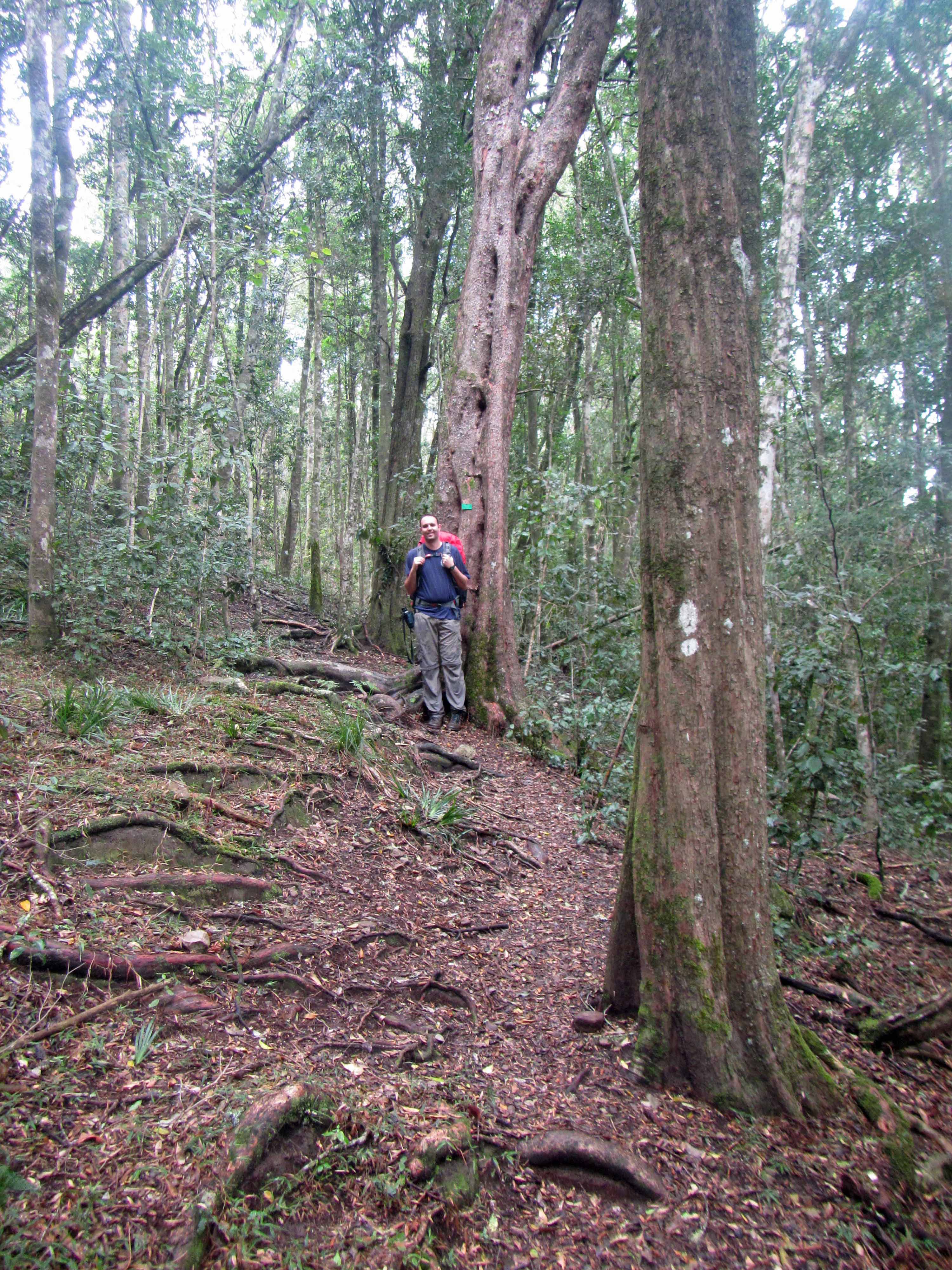
After awhile, we made our way into the indigenous afromontane forest. The forest felt very old and magical and was full of tall trees (such as yellowwood trees), bright red and orange mushrooms, and thick green vegetation. I felt almost as if I had stepped into a fairytale world. I half expected to encounter hobbits, elves, or fairies along the path.
The path through the forest.An interesting, fuzzy plant. Anyone know what it’s called?Another view of the fuzzy plant.Mushrooms on a log.Jackie posing next to a tall tree.Jackie and I making our way along a wider part of the trail.A snail on the path.
We stopped for lunch by a coca-cola colored waterfall cascading over some Table Mountain sandstone rocks:
A coca-cola colored waterfall and pool.
We didn’t stop for lunch for too long because it started to rain:
A coca-cola colored waterfall and pool.
Fortunately, we (well, at least two of us!) were well-prepared for the rain:
Protected by large rain ponchos.
After a couple more hours of hiking through the forest, we arrived at the jeep track leading to the Blaauwkrans Hut:
Hiking along the jeep track.
We followed the jeep track for a few kilometers. As we continued, we could see the Bloukrans Bridge in the distance:
Bloukrans (or Blauuwkrans or Bloukrantz… there are several spellings!) Bridge.
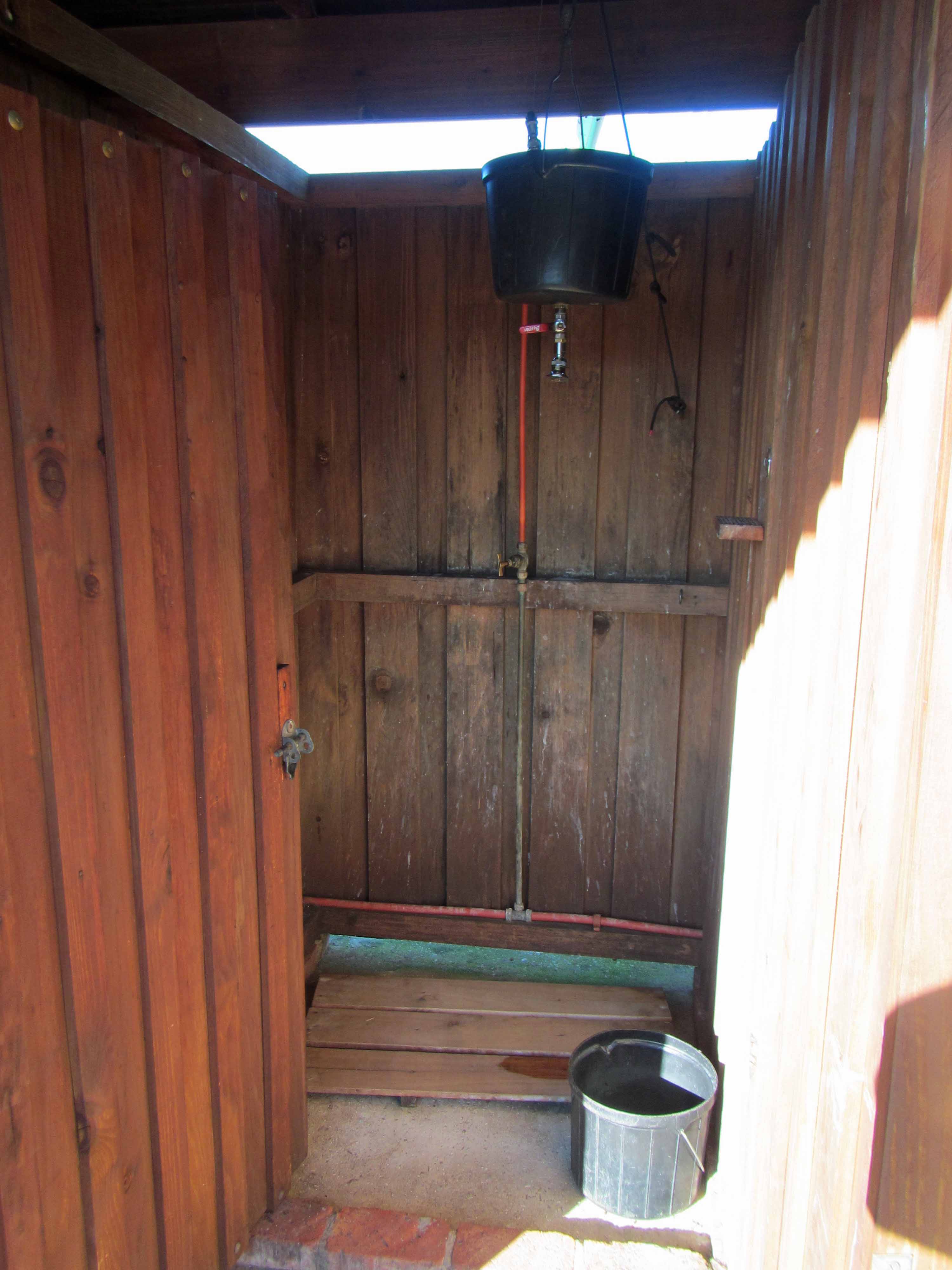
Here are some more views of the hut and its associated facilities:
The sleeping hut.Lapa / cooking area.The view from the lapa area, taken on the morning of Day #3, when the sun was out again.The hot water shower. You heat water in a kettle and put it in the big black bucket. After diluting the boiling water with some cool water, you can take a wonderfully refreshing hot shower that lasts a few minutes.
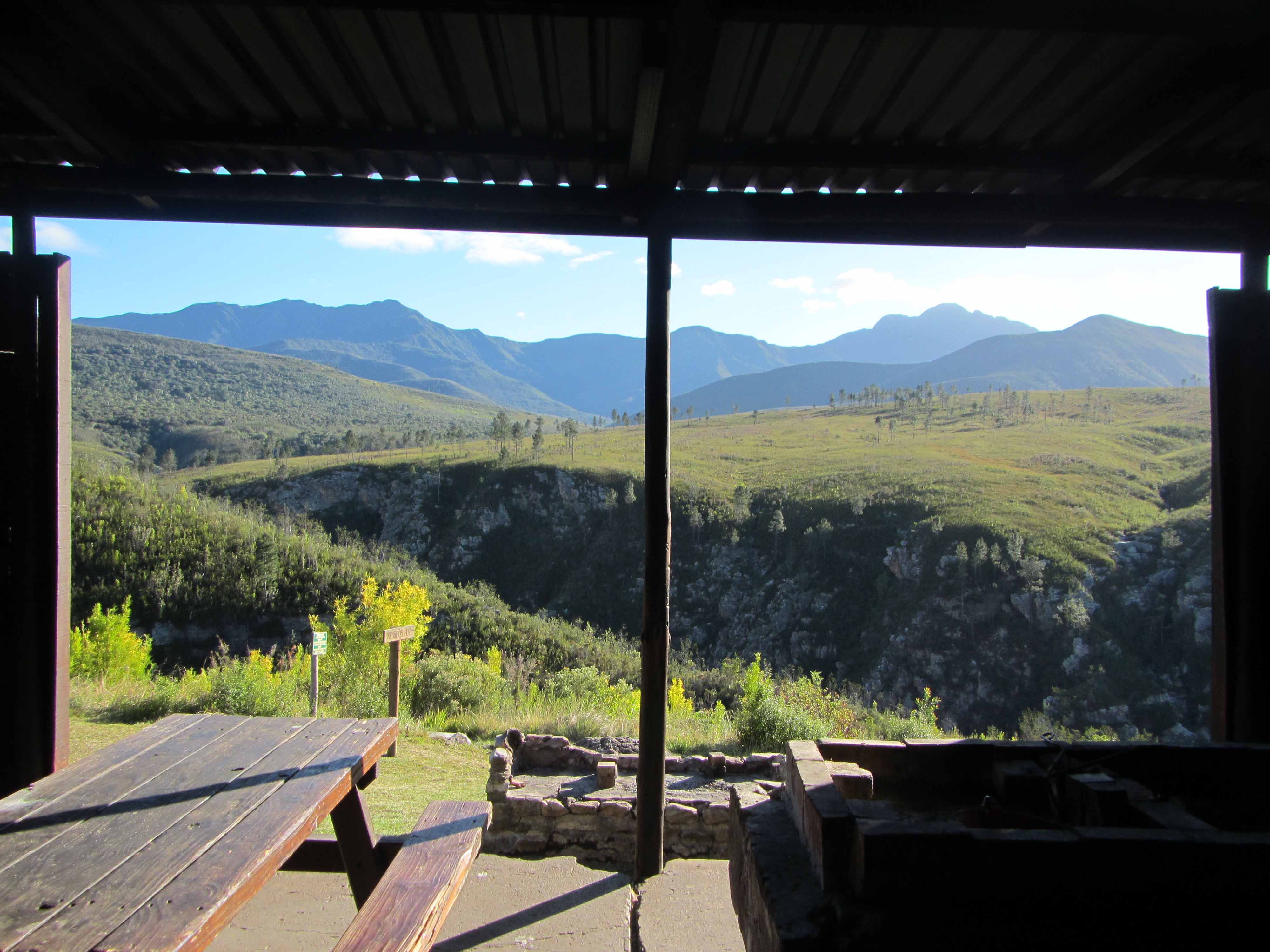
Last but not least, here is the view from the front porch of the sleeping hut:
The view of the waterfalls from Blaauwkrans Hut. I think this view makes the 17 km hike worthwhile!
Isn’t that double waterfall stunning? Here’s a closer view:
A coca-cola colored double waterfall. You can swim in those pools!
Here’s a picture of Jackie and me on the front porch of the hut:
Tired but happy hikers.
We saw some animals during our stay at Blaauwkrans Hut. We saw a troop of baboons hanging out above the waterfall:
Baboons.
We also saw a genet, but it moved too quickly for us to take a picture.
Well, that’s it for Day #2 of the Tsitsikamma Trail. Stay tuned for Day #3!
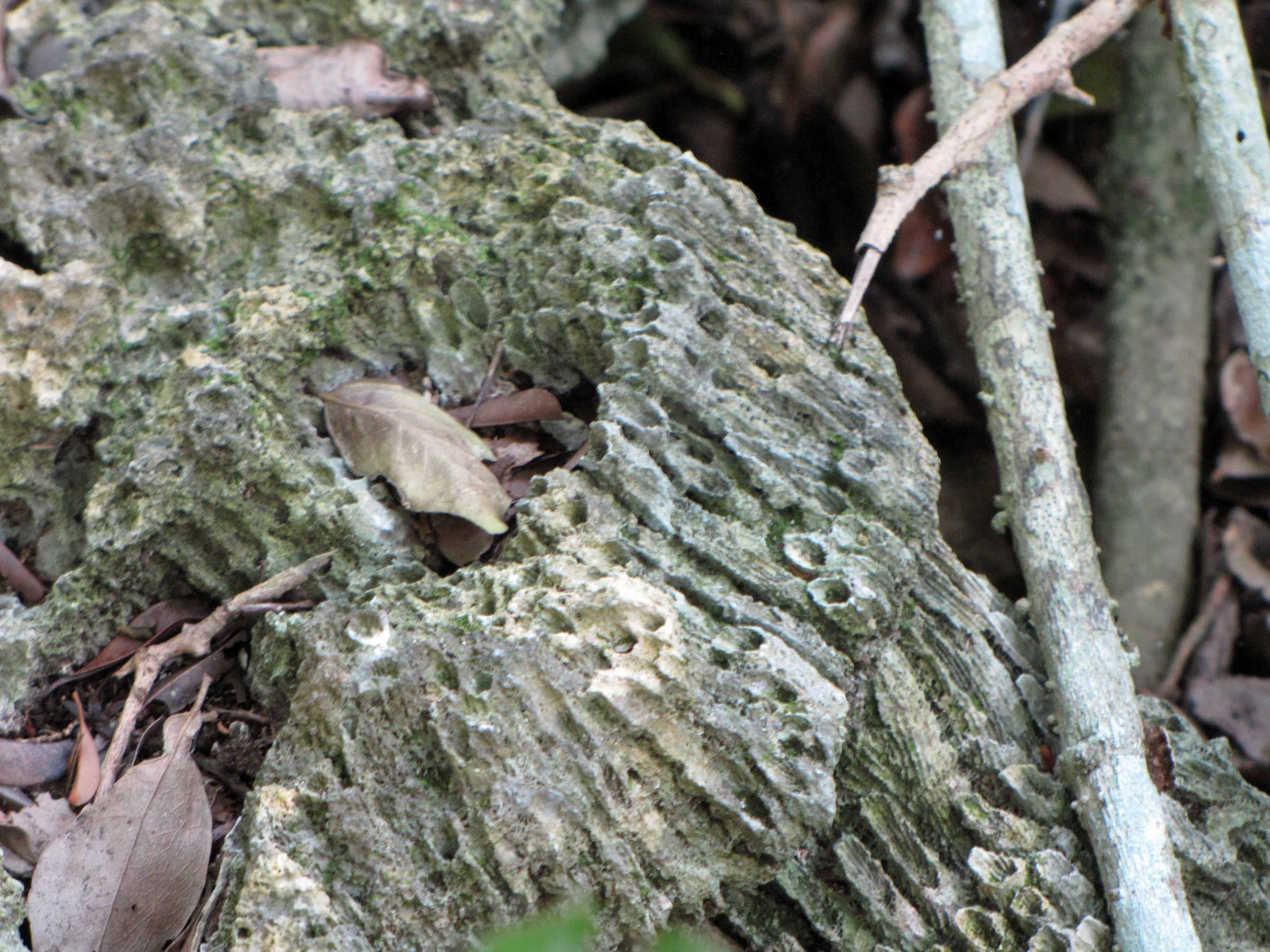
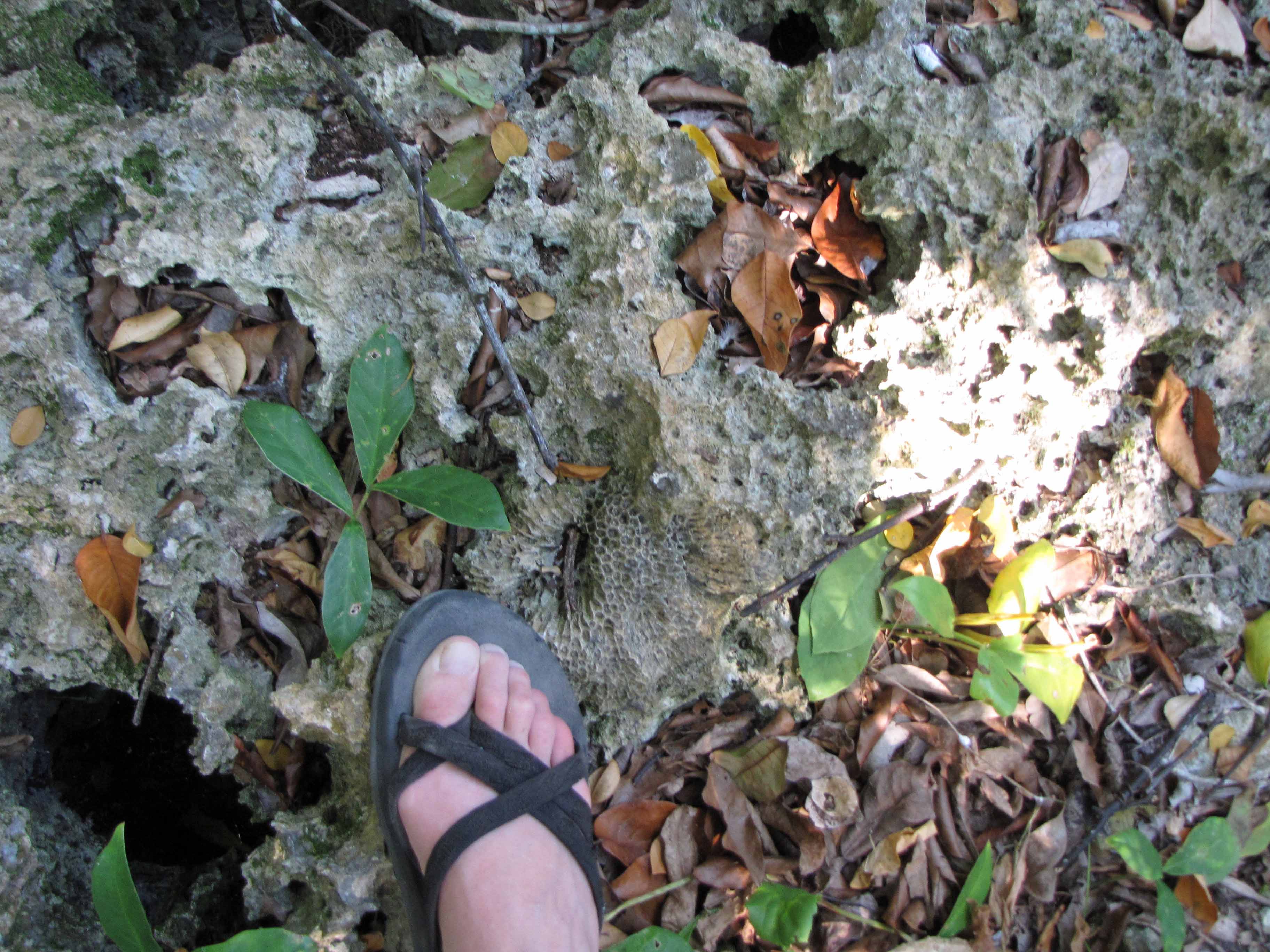
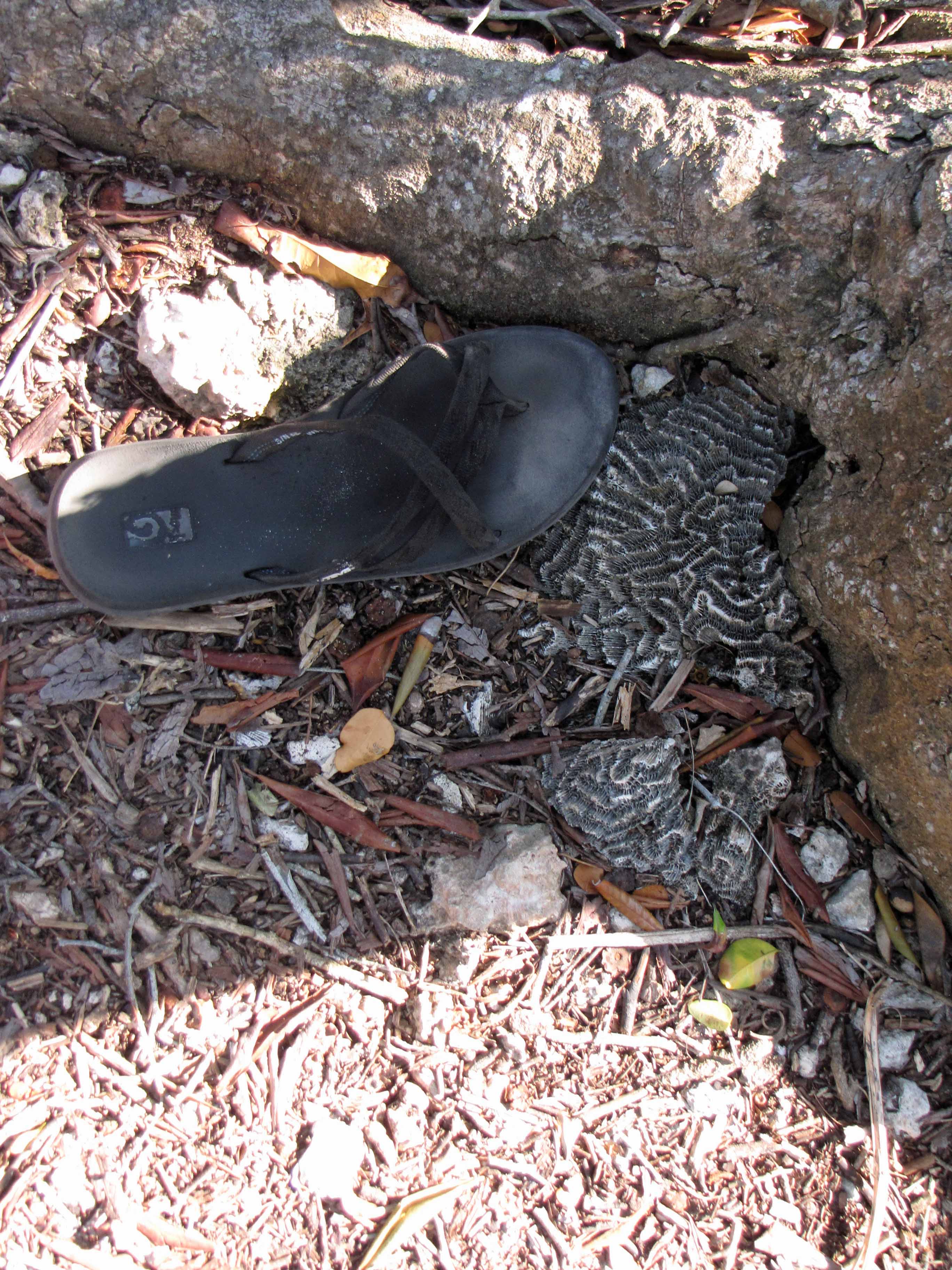
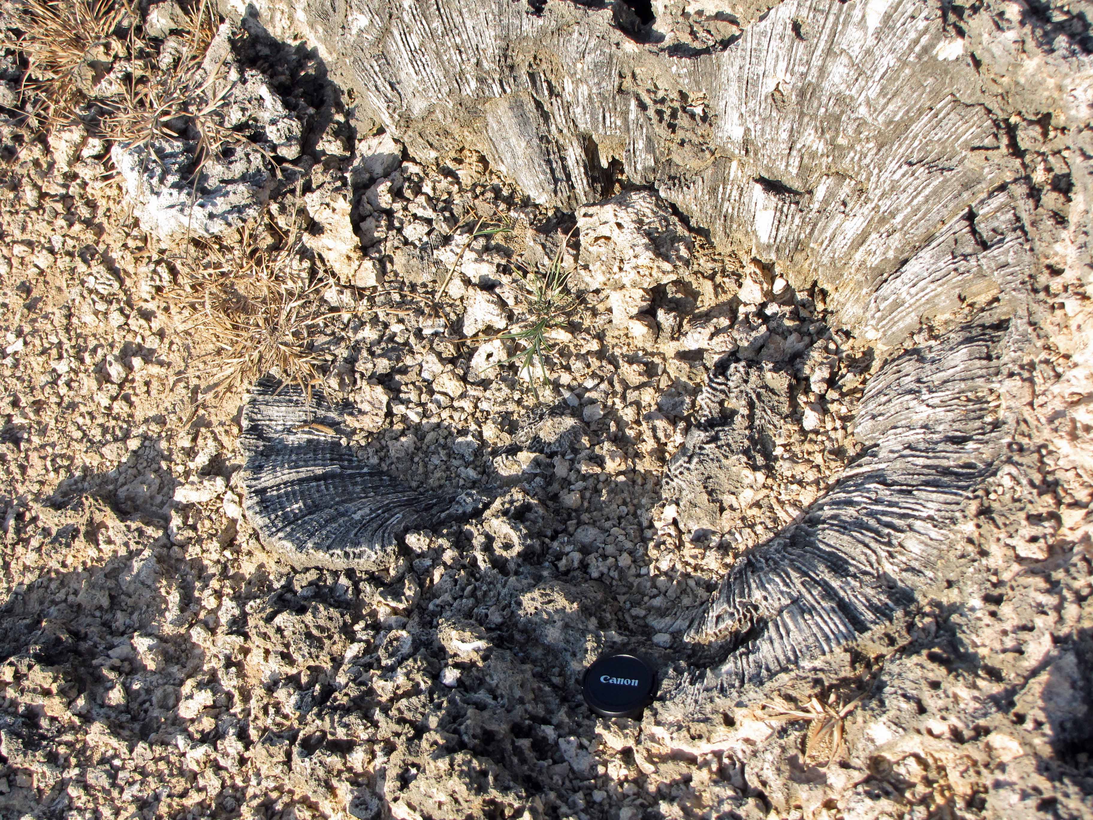
Last week I shared some pictures of giant clam fossils on Chumbe Island, Zanzibar. This week, I’d sharing some pictures of fossil corals that I observed on Chumbe Island. Can anyone identify the corals?
Fossil coral on Chumbe Island #2.Fossil coral on Chumbe Island #3.Fossil coral on Chumbe Island #4.Fossil coral on Chumbe Island #5.Fossil coral on Chumbe Island #6.Fossil coral on Chumbe Island #7.Fossil coral on Chumbe Island #8.Fossil coral on Chumbe Island #9.