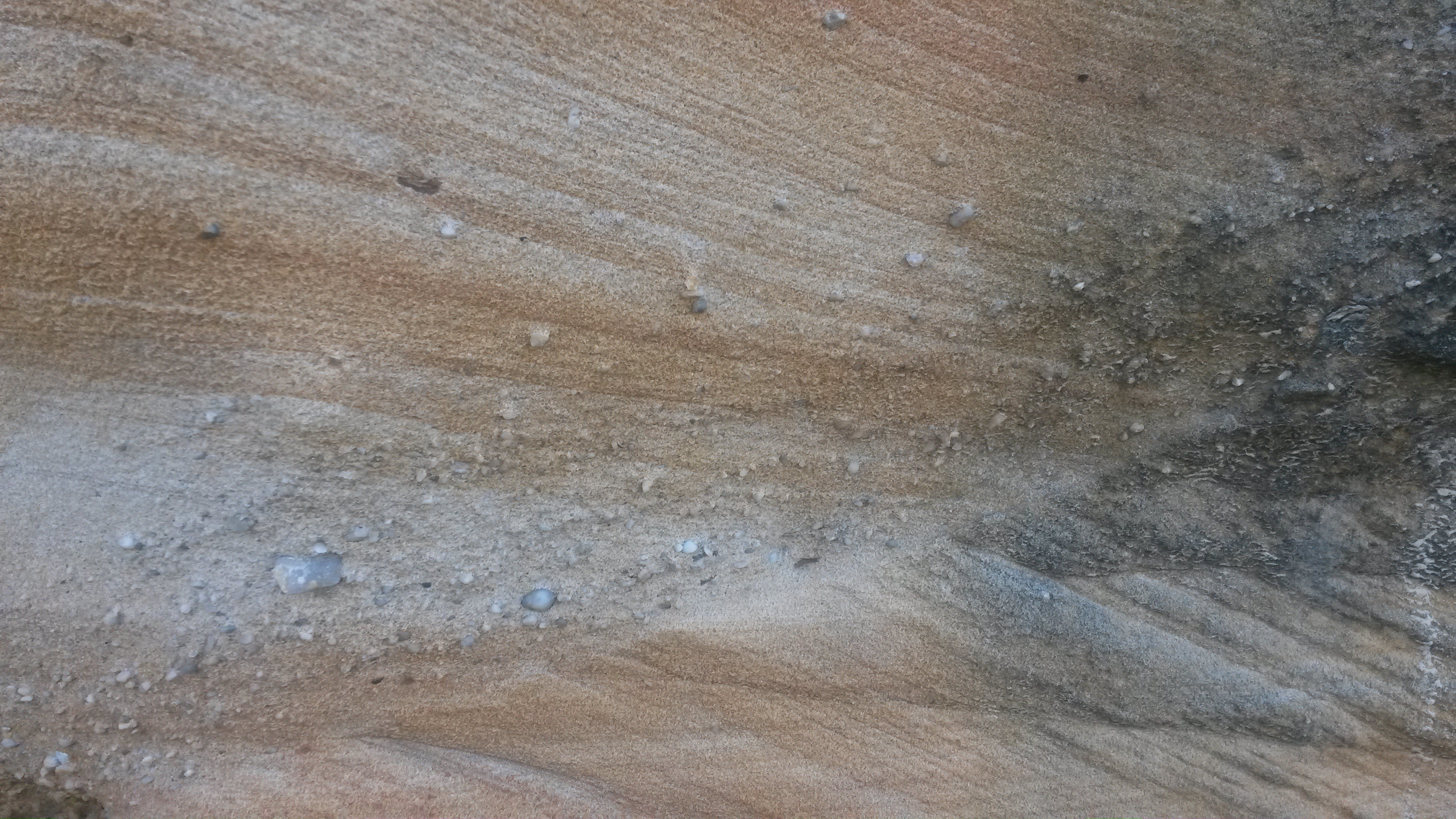
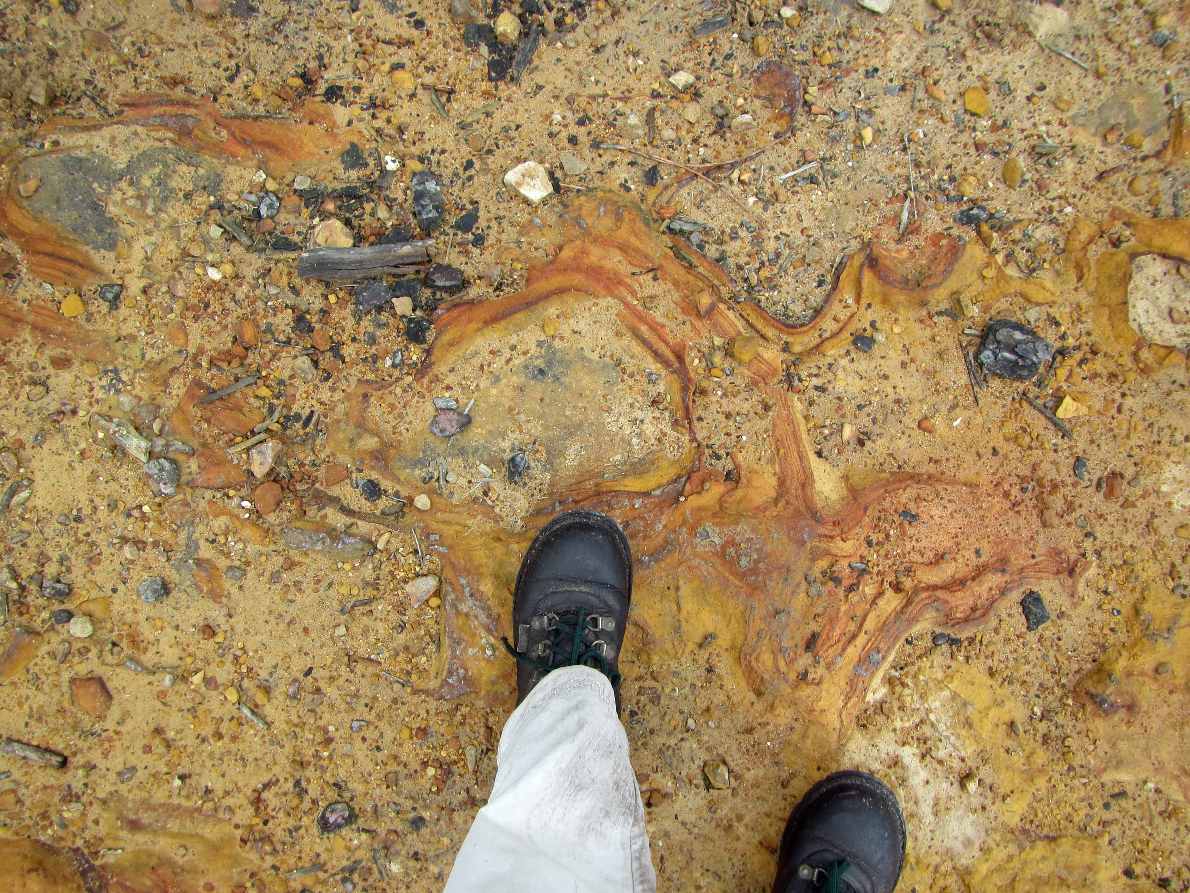
Sandstone with iron oxidation coloration and bedding.
I’m still in Australia at the moment but will be home in a few days. I’m looking forward to writing up a few blog posts about some geological sights in Australia once I’m back home. For now, though, here’s a picture showing another beautiful example of sandstone in the Sydney area. This picture was taken at the Sydney Zoo. The red and orange colors are a result of iron oxidation. The white is sandstone that lacks a color change from iron oxidation. Some bedding is also visible in this sandstone outcrop.
I’m visiting Australia at the moment and will have a few blog posts to write up once I’m back at home. For now, though, here’s a sneak peek at some geology in Sydney. I took this picture close to Bondi Beach. There are some lovely exposures of sandstone outcrops near the beach.
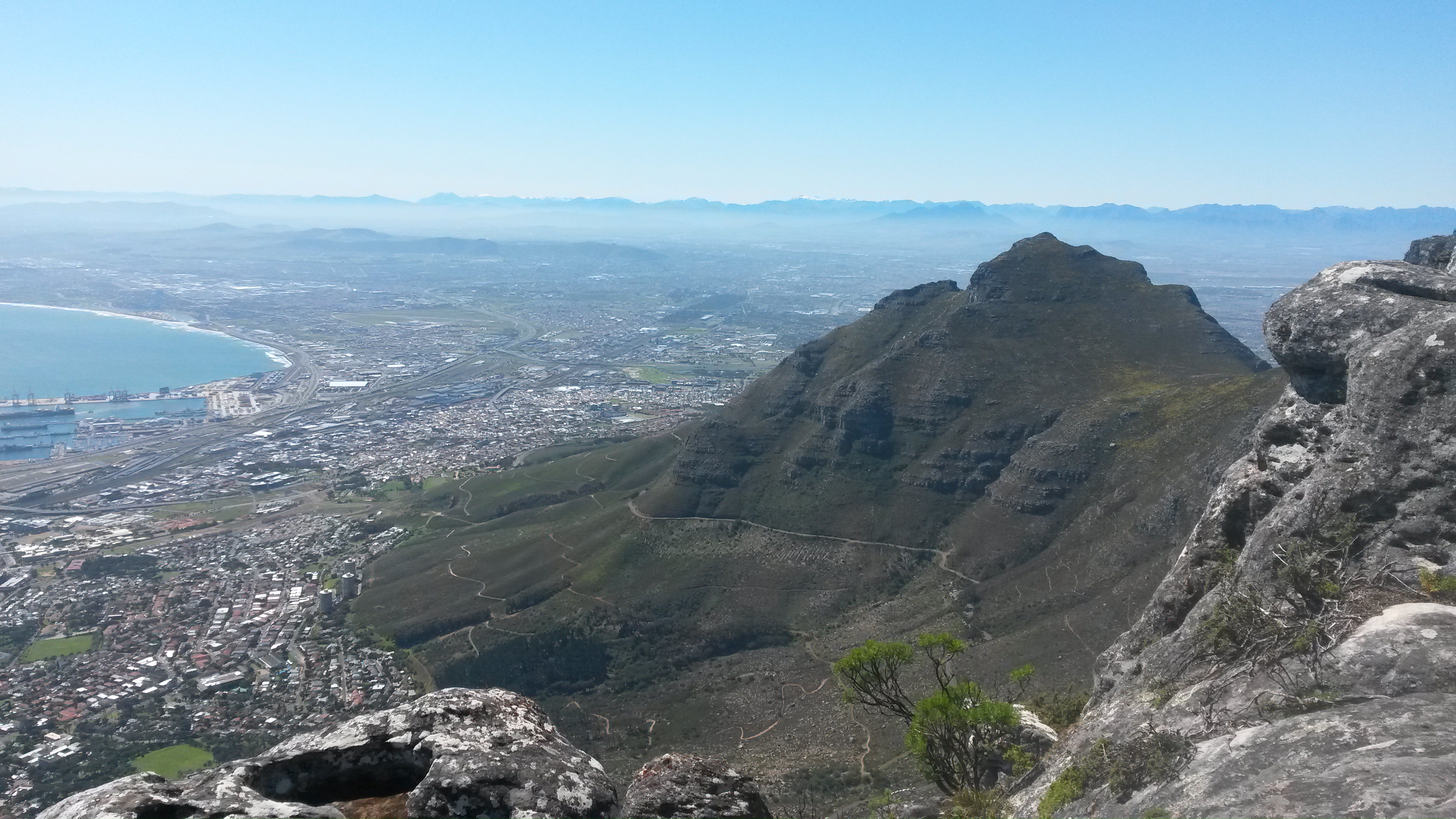
My two American geologist friends, with whom I went ziplining amidst some sedimentary rocks a little over a week ago, left on Saturday. Before they left on their evening flight, we decided to go up Cape Town’s beautiful Table Mountain. We took the cable car up the mountain, hiked around on the top for a couple of hours, and then took the cable car back down. Saturday was a beautiful sunny day with good visibility, so we saw some stunning views from the top of the mountain. Here are two of them:
Table Mountain, sloping down to the city of Cape Town below.Another view from the top of Table Mountain, this time looking towards the inselberg Lion’s Head (the knob of rock) and Robbin Island.
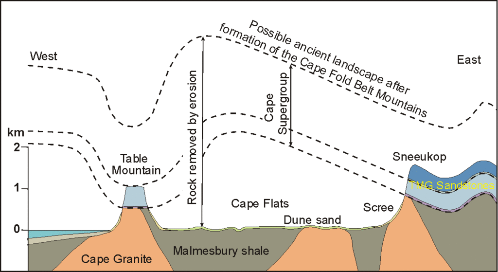
Table Mountain is comprised of the same sandstone rocks that we saw when we went ziplining in the Cape Fold Belt. However, the sandstone rocks of Table Mountain are relatively flat and unfolded, their preservation a result of the mountain’s granite core. Here’s a figure, taken from Prof. John Compton’s book The Rocks and Mountains of Cape Town, that explains the geological relationship:
Geology of the greater Cape Town area, showing how the Table Mountain Group sedimentary rocks are related to uplifted rocks in the Cape Fold Belt. Image taken from Compton (2004). Click image to enlarge.
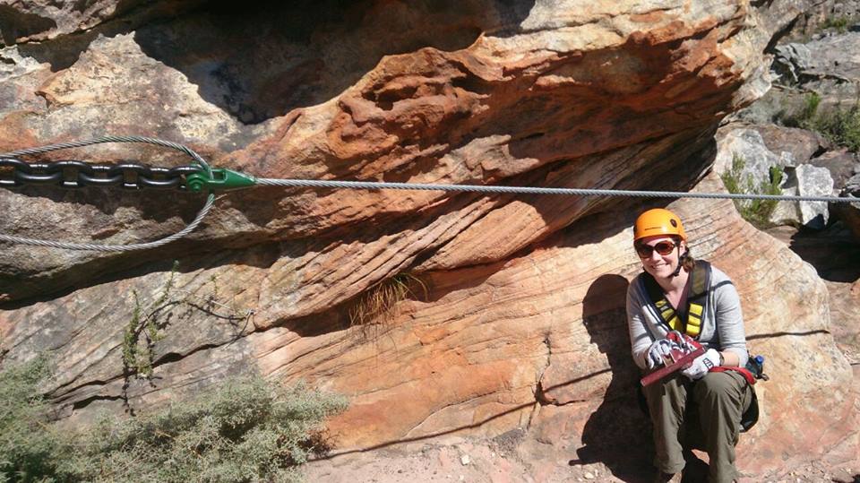
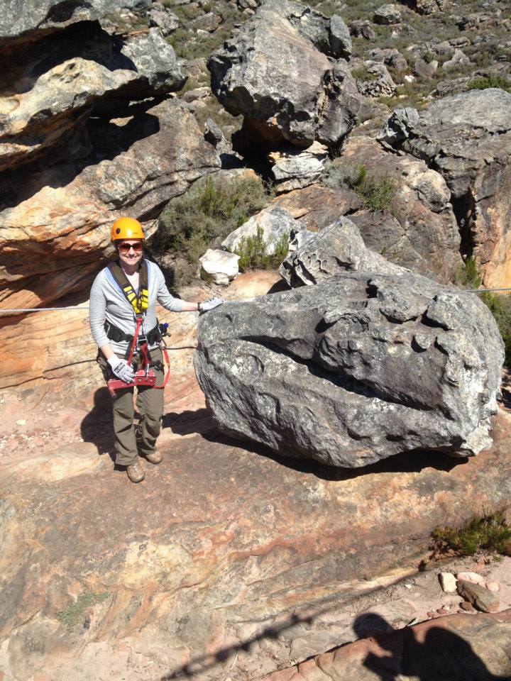
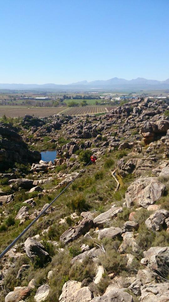
Posing with some pretty sandstone cross-bedding in the Cape Fold Belt, Ceres, South Africa.
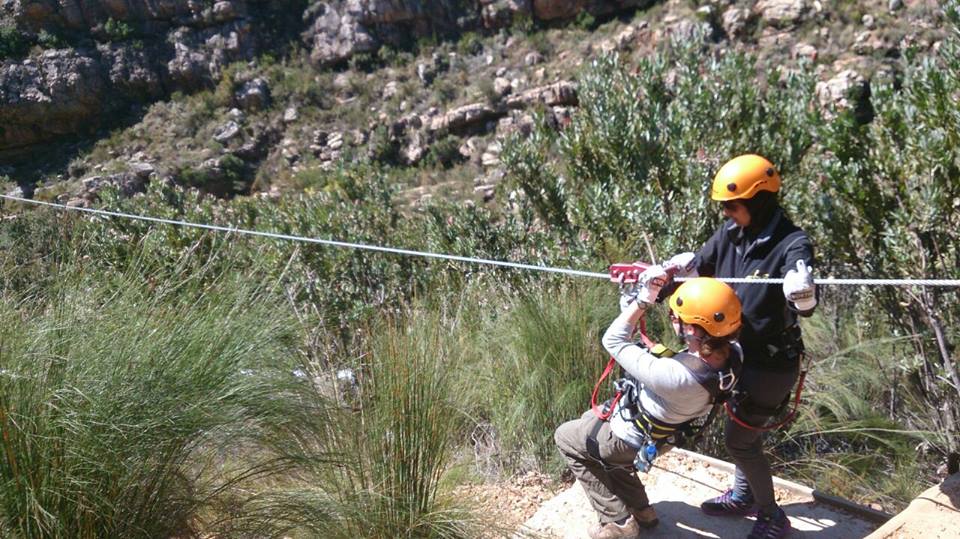
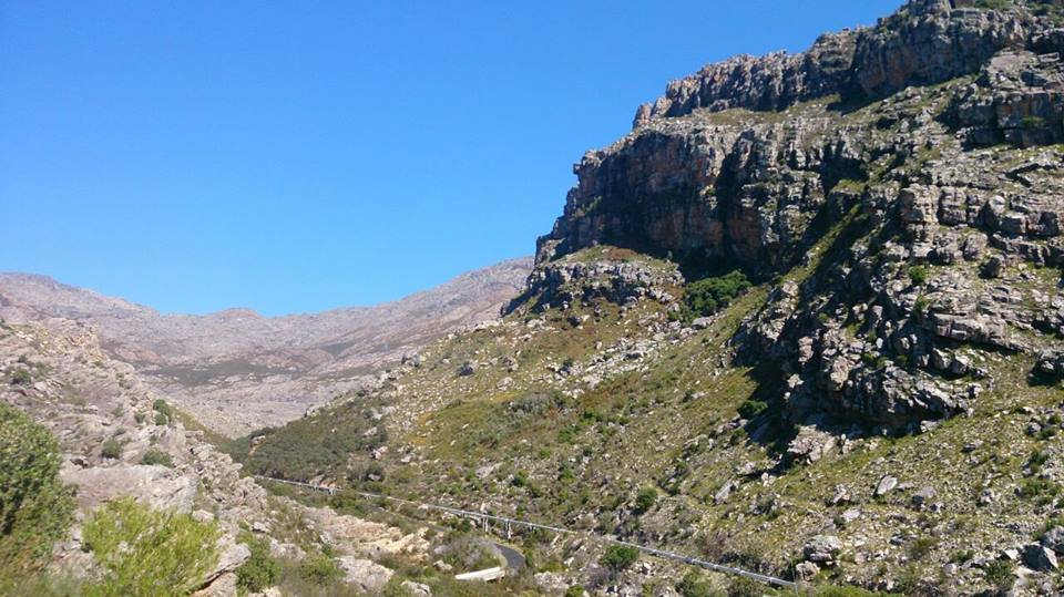
Soon, I’ll continue with sharing more pictures from my geological wanderings in Mauritius earlier this year. However, for this week’s “Monday Geology Picture” I want to share some pictures from my recent visit to the little town of Ceres in the Western Cape of South Africa. Last Friday, I went to Ceres for the day with my husband and two friends visiting from America. Ceres is about an hour and a half north of Cape Town by car and is located in a geologic feature known as the Cape Fold Belt. In the Cape Fold Belt, sandstones and other sedimentary rocks have been extensively uplifted and folded. However, there are still many places where you can glimpse some primary sedimentary structures, such as the sandstone cross-bedding shown in the picture above. I posed with this cross-bedding when I was on a zipline adventure at Ceres Zip Slide Tours. If you like beautiful views of sedimentary rocks and aren’t afraid of heights, I highly recommend ziplining in Ceres. We had a great time!
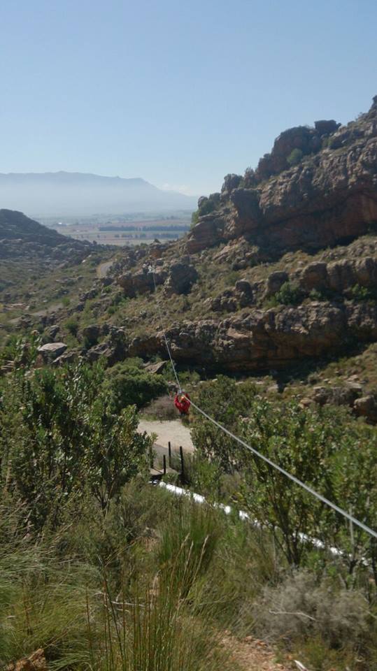
Here are some more pictures from our ziplining adventure in Ceres:
Nervously preparing to launch myself on the first zipline of the day.One of my friends on the first zipline. You can see some vineyards in the background.On another zipline. What a view! What a great way to look at some uplifted sedimentary rocks!Stunning sedimentary scenery.More stunning scenery.Yet more stunning scenery.A friend on another zipline. This was a long one!Posing with an interesting rock that resembles a dinosaur head.Another stunning zipline view.Having fun… I think I’m (mostly) over my nervousness here.On one of the last ziplines.
This week’s Monday Geology Picture is a pretty shot that was taken several years ago in the Red Rock Canyon National Conservation Area, which is located just outside of Las Vegas. If you ever visit Las Vegas, I highly recommend making a trek out to Red Rocks– it’s a short drive away from the casinos and is a nice escape from the gaudy and glitzy Las Vegas strip. Also, you can see some very impressive sandstone cross-bedding, such as the bedding shown in the picture above.
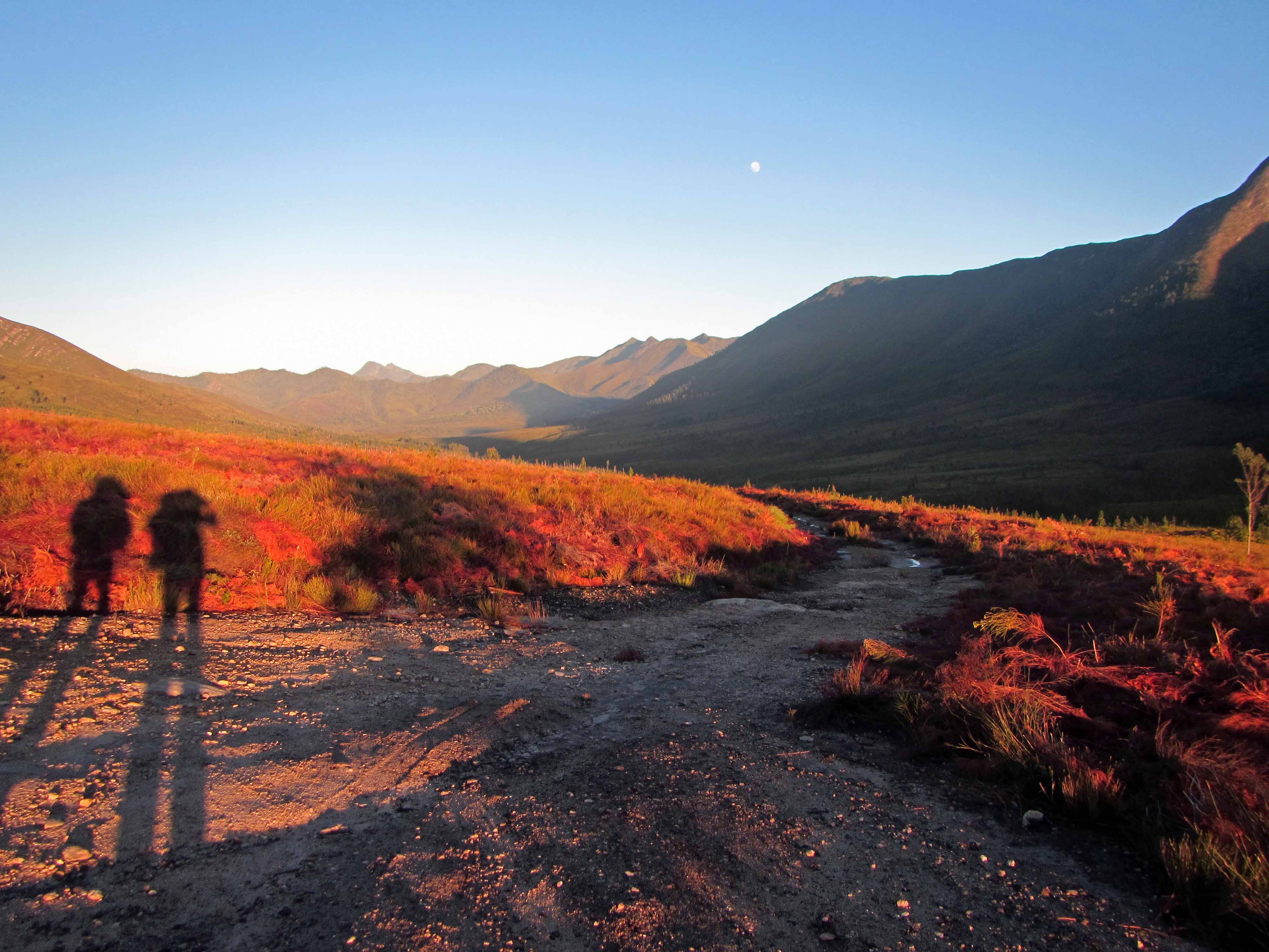
Today I’ll be discussing the fourth and final day of my recent backpacking trip along the Tsitsikamma Trail with my husband Jackie and five of our friends. I’ve already blogged about Day #1, Day #2, and Day #3. On Day #4 we hiked 11.5 km from the Kerbous Hut to the Lottering Plantation, where we had parked one of our cars.
Hiking the full Tsitsikamma Trail actually takes six days. So, we hiked to the Lottering Plantation along a dirt road “escape route” that is used by forest rangers to take care of the trees on the plantation and also to service the Kerbous Hut and check on the hikers staying there. The road may also be used during rainstorms, when rivers and streams may flood and hikers may need to cut their backpacking trip short. However, we cut our trip short on purpose as we had only planned to hike for four days.
Since we had a long drive back to Cape Town (and many of us had to work the next day!), we woke up very early on our last day and started hiking at dawn. We actually hiked all 11.5 km before 10 am! We made much better time than we expected, probably because most of the hike was along a wide dirt road. Also, after we survived a couple of hours of uphill climbing, the rest of the hike was mostly downhill.
The plantation staff looked slightly surprised to see us arrive so early. After a few minutes of picture taking and relaxing, we ran shuttle to fetch the second car and then started the long seven hour drive back to Cape Town.
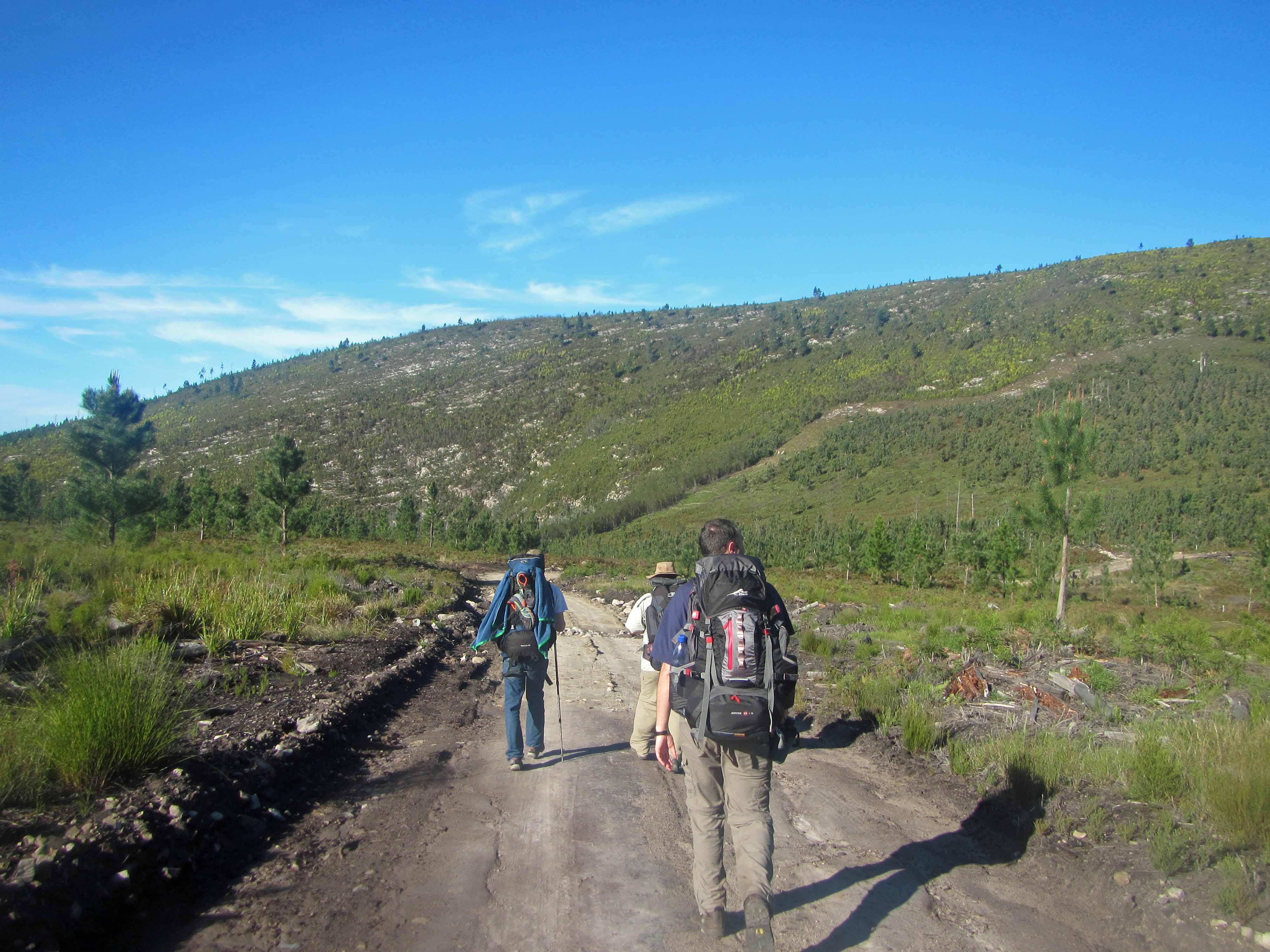
Here are a few pictures from our hike out to the Lottering Plantation:
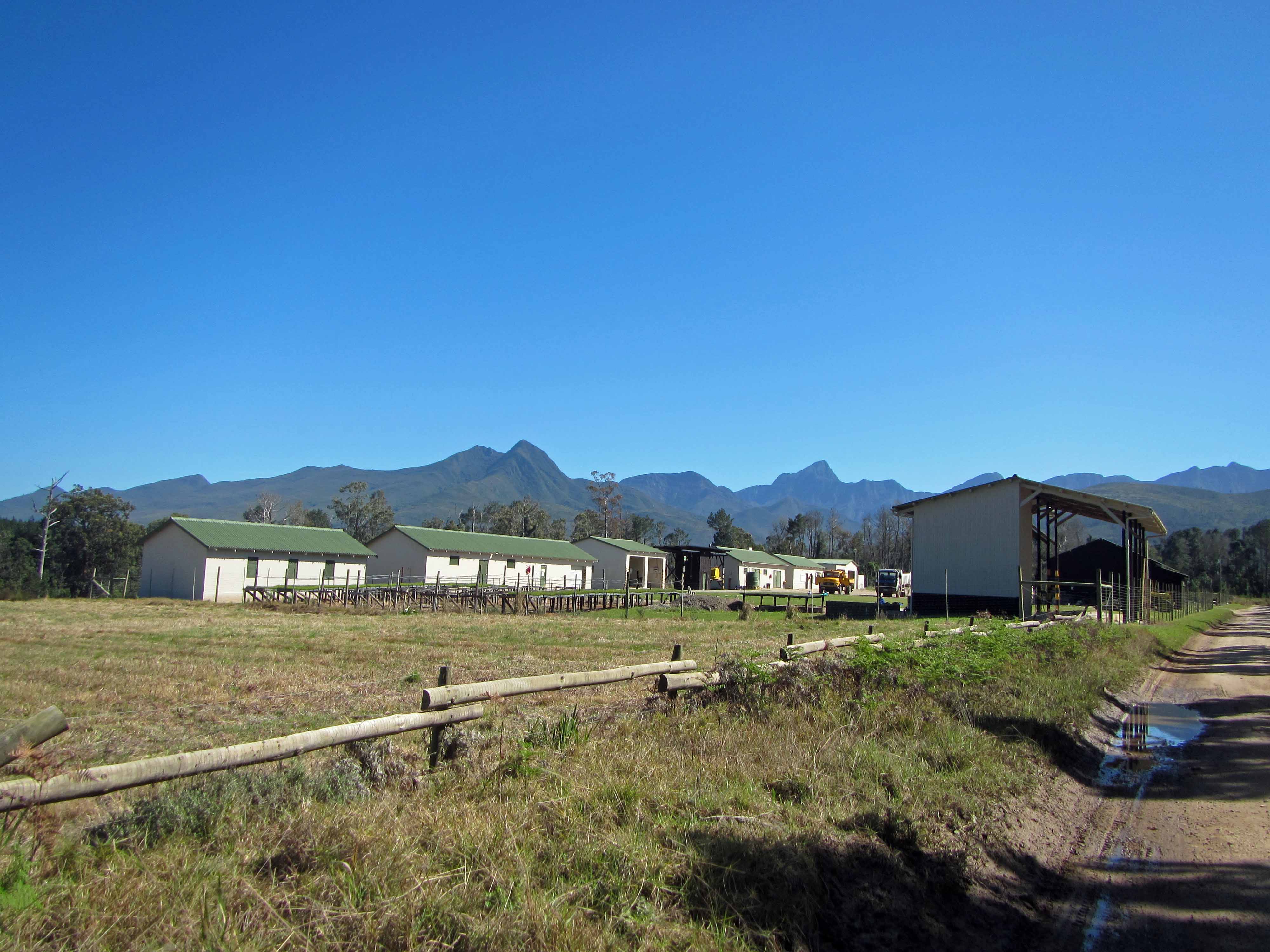
A stunning early morning view, looking back on the Tsitsikamma Mountains.A pretty black bird.Pine trees and uplifted sandstone.Making our way along the dirt road.Another coca-cola colored stream.Tall pine trees along the dirt road.The plantation buildings! We arrived a little before 10 am.A closer look at some of the plantation buildings.
Here’s the group at Lottering Plantation at the end of the hike:
Tired but happy hikers after four days on the Tsitsikamma Trail.
I really enjoyed this backpacking trip. The trail is well maintained and organised and winds its way amongst some impressive geology and vegetation.
The huts where we stayed were very comfortable, and it was great that we didn’t have to carry tents and heavy cooking equipment.
If you find yourself in South Africa, I highly recommend spending a few days hiking along the Tsitsikamma Trail! If you’re not up for all six days, you can arrange a two or three or four day hike or even a single day hike.
Today I’m continuing with my account of my recent backpacking trip along the Tsitsikamma Trail with my husband Jackie and five of our friends. Today, I’ll blog about Day #3 of the trip. I discussed Day #2 and Day #1 previously. On Day #3 we hiked 13.4 km from Blaauwkrans Hut to Keurbos Hut. Along the way, we passed through more beautiful fynbos and indigenous afromontane forest, and we made numerous river and stream crossings.
We started out the day by crossing the stunning, coca-cola colored double waterfall that we could see from Blaauwkrans Hut. Here’s a picture of that waterfall again:
This picture is worth putting in two blog posts!Crossing over the double waterfall below Blaauwkrans Hut.Jackie on the trail above the waterfall.
After we crossed over the double waterfall, we hiked up onto and across a fynbos-covered plateau and looked back on Blaauwkrans Hut from above:
The view back towards Blaauwkrans Hut. You can see the sea in the distance.Pretty pink fynbos flowers.
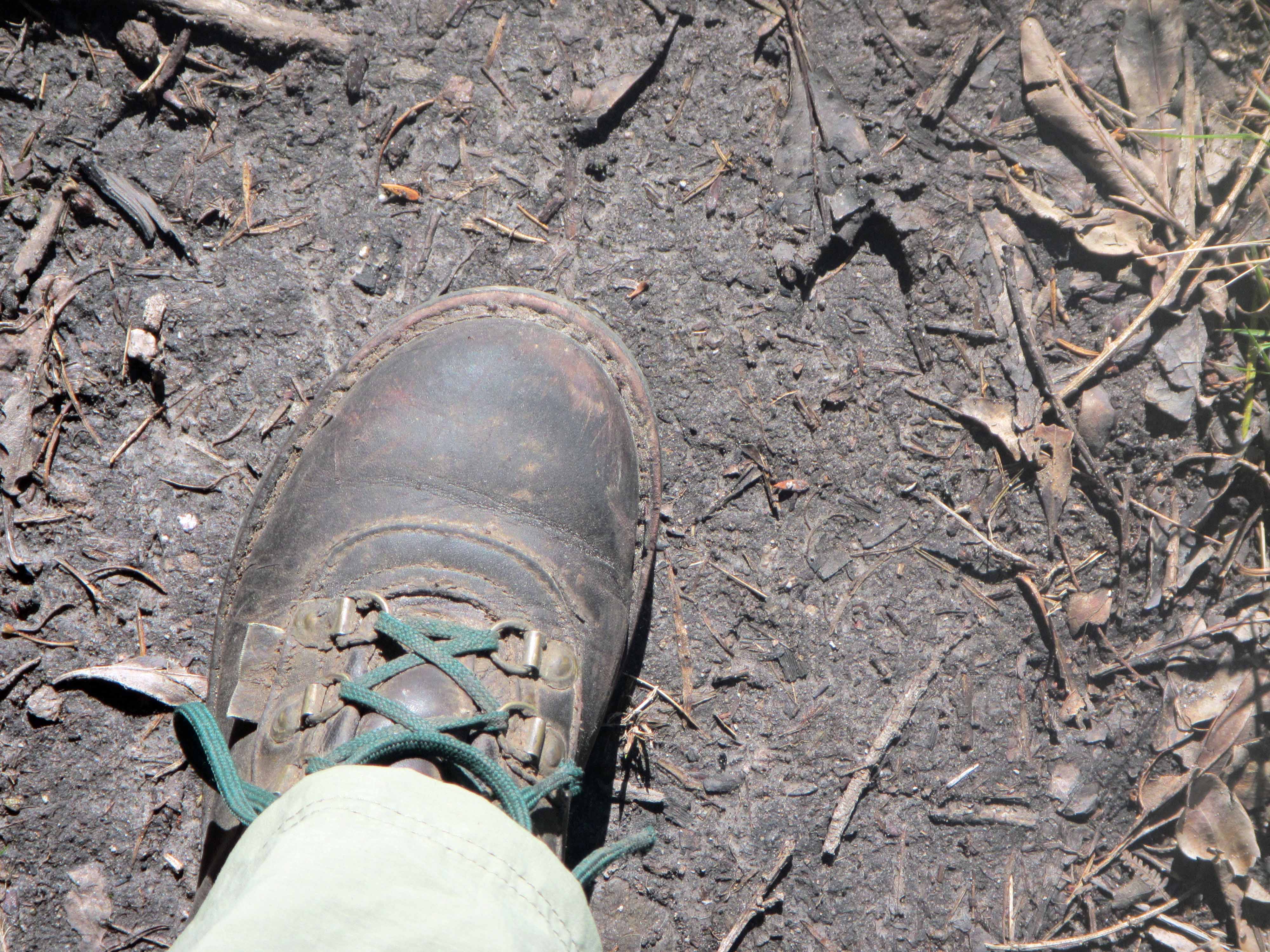
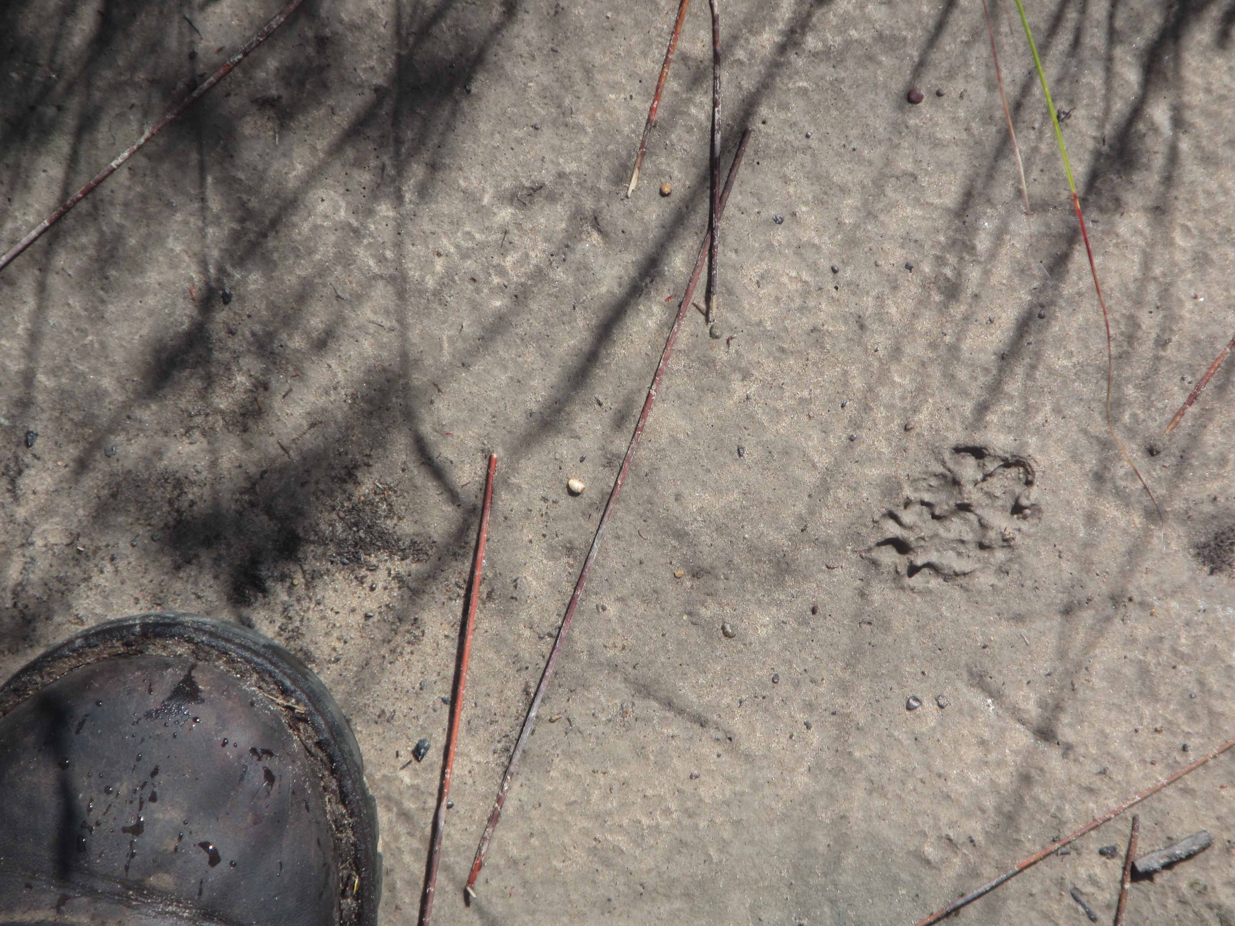
We soon came across some more animal tracks:
Small animal footprint.
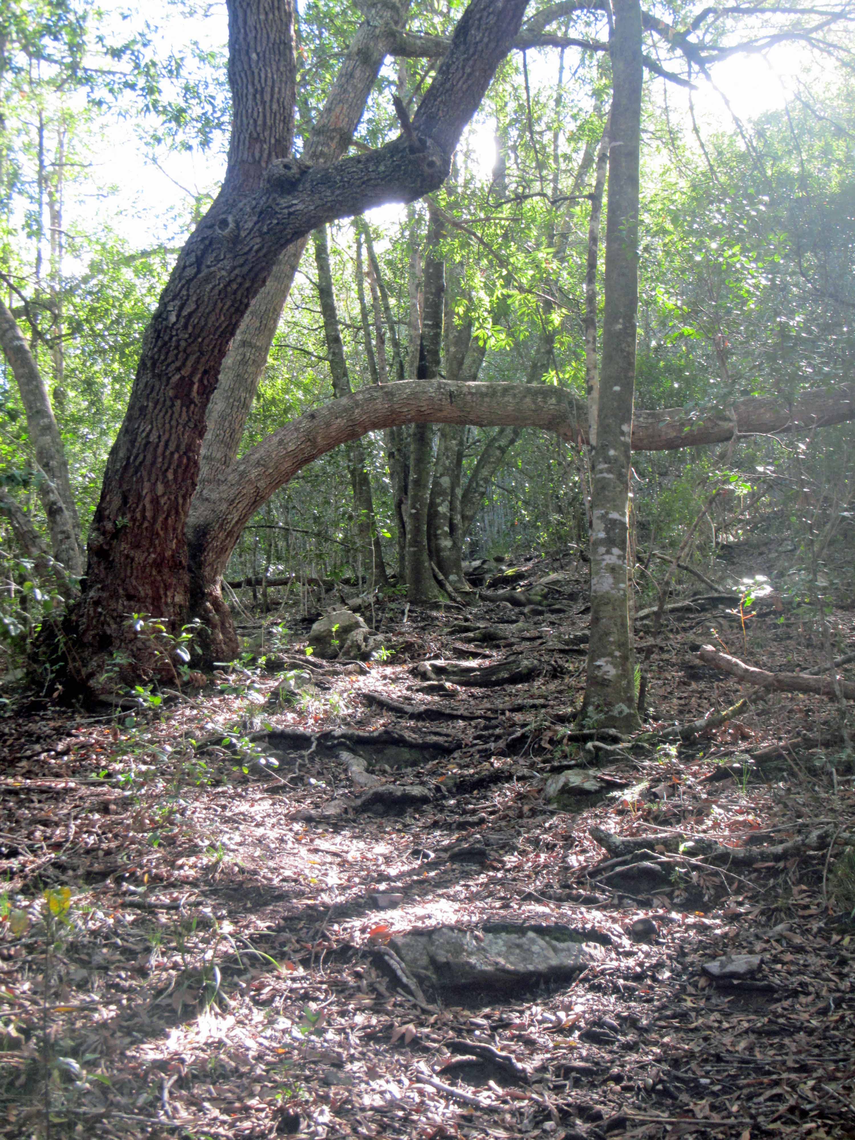
After an hour or so of hiking, we entered the forest:
A magical forest path with tree roots for stairs.The forest path parting a sea of green.
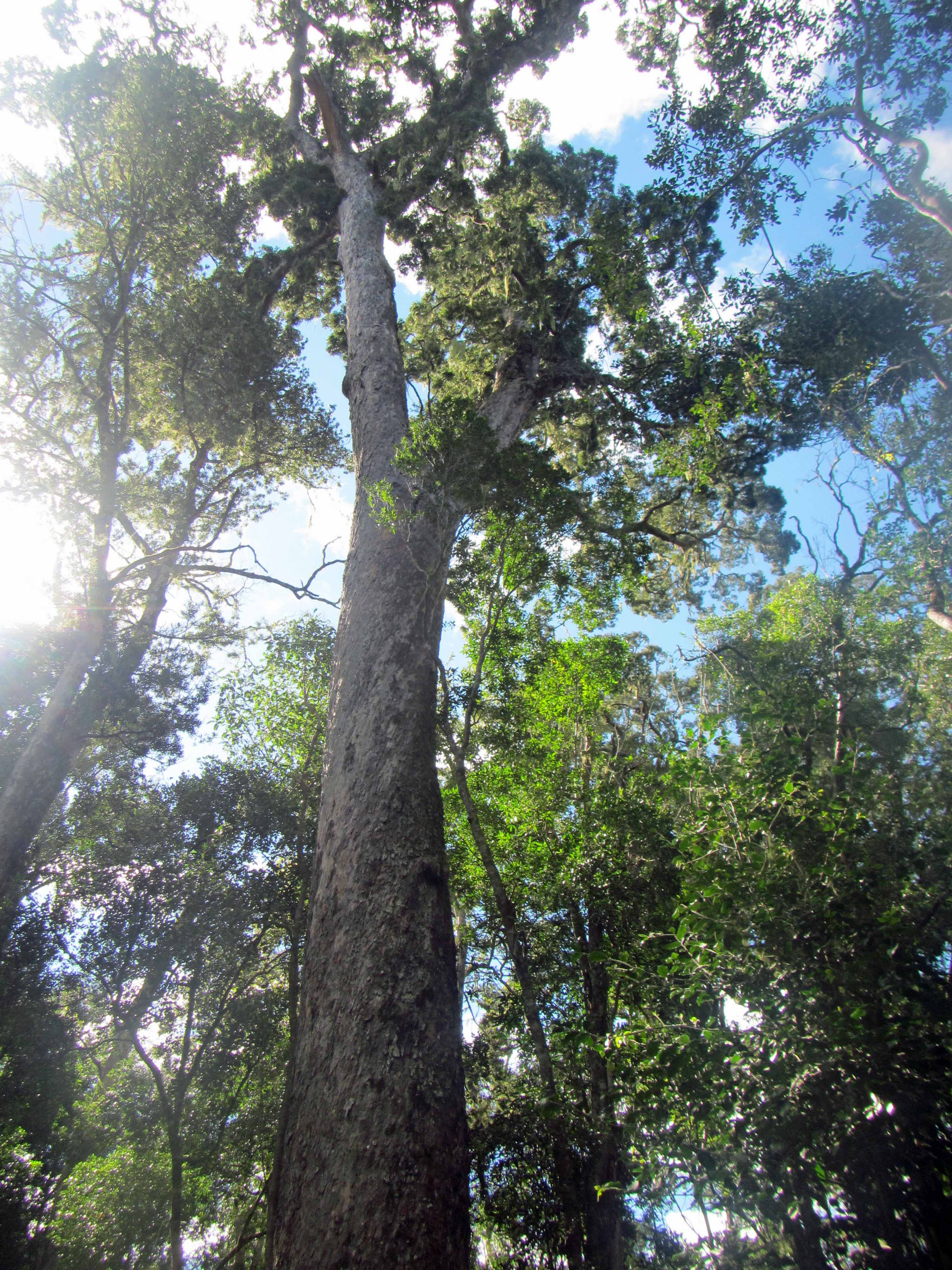
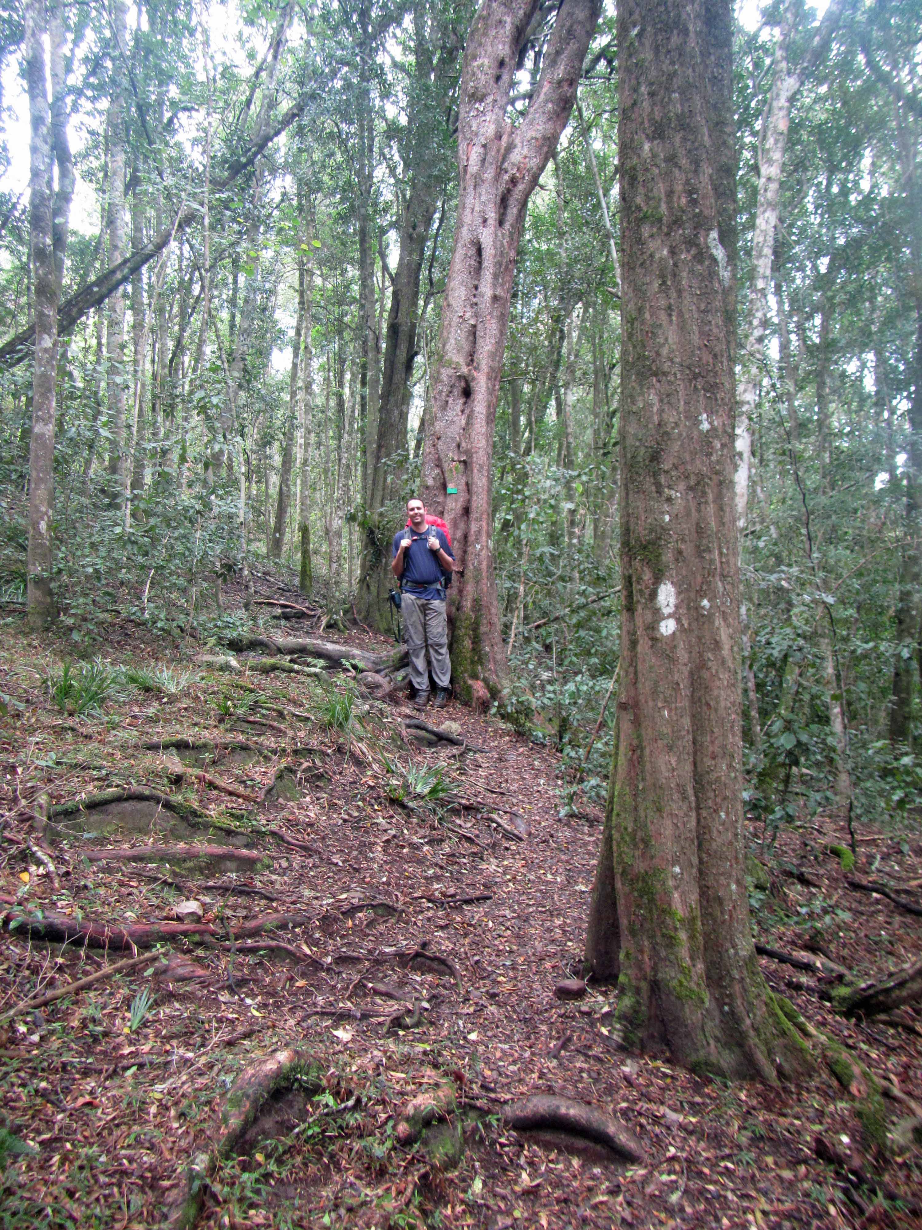
While hiking through the forest, we saw many impressive trees. For instance, this tall Yellowwood:
A majestic yellowwood tree.Many of the trees had identification signs.The group on the trail.
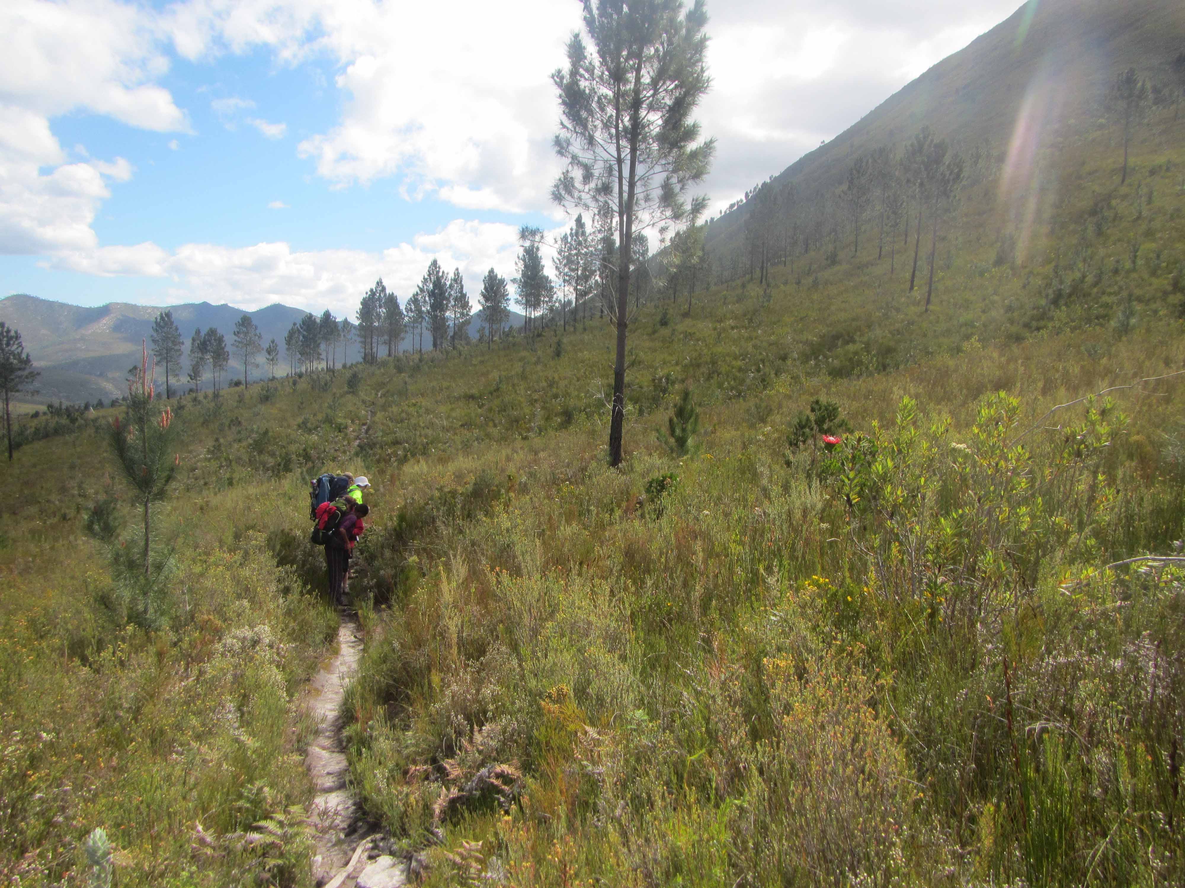
After awhile, we emerged from the forest and walked through fynbos again. We had some beautiful views of the folded sandstone mountains as we walked through the fynbos:
Mountain views while walking through the fynbos.Another angle on the beautiful view that we had while walking through the fynbos.
Here are a few pretty fynbos plants:
White fynbos plant.Yellow fynbos plant.Pink fynbos plant.
After a little while, we headed down into a valley to cross the Bloukrantz (or Blaauwkrans) River:
The Bloukrantz River viewed from above.The forest near the Bloukrantz River.Crossing the Bloukrantz River.The coca-cola colored water of the Bloukrantz River.
After crossing the Bloukrantz River, we had a steep climb back up onto the plateau, where we again found ourselves in fynbos:
More stunning fynbos and a closer view of the sandstone mountains.Another view of the sandstone mountains.
We saw several lovely examples of king protea, which is South Africa’s national flower:
A stunning bright pink king protea.More king protea along the trail.Checking out a king protea.
We hiked along the fynbos plateau for a few hours and also stopped for a long lunch break. We were fairly hungry and tired!
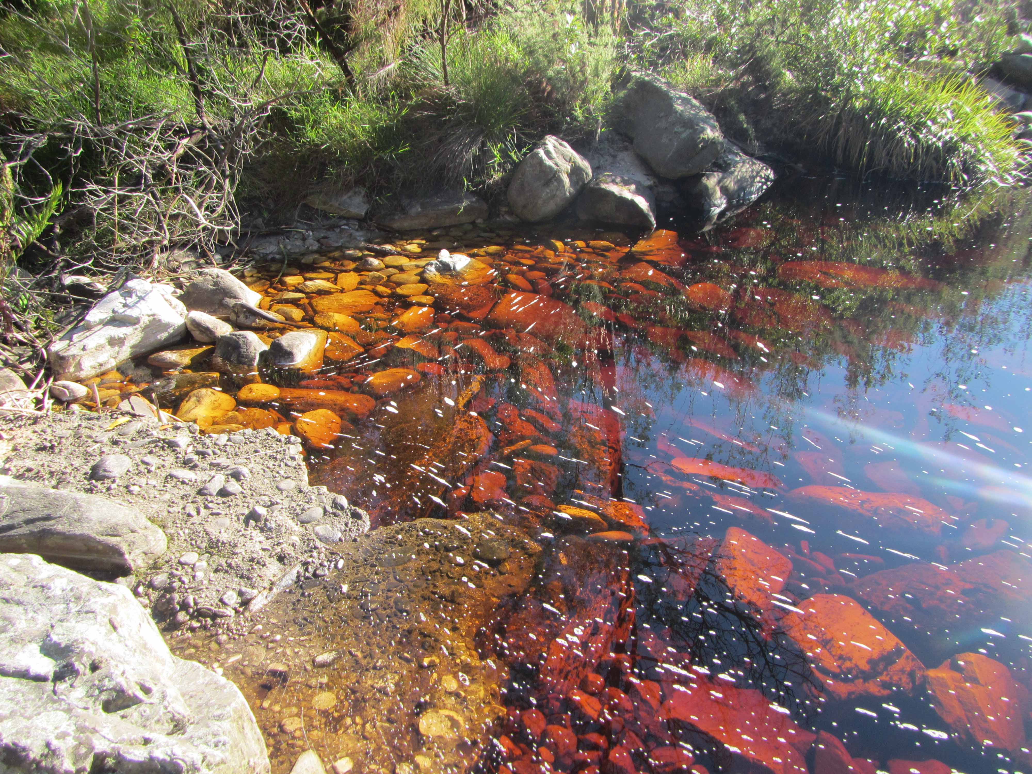
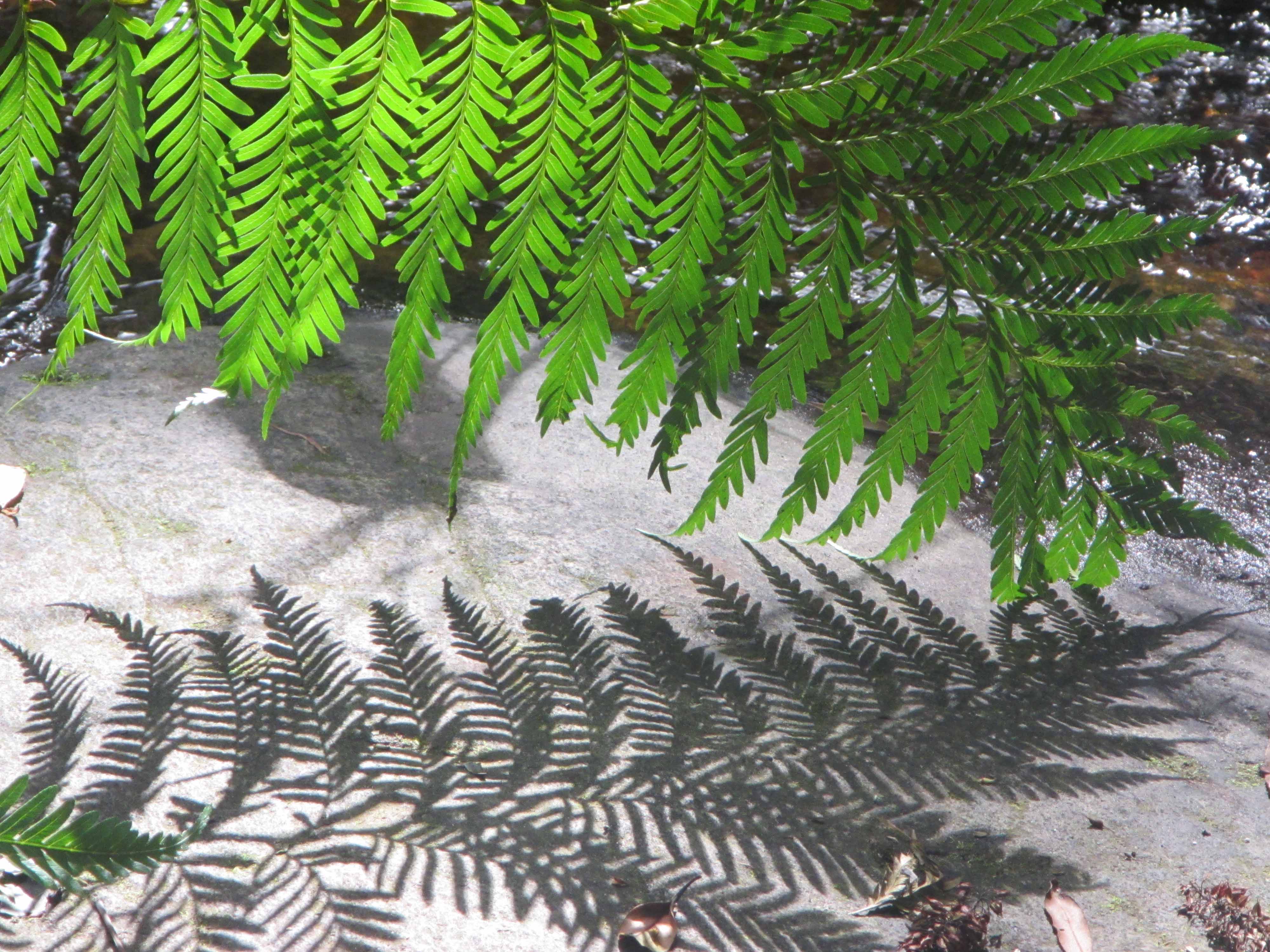
In the mid-afternoon we arrived at another patch of forest. This particular patch of forest was my favorite of the trip as it felt particularly enchanting. There are several rusty red colored streams cascading through the thick green vegetation of this section of the forest. There are also many tall, wide green ferns. In this section of forest, I felt as if we would come across Tarzan or maybe a dinosaur!
Crossing one of the rusty red streams of the forest.Twin tall trees… with a vine!Another view of the forest.A lovely forest stream.A fern and its shadow.More ferns.
After we emerged from the forest, we found the jeep track leading to Keurbos Hut. At long last, we arrived at the hut itself:
Arriving at Keurbos Hut.
That’s all I have for Day #3 on the Tsitsikamma Trail. Stay tuned for Day #4!
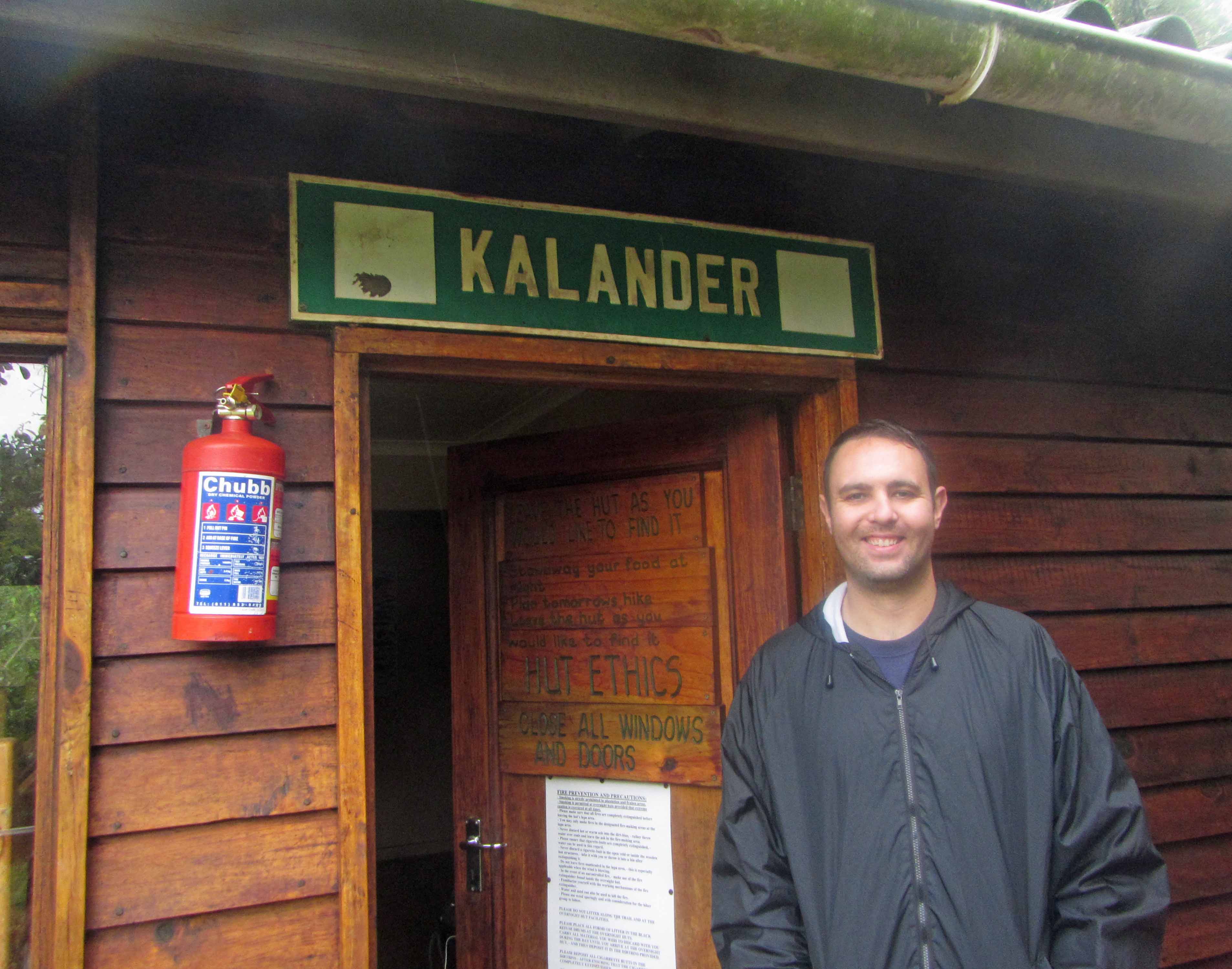
Yours truly posing with some shell fossils near Kalander Hut.
Today, I’m continuing with my posts about my recent backpacking trip along the Tsitsikamma Trail in South Africa with my husband Jackie and five of our friends. Earlier today, I realized that blogging about my Tsitsikamma Trail trip this week is appropriate since this is Earth Science Week and The Geological Society is encouraging people to participate in what they are calling, “The Great Geology Walk”. This event is aimed at getting, “as many people as possible will take notice of the geology all around them during this year’s Earth Science Week.” The Geological Society is encouraging people to share pictures of the geology they observe around them and also encouraging people to participate in organized and self-guided geology walks. This week I’m pretty busy with my day job and also with paper revisions in the evenings, so I guess my geology walk will be virtual. I’ll relive (and share with my blog readers) my Tsitsikamma Trail hike. Perhaps on Friday afternoon or Saturday I can escape for a real-life geology walk as well!
Today I’ll be blogging about Day #2 of the Tsitsikamma Trail hike. On Day #2 we hiked approximately 17 km from Kalander Hut to Blaauwkrans Hut. The trail website says that the hike is 13.5 km, but the trail website is out-of-date. The day’s hike has been re-routed and lengthened to about 17 km, making the hike long and challenging. We didn’t realize that the trail had been re-routed until after we were more than halfway done with the hike. I think that was actually a good thing! Once we were more than halfway done, we decided that we may as well carry on to the next hut!
In any case, although we were exhausted, very hungry, and quite sore when we finally arrived at Blaauwkrans Hut in the late afternoon, the hike was well worth the effort and the little aches and pains. The trail wound its way from the beach, up a steep escarpment, across mountain fynbos, and through indigenous afromontane forest. Along the way, we saw fossils; tilted Table Mountain sandstones; rusty red, coca-cola colored streams and waterfalls; giant protea flowers and tall, tall yellowwood trees; various animal footprints; a large land snail; and many other wonderful sights. At the end of the 17 km hike, we arrived at the hut, which is in a truly breathtakingly beautiful location. The hut is perched on the edge of a deep ravine and overlooks a double waterfall.
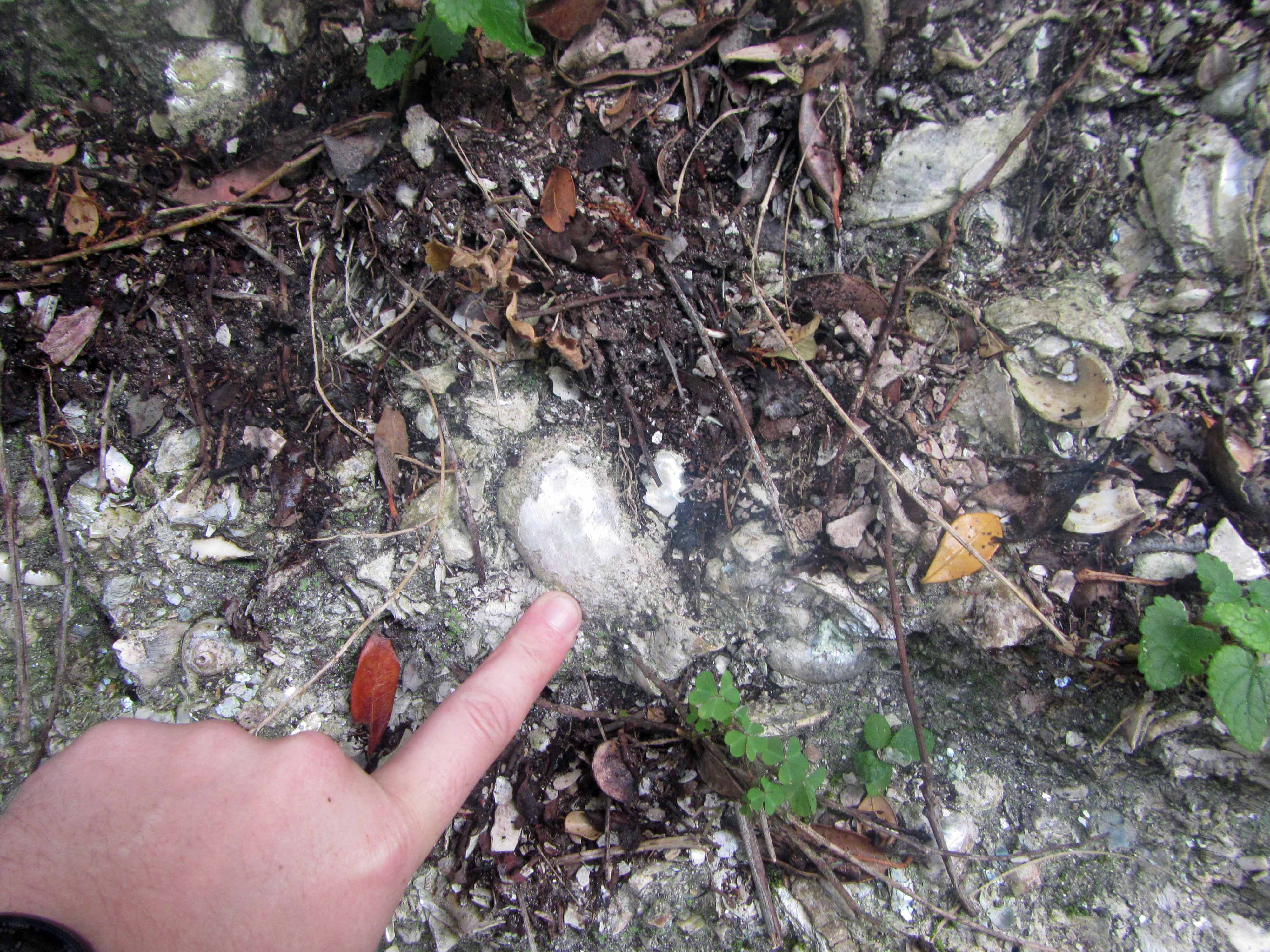
The hike started out by passing an outcrop with fossils, which made me quite happy:
Shell fossils exposed in outcrop near Kalander Hut.Another view of the shell fossil outcrop, with finger for scale.
The fossil outcrop is located just a few minutes’ walk from the Kalander Hut. I wasn’t able to find (in a quick Google search, at least) any information about the fossils, but they look like fairly young shell fossils in loosely-consolidated sediments of a vegetation-covered beach dune. If anyone knows any more about the fossils near Kalander Hut, please let me know. I’d love to learn more about them.
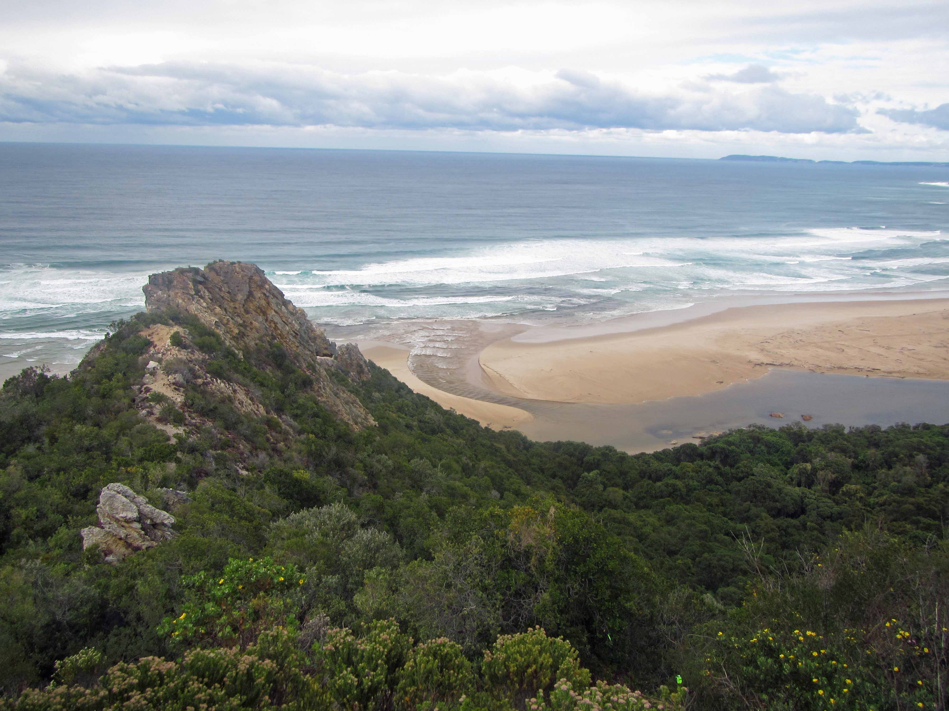
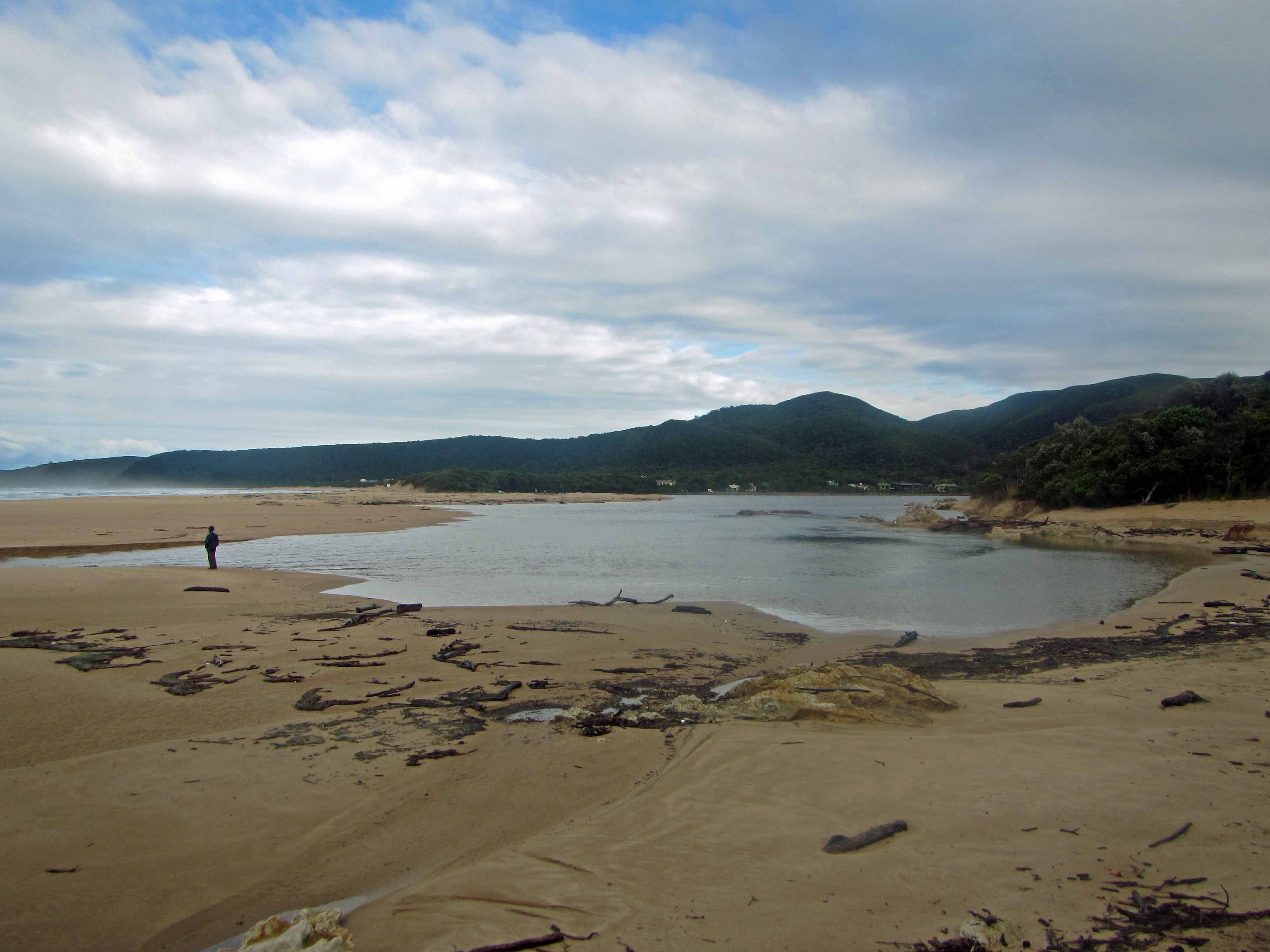
After the group dragged me away from the fossil outcrop, we started the steep hike up the escarpment and into the Tsitsikamma Mountains. After we finished huffing and puffing our way up onto the escarpment, we were rewarded with a beautiful view of the Nature’s Valley beach below:
The beach at Nature’s Valley, viewed from above.Another view of the Nature’s Valley beach.Yet another view of the Nature’s Valley beach. That’s mountain fynbos in the foreground.Jackie and I posing with the beach in the background.
After we recovered from the steep start to the hike, we continued along the trail, which cut through rich mountain fynbos vegetation:
The trail leading through the fynbos.
Here’s a pretty protea plant we saw:
A lovely red protea.
Here’s the group on the trail:
Hanging out amongst the fynbos. We don’t look too tired yet.
We didn’t encounter many animals along the trail, but we did observe many animal tracks. Here are a couple of the tracks we saw:
Animal tracks #1.Animal tracks #2.
After awhile, we made our way into the indigenous afromontane forest. The forest felt very old and magical and was full of tall trees (such as yellowwood trees), bright red and orange mushrooms, and thick green vegetation. I felt almost as if I had stepped into a fairytale world. I half expected to encounter hobbits, elves, or fairies along the path.
The path through the forest.An interesting, fuzzy plant. Anyone know what it’s called?Another view of the fuzzy plant.Mushrooms on a log.Jackie posing next to a tall tree.Jackie and I making our way along a wider part of the trail.A snail on the path.
We stopped for lunch by a coca-cola colored waterfall cascading over some Table Mountain sandstone rocks:
A coca-cola colored waterfall and pool.
We didn’t stop for lunch for too long because it started to rain:
A coca-cola colored waterfall and pool.
Fortunately, we (well, at least two of us!) were well-prepared for the rain:
Protected by large rain ponchos.
After a couple more hours of hiking through the forest, we arrived at the jeep track leading to the Blaauwkrans Hut:
Hiking along the jeep track.
We followed the jeep track for a few kilometers. As we continued, we could see the Bloukrans Bridge in the distance:
Bloukrans (or Blauuwkrans or Bloukrantz… there are several spellings!) Bridge.
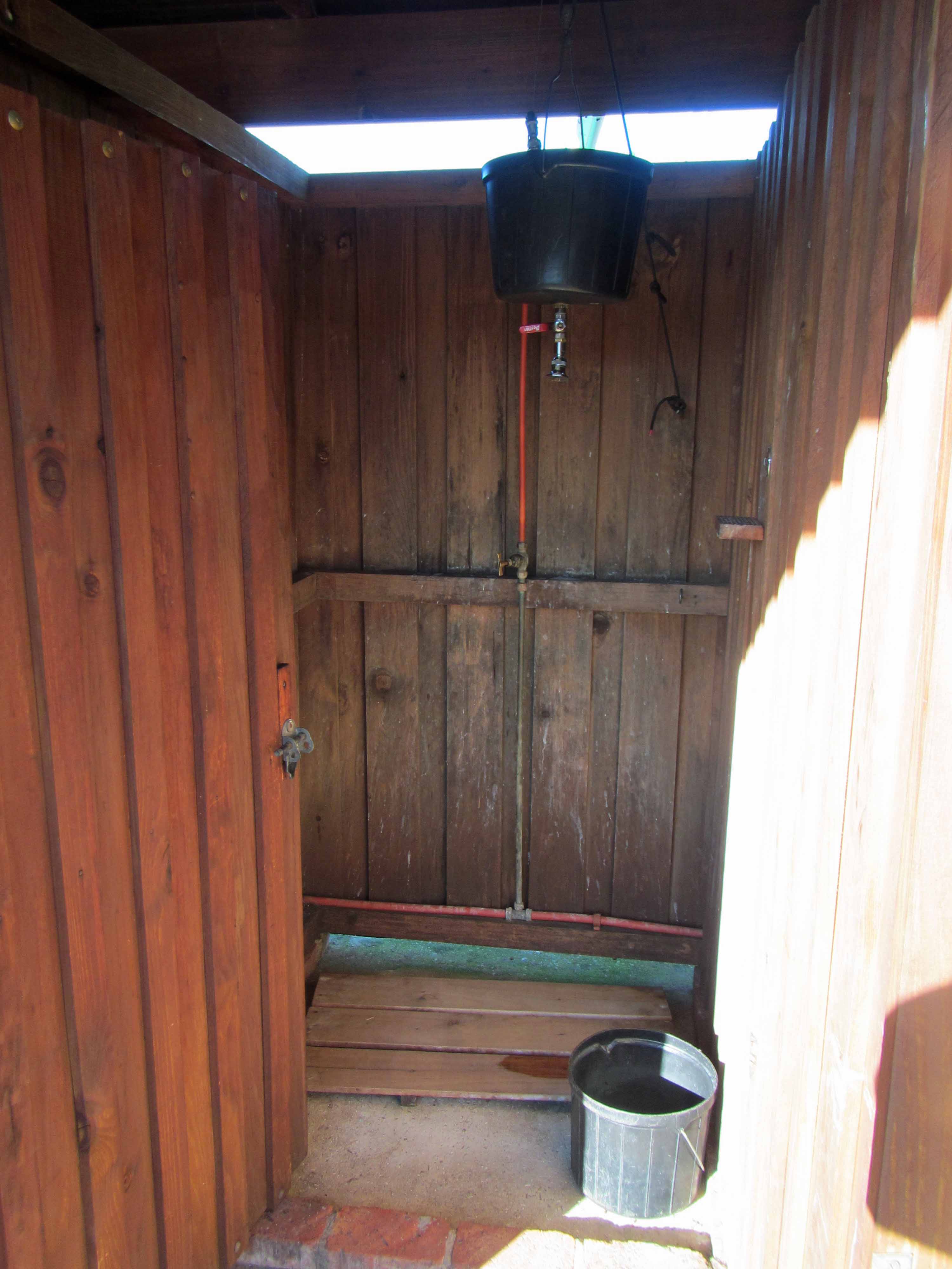
Here are some more views of the hut and its associated facilities:
The sleeping hut.Lapa / cooking area.The view from the lapa area, taken on the morning of Day #3, when the sun was out again.The hot water shower. You heat water in a kettle and put it in the big black bucket. After diluting the boiling water with some cool water, you can take a wonderfully refreshing hot shower that lasts a few minutes.
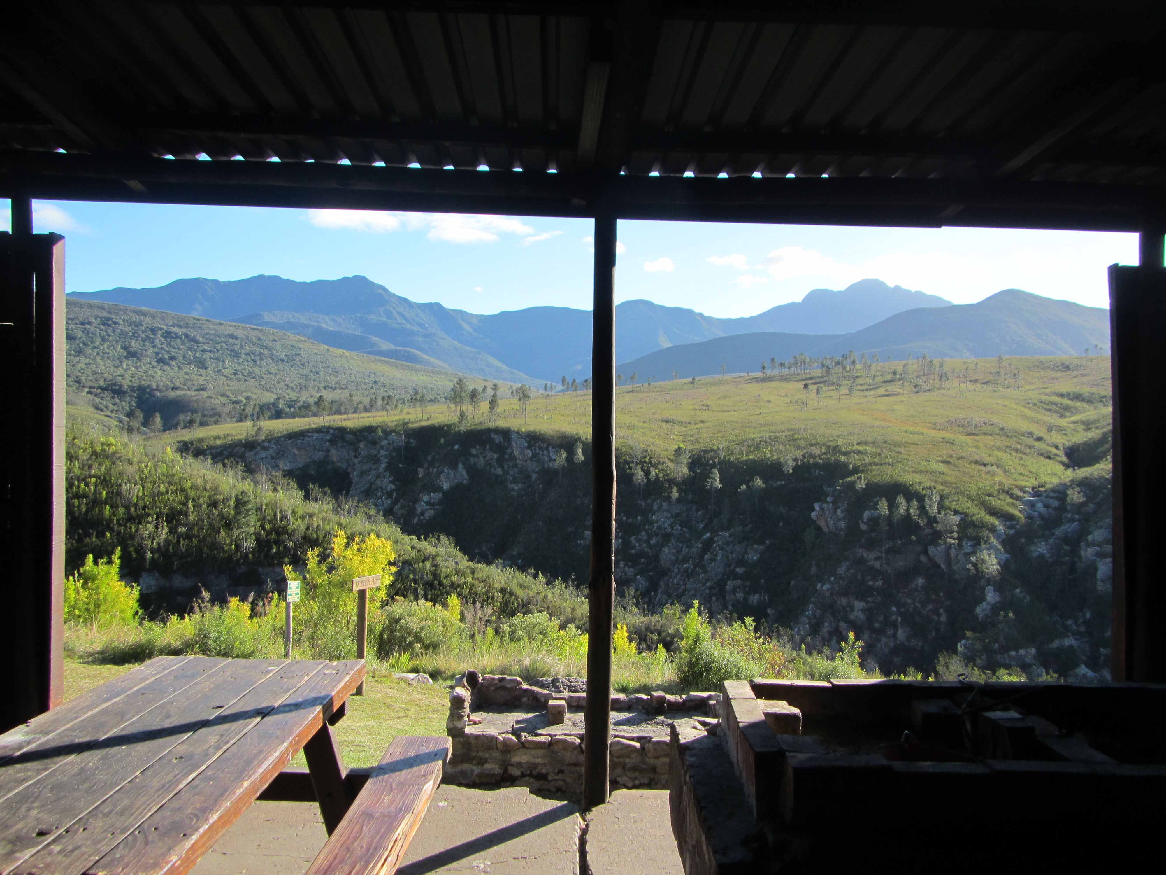
Last but not least, here is the view from the front porch of the sleeping hut:
The view of the waterfalls from Blaauwkrans Hut. I think this view makes the 17 km hike worthwhile!
Isn’t that double waterfall stunning? Here’s a closer view:
A coca-cola colored double waterfall. You can swim in those pools!
Here’s a picture of Jackie and me on the front porch of the hut:
Tired but happy hikers.
We saw some animals during our stay at Blaauwkrans Hut. We saw a troop of baboons hanging out above the waterfall:
Baboons.
We also saw a genet, but it moved too quickly for us to take a picture.
Well, that’s it for Day #2 of the Tsitsikamma Trail. Stay tuned for Day #3!
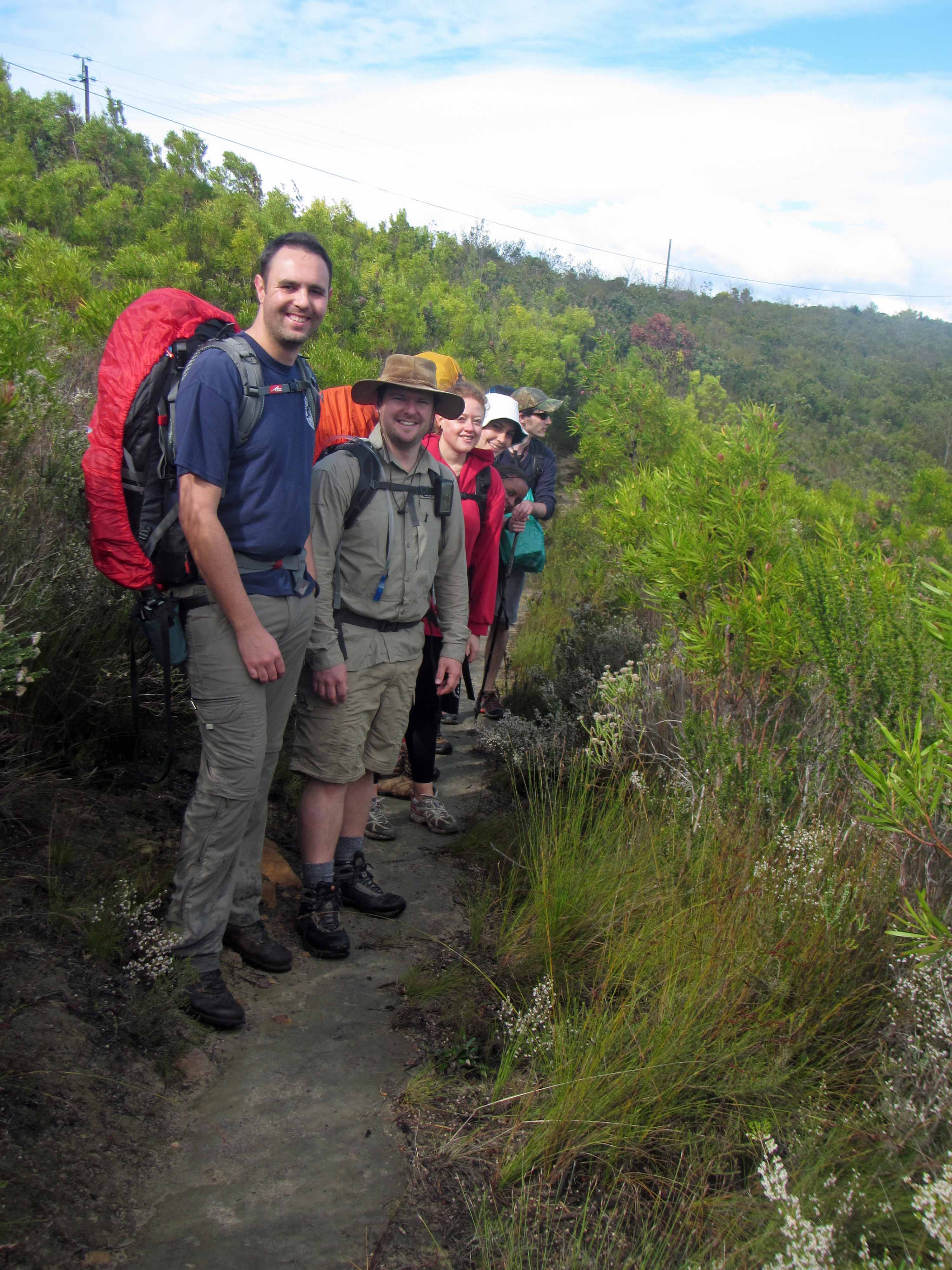
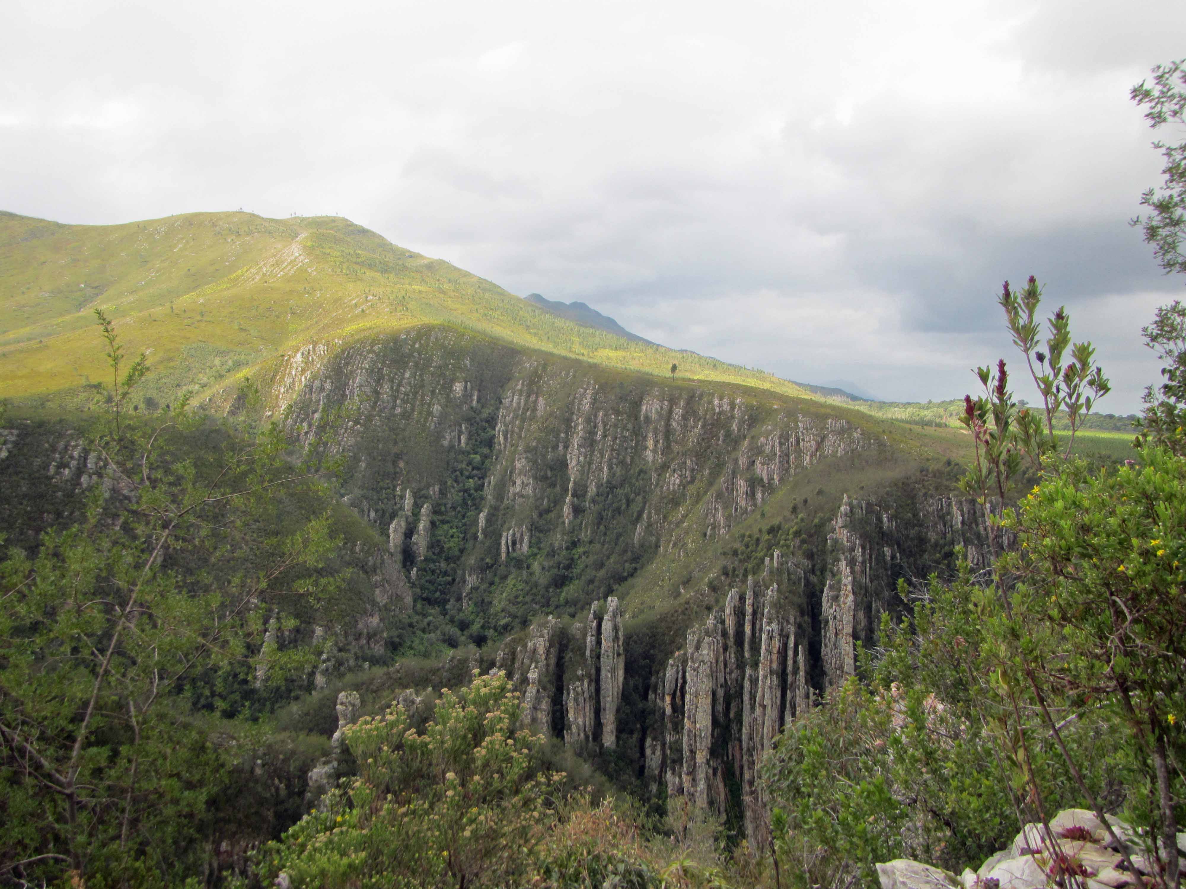
A couple of weeks ago, I went on a backpacking trip with my husband Jackie and five of our friends. We drove from our home in Cape Town, South Africa about seven hours down the coast to the Garden Route National Park. We went to hike the Tsitsikamma Trail, a 6 day, 60 km long trail that winds its way through the beautiful Tsitsikamma Mountains, which contain areas of indigenous afromontane forest and mountain fynbos. Fynbos is a type (a floral kingdom, in fact!) of shrubland or heathland vegetation that is found only in the southwestern part of South Africa. Fynbos is known for its high biodiversity and for its large numbers of endemic plants– that is, plants that are found nowhere else in the world. The Tsitsikamma Trail also meanders past a beautiful beach on the Indian Ocean, amongst impressive exposures of Table Mountain sandstones, and across many beautiful rivers and streams, which are either clear or a rusty red color. The word Tsitsikamma comes from the Khoekhoe language and means “clear water” or, possibly, “place of much water” or “waters begin”.
Jackie, our friends, and I started hiking the Tsitsikamma Trail on Thursday, September 19th and completed the first four days of the hike, finishing on Sunday, September 22nd. We didn’t fail to complete the entire hike– we actually planned to do just four days of the hike. We decided to do just four days primarily because our vacation time was limited. I guess we were also a little worried about our fitness level! The hike was physically challenging, but all seven of us managed to keep up a fairly good pace, even while carrying heavy backpacks! After the hike, I was quite sore for a couple of days. However, the soreness was well worth it. The Tsitsikamma Mountains are full of magical places, and it was wonderful to spend four days re-connecting with the natural world, my smartphone turned off and my emails ignored.
The trail is very well maintained and organized. Along the trail, there are five huts where hikers can stay overnight. The huts are very nice with a sleeping area, a lapa (a covered cooking / fireplace area), flush toilets, running water, and showers. There is no electricity, but kettles can be used to heat water for hot showers. The huts (with the exception of Kalander Hut, which has limited service because the road to the hut recently washed away) are stocked with firewood and other supplies. The cost for using the huts is R70 (a little less than US $10) per person per night. The huts are regularly checked on and maintained by forest rangers, who also keep an eye on all the hiking groups. Many hikers carry their own gear (food, extra clothes, water, sleeping bags, etc.) in large backpacks. That’s the option that our group chose. However, hikers who want a more leisurely hiking experience can pay to have their gear portaged between huts and can just hike with day packs. Hikers don’t have to pack in too much (heavy!) water since there is plenty of fresh water along the trail. The huts all have running water, and there are many streams along the trail. It is safe to drink the water at most huts and from most streams. As a precaution, I did treat my water with sterilization tablets. However, many of my South African friends drank the water directly and suffered no ill effects. In any case, you only need to carry enough water for a day or part of a day.
Over four posts, I would like to share some pictures and information from our Tsitsikamma Trail hike. I will devote one post to every day of the hike.
Here is the hiking schedule we followed:
Day #1: Leave Cape Town early and drive 7 hours to the start of the hike in Nature’s Valley. Shuttle one car to the Lottering Plantation. Hike 3.6 km from Nature’s Valley to Kalander Hut.
Day #2: Hike approximately 17 km (note that the map below is outdated and that the trail has been re-routed and is now significantly longer) from Kalander Hut to Blaauwkrans (or Bloukrantz) Hut.
Day #3: Hike 13.4 km from Blauuwkrans Hut to Keurbos Hut.
Day #4: Hike 11.5 km along the “escape route” from Keurbos Hut to Lottering Plantation. Drive 7 hours back to Cape Town.
After four days of hiking and driving, we were fairly exhausted for work on Monday morning. Fortunately, the Tuesday was a public holiday (Heritage Day) in South Africa, so we only had to work one day before we had a day to rest.
Here are some maps showing the location of the Tsitsikamma Trail:
Google map showing the approximate location of the Garden Route National Park (B) relative to Cape Town (A). Click to enlarge.A map of the Tsitsikamma Trail.Click to enlarge.
Today, I’ll be sharing some pictures from the first day of our hike. The first day was a short hike to the Kalander Hut, which is located close to the beach. When we arrived at the hut, it was nearly dark. So, we visited the beach very quickly then prepared dinner. We visited the beach again early the next morning before we started on our long hike to Blaauwkrans Hut.
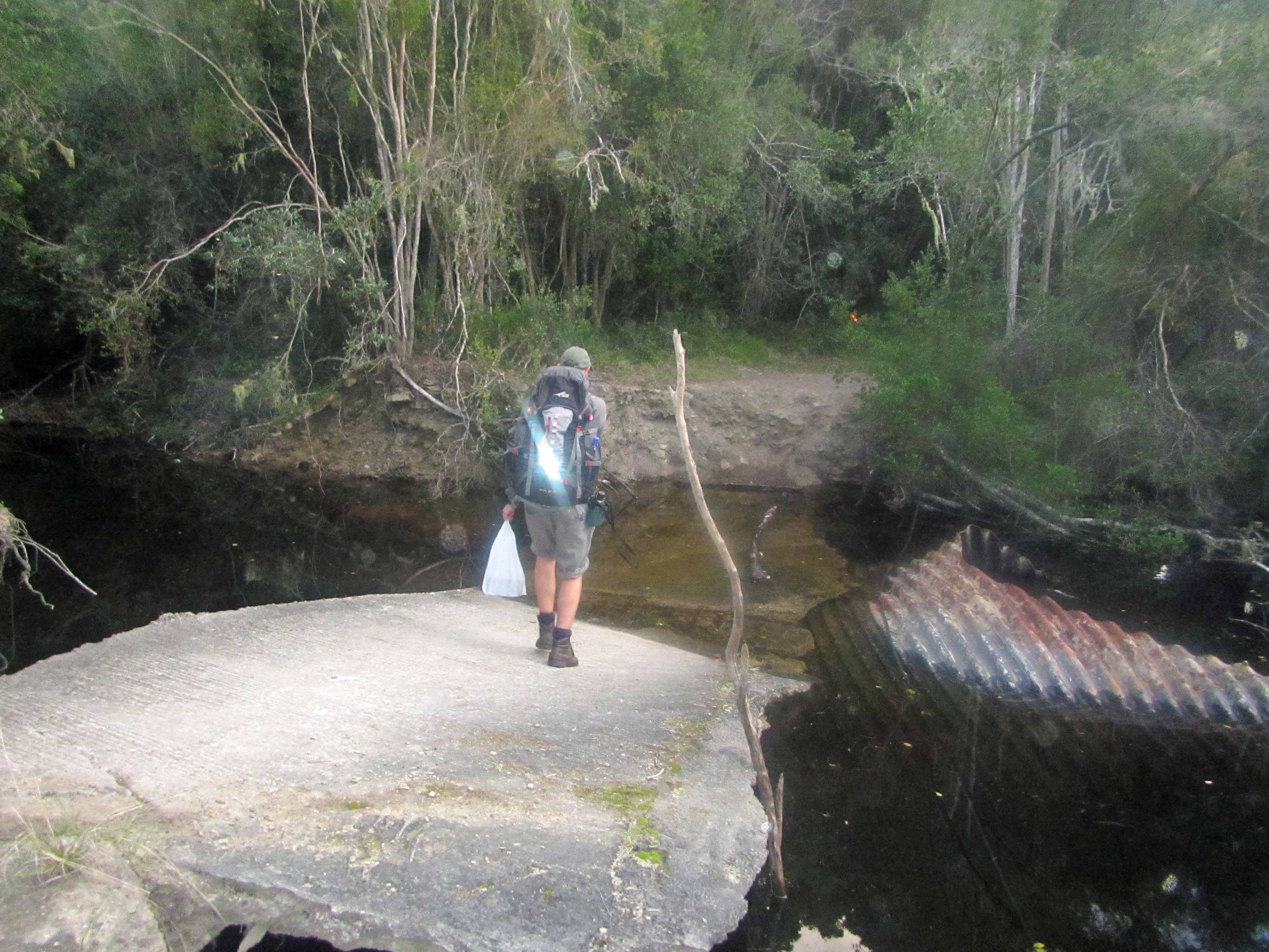
Jackie and I at the start of the hike. Jackie carried in firewood and beer for the first night. Fortunately, we only had to hike 3.6 km the first day!There is a jeep track leading to Kalander Hut, but it has collapsed / washed out at this river. However, hikers can still make it through to the hut! We took off our shoes and waded through the water, which was nearly to my knees at its deepest.Jackie in front of Kalander Hut.The beach near the Kalander Hut. The trench was dug (by park rangers with a backhoe) the night before to alleviate inland flooding. By morning, there was a swift river running through the trench!Swiftly flowing waters in the trench.Cliff near the beach.Informational signs on the beach, perched far above high tide and rouge waves.A close-up of some beach rocks.Beach flowers.The hiking group on the beach, wearing various shades of rain gear.
Last weekend my geologist husband Jackie and I visited the Robertson area of South Africa. On Saturday morning we visited a lovely little place called “Gnoem Gnoemskloof” (pronounced like “Noom Noomskloof”) at the invitation of Francie, a woman who emailed me to ask if I could tell her more about the rocks on her family’s property. Jackie and I spent a couple of hours with Francie and her family looking at the various rocks on the property, which is nestled in the Breede River Valley.
The Breede River Valley is located in the Cape Fold Belt, and there’s a great description of the Breede River Valley’s geology (focused on how the geology affects vinticulture, but still a great article) located here. Jackie and I still need to take a look at a local geologic map, but we think that the sandstones exposed at Gnoem Gnoemskloof are part of the Cape Supergroup, specifically the Witteberg Group.
All of the rocks exposed at Gnoem Gnoemskloof are sandstones. If these sandstones do belong to the Witteberg Group as we suspect, then they are early Ordovician (490-439 million years) to early Carboniferous (363-290 million years) in age. Originally deposited in a flat-lying, shallow marine environment, the sandstones were subsequently folded during the formation of the supercontinent Pangea (~300 million years ago). The folding is quite complex in places, leading to some beautiful scenery in the Robertson area.
Some of the beautifully folded sandstones at Gnoem Gnoemskloof.Tilted and folded sandstones at Gnoem Gnoemskloof.Sandstones at Gnoem Gnoemskloof... next to the fantastic swimming hole!More sandstone terrain at Gnoem Gnoemskloof.
The sandstones exposed at Gnoem Gnoemskloof are fairly uniform. For the most part, they are comprised of pure quartz although in places they also contain a small amount of mica which makes them sparkly. One thing that surprised Francie and her family is the variety of colors found in the sandstone. The sandstone can be a white, slightly gray color (close to the original color of the sandstone) or a darker tan color or a rusty red color (caused by the oxidation of iron in the sandstone). The outside of the sandstone can also sometimes be dark black, probably due to surface weathering / precipitation of material similar to desert varnish.
Before Jackie and I visited, Francie and her family thought that perhaps the different colored rocks were different types of rocks. Jackie and I explained that all the rocks were the same type of rock: sandstone. Originally, most of the sandstones would have been similar in color (a white/gray color). However, post-depositional oxidation/reduction processes and weathering processes have changed the original color of many of the sandstones. Some of the sandstones also contain quartz veins, which formed when hot fluids circulated through the sandstones and re-precipitated some of the original quartz grains as quartz veins. Some sandstones contain dark black patches or nodules which are iron-rich concretions also formed during secondary alteration.
Here are some examples of the different colors found in the sandstones at Gnoem Gnoemskloof:
Sandstones of many colors #1.Sandstones of many colors #2. You can see quartz veins (bright white) and iron-rich (black) bands in this picture.Sandstones of many colors #3. Here you can see a rusty red, oxidized weathering zone and a lighter-colored, less-weathered interior.Sandstones of many colors #4. The upper rock has black, iron-rich areas and the lower rock has a coarse (big crystals) quartz vein.Sandstones of many colors #5. This sandstone contains several fine (small crystals) quartz veins.Sandstones of many colors #6. This sandstone had a thin black coating on one side-- perhaps something similar to desert varnish?
I think the lesson to be learned from the above photos is to never identify a rock by its color– or at least not by its color alone. Many rocks, such as sandstones, come in several colors. Geologists must use several features– texture, morphology, grain size, hardness, reaction with acid, taste (yes, taste), and many others– to identify a rock. Color is one feature used to identify a rock– but only with caution since the colors of rocks and minerals often vary due to the presence of trace elements and can also be modified through weathering and reduction/oxidation processes.
Although the sandstones at Gnoem Gnoemskloof come in many colors and have also been folded and uplifted, some of the original sandstone features such as ripple marks, cross-bedding, and even trace fossils have been preserved in places.
An exposure of sandstone. Along this exposure we observed ripple marks and trace fossils.Ripple marks, with hammer for scale.Cross-bedding, with my handsome husband Jackie for scale.Jackie explains cross-bedding to Francie's husband and the rest of us (out of the picture).A closer view of some cross-bedding. Look at how the red color (from iron oxidation) makes the cross bedding stand out! Neat, isn't it?Trace fossils, located about 2 meters away from the ripple marks shown above.
We found the trace fossils particularly interesting, but neither Jackie nor I are fossil experts. Therefore, I sent the fossil pictures through to fellow geoloblogger Tony Martin, an ichnologist who blogs at Life Traces of the Georgia Coast. Tony identified the trace fossils as, “Zoophycos ( ‘witchbroom’ pattern) and probably Scolicia (tube with meniscae).”
Here’s an annotated version of the picture above:
Trace fossils, with labels.
I asked Tony to write up a little something about the Zoophycos trace fossil, and here’s what he wrote:
Zoophycos is a beautiful, complex trace fossil with a wide geologic range, from the Lower Cambrian Period to the Holocene Epoch. It serves as the namesake of the Zoophycos ichnofacies, an assemblage of invertebrate trace fossils that mostly represent sediment feeding in deeper, quiet-water marine environments. But this trace fossil also occurs in shallow-water (shelf) deposits from the Paleozoic Era. I’ve encountered it in Ordovician shallow-marine rocks of Ohio-Kentucky and Carboniferous prodelta rocks of Kentucky. So for it to be in Ordovician prodelta rocks of South Africa is probably not too unusual, but might be worthy of further investigation by ichnologists who work specifically with Zoophycos. (Surprisingly, it’s more than one person!)
How was Zoophycos made, and what made it? That’s been the subject of lots of discussion among ichnologists, but everyone agrees that it is a systematic feeding trace, in which its maker repeatedly probed into the sediment and shifted its position each time, making “lobes.” These lobes then overlap and spiral in one direction or another, making what some researchers have described as a “Chinese hat” arrangement. Because of its long geologic range, it obviously has not been made by a single species of animal, but rather reflects an identical behavior expressed by many species over the past 500+ million years. These trace fossils were most likely made by a marine worm, and the best candidates so far are sipunculids, also known as peanut worms.
Thanks for the information, Tony! Fascinating! If you’re ever in South Africa, we’ll have to take you down to Gnoem Gnoemskloof to have a look at the trace fossils in person.
Here’s a few more pictures of the trace fossils:
Another view of the trace fossils.Yet another view of the trace fossils.And yet another view of the trace fossils.
Francie, thanks so much for inviting us out to Gnoem Gnoemskloof! We had a lovely time checking out your beautiful property and your rocks. I hope that Jackie and I were able to help you better understand the geology of your property. We’ll have to come back in the summertime to take a dip in your swimming hole!