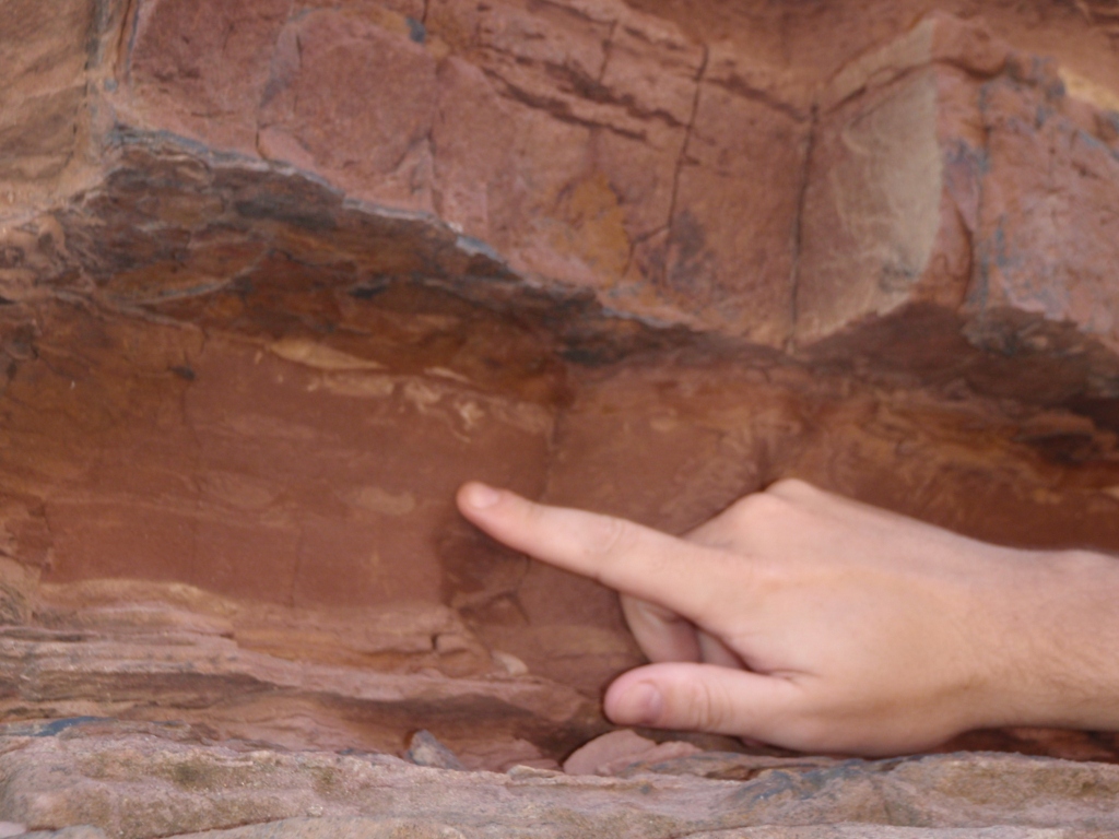
Teeny tiny footprints, with hammer for scale.Little duiker footprint!
When my husband and I visited Gnoem Gnoemskloof in the Robertson area of South Africa a little over a week ago, we noticed some teeny tiny footprints, shown above with a rock hammer for scale. We’re not animal footprint experts, but we suspect that these tiny footprints belong to the duiker, a little antelope which is found throughout sub-saharan Africa. Most likely, these are footprints of the common duiker.
I have yet to take a good picture of a duiker in the wild (these little antelope move quickly!), but here are a few pictures of duiker in a small zoo in Knysna, South Africa:
A little duiker taking a drink.Another little duiker.A little duiker house.All nestled in the little house.
Aren’t these little duiker cute? I especially love their little houses!
Last weekend my geologist husband Jackie and I visited the Robertson area of South Africa. On Saturday morning we visited a lovely little place called “Gnoem Gnoemskloof” (pronounced like “Noom Noomskloof”) at the invitation of Francie, a woman who emailed me to ask if I could tell her more about the rocks on her family’s property. Jackie and I spent a couple of hours with Francie and her family looking at the various rocks on the property, which is nestled in the Breede River Valley.
The Breede River Valley is located in the Cape Fold Belt, and there’s a great description of the Breede River Valley’s geology (focused on how the geology affects vinticulture, but still a great article) located here. Jackie and I still need to take a look at a local geologic map, but we think that the sandstones exposed at Gnoem Gnoemskloof are part of the Cape Supergroup, specifically the Witteberg Group.
All of the rocks exposed at Gnoem Gnoemskloof are sandstones. If these sandstones do belong to the Witteberg Group as we suspect, then they are early Ordovician (490-439 million years) to early Carboniferous (363-290 million years) in age. Originally deposited in a flat-lying, shallow marine environment, the sandstones were subsequently folded during the formation of the supercontinent Pangea (~300 million years ago). The folding is quite complex in places, leading to some beautiful scenery in the Robertson area.
Some of the beautifully folded sandstones at Gnoem Gnoemskloof.Tilted and folded sandstones at Gnoem Gnoemskloof.Sandstones at Gnoem Gnoemskloof... next to the fantastic swimming hole!More sandstone terrain at Gnoem Gnoemskloof.
The sandstones exposed at Gnoem Gnoemskloof are fairly uniform. For the most part, they are comprised of pure quartz although in places they also contain a small amount of mica which makes them sparkly. One thing that surprised Francie and her family is the variety of colors found in the sandstone. The sandstone can be a white, slightly gray color (close to the original color of the sandstone) or a darker tan color or a rusty red color (caused by the oxidation of iron in the sandstone). The outside of the sandstone can also sometimes be dark black, probably due to surface weathering / precipitation of material similar to desert varnish.
Before Jackie and I visited, Francie and her family thought that perhaps the different colored rocks were different types of rocks. Jackie and I explained that all the rocks were the same type of rock: sandstone. Originally, most of the sandstones would have been similar in color (a white/gray color). However, post-depositional oxidation/reduction processes and weathering processes have changed the original color of many of the sandstones. Some of the sandstones also contain quartz veins, which formed when hot fluids circulated through the sandstones and re-precipitated some of the original quartz grains as quartz veins. Some sandstones contain dark black patches or nodules which are iron-rich concretions also formed during secondary alteration.
Here are some examples of the different colors found in the sandstones at Gnoem Gnoemskloof:
Sandstones of many colors #1.Sandstones of many colors #2. You can see quartz veins (bright white) and iron-rich (black) bands in this picture.Sandstones of many colors #3. Here you can see a rusty red, oxidized weathering zone and a lighter-colored, less-weathered interior.Sandstones of many colors #4. The upper rock has black, iron-rich areas and the lower rock has a coarse (big crystals) quartz vein.Sandstones of many colors #5. This sandstone contains several fine (small crystals) quartz veins.Sandstones of many colors #6. This sandstone had a thin black coating on one side-- perhaps something similar to desert varnish?
I think the lesson to be learned from the above photos is to never identify a rock by its color– or at least not by its color alone. Many rocks, such as sandstones, come in several colors. Geologists must use several features– texture, morphology, grain size, hardness, reaction with acid, taste (yes, taste), and many others– to identify a rock. Color is one feature used to identify a rock– but only with caution since the colors of rocks and minerals often vary due to the presence of trace elements and can also be modified through weathering and reduction/oxidation processes.
Although the sandstones at Gnoem Gnoemskloof come in many colors and have also been folded and uplifted, some of the original sandstone features such as ripple marks, cross-bedding, and even trace fossils have been preserved in places.
An exposure of sandstone. Along this exposure we observed ripple marks and trace fossils.Ripple marks, with hammer for scale.Cross-bedding, with my handsome husband Jackie for scale.Jackie explains cross-bedding to Francie's husband and the rest of us (out of the picture).A closer view of some cross-bedding. Look at how the red color (from iron oxidation) makes the cross bedding stand out! Neat, isn't it?Trace fossils, located about 2 meters away from the ripple marks shown above.
We found the trace fossils particularly interesting, but neither Jackie nor I are fossil experts. Therefore, I sent the fossil pictures through to fellow geoloblogger Tony Martin, an ichnologist who blogs at Life Traces of the Georgia Coast. Tony identified the trace fossils as, “Zoophycos ( ‘witchbroom’ pattern) and probably Scolicia (tube with meniscae).”
Here’s an annotated version of the picture above:
Trace fossils, with labels.
I asked Tony to write up a little something about the Zoophycos trace fossil, and here’s what he wrote:
Zoophycos is a beautiful, complex trace fossil with a wide geologic range, from the Lower Cambrian Period to the Holocene Epoch. It serves as the namesake of the Zoophycos ichnofacies, an assemblage of invertebrate trace fossils that mostly represent sediment feeding in deeper, quiet-water marine environments. But this trace fossil also occurs in shallow-water (shelf) deposits from the Paleozoic Era. I’ve encountered it in Ordovician shallow-marine rocks of Ohio-Kentucky and Carboniferous prodelta rocks of Kentucky. So for it to be in Ordovician prodelta rocks of South Africa is probably not too unusual, but might be worthy of further investigation by ichnologists who work specifically with Zoophycos. (Surprisingly, it’s more than one person!)
How was Zoophycos made, and what made it? That’s been the subject of lots of discussion among ichnologists, but everyone agrees that it is a systematic feeding trace, in which its maker repeatedly probed into the sediment and shifted its position each time, making “lobes.” These lobes then overlap and spiral in one direction or another, making what some researchers have described as a “Chinese hat” arrangement. Because of its long geologic range, it obviously has not been made by a single species of animal, but rather reflects an identical behavior expressed by many species over the past 500+ million years. These trace fossils were most likely made by a marine worm, and the best candidates so far are sipunculids, also known as peanut worms.
Thanks for the information, Tony! Fascinating! If you’re ever in South Africa, we’ll have to take you down to Gnoem Gnoemskloof to have a look at the trace fossils in person.
Here’s a few more pictures of the trace fossils:
Another view of the trace fossils.Yet another view of the trace fossils.And yet another view of the trace fossils.
Francie, thanks so much for inviting us out to Gnoem Gnoemskloof! We had a lovely time checking out your beautiful property and your rocks. I hope that Jackie and I were able to help you better understand the geology of your property. We’ll have to come back in the summertime to take a dip in your swimming hole!
A few weeks ago on Twitter, I expressed amazement that I had accumulated 800 followers. Unfortunately, I neglected to save the series of tweets, but I tweeted something along the lines of: “Wow. 800 followers. I can’t believe so many people are interested in ophiolites and trace fossils.” I tweeted this because ophiolites and trace fossils are the topics I have been blogging about the most in recent months.
In response, a number of my twitter followers assured me that they loved ophiolites and trace fossils. Some people also joked, “We just follow you for Geokittehs.” Then fellow geoblogger Tony Martin suggested that I post an ophiolite and trace fossil mash-up post to see how many twitter followers I would gain. I laughed and said I would do so, but a few weeks have slipped by since I’ve been so busy working on my thesis.
At this moment, I have 981 Twitter followers. That means I’ve accumulated almost 200 new followers in a few weeks! Since I haven’t posted all that much on Georneys, I attribute most of that to my Geokittehs posts :-).
I normally don’t worry too much about how many Twitter followers I have or how much traffic this blog receives. I really enjoy writing Georneys, and if other people enjoy reading Georneys then that’s just icing on the cake for me. However, I do find myself amazed that I have accumulated nearly 1,000 Twitter followers and that so many people read– and sometimes enjoy!– my geological musings. That’s really great. I’m happy that I reach so many people and, in some cases, help them understand geology a little bit better. I also really enjoy and appreciate the interactions I have with other geologists through this blog. Perhaps, then, the more Twitter followers I have, the merrier.
So, I think I will take up Tony’s challenge. Below is a mash-up of pictures of ophiolites and trace fossils. I’ve only visited two ophiolites, and many of the trace fossil pictures are actually just traces, but hopefully this ophiolite and trace fossil mash-up is good enough to gain me some more tweeps. If you appreciate this mash-up, please consider following me on Twitter. My user name is @GeoEvelyn. I’ll check back in a week to see how many twitter followers I’ve gained (or lost) as a result of this mash-up. In any case, enjoy!
Ophiolite:
Garnet peridotite (from more than 300 km depth!) exposed at Alpi Arami, Switzerland, June 2010.
Trace Fossil:
Dinosaur footprint, Western USA, Fall 2005.
Ophiolite:
Dunite channels (light brown) in harzburgite (darker brown), Samail Ophiolite, Oman, January 2009.
Trace Fossil:
Footprints on the beach, Woods Hole, Cape Cod, December 2010.
Ophiolite:
Pillow Basalts in the Samail Ophiolite, Oman, January 2012.
Trace Fossil:
More dinosaur footprints, Western USA, Fall 2005.
Ophiolite:
Hyperalkaline (pH ~12) pool in the peridotite layer of the Samail Ophiolite, Oman, January 2009.
Trace Fossil:
Crab house in the sand, Barr Al-Hikman, Oman, January 2012.
Ophiolite:
Examining ophicarbonate rocks in Davos, Switzerland... in JUNE! There's ophiolite in this picture, I swear. Switzerland, June 2010.
Trace Fossil:
Penguin burrow. With Penguin. Simonstown, South Africa, January 2008.
Ophiolite:
Sheeted dikes in the Samail Ophiolite, Oman, January 2012.
Trace Fossil:
Crab and gastropod traces, Barr Al-Hikman, Oman, January 2012.
Ophiolite:
Hiking in the Samail Ophiolite as sunset approaches, Oman, January 2009.
Trace Fossil:
Cat footprints in the snow, New Hampshire, December 2010.
Cat:
Zayna on a walk in the snow. Yes, my awesome cat walks on a leash in the snow. New Hampshire, December 2010.
I put the cat photo in for good measure. Cat photos are always good for attracting internet followers.
"En garde!" says Mr. Red Crab. Barr Al-Hikman, Oman, January 2012.
My post yesterday about the crab houses in the sand at Barr Al-Hikman turned out to be quite popular, so I thought I’d share some more pictures of crabs and crab houses and other crab life traces which I observed at Barr Al-Hikman. In addition to the Ocypode saratan “ghost” crab (thanks for the identification help, Tony Martin!), I observed at least two other species of crab at Barr Al-Hikman.
The first species is a dark red colored crab that I observed when walking out on some of the modern coral and carbonate deposits. These crabs were scuttling about everywhere, but if you came too close to them they would dart into small cracks and crevices in the carbonates and put up their big claw defensively.
Mr. Red Crab looks ready for a fight, doesn’t he? Barr Al-Hikman, Oman, January 2012.
Hiding in a crevice… with a big claw for protection! Barr Al-Hikman, Oman, January 2012.
The second species of crab which I observed is a very tiny, tan-colored crab. We actually pulled this poor little guy out of his home. On several of the beaches, we noticed small holes surrounded by small balls of sand. The field trip leaders informed us that these the little balls of sand are called “sand bubbles” and that they are produced by the tiny crabs that live in the little holes. The sand bubbles are made by the crabs when they emerge from their holes during low tide to search for bits of food that have been brought in by the recent high tide. After they search through a few grains of sand, the crabs roll the sand grains into a tiny ball so that they don’t search the same sand grains again. Smart behavior, if you ask me! Sand bubbles can leave some spectacular patterns and designs on the beaches, as show in this article.
We were curious to see one of the little crabs responsible for the sand bubbles, so we decided to dig one of the little crabs out of his (or her?) “safe” little home. We took a shovel and started turning over some sand. Before long, we found a little crab. After inspecting him for a minute or two, we returned him to the beach, where he quickly dug himself back into the sand. I feel bad that we disturbed the little guy and destroyed his home, but it was neat to see him!
Crab holes and sand bubbles, with an Arabic Coca-Cola can for scale. Barr Al-Hikman, Oman, January 2012.Another view of the crab holes and sand bubbles. Barr Al-Hikman, Oman, January 2012.Digging out the poor little crab. Barr Al-Hikman, Oman, Janaury 2012.
“En Garde, giants!” says Mr. Little Crab. Barr Al-Hikman, Oman, January 2012.
Another view of Mr. Little Crab. Barr Al-Hikman, Oman, January 2012.
I’m not normally that interested in biology. Generally, I find biology stuff such as vegetation annoying since it covers up the interesting rocks. However, I enjoyed meeting these two crabs: Mr. Red Crab and Mr. Little Crab. Can anyone identify these two crab species and tell me more about them?
Crab house in the sand #1. Barr al-Hikman, Oman, January 2012.
Last month I participated in a three-day geology field trip to Barr Al-Hikman, a peninsula in Oman. On the peninsula there are numerous beautiful beaches and interesting geological features such as sabkhas and paleolagoons. We visited the peninsula to look at some recent carbonate deposits and also to investigate some modern beach features, such as the coral reefs located just off shore and the traces left on the beach by various modern critters. Yes, we went to the beach for three days. Being a geologist is fun sometimes! Seriously, though, looking at modern life traces gives geologists a better sense of how to identify trace fossils in the geologic record. If you want to learn more about traces and trace fossils, I recommend Tony Martin’sblog and forthcoming book Life Traces of the Georgia Coast. I’m certainly looking forward to the book!
I don’t normally study life traces or trace fossils, so looking at these traces in Oman was new and exciting for me. I don’t know much about the traces– other than what the field trip leaders told me– but I thought I’d share some pictures of some life traces I saw at Barr Al-Hikman. In this post I’m sharing some pictures of holes with piles of sand next to them. Apparently, these holes were dug by crabs. I’m not sure of the exact species. Does anyone know? I spotted a likely suspect a few meters from the holes.
Crab house in the sand #2. Barr al-Hikman, Oman, January 2012.Numerous crab holes and piles of sand, with our Land Cruisers in the distance. Barr Al-Hikman, Oman, January 2012.A likely suspect for the house-builder. And look at those traces being left by the living shell thingies (yes, I am the worst biologist ever). Barr Al-Hikman, Oman, January 2012.Mr. Crab... and some geologists in the background. Barr Al-Hikman, Oman, January 2012.
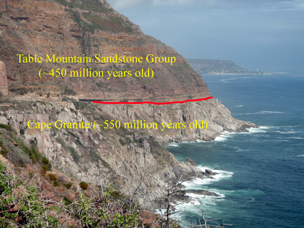
Chapman’s Peak Nonconformity, South Africa, May 2011.
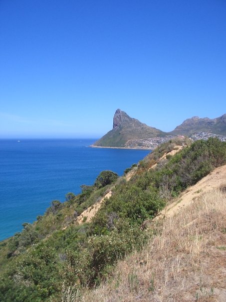
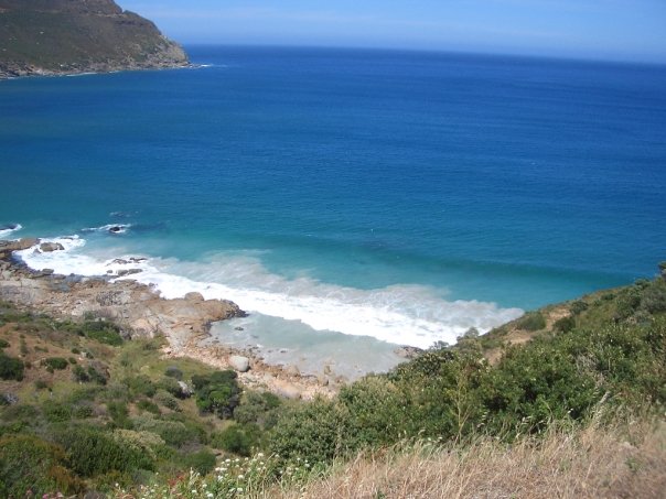
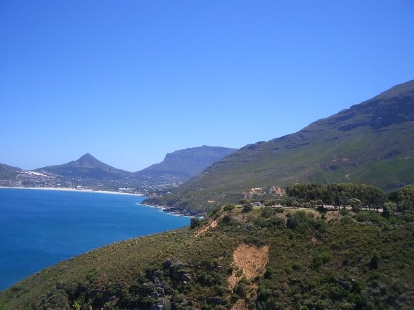
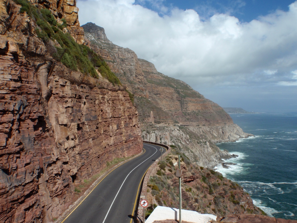
On my recent trip to South Africa (see also my recent posts Sevilla Rock Art Trail, The Maltese Cross, The “Peace in Africa” in Port, and Cape Peninsula in Pictures), I spent my very last day touring around Cape Town with my fiance, my future sister-in-law, and her boyfriend. One of the things that we did just before I headed to the airport was drive along the Chapman’s Peak Drive, a road just outside Cape Town that stretches from Noordhoek (which means “North Corner” in Afrikaans) to Houtbaai (which means “Wood Bay” in Afrikaans; the Afrikaans-English hybrid “Hout Bay” is commonly used). The drive follows the rocky coastline and provides breathtaking views. First constructed during World War I (and considered an incredible feat of engineering for the time), the drive was closed for a time in the 1990s due to safety concerns. The winding road is built on quite steep terrain and is frequently covered by rockfalls. However, the drive was re-opened in the 2000s (with reinforced safety features) as a scenic toll road catering to foreign tourists. However, there are many residents of Hout Bay and the surrounds who travel along Chapman’s Peak everyday. Occasionally, the drive is closed because of weather or rockfall.
Google map showing location of Chapman’s Peak Drive. Click to enlarge.
Google map showing location of Chapman’s Peak Drive (zoomed out). Note the location of Cape Peninsula just below the drive. Click to enlarge.
I highly recommend that every visitor to Cape Town go on the Chapman’s Peak Drive, which has gorgeous views of the coastline and ocean. If you are a geologist visiting Cape Town, you absolutely have to go on the Chapman’s Peak Drive. The reason is simple: the road follows a spectacular nonconformity between ~550 million year old Cape Peninsula granite and ~450 million year old sandstone of the Table Mountain Sandstone Group. The basal (bottom-most) layer of this sandstone group is called the Graafwater*. The Chapman’s Peak road was built by carving out the cliffside into the softer sandstones; the road itself rests on top of the harder granite.
Same picture as above, but with the nonconformity marked, South Africa, May 2011. Click to enlarge.
For those of you who are not geologists, a nonconformity is a place where there were igneous or metamorphic rocks that were eroded are in contact with overlying sedimentary rocks. Nonconformities form when, after a period of erosion, sedimentary rocks are deposited on top of igneous or metamorphic rocks. There is missing time (the time of erosion) in the rock record. Thus, there is a nonconformity of geologic time. At the Chapman’s Peak nonconformity, about 100 million years of time is missing in the geologic record. The word nonconformity is closely related to the word unconformity, which is a similar contact between two sedimentary rocks (or rock groups).
Here are some figures (taken from University of Cape Town Geology Department websites here and here) that give you a sense of the geology of the Cape Town area, including along the Chapman’s Peak Drive:
Postcard view of Cape Town. Taken from here. Click to enlarge.
Similar view to above postcard, but with rock types colored in. Figure taken from here. By the way, one of my favorite things to do in Cape Town is take a moonlight hike up Lion’s Head, the little knob of sandstone sticking out of the Cape Granite. Note the location of Hout Bay. Click to enlarge.
Rock types of Table Mountain, Cape Town. The red link marks the unconformity/nonconformity. Figure taken from here. Click to enlarge.
This University of Cape Town website has a good description of the geologic history of the Cape Town area. The oldest rock around Cape Town is the Malmesbury Group (alternating graywacke sandstone and slate), which was intruded by the Cape Granite (and some later dykes). Then there was erosion, and then the impressive Table Mountain Sandstone Group was deposited. I look forward to learning more about Cape Town geology when I move to Cape Town in August, but the above figures should give you a rough idea of the geology in which the Chapman’s Peak nonconformity is found.
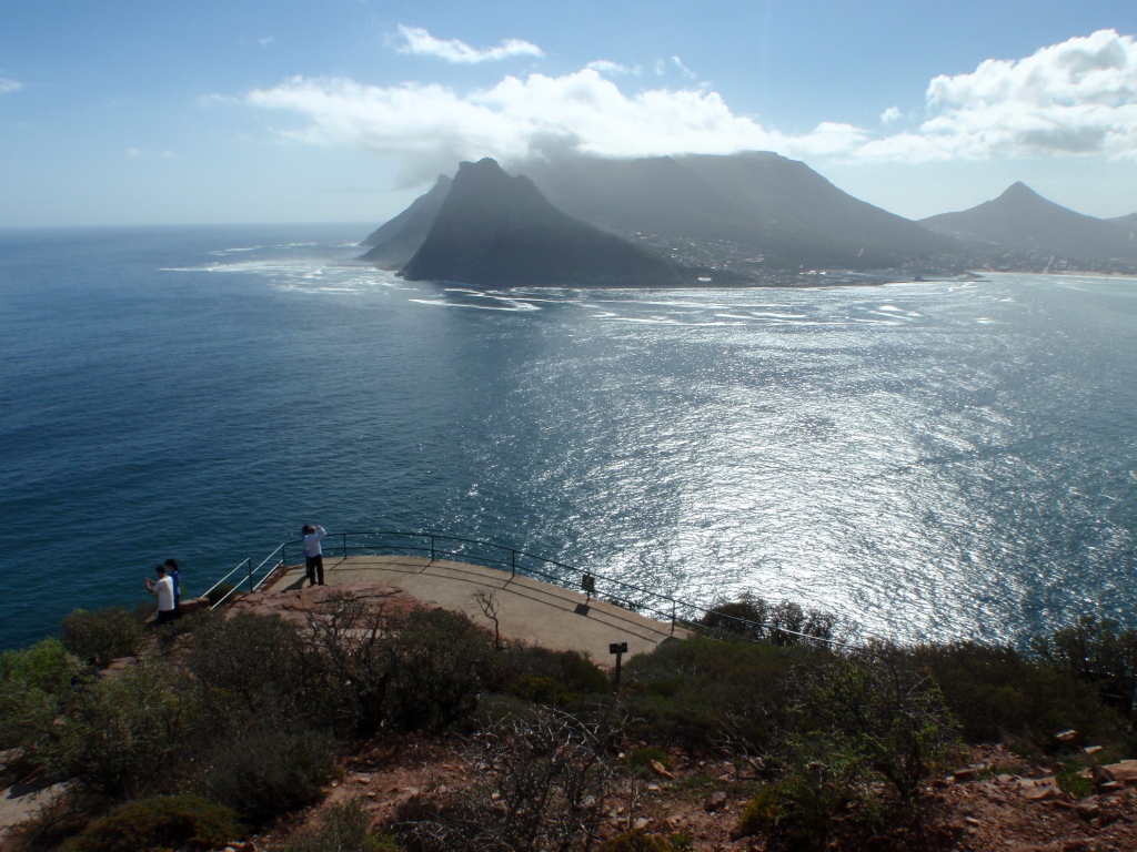
Below are some more pictures of Chapman’s Peak Drive. These pictures are from my recent trip and also from my first visit to the Chapman’s Peak Drive in January 2008.
Sign for the Chapman’s Peak Drive toll road, South Africa, January 2008.
A trio looking over Hout Bay, South Africa, May 2011.
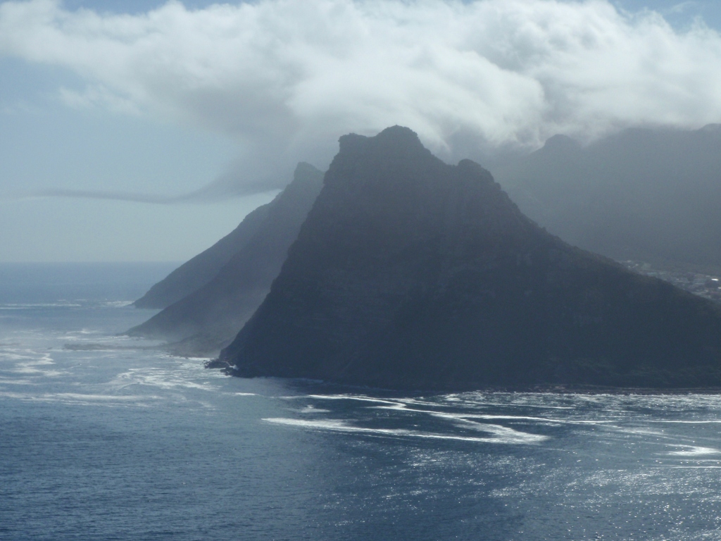
Another Hout Bay view, South Africa, May 2011.
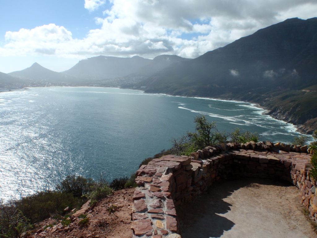
Viewing platform at Hout Bay, South Africa, May 2011.
Cliffs along Chapman’s Peak Drive, South Africa, May 2011.
Another viewing platform at Hout Bay, South Africa, May 2011.
Jackie contemplates some geology (and scenery), Hout Bay, South Africa, May 2011.
Hout Bay Sentinal, South Africa, January 2007.
Beach view, Chapman’s Peak Drive, South Africa, January 2008.
Looking across Hout Bay, South Africa, January 2008.
Another spectacular Chapman’s Peak Drive view, South Africa, January 2008.
Can you spot the nonconformity? Chapman’s Peak Drive, South Africa, January 2008.
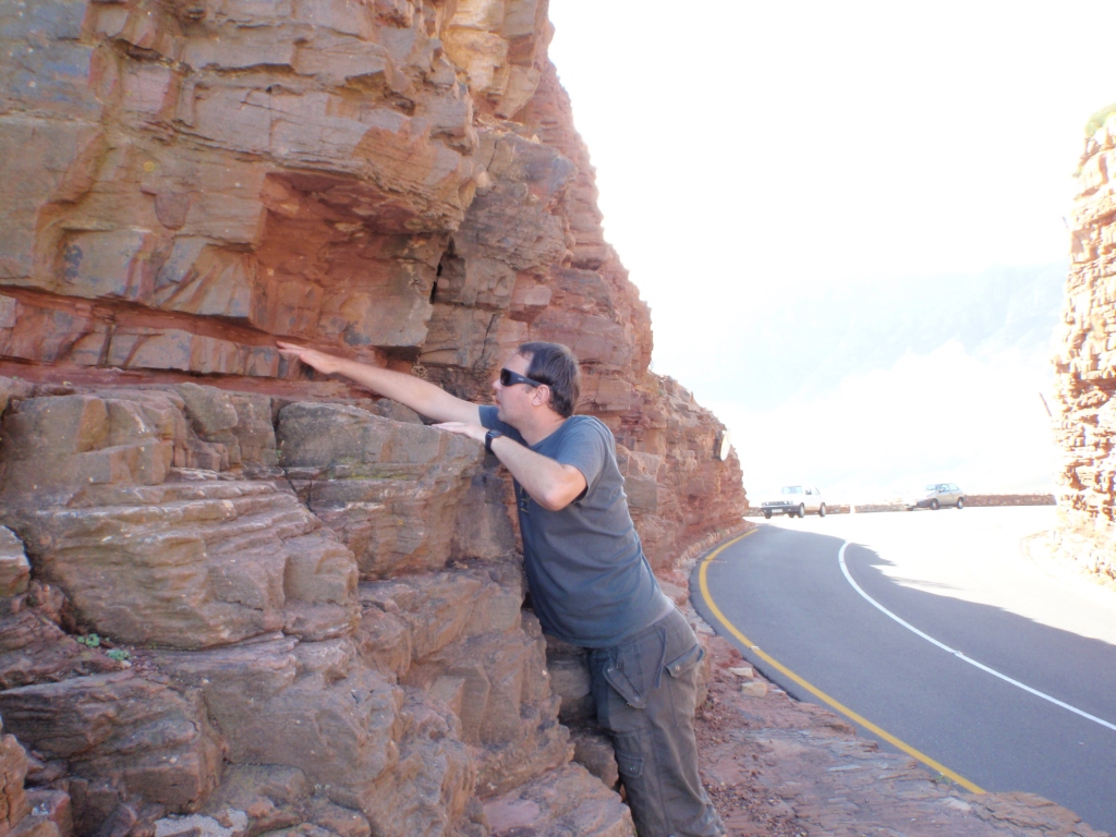
Roadcut through the Graafwater formation. Chapman’s Peak Drive, South Africa, May 2011.
A perilous place to investigate the Graafwater– but we did anyway! Chapman’s Peak Drive, South Africa, May 2011.
Jackie takes a closer look at the Graafwater. Do you see the cross-bedding? Chapman’s Peak Drive, South Africa, May 2011.
Found something interesting… Chapman’s Peak Drive, South Africa, May 2011.
What is it? Chapman’s Peak Drive, South Africa, May 2011.
It’s a trace fossil! A filled-in burrow. Chapman’s Peak Drive, South Africa, May 2011.
More trace fossils in Graafwater. Chapman’s Peak Drive, South Africa, May 2011.
These fossilized burrows were filled with either sand or organic material. Chapman’s Peak Drive, South Africa, May 2011.
More trace fossil burrows! Chapman’s Peak Drive, South Africa, May 2011.
Another view of the road along the nonconformity. Chapman’s Peak Drive, South Africa, May 2011.
Yet another view of the road and nonconformity. Chapman’s Peak Drive, South Africa, May 2011.
Obligatory cute (and slightly sunburnt) geologist couple shot in front of the nonconformity. Chapman’s Peak Drive, South Africa, May 2011.
*I asked my fiance what “Graafwater” means. He says: “directly translated [from Afrikaans] it’s rubbish, ‘spade-water.’ “


