A gorgeous volcanic crater known as “Formica Leo”. Note the people for scale – click to enlarge image.
Today I’m sharing a picture of the stunning Formica Leo (foreground), a volcanic crater located at the Piton de la Fournaise volcano on Réunion Island in the Indian Ocean. My husband and I hiked up this crater when we visited the island for a holiday last year. We also hiked up to the top of the volcanic hill in the distance — crossing over a number of lava flows of various ages. If you ever have the chance, I highly recommend a visit to Piton de la Fournaise — and to Réunion in general. We certainly plan to go back within the next couple of years.
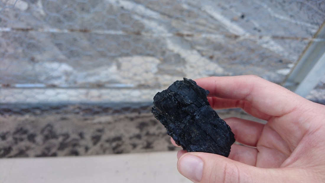
A piece of coal in my hand — freshly fallen from an outcrop.
During my recent trip to Australia, I was able to pick a piece of coal off of the ground — something that I’ve never done before. I was in Newcastle, a coal mining region, for a conference. One evening I went for a walk along the beach, where coal seams are visible in outcrop. The picture above shows a piece of coal that I picked up off of the beach walking path. Pretty neat! I’ll blog a little more about Newcastle coal when I have a chance — stay tuned!
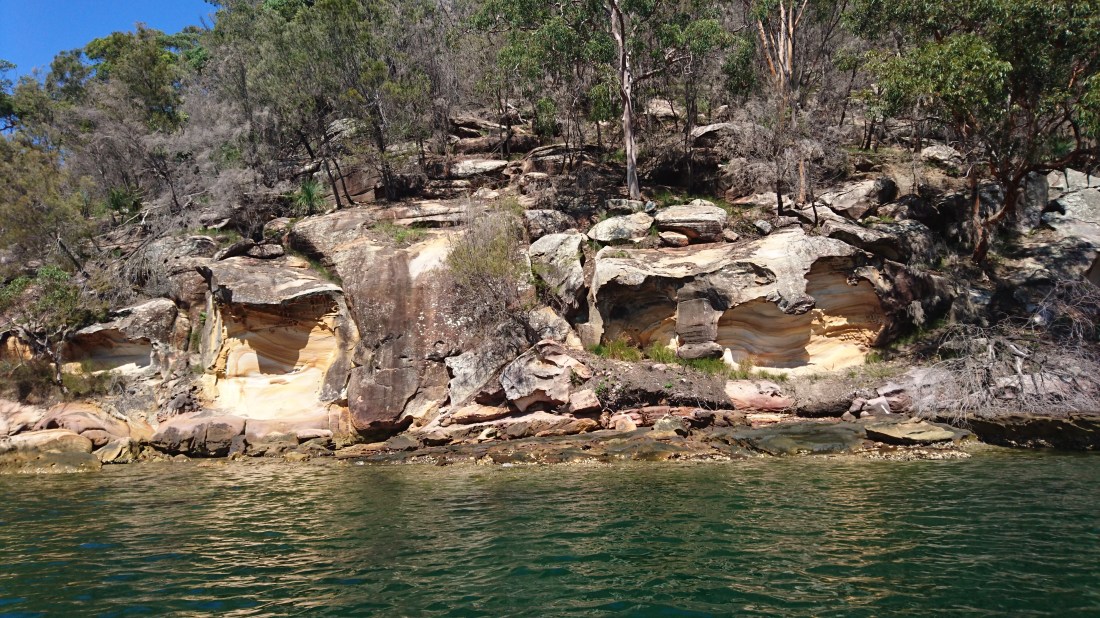
Weathered sandstone exposure at Cottage Point, Australia.
Here’s another picture from my recent trip to Australia. This picture shows a weathered sandstone outcrop that I saw (by kayak!) at a place called Cottage Point. You can see fresh banded sandstone (light in color) underneath a darker weathering rim. Weathering has created some very interesting shapes in this outcrop!
There are quite a few sandstone rocks in the Sydney area. They are frequently used as building stones — for example, the ones I shared in an earlier post.
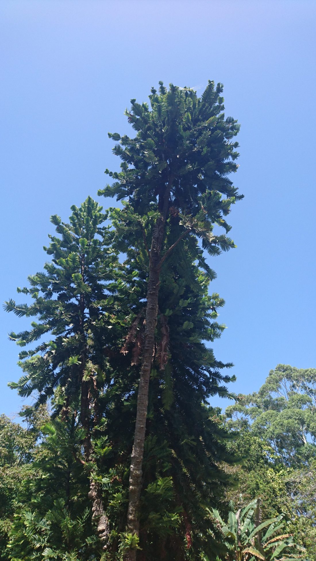
The majestic Wollemi Pine — it certainly looks like a tree that grew during the time of the dinosaurs! And it did grow at that time!
Today is my last day in Australia. Today, my family, some friends, and I spent a few hours exploring the Royal Botanic Garden in Sydney. There are many beautiful and amazing plants in the garden. However, one plant in particular caught my eye: the Wollemi Pine, which is considered a living fossil because until the tree was discovered in the 1990s it was only known from the fossil record. The Wollemi Pine is critically endangered, with only few wild trees remaining in remote sandstone gorges located about 150 km outside of Sydney. While wild trees are uncommon, cultivated trees have become fairly common. In fact, you can buy your very own Wollemi Pine tree in the garden gift shop. I didn’t buy one because I live in South Africa, but if you’re in Australia you should consider buying one to add to your garden.
Here’s a sign board with a little more information about the tree:
I’m currently on the east coast of Australia, where local sandstone is commonly used as a building stone. Above is a picture that I took this morning. This picture shows some beautiful building stones on display at the University of Newcastle. The cross-bedding and variable coloration of the sandstone layers is just gorgeous. What a lovely building stone!
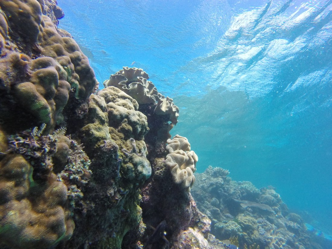
Underwater view of the reef, taken offshore of Port Douglas.
My family and I are flying to Australia tomorrow, so for this week’s “Monday Geology Picture” I thought I would share a view of the Great Barrier Reef that we took when we last visited Australia back in 2015 — before the serious coral bleaching events of 2016 and 2017. I’ll be sharing more Australia pictures soon, so stay tuned!
Yesterday morning I flew back to Cape Town after a business trip. I arrived a little after 7 am and was treated to a stunning view of Table Mountain and Lion’s Head as I flew in. I’m sharing a picture I snapped of that view as this week’s geology picture. Here’s a closer look as well:
A closer look at the mountain.
I am lucky to live in such a beautiful city! However, you can see that the city is looking somewhat brown and dry, due to the drought and water restrictions. No one is watering their gardens!
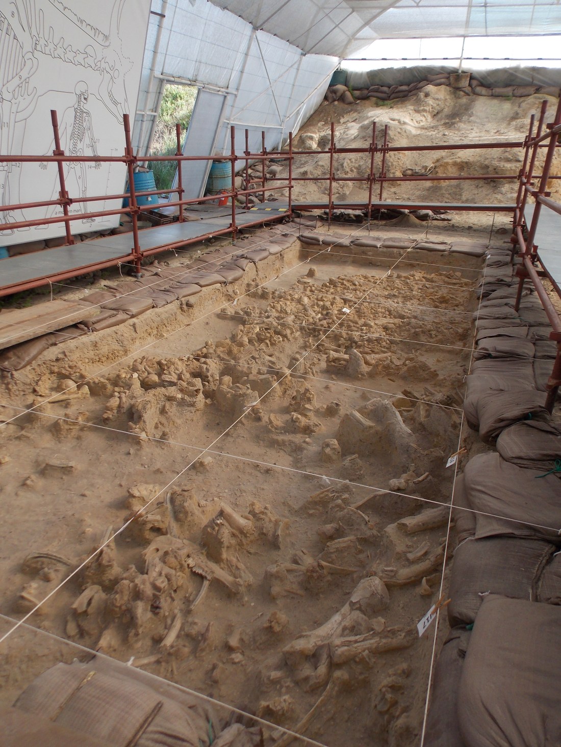
Today I’m sharing a picture of some Pleistocene age fossils that are on display at the West Coast Fossil Park, which is located about an hour’s drive north of Cape Town, South Africa. If you ever find yourself in the area I highly recommend a visit to the park.
Today I’m continuing with my recent theme of blogging about glacial pavements, and I’m sharing a picture of me sitting on top of a glacial pavement at Nooitgedacht, which is near the town of Kimberley in South Africa. I’ll share more pictures and information about this pavement soon. For now, however, you can read a little about the pavement on Wikipedia here. Although this pavement is located about 700 km away from the pavement at Oorlogskloof (which I blogged about recently), it was carved by the same 300 million year old Dwyka glaciation!
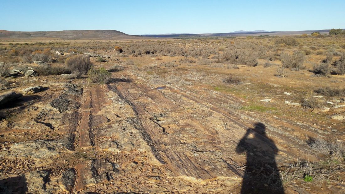
Gorgeous glacial pavement, with sunglasses for scale.
Last week I shared the above picture of the Oorlogskloof Glacial Pavement for my “Monday Geology Picture” series.
Today I’d like to share some more pictures and also a little more information about this incredible geologic site.
Oorlogskloof is the name of the farm where the glacial pavement is located. The name is Afrikaans and translates as “War Valley”. Oorlogskloof is located about 4 hours drive north of Cape Town, South Africa, near the town of Nieuwoudtville.
The glacial pavement is about 300 m wide and 140 m long. On the pavement, you can see impressive glacial grooves that were carved by Dwyka glaciers 300 million years ago. A fence protects the site, which is a short distance off the road. A nice information sign has been put up, with explanation both in Afrikaans and in English. There is even a road sign that reads “Glacial Pavement” – now that’s not a road sign that you see every day!
Information sign, with both Afrikaans and English text.
Close-up of the English text.
Close-up of the geologic figure.
Road sign!
In addition to the information sign, the South African Council for Geoscience has prepared a wonderful guide to the site. You can download it here.
An excerpt from the guide is:
About 300 million years ago, glacial conditions
prevailed over Southern Africa when it migrated with
the rest of the Gondwana supercontinent over the
South Pole. The ridges and striations in the sandstone
at Oorlogskloof formed as a result of ice movement
during this time.
The grooves were not made on bedrock, but in a thin
layer of sandy debris trapped between bedrock and
the glacier base. This veneer of glacial detritus, which
was eroded from sandstone bedrock and carried
along by the ice, is preserved as a pebbly quartzose
sandstone. The grooves were made by rock and
pebbles held in the ice.
Please go and read the rest of this excellent guide.
Here are some more pictures of the spectacular glacial grooves:
A closer look at some grooves, with sunglasses for scale.
Grooves…
…grooves…
…grooves…
…and more grooves!
A slightly closer view, with sunglasses for scale.
Grooves, with foot for scale.
Another view with a foot for scale.
A stunning landscape view.
If you find yourself in South Africa, I highly recommend a visit to the glacial pavement. It’s worth the 4 hour drive from Cape Town, and you’ll see some spectacular geology on the way as you drive through the Cape Fold Belt. The general scenery in the area is also very beautiful.