The Cape Fold Belt, viewed from the Stellenbosch winelands outside of Cape Town, South Africa.
For this week’s “Monday Geology Picture” here’s a view of the Cape Fold Belt with a vineyard in the foreground. I took this picture yesterday when I took a short walk with some friends through a vineyard located in the Stellenbosch winelands, just outside of my home city of Cape Town. You can see some impressive folding in those distant mountains!
Rock art and sandstone bedding in the Cederberg Mountains, South Africa
First and foremost, I must apologize for the long gap in my blogging. I started the year with great intentions to revive this blog with my monthly science book posts… and then I didn’t post for several months! However, I think I have a good excuse: in January I found out that I am pregnant. Unfortunately, I have been suffering from an extreme form of morning sickness. I’ve been really, really ill for months. So, it was all I could do to keep up with my day job… let alone make time for blogging and other hobbies! I didn’t see my friends for weeks. I was even too sick to even do much reading, which obviously impacted my good intentions of reading more science books this year!
However, I am finally starting to feel a little better… so, I’d like to make another attempt to revive my blogging! So, stay tuned!
For today, however, I thought I would share a picture of some rock art on a lovely sandstone outcrop. I like how you can see some bedding in the sandstone behind the artwork. I took this picture last October, when my husband and I visited the Sevilla Rock Art Trail as part of a weekend trip to the Cederberg Mountains in South Africa. We visited the Cedeberg, one of our favorite places in the world, to celebrate our 5 year wedding anniversary. I previously posted some pictures of this rock art trail several years ago… perhaps I’ll put up a few more from this more recent trip when I have a chance. If you ever find yourself in the Cederberg, I definitely recommend a visit to the trail!
This week’s “Monday Geology Picture” is a shot of the Big Hole in Kimberley, South Africa. This hole, now filled partly with water, is the remains of an early diamond mine in a kimberlite (a rock type named after the town of Kimberley) pipe. The pipe was mined from 1871 to 1914 and today can be safely visited and observed (from a walkway) as part of a visit to The Big Hole Museum. The hole really is big: it’s 214 meters deep and has a perimeter of 1.6 kilometers. I took the above picture when I visited Kimberley earlier this year. If you ever find yourself in the Kimberley area, I highly recommend a visit to the The Big Hole Museum! In addition to the hole, there is a very nice display on diamond and kimberlite geology. You can even see some real diamonds! Around the museum there are also some historical buildings from early mining days with various old items on display.
Here’s another view of the Big Hole, with some buildings in the background for some sense of scale:
The Big Hole, Kimberley – with some buildings for scale.
And here are a couple of views of the Big Hole that I took from the airplane when I was flying into Kimberley:
The Big Hole viewed from an airplane – Picture #1.The Big Hole viewed from an airplane – Picture #2.
For this week’s “Monday Geology Picture” here’s a shot of a pretty granite boulder that I spotted during a forest hike in the Constantia region of the Cape Town, South Africa. No doubt, this boulder consists of ~550 million year old Cape Granite. There’s no scale in this picture, but the boulder is about 2 meters wide.
Today I’m sharing some more pictures from our recent holiday in the KwaZulu-Natal region of South Africa. You can see my first post about an impressive waterfall here. Today I’m sharing some pictures from an area known as The Midlands. This region is located inland of Durban and Pietermaritzburg and consists of rolling green hills, a gentle landscape located in between the low-lying, flat coastal area and the elevated, steep landscape of the Drakensberg (Dragon Mountains) region. The landscape is very green (especially when we visited, toward the end of the rainy season) and is covered mostly with fields and small patches of woodland. There are several small villages and a couple of towns located in The Midlands, and there are farms everywhere.
For four nights during our holiday, my husband and I stayed with some good friends of ours in a little town called Hilton, which is located at the edge of the famous Midlands Meander tourist route. In addition to spending some time in Hilton and surrounds, we spent two days exploring farther afield on the tourist trail, driving on various paved and dirt roads and stopping at farms, restaurants, and little shops. It was nice to see so many small businesses, and we did a little shopping to support them. I bought a pair of locally-made leather sandals and some beautiful, soft yarn that was handspun from local sheep. My husband and I also bought some local cheese and honey. It was wonderful to buy some locally made souvenirs rather than plastic ones made in China!
I really enjoyed meandering around The Midlands. The region reminds me of The Shire from J.R.R. Tolkien stories. I kept looking around for Bilbo Baggins and his hobbit friends!
Because of all the greenery, we didn’t see much geology in The Midlands, aside from Howick Falls and the general landscape, of course. Although we didn’t see many good outcrops, from what I understand the rocks of The Midlands are primarily sedimentary rocks of the Beaufort and Ecca groups of the Karoo Supergroup. These rocks are approximately 200 to 300 million years old and have weathered over the years into the gently rolling Midlands landscape. In contrast, the rocks of the Drakensberg include younger ~180 million year old lavas, which comprise the highlands areas. There’s much more obvious and interesting geology to see in the younger, steeper terrain of the Drakensberg… stay tuned for future posts! For today, however, enjoy some scenic images of The Midlands.
The Midlands #2.The Midlands #3.The Midlands #4. Hobbits must live here.The Midlands #5. An inn fit to serve a meal to adventuring hobbits!The Midlands #6.The Midlands #7.The Midlands #8.The Midlands #9. Swissland Cheese. We had the most delicious goat cheese here!The Midlands #10.The Midlands #11.The goats!The Midlands #12.The Midlands #13. Feeding the cheese-makers!The Midlands #14. Beautiful garments handknitted from handspun yarn from local sheep.The Midlands #15. More gorgeous handknits. I bought a hat and scarf… and some yarn to knit myself matching mittens!The Midlands #16. Handspun yarn.
Last but not least, here’s a darling statue that was outside Groundcover, the shoe shop where I bought the leather sandals:
Over the next two or three weeks I’ll be sharing some pictures from my recent week-long holiday in March to the KwaZulu-Natal province of South Africa. A week is not nearly enough time to fully explore this beautiful part of the world. However, my husband and I managed to see a fair amount! We took a flight from Cape Town (our home city) to Durban and then we drove through to the lovely little town of Hilton, where we stayed with friends for three nights. From Hilton we explored a beautiful part of the country known as The Midlands. Then we drove to the town of Underberg in the Drakensberg, which is Afrikaans for “Dragon Mountains”. On our way to Underberg we took a detour to Kamberg to see some rock art. We spent four nights in Underberg, and one day we went on a day trip up Sani Pass to spend a few hours in the Kingdom of Lesotho.
To start off the KwaZulu-Natal holiday blogging, today I’m sharing pictures from our visit to Howick Falls, an impressive waterfall located a short drive away from Hilton. Howick Falls is a 95 m tall waterfall on the Umgeni River. The falls cascade over a cliff composed of dolerite that intruded into Ecca Group sedimentary rocks. Both the dolerite and the Ecca Group rocks are Karoo Supergroup rocks. At the falls, a layer of Ecca shale can be seen sandwiched between sills of dolerite, and there’s also a dolerite dyke.
Let’s take a closer look at part of the cliff:
Howick Falls #2.
It’s a little difficult to see the boundaries between the dolerite sills and the Ecca shale, but they’re there.
Do you see the dolerite dyke? If not, let me point it out to you:
Howick Falls #3.
Here’s a closer look at the upper dolerite sill:
Howick Falls #4.
Here are two more pictures pictures of the falls:
Howick Falls #5.Howick Falls #6.
Do you see the Ecca shale layer in the above picture? Here are the rough boundaries:
Howick Falls #7.
As I mentioned, it’s a little difficult to pick out the boundaries from these pictures, but there’s definitely a shale layer in there!
Here are some pictures of an informational sign at the falls:
Howick Falls #8. The sign says sandstone but note that the Ecca Group consists of both shale and sandstone. My one geology book says that a shale-rich Ecca layer is located at Howick Falls. Click to enlarge.Howick Falls #9. A close-up of the geological diagram on the informational sign.
There’s a neat signpost at the falls showing the directions and distances to other famous waterfalls:
Howick Falls #10.Howick Falls #11.
Last but not least, here are some pictures of the beautiful river valley below the falls:
Howick Falls #12.Howick Falls #13.
That’s all for now. Stay tuned for more KwaZulu-Natal adventures here on Georneys!
Investigating soil horizons by kayak, Berg River Mouth, South Africa, February 2016.
A few weeks ago I participated in a kayak race on the Berg River a few hours north of Cape Town, South Africa. I went on a short warm-up paddle the evening before the race. While on this paddle, I couldn’t resist checking out some soil horizons that were visible along the river in several places. In the picture above, I am posing next to some soil horizons. You can see the horizons of surface soil and subsoil.The organic soil horizon is also visible although due to drought the vegetation is pretty dry. Geology by kayak is wonderful… it combines two of my favorite things! I should try to see more geology by kayak.
My thick paperback copy of Diamonds, Gold, and War.
Earlier this week I shared a picture of a few books on diamonds that are on my current reading list. I’ve also mentioned in a couple of previousposts that I’d like to share with you a little information about some of the geology-themed books that I’ve read recently.
I read Diamonds, Gold, and War (hereafter abbreviated as DGW) over a couple months last year. The book is thick, so it took me a few airplane trips and many nights at home to read through. Although it took me awhile to read, without a doubt DGW is the most interesting and important book that I read last year. The book provides a detailed account of key events in South African history focusing on the 1870s to the 1910s. During this time period, rich deposits of diamonds and gold were discovered and developed into mines, kicking off the modern economic development of the region and a legacy of mining that continues to be important to the South African economy to this day. Some of the mineral deposits that were first discovered in South Africa over a hundred years ago are still being mined in today. Several large mining companies, such as De Beers, were founded in South Africa during this time period. However, while the rich mineral deposits played an important role in the economic development of the country, they also led to a fierce battle to control the new-found riches. At the turn of the century, the British battled the Afrikaner Boers for control of southern Africa, waging a costly and bloody war that badly affected both parties. In addition, businessmen such as Cecil Rhodes schemed to dominate the mining industry, ruthlessly forcing aside the competition. During this time period, South Africa’s mineral wealth was largely controlled by a few individuals, who often exploited their mine workers and who did not put much emphasis on health and safety standards, considering mine injuries and deaths to simply be part of the cost of doing business.
Here’s an excerpt from the book’s introduction:
“… in 1871, prospectors exploring a remote area of sun-scorched scrubland in Griqualand, just outside the Cape’s borders, discovered the world’s richest deposits of diamonds. Britain promptly snatched the territory from the Orange Free State. Fifteen years later, an itinerant English digger, George Harrison, stumbled across the rocky outcrop of a gold-bearing reef on a ridge named by Transvaal farmers as the Witwatersrand. Beneath the reef lay the richest deposits of gold ever discovered. The gold strike transformed the Transvaal from an impoverished rural republic into a glittering prize.
What followed was a titanic struggle fought by the British to gain supremacy throughout southern Africa and by the Boers to preserve the independence of their republics. It culminated in the costliest, bloodiest and most humiliating war that Britain had waged in nearly a century…
Two men personified the struggle: Cecil Rhodes and Paul Kruger. Rhodes, the son of an English country parson, used his huge fortunes from diamonds and gold to promote the expansion of the British empire as well as his own business interests… Paul Kruger, the Boer leader and landowner, whose only education was the Bible and who believed the earth was flat, defied Britain’s prime ministers and generals for nearly a quarter of a century.”
DGW covers a fascinating and important time period in South Africa’s history. The book is thoroughly researched and contains several pages of historical pictures and maps. Although the book is long (570 pages) and a little cumbersome at times, overall it is extremely readable – it’s not dry history at all. The book is full of rich detail and anecdotes. In particular, Meredith paints a vivid picture of Cecil Rhodes and Paul Kruger, two of the most influential – and also the most controversial – figures of the time period. Meredith also paints a vivid picture of the early days in the mining towns of Kimberly (diamonds) and Johannesburg (gold).
Personally, the book was an important one for me to read. I’ve been living in South Africa for nearly five years. During this time period, I’ve worked as a geologist in both the diamond and gold industries. Fortunately, the mining industry in South Africa looks quite different today than it did back in the late 1800s and early 1900s. Today, mining companies are much more socially responsible, and there is also a great emphasis placed on the health and safety of employees. The modern South African mining industry isn’t perfect, but it has come a long, long way. I found it extremely valuable to read DGW in order to better understand the origins and complex development of South African’s mining industry. In addition, I found it fascinating to read about how deposits of diamonds and gold were first discovered and developed in South Africa. Fortunately, Meredith’s descriptions of geology are fairly accurate, as history books go! I didn’t spot any glaring geological errors or omissions.
Overall, I highly recommend reading DGW. The book provides a wonderful example of how geology influences history. The discovery of rich mineral deposits in South Africa played a key role in shaping the country’s history and continues to shape the country to this day. If neither diamonds nor gold were discovered in South Africa, the country’s development would likely have taken a radically different path, for better or for worse.
Granite boulders on one of Cape Town’s beautiful beaches.
If you want to present at the 35th International Geological Congress, which is being held in Cape Town later this year, it’s not too late to submit an abstract! The deadline is January 31st.
I plan to submit my own abstract tomorrow. Come and join me at the congress! There are going to be some great talks and field trips… and you can come visit the gorgeous city of Cape Town, South Africa.
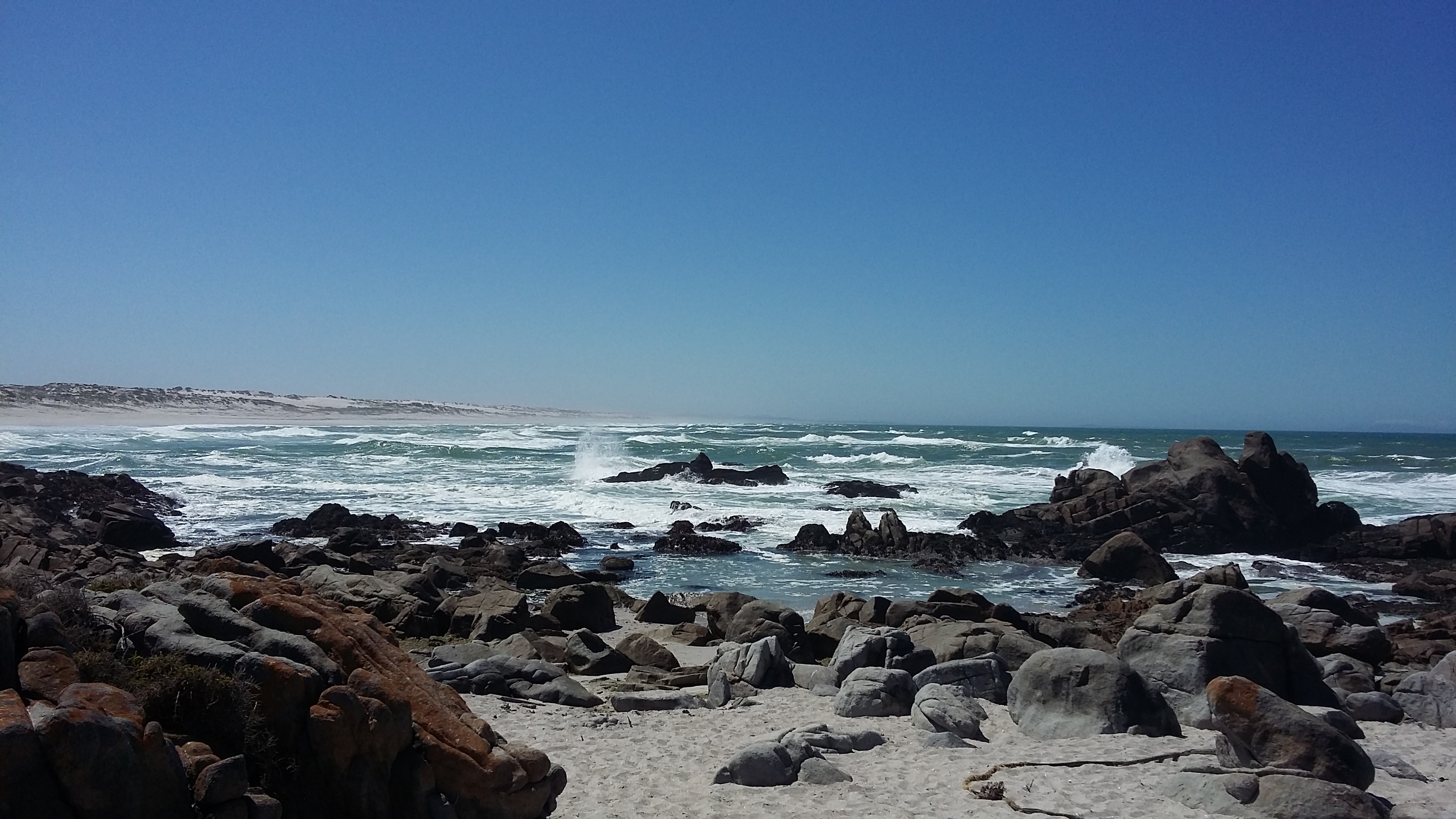
For this week’s Monday Geology Picture, here are some lovely granitoid beach rocks along the Atlantic Ocean at Langebaan, South Africa. I visited Langebaan again this past weekend with some family. Stay tuned for some pictures from the fossil park near Langebaan!