What to Buy a Geologist for Christmas

Zayna (my cat) in my Newtonmas tree.

Christmas is just over three weeks away. If you’re like me, you’ve recently put up your tree and a few decorations and are contemplating what to buy your friends and relatives. My family isn’t religious, so we celebrate Newtonmas instead of Christmas. We call the holiday Newtonmas because Issac Newton, the famous mathematician and scientist, was born on Christmas Day. We celebrate Newtonmas on the same day as Christmas.

My family is very festive about Newtonmas. My mom often throws a science-themed Newtonmas Party, and we have all kinds of Newtonmas decorations, including a Newtonmas tree. The best thing about a Newtonmas tree is that you don’t have to use an angel or a star as a tree topper (unless you want to). Rather, you can use anything you want! When we lived in Europe for a couple of years, we bought a little Napoleon doll and this has become our traditional tree-topper. Since I’ve moved out of the house and started putting up my own tree, I’ve used various stuffed animals and toys as tree-toppers. This year I’m using the little blue dragon from the “How to Train Your Dragon” movie. Because dragons are cute and are as real as angels, to me anyway. In honor of Newton, my family exchanges gifts and eats delicious food and even plays Christmas music. Because music is pretty, whatever your religious beliefs (or lack thereof).

Many of you may be wondering what to buy a geologist for Christmas/Newtomas. Below I’ve listed a few suggestions of gifts I think a geologist would like. Feel free to post your own suggestions for gifts in the comments!

And Merry Christmas/Chanukah/Newtonmas!

Gift #1: Geology Cake T-Shirt

Image from Threadless.com

This T-shirt is sold by Threadless.com here. Unfortunately, this t-shirt is currently sold out. Everyone should help request a reprint! A quick note is that geoblogger Callan Bentley pointed out in his NOVA blog that the angular unconformity cake/geology layer is highly improbable. Despite that, this is a fun t-shirt!

Cost: $18 (cheaper if it’s on sale!). 


Gift #2: Global Warming Mug

Image from Amazon.com

My mom actually bought this mug for me for Christmas several years ago. This mug is great- when empty or filled with cold water, the continents look normal. However, when you add hot water the edges of the continents recede as they would during sea level rise. I’m not sure exactly how much sea level rise this mug represents, but it’s so much fun! You can buy the mug (and watch a video of it being filled with hot water) here

Cost: $12.95.

Gift #3: Brunton Compass

Image from Brunton.com

A Brunton compass- used for general navigation and taking strike and dip measurements for geologic maps- is a must-have for any geologist. Alas, these compasses are expensive so not all geologists have their own. I finally bought one a couple of years ago, but before that I would always borrow them from the department or friends. Many geologists already own these, so you might want to check first. However, if you’re rich and your geologist friend doesn’t already own one of these, this will make a fantastic gift certain to provoke squeals of delight and dramatic hugs. Brunton compasses can be purchased here.

Cost: About $500-$800 depending on the model.

Gift #4: Rite in the Rain All-Weather (Except Wintry Mix) Writing Products:

Image from Amazon.com

The Rite-in-the-Rain people may not be very good at spelling, but they make wonderful notebooks, papers, and pens that are great for using in all sorts of field conditions- rain, snow, and sunshine. My favorite Rite-in-the-Rain product is the geology notebook as it comes with a ruler and all sorts of useful reference pages, such as a geologic timescale, in the back. The Rite-in-the-Rain Geological Field Notebook can be bought from Amazon.com here. Be sure to check out other Rite-in-the-Rain products at their webpage.

Cost (for geology field book): $17.95 on Amazon.com.

Gift #5: GPS

Image from Amazon.com

A GPS is another must-have for a geologist. Fifteen or even ten years ago, GPS units were bulky and expensive. These days, most people have them in their cars to give driving directions. Outdoor (often waterproof) GPS field units are now pocket-sized and very convenient to bring along for fieldwork. Many hikers even use these now. I must admit that I somewhat miss the pre-GPS days when you had to hone your map-and-compass skills, but GPS units are very convenient. Most geologists will already own a GPS so you might check on this first. Perhaps your geologist friend wants a GPS upgrade! There are many types of GPS units, but I find the Garmin etrex to be a great, simple unit to use for my purposes– basic navigation and recording sampling positions.

Cost: About $100-200 for a basic unit.

Gift #6: Annals of the Former World

Image from GoodReads.com

This is an absolutely amazing book by John McPhee, one of my favorite writers. McPhee is an incredible non-fiction writer who personalizes his non-fiction and makes it entertaining by incorporating storytelling techniques. McPhee researched and wrote this book about North American geology by traveling with various geologists. McPhee makes both the geologists and their geology come alive in this masterpiece. If my recommendation isn’t enough, this book won the 1999 Pulitzer Prize for general non-fiction.

Cost: $14.28 from Amazon.com here.

Gift #7: Nature’s Fire Undersea Volcano Kinetic Light Sculpture

Image from powscience.com

This “volcano sculpture” looks tacky- and it is! Wonderfully tacky! This volcano sculpture erupts little plastic “magma” beads and makes a rhythmic, sort of soothing, clicky woosh as it does so. Multicolored lights (blue, yellow, pink) flash as the volcano erupts. The only problem with this volcano sculpture is that if you don’t keep it completely filled with water, the little beads tend to float up at the top. By the way, the sculpture doubles as a cat-hypnotizer. My cats will watch it for hours!

Here’s a video of my volcano sculpture:

Cost: $27.95 (sale price!) here at The Nature Store.

 Gift #8: Foam Rocks

Image from Amazon.com

Fake foam rocks can be ordered from a variety of toy and gift stores. These are great to throw at geology students who aren’t paying attention in class…

Cost: $5-10.

Gift #9: Bad Geology Disaster Movie

Image from Amazon.com

Pretty much every year, my mom and sister buy me a bad geology movie or two. There are dozens upon dozens of these. If you’d like to own “Magma: Volcanic Disaster” you can buy this movie at Amazon.com here for only $11.99. The great thing about bad geology movies, though, is that they are generally fairly cheap. I often find them in the $5 sale bin at Wal-Mart. There are endless options!

Here are a few more movie suggestions:
-Journey to the Center of the Earth (many versions… I highly recommend the 1950s version starring Pat Boone)
-The Core
-Deep Impact
-Dante’s Peak
-The Day After Tomorrow
-Volcano
-Earthquake
-2012

Cost: $5-20.

Gift #10: A Rock
Seriously. Any rock. You can order a pretty mineral off the internet if you want, but the great thing about geologists is that they find pretty much any rock interesting. So, go out in your yard or dirt driveway or down to the beach or your local hiking trail. Look around until you find a rock with pretty, shiny crystals or interesting layers or an interesting texture. Take the rock and put it in a box. Wrap the box and add a note that says, “I found this and thought of you.” Presto! A free gift that any geologist will love!

Cost: Free!

Geology Word of the Week: E is for Eustasy

Ocean meets land, Western Cape, South Africa, March 2009.

def. Eustasy:
A global change in sea level. The key word in the definition is global— eustasy is not used to refer to local variations in sea level. Rather, a eustatic change in sea level occurs when there is a global change in (a.) the total amount of water in the oceans and/or (b.) the total volume of the ocean basins.

Changes in the total amount of water in the oceans are most often related to glacial-interglacial cycles. Or, to put it more simply, to hot-cold cycles. When the planet is hotter, there is more liquid water in the oceans. When the planet is colder, there is more solid water stored on land as glaciers and ice sheets. There is also more ice stored as ice sheets covering parts of the ocean. When the planet is hotter and there is more liquid water, global sea level rises. When the planet is colder and there is less liquid water, sea level drops.

Motions of Earth’s tectonic plates can also affect sea level. Movement of the plates over millions of years changes the shape of the ocean basins. Although plate tectonic changes (millions of years) occur more slowly than glacial-interglacial cycles (thousands of years), tectonic motion nonetheless can have a big influence on global sea level. When the plates are arranged in such a way that the oceans are wider, sea level will be lower. When the plates are arranged in such a way that the oceans are narrower, sea level will be higher.

In addition to eustatic changes in global sea level, there are also local changes in sea level. Local sea level changes are caused by regional factors, such as local tectonic uplift/depression, gravity, ocean temperature, and ocean currents. For example, sea level in Iceland (one of my favorite geologic locales) dropped significantly at the end of the last ice age ~13,000-10,000 years ago. During the last ice age (or glacial period), sea level in Iceland was higher by ~50-60 meters. This is because during the last glacial period, Iceland truly was Iceland… the entire island was covered by a thick ice sheet, at least 1km thick and possibly as thick as 2km. The ice sheet even extended beyond the island to the edge of the continental shelf. The large mass of the ice sheet depressed Iceland downwards, raising local sea level. When the ice sheet rapidly melted ~13,000 years ago, Iceland rebounded. That is, the land started rising upwards again. This caused local sea level to drop. Note that this drop is sea level has to be attributed to local rebound. This is because eustatic sea level was rising as ice melted in Iceland and all over the world.

A simple way to think about eustatic sea level is to think of an ocean like a giant bathtub. When there’s more water, the water level in the bathtub is higher everywhere. When there’s less water, the water level in the bathtub is lower everywhere. Now, extent this metaphor a little. I’ve already explained that plate tectonic movements can change the shape of the ocean basins. So, maybe think of the bathtub as a crazy Alice in Wonderland bathtub that changes shape and size with time. You should also think about the bathtub walls, which are bumpy. These higher-mass bumps have a gravitational influence on the water. The bathwater is attracted to these higher masses. This is true in your bathtub at home, but the effect is so small it’s negligible. On a larger scale in the ocean, the effect is measurable and significant. The surface of the oceans is not level– and not just because of waves and tides and such. The surface of the ocean is bumpy, and these bumps match topography. This is one way we can tell the topography of the ocean floor… from outer space! Satellites actually measure the height of the ocean and infer topography from this. Where the water is higher, the underlying topography is higher. Finally, I encourage you to think outside the bathtub. Just as the bumps on the surface of the bathtub have an influence on the water, so does everything surrounding the bathtub. The continents and the ice sheets also influence the water. Again, the water is attracted to higher masses.

Pretty cool, huh? But why do we care about this, unless we’re interested in seafloor topography? We care because gravity may actually play a role in sea level rise as a result of anthropogenic global warming. Jerry Mitrovica, a geophysicist at the University of Toronto, warns that if you take gravity into account, sea level does not rise evenly as a result of global warming. Rather, sea level may rise more than expected some places on the planet and may actually fall elsewhere. This means that sea level rise may be more catastrophic than previously realized for certain regions.

I worry over global warming and eustasy. Unfortunately, I am also lazy. Even after drinking a cup of tea out of my global warming mug, I usually drive the 5 minutes to work rather than walk or bike. I am lazy other ways, too– I waste paper, I don’t recycle everything, I drink far too many beverages in wasteful cans, I forget to turn lights off sometimes, and I sometimes buy bottled water. But I am proud to be working as an Earth Scientist, striving to better understand how the planet works. There are many scientists working hard (myself included) trying to figure out how we might be able to geo-engineer– or at least better understand– the planet so that we can mitigate global warming and sea level rise.

Many of us are lazy. Fortunately, we are also smart and we also have science. I’m going to go fill my global warming mug with another cup of tea and then I’m going to go back to picking carbonate crystals for several hours. Because maybe, just maybe, my research will help us understand a little more about the planet and maybe, just maybe, these little carbon dioxide-storing crystals can help us geo-engineer a way out of global warming and eustatic sea level rise. Not from my research alone. But maybe my little piece of research can help, in some little way. And maybe, just maybe, working hard at science will make up (just a little) for my laziness in other aspects of my life. Or maybe not. But at least my little piece of research will help us understand our planet just a little bit better.

Bad Geology Movie of the Month- Magma: Volcanic Disaster

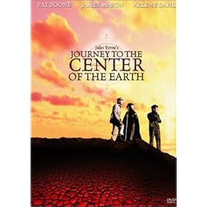
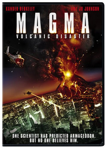
Above photo (of DVD cover) taken from Amazon.com.

I just realized that today is the last day of November and that I have yet to post my Bad Geology Movie of the Month! I can’t let November pass by without a movie, so for this month’s movie I’ve selected one of  my all-time favorite Bad Geology movies- “Magma: Volcanic Disaster.”

Before I give my review, let me explain a little more about the Bad Geology Movie of the Month. First of all, what is a bad geology movie? A bad geology movie is any Hollywood-style flick with a geological theme. Many bad geology movies are mainstream films such as “The Core”, “Deep Impact”, “The Day After Tomorrow”, “2012”, and “Dante’s Peak”. Others are made-for-TV (often for the SciFi or SyFy channel), low budget flicks that often copycat mainstream movies. For instance,  there were several copycat, made-for-TV “Journey to the Center of the Earth” movies made the same year that the high-budget Brendan Fraser flick was released.

So, why do I call these movies bad geology movies rather than just geology movies? This is because, in most cases, Hollywood geology is just that- bad geology. Scientifically inaccurate geology. Exaggerated geology. Stereotypical and skewed geology (and geologists). Some geology movies do better than others at staying true to geological science, but most do fairly poorly. Many geology movies have completely ridiculous geology- giant crystals growing in cavities deep in Earth’s mantle,  dinosaurs living at the center of the Earth, Hawaiian-style lava erupting from a Cascade-type volcano, complicated geophysical models programmed in mere seconds by hero geologists, neutrinos heating up Earth’s core, and so on.

However, despite the abundant bad geology in these movies, I absolutely love geology-themed Hollywood-style flicks. I have an extensive collection of bad geology flicks, and I am always on the lookout for more flicks to add to my collection. The $5 movie bin at Wal-Mart is one rich source of bad geology movies. My family usually gives me 1 or 2  bad geology movies for Christmas, and others are loaned or sent to me by scientist friends who know my interest.

I like bad geology movies because they are entertaining (they spice up the science!) and can inspire people to become interested in real science. For instance, I first became interested in geology when as a young child (perhaps 5 or 6) I watched the 1950s Disney movie “Journey to the Center of the Earth.” This movie is an absolute gem of gems in the bad geology movie category. Pat Boone sings his way to the center of the Earth with his companions! With an accordion! I will most certainly write a review of this movie another month. I loved this movie as a child- I used to watch it every single time I visited my grandmother’s house. A few years ago, my mom bought me a DVD of the film, so now I can watch it whenever I want. The movie is scientifically inaccurate in countless ways, but despite that the film sparked my interest in real geology and now, many years later, I am a geologist. I suppose I also like bad geology movies because they make me feel smart… I can debunk Hollywood geology! Yay!

Of course, the bad geology in these flicks can be dangerous, like all misrepresentations of science in Hollywood. But the bad geology is not all bad. Some geology professors actually have their students debunk the bad geology in these movies. I’m not convinced that this is the most efficient way to teach geology, but I can see how it is fun and useful. In a geology class made up mostly of non-majors, debunking the bad geology in movies is actually very practical. If students aren’t going to go on to become geologists, much of the “geology” they encounter may very well be filtered by Hollywood. If they can learn a little geology and use this knowledge to evaluate the accuracy of Hollywood geology, all the better.

Also, I do want to cut Hollywood a little slack. Movies need to be fast-paced and entertaining. Science, including geology, can at times be too slow-paced and boring for Hollywood.  I can understand how Hollywood distorts geology to make it more interesting and fast-paced. Many weeks, I know, my geology consists of not-so-thrilling activities such as picking tiny crystals under the microscope for hours or applying statistics to a set of data. Even in the field, I often spend hours measuring things and sampling a sequence of rocks painfully slowly. Science requires meticulous care and documentation, and that can take time and can, indeed, be boring.

However, I’d also argue that science- real science!- can also be amazingly cool. I think that it is totally possible to write an entertaining, geologically-accurate movie script. In fact, that is on my to-do list- one of my many things I want to do after I graduate and am a bum for a little while. I’m moving abroad (my fiance lives overseas) and need to go through immigration, so I’m using this as an excuse to take a few months off and do things like brush up on a couple of foreign languages and write a geology movie script. I’ll probably just watch television and go rock climbing and hiking all the time, so we’ll see if the script ever materializes.I hope it does.

Although Hollywood science has an abysmal reputation when it comes to being scientifically (in)accurate, there is some good science in Hollywood and also some hope for Hollywood science. I highly recommend that you check out The Science and Entertainment Exchange, a forum for science and entertainment professionals to exchange ideas and knowledge. This exchange aims to make the science in movies more accurate and also to help scientists become better at explaining their science to a general audience.

Back to the bad geology movies, though. I have found that the *best* bad geology movies are the ones that are most entertaining: either because the thriller (but often scientifically flawed) plot is well-written and well-acted and has you biting your nails (even if you *know* Earth’s core can’t do whatever it’s doing to destroy the planet) or- more commonly- because you find the movie hilarious because of a scientifically ridiculous plot, poor acting, poor special effects, and stereotypical scientific characters. Most bad geology movies are “serious” movies though a few (and I have to admit, these are probably my favorites) are more light-hearted- such as the two Disney versions of “Journey to the Center of the Earth.” Unfortunately, some bad geology movies are just bad. They are not entertaining at all- they’re just mediocre and boring. They’re not good enough to be thrillers and they’re not bad enough to be funny. They’re just sort of “meh” with some bad geology thrown in.

In order to review several aspects of each bad geology movie, I am going to rate each movie (from 1 to 5 stars, whatever a star is… not really a scientific unit of measurement, but I’ll go with it) in several categories:

Category 1: Quality of Movie Production
This will give you a sense of if this film is low budget or high budget. If low budget, this will give you a sense of just how low budget. Low budget is not necessarily bad, though… it can be very, very funny!

Category 2: Quality of Acting
I am not an actress, so this rating will be very subjective. Basically, this rates how good a job the actors and actresses did with a script that may or may not be well-written and may or may not be scientifically accurate/plausible.

Category 3: Accuracy of Geology
My assessment of the scientific accuracy of the science in each movie. I welcome input on this from other geologists, since I am not an expert in all fields of geology.

Category 4: Entertainment Value
Sure, the production quality may be poor and the acting crap and the geology nonsensible… but is the movie entertaining? Does it make you laugh because of its sheer ridiculousness? Often, the worst of the bad geology flicks are actually the most entertaining.

For all of the bad geology movies I review, I encourage you to watch them and reply in the comments with your own reviews. Perhaps you can help me catch more of the scientific inaccuracies as well as help me praise those rare times when Hollywood is accurate in its geology.

Without further ado, on to this month’s movie review….

******************************

Magma: Volcanic Disaster
Year Released: 2006
Release Format: Television movie by Sci Fi Pictures
Quality of Movie Production: 1 out of 5 Stars
Quality of Acting: 2 out of 5 Stars 
Accuracy of Geology: 1 out of 5 Stars 
Entertainment Value: 5 out of 5 Stars
Movie Quotation: 
“Our survival as a species is dependent upon our ability to understand and adapt to the planet’s ongoing evolution. Hence, volcanology– despite Mr. Taylor’s earlier assertion to the contrary– has nothing to do with Mr. Spock or the Starship Enterprise. Rather, it is the study of the Earth’s blood pressure.” — Dr. Peter Shepherd, “Magma: Volcanic Disaster”
Note: I am going to ruin any movie surprises below… but don’t worry: even if you know the entire plot, you will still find this movie hilariously entertaining! 
Movie Description:
Dr. Peter Shepherd (played by Xander Berkeley of 24 fame), a volcanologist and professor of geology at Mount Raven University, takes a group of graduate students to Iceland on a winter break field trip. The purpose of the research trip is to test Shepherd’s theory that the Grimsvotn Volcano (an actual volcano in Iceland… well, actually a series of lakes above a volcanic fissure) is millions of years older than previously thought. Shortly before the trip, the Trollsvotn Volcano (as far as I can tell, not a real volcano) erupted “suddenly” after lying dormant for 700 years. So, a secondary purpose of Shepherd’s trip is to understand why there is “suddenly” an increase in volcanic activity in Iceland. 
The day before the research trip is scheduled to leave, a cute, bubbly, high heel-wearing female graduate student named Brianna “Bree” Chapman (played by Amy Jo Johnson, the Pink Power Ranger!) enters Shepherd’s classroom and inquires if she can join the research expedition. Shepherd tries to wave her off with sexist remarks, implying that the field work will be too difficult for her and that his male graduate student (CJ) only told her about the expedition because he was hitting on her. Bree persists, saying that she is a geochemist and that she heard that the expedition geochemist dropped out last minute. Finally, Shepherd agrees to take her as long as she doesn’t expect a recommendation letter or college credit and also if she buys her own plane ticket.*
The next morning, Bree meets the rest of the expedition team at the airport (well, a field… but presumably an airport field). Before she arrives, we are introduced to Shepherd’s other graduate students: two male graduate students who- seriously- look and sound more like those guys from Jersey Shore or- to be a little nicer- members of a boy band such as ‘N Sync than they do geology graduate students. The names of the ‘N Sync graduate students are CJ and Kai. The third male graduate student is a guy named Jacques who- from his name and slight English accent- I presume is supposed to be French. Upon seeing the attractive Bree approach, Jacques says to CJ: “It’s a good thing to see you’re still doing your part in putting the T & A back into being a TA.”All I can say about that line is: AWESOME. Awesomely sexist, that is.
On the plane to Iceland, the graduate students start revealing some of their geologic knowledge (or lack thereof). They are all idiots- except, perhaps, for the English/French one. The Pink Power Ranger says something along the line of, “So why are we going to this Iceland place, anyway…” One of the ‘N Sync grad students says, “Yeah.. all I know about Iceland is… Ice.” Another ‘N Sync graduate student says, “No- that’s Greenland.” The smartie French graduate student then explains that they are going to Iceland because 1/3 of all lava that’s ever flowed upon the Earth has come from Iceland. Okay, I’ve changed my mind. The French grad student is an idiot, too. Iceland has produced significant amounts of lavas over the years, but nowhere near 1/3 of the total amount of lava ever produced. I’d like to point out that Iceland is one of the most famous volcanic locations on Earth… any self-respecting geology graduate student should know at least something about Iceland.
Miss Pink Power Ranger tries to show her geological expertise when she comments that Grimsvotn Volcano hasn’t blown its top in 700 years… so why did it just erupt if it was dormant? Well, for a volcano 700 years isn’t a long time… barely any time at all! But no one answered her that way. Instead, Dr. Shepherd sort of shakes his head ominously.
Finally, the team arrives at the volcano. They leave one ‘N Sync graduate student at the top to monitor the volcano using magical “Thermal Activity” monitors (and I guess some seismics) that have impressive colorful, wavy lines whenever a volcano is just about to erupt. Cool- I want one of those monitors! Dr. Shepherd and the other graduate students descend into the volcanic crater to do research. Dr. Shepherd notices something that will help him date this volcano… an ammonite fossil!** This is exciting because it dates the volcano to the Mesozoic, if not the Devonian.***  Just as Jacques begins to chip the ammonite out of the volcano, one of the ‘N Sync grad students (I really can’t tell these guys apart… oh well…) warns the other three to evacuate the volcano as the “Thermal Activity” monitor has begun to go crazy. The horrible CGI lava effects begin… these are a recurring feature throughout the movie. In the opening sequence (which follows the early team at Trollsvotn), the scientists die by slipping and falling into the CGI lava. Pure awesomeness.
The group evacuates at the last minute by calling “Iceland Transport,” which consists of  a few guys with distinctly American accents. The group flies back to America and watches the news about the Iceland eruptions on the way back. Shepherd is convinced that the eruption of *two* volcanoes in Iceland so close together cannot be a coincidence.

Back in America, Shepherd visits his friend and former advisor Dr. Oskar Valenteen. Valenteen informs Shepherd that he quit his job at the USGS (where the boss is jerk scientist Dr. Kincaid, also a former student of Valenteen). The reason he quit his job is thatValenteen was told by Kincaid that his “Exodus” theory was bogus. Shepherd expresses concern that the recent Iceland eruptions are evidence that “Exodus” has begun… but Valenteen points out that there have been other eruptions, starting weeks earlier… he ominously says that “This cannot be the start of Exodus… because Exodus already started.” Cue: ominous music!

So, what is the Exodus theory? Let me summarize it briefly: Because of radioactive pollution which has seeped (somehow, not exactly sure how) into Earth’s core, the core is expanding. This expansion of the core is putting extra pressure on the planet, causing every one of Earth’s 1500 volcanoes to erupt.****  Yes, that’s right… Pollution on Earth’s Surface –> Core Expansion –> Eruption of Every Volcano on Earth. AWESOME. 
Concerned, Shepherd calls the government (The Bureau of Disaster Relief and Awareness) and explains his Exodus concerns to some FBI-looking guys. When asked what the worst case scenario is if the Exodus theory is right, Shepherd explains that it would mean the extinction of every living thing on the planet… in a matter of months. Kincaid, Shepherd’s nemesis at the USGS, is brought in to evaluate the Exodus theory. 
Kincaid dismisses the theory at first, and meanwhile Shepherd and his graduate student boy band, power ranger, and Frenchie travel to a mine in Colombia/Ecuador (they say they’re going to Ecuador, but then the caption says they’re in Colombia… whatever, they’re in a generic Latin American country) to collect “proof” for the government. They go into some mine tunnels which have been closed due to “poisonous magma.” Deciding things have gotten too hot, CJ and Jacques stay to get some samples while Kai, Bree, and Shepherd evacuate. As they are sampling, Jacques and CJ realize that they’re not in a tunnel (it’s not on the map! gasp!) but rather in a lava tunnel… with lights… and beam supports…. and more lights… but a lava tunnel nonetheless! Jacques dies when he falls into the magma chamber. CJ’s leg is burned, but he is rescued by the others and left in a hospital in Colombia/Ecuador. Bree kisses CJ for some unknown reason, then she, Shepherd, and Kai return to the US to convince the government about Exodus with their new data. Kai analyzes the samples in Colombia/Ecuador (in the hospital, apparently?) and concludes that THE MAGMAS IN THE MINE CAME FROM THE CORE!
Meanwhile, Valenteen and his beautiful assistant travel to Japan because he believes Mt. Fuji will erupt very soon. Sure enough,  Mt. Fuji erupts and Valenteen (and his assistant and many Japanese people) die in the eruption and ensuing Tsunamis. Also, Shepherd calls his estranged wife, who is a park ranger in Yellowstone. He warns her about Exodus and encourages her to evacuate Yellowstone because it will erupt.***** More volcanoes erupt, including Mt. Kilimanjaro in Africa.
Shepherd and the gang (minus Frenchie and CJ) return to the FBI-type guys and interrupt a meeting of Kincaid and his USGS team with the president. Kincaid now believes the Exodus theory, partly because of data he stole by hacking into Shepherd’s computer database. Shepherd argues that Kincaid does not have all the information.  He then goes on to fully explain the Exodus theory. Shepherd starts out by explaining that the Earth’s core has expanded, creating fractures that are bringing core magma up to the crust and causing every volcano on Earth to erupt. Shepherd and his team can predict when every volcano will erupt because all volcanoes are linked by faults. At least, I think that’s the theory… I didn’t follow it very well. The President didn’t either, until the Pink Power Ranger piped up with another gem of a line, “Basically, it’s like the Earth is trying to get rid of a really bad case of double burrito indigestion.” The president says, “Now, her explanation I understand.” He agrees that Shepherd and his team need to figure out how to stop Exodus and save the world. 
Don’t worry, though! Shepherd has a plan! His idea is that they select which volcanoes erupt to release the extra core pressure. Rather than have volcanoes erupt on land, he thinks it’s better to trigger underwater volcanoes to erupt. Obviously, the way to accomplish this is to fire nuclear missiles at the Mid-Atlantic and Mid-Pacific Ridges****** using submarines. The President and FBI-types think this plan is wonderful and the movie ends by Shepherd and Kai going on submarines while Bree coordinates things with the FBI guys. The missile launches are successful, but Kai dies when his submarine is hit (by an eruption, I think) and sinks to the bottom of the ocean.
The movie ends with the lava erupting, then subsiding, in Yellowstone (and presumably everywhere else on Earth). Shepherd and his wife get back together, and the movie ends by Shepherd explaining why he turned down Kincaid’s job at the USGS. He likes to teach, he says. 
I presume the sequel (I propose the title: “Marine Magma: Climate Disaster”) will be about how the increased eruption of lava on the seafloor has caused the oceans to heat up and has interrupted the thermohaline circulation of the oceans. I really hope they cast the Pink Power Ranger again!
I highly recommend this movie. The bad lava special effects alone are worth it!

Here is a link to the movie trailer: “Magma: Volcanic Disaster” Trailer.

Footnotes: 
*I have to say, the part about the plane ticket mystifies me because as far as I can tell they always take private planes everywhere in this movie… or at least a hallway decorated like a private plane….
**Volcanoes are not generally dated by fossils, which are mostly found in sedimentary rocks. Igneous fossils (I’ll blog about this another day) are actually very rare and usually involve people/animals/plants (such as the Pompeii fossils) that have been quickly covered by volcanic ash and preserved, sometimes only as impressions when they vaporize completely. Ammonites are certainly not found in volcanoes but rather in sedimentary deposits. To date volcanic rocks, scientists use radiogenic isotopes. K-Ar is useful one for volcanic rocks older than ~1 million years. Pb-Pb dating can also be used for older volcanic flows. For younger volcanic rocks, uranium-series isotopes can sometimes be used (up to ~350,000 years in age). Very young lava flows (less than 50,000 years old) can be dated by carbon dating of organic material trapped underneath lava flows and in volcanic ash. Isotope dating is complicated, but this is what is generally used to determine ages of volcanic flows, not fossil identification.
***The Devonian time period ranges from approximately 360 to 410 million years ago. Iceland isn’t this old… the oldest lavas are Tertiary in age (1.8 to 65 million years old).
****This number is actually pretty accurate, according to the Global Volcanism Program: Number of Active Volcanoes. Although I would point out that this estimate does not include submarine volcanoes.
*****If Yellowstone ever does erupt, don’t bother trying to evacuate. I’d recommend staying and watching the show. It’s a supervolcano! Last time it erupted, animals as far away as Kansas were covered in ash. If it ever erupts again, the whole world will be in trouble and many, many living things will die. So, if you do evacuate from Yellowstone, maybe go to the moon? Or another planet?
******There is no Mid-Pacific Ridge. Nope.

Field Animal Favorites

If I were not a geologist, I think I would be a zoologist or would go to graduate school to study animal behavior. I really like animals. I limit myself to two housecats because I like to travel and animals require you to stay home and take care of them. However, a part of me wants a whole zoo… in my one bedroom apartment. I think this runs in the family. My grandmother has six cats, three dogs, fifteen horses, several cows, peacocks, and some goats. She used to have a three-legged goat that lived in her house with her. My sister has two ferrets, many lizards, and fish. My sister also breeds (yes, breeds) tarantulas. Yes, my sister is cool and bad-ass. My parents currently only have two cats and a dog, but when I was growing up we also had nine guinea pigs and myriad hermit crabs and fish.

Fortunately, in my geological wanderings I often come across field animals… so I will probably continue to limit myself to the two cats. This weekend I am mired in histograms and models and putting together my AGU (American Geophysical Union, a big annual geology conference) poster. I like analyzing data, but it can be a bit tiring sometimes. So, to take a quick break from data analysis and poster-making, here are some of my favorite field animals I’ve run across on geology trips. From camels to coatis to streetcats, they all make me happy.

Bison, Sheep, Goats, and Camels… Oh My!

Bison Jam, Yellowstone, Fall 2005.

Sheep Jam, Italian Alps, June 2010.

Adorable Shepard Dog, Italian Alps, June 2010.
Goats, Oman, January 2009.
Baby twin goats with mom, Oman, January 2009.
Why hello there, Oman, January 2010.
Momma and baby camel, Oman, January 2010.
Okay, this camel isn’t so cute…, Oman, January 2009.

Just in case the 4×4 breaks down, Oman, January 2009.

African Menagerie:

Baboons, South Africa, September 2010.
More baboons, South Africa, September 2010.

Elephant, South Africa, December 2009.

Baby elephant, South Africa, December 2009.

Elephants eating invasive plants, South Africa, December 2009.
Dassie (rock hyrax), South Africa, December 2009.

Baby lions *and* tigers, South Africa, January 2008.


Aquatic Animals:

Dolphin, Indian Ocean, Summer 2007.
Whale, Indian Ocean, Summer 2007.
Seal, South Africa, March 2009. 
Monitor Lizard 1, Singapore, August 2007.
Monitor Lizard 2, Singapore, August 2007.

Crab lunch, Singapore, August 2007.

A Few More Jungle Animals:

Monkey 1, Singapore, August 2007.

Monkey 2, Singapore, August 2007.
Coati, Costa Rica, November 2010.

This coati is a thief as you can read about here.

Streetcats:

Streetcat 1, Thailand, June 2007.

Streetcat 2, Thailand, June 2007.
Streetcat 3, Thailand, June 2007. Can you tell that Thailand in June is hot and sweaty?
Streetcat 1, Oman, January 2009.
A year later, the same streetcat, Oman, January 2010.

Streetcat 2, Oman, January 2010.

Streetcat in tree 1, Oman, January 2010.
Streetcat in tree 2, Oman, January 2010.

A Thanksgiving Rock: Granodiorite

Plymouth Rock, image taken from Wikipedia Commons.

Happy Thanksgiving, everyone!

In honor of Turkey Day, I want to share with you an article by John McPhee, one of my all-time favorite writers. McPhee wrote an article about Plymouth Rock that can be read here: Travels of the Rock.

Like the Pilgrims, Plymouth Rock- which marks the Pilgrims’ traditional, almost mythical landing place– was a traveler. This rock is a glacial erratic, a piece of bedrock that was scraped up by a glacier and transported miles and miles from its original location. However, Pilgrim Rock didn’t travel quite as far as the Pilgrims themselves… unless you count earlier Plate Tectonic wanderings. Most likely, Pilgrim Rock is a piece of Dedham granodiorite from Eastern Massachusetts and came from no further than Concord or Lexington, according to the McPhee article. However, whatever its origin, I can think of no worthier rock to commemorate the Pilgrims’ voyage than a glacial erratic.

Geology Word of the Week: D is for Dredge

A dredge, Indian Ocean, Summer 2007.

def. dredge:
1. (verb, definition 1) Removing sediments or other material from one area and depositing them in another area, usually done in a lake or other body of water. For example, harbors and canals are often dredged to removed accumulated sediments so that the water remains deep enough for ships to pass safely.
2. (verb, definition 2) Searching for something lost or valuable by combing- so to speak- the bottom of a body of water. I think I most often hear this usage on shows such as “CSI” and “Bones.” The detectives say something like, “We are going to dredge the lake/pond/entire ocean to look for the rest of the body.”
3. (noun, marine geology) A tool used to collect geological samples from the seafloor. Dredges used to obtain rocks from the seafloor generally consist of a metal net attached to square metal shovel that scrapes rocks into the net. The dredge is attached to a ship with a cable and dragged along the seafloor. After dragging a dredge along the seafloor for a period of time or a certain distance, the dredge is hauled back up to the ship by the cable. When the dredge is successful, the metal net will be filled with rocks.

Marine geologists have a daunting task: their job is to learn more about the geology of the seafloor. Land-based geology is challenging enough. Rock layers are eroded, folded, faulted, and covered by alluvium, vegetation, & each other. Rocks can be altered, partially melted, and re-worked into a sedimentary rock. Reconstructing the history of rocks and rock layers is a complex process. However, at least on land you can walk around with your trusty geology tools such as a map, Brunton compass, and GPS unit and do your best to untangle the complex history. You just need your hiking boots, some camping equipment, and perhaps a rugged 4×4.

Unfortunately, you can’t just go and walk the seafloor with your Brunton compass. This is because the seafloor is generally covered by several kilometers of water. To study the geology of the seafloor, you generally need a research ship and some equipment that allows you to observe and sample the seafloor. This makes marine geology challenging. However, since about 70% of our planet’s surface is covered by ocean crust (and ocean), study of marine rocks is important.

In many ways, marine geology is simpler than land-based geology. One reason is the oldest seafloor rocks are only ~200 million years old whereas the oldest continental rocks are more than 4 billion years old. This is because the seafloor acts sort of like a giant conveyor belt. New ocean crust is continually being generated at mid-ocean ridges, which are places where oceanic plates diverge and melts are generated as mantle material rises and decompresses. As new ocean crust is formed at mid-ocean ridges, the older material moves slowly but steadily along the conveyor belt away from the ridge towards the edge of the ocean basin. If an ocean basin is young (such as the Atlantic), the ocean basin may still be opening to accommodate new crust. However, in older ocean basins one or more sides of the ocean have generally developed subduction zones, which are places where ocean crust (which is denser than continental crust) is pushed underneath continental crust and back into Earth’s mantle, where it melts and is recycled. Because of this subduction, you do not find very old rocks on the seafloor. Rarely, small segments of oceanic crust are overthrust on a continent edge and preserved. However, the vast majority of ocean crust exists ephemerally (well, on geologic scales anyway) and quickly returns to its mantle maker.

Oceanic crust is also more uniform in composition than continental crust and, since it is younger and moves steadily along the conveyor belt, generally has a less-complicated history than continental crust.

However, there is still the problem that a marine geologist’s field sites are usually located deep underwater. You need a research ship, which is expensive and requires waiting for a slot on a schedule since there are only a few scientific research ships. Then, you need some equipment that allows you to study the seafloor. Most research ships come equipped with basic instruments such as multibeam bathymetry, which allows you to map the seafloor, and a gravimeter, which measures gravity. Depending on the goals of your science, however, you generally need to arrange for additional equipment to allow you to study the seafloor.

One of the coolest tools we have for studying seafloor geology (and biology and chemistry) is deep-sea submersibles such as Alvin. These submersibles allow scientists to descend to the bottom of the seafloor and actually see- albeit through tiny portholes- the seafloor. These submersibles have arms and other attachments that the scientists can manipulate to obtain samples. However, Alvin is very expensive to operate- about $40,000 USD a day. So while it would be great to obtain all geological samples of the seafloor using a submersible so that the exact field relations are known, this is not economically practical.

A cheaper alternative is using a dredge to obtain rocks from the seafloor. Dredging is fairly simple technology- basically, you drag a metal basket along the seafloor and hope that some rocks fall into it. You cannot obtain detailed field relations for your rocks, but you can obtain large quantities of rocks relatively quickly and cheaply with some idea of where they’ve come from.

Dredging is a little more complicated that it sounds. For instance, you can’t dredge just anywhere. Much of the seafloor is covered with thick sediment,  so unless you are dredging at a very young mid-ocean ridge it is important to do careful surveys first. You use multibeam bathymetry and sidescan sonar to look at the seafloor to select locations for dredging.

Where are the best places to dredge for rocks? Generally, steep, sediment-free slopes. You can identify good dredging locations using multibeam bathymetry and sidescan sonar. Multibeam bathymetry uses sound echoing to determine the topography underneath the ship and thus allows you to identify good slopes. Sidescan sonar also uses sound, this time looking at the attenuation of sound on the seafloor. Sidescan sonar returns a black-and-white image. The white, “brighter” parts of the image are places where sound is strongly absorbed. The black, “darker” parts of the image are places where sound is strongly reflected. How is this helpful? Loosely-consolidated sediment (the alluvial crap of the seafloor… often called “marine ooze”) strongly absorbs sound while hard rock strongly reflects sounds. So, you want to dredge along a fairly steep slope that returns a dark sidescan sonar image.

Side-by-side multibeam bathymetry and sidescan sonar, Indian Ocean, Summer 2007.

You also want to map out a track for the ship to follow as it drags the dredge along the seafloor.
You want a track that is long enough to catch some rocks, but not too long. If your dredge track is too long, then you end up sampling a large area of the seafloor and it’s difficult to pinpoint where your samples have come from. Of course, with dredging there is always the possibility that you are picking up a loose rock that has rolled downhill from somewhere else. You need to make sure you understand not only the topgraphy of the area you are dredging but also some of the surrounding topography.

Mapping out a dredge track, Indian Ocean, Summer 2007.

When you’ve found a good dredging location, you hook up the dredge to a long, very strong cable which hangs from the ship’s A-frame.

 
Readying the dredge, Indian Ocean, Summer 2007.
Once the dredge is attached, you lower it slowly into the ocean until it reaches the bottom.
Lowering the dredge 1, Indian Ocean, Summer 2007.
Lowering the dredge 2, Indian Ocean, Summer 2007.
Lowering the dredge 3, Indian Ocean, Summer 2007.

Until the dredge has been completely lowered, it is important to keep it steady with ropes. As the ship moves, the dredge can easily swing and injure someone. Conditions for dredging are sometimes a bit rough. When the sea is too rough, dredging is impossible as it is too dangerous for the ship to have to keep in a steady position. Rarely, the dredge can become snagged and stuck on the seafloor. This can be very dangerous as it acts like an anchor, tethering the ship in place. Dredges are sometimes lost- the metal net often breaks, and sometimes the dredge is lost completely. Usually, several dredges are kept on hand in case one or two are lost to sea.

Keeping lines secure as dredge is moved, Indian Ocean, Summer 2007.

After the dredge has been lowered a ways, you attach a device called a pinger to the cable. The pinger makes noises (pings!) that the ship receives and which can be used to determine the depth of the dredge.

Pinger attached to dredge cable, Indian Ocean, Summer 2007.

Then, you go inside and wait for the dredge to reach the ocean bottom, which can take an hour or several hours depending on the depth of the dredge. You have to watch the dredge at all times, moving it up and down with the topography and keeping it from snagging. A skilled dredge-expert is usually hired for this task and is aided by the research scientists.

Anxiously monitoring the dredge. The inside ship rooms can be quite cold! Indian Ocean, Summer 2007.
Eventually, the dredge is hauled back up to the ship. Sometimes, there is nothing in the dredge basket. Sometimes, you only end up with “marine alluvium” crap. However, when you’re lucky your retrieved dredge basket looks like this:
Full dredge basket, Indian Ocean, Summer 2007.
 An appropriate response to a full dredge basket is this:
Caught some rocks, Indian Ocean, Summer 2007.
Dredged seafloor rocks generally have thick weathering rims and may also be covered with black iron-manganese crusts. However, once you break or cut these rocks open they can actually be very beautiful… rare treasures dredged from the sea.
A rock with a thick iron-manganese rind, Indian Ocean, Summer 2007.
Typical weathered seafloor basalts, Indian Ocean, Summer 2007.
Chert, Indian Ocean, Summer 2007.
Brecciated basalt, Indian Ocean, Summer 2007.
Basalt breccia, Indian Ocean, Summer 2007.
Vesicular basalt, Indian Ocean, Summer 2007.
Sedimentary marl, Indian Ocean, Summer 2007.
Pink phosphate vein, Indian Ocean, Summer 2007.
Botryoidal (grape-like) manganese crust, Indian Ocean, Summer 2007.
By the way, all of the pictures in this blog post are ones that I took when I was a student geologist on an expedition to study the Ninetyeast Ridge in the Indian Ocean. There is a great website that was put together about the expedition: Sea90E.
Many of the scientists and crew involved in this expedition wrote articles about their research and the day-to-day operations of the ship. I especially recommend the following articles:

Dredging Operations Aboard the R/V Revelle

What is Bathymetry?

Acoustics: Substitute for Superman Vision?

Rocks rock!

My First Visit to Petra


Posing with some rocks, Petra, Fall 1999.

I cannot resist one last post about Petra before I return to the Geology Word of the Week tomorrow. I first visited Petra in the Fall of 1999 when I was fifteen. At the time, I was an exchange student living in Amman, the capital city of Jordan. I visited Petra as part of a class field trip. If it is possible to fall in love with a place, that is what happened on my first visit to Petra. My visit to Petra was one of many factors that influenced my decision to study geology in college.
 
Below is an email–pretty much verbatim, though I corrected the worst horrors of grammar– that I sent to my family and a few friends shortly after I first visited Petra. The writing is dramatic and lacks polish, but remember that I was a young teenager at the time.

I feel very lucky to have had the opportunity to live in Jordan when I was fifteen.Thank you to everyone who made this possible: my American and Jordanian high schools, my host family, my parents, and the Jordanian Royal Family, especially Princess Zein and the late King Hussein.

Date: Sat, 13 Nov 1999 12:43:11 -088 (PST)
From: Evelyn
To: Friends & Family
Marhaba [hello in Arabic] to all,
I write with new eyes. I feel as if my entire perspective on life has changed…  as if I have visited another solar system and returned all within one day! Indeed, Petra, the remarkable Nabatean city hidden within a strange and beautiful formation of rocks (rather like the Grand Canyon, for those who have been there*), is just like another universe. The instant you leave the tourist shops and main gate behind and begin walking down the magical, mysterious Siq– the crevace-like entrance to Petra– you leave everything you ever thought you knew behind.
One does not simply enter Petra. There is a short walk from the bus to the main gate and then a reasonable walk before one reaches the Siq… yet the anticipation begins the moment the strikingly gargantuan rock formations which hide Petra are seen from the bus. I kept watching, searching, not really knowing quite what to expect as we walked toward the Siq. I had been forbidden to speak near the gate as English-speaking tourists pay a 25 JD [Jordanian Dinar] entrance fee while Jordanian students are allowed to enter for less than 8, but even though I was allowed to speak again, I found myself unable to. I simply walked, unable to believe I was really walking on that timeless soil, even though I had yet to be struck by the true wonders of Petra.
I ended up riding a horse the last few yards to the Siq. Horses are not generally allowed in through the Siq, so I dismounted and paid the horse’s owner a dinar. Then, saying goodbye to the last tourist shop outside Petra, I entered.
As I said time and time again on the bus ride home, I would fly thousands of miles to Amman and drive the 3-4 hours to Petra just to see the Siq. One underestimates this amazing entrance to the great city when one reads National Geographic or other magazine articles about Petra. The rock formations are magnificent… brilliant colors soar high above one’s head and, if one keeps a watchful eye, various carvings can be seen spotting the two tall cliff faces. About halfway through the Siq there are even the remains of several statues, carved out of the hard stone. All that remains of three statues is their feet, but the effect is nonetheless surprising. As if one entered the grand canyon and suddenly encountered some ancient civilization. Indeed, although I have never been to the Grand Canyon**, I am not afraid to boast that I believe Petra to be at least a thousand times more magnificent! [I have to agree with my fifteen-year-old self here. Though the Grand Canyon is pretty mangificent.]
I was distracted as we approached the end of the Siq, so when I turned my head and saw the Khasneh, or the famous Treasury, just visible through the Siq, my breath literally caught in my throat. I gasped, but I did not run. I do not think I could have. I simply walked slowly, camera in hand, and tried to enter as gracefully as if I were an ancient Nabatean on her way to the city center. Nevertheless, I was awestruck. The Treasury must be seen– not simply on a cheap souveni or a postcard or even a book, but really SEEN to be imagined. Even now I do not entirely trust my memory. What detail have I missed? What subtle curve or color of the rich rocks do I not remember? Petra cannot be experience through words or photographs or even memories… one must BE there.
And, oh what a place! I heard on the way back to Amman that it takes 16 days to really see all of Petra thoroughly. We spent five hours at Petra, perhaps 3 1/2 of them walking, and only saw the smallest, although juiciest, parts. Today I can proudly say that I not only rode a camel (one of my major accomplishments thus far! I only hope the photographs turn out well!) and horses and went through two rolls of film [Heh. Film. Remember those days?], but also ate at the most beautiful dining hall in the world: on top of one of the tall rock formations with a beautiful view of the small valley below and temples carved into the swirling rocks in the distance. Below me: tents, tourists, and camels. Above me: The endless stretch of rocks against a lucid blue sky.
I think Westover [my high school back in America] should import a little bit of Petra for their dining room. Perhaps I’ll make a suggestion to the food committee… if I could only eat my lunch in Petra every day I should be content with all of life! Food ceases to be important… one only thinks of the landscape. Of a different age and world. Of life itself…
Well, I think that my photographs shall have to do for the rest of Petra as I have already made this email much too long. All I can say is that I have just spent five of the most wonder-filled hours of my life. Never, never shall I look at anything the same. Unfortunately for the rest of the world, I have a new standard of beauty to judge by, and I have not even seen all of Petra.. only a very small piece! Never shall I look at anything in quite the same way- oh, I felt like I was in heaven today!
Well, I had better leave everyone for now with the encouragement to look over my slides, photographs, and books [about Petra… tourist type books] when I return. However, these do NOT do Petra justice. My real encouragement lies in actually visiting Petra yourself… I should not wish to die before having seen this wonder at least one more time myself! [Note to self: Done x3. Time for a fifth visit…]
I encourage EVERYONE to visit Petra. It is an experience you shall not easily regret and shall NEVER regret.
Ma’a salama [Goodbye in Arabic] for now,
Evelyn

*This was clearly speculation since I didn’t visit the Grand Canyon until I was 21.
**Ah-hah! I admit it here. 

Petra in Pictures

Petra is my favorite place in the whole world. When I was fifteen, I lived in Amman, Jordan for five months as part of a high school exchange program. I lived with a Palestinian refugee family and attended a school where I was the only foreigner. My five months in Jordan were eye-opening and full of wonder, but one experience stood high above all others: my first visit to Petra, the red-rose sandstone city.

Petra is an amazingly beautiful place. The towering, glittering sandstone cliffs are awe-inspiring, but what really takes your breath away is the widespread evidence of ancient civilization: facades carved into the sandstone cliffs, water-channels lining the walkways, and windswept remnants of sculpture everywhere.

I visited Petra twice more during my high school exchange. For years I longed to return to Jordan and especially to Petra. In 2007 I managed to return to Jordan for a week. I had been on a research cruise in the Indian Ocean, and the end port was Singapore. I booked my ticket home via Amman (for just a little extra), and my old high school connections lined up a place for me to stay for a week. I paid far too much money for a driver to take me down to Petra and Wadi Rum, but as a single female staying with a conservative muslim family, I felt obligated to pay for a proper driver/escort. However, I long to return (with a friend this time), stay in a backpacker lodge, and wander the desert, exploring Petra for days.

Below are some pictures I took during my 2007 visit to Petra. I hope you enjoy! I encourage all of you to visit Petra, though a part of me wishes Petra were still a lost (to Westerners, anyway) city. Petra is now weathering faster as a result of so much tourism. Hopefully, a balance can be struck between encouraging tourism (which helps Jordan’s economy immensely) and protecting these incredible ruins from the devastation of millions of foreign footprints.

Click on any of the images below for a larger version. 

Roadstop on the way to Petra from Amman 1, August 2007.

Roadstop on the way to Petra from Amman 2, August 2007. 

On the road to Petra, August 2007.
Town near Petra 1, August 2007.

Town Near Petra 2, August 2007.

Town near Petra 3, August 2007.  
A first hint of Petra, August 2007.

Nodules/concretions in sandstone, Petra, August 2007.

Sandstone cross-bedding, Petra, August 2007.

Walkway to Siq, Petra, August 2007.

Windswept cube, Petra, August 2007.
The first facade 1, Petra, August 2007.
The first facade 2, Petra, August 2007.
Tourist horse, Petra, August 2007.
Entrance to The Siq, Petra, August 2007.

Siq Sign, Petra, August 2007.

Cart in The Siq, Petra, August 2007.

Siq Entrance Ruins 1, Petra, August 2007.

Siq Entrance 2, Petra, August 2007.

Siq Sky 1, Petra, August 2007.
Siq Sky 2, Petra, August 2007.
Walking the Siq, Petra, August 2007.

Siq Wall 1, Petra, August 2007.

Siq Wall 2, Petra, August 2007.
Siq Wall 3, Petra, August 2007.

Stairway in the Siq, Petra, August 2007.
Siq Sculpture 1, Petra, August 2007.

Siq Sculpture 2, Petra, August 2007.

Al-Khaznah through the crack, Petra, August 2007.

Aweseome Al-Khazneh, Petra, August 2007.

Tourists mob Al-Khazneh, Petra, August 2007.

Al-Khazneh close-up, Petra, August 2007.

Al-Khazneh with flag, Petra, August 2007.

Child on camel, Petra, August 2007.

Fading facade, Petra, August 2007.

Geometries of sky, Petra, August 2007.

Man with camels, Petra, August 2007.

Sandstone facades, Petra, August 2007.

Theater, Petra, August 2007.

Souvenir heaven, Petra, August 2007.

Camels, Petra, August 2007.

Far-off facade, Petra, August 2007.

Goat crossing, Petra, August 2007.

Goats on hillside, Petra, August 2007.

Column base, Petra, August 2007.

4 bars of signal, Petra, August 2007.

Littered columns, Petra, August 2007.

Breathtaking view, Petra, August 2007.

Single branch, Petra, August 2007.

1000 Steps, Petra, August 2007.

Donkey 1, Petra, August 2007.

A camel collectors delight, Petra, August 2007.

Donkey 2, Petra, August 2007.

The Monastary, Petra, August 2007.

The photographer, on a tourist camel, Petra, August 2007.
Sunset over Petra, August 2007.

Geology Word of the Week: C is for Coprolite

A coprolite. Image courtesy of USGS, taken from Wikipedia commons.

def. Coprolite:
1. Fossilized animal dung. That’s right, rock solid animal poop.
2. Something I occasionally find under the sofa next to my cats’ litter box. Thanks, Samira and Zayna, you little furballs.

I have actually never seen a genuine coprolite. The “cat coprolites” I sometimes find are not true fossils- they’re dried out, but their structure hasn’t been replaced with silicates and calcium carbonates. I would like to see a real coprolite, or several. If anyone knows of a good museum displaying these, let me know, and I’ll try to plan a vacation there at some point. That’s right, I will include “go see fossilized poop” on my vacation agenda. Why? Because coprolites are pretty cool, when you think about it. I find it amazing that poop can become fossilized and that, millions of years later, geologists can recognize fossilized poop and learn things from it.

Coprolites are one of many trace fossils. A trace fossil is a fossil which does not preserve the animal itself (well, unless you count poop as part of the animal…) but rather preserves traces of animal life.  Other types of trace fossils are footprints, burrows, borings, feeding traces, and resting traces. Coprolites and other bromalites (see below) are important because from these fossils we can learn about the bodily processes of ancient animals and humans. Millions of years ago, animals and humans were just as gross as they are today: they pooped, peed, and vomited. In lucky cases where these bodily excretions were fossilized, we can learn much about the biology of ancient organisms- what they ate, where they ate, where they peed, where they pooped, and so on.

Here are a few other awesomely gross trace fossil words:

Bromalite: a general term used to describe any kind of fossilized remains from the digestive system of an animal or human.

Urolite: trace fossil preserving erosion caused by peeing. Did you know that dinosaurs peed?

Paleofeces: fossilized human (distinguished from animal) poop.

Regurgitalite: fossilized vomit or other regurgitated material (such as stones to aid digestion).

Cololite: fossilized intestinal contents.

Gastrolite: fossilized stomach contents.

And, here are my two little coprolite producers:

Samira.
Zayna.

Beware the Jungle Raccoon

Arenal volcano, viewed from just outside the room where I stayed at the Observatory Lodge

I just returned from a whirlwind, but wonderful, trip to beautiful Costa Rica. Two of my very good friends were married on Saturday at the Arenal Observatory Lodge, which is located within Arenal National Park and is the closest you can sleep (safely, anyway) next to the active Arenal Volcano. The lodge is less than 2 miles from the active volcano, but is relatively well-protected because the property is separated from the volcano by a deep gorge carved by the Agua Caliente River.

 The lodge originally opened in 1987 as a volcano observatory for the Smithsonian Institution. Researchers from the Smithsonian and elsewhere still use the lodge to study the volcano and the surrounding landscape. However, in recent years the lodge has expanded and has also become a tourist destination. Today, anyone can rent a simple, but elegant, room with a view of Arenal Volcano. I highly recommend the lodge to anyone who wants to see Arenal and spend some time in the park. The rooms are no-frills and the paper-thin walls allow you to hear your neighbors’ conversations, but the rooms are very spacious and cozy. By volcano observing standards, the rooms are actually quite posh: there’s hot running water, screens to keep out the bugs (and coatis), and the staff even make towel swans. Most rooms have fabulous views of the volcano, and the walls are adorned with photos of the erupting volcano.

Towel swan!

The grounds consist of beautiful gardens full of tropical flowers and trees. There are at least two Indiana Jones style hanging bridges (one near the reception, another off in the jungle) on the grounds– very fun! There is also a spectacular cobalt blue pool and hot tub. Sitting in the hot tub with a view of Arenal is pretty much an ideal way to relax for a geologist. Unfortunately (fortunately?), the volcano has been very quiet recently. When I visited Arenal in 2008, the top of the volcano glowed nightly with the eruptions. Even when quiet, Arenal volcano still provides an impressive sight. The barren top of the volcano resembles an extraterrestrial landscape (Mars, perhaps?), especially in contrast to the enveloping dense, green jungle.

View from the hot tub at the Observatory Lodge. The mountain in the background is Arenal volcano.
A closer view of the top of Arenal Volcano.

The lodge has a restaurant located near the reception area. The meals are pricey by Costa Rican standards, but the food is excellent and the portions generous. I recommend talapia and wine for dinner and the tuna fish sandwich with an Imperial beer for lunch. Breakfast is a buffet and is included in the price of the room. The service in the restaurant is excellent. The waiters- indeed all the staff- are genuinely friendly, enthusiastic, and very proud of their country, language, volcano, and- of course- the lodge.

There is a balcony outside the restaurant from which visitors can view the volcano and also some of the local wildlife, which is attracted by fruit placed out by the staff. We saw many types of birds, including an impressive species of bird (I forget the name… I will try to look it up, but there are so many types of birds in Costa Rica!) where the males are much bigger than the females. Thus, it is not uncommon to see a small female feeding her much larger male baby (see the photo and movie below). We also saw several coatis, which we called “tropical raccoons” or “jungle raccoons” until we figured out their proper name. I will return to the troublesome coati in a little while… 

Arenal animals, viewed from the restaurant porch.
A little mother bird feeds her giant son.

A coati… on its way to the old lava flow?

 As I was busy helping my friends prepare for their wedding, I didn’t have too much time for hiking and exploring the grounds. However, every morning the lodge offers a free guided hike. You can hire guides for other hikes, or you can explore parts of the property on your own. The day before the wedding, we did manage to make a short hike to a beautiful waterfall.

Waterfall on the grounds of the Observatory Lodge.

 The lodge is located several kilometers away from the ultra-touristy but charming town of La Fortuna. In La Fortuna the shops, cafes, and tour businesses generally have “lava,” “volcano,” or “gecko” in their name… such as the “Lava Lounge Bar & Grill.” The town is a mix of hippie souvenir shops, adventure tour businesses, restaurants, and a few other buildings such as a beautiful church with an adjacent park. In La Fortuna there are also several spas and resorts with hot pools, which are, of course, volcano-heated. To reach the lodge, you must travel 10 kilometers or so along a bumpy dirt road. I do not recommend doing so when you really have to use the bathroom. About a kilometer along the road, I made my friends pull over the 4×4, and I watered the vegetation adjacent to the road.

The lodge made a breathtaking wedding venue for my friends. The groom is a geologist and the bride is an engineer and oceanographer, but she has many geologist friends who drag her along on all sorts of geology-themed trips. The small wedding went perfectly… except for the troublesome coati.

The coati looks adorable. I mean… what could be more adorable than this:

An adorable coati on the restaurant porch.

Or this:

An adorable (and fearless) coati on a walking path.

Beware, though! Although the coati has a long nose and long tail that distinguish it from its equally-cute cousin, the North American raccoon, the coati is really just a tropical raccoon. The coati is just as pesky as the North American raccoon, which I most often encounter eating trash. I think I saw more raccoons (usually in alleys eating trash) during the two years I lived in Boston than I did during my childhood in rural New Hampshire. Or perhaps I just saw the same urban raccoons repeatedly. In any case, there is no doubt that the raccoon is a pest… the coati is just a more exotic version of the cute raccoon pest.

For example, we encountered a “wild” coati eating pizza outside our hotel room. A not-very-smart tourist had left a box of half-eaten pizza outside his hotel room, along with a few beer bottles. The coati helped himself (or herself?) to a slice of pizza then returned for a second slice, walking just a foot or so from us as we watched with surprise and laughter. Somehow, I don’t think that pizza is part of the natural diet of a coati. At least the pizza was hawaiian… perhaps the pineapple is good for the coati. Although, come to think of it, all of the coatis we saw on the lodge grounds did look somewhat plump.

A coati eating a slice of pizza.

You definitely shouldn’t leave your lunch unguarded around a coati. I think the coatis around the lodge often make off with a granola bar or piece of fruit or part of a tourist’s sandwich. We expected the coatis to make off with our food, and so we kept a close eye on it. However, we did not expect the coatis to make off with other items. Following the wedding, we took pictures all over the lodge grounds… a gorgeous place for pictures! The groom’s mother set down her point-and-shoot camera on the deck outside the restaurant while she went to join family for a picture in front of Arenal volcano.

As the family posed for the picture, a coati boldly picked up the point-and-shoot camera in its mouth. The groom’s father noticed and started chasing the coati. The coati took off into the jungle, followed by the groom’s father and a few members of the hotel staff. Although several people searched, the camera was not recovered. In retrospect, perhaps a better strategy would have been to offer food to the coati… perhaps it would have exchanged the camera for a better snack. There are many other pictures from the wedding, but the groom’s mother was quite sad about losing her own photos. Perhaps someone will recover the camera so that we can obtain the memory card, but in such thick jungle that is unlikely. At least the camera-stealing coati provided a fun wedding story! As if being married next to a volcano wasn’t already a good enough story!

To my wonderful friends who were married, your wedding was beautiful. I cannot imagine a better venue for you! Thank you so much for inviting me. I wish you many years of happiness and many adventures, perhaps even a few more involving troublesome jungle raccoons.

**********
An addition: I just received some breaking news from the groom’s sister. The stolen camera has been recovered!

Here is her message:
Ah, but you didn’t get to hear the conclusion of the camera robbery! My dad went out into the woods the next day, guided by two workers, and they found it!! The case was covered in bite marks, but the camera was just fine. :)”