Syndey Sandstone

Sydney Sandstone #1.

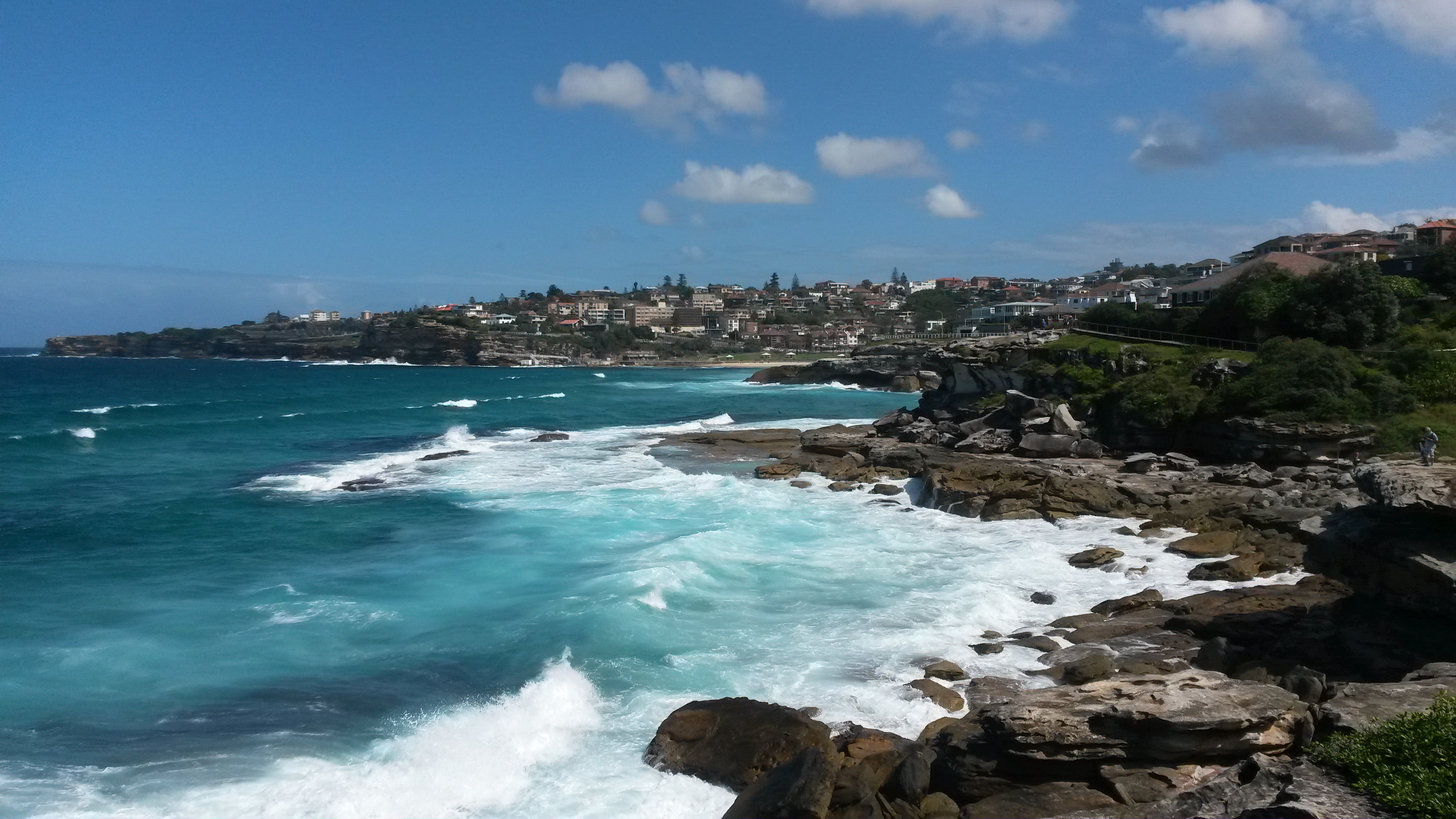
Back in March and April 2015 my husband and I travelled to Australia for a couple of weeks for vacation. We went to visit some good friends who live in Sydney. We spent most of our time in Sydney and some of the surrounding areas, such as the Blue Mountains. We also spent a few days up in the Port Douglas area, including a couple of days on a boat out on the Great Barrier Reef.

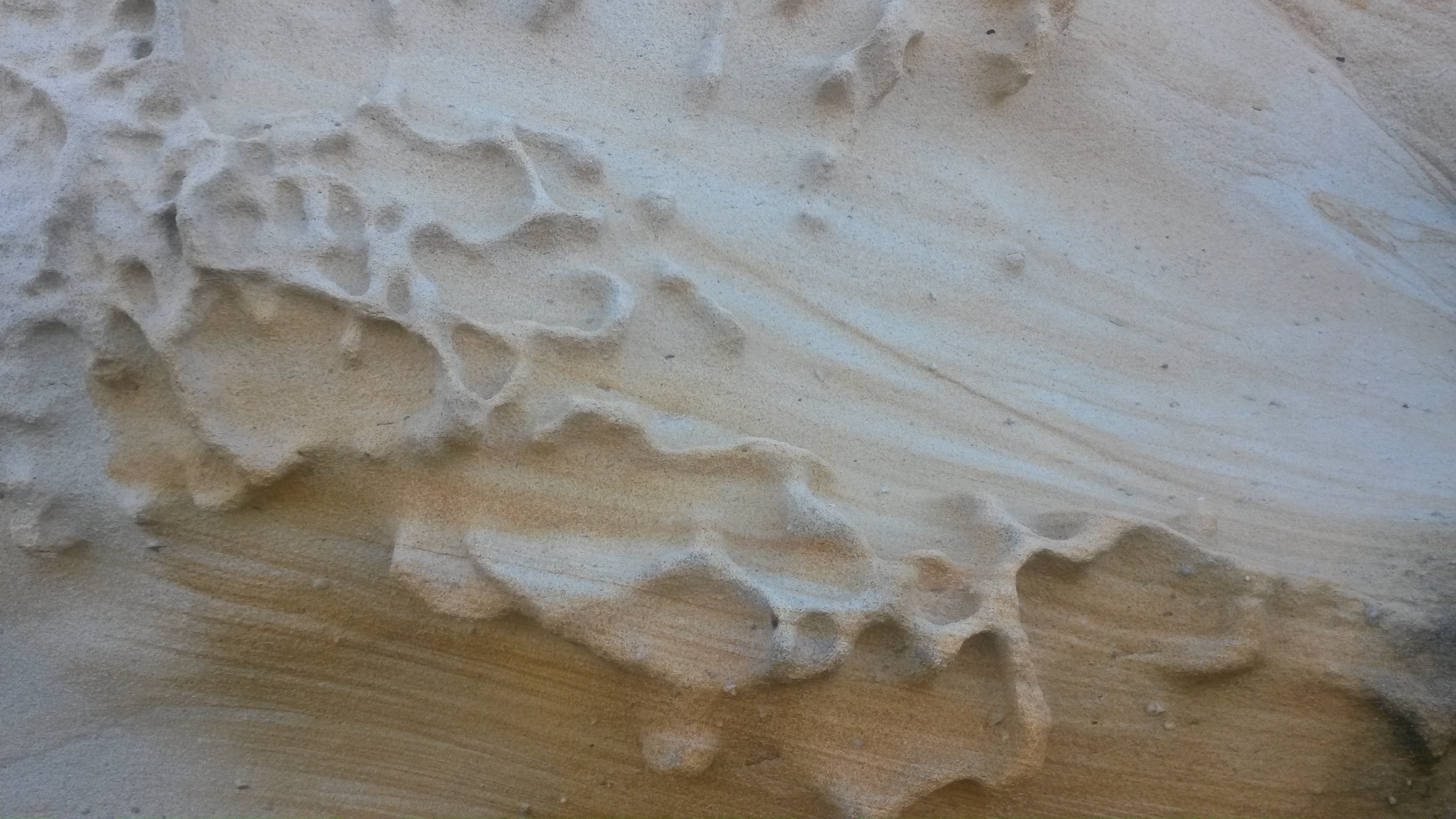
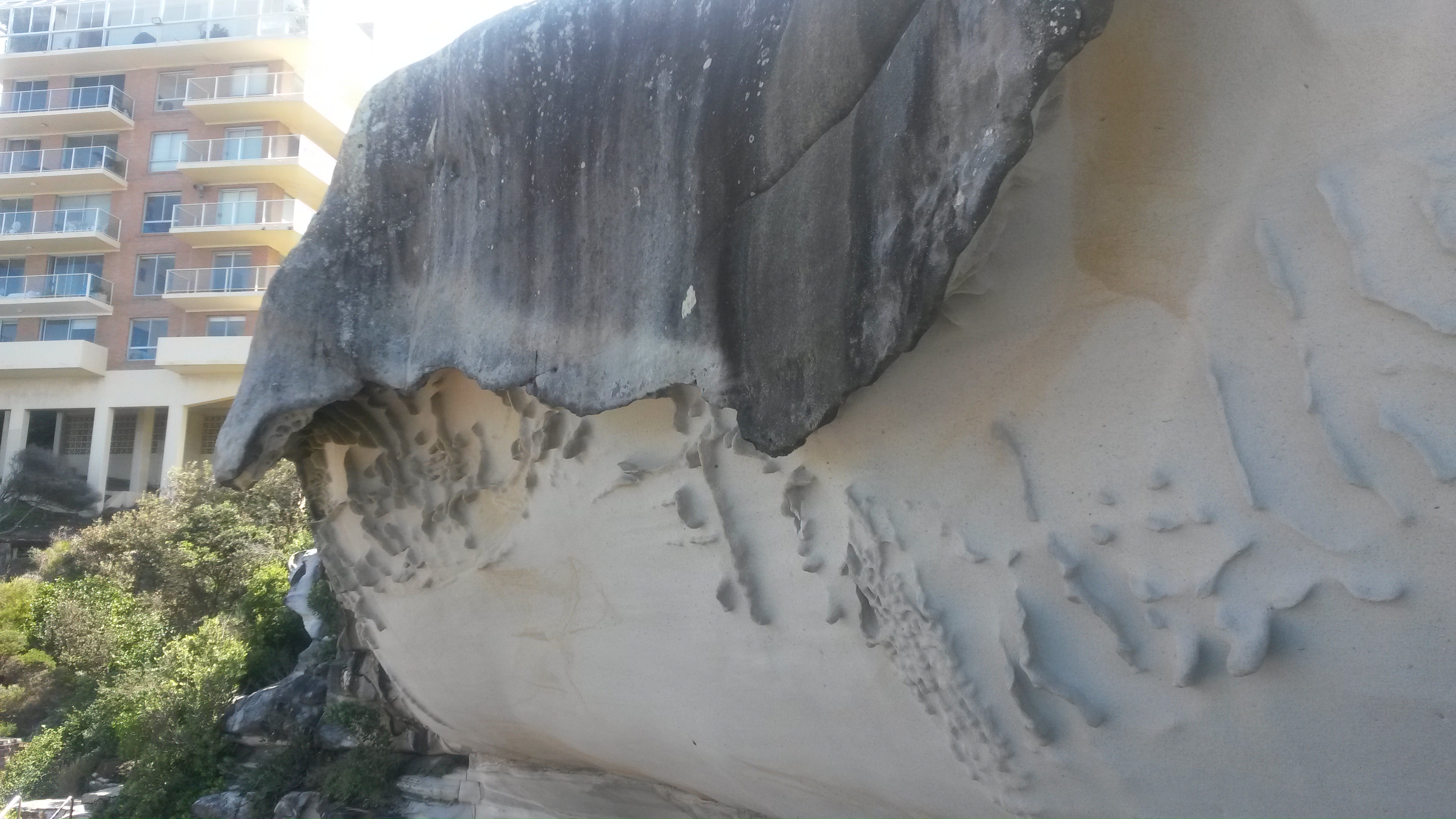
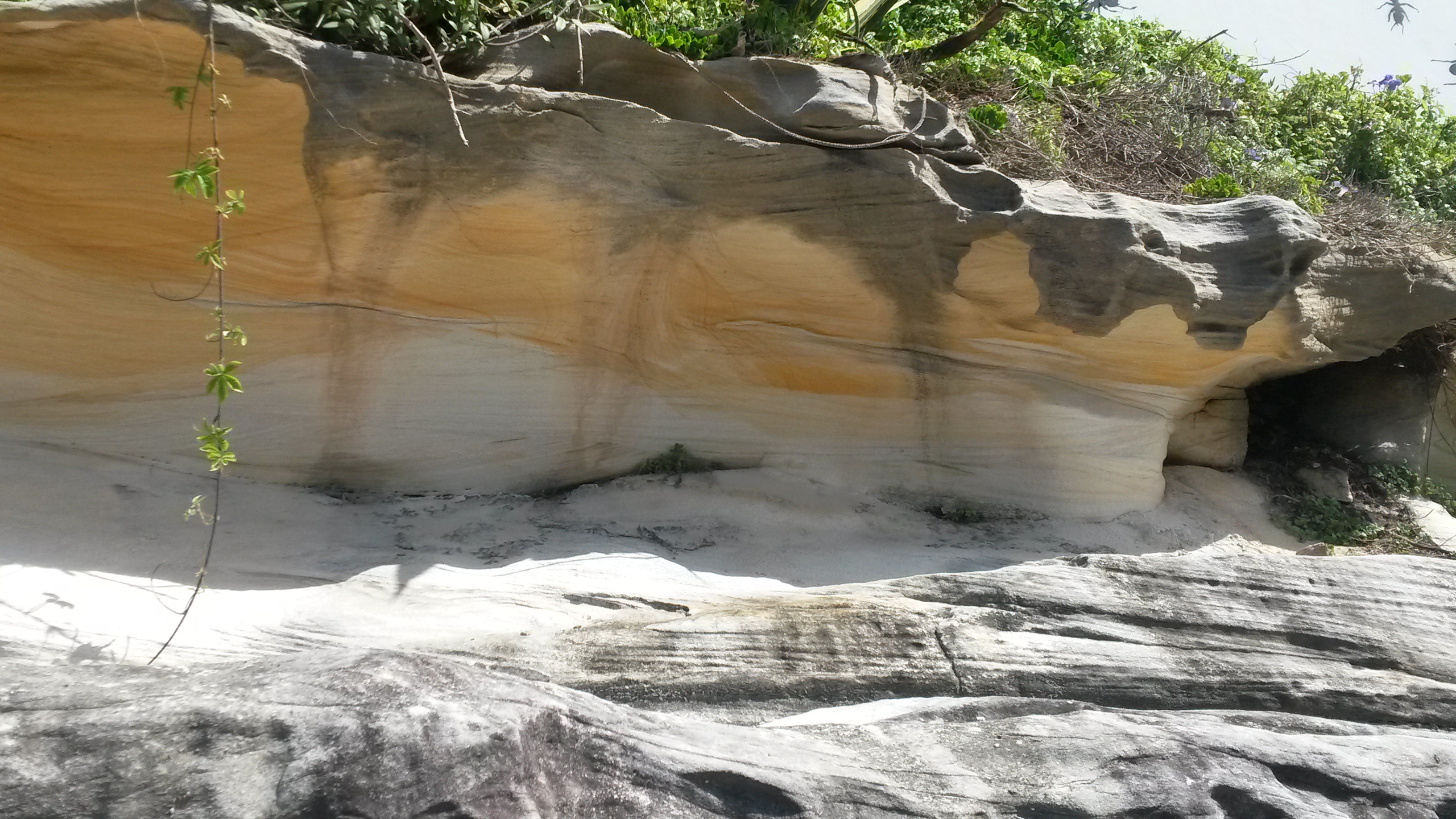
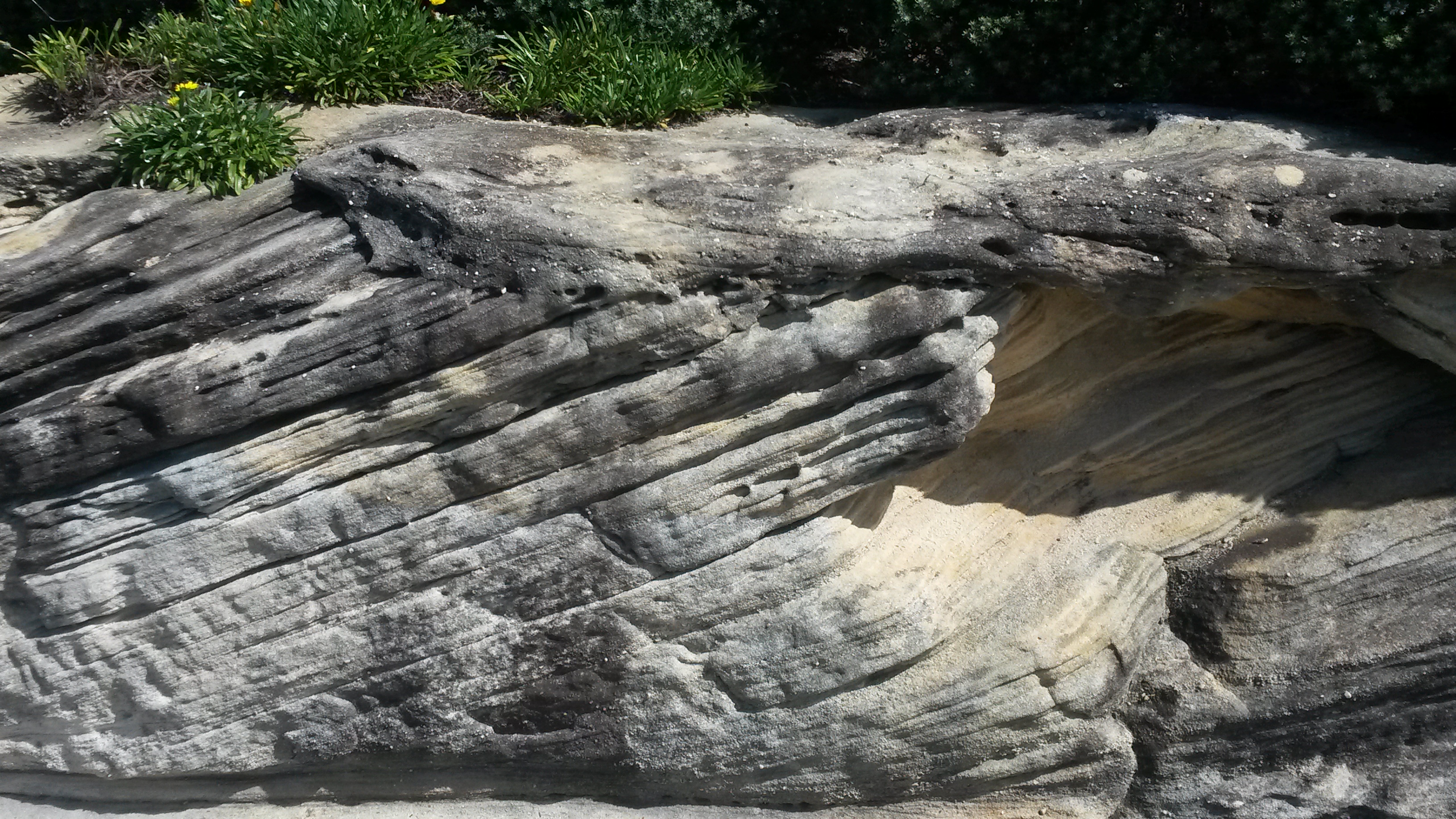
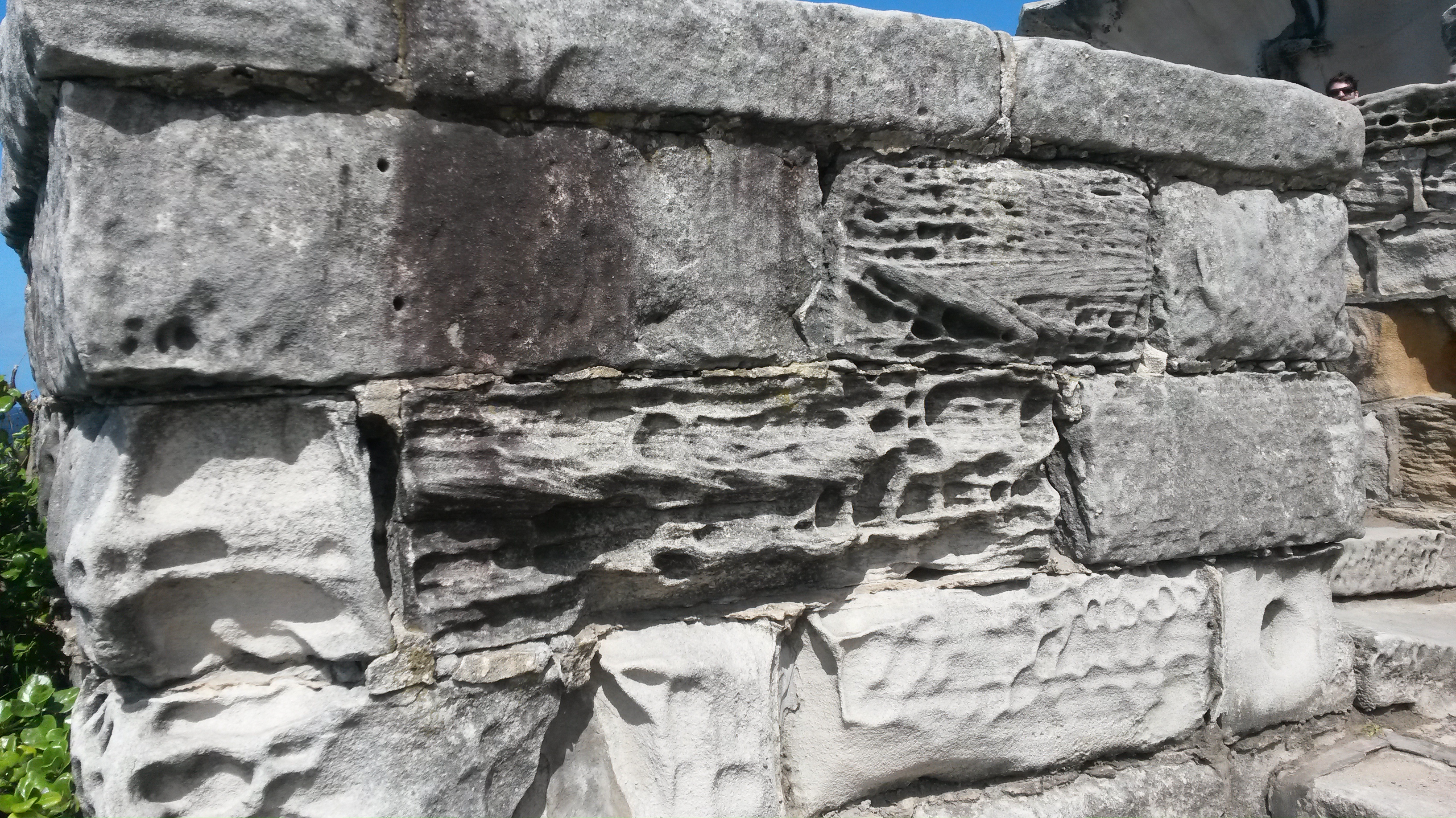
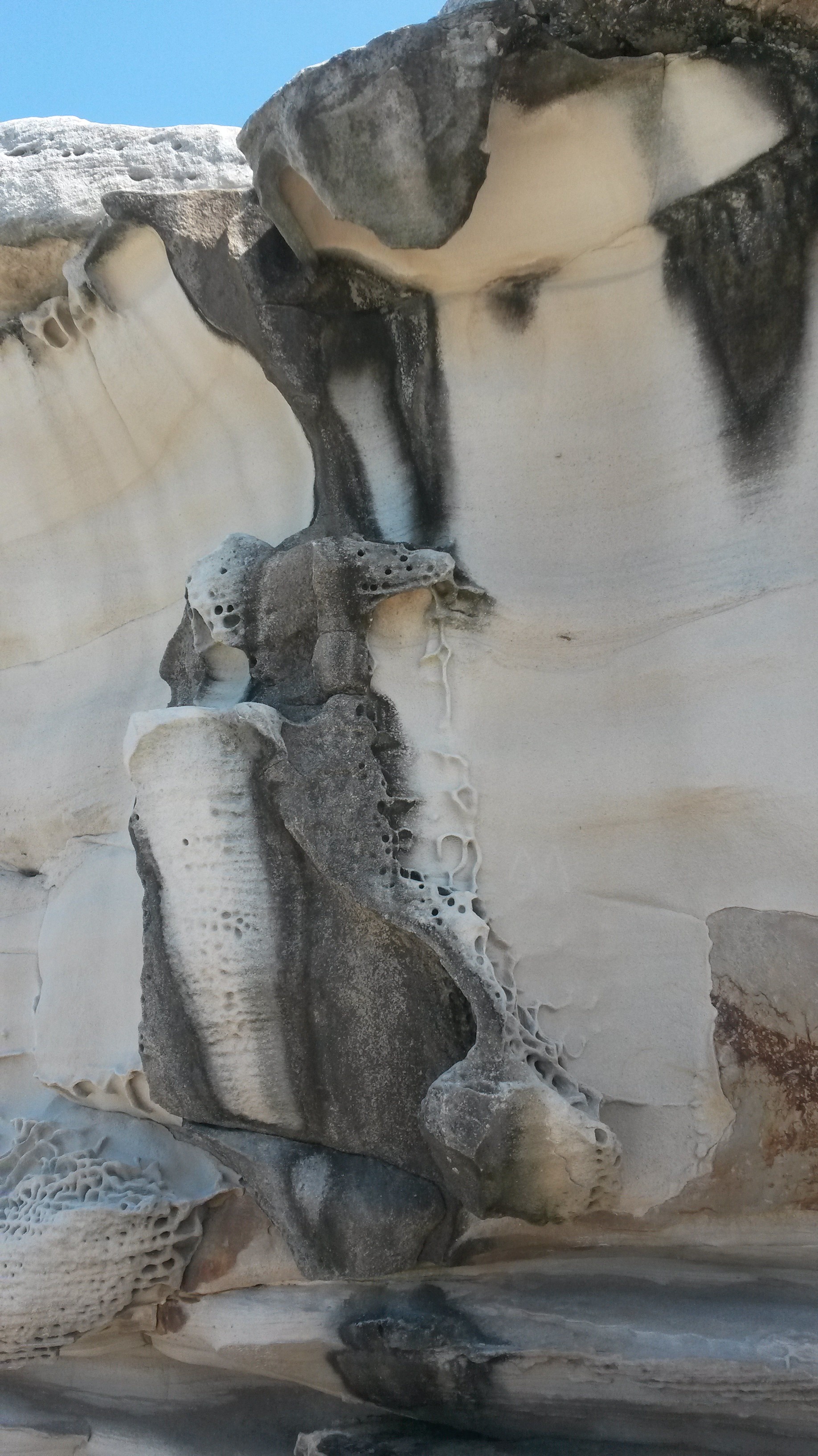
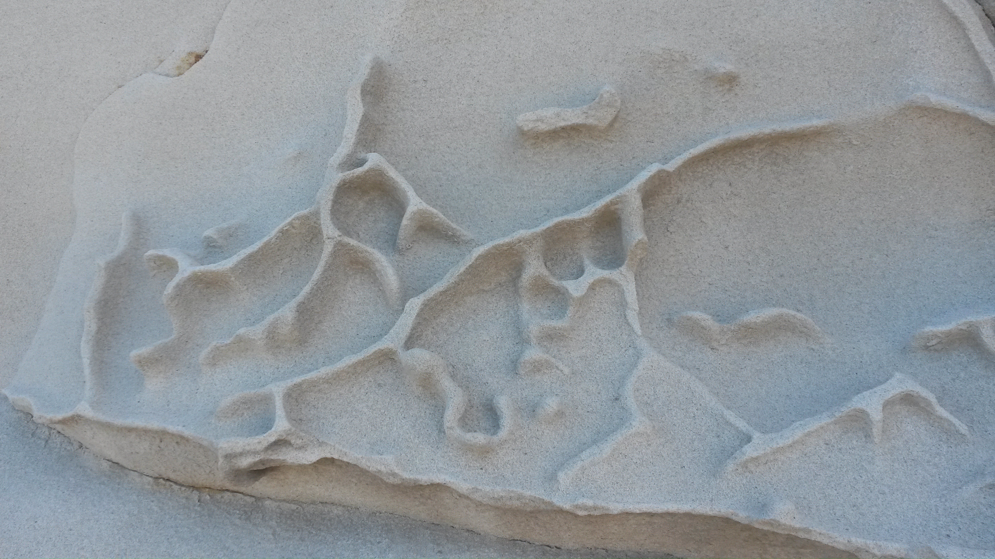
While we were in Sydney, we were very impressed by all of the sandstone, which can be seen in outcrop at many places in Sydney, including along many of the beaches. We observed many interesting features in these sandstone outcrops, such as impressive cross-bedding structures, trace fossils, interesting erosional forms, and oxidation/coloring of various types and shades. We also observed that many buildings, walls, bridges, and other structures in Sydney are constructed out of sandstone blocks, which we assume were locally derived.

I’ve already shared some pictures of Sydney sandstone outcrops here, here, and here and of some sandstone building stones here. Today, I want to share some more pictures of Sydney sandstone and also briefly discuss its geology.

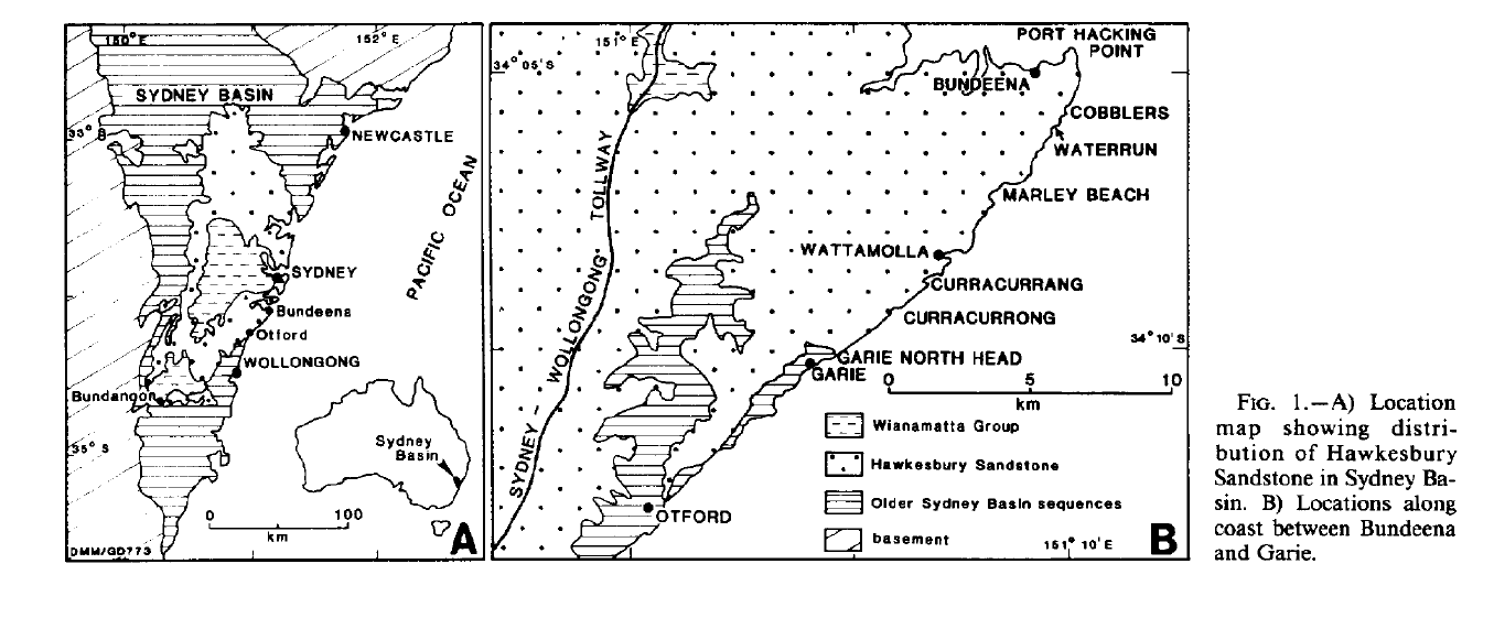
The sandstone that we observed around Sydney is known as the Syndey Sandstone or the Hawkesbury Sandstone. A nice scientific paper about the sandstone can be found here. The sandstone is Triassic in age and is interpreted to have been deposited in a fluvial environment by the ancient Hawkesbury River. Based on the scale and nature of features in the sandstone, such as cross-bedding and abandoned filled channels, this ancient river was likely a very large, sand-rich, braided river with deep main channels. Some of the abandoned channel fills are up to 18 m deep. The Hawkesbury Sandstone is extensively exposed in the Sydney area, outcropping over ~20,000 square kilometers in the Sydney Basin. The sandstone unit has a maximum thickness of ~290 m. The sandstone is a beautiful rock and has been used extensively as a building stone in Sydney, from the 1700s through to the present day.

Here’s a map showing the extent of the Hawkesbury Sandstone in the vicinity of Sydney:

Map showing the extent of the Hawkesbury Sandstone in the Sydney Area. Map from
Map showing the extent of the Hawkesbury Sandstone in the Sydney Area. Map from Rust and Jones (1987), Journal of Sedimentary Research, Vol. 57, No. 2: 222-333. Click to enlarge.

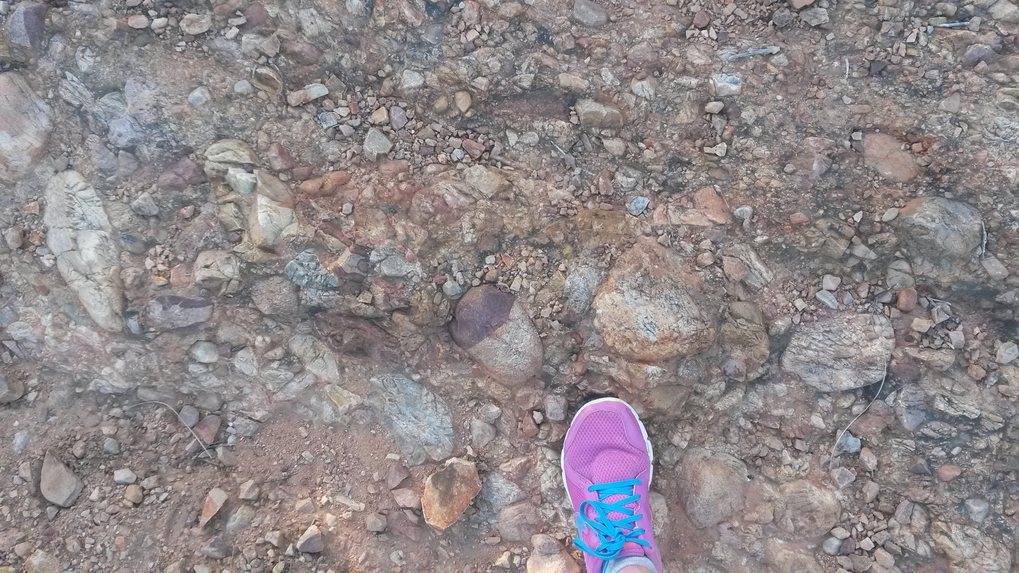
Here are some more pictures of this remarkable sandstone that we encountered pretty much everywhere in Sydney. The pictures below were all taken during a walk along the ocean, near Bondi Beach.

Sydney Sandstone #2.
Sydney Sandstone #3.
Sydney Sandstone #4.
Sydney Sandstone #5.
Sydney Sandstone #6.
Sydney Sandstone #7.
Sydney Sandstone #8.
Sydney Sandstone #9.
Sydney Sandstone #10.
Sydney Sandstone #11.
Sydney Sandstone #11. Sandal for scale.
Sydney Sandstone #12.
Sydney Sandstone #13.
Sydney Sandstone #14.
Sydney Sandstone #15. A bench amidst the cross-bedding.
Sydney Sandstone #16. Another view of the bench adjacent to the cross-bedding.
Sydney Sandstone #17.
Sydney Sandstone #18.
Sydney Sandstone #19.
Sydney Sandstone #20.
Sydney Sandstone #21.
Sydney Sandstone #22.
Sydney Sandstone #23.
Sydney Sandstone #24.
Sydney Sandstone #25. Sandstone being used as a building stone along the walking path... near an outcrop of the same sandstone.
Sydney Sandstone #25. Sandstone being used as a building stone along the walking path… near an outcrop of the same sandstone.
Sydney Sandstone #26.
Sydney Sandstone #27.
Sydney Sandstone #28.
Sydney Sandstone #29.
Sydney Sandstone #30.
Sydney Sandstone #31.
Sydney Sandstone #32.

That’s all for today… stay tuned for some more pictures from our recent Australian travels!

Monday Geology Picture(s): Stone Wall in a New Hampshire Forest

Stone Wall 1, September 2015.

I have been highly negligent in my blog writing recently. I hope to make up for that over the next few months… starting with writing my “Monday Geology Picture” posts regularly again.

For this week’s picture I’m sharing a picture that I took today in Deering, New Hampshire. The picture shows an old stone wall, now partly covered over by forest. Here in New England one often runs across old stone walls in the forest. These walls are generally remnants showing the outlines of former fields, most likely used long ago for sheep or other animals. Every now and then in the forest you run across other signs of former farming, such as apple trees and old stone foundations. Land use changes over the years, and here in New England much former farmland has returned to forest, albeit new growth forest full of young trees and other vegetation.

Here are a couple more pictures of the  stone wall that I saw today:

Stone Wall 2, September 2015.
Stone Wall 3, September 2015.

Monday Geology Picture: Cross-Bedding Sandstone Bench, Sydney, Australia

Enjoying a stop at a bench in front of some Sydney sandstone with classic cross-bedding.

Goodness, I’ve been busy recently! I’m afraid that my blogging has been quite neglected… as it has been for the past few months.

However, things have finally calmed down a little now, so I’m going to make an effort over the next few weeks to share some geological pictures from some of my recent travels… and also possibly from some travels in 2014 that I neglected to blog about.

I’ll start with this quick “Monday Geology Picture” post. This week’s picture shows me sitting on a bench in front of some sandstone in Sydney, Australia. This particular sandstone displays some impressive cross-bedding. My husband took this picture when we were on a beachside walk near Bondi Beach back in March 2015. I wish that all benches had such great geological scenery in the vicinity!

Monday Geology Picture: The Three Sisters, Blue Mountains, Australia

The Three Sisters, viewed in April 2015.

This week’s Monday Geology Picture was taken during my recent vacation in Australia. One day my husband and I drove outside of Sydney to spend some time exploring the Blue Mountains. One of the tourist attractions that we visited is a lovely rock formation known as The Three Sisters. This rock formation was carved (by erosion) out of ~250 million year old sandstone.

Monday Geology Picture(s): Bogenfels Rock Arch, Sperrgebiet, Namibia

20150613_164245


My apologies that I’ve been very quiet here on Georneys recently. My travel and work schedule were extremely hectic during the past month… plus I was working on a couple of scientific papers related to my PhD thesis research. However, life is a bit calmer now, so hopefully I’ll catch up on some blogging soon! I want to share some more pictures from my trip to Australia, amongst other things.

I’ll start with a few pictures from my recent trip to Namibia. Recently, I had the good fortune to spend a couple of weeks in the Sperrgebiet in Namibia doing some fieldwork on behalf of De Beers. I do not blog about my industry work here on Georneys (unless the work is published and thus in the open domain), so I can’t share the details of my trip. However, I can share a few pictures of some of the “tourist attractions” that I saw during my field work.

Sperrgebiet means “Prohibited Area” in German (the Germans colonized Namibia, so some German words and town names are still found in the country). The Sperrgebiet is an area in southern Namibia (stretching between Lüderitz and Oranjemund) where very rich placer diamond deposits are found. Since the early 1900s, access to this area has been highly restricted. Even for De Beers employees, special police clearances and permits are required to enter the area, and security remains strict. However, for those who do have access, the Sperrgebiet is a fascinating and magical place. Aside from the fantastic hard rock and sedimentary geology (and wildlife!) that one can see, the area contains a number of historical and archaeological sites. There are a number of abandoned diamond mining “Ghost Towns” that are weathering away in the desert, pretty much undisturbed (by humans, anyway) since they were abandoned tens of years to more than a hundred years ago. For the general public, it is extremely difficult to enter the Sperrgebiet. However, there is one tour company that operates a day trip (from Lüderitz) to Pamona, one of the abandoned diamond mining towns, and the Bogenfels Rock Arch, which is the subject of today’s post. If you ever find yourself in southern Namibia, I highly recommend the tour although you must remember to submit paperwork for the tour well in advance. Even tourists require a permit to enter the Sperrgebiet!

Without further ado, I present a few more pictures of the impressive Bogenfels Rock Arch below. From what I understand “Bogenfels” actually means “Rock Arch” in German. Certainly, the arch is an impressive feature located right on the coastline.

Bogenfels Rock Arch #2 - from a distance.
Bogenfels Rock Arch #2 – from a distance.
Bogenfels Rock Arch #3.
Bogenfels Rock Arch #4.


That’s all for now… stay tuned for a few more pictures from Namibia!

Monday Geology Picture: South African Wind Farm

A wind farm near Jeffrey's Bay, South Africa.
A wind farm near Jeffrey’s Bay, South Africa.

South Africa is currently facing a significant shortage of electricity. Recently, there have been regular periods of “load shedding” or planned power outages. Basically, there is often not enough power to go around, so the power is purposely turned off on a rotating schedule. In the neighborhood where I live and work in Cape Town, the power is regularly turned off for two hours a day or sometimes for four or more hours per day. As you can imagine, these regular power outages are quite disruptive to work and home life and certainly have a negative impact on the economy.

There is a great need for more power sources here in South Africa. Thus, I was quite pleased when I recently drove past a relatively new wind farm near Jeffrey’s Bay, South Africa. As the wind turbines spun, I smiled thinking about the power that they are diligently producing. Although wind farms will probably only play a small role in solving South Africa’s energy crisis, every little bit helps. Also, every megawatt of power produced by a wind farm is one less megawatt of power than needs to be produced by “dirtier” carbon emitting power plants, such as coal plants.

Red Conglomerate Hills Near Oudtshoorn, South Africa

Red conglomerate hills with a rock arch.

On Monday I shared a picture of a pretty conglomerate that I recently walked across. Today I thought that I would share a few more pictures of this conglomerate formation and also tell you a little more about it. Although in Monday’s picture the conglomerate looks somewhat dull-colored, the conglomerate formation is actually impressively red in color in many places, so much so that hills made of the conglomerate are known as “the red hills” or “the red stone hills”.

My husband and I hiked amongst the red conglomerate rocks during a recent stay at a wonderful holiday farm known as the Red Stone Hills, named in honor of the local geology, of course! The farm is located a few miles outside of Oudtshoorn, South Africa, a town known for ostrich breeding… so you pass fields of ostriches on your way to the farm! We also stayed at the farm a couple of years ago although I neglected to share pictures of that visit here on Georneys. Around the farm there are several hills of the striking red conglomerate rock. On some of the hills, impressive rock arches have formed. During our previous visit, we hiked up to one of the rock arches and took some pictures. The climb was quite strenuous, however. We only had a few hours for hiking on our recent visit, so we kept mostly to the valleys and observed the rock arches from a distance.

Geologically, the red conglomerates are part of the Buffelskloof Formation. This formation has also been called Enon in the past, so some people still refer to the red rocks as the Enon Conglomerates. The Buffelskloof Formation also contains breccias. The conglomerates and breccias were deposited in a large, land-locked basin in the early Cretaceous. The conglomerates were deposited by rivers and streams while the breccias represent scree deposits. The precise age of the Buffelskloof Formation is not known very well because of poor fossil preservation, most likely due to the sediments being emplaced in an oxidizing environment. Oxidation is also responsible for the reddish color of the rocks. The red color results from oxidation of iron in the matrix of the conglomerate/breccia rocks.

Without further ado, here are some more pictures of the pretty red conglomerates:

The lovely guest cottage where we stayed, nestled at the foot of one of the red conglomerate hills.
Another one of the lovely guest cottages on the farm.
The start to our walk amongst the red conglomerate hills.
Red conglomerate hills in the late afternoon sun.
Red conglomerate hills with intriguing weathering patterns.
Red conglomerate hills in the foreground and distance.
A closer view of the conglomerate texture.
Hiking across a conglomerate path.
Red conglomerate hills and impressive aloe.
Red conglomerate hills and impressive aloes.

I managed to find my pictures from our last visit to the Red Stone Hills farm, so here are some closer images of one of the impressive rock arches:

Conglomerate rock arch.
Standing in the conglomerate rock arch.
Standing in the conglomerate rock arch. For scale, my husband is about 6’2″ tall.
Another view through the arch.
Looking through the arch to more conglomerate hills.
A close-up view of some conglomerate texture near the arch.
One last view of conglomerate texture.
Another view of conglomerate texture.
Conglomerate texture, with husband for scale.

If you ever find yourself near Oudtshoorn, be sure to visit these impressive red conglomerate rocks!

Monday Geology Picture: Conglomerate Near Oudtshoorn, South Africa

Pretty red conglomerate, with my foot for scale.
Pretty conglomerate, with my foot for scale.

A couple of weeks ago I spent part of a weekend staying near Oudtshoorn, South Africa. During a hike, I walked by and, at times, across a beautiful Cretaceous age conglomerate. Here’s one image of the conglomerate, taken when I hiked across it. I’ll share some more pictures in another post.

Monday Geology Picture: Sydney Sandstone Building Stones

Sandstone building stones used in a bridge in North Sydney.

During my recent travels in Australia, I noticed quite a bit of sandstone around Sydney. Therefore, I was not particularly surprised to also see quite a few sandstone building stones around the city. For example, the stones shown in the above picture, which shows part of a bridge in North Sydney.

By the way, I’m back home in South Africa now and won’t be travelling for a little while. So, I hope to have time to write up several posts on my recent Australian trip. Stay tuned!