Elephant’s Eye on a rainy Saturday in February 2016.
This week’s “Monday Geology Picture” post features a natural rock formation that resembles an elephant. A small cave named “Elephant’s Eye” is located at the eye of this rock elephant’s head. The elephant consists of Table Mountain Sandstone and is located in the Silvermine Nature Reserve here in the Cape Town region of South Africa. On Saturday I hiked up to Elephant’s Eye with some friends. We hiked on a rare rainy summer day, and we appreciated the cooler weather for our hiking. The scenery on our hike was ethereal and beautiful, although we didn’t have much of a view from the top of the hill! We mostly saw mist. I’ll share some more pictures from our hike later this week.
Granite boulders on one of Cape Town’s beautiful beaches.
If you want to present at the 35th International Geological Congress, which is being held in Cape Town later this year, it’s not too late to submit an abstract! The deadline is January 31st.
I plan to submit my own abstract tomorrow. Come and join me at the congress! There are going to be some great talks and field trips… and you can come visit the gorgeous city of Cape Town, South Africa.
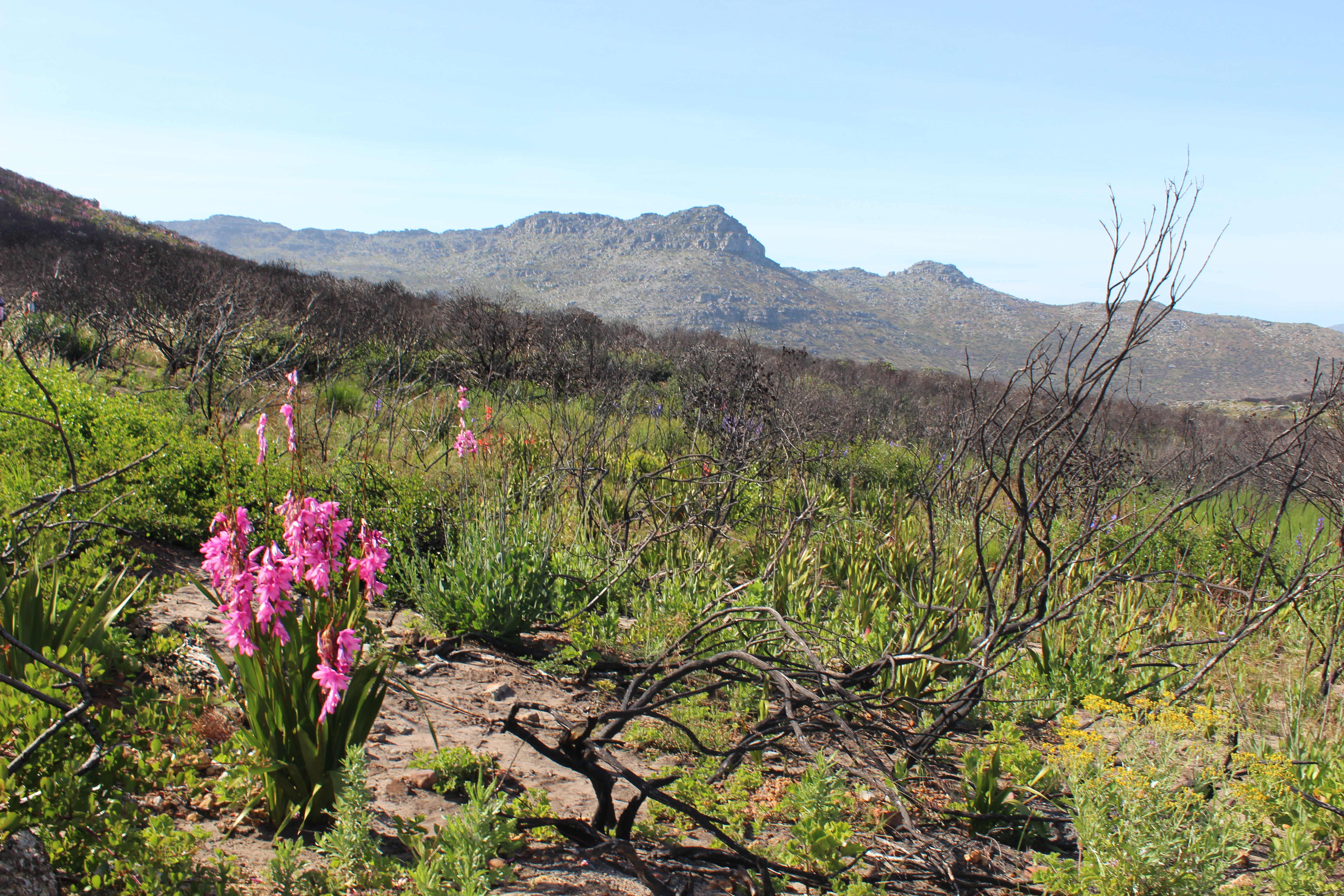
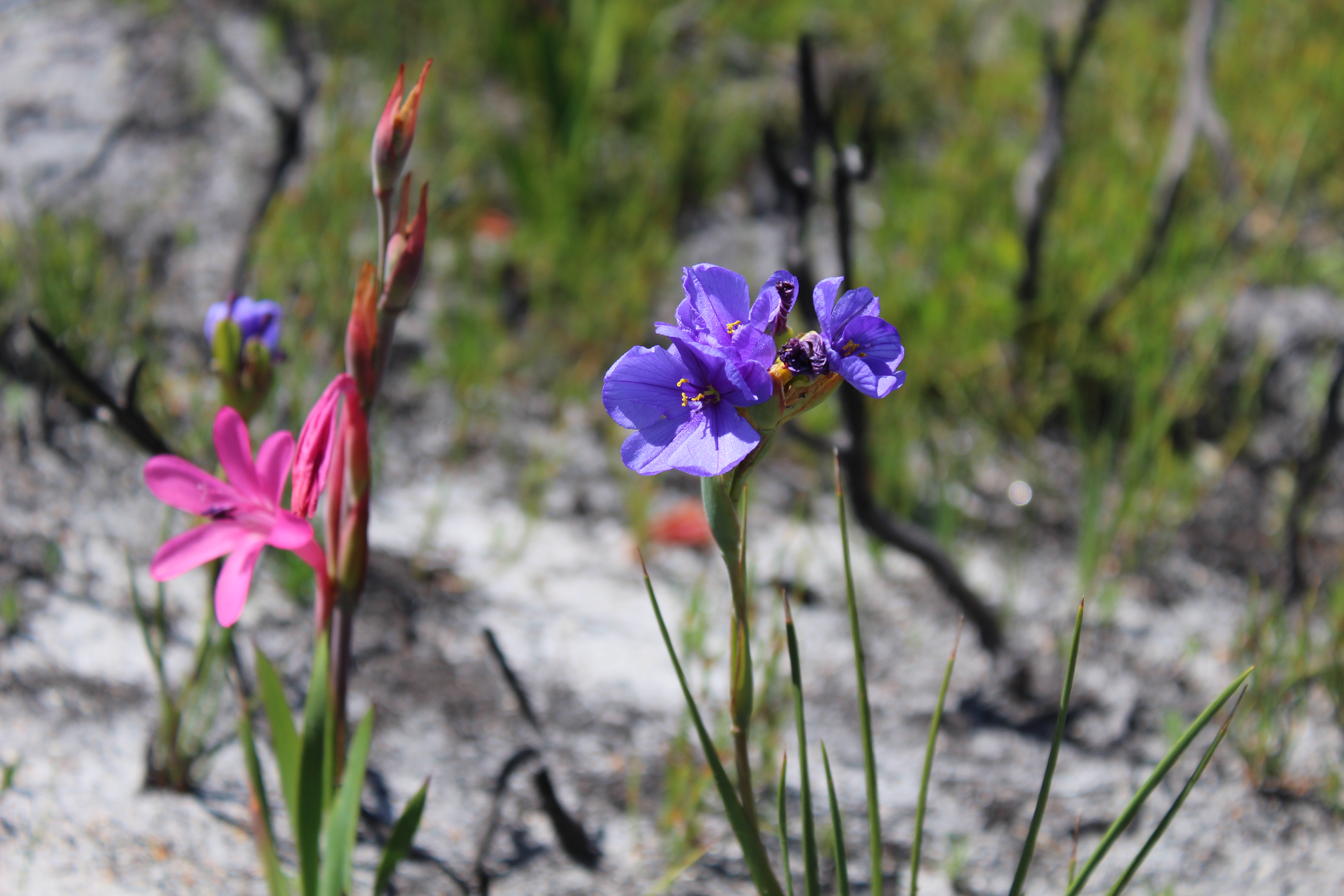
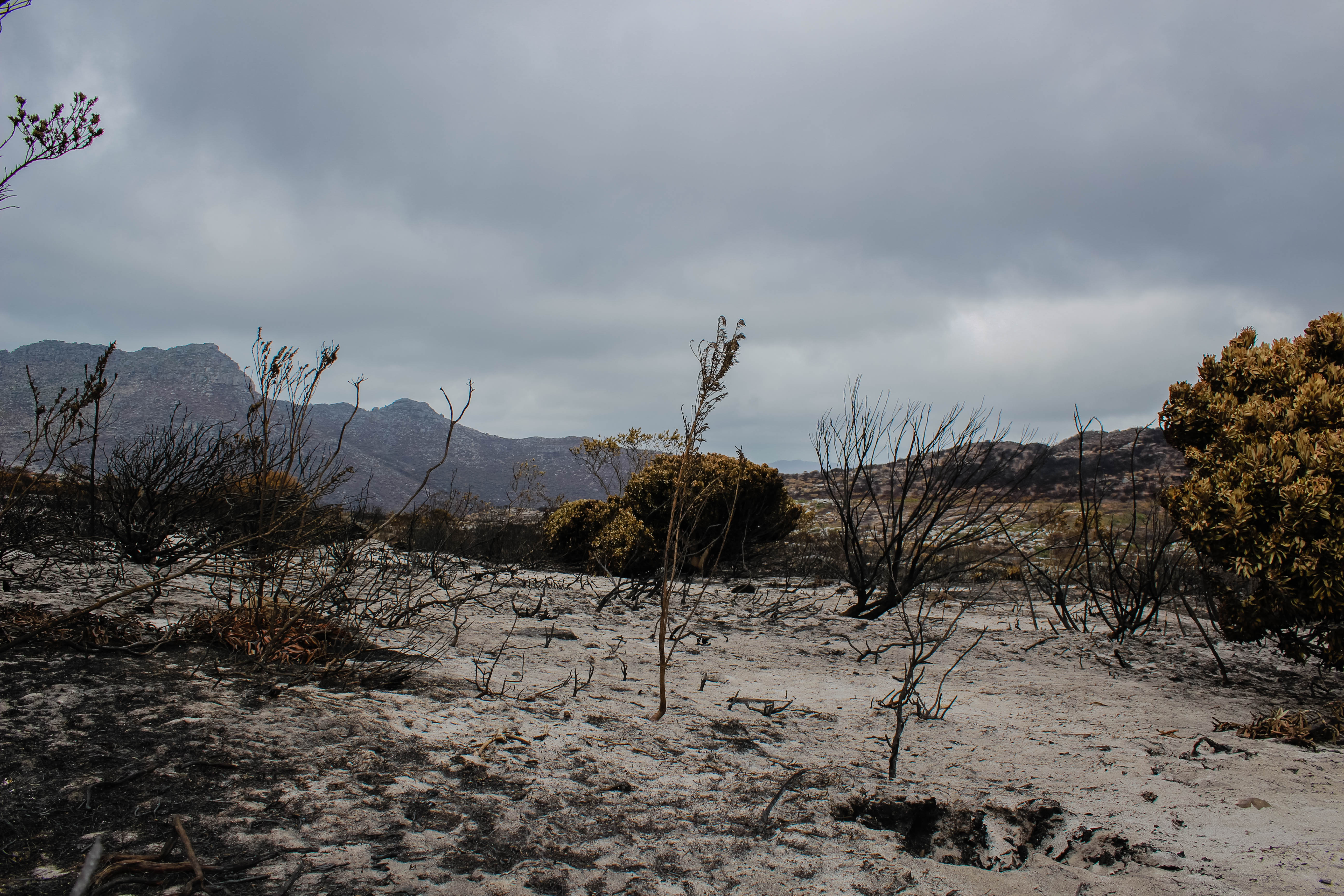
Silverine #1. Pink watsonia flowers are in the foreground, charred vegetation is in the background.
Earlier this year back in March, as I blogged about here and here, a large forest fire raged over much of the Cape Peninsula region of South Africa. Shortly after the fire was extinguished, my husband and I went on a hike in the Silvermine Nature Reserve, one of the areas badly affected by the fire. We found ourselves walking through a surreal, ash-covered landscape filled with charred vegetation, with occasional spared pockets of greenery.
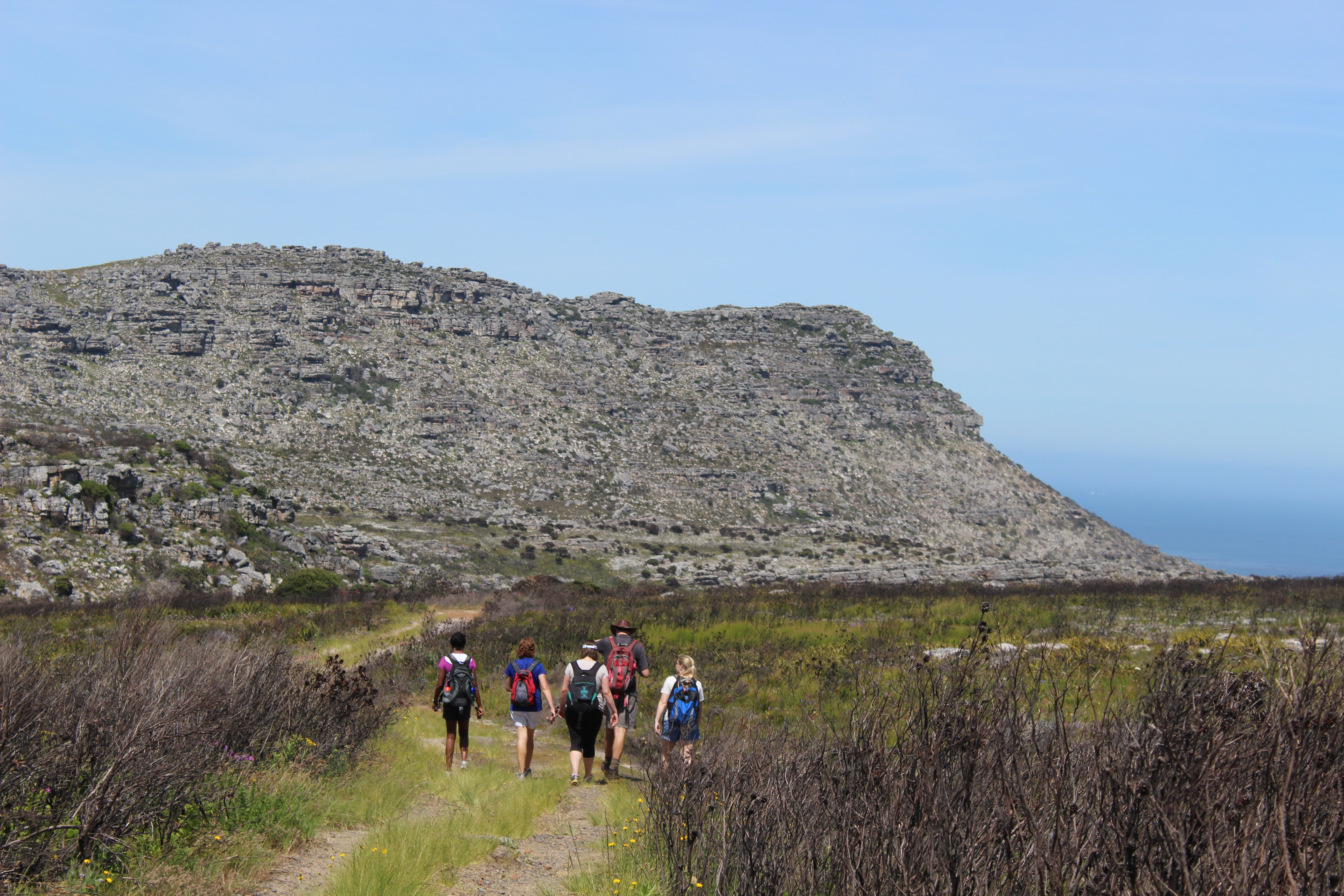
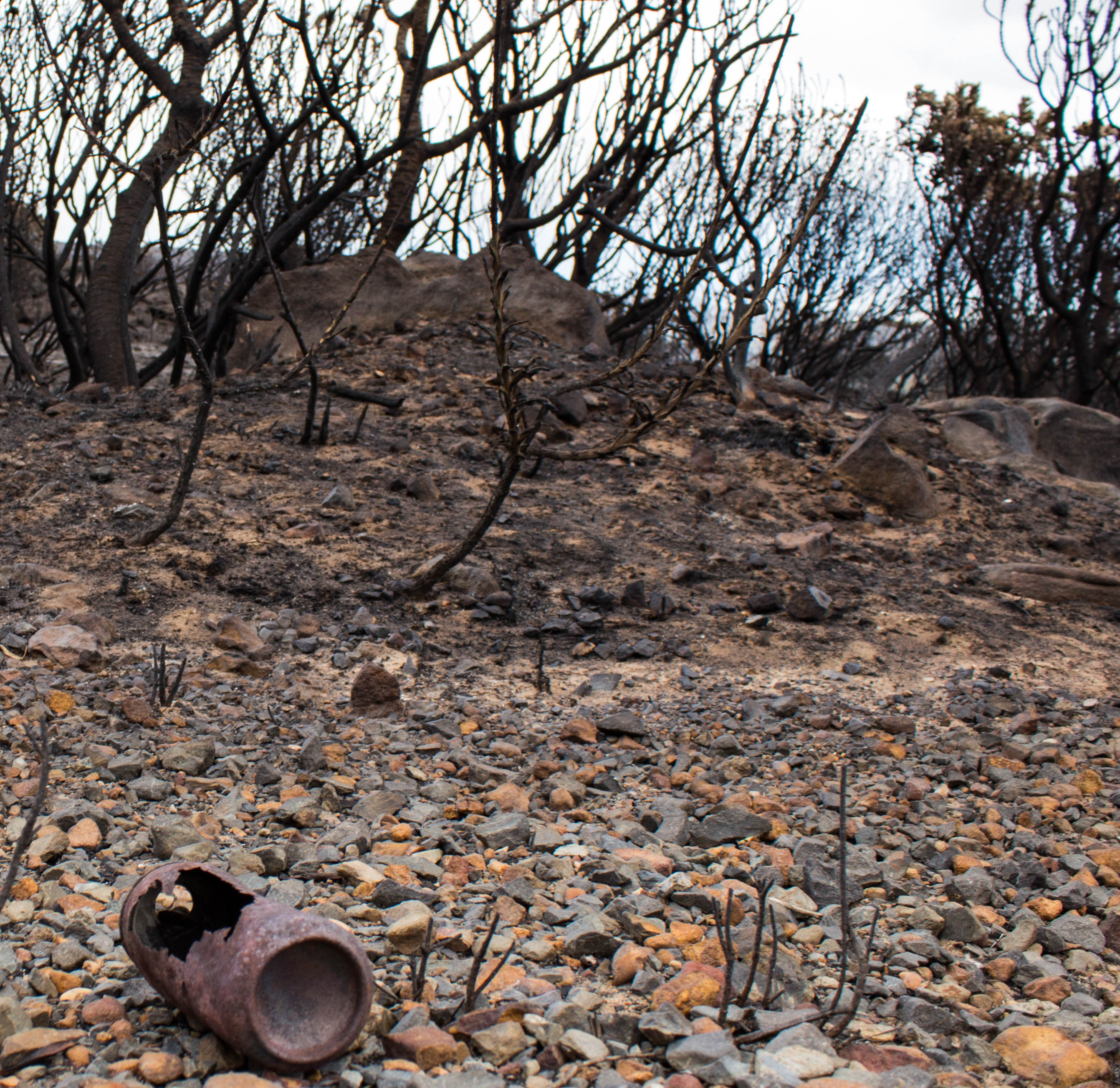
Originally, I had hoped to hike in Silvermine every month or two after the fire, to document the re-growth of the vegetation and other changes to the landscape. However, the reserve was closed shortly after our hike back in March. The reserve was closed to protect the environment, including the recovering vegetation, and also to protect people from hazards, such as partially-burned trees and damaged buildings. However, in October a portion of the reserve was opened up for hiking again. So, in November my husband and I organized a few friends, and we went on a half day hike at Silvermine. Today I want to share some pictures from that hike with you here.
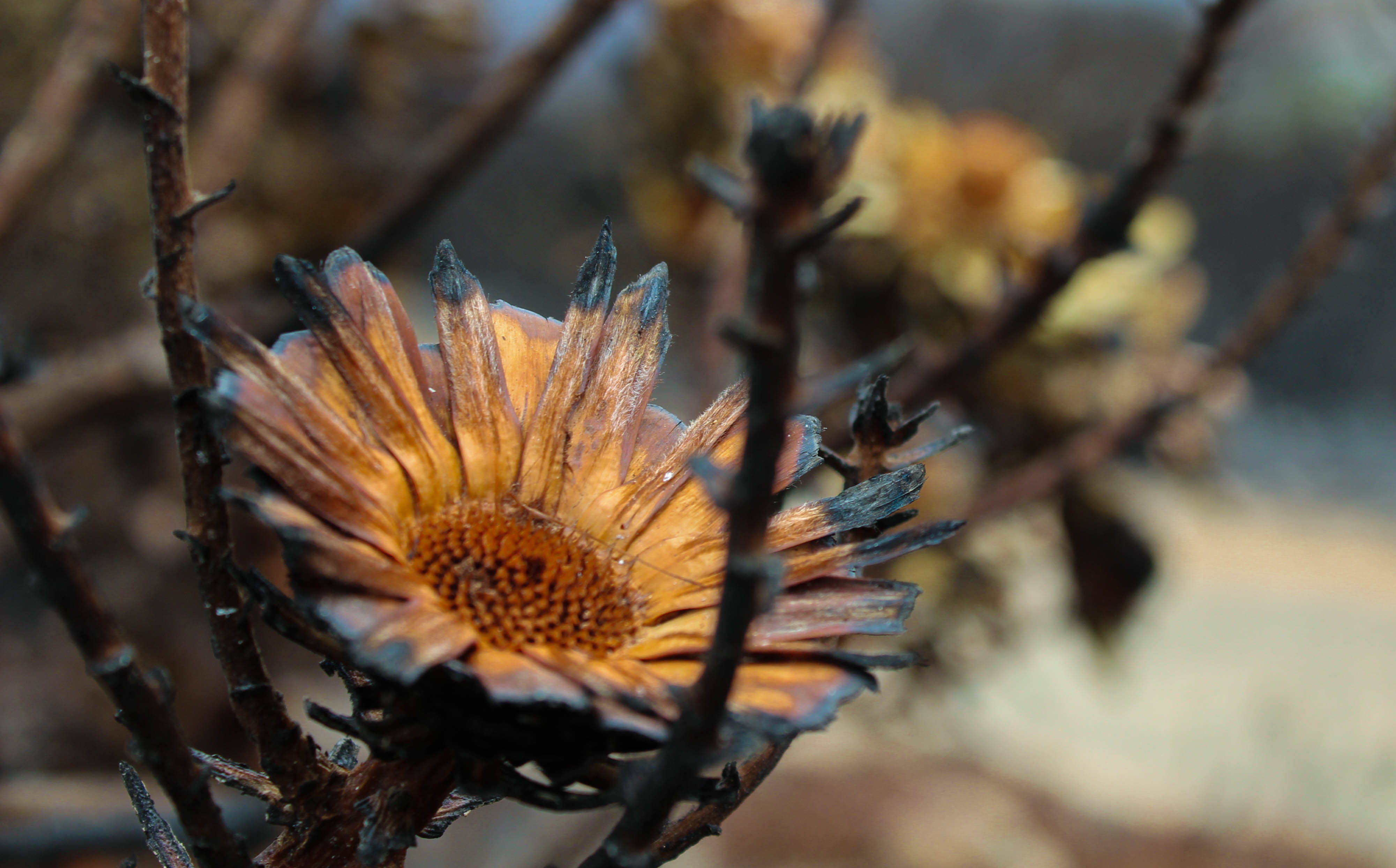
The Silvermine area is slowly but surely recovering from the fire. Animals are returning to the reserve, and the vegetation is also recovering. During our hike back in November, we found the flowers amazing, especially the gorgeous pink watsonias. There are always flowers at Silvermine, particularly during flower season, which has its peak in September and October. However, the flowers this year are the most impressive that I’ve ever observed at Silvermine during my 5 years of living in Cape Town. Because of the fire earlier this year, the flowers are more visible and stand out in vivid contrast against a charred backdrop of burned vegetation. In addition, the vegetation at Silvermine is different this year because opportunistic plants, including some flowers, are taking advantage of the extra space and sunlight.
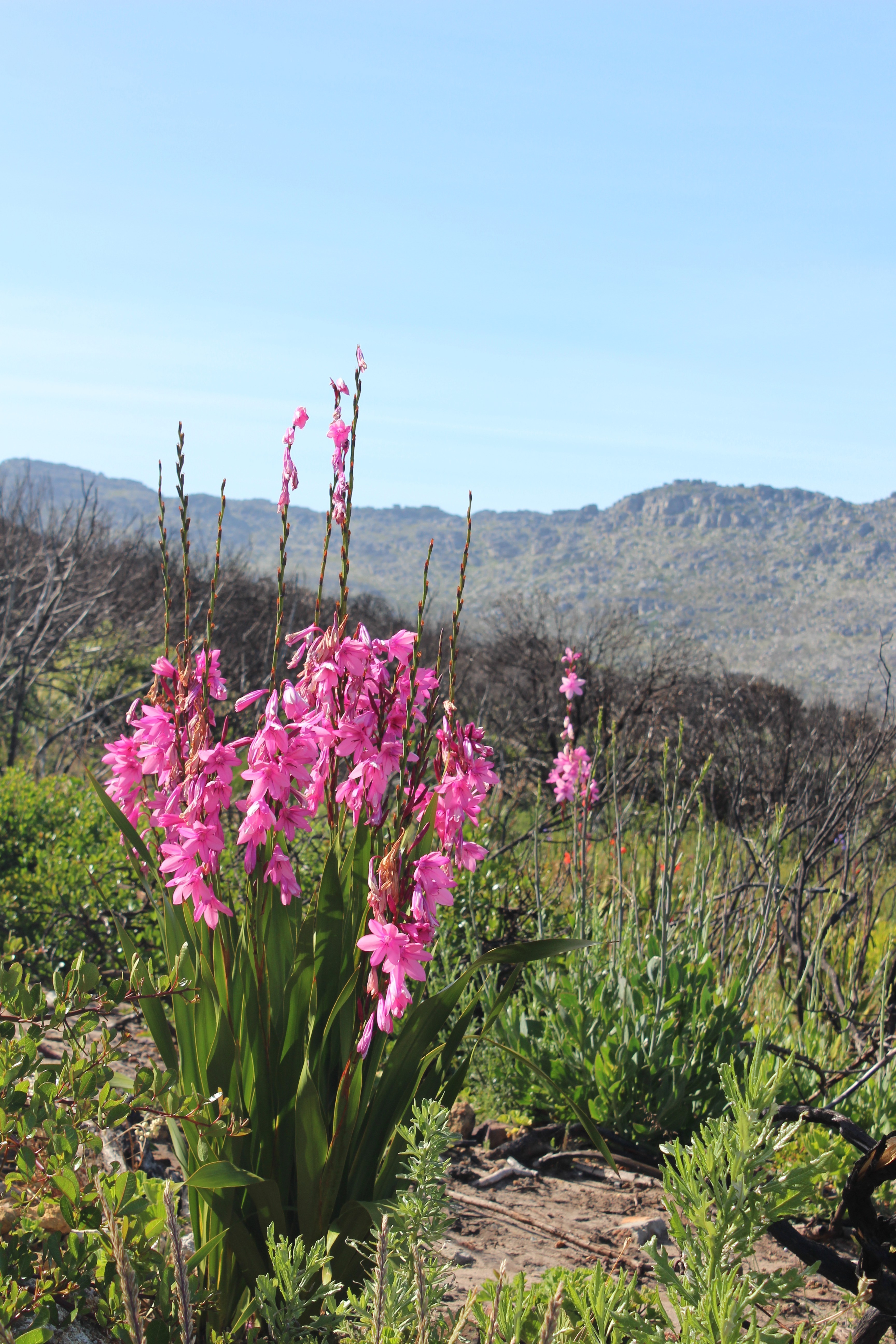
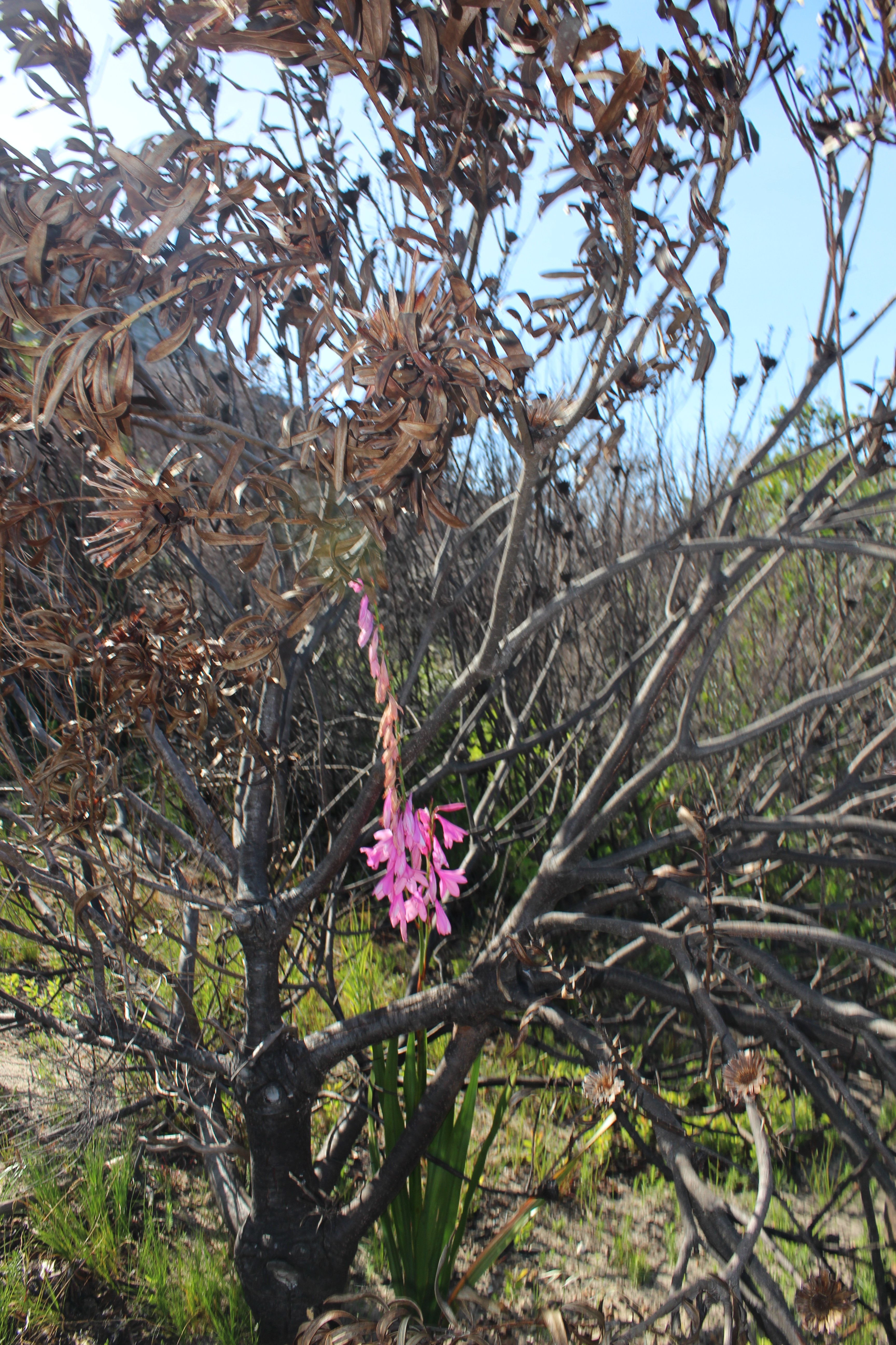
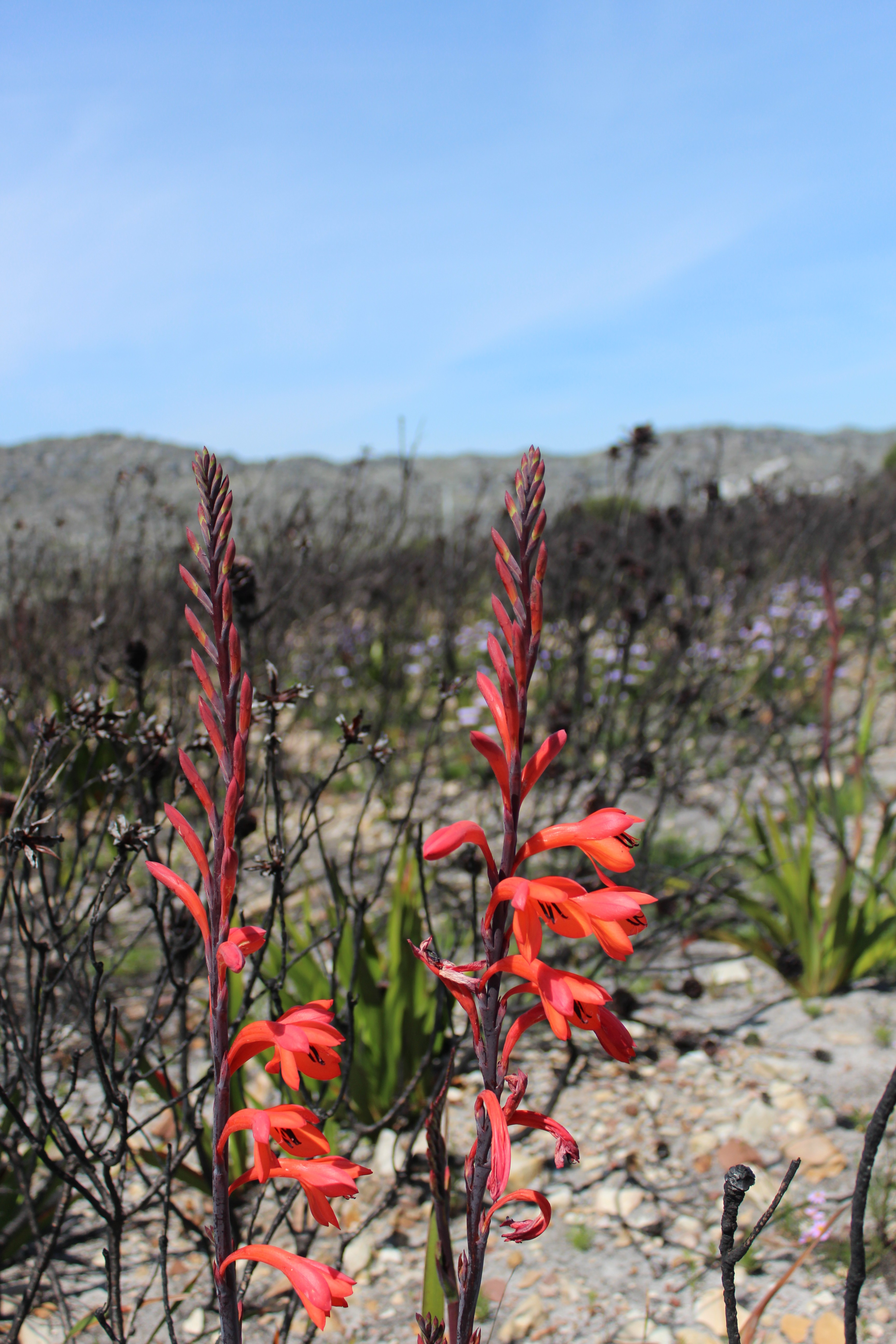
Without further ado, enjoy some pictures of our stunning November hike at Silvermine:
Silvermine #2. Hiking amongst burned vegetation, with some green below.Silvermine #3.Silvermine #4.Silvermine #5.Silvermine #6.Silvermine #7.Silvermine #8.Silvermine #9.Silvermine #10.Silvermine #11.Silvermine #12. My husband stops to admire a watsonia flower.Silvermine #13. Up close shot of watsonia flowers.Silvermine #14.Silvermine #15.Silvermine #16. Yours truly, posing with some watsonias.Silvermine #17.Silvermine #18.Silvermine #18.Silvermine #19.Silvermine #20.Silvermine #21. A protea bush that survived the fire.Silvermine #22.Silvermine #23.Silvermine #24. The happy group of hikers, sans photographer.
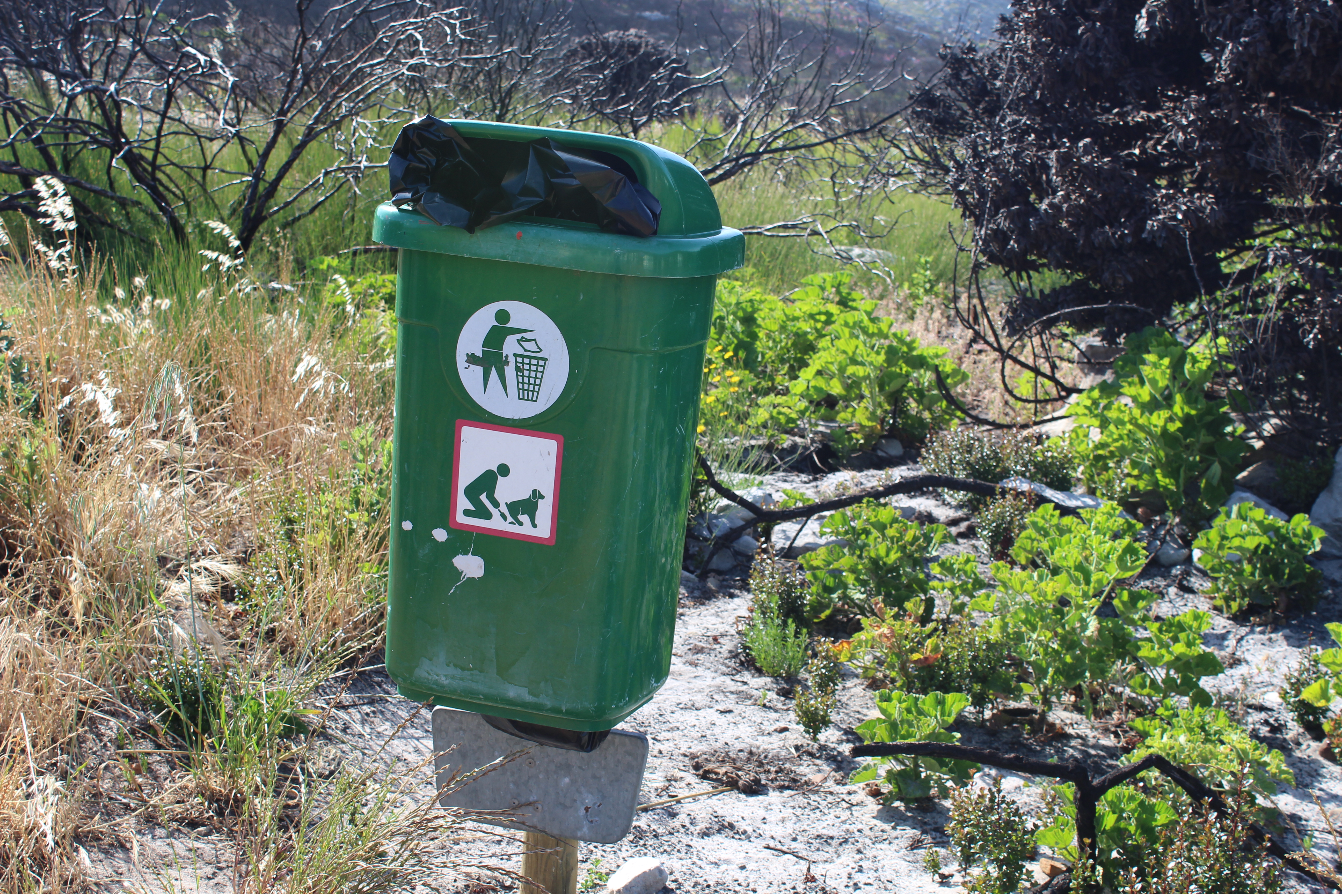
Last but not least, there’s a new (non-melted) green trash can:
Silvermine #25.
Certainly, Silvermine looks very different now compared to when we hiked there after the fire in March. The landscape will continue to change as the vegetation continues to grow back.
Website for the 35th International Geological Congress. Go check it out!
I recently registered to attend the International Geological Congress, a big geological conference that is held every four years in different locations around the globe. Next year, the 35th International Geological Congress is being held in Cape Town, South Africa, the beautiful city that I currently call home! The conference is being held August 27th to September 4th 2016, and there are a number of exciting field trips being held before and afterwards. For example, you can ride a train from Cape Town to Victoria Falls in Zimbabwe, stopping to see all sorts of geological wonders along the way. Or, if you prefer, you can spend a week travelling down the Orange River by canoe, paddling past 2 billion years of geological history. Or, if you’d like to learn a little about the geology that I study for my day job working as an industry geologist for De Beers, you can participate in a diamond field trip in South Africa or in a second diamond field trip up in Namibia. If you can’t attend one of the longer field trips, there are also a number of shorter field trips. For example, you can attend a day field trip to the West Coast Fossil Park, which I featured in this week’s “Monday Geology Picture” post.
I’m very excited to be attending the congress next year, and I hope that some of my local and overseas geological colleagues will consider attending. You can register for the conference any time between now and the day it begins. If you want to present a talk or a poster, the abstracts are due at the end of January. If you happen to be a friend of mine (that is, I know you in person, from graduate school or something like that), I might even be able to provide you with accommodation. Our house is a short drive from the conference venue, and we have two guest rooms and a couple of sofas that could accommodate visitors… and we have a swimming pool in the front yard! First come, first serve… although you have to like cats since we have three! At the very least, my geologist husband and I hope to host a couple of geological parties at our house for friends attending the conference.
Our pool… the perfect venue for post-conference relaxation!
I’m excited about this conference, for a number of reasons. First, I think it’s wonderful that geologists from all over the world will be coming to Cape Town and that I’ll be able to spend a week listening to all sorts of geological talks. Second, I haven’t attended a scientific conference since I started working in industry. It will good to attend an old fashioned academic conference again… and it sounds as if the International Geological Congress is going to be a good one! Last but not least, I have permission from my superiors to give a talk on some research that I’ve been working on recently. I can’t share the details yet since my abstract needs to go through various approvals first, but I’m looking forward to being able to share a little about some of the research that I carry out as an industry geologist. I’ll be sure to post a link to the abstract once it’s available on-line a few months from now.
And if all that doesn’t convince you to attend the 35th International Geological Congress, below are a few pictures of gorgeous Cape Town. Come and visit!
Gorgeous scenery, including an inselberg!Check out this beautiful nonconformity!Cape Town has great rocks… and some of them have adorable penguins living on top of them!More stunning scenery. Just sign up for the conference already!
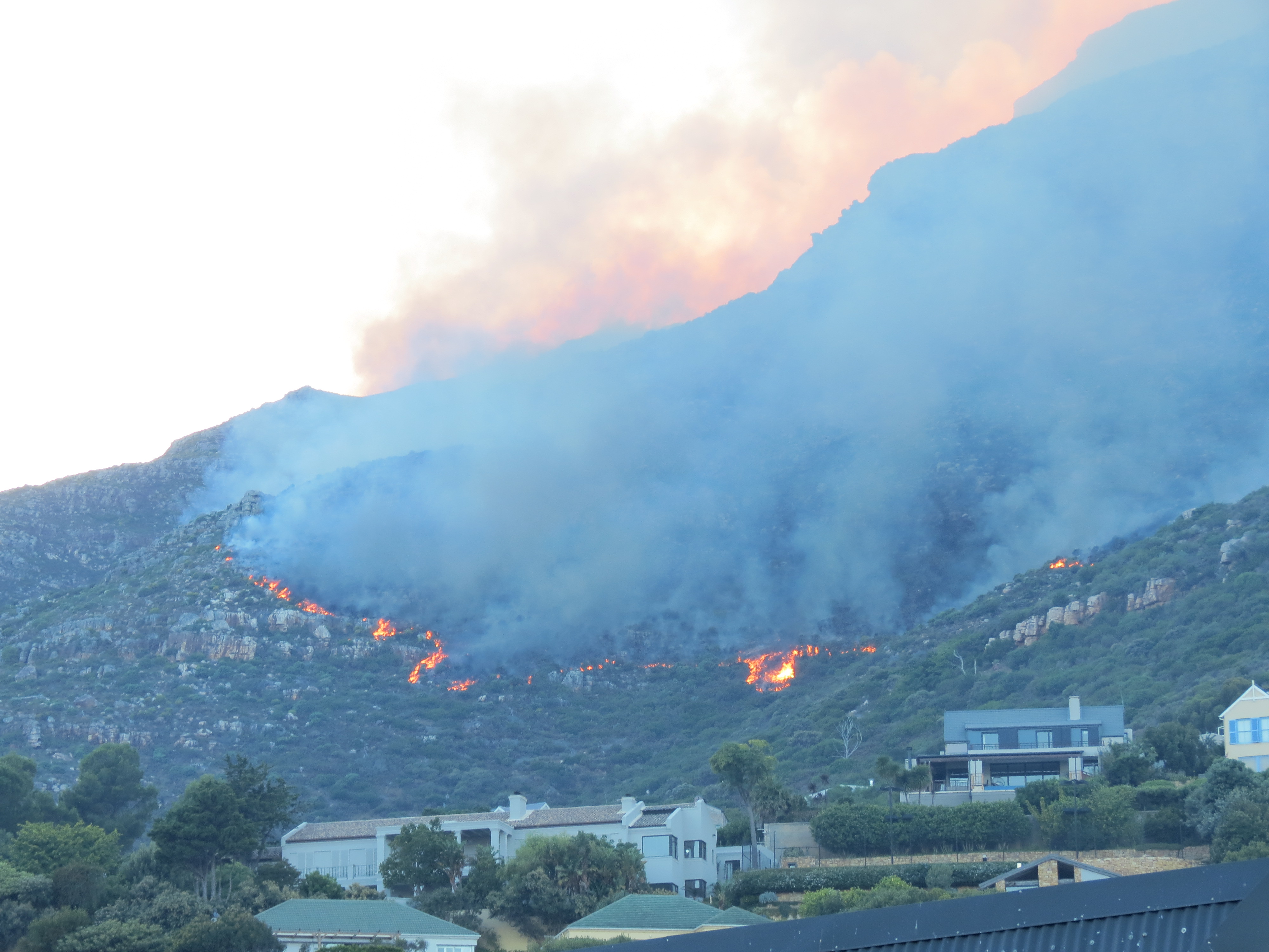
Earlier today I wrote up a post about the recent fire on the Cape Peninsula, nearby my home city of Cape Town, South Africa. I also shared some pictures of the fire raging near the town of Hout Bay. In this post, I’d like to share some pictures of the landscape that the fire left behind. This afternoon my husband and I spent a few hours hiking in the Silvermine Nature Reserve, which was burned by the fire just a few days ago. Before the fire, Silvermine was covered in fairly thick, lush, green fynbos vegetation, sprinkled here and there with colorful flowers. However, when we walked through Silvermine today the landscape was barely recognizable. Much of the vegetation had been burned away completely, and many of the plants and trees that remained had been charred black. In between the roasted remains of the vegetation, we saw bare soil, often singed black, or accumulations of white ash. Remarkably, every now and then we would pass a patch of vegetation that had been largely spared from the fire. For example, we occasionally passed patches of bright green succulents or brilliant protea bushes, remnants of the landscape that existed before the fire. When we hiked down a small valley, we reached the edge of the fire damage. For awhile, we followed the sharp boundary that separated charred soil from vibrant vegetation. The difference between the two sides – one burned, one green – was remarkable. It was fascinating wandering through the recently-burned landscape, which at times felt like a moonscape or perhaps a view from Mars or some other planet.
Without further ado, here are some pictures of the recently-burned Silvermine landscape:
Hout Bay Fire #1. Picture courtesy of Nils Backeberg.
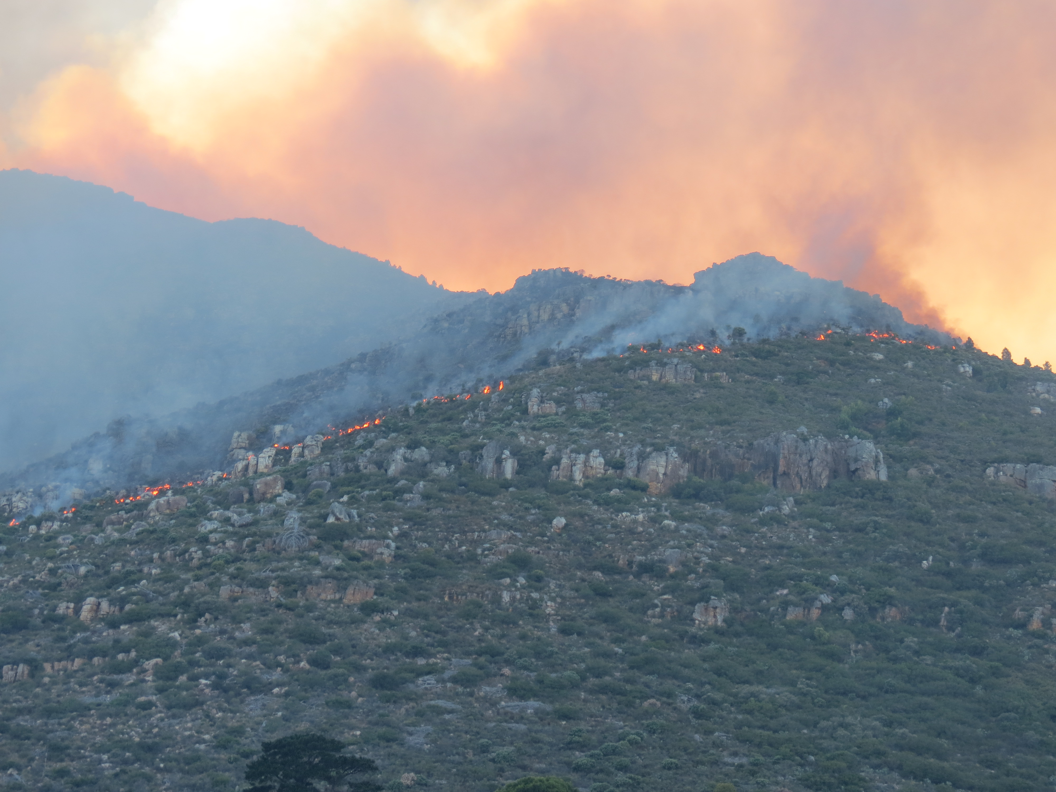
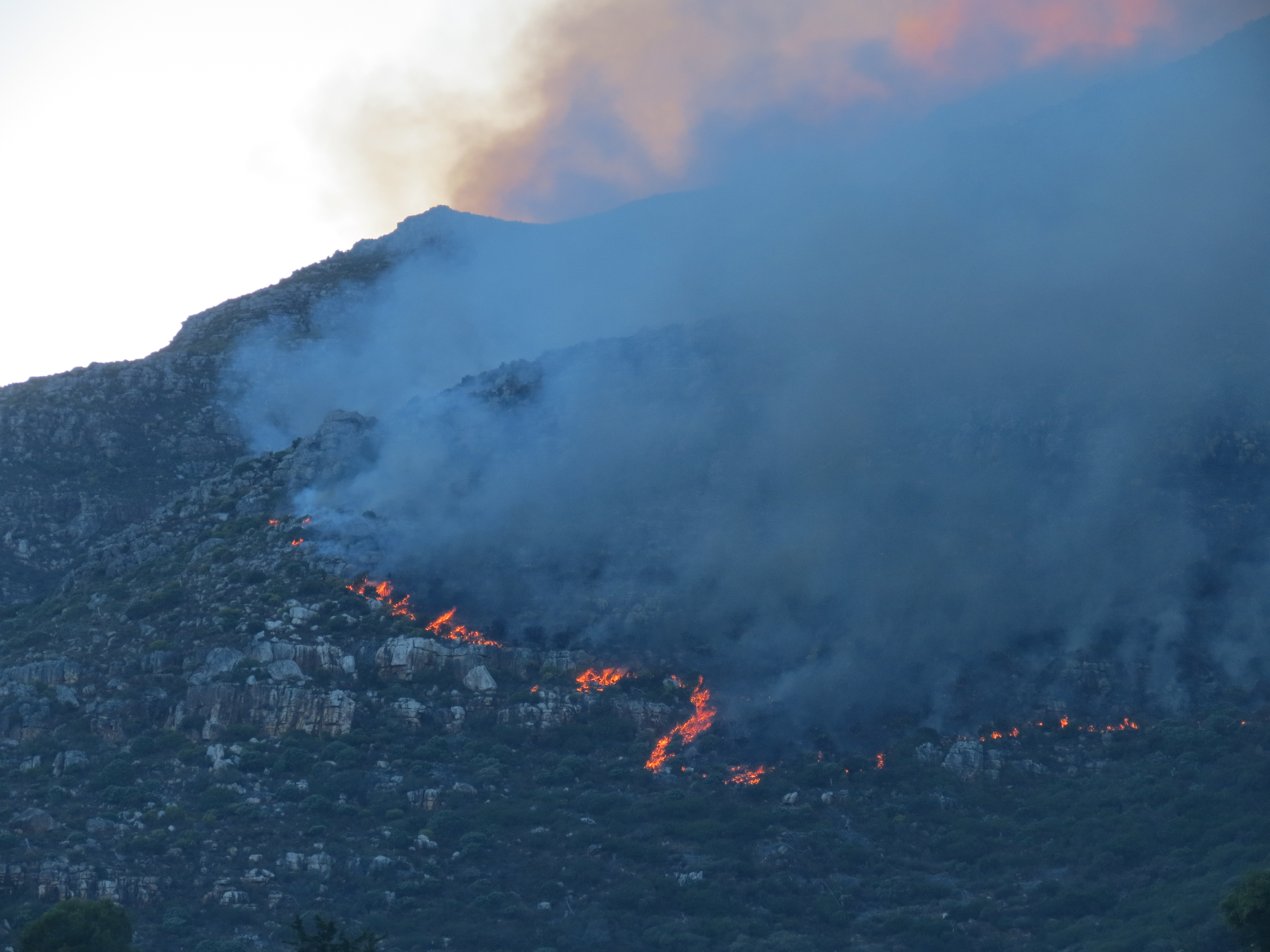
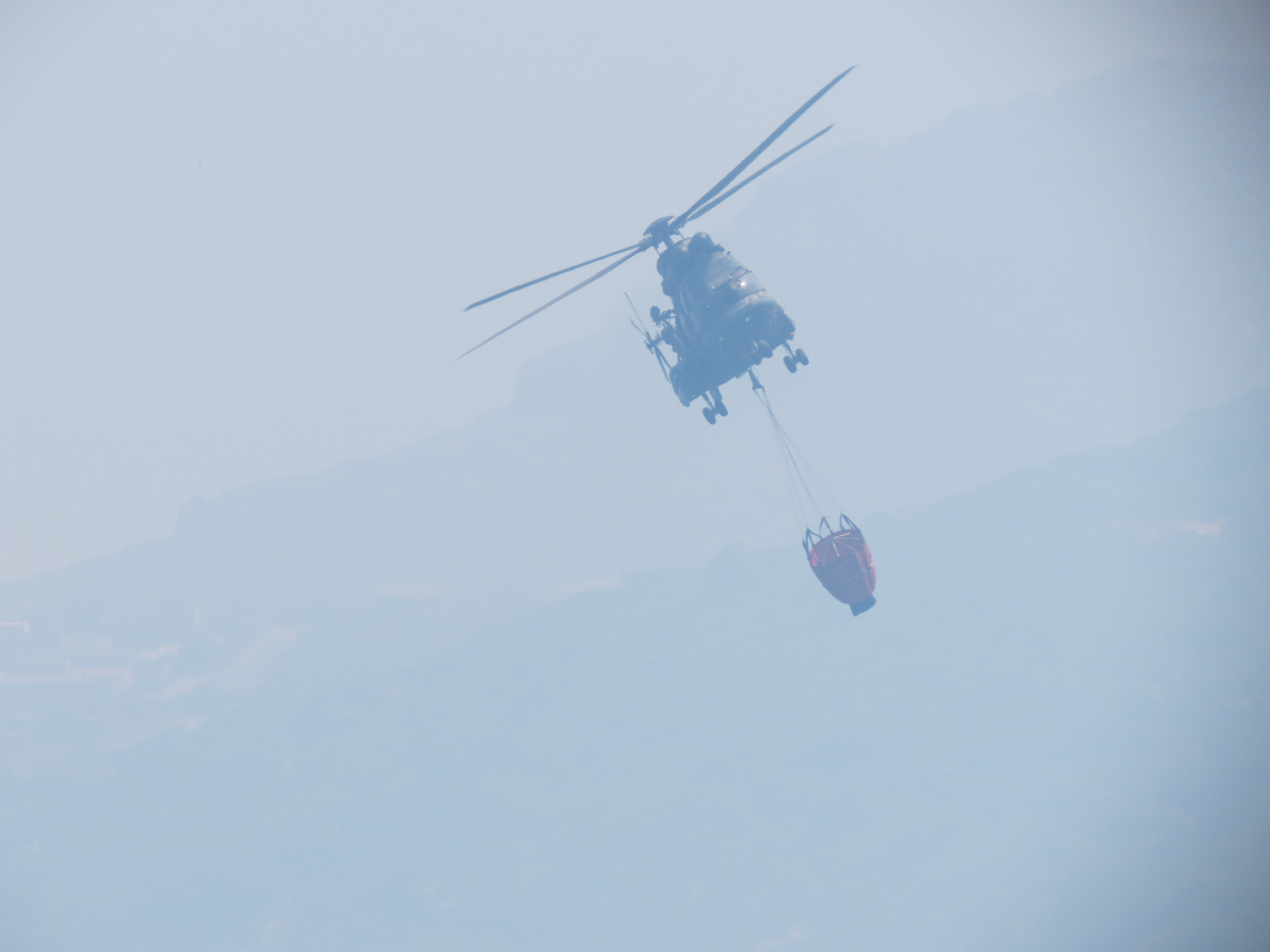
For nearly a week, a forest fire raged through much of the Cape Peninsula region of South Africa. On Sunday, March 1st the fire began on the hills above the seaside town of Muizenberg, a popular destination for surfers and other beach visitors. Over the next few days, aided by strong winds, the fire spread across the mountains to the towns of Hout Bay, Tokai, and Noordhoek. These towns are all suburbs of the city of Cape Town, where I live and work. For a time, the normally busy mountain roads Ou Kaapse Weg (Afrikaans for “Old Cape Road”) and Chapman’s Peak were closed to traffic as the fire raged along them. For five days, professional firefighters and many volunteers battled the raging fire, which threatened many homes and other structures and which, unfortunately, engulfed a few buildings, reducing them to charred pieces of wood. Many people, including some of my friends and work colleagues, were evacuated from their homes when the flames ranged dangerously close. Emotions ran high as people wondered if they would still have homes by the weekend. Some of the Cape region’s famous vineyards were burned, and some historical buildings were threatened. For example, as a precaution antiques from the famous Groot Constantia Manor were removed although, thankfully, the flames on the farm were put out before the manor house burned down. The fire was mostly fought on the ground, but helicopters and airplanes fought the fire in places where ground crews could not reach, or could not reach quickly enough. Helicopters equipped with giant buckets scooped up water from the sea and from lakes and dropped the water on the flames. Crop-dusting type airplanes spread water rather than pesticides. Thankfully, the fire was finally brought under control yesterday, and the last of the flames were extinguished today.
Although forest fires commonly occur in the greater Cape Town area during the hot and dry summer months, the fire that raged this past week was unusually extensive and destructive. Here’s an infographic from News24 that summarizes the recent Cape fire:
Infographic on the recent Cape fire. Taken from the News24 website.
The fire has had a dramatic effect on the peninsula landscape. Normally fairly green, much of the mountain range now seems an alien landscape, reminiscent of Mars or the moon, perhaps. Ecologically, the fire will have a big impact on the animals, such as the baboon troops, and the vegetation of the forest. For the local fynbos vegetation, the recent fire is actually a good thing, in many ways. Many fynbos plants actually thrive after forest fires, taking advantage of the sudden room. Some fynbos plants even depend upon regular fires in order to be able to reproduce because their seeds germinate as a result of heat from the fire and chemical compounds from the fire smoke. Many fynbos plants can re-sprout after a fire. Mere hours after a fire sweeps through, the vegetation begins to grow again. All that said, fynbos does not thrive if fires occur too often, so it is still important for humans to be vigilant and not start fires accidentally. Potentially, a single carelessly tossed cigarette may have started the recent fire.
Today, my husband and I went hiking in the Silvermine Nature Reserve off of the Ou Kaapse Weg road. We often hike at Silvermine, which is usually covered in thick green vegetation. However, today we hiked in amazement through the sparse charred remains of trees and other vegetation, which were sticking up out of bare reddish brown soil and white ash. We took quite a few pictures of the recently-burned landscape, and I’ll share some of those pictures in my next post. Today, I’d like to share some pictures of the fire itself. All of the pictures in this post were kindly sent to me by Nils Backeberg, a geologist friend of mine who lives in Hout Bay. The pictures show the fire raging in Hout Bay. Thanks very much to Nils for allowing me to share these pictures here on Georneys.
Hout Bay Fire #2. Picture courtesy of Nils Backeberg.Hout Bay Fire #3. Picture courtesy of Nils Backeberg.Hout Bay Fire #4. Picture courtesy of Nils Backeberg.Hout Bay Fire #5. Picture courtesy of Nils Backeberg.Hout Bay Fire #6. Picture courtesy of Nils Backeberg.Hout Bay Fire #7. Picture courtesy of Nils Backeberg.
Here are some pictures of the fire being fought by a helicopter:
Helicopter #1. Picture courtesy of Nils Backeberg.Helicopter #2. Picture courtesy of Nils Backeberg.Helicopter #3. Picture courtesy of Nils Backeberg.Helicopter #4. Picture courtesy of Nils Backeberg.Helicopter #5. Picture courtesy of Nils Backeberg.Helicopter #6. Picture courtesy of Nils Backeberg.Helicopter #7. Picture courtesy of Nils Backeberg.Helicopter #8. Picture courtesy of Nils Backeberg.
So, those are some pictures of the flames. Stay tuned for some pictures of the ashes in the next post!
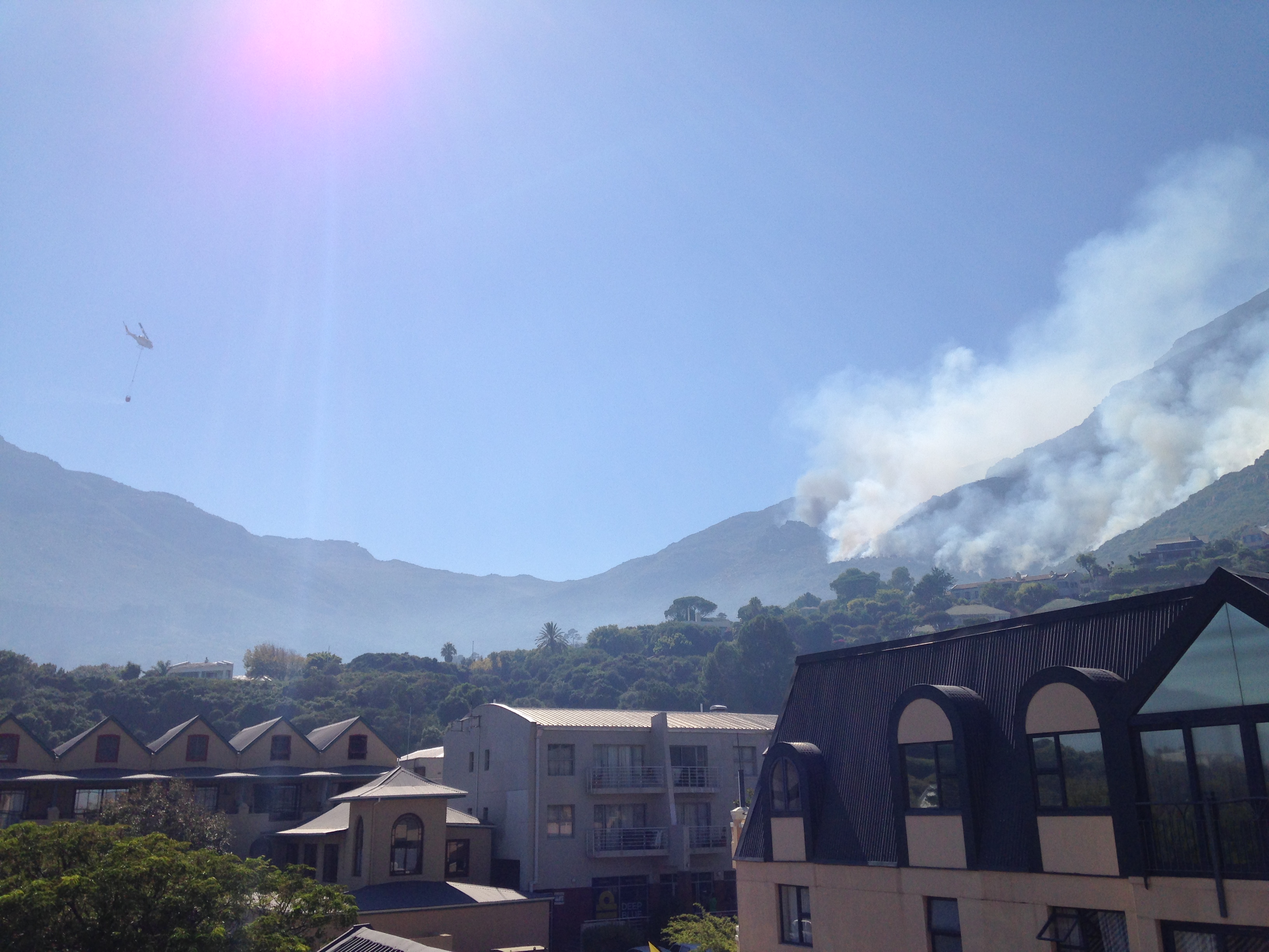
Currently, forest fires are raging here in Cape Town, South Africa. You can see some images of the fires here and here and here. I live and work relatively far away from the fires. However, from my office today I could see smoke from the fires in the distance. I hope that the fires are put out soon since they threaten much of Cape Town’s beautiful forest as well as many homes and other buildings.
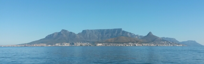
Table Mountain viewed from the sea. Bon Voyage, Cape Town!
On Saturday, I unexpectedly had to hop on a ship for a month for a work trip. So, blogging may be a little bit light over the next month. I’ll try to post when I can, but I’ll be limited by the slow shipboard internet.
As the ship was leaving Cape Town on Saturday afternoon, I enjoyed some stunning views of Cape Town from the sea. The picture above shows a beautiful view of Table Mountain with the city of Cape Town in front of it.
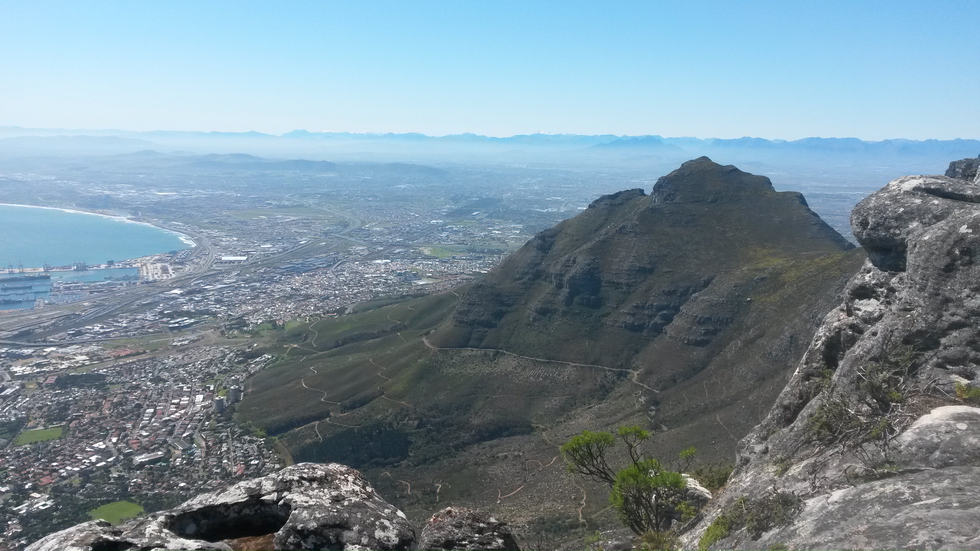
My two American geologist friends, with whom I went ziplining amidst some sedimentary rocks a little over a week ago, left on Saturday. Before they left on their evening flight, we decided to go up Cape Town’s beautiful Table Mountain. We took the cable car up the mountain, hiked around on the top for a couple of hours, and then took the cable car back down. Saturday was a beautiful sunny day with good visibility, so we saw some stunning views from the top of the mountain. Here are two of them:
Table Mountain, sloping down to the city of Cape Town below.Another view from the top of Table Mountain, this time looking towards the inselberg Lion’s Head (the knob of rock) and Robbin Island.
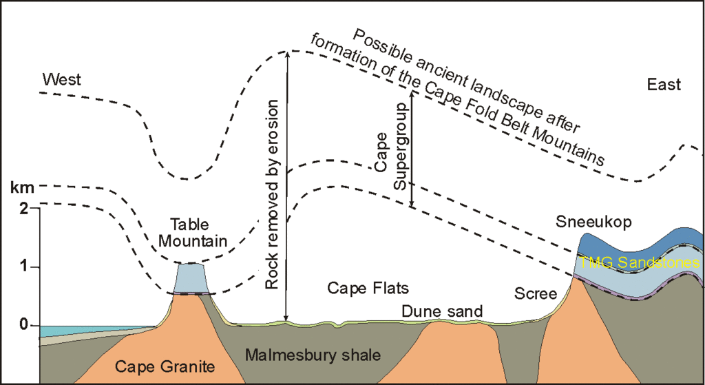
Table Mountain is comprised of the same sandstone rocks that we saw when we went ziplining in the Cape Fold Belt. However, the sandstone rocks of Table Mountain are relatively flat and unfolded, their preservation a result of the mountain’s granite core. Here’s a figure, taken from Prof. John Compton’s book The Rocks and Mountains of Cape Town, that explains the geological relationship:
Geology of the greater Cape Town area, showing how the Table Mountain Group sedimentary rocks are related to uplifted rocks in the Cape Fold Belt. Image taken from Compton (2004). Click image to enlarge.
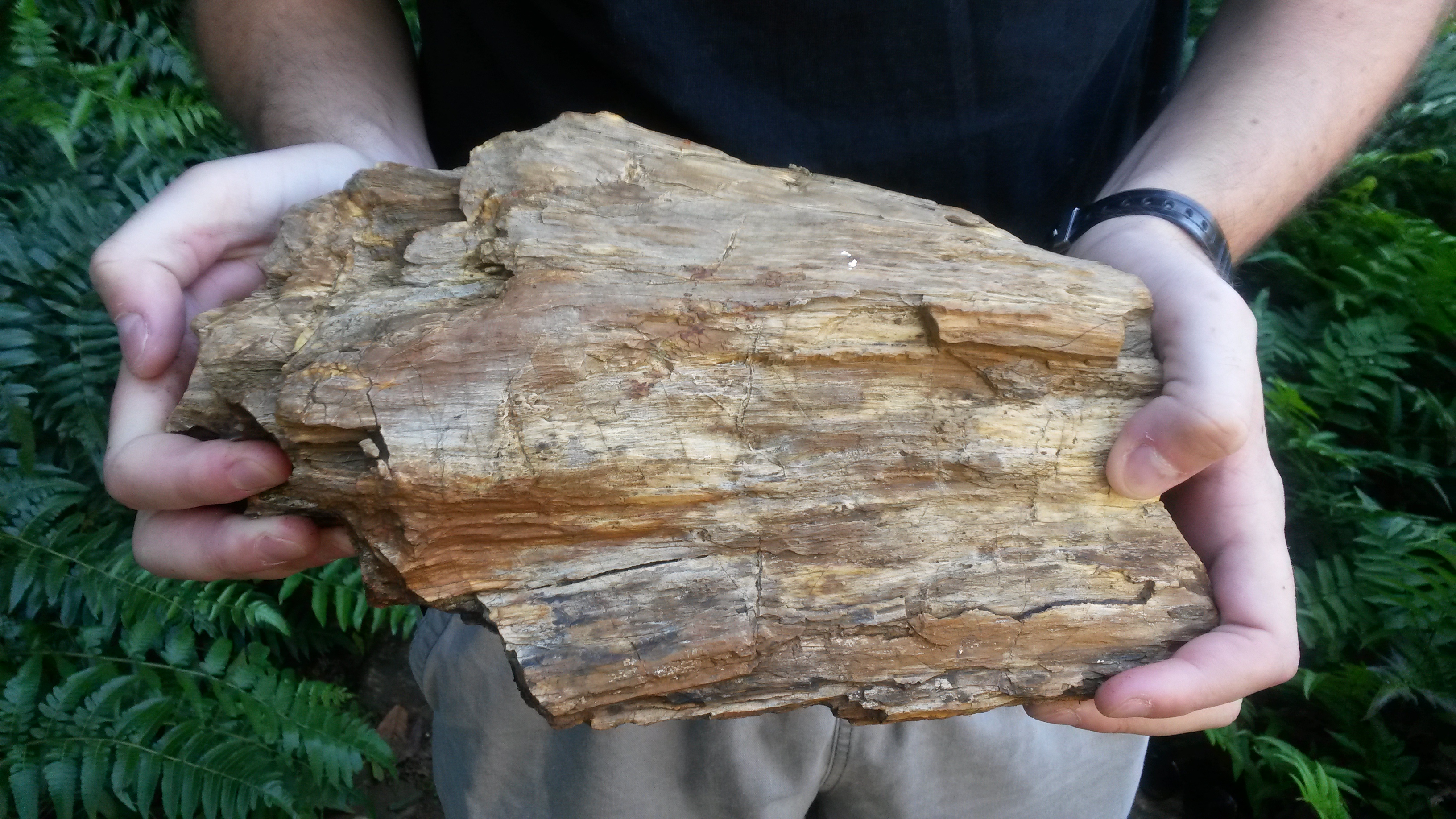
Petrified log at Kirstenbosch Garden, held by my husband.
My apologies again for the light blogging recently. My day job as an industry geologist has been keeping me extremely busy over the past couple of months. However, on Friday my husband and I are to the US for a much-needed three weeks of vacation, including spending time with friends and family whom we see far too rarely. Hopefully I’ll be able to squeeze in a little time for blogging during our vacation. Otherwise, I’ll do my best to pick up the blogging again in about a month. In the meantime, the “Monday Geology Picture” posts will have to tide you over until I can settle down for some real blogging.
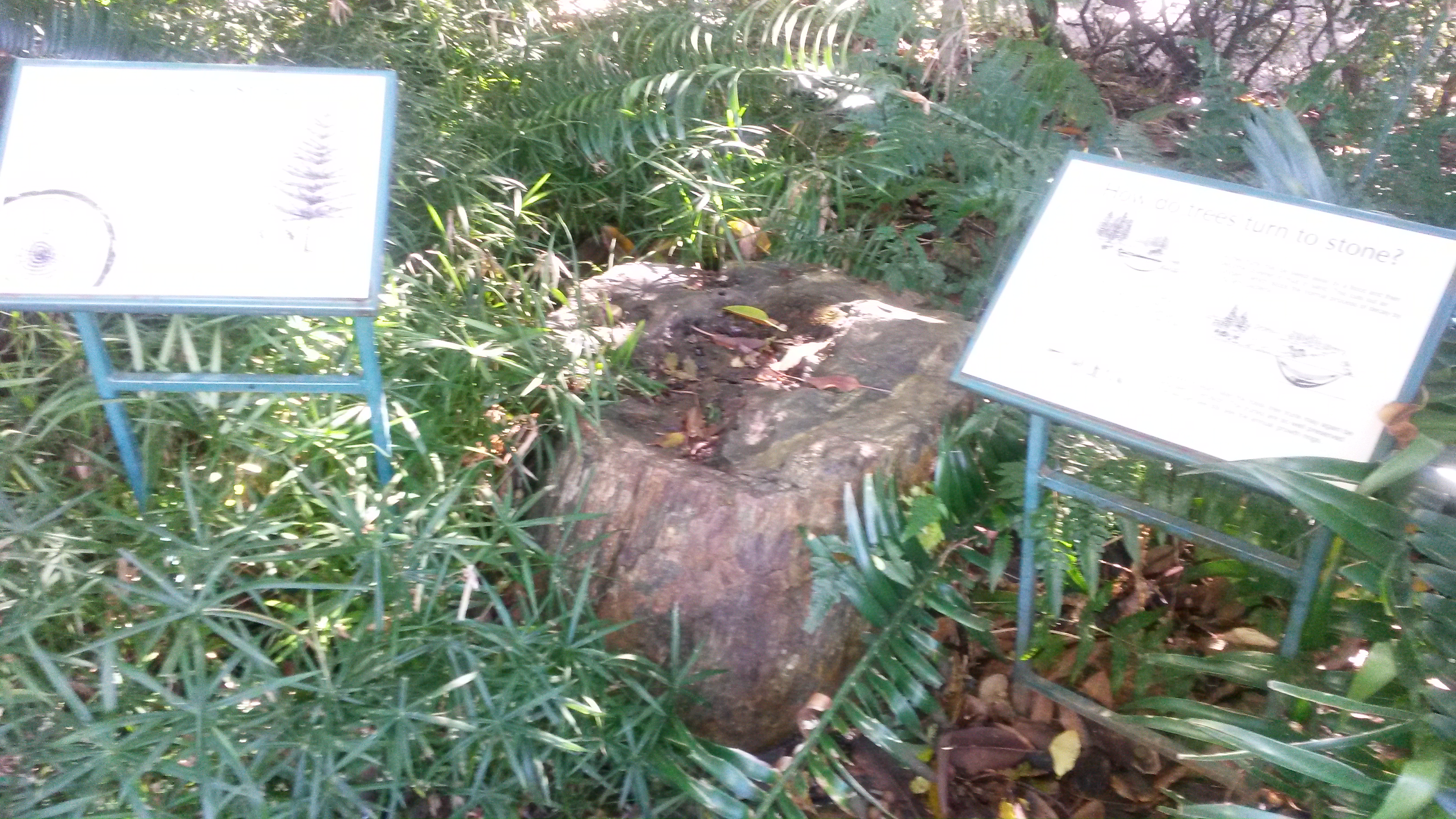
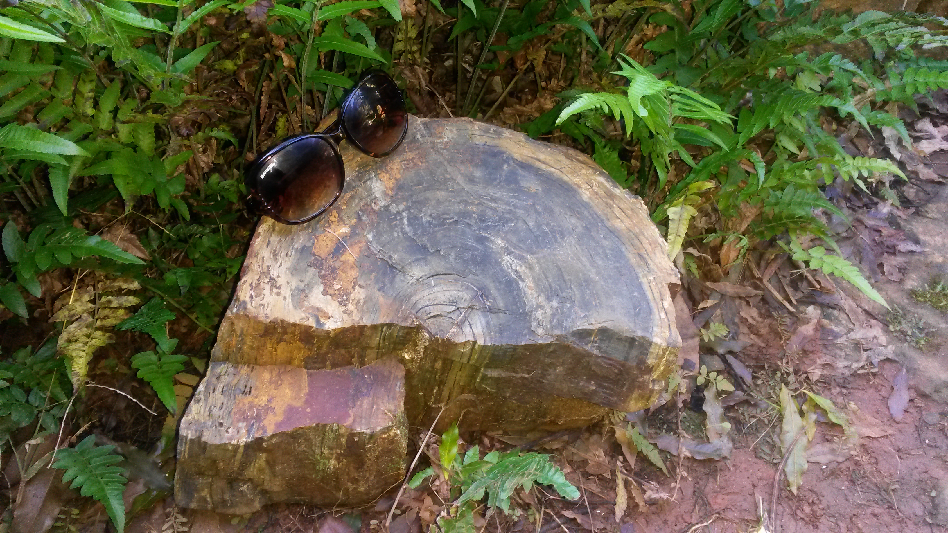
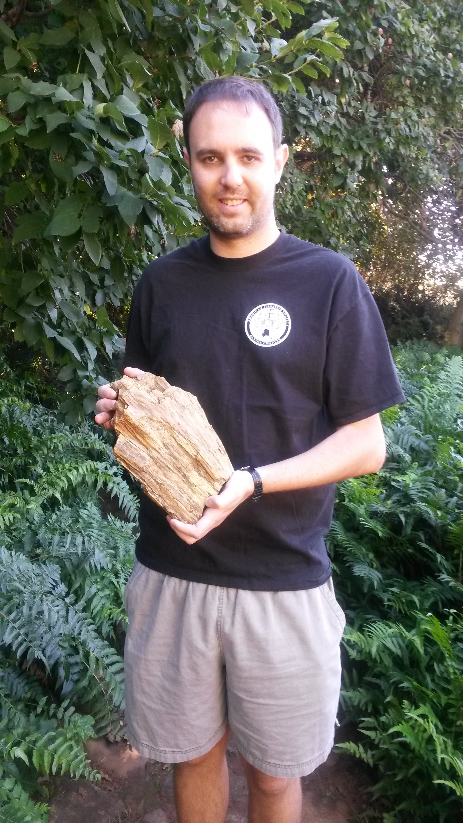
Today, I thought I would share some more pictures of the petrified wood that my husband and I recently saw at Kirstenbosch Garden here in our home city of Cape Town, South Africa. Enjoy! True geologists, my husband and I spent far more time looking at the “trees of stone” than at the real trees of the botanical garden.
Sign #1 explaining how petrified wood is formed. Click to enlarge.Sign #2 explaining how petrified wood is formed. Click to enlarge.Sitting on a petrified log.Petrified wood between the signs about how petrified wood forms.Petrified wood, with sunglasses for scale.More petrified wood. These are heavier than they look!My husband Jackie holding some petrified wood.