A helicopter flying through the canyon… giving an awe-inspiring sense of scale! Picture courtesy of Ray Hall.
In last week’s “Monday Geology Picture” post I featured the incredible Painted Wall of Black Canyon in Gunnison National Park in Colorado. Last week’s picture was taken by my friend Ray Hall. After my post, fellow geoblogger Ron Schott sent me a link to an impressive GigaPan that he took of Painted Wall. Well, last week I don’t think I quite appreciated the enormous scale of Painted Wall. I stated that the wall is over 2,000 feet tall, but I didn’t appreciate just how tall that really is.
Well, I think that this week’s picture helps to put the 2,000 foot wall into perspective. Ray sent me this follow-up shot that he took of a helicopter flying through Black Canyon near Painted Wall. Look how small the helicopter is compared with the wall! That’s one very tall cliff!
Geologists love putting things in pictures for scale. Normally, geologists use rock hammers or pencils or rulers or– at the largest– people for scale. It’s rare that they get to use a helicopter for scale, but a helicopter is a perfect scale marker for the impressively large Painted Wall.
Thanks again for sharing another picture of the canyon, Ray!
Rock of Raouché, Beirut, Lebanon. Picture courtesy of Diana Abouali.
This week’s Monday Geology Picture features the Rock of Raouché (aka Pigeon’s Rock) in the Raouché area of Beirut, Lebanon. The rock features some lovely sedimentary bedding and, when viewed from another angle, a beautiful arch. This week’s picture is courtesy of Diana Abouali, who was one of my Arabic professors at Dartmouth College. Thanks very much for sharing this lovely picture, Diana!
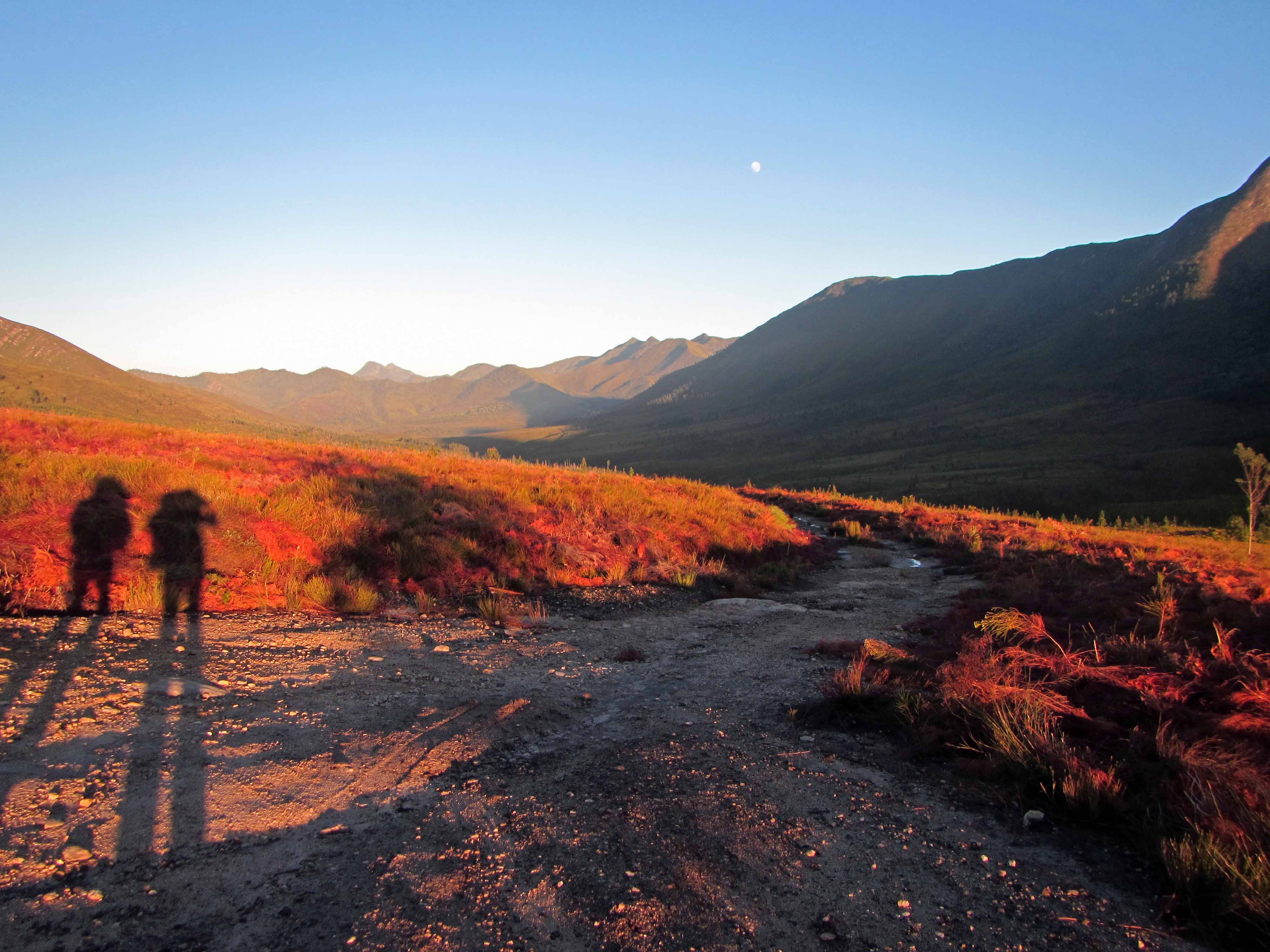
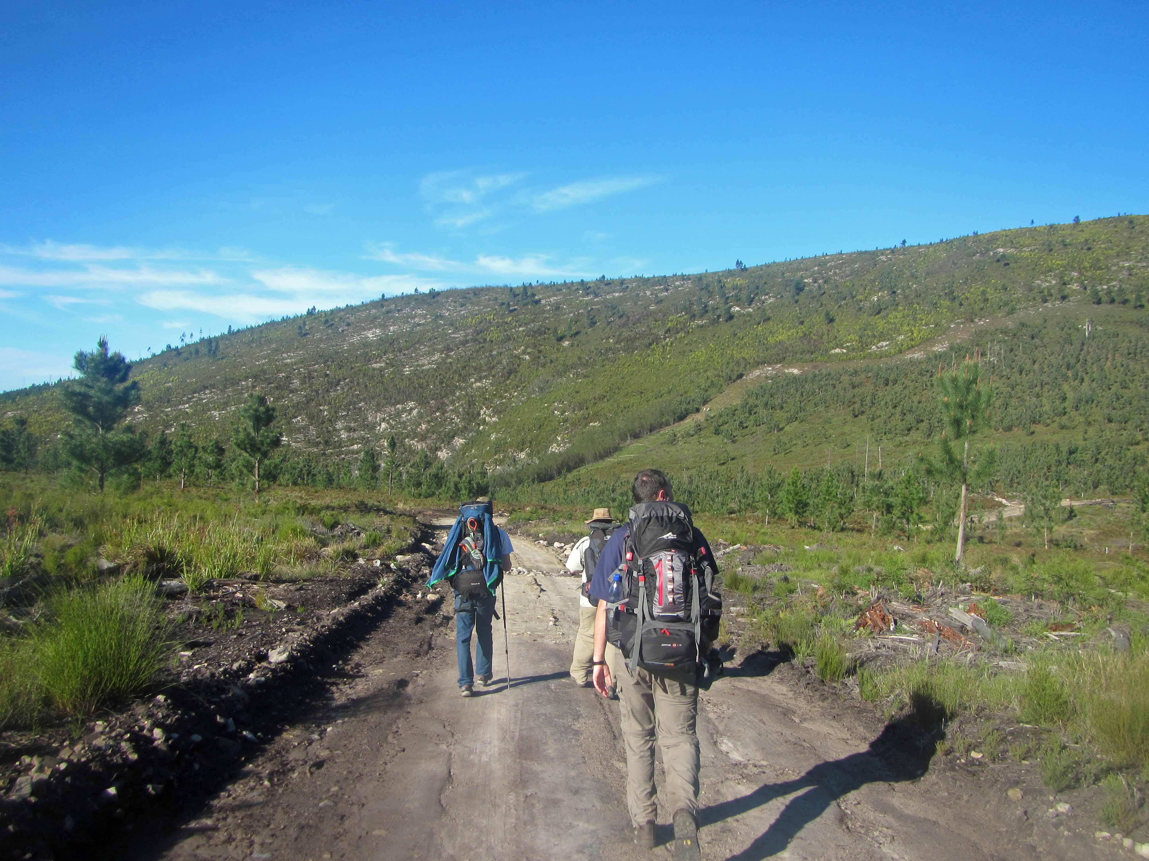
Today I’ll be discussing the fourth and final day of my recent backpacking trip along the Tsitsikamma Trail with my husband Jackie and five of our friends. I’ve already blogged about Day #1, Day #2, and Day #3. On Day #4 we hiked 11.5 km from the Kerbous Hut to the Lottering Plantation, where we had parked one of our cars.
Hiking the full Tsitsikamma Trail actually takes six days. So, we hiked to the Lottering Plantation along a dirt road “escape route” that is used by forest rangers to take care of the trees on the plantation and also to service the Kerbous Hut and check on the hikers staying there. The road may also be used during rainstorms, when rivers and streams may flood and hikers may need to cut their backpacking trip short. However, we cut our trip short on purpose as we had only planned to hike for four days.
Since we had a long drive back to Cape Town (and many of us had to work the next day!), we woke up very early on our last day and started hiking at dawn. We actually hiked all 11.5 km before 10 am! We made much better time than we expected, probably because most of the hike was along a wide dirt road. Also, after we survived a couple of hours of uphill climbing, the rest of the hike was mostly downhill.
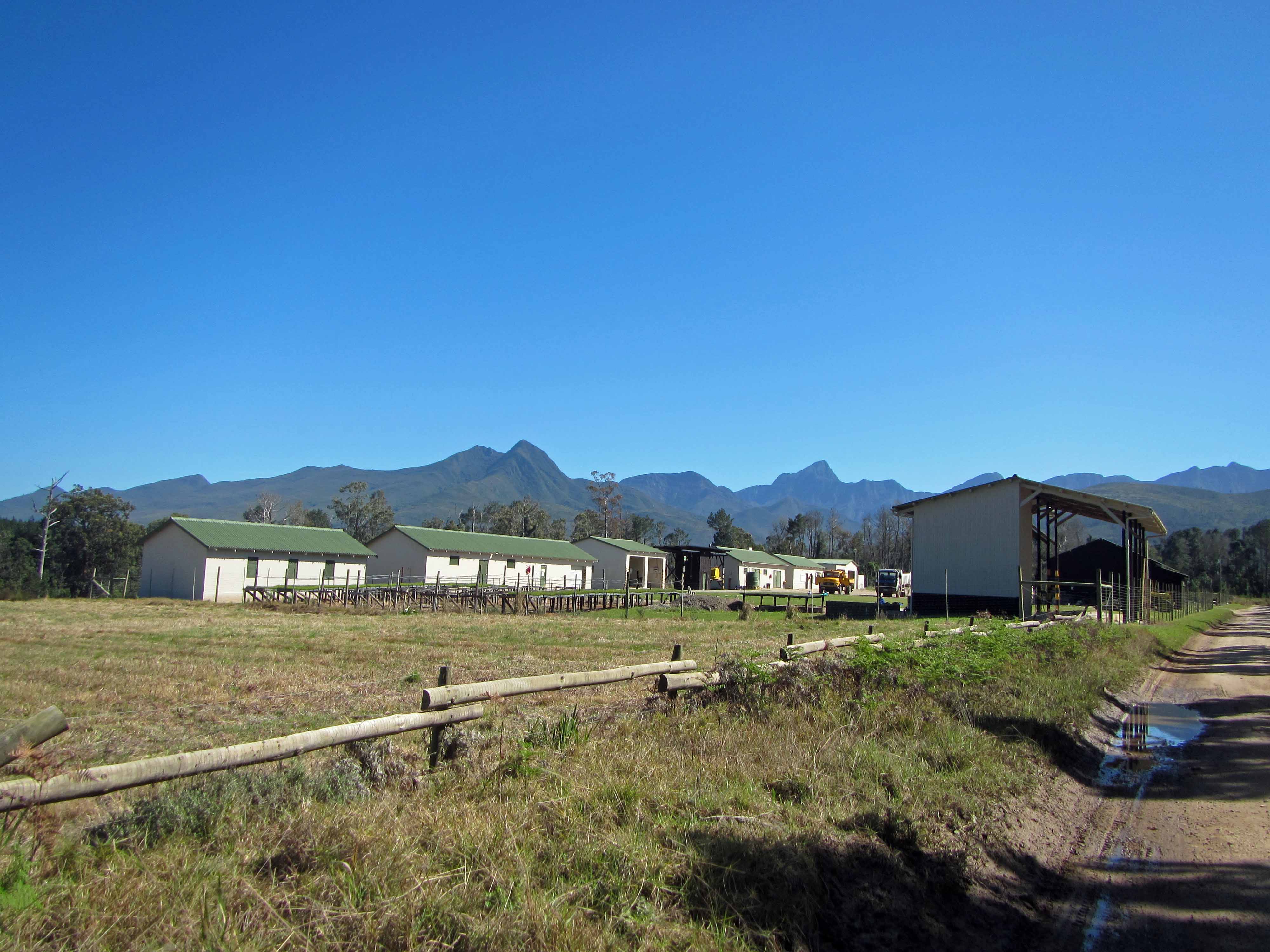
The plantation staff looked slightly surprised to see us arrive so early. After a few minutes of picture taking and relaxing, we ran shuttle to fetch the second car and then started the long seven hour drive back to Cape Town.
Here are a few pictures from our hike out to the Lottering Plantation:
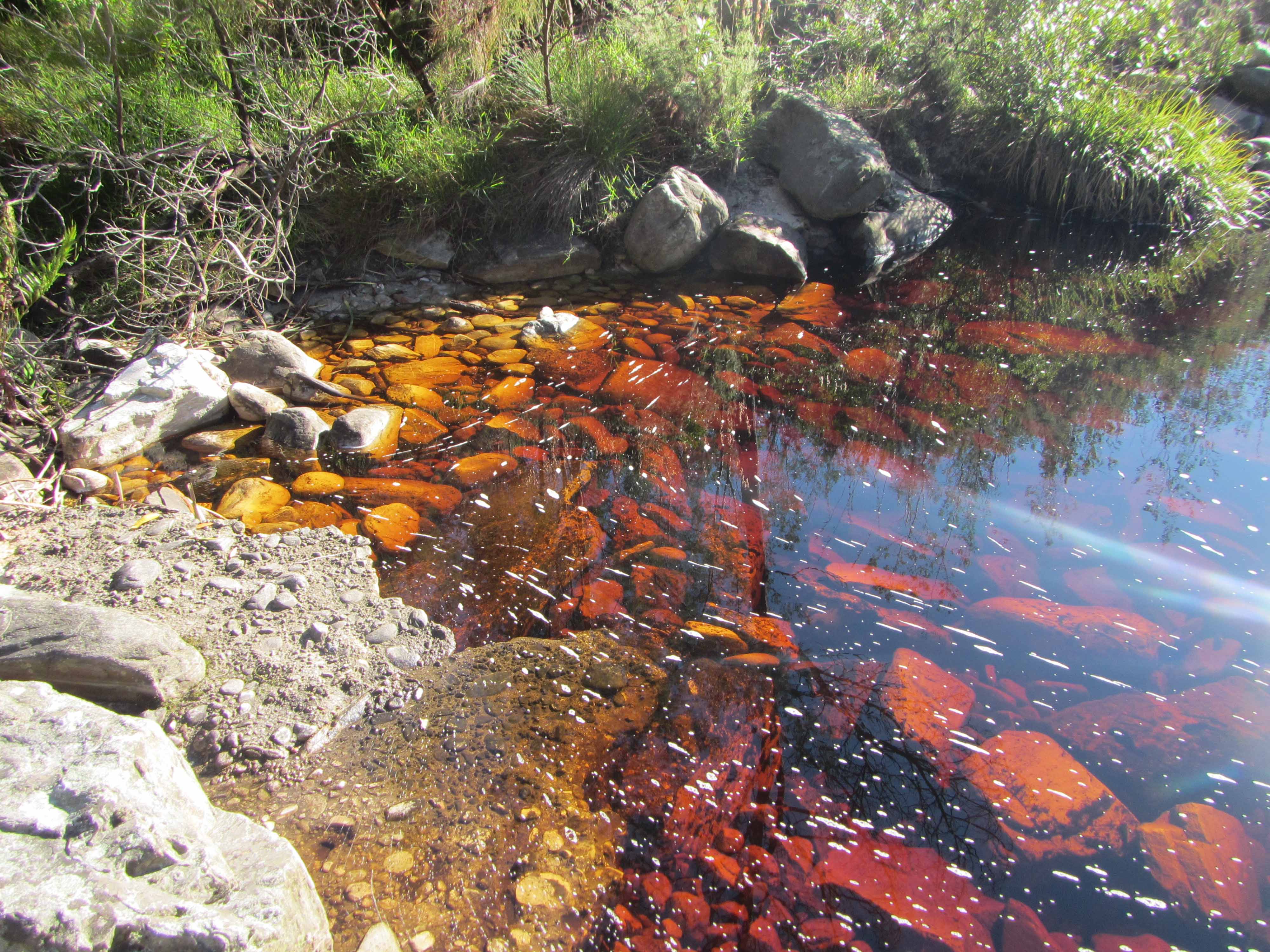
A stunning early morning view, looking back on the Tsitsikamma Mountains.A pretty black bird.Pine trees and uplifted sandstone.Making our way along the dirt road.Another coca-cola colored stream.Tall pine trees along the dirt road.The plantation buildings! We arrived a little before 10 am.A closer look at some of the plantation buildings.
Here’s the group at Lottering Plantation at the end of the hike:
Tired but happy hikers after four days on the Tsitsikamma Trail.
I really enjoyed this backpacking trip. The trail is well maintained and organised and winds its way amongst some impressive geology and vegetation.
The huts where we stayed were very comfortable, and it was great that we didn’t have to carry tents and heavy cooking equipment.
If you find yourself in South Africa, I highly recommend spending a few days hiking along the Tsitsikamma Trail! If you’re not up for all six days, you can arrange a two or three or four day hike or even a single day hike.
Majestic Blackstone Glacier. Picture courtesy of Jackie Gauntlett.
This week’s picture was taken by my husband Jackie in Prince William Sound, Alaska, back in early September. Jackie and I spent about two months working in Alaska earlier this year. After our work, I went to visit my family in New Hampshire for a few days while Jackie stayed behind with a colleague to pack up gear and such. Just before flying home to South Africa, Jackie and the colleague went on a glacier viewing cruise in Prince William Sound. They saw some impressive views of glaciers and highly recommend the cruise. I’m hoping to go on the cruise another year. Jackie tells me that the boat in the above picture above is bigger than it seems– Blackstone Glacier is quite a big glacier!
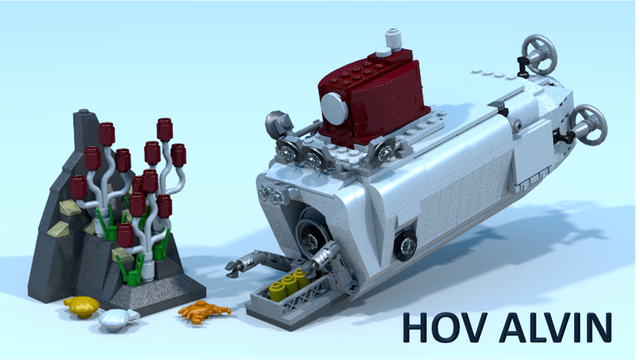
A week ago I asked you to go vote for a proposed design for a LEGO Deep Sea Submersible Alvin. At the time, LEGO Alvin had 275 votes. I said that I’d give you an update on the voting a week later. At the moment, LEGO Alvin has 356 votes. So, over the last week LEGO Alvin has gained an additional 81 votes. That’s not bad, but I think we can do better! Well, we need to do better since a design needs 10,000 votes before LEGO will even take a look at it. Do you think we can convince 10,000 people to vote for LEGO Alvin? I think we can!
So, I’m going to extend the LEGO Alvin challenge for another two weeks. Please, please go vote for LEGO Alvin here. Please advertise the LEGO Alvin voting on Facebook, G+, Twitter, on your blog, etc. Please also encourage your friends, family, colleagues, and everyone else to go vote!
To encourage voting, I’ll offer a small prize. If you voted for LEGO Alvin, leave a comment below (honor system!). In two weeks I’ll select a winner by drawing names randomly out of a hat. I will send a rock prize to the winner. More specifically, I will send the winner a beautiful hand sample of Dwyka tillite which I collected in South Africa’s Karoo region.
You know you want this gorgeous sample of Dwyka tillite.
Do you know what would make a wonderful addition to the Georneys annual What to Buy a Geologist for Christmas list? A LEGO version of the Deep Sea Submersible Alvin! I have a soft spot in my heart for Alvin because I obtained my Ph.D. in Marine Geology from Woods Hole Oceanographic Institution, which operates the Alvin. I have never personally participated in an Alvin dive. However, my Ph.D. supervisor Susan Humphris has participated in many Alvin dives and is the scientist who has been leading the recent Alvin upgrade. You can read more about Susan and her work on Alvin in this recent article. I would love to be able to buy a LEGO Alvin for Susan– I’m sure she would love it! In fact, I want to buy a dozen or so LEGO Alvins and give them to all my scientist friends.
Here’s the thing, though: LEGO doesn’t actually make an Alvin. Not yet, anyway. However, there is a design for a LEGO Alvin in the Idea Stage, and you can help turn the Idea Stage into reality by voting here. The LEGO Alvin currently has 275 votes. Personally, I think we can do a little bit better than that! In order for LEGO to even take a look, a design needs 10,000 votes. So, please go vote for LEGO Alvin and tell all your friends and family to vote, too! Now, voting is a little bit difficult because you have to create an account or sign in with Facebook. However, please be patient and take a minute to vote for Alvin. And help me spread the word on other geology blogs and social media. Let’s aim for 10,000 votes!
Let’s start by seeing how many votes we can gather for LEGO Alvin in the next week. I’ll check-in again on Friday, October 25th to see how many more votes there are.
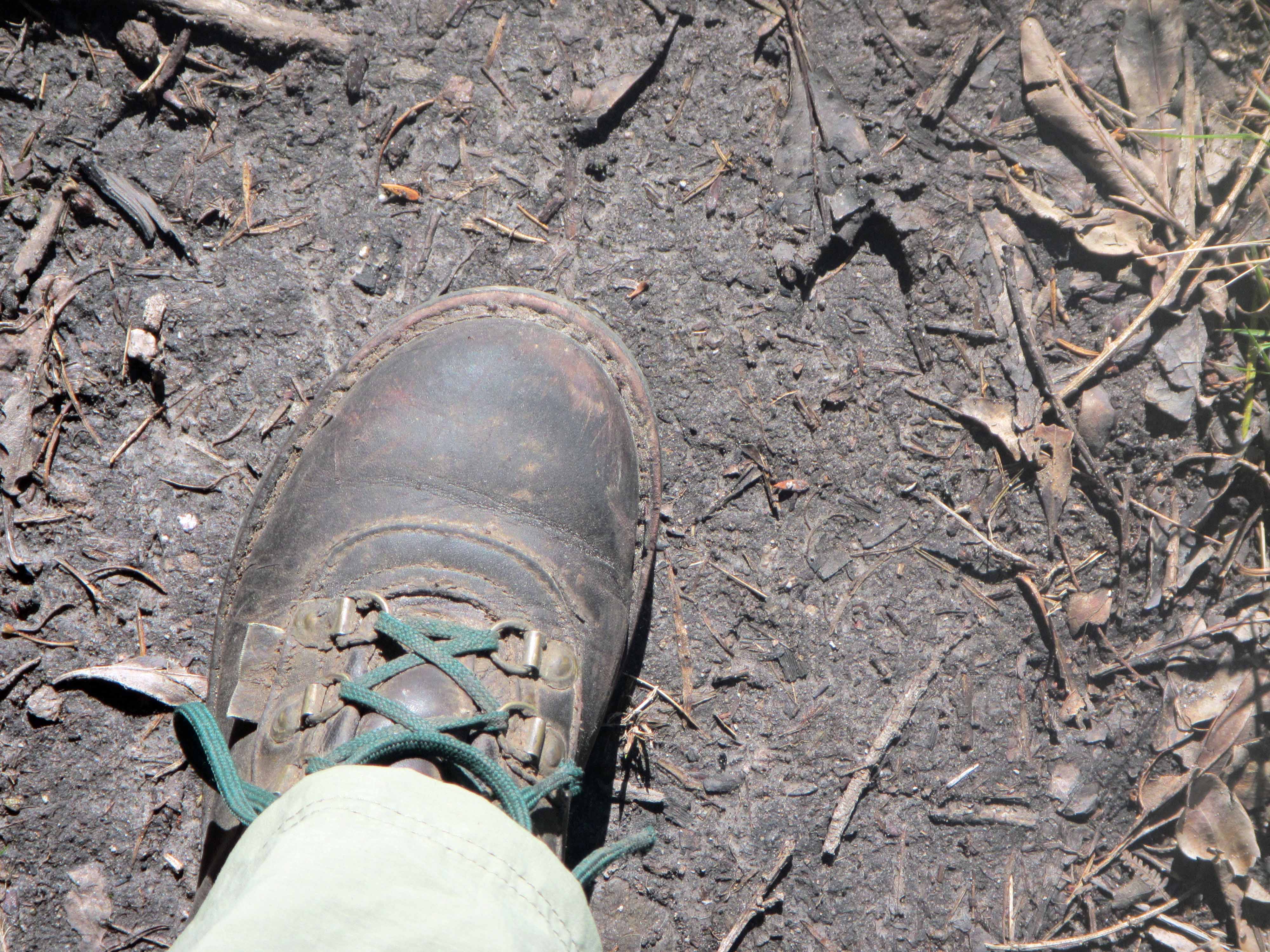
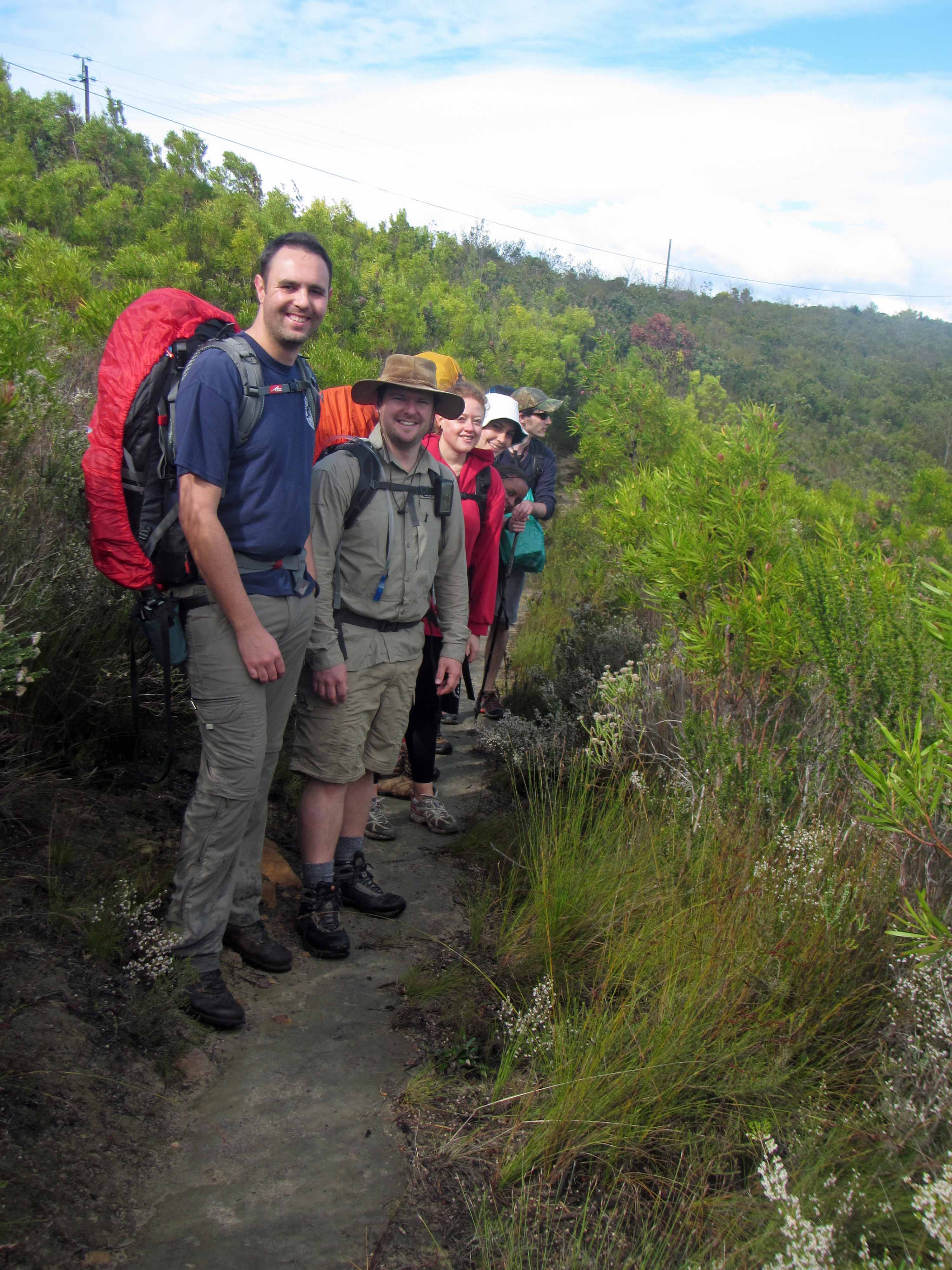
Today I’m continuing with my account of my recent backpacking trip along the Tsitsikamma Trail with my husband Jackie and five of our friends. Today, I’ll blog about Day #3 of the trip. I discussed Day #2 and Day #1 previously. On Day #3 we hiked 13.4 km from Blaauwkrans Hut to Keurbos Hut. Along the way, we passed through more beautiful fynbos and indigenous afromontane forest, and we made numerous river and stream crossings.
We started out the day by crossing the stunning, coca-cola colored double waterfall that we could see from Blaauwkrans Hut. Here’s a picture of that waterfall again:
This picture is worth putting in two blog posts!Crossing over the double waterfall below Blaauwkrans Hut.Jackie on the trail above the waterfall.
After we crossed over the double waterfall, we hiked up onto and across a fynbos-covered plateau and looked back on Blaauwkrans Hut from above:
The view back towards Blaauwkrans Hut. You can see the sea in the distance.Pretty pink fynbos flowers.
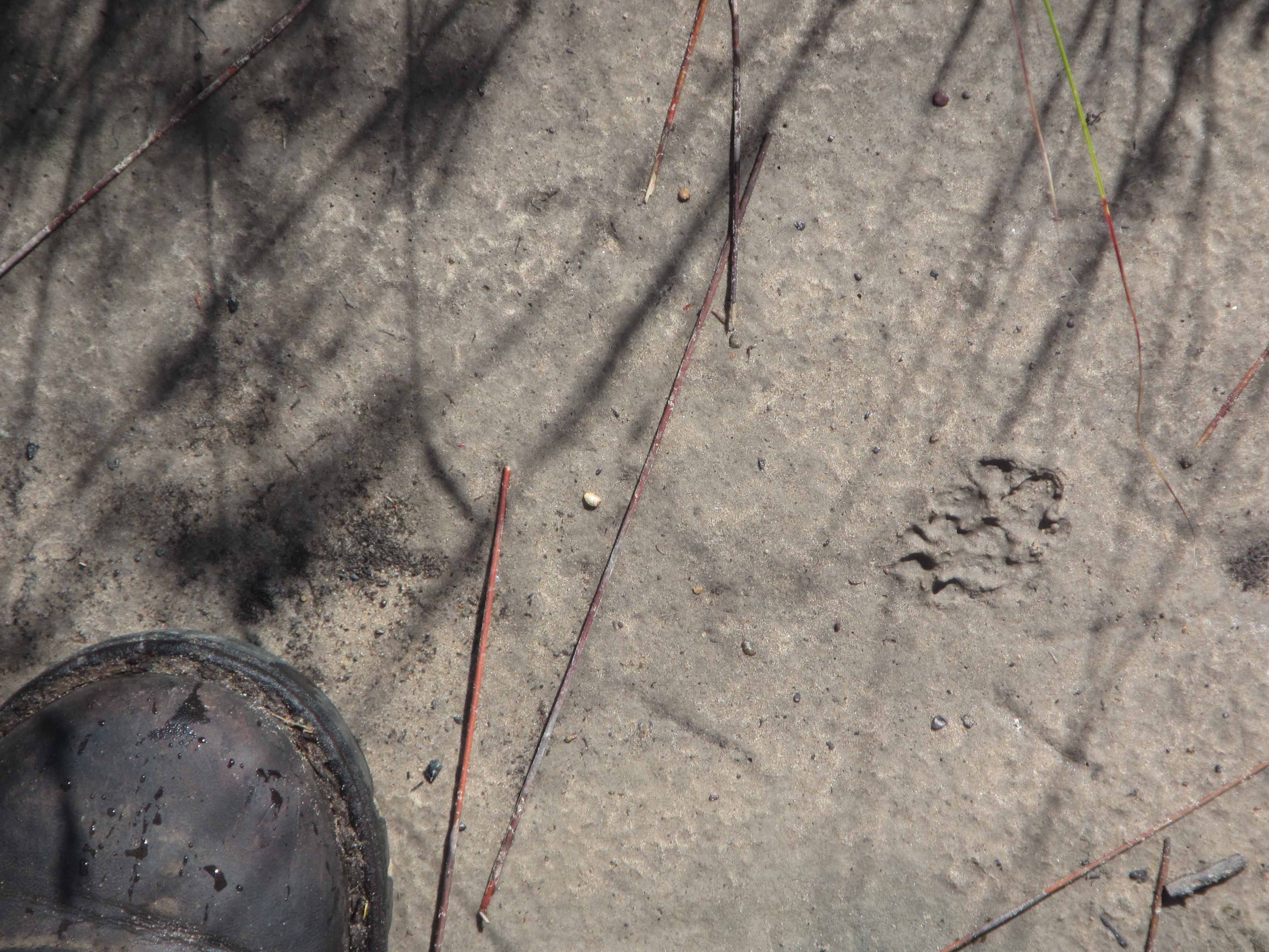
We soon came across some more animal tracks:
Small animal footprint.
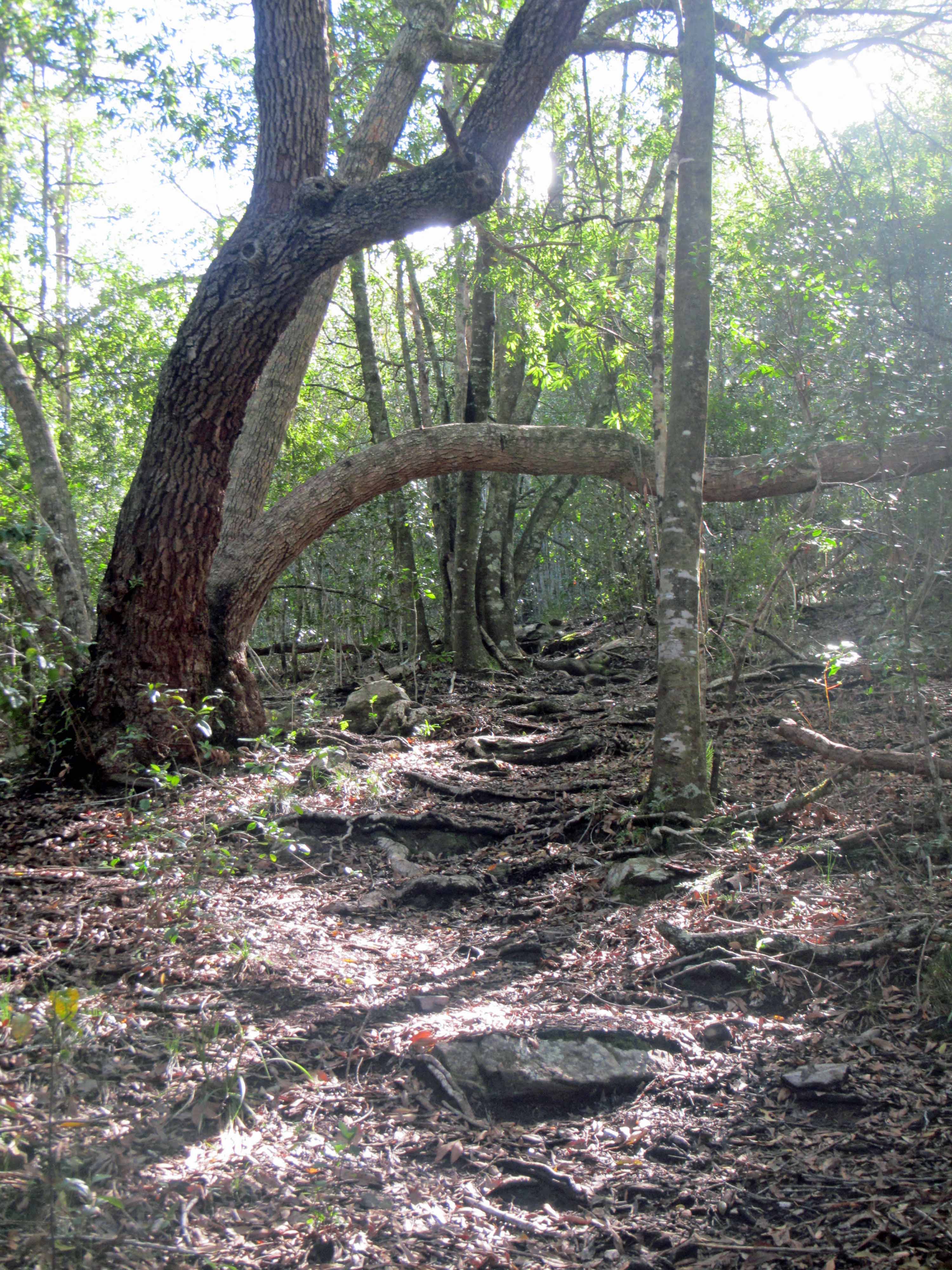
After an hour or so of hiking, we entered the forest:
A magical forest path with tree roots for stairs.The forest path parting a sea of green.
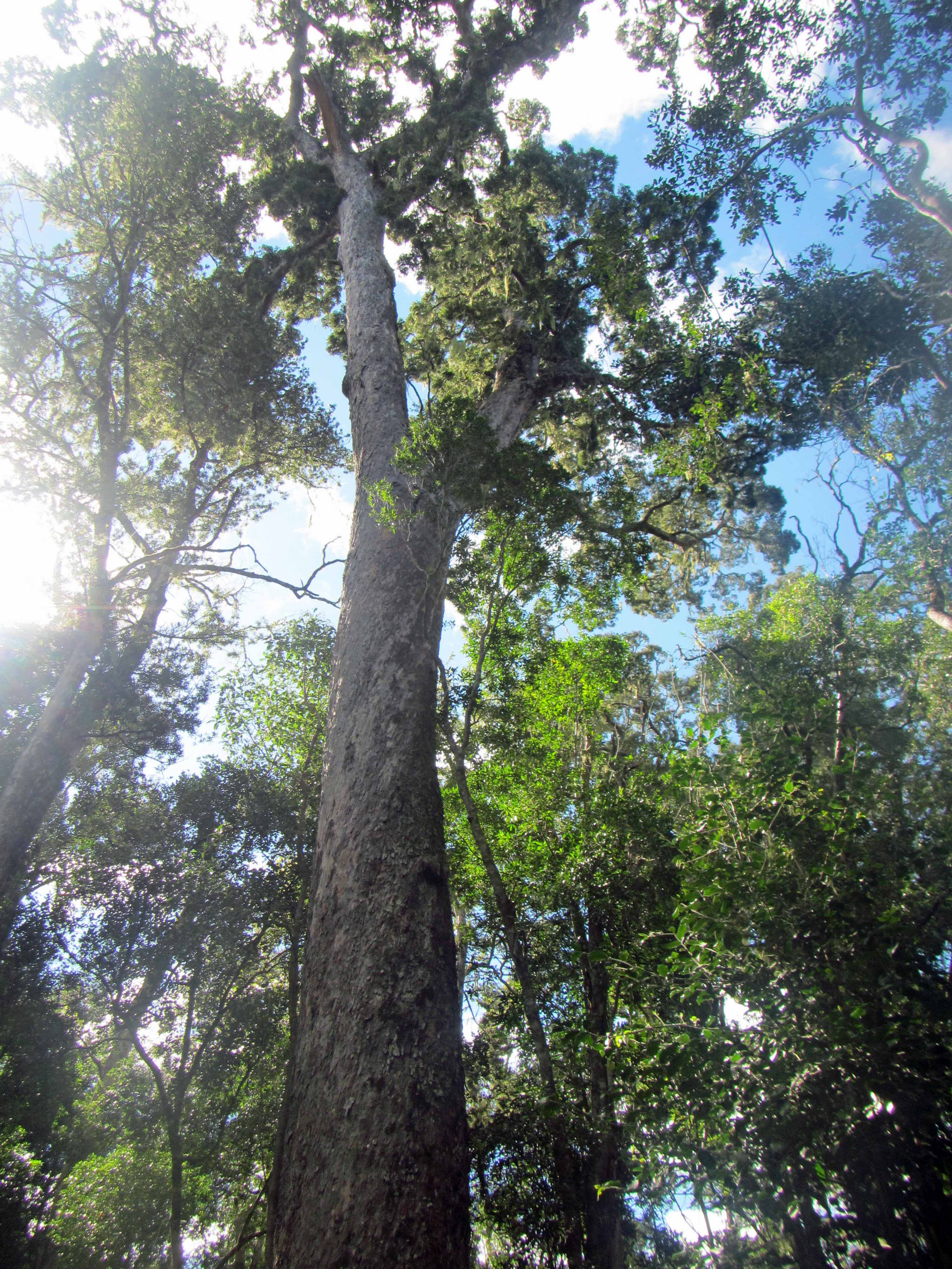
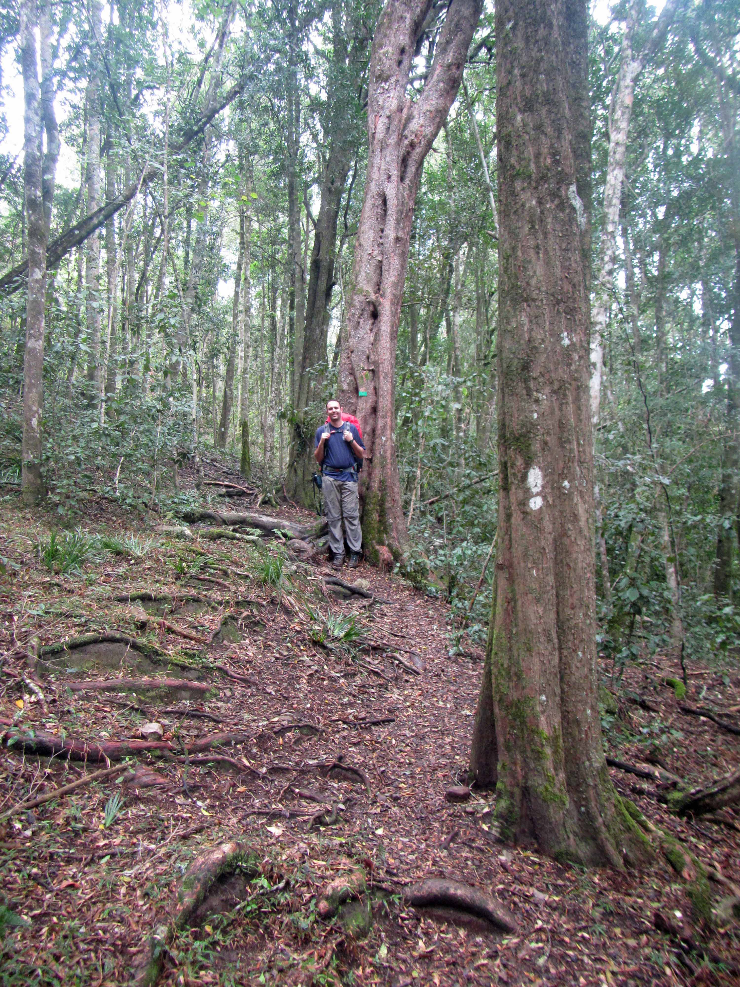
While hiking through the forest, we saw many impressive trees. For instance, this tall Yellowwood:
A majestic yellowwood tree.Many of the trees had identification signs.The group on the trail.
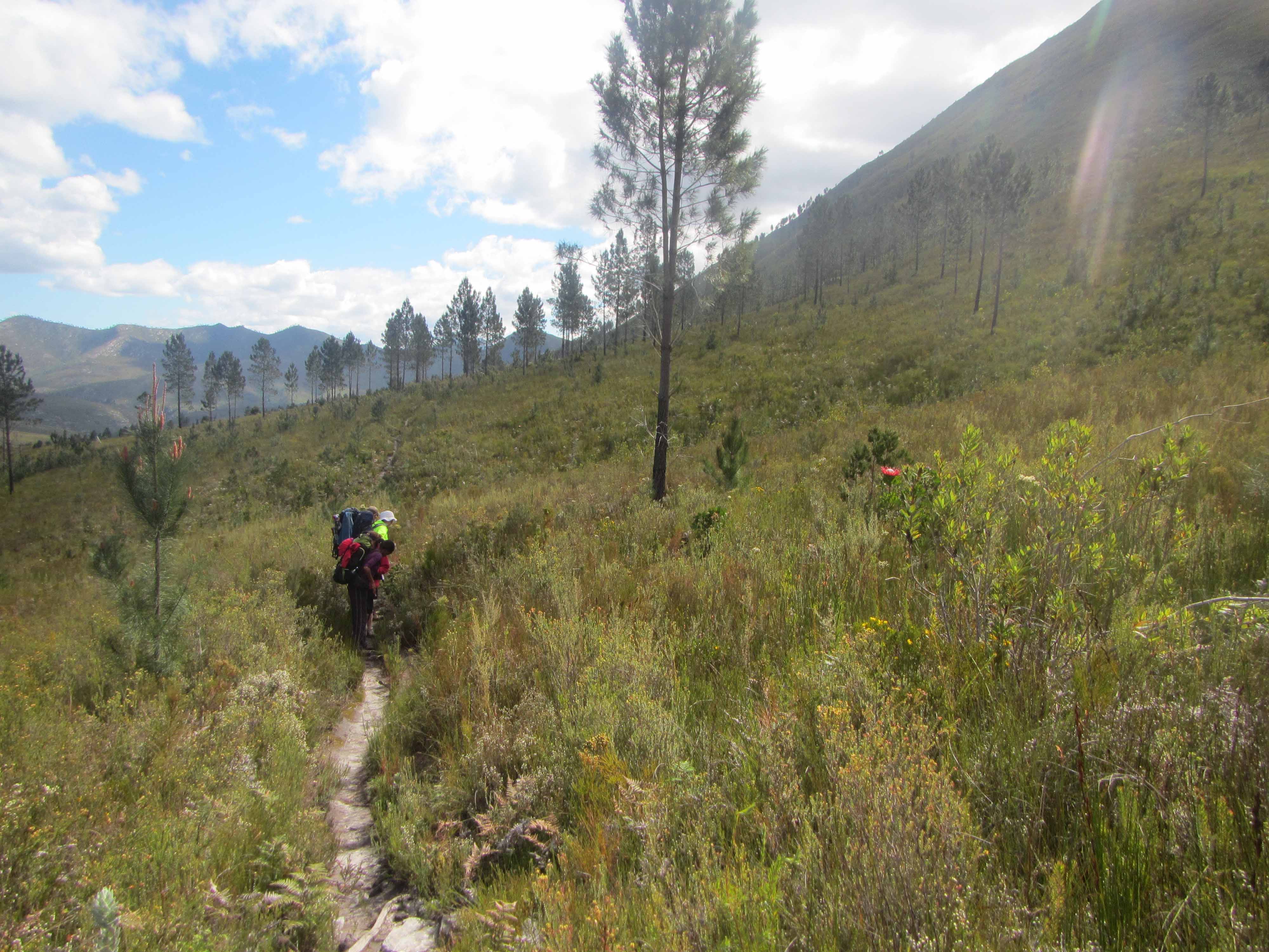
After awhile, we emerged from the forest and walked through fynbos again. We had some beautiful views of the folded sandstone mountains as we walked through the fynbos:
Mountain views while walking through the fynbos.Another angle on the beautiful view that we had while walking through the fynbos.
Here are a few pretty fynbos plants:
White fynbos plant.Yellow fynbos plant.Pink fynbos plant.
After a little while, we headed down into a valley to cross the Bloukrantz (or Blaauwkrans) River:
The Bloukrantz River viewed from above.The forest near the Bloukrantz River.Crossing the Bloukrantz River.The coca-cola colored water of the Bloukrantz River.
After crossing the Bloukrantz River, we had a steep climb back up onto the plateau, where we again found ourselves in fynbos:
More stunning fynbos and a closer view of the sandstone mountains.Another view of the sandstone mountains.
We saw several lovely examples of king protea, which is South Africa’s national flower:
A stunning bright pink king protea.More king protea along the trail.Checking out a king protea.
We hiked along the fynbos plateau for a few hours and also stopped for a long lunch break. We were fairly hungry and tired!
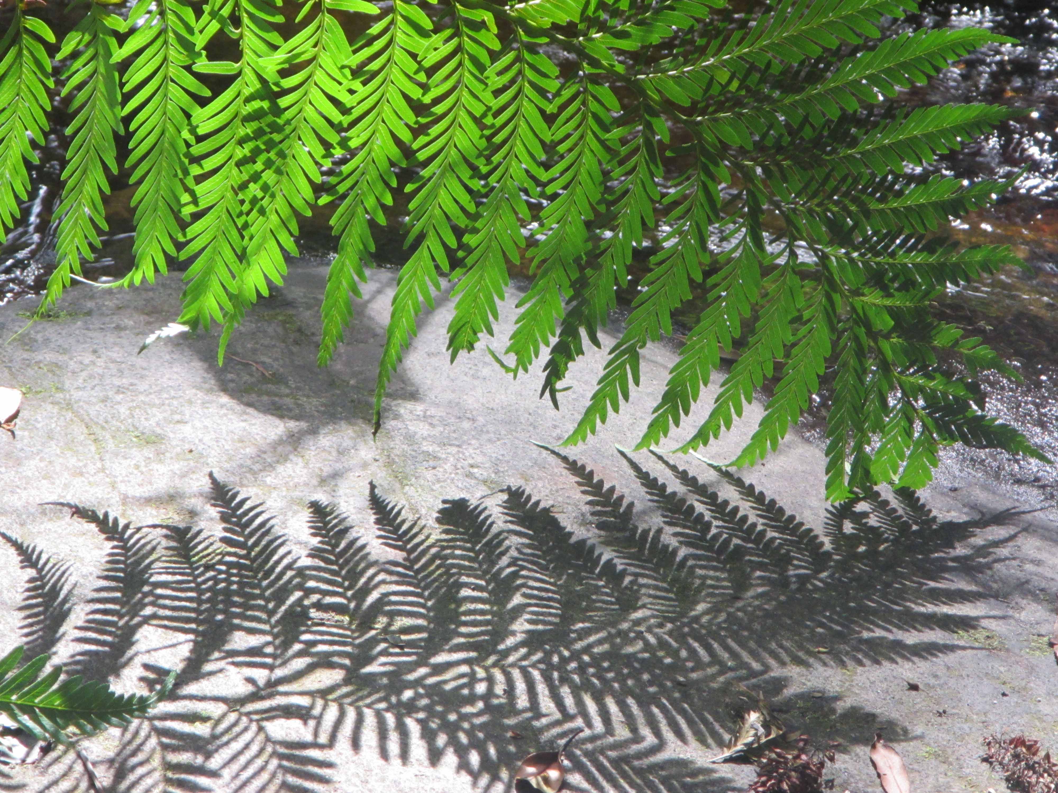
In the mid-afternoon we arrived at another patch of forest. This particular patch of forest was my favorite of the trip as it felt particularly enchanting. There are several rusty red colored streams cascading through the thick green vegetation of this section of the forest. There are also many tall, wide green ferns. In this section of forest, I felt as if we would come across Tarzan or maybe a dinosaur!
Crossing one of the rusty red streams of the forest.Twin tall trees… with a vine!Another view of the forest.A lovely forest stream.A fern and its shadow.More ferns.
After we emerged from the forest, we found the jeep track leading to Keurbos Hut. At long last, we arrived at the hut itself:
Arriving at Keurbos Hut.
That’s all I have for Day #3 on the Tsitsikamma Trail. Stay tuned for Day #4!
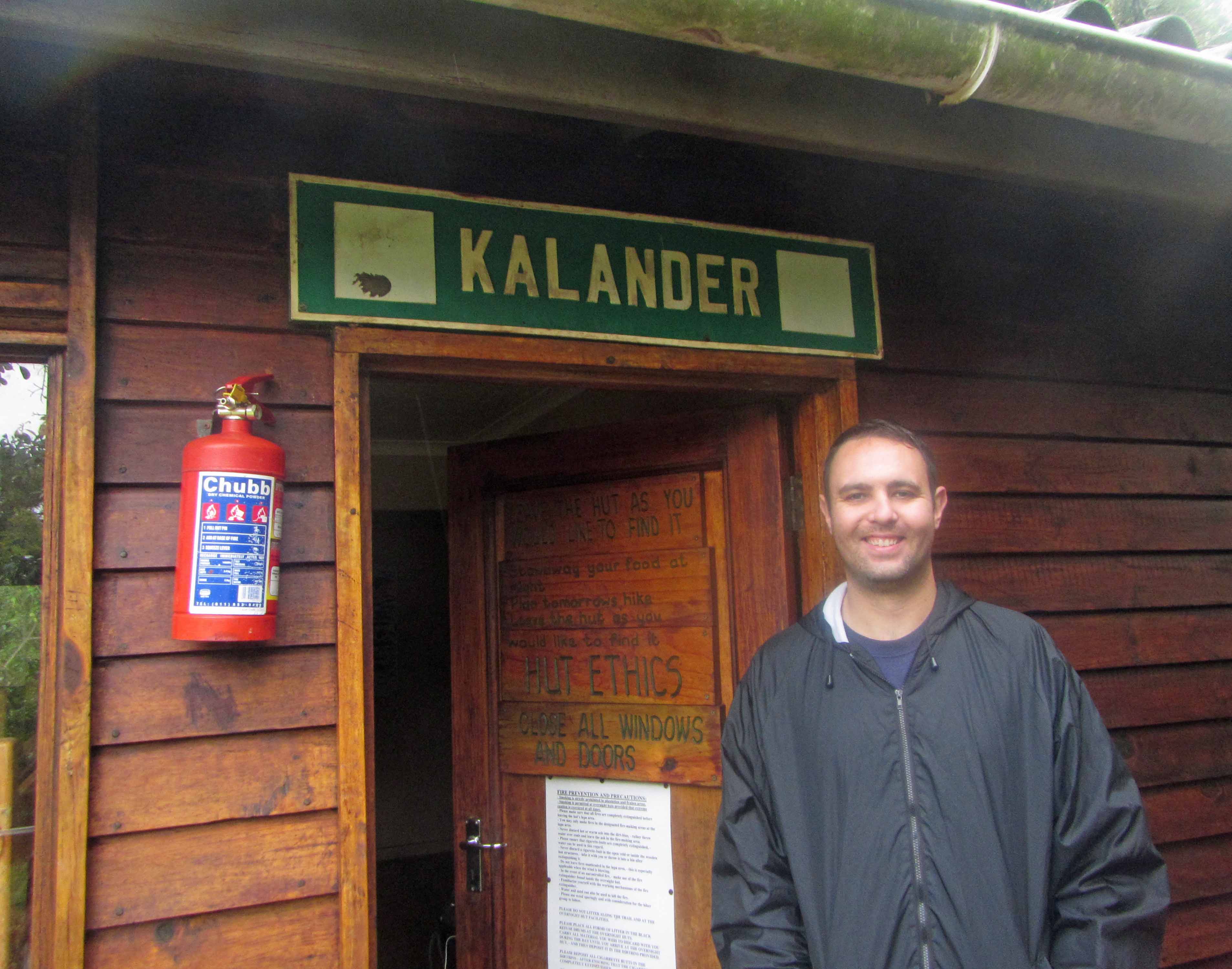
Yours truly posing with some shell fossils near Kalander Hut.
Today, I’m continuing with my posts about my recent backpacking trip along the Tsitsikamma Trail in South Africa with my husband Jackie and five of our friends. Earlier today, I realized that blogging about my Tsitsikamma Trail trip this week is appropriate since this is Earth Science Week and The Geological Society is encouraging people to participate in what they are calling, “The Great Geology Walk”. This event is aimed at getting, “as many people as possible will take notice of the geology all around them during this year’s Earth Science Week.” The Geological Society is encouraging people to share pictures of the geology they observe around them and also encouraging people to participate in organized and self-guided geology walks. This week I’m pretty busy with my day job and also with paper revisions in the evenings, so I guess my geology walk will be virtual. I’ll relive (and share with my blog readers) my Tsitsikamma Trail hike. Perhaps on Friday afternoon or Saturday I can escape for a real-life geology walk as well!
Today I’ll be blogging about Day #2 of the Tsitsikamma Trail hike. On Day #2 we hiked approximately 17 km from Kalander Hut to Blaauwkrans Hut. The trail website says that the hike is 13.5 km, but the trail website is out-of-date. The day’s hike has been re-routed and lengthened to about 17 km, making the hike long and challenging. We didn’t realize that the trail had been re-routed until after we were more than halfway done with the hike. I think that was actually a good thing! Once we were more than halfway done, we decided that we may as well carry on to the next hut!
In any case, although we were exhausted, very hungry, and quite sore when we finally arrived at Blaauwkrans Hut in the late afternoon, the hike was well worth the effort and the little aches and pains. The trail wound its way from the beach, up a steep escarpment, across mountain fynbos, and through indigenous afromontane forest. Along the way, we saw fossils; tilted Table Mountain sandstones; rusty red, coca-cola colored streams and waterfalls; giant protea flowers and tall, tall yellowwood trees; various animal footprints; a large land snail; and many other wonderful sights. At the end of the 17 km hike, we arrived at the hut, which is in a truly breathtakingly beautiful location. The hut is perched on the edge of a deep ravine and overlooks a double waterfall.
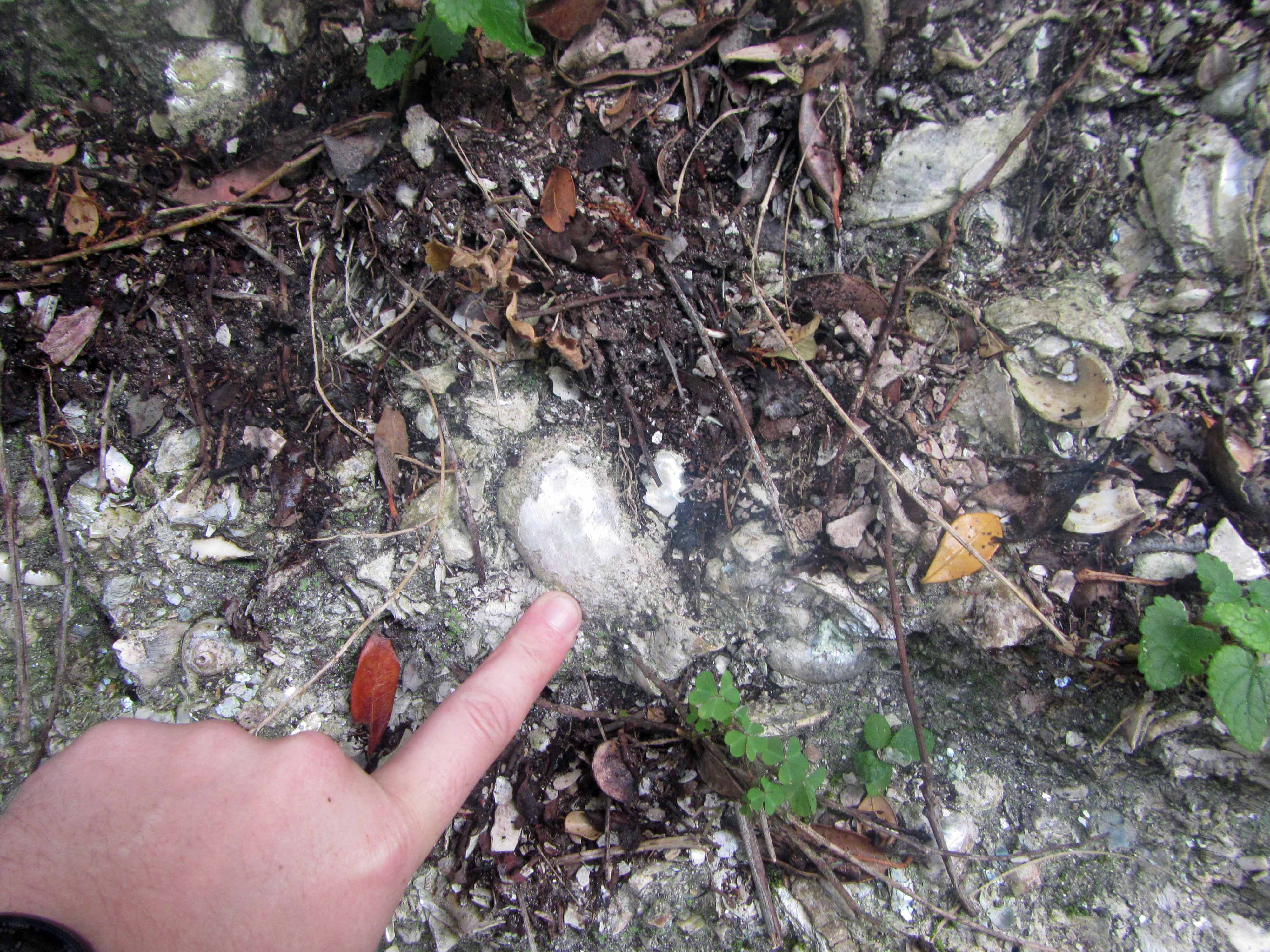
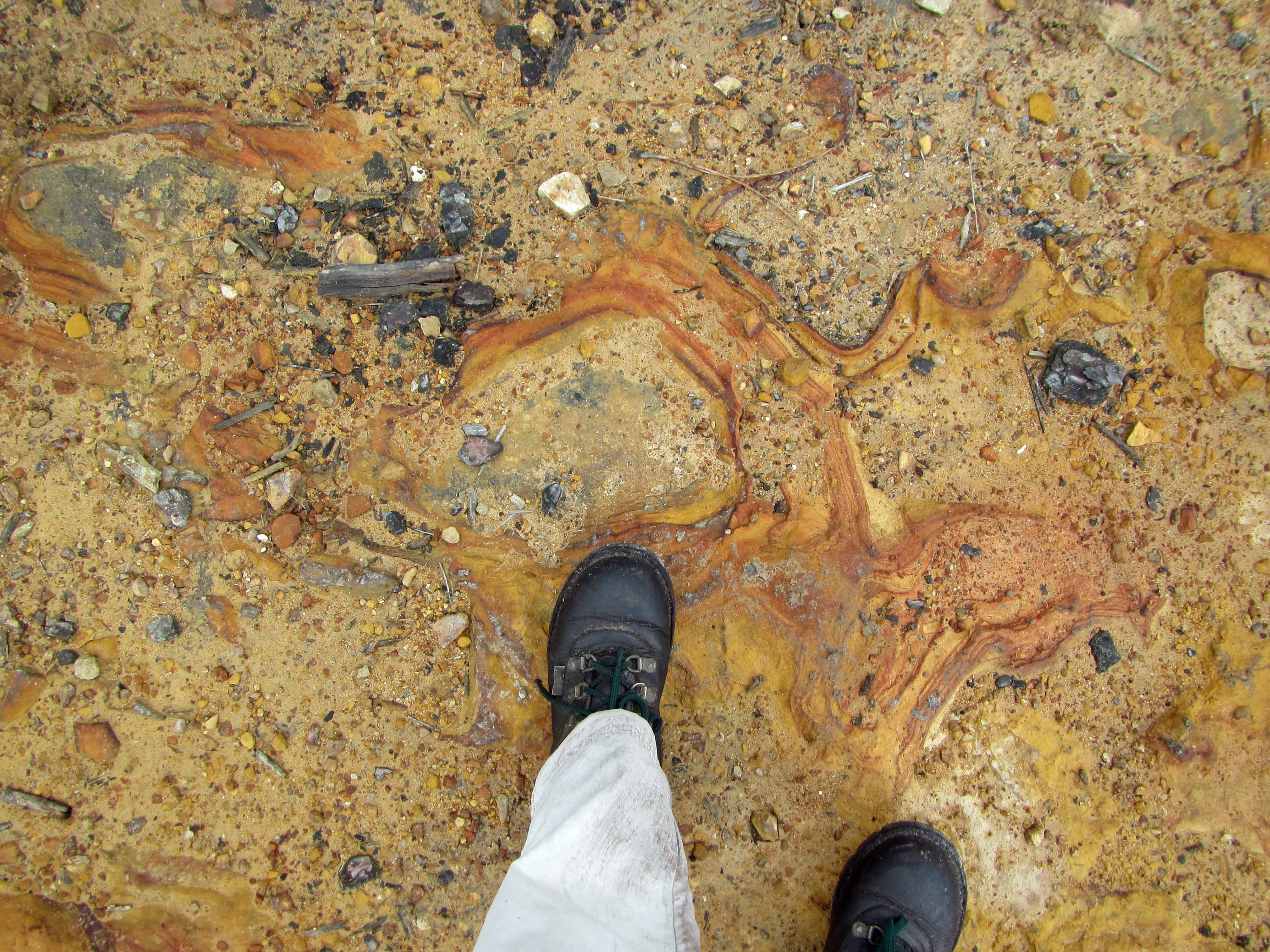
The hike started out by passing an outcrop with fossils, which made me quite happy:
Shell fossils exposed in outcrop near Kalander Hut.Another view of the shell fossil outcrop, with finger for scale.
The fossil outcrop is located just a few minutes’ walk from the Kalander Hut. I wasn’t able to find (in a quick Google search, at least) any information about the fossils, but they look like fairly young shell fossils in loosely-consolidated sediments of a vegetation-covered beach dune. If anyone knows any more about the fossils near Kalander Hut, please let me know. I’d love to learn more about them.
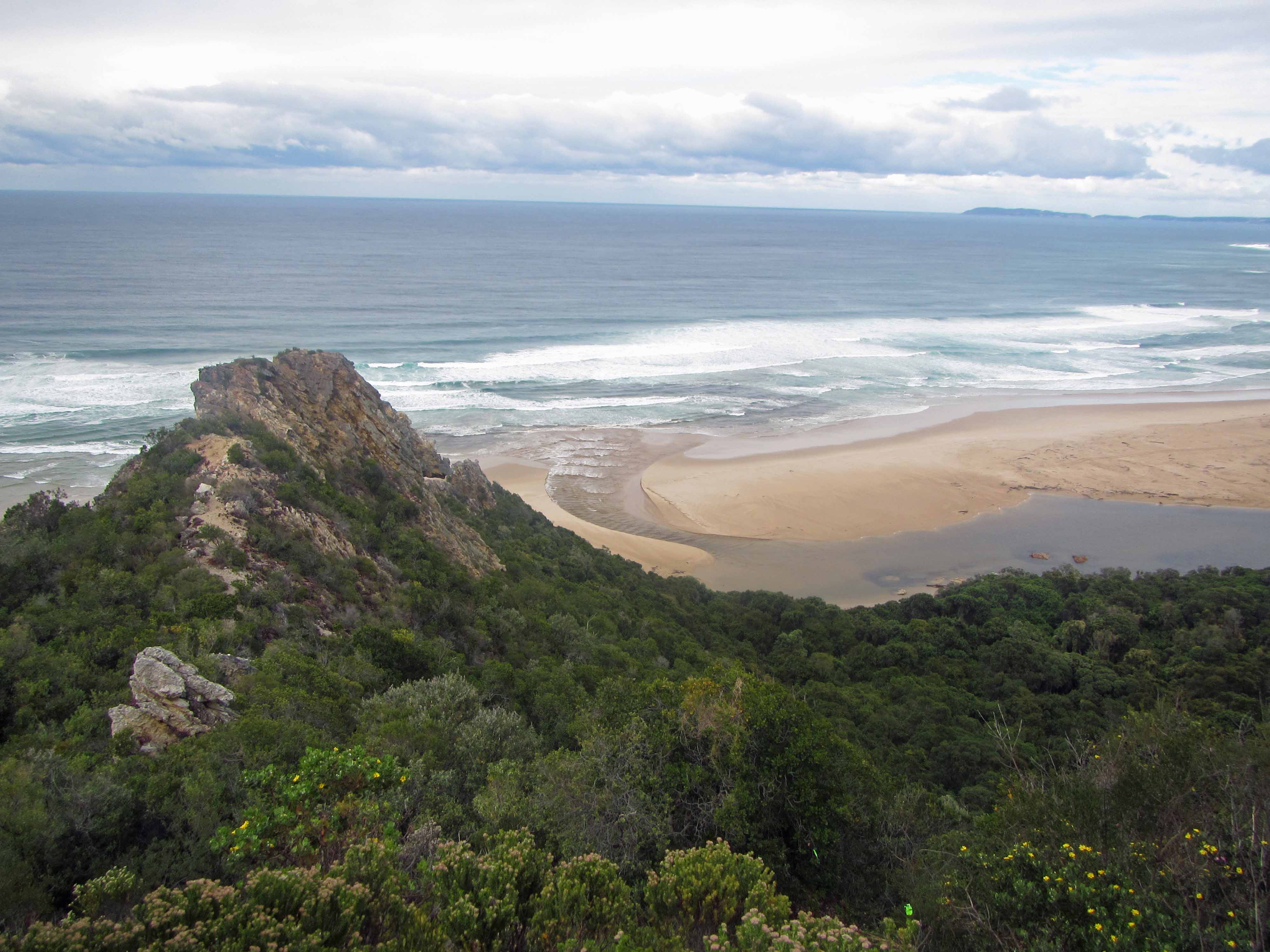
After the group dragged me away from the fossil outcrop, we started the steep hike up the escarpment and into the Tsitsikamma Mountains. After we finished huffing and puffing our way up onto the escarpment, we were rewarded with a beautiful view of the Nature’s Valley beach below:
The beach at Nature’s Valley, viewed from above.Another view of the Nature’s Valley beach.Yet another view of the Nature’s Valley beach. That’s mountain fynbos in the foreground.Jackie and I posing with the beach in the background.
After we recovered from the steep start to the hike, we continued along the trail, which cut through rich mountain fynbos vegetation:
The trail leading through the fynbos.
Here’s a pretty protea plant we saw:
A lovely red protea.
Here’s the group on the trail:
Hanging out amongst the fynbos. We don’t look too tired yet.
We didn’t encounter many animals along the trail, but we did observe many animal tracks. Here are a couple of the tracks we saw:
Animal tracks #1.Animal tracks #2.
After awhile, we made our way into the indigenous afromontane forest. The forest felt very old and magical and was full of tall trees (such as yellowwood trees), bright red and orange mushrooms, and thick green vegetation. I felt almost as if I had stepped into a fairytale world. I half expected to encounter hobbits, elves, or fairies along the path.
The path through the forest.An interesting, fuzzy plant. Anyone know what it’s called?Another view of the fuzzy plant.Mushrooms on a log.Jackie posing next to a tall tree.Jackie and I making our way along a wider part of the trail.A snail on the path.
We stopped for lunch by a coca-cola colored waterfall cascading over some Table Mountain sandstone rocks:
A coca-cola colored waterfall and pool.
We didn’t stop for lunch for too long because it started to rain:
A coca-cola colored waterfall and pool.
Fortunately, we (well, at least two of us!) were well-prepared for the rain:
Protected by large rain ponchos.
After a couple more hours of hiking through the forest, we arrived at the jeep track leading to the Blaauwkrans Hut:
Hiking along the jeep track.
We followed the jeep track for a few kilometers. As we continued, we could see the Bloukrans Bridge in the distance:
Bloukrans (or Blauuwkrans or Bloukrantz… there are several spellings!) Bridge.
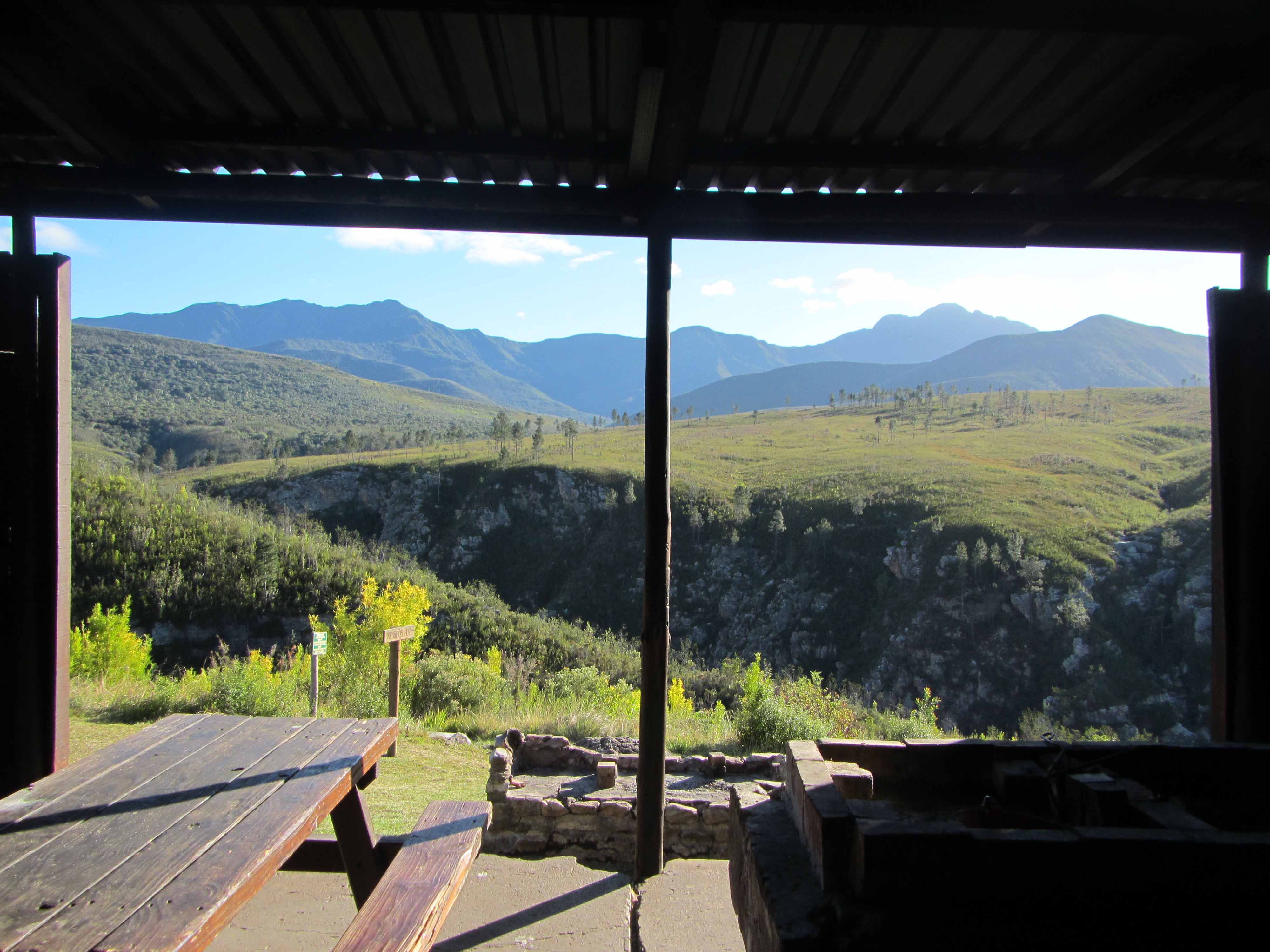
Here are some more views of the hut and its associated facilities:
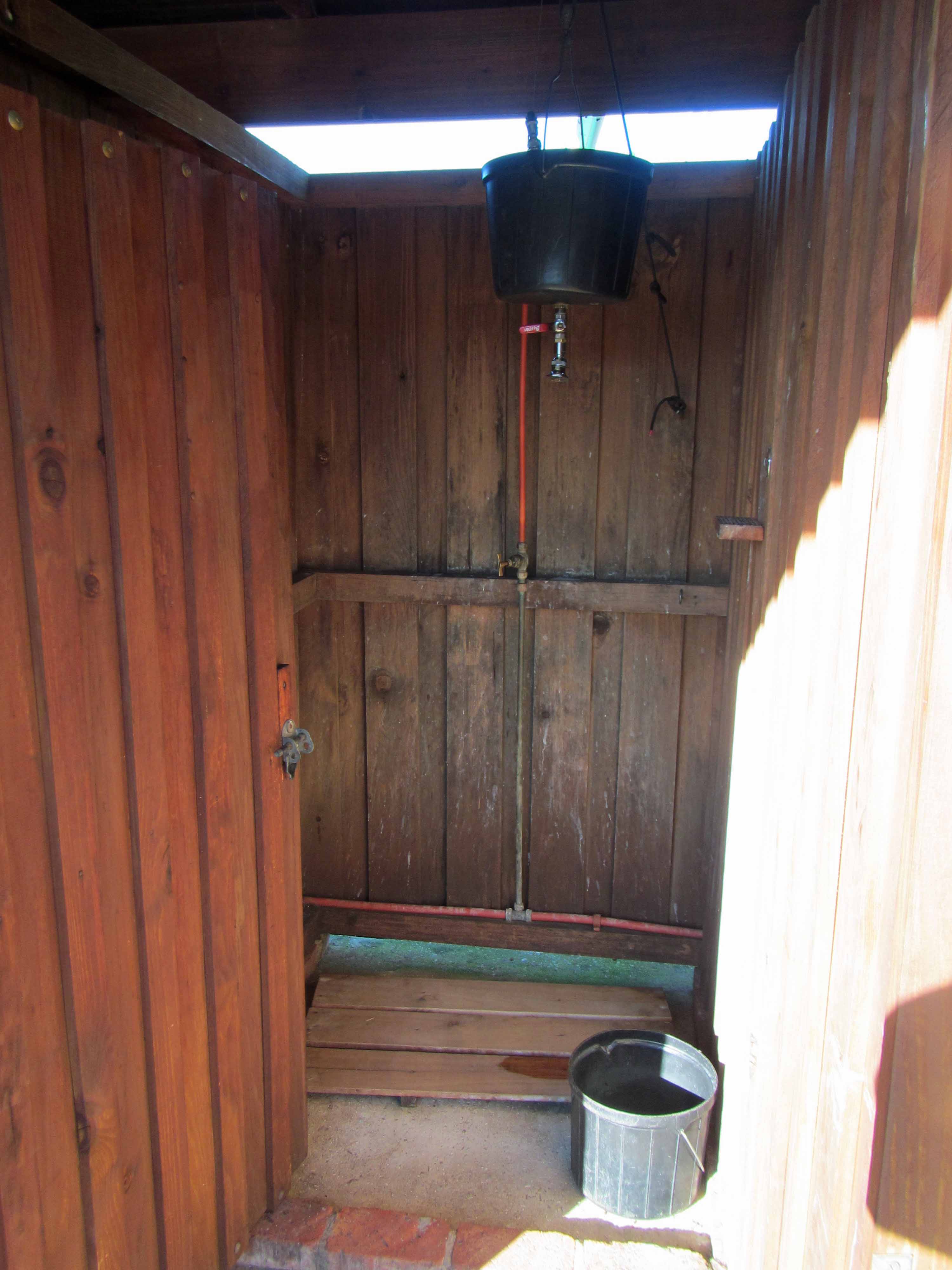
The sleeping hut.Lapa / cooking area.The view from the lapa area, taken on the morning of Day #3, when the sun was out again.The hot water shower. You heat water in a kettle and put it in the big black bucket. After diluting the boiling water with some cool water, you can take a wonderfully refreshing hot shower that lasts a few minutes.
Last but not least, here is the view from the front porch of the sleeping hut:
The view of the waterfalls from Blaauwkrans Hut. I think this view makes the 17 km hike worthwhile!
Isn’t that double waterfall stunning? Here’s a closer view:
A coca-cola colored double waterfall. You can swim in those pools!
Here’s a picture of Jackie and me on the front porch of the hut:
Tired but happy hikers.
We saw some animals during our stay at Blaauwkrans Hut. We saw a troop of baboons hanging out above the waterfall:
Baboons.
We also saw a genet, but it moved too quickly for us to take a picture.
Well, that’s it for Day #2 of the Tsitsikamma Trail. Stay tuned for Day #3!
A couple of weeks ago, I went on a backpacking trip with my husband Jackie and five of our friends. We drove from our home in Cape Town, South Africa about seven hours down the coast to the Garden Route National Park. We went to hike the Tsitsikamma Trail, a 6 day, 60 km long trail that winds its way through the beautiful Tsitsikamma Mountains, which contain areas of indigenous afromontane forest and mountain fynbos. Fynbos is a type (a floral kingdom, in fact!) of shrubland or heathland vegetation that is found only in the southwestern part of South Africa. Fynbos is known for its high biodiversity and for its large numbers of endemic plants– that is, plants that are found nowhere else in the world. The Tsitsikamma Trail also meanders past a beautiful beach on the Indian Ocean, amongst impressive exposures of Table Mountain sandstones, and across many beautiful rivers and streams, which are either clear or a rusty red color. The word Tsitsikamma comes from the Khoekhoe language and means “clear water” or, possibly, “place of much water” or “waters begin”.
Jackie, our friends, and I started hiking the Tsitsikamma Trail on Thursday, September 19th and completed the first four days of the hike, finishing on Sunday, September 22nd. We didn’t fail to complete the entire hike– we actually planned to do just four days of the hike. We decided to do just four days primarily because our vacation time was limited. I guess we were also a little worried about our fitness level! The hike was physically challenging, but all seven of us managed to keep up a fairly good pace, even while carrying heavy backpacks! After the hike, I was quite sore for a couple of days. However, the soreness was well worth it. The Tsitsikamma Mountains are full of magical places, and it was wonderful to spend four days re-connecting with the natural world, my smartphone turned off and my emails ignored.
The trail is very well maintained and organized. Along the trail, there are five huts where hikers can stay overnight. The huts are very nice with a sleeping area, a lapa (a covered cooking / fireplace area), flush toilets, running water, and showers. There is no electricity, but kettles can be used to heat water for hot showers. The huts (with the exception of Kalander Hut, which has limited service because the road to the hut recently washed away) are stocked with firewood and other supplies. The cost for using the huts is R70 (a little less than US $10) per person per night. The huts are regularly checked on and maintained by forest rangers, who also keep an eye on all the hiking groups. Many hikers carry their own gear (food, extra clothes, water, sleeping bags, etc.) in large backpacks. That’s the option that our group chose. However, hikers who want a more leisurely hiking experience can pay to have their gear portaged between huts and can just hike with day packs. Hikers don’t have to pack in too much (heavy!) water since there is plenty of fresh water along the trail. The huts all have running water, and there are many streams along the trail. It is safe to drink the water at most huts and from most streams. As a precaution, I did treat my water with sterilization tablets. However, many of my South African friends drank the water directly and suffered no ill effects. In any case, you only need to carry enough water for a day or part of a day.
Over four posts, I would like to share some pictures and information from our Tsitsikamma Trail hike. I will devote one post to every day of the hike.
Here is the hiking schedule we followed:
Day #1: Leave Cape Town early and drive 7 hours to the start of the hike in Nature’s Valley. Shuttle one car to the Lottering Plantation. Hike 3.6 km from Nature’s Valley to Kalander Hut.
Day #2: Hike approximately 17 km (note that the map below is outdated and that the trail has been re-routed and is now significantly longer) from Kalander Hut to Blaauwkrans (or Bloukrantz) Hut.
Day #3: Hike 13.4 km from Blauuwkrans Hut to Keurbos Hut.
Day #4: Hike 11.5 km along the “escape route” from Keurbos Hut to Lottering Plantation. Drive 7 hours back to Cape Town.
After four days of hiking and driving, we were fairly exhausted for work on Monday morning. Fortunately, the Tuesday was a public holiday (Heritage Day) in South Africa, so we only had to work one day before we had a day to rest.
Here are some maps showing the location of the Tsitsikamma Trail:
Google map showing the approximate location of the Garden Route National Park (B) relative to Cape Town (A). Click to enlarge.A map of the Tsitsikamma Trail.Click to enlarge.
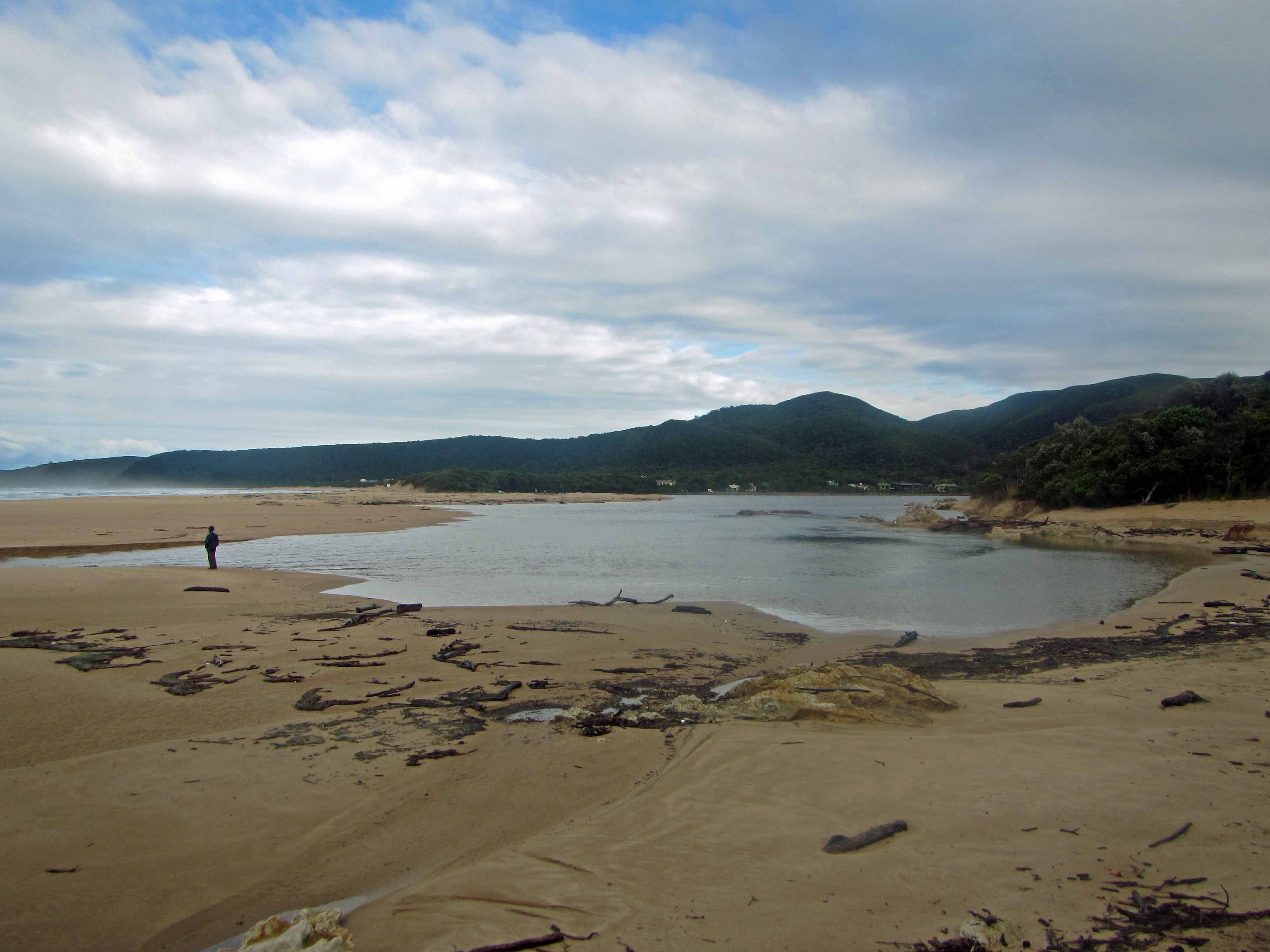
Today, I’ll be sharing some pictures from the first day of our hike. The first day was a short hike to the Kalander Hut, which is located close to the beach. When we arrived at the hut, it was nearly dark. So, we visited the beach very quickly then prepared dinner. We visited the beach again early the next morning before we started on our long hike to Blaauwkrans Hut.
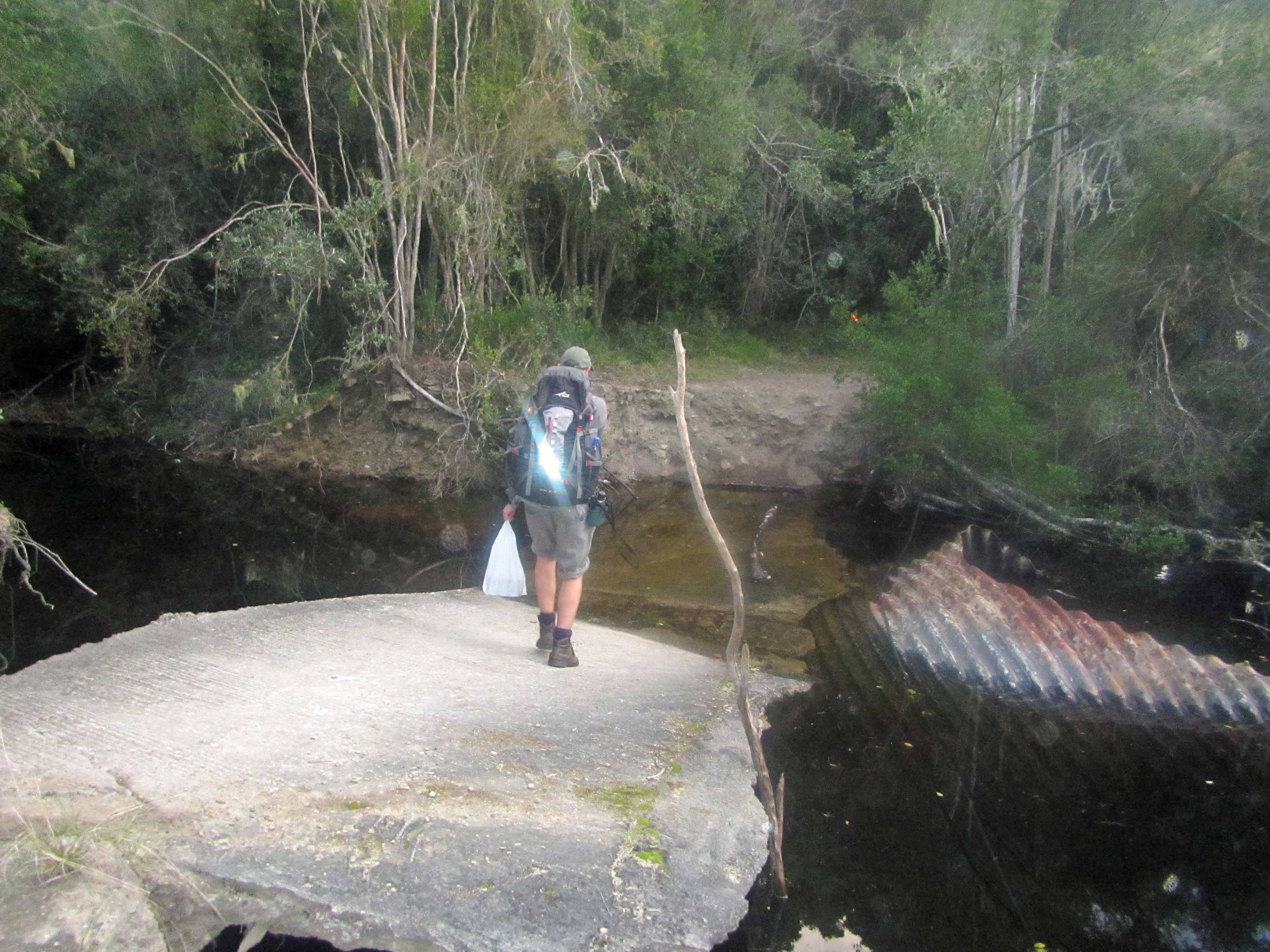
Jackie and I at the start of the hike. Jackie carried in firewood and beer for the first night. Fortunately, we only had to hike 3.6 km the first day!There is a jeep track leading to Kalander Hut, but it has collapsed / washed out at this river. However, hikers can still make it through to the hut! We took off our shoes and waded through the water, which was nearly to my knees at its deepest.Jackie in front of Kalander Hut.The beach near the Kalander Hut. The trench was dug (by park rangers with a backhoe) the night before to alleviate inland flooding. By morning, there was a swift river running through the trench!Swiftly flowing waters in the trench.Cliff near the beach.Informational signs on the beach, perched far above high tide and rouge waves.A close-up of some beach rocks.Beach flowers.The hiking group on the beach, wearing various shades of rain gear.
A coral terrace on the beach near the village of Matemwe, Zanzibar.
For this week’s “Monday Geology Picture” post, I’m continuing with sharing some pictures from my vacation in Zanzibar back in June 2013. I thought I would share some pictures of a coral terrace on the beach near the village of Matemwe. My husband and I stayed at the beautiful resort of Azanzi near Matemwe. Most of the coral found along the beaches in Zanzibar is likely of Marine Isotope Stage 5e Pleistocene age (Arthurton et al., 1999).
A crab crawling on a coral beach terrace, Matemwe, Zanzibar.The view of the beach near the coral terrace, Matemwe, Zanzibar.
Reference: Arthurton et al. (1999) Late Quaternary Coastal Stratigraphy on a Platform-Fringed Coast: A Case Study from Zanzibar, Tanzania. Journal of Coastal Research, Vol. 15, No. 3: 635-644.


