KwaZulu-Natal Holiday: Howick Falls

HowickFalls1
Howick Falls #1.

Over the next two or three weeks I’ll be sharing some pictures from my recent week-long holiday in March to the KwaZulu-Natal province of South Africa. A week is not nearly enough time to fully explore this beautiful part of the world. However, my husband and I managed to see a fair amount! We took a flight from Cape Town (our home city) to Durban and then we drove through to the lovely little town of Hilton, where we stayed with friends for three nights. From Hilton we explored a beautiful part of the country known as The Midlands. Then we drove to the town of Underberg in the Drakensberg, which is Afrikaans for “Dragon Mountains”. On our way to Underberg we took a detour to Kamberg to see some rock art. We spent four nights in Underberg, and one day we went on a day trip up Sani Pass to spend a few hours in the Kingdom of Lesotho.

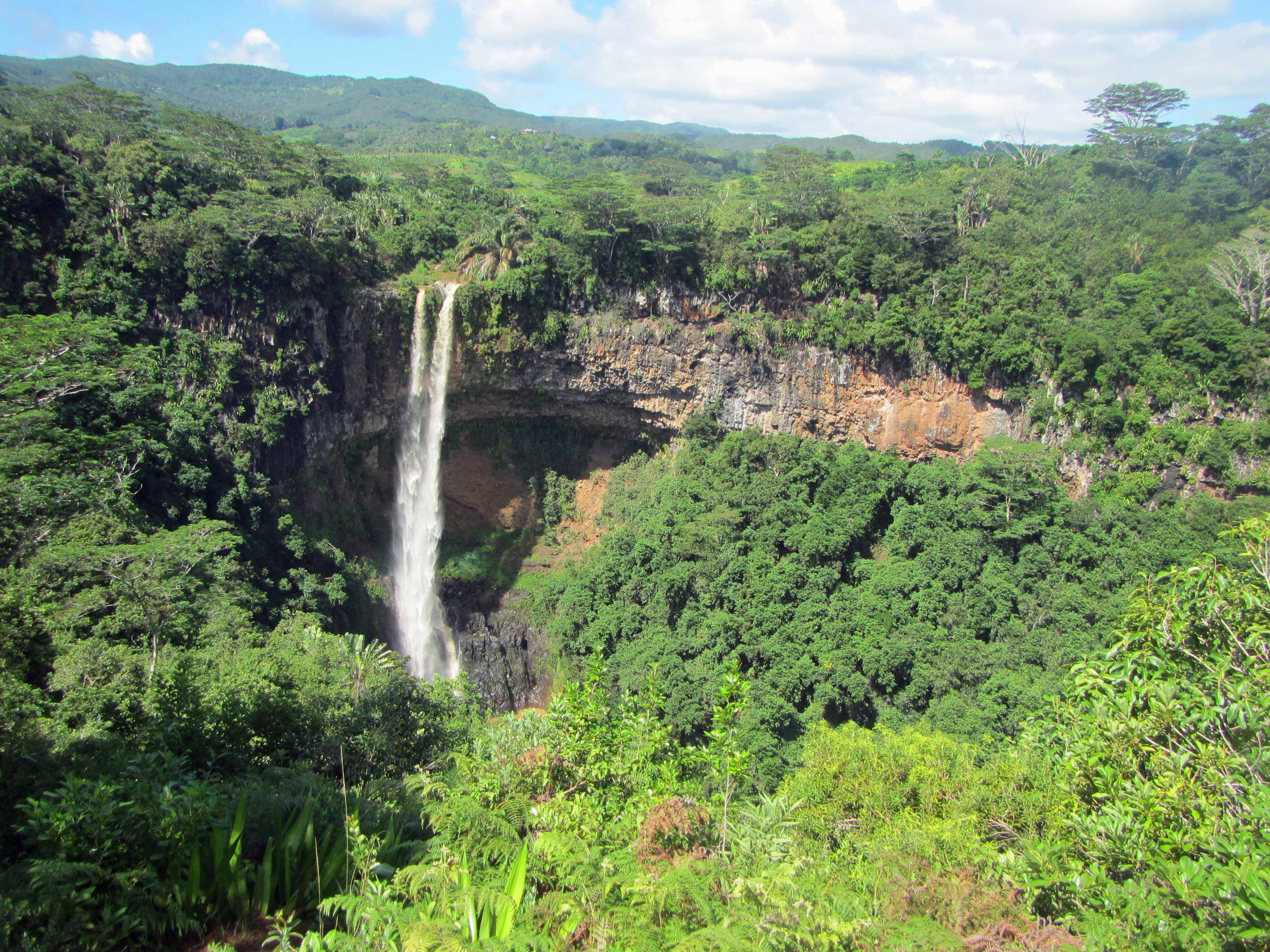
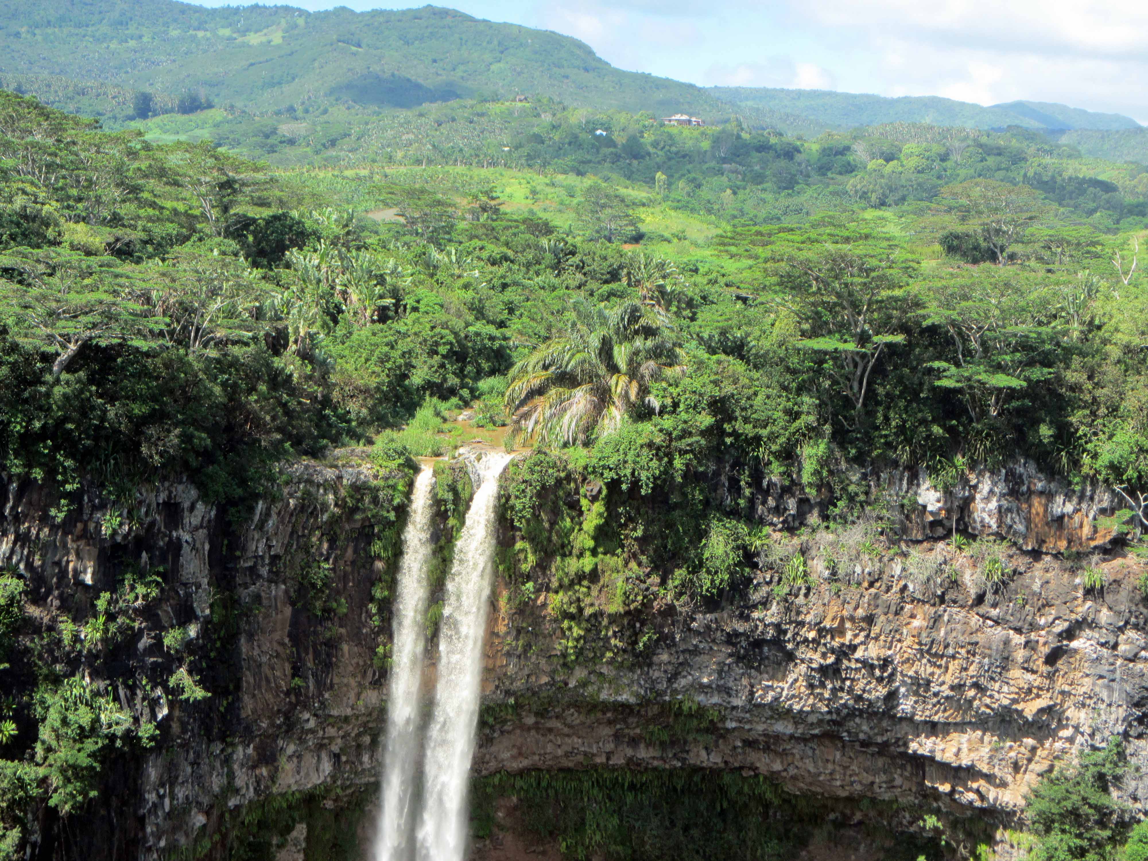
To start off the KwaZulu-Natal holiday blogging, today I’m sharing pictures from our visit to Howick Falls, an impressive waterfall located a short drive away from Hilton. Howick Falls is a 95 m tall waterfall on the Umgeni River. The falls cascade over a cliff composed of dolerite that intruded into Ecca Group sedimentary rocks. Both the dolerite and the Ecca Group rocks are Karoo Supergroup rocks. At the falls, a layer of Ecca shale can be seen sandwiched between sills of dolerite, and there’s also a dolerite dyke.

Let’s take a closer look at part of the cliff:

Howick Falls #2.
Howick Falls #2.

It’s a little difficult to see the boundaries between the dolerite sills and the Ecca shale, but they’re there.

Do you see the dolerite dyke? If not, let me point it out to you:

Howick Falls #3.
Howick Falls #3.

Here’s a closer look at the upper dolerite sill:

Howick Falls #4.
Howick Falls #4.

Here are two more pictures pictures of the falls:

Howick Falls #5.
Howick Falls #5.
Howick Falls #6.
Howick Falls #6.

Do you see the Ecca shale layer in the above picture? Here are the rough boundaries:

Howick Falls #
Howick Falls #7.

As I mentioned, it’s a little difficult to pick out the boundaries from these pictures, but there’s definitely a shale layer in there!

Here are some pictures of an informational sign at the falls:

Howick Falls #8. The sign says sandstone but note that the Ecca consists of both shale and sandstone. My one geology book says that a shale-rich Ecca layer is located at Howick Falls.
Howick Falls #8. The sign says sandstone but note that the Ecca Group consists of both shale and sandstone. My one geology book says that a shale-rich Ecca layer is located at Howick Falls. Click to enlarge.
Howick Falls #9. A close-up of the geological diagram on the informational sign.

There’s a neat signpost at the falls showing the directions and distances to other famous waterfalls:

Howick Falls #10.
Howick Falls #10.
Howick Falls #11.
Howick Falls #11.

Last but not least, here are some pictures of the beautiful river valley below the falls:

Howick Falls #12.
Howick Falls #12.
Howick Falls #13.
Howick Falls #13.

That’s all for now. Stay tuned for more KwaZulu-Natal adventures here on Georneys!

Chamarel Waterfall, Mauritius

Stunning Chamarel Waterfall, Mauritius.
Stunning Chamarel Waterfall.

Today I’m continuing with sharing some pictures from my March 2014 trip to the volcanic island of Mauritius. You can see some of my previous posts on Mauritius here, here, and here. Mauritius is a tropical island, so in many places the lava rocks, particularly the older ones, are covered by thick green vegetation. However, there are some places where you can see the lavas well. One of those places is Chamarel, a popular tourist destination that consists of Chamarel Waterfall as well as a geologic attraction known as the Seven Coloured Earth— I’ll blog about the Seven Coloured Earth in another post. Today, I’d like to share some pictures of Chamarel Waterfall, a tall waterfall about the same height (~100 meters) as the Statue of Liberty. At the waterfall, two units of volcanic rocks are exposed. The first unit is approximately 8-10 million years in age and thus represents some of the oldest lavas of Mauritius. The second unit is approximately 1.7-3.5 million years in age.

Here’s an informational sign about the waterfall and the lavas:

Informational sign about the Chamarel Waterfall.
Informational sign about Chamarel Waterfall.
A closer view of the informational sign.

Here are a couple more pictures of the waterfall:

Waterfall... and lava flows!
Waterfall… and lava flows!
A closer view of the younger lava flow.

Stay tuned for more posts about Mauritius!

Monday Geology Picture(s): Berlin Falls, Mpumalanga, South Africa

Berlin Falls. Photo courtesy of Bonita and Jonathan Hall.

For this week’s geology picture post I thought I would share some more pictures from my sister-in-law’s recent honeymoon in the Mpumalanga region of South Africa. Last week I shared some pictures of Bourke’s Luck Potholes. This week I’m sharing two pictures of Berlin Falls. What a lovely waterfall!

Another view of Berlin Falls. Picture courtesy of Bonita and Jonathan Hall.

Monday Geology Picture: Niagara Falls

Niagara Falls, Summer 2005.

I’ve only visited Niagara Falls once. I visited the American side of the falls for a few hours back in 2005 when I went with my mom, dad, and sister on a roadtrip from New Hampshire to Ohio. We drove to Ohio to pick up my parents’ new dog from a friend who had a litter of puppies. I didn’t have a very good camera back in 2005, so I only took a few pictures of the falls. I ran across the falls pictures when I was browsing my folders of pictures for a “Monday Geology Picture,” and I decided to share the above picture with you. I like the above picture because the falls almost look as if they’re falling from the sky… from the clouds, perhaps. Does anyone else have good pictures of Niagara or other famous waterfalls?