Monday Geology Picture: Ripple Marks in Sandstone of the Cape Fold Belt, South Africa

Ripple marks, with hammer for scale.

This past Saturday my husband and I visited the Robertson area, which is about an hour and a half drive from Cape Town, South Africa. We went to visit my husband’s grandmother and also to meet up with a very nice woman named Francie, who emailed me several months ago about some rocks on her property outside of Robertson. Francie asked if she could send me some rock pictures, and I told her I’d do better and come look at her rocks. Saturday morning we finally met up with Francie as well as her husband and daughter at their property, which is delightfully called “Gnoem Gnoemskloof” (pronounced like “Noom Noomskloof”). Gnoem Gnoemskloof is located in the Cape Fold Belt, so the rocks we saw on the property were all sandstones. There were some beautiful sandstones on the property. I’ll be sharing some more pictures and geologic information from our visit to Gnoem Gnoemskloof in the future. For today, I thought I would share this neat picture of ripple marks which have been preserved in the sandstone.

Monday Geology Picture: A Glimpse of the Cape Fold Belt Through a Car Window

South Africa's Cape Fold Belt viewed through a car window, September 2011.

This week’s Monday Geology Picture shows some geology viewed through a car window. Specifically, the picture shows a glimpse of the magnificently folded and twisted sandstones of the Cape Fold Belt in South Africa. I snapped this picture as my husband and I drove along the N1 road on our way from Cape Town to Oudtshoorn for a long weekend trip. One of my favorite things to do is drive around South Africa with my husband. We often encounter interesting rocks, animals, and plants along the way… and we often stop to take a closer look at them. Even when we don’t stop, I often take pictures through the car windows, such as the picture above. The only reason we didn’t stop for a picture at that moment was that I had already snapped a few dozen roadside pictures of similar rocks. However, I couldn’t resist a quick shot through the window.

One of the things I’m really looking forward to after I finally finish up this PhD of mine is a roadtrip across South Africa. Sometime next year, my husband and I plan to take a couple of weeks vacation and drive from Cape Town to KwaZulu-Natal, where we plan to visit some friends who live in the Drakensberg (note that Drakensberg means “Dragon Mountains”– how could I not want to visit there?). We plan to stop plenty along the way, investigating some local geology of course! I imagine I will also snap many more pictures through car windows.

Friday Geology Picture: Red, Red Las Vegas Rocks

Red and white sandstone with casinos in the far distance, Las Vegas, July 2011.

For the final picture in geology picture-a-day week here at Georneys, I’ve selected a landscape from Red Rock Canyon, Las Vegas. The canyon’s name originates from the color of fossilized sand dunes that have been oxidized, converting the Fe (iron) in the rock from a 2+ to 3+ charge, which changes the color of the sandstone from white-tan to bright, rusty red. Recently, Red Rock Canyon was in the news because hikers stumbled across some dinosaur footprints, the first to be found in Nevada.

Although I am not generally very fond of cities or casinos, I have a soft spot in my heart for Las Vegas. In fact, I travel to Las Vegas often. I’ve traveled to Las Vegas a couple of times for geology field trips, and every year I spend a few days in Las Vegas to attend The Amaz!ng Meeting, a meeting founded by James “The Amaz!ng” Randi— a conjurer, writer, advocate for reason, and fighter of pseudoscientific nonsense. I’ve known Randi for many years, and I spent a couple of semesters back in undergrad working for him as an intern. I feel very fortunate to be able to call him a dear, dear friend. If you aren’t familiar with Randi’s work, I highly recommend reading some of his books. Some of them are even available for Kindle— and on sale for the holiday season!

As much as I enjoy seeing Randi and attending The Amaz!ng Meetings, the sparkle, fluorescence, garish carpeting, temperature control, liquor scent, smokey haze, and ching-ching-ching of a Las Vegas casino start to drive me crazy after a day or two. So, whenever I attend The Amaz!ng Meeting, I try to escape to Red Rock Canyon for an afternoon or two. Red Rock Canyon is about a half hour drive from the casinos and provides a peaceful, beautiful, and geologically interesting escape. Over the years, I’ve even led a few geologic field trips to Red Rock Canyon for Amaz!ng Meeting attendees. I’m not sure if I’ll be able to attend the 2012 Amaz!ng Meeting, but if I do I’ll be sure to take a quick trip out to the red, red rocks.

Here are some more pictures from my 2011 visit to Red Rock Canyon. I never did write up a post about the geology of Red Rock Canyon, but I promise to do so sometime! And, in case you missed them, here are my other geology pictures from this week: Monday, Tuesday, Wednesday, and Thursday.

Well, that wraps up geology picture-a-day week. I’ve enjoyed posting these geology pictures so much that I’m actually going to add a new weekly feature to Georneys: the Monday Geology Picture! Every Monday, I’ll post an interesting– and perhaps pretty– geology picture from my georneys (geological journeys) that will help inspire and motivate me for the work week ahead. As I finish up my PhD over the next few months, I’m not sure how much time I’ll have for regular blogging. I’ll do my best to blog when I can– mostly when I need a study break, I imagine– but I’m going to cut myself a little bit of slack over the next few months. If the Geology Word of the Week doesn’t appear some weeks, it’s because I’m feeling overwhelmed by my thesis. I should be able to keep up with a weekly geology picture, though– and hopefully some other more substantial posts now and then!

I hope you’ve enjoyed the pictures this week! Thanks to everyone who joined in and also posted geology pictures on their geoblogs. I’ve enjoyed seeing all of your pictures as well. If you haven’t already participated, it’s not too late to post a Friday Geology Picture!

Thursday Geology Picture: Sandstone Statues in the Petra Siq

Remnants of ancient statues carved out of the sandstone walls of the Petra Siq, Jordan, August 2007.

Geology picture-a-day week continues here at Georneys. Today’s geology picture comes from one of my favorite places on Earth: Petra, Jordan. Petra is an ancient Nabatean city nestled in a broad valley that is protected by steep sandstone terrain. Petra is accessed by the Siq, a narrow canyon through the sandstone. The geology of the Siq is impressive enough: the walls of the canyon reveal beautiful, red rose colored sandstone which contains cross-bedding, concretions, quartz veins, and other interesting textures. However,  the Siq is made even more impressive by the archaeological artifacts it contains: ancient water aquaducts that run along the sides of the canyon (see the background of the above picture), windswept stairs leading to small niches carved out of the rock, and even remnants of what must have been large and impressive statues. In the picture above, you can see the remnants of a sandstone statue of a man leading a camel– but only feet and hooves remain. The small archaeological artifacts found in the Siq hint at the impressive wonders that are found within the city of Petra itself; the Siq teases visitors and leads them along in anticipation.

For those of you who have never heard of the Petra or the Siq before, you might recognize the end of the Siq as well as the impressive Al-Khasnah or “The Treasury” building from the movie Indiana Jones and the Last Crusade.  Petra and The Treasury were also visited by my favorite cartoon explorer: Tintin! Speaking of Tintin, is anyone else excited for the Tintin movie that’s coming out very soon? I am!

Here’s what Tintin saw when he reached the end of the Siq:

Tintin's view of The Treasury. Photograph: Hergé/Moulinsart 2010. Image taken from here: http://www.guardian.co.uk/travel/2010/oct/19/tintin-adventure-jordan-petra

And here’s what I saw in 2007 when I reached the end of the Siq:

The end of the Siq revealing a sliver of The Treasury. Petra, Jordan, August 2007.
Astonished tourists gazing on The Treasury for the first time. Petra, Jordan, August 2007.
The Treasury! Petra, Jordan, August 2007.

Petra is a truly remarkable place, both in terms of geology and archaeology. I could spend days upon days there. Here’s a few more pictures from my 2007 visit to Petra.

And, in case you missed them, here’s my other geology pictures from this week: Monday, Tuesday, and Wednesday. If you follow my twitter feed, I’ve been trying to retweet the geology pictures posted by other geobloggers. If you haven’t already, feel free to join geology picture-a-day week, even if you missed the first part of the week. The more geology pictures, the better!

The Maltese Cross

I’m back to working long days in lab, and I miss being outdoors in South Africa. So, to make myself happy after a long 12-hour lab day, I thought I’d post some more pictures from my recent trip to the Cederberg Mountains in South Africa.

The day after we visited the Sevilla Rock Art Trail, my fiance and I hiked up to a rock feature known as “The Maltese Cross.”  Hiking up to the cross is a relatively easy, ~1/2 day hike if you’re in good hiking shape. For various reasons (too much time in lab for me and too much time at sea for my fiance), we are not currently in top hiking form. So, we decided to allocate a full day to the Maltese Cross hike. We also needed a full day because we were staying in a little cabin near the town of Citrusdal. The cabin where we were staying is actually very close to the cross as the bird flies, but there is no road or path leading directly from Citrusdal to the cross. So, we had to drive north– about halfway to Clanwilliam– and take a small, pothole-riddled dirt road through the town of Algeria and then down to the little village (just a wine farm, really) of Dwarsrivier. The drive from Citrusdal to Dwarsrivier takes about 1.5 hours– including about an hour on the dirt road– each way.

Driving from Algeria to Dwarsrivier is very scary, particularly when you are driving an old, rusty 1994 VW CitiGolf. Note that the car actually has the word “Citi” in it. This is a city car, not a Cederberg car. However, my fiance’s trusty CitiGolf– named Hubert– has made many a trip along the dirt roads of the Cederberg. As you might expect, Hubert always comes back from the Cederberg with an injury. On this trip a rock badly cracked one of his front lights. A month or so ago when my fiance was in the Cederberg, a tire blew out in a dramatic fashion. Last September we snapped the muffler in two. As you can imagine, driving along a dirt road in Hubert is somewhat nerve-wracking and destructive (to poor Hubert), which is why we are now looking into buying a proper 4-by-4 vehicle.

My fiance’s “field” CitiGolf at the farm in Dwarsrivier, South Africa, May 2011.

Paved to dirt, road to through Algeria, South Africa, September 2010.

Driving the “field vehicle,” Cederberg, South Africa, September 2010.

Even if you are in a 4-by-4, the road from Algeria to Dwarsrivier is scary. So scary that I do not even have good pictures of the scariness because I was too scared to operate the camera. The dirt road follows the edge of a very steep cliff for several kilometers. Then the really scary part comes– the Uitkyk Pass: a narrow, steep pass with a sheer and scary drop-off on one side. Most of the pass is unpaved. In very recent years, a small section of the pass that crosses a river and bends sharply at the same time has been paved. Before the paving, this section of the pass narrowed to single-file traffic… because the other half of the road had collapsed into the valley due to erosion. This narrow turn (just a few meters, really) has now been reinforced and paved in stone, but the rest of the pass is still dirt and still nerve-wracking to drive along, especially in a 1994 VW CitiGolf.

The best picture I managed to take of the Uitkyk Pass (near the paved section) The baboons (on the right) made me brave enough to take a photo but not brave enough to lean out the window. This doesn’t look scary in the picture, but it is. Scary cliffs are just out of the shot. Cederberg, South Africa, September 2010.
Slightly better view (through the dirty windscreen) of the paved section of the Uitkyk Pass. Cederberg, South Africa, September 2010.
Scary death road, the twisty part is the scary pass. Click to enlarge.

Zoomed in view of scary death pass. I think this image (from 2005) is from before they paved the scary section. Click to enlarge.

Anyway, I’ve survived the pass twice now. The saving grace of the scary road and pass is that the scenery is absolutely breathtaking. The view from the top of the pass is one of the most beautiful views I have ever seen, and the valley beyond is enchantingly quiet and lovely. The destination is also worth the scariness. Near the village of Dwarsrivier are two well-known hikes: the first is a hike through the Wolfberg Cracks and on to the Wolfberg Arch, and the second is a hike to the Maltese Cross. So far, I’ve hiked to the Wolfberg Cracks (back in September) and to the Maltese Cross (this trip). I hope to hike all the way to the arch next time I visit the Cederberg.

Looking back on the valley below the Uitkyk Pass, Cederbeg, South Africa, September 2010.
Another view from the bottom (non-scary) part of the Uitkyk Pass, South Africa, September 2010.

Here are some maps showing the location of the Maltese Cross:

Maltese Cross relative to Cape Town. Click to enlarge.
Maltese Cross relative to the town of Citrusdal. Click to enlarge.

Closer view of the Maltese Cross. Note the farm at Dwarsrivier in the upper right corner. Click to enlarge.

Closer view of the farm. Click to enlarge.

And here are some pictures of our hike up to the cross:

Dwarsrivier farm viewed from the hike up to Wolfberg Crack, September 2010.
Dwarsrivier farm 1, South Africa, May 2011.

Dwarsrivier farm 2, South Africa, May 2011.

Dwarsrivier farm 3, South Africa, May 2011.

Jeep (and CitiGolf?) track to start of Maltese Cross hike, South Africa, May 2011.
Long-tailed bird 1, South Africa, May 2011.

Long-tailed bird 2, South Africa, May 2011.
Long-tailed bird 3, South Africa, May 2011.

Long-tailed bird 4– just look at that tail!, South Africa, May 2011.
Starting the hike, South Africa, May 2011.
Don’t hike that away– too steep, South Africa, May 2011.

Bounding bokkies! Almost over the hill… look carefully, South Africa, May 2011.

Maltese Cross 1– in this photo I look bigger than the cross, South Africa, May 2011.

Maltese Cross 2, South Africa, May 2011.

Maltese Cross 3– in this photo I look much, much smaller than the cross, South Africa, May 2011.

Maltese Cross 4, South Africa, May 2011.

Maltese Cross 5, South Africa, May 2011.
Back down the trail, South Africa, May 2011.

Interesting sandstone weathering, South Africa, May 2011.

Gorgeous view on the hike down, South Africa, May 2011.

Another spectacular view, South Africa, May 2011.

View and leaves, South Africa, May 2011.

Tree-frame, South Africa, May 2011.

Sevilla Rock Art Trail

Jumping man with spear, Sevilla Rock Trail, South Africa, May 2011.

Last week my fiance and I spent a few days in the Cederberg Mountains, a couple of hours drive north of Cape Town, South Africa. One day we drove from our cabin in Citrusdal to the town of Clanwilliam and then a little farther up the R364 to a little place called “Traveller’s Rest.” After buying permits, obtaining a map and guidebook, and eating a tasty lunch (only 25 rand, just under $4 US at the current exchange rate) at the Khoisan Kitchen, we set out on a self-guided hike along the Sevilla Rock Art Trail

Delicious lunch at the Khoisan Kitchen, South Africa, May 2011.

The trail is only 4km long, and the hiking is flat and easy. However, we spent an entire afternoon slowly walking along the trail and marveling at hundreds of rock art paintings. These paintings were made by the San people hundreds to thousands of years ago. In South Africa “San” is now the favored, politcally correct term used for the bushmen people.

Interpretation of the rock paintings is tricky since the San have no written language. Some of the more fantastical paintings are likely associated with “trance states” and San religious customs. Some of the paintings may simply be scenes of everyday San life. The meaning of many paintings is lost forever.

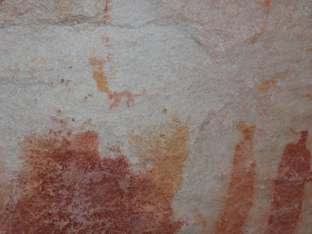
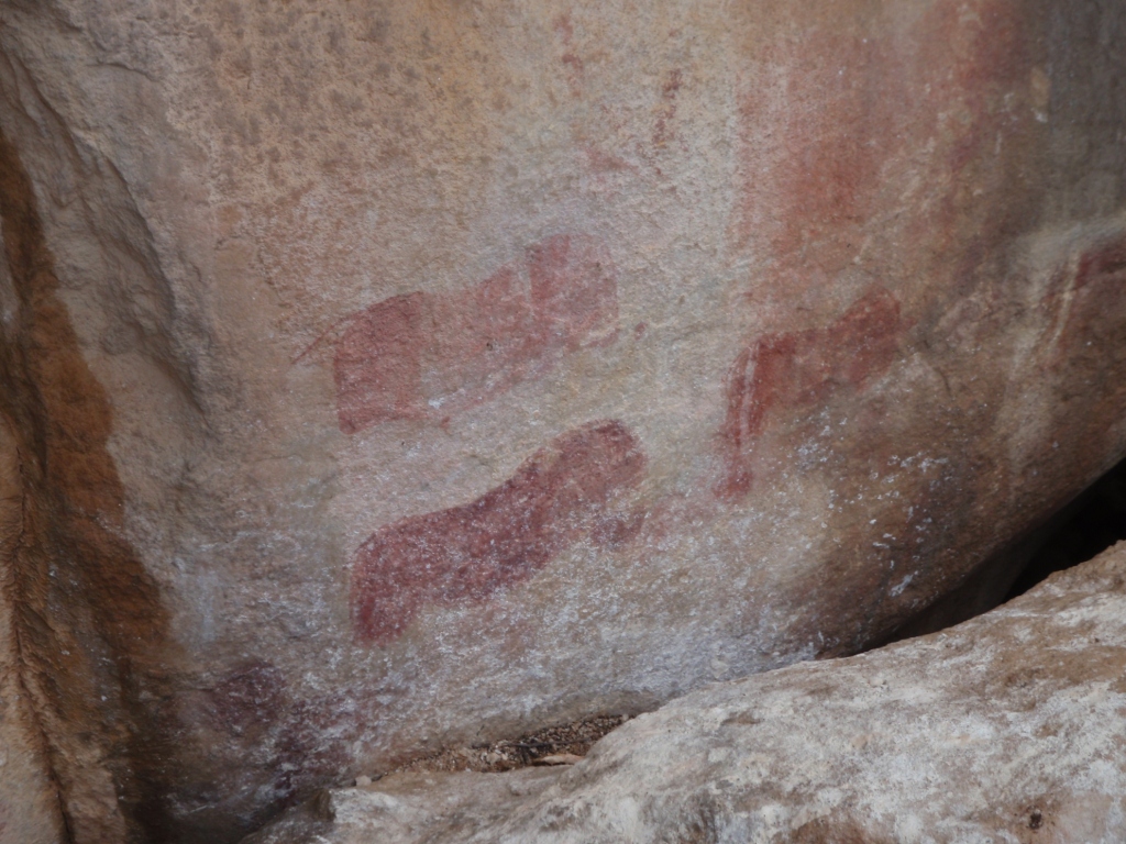
Most of the paintings are monotone– red or brown or white or black, though some of the black is actually lichen that is attracted to the paint and in the process of destroying the paintings through biological weathering. However, there are some polychrome paintings, and many of the paintings seem to have parts missing– perhaps these paintings once were done in two or more colors, but only one color has survived because one type of paint was more resistant to weathering. For instance, animals sometimes lack heads and legs (which may have been drawn in a different color), and the “hook headed” people may have had faces drawn in a different color. Often, it is difficult to tell if the omissions are from differential weathering or if they are a purposeful part of the artwork.

You might be familiar with the controversial but classic portrayal of the San people in the 1980 film “The Gods Must Be Crazy,” which is a comedy about the interactions between a bumbling biologist researcher, a schoolteacher, a band of guerilla revolutionaries, and Xi– a San/Bushman who (in the movie) has never seen white people before meeting the biologist and the schoolteacher. Xi assumes these mysterious, large, white Afrikaaners must be gods, and he is befuddled by their strange ways. Xi is also upset that the “gods” will not take back a glass coca-cola bottle which fell from the sky (from an airplane). This bottle had caused trouble when his tribe members fought over the bottle (useful as a tool), which they believed was sent as a gift from the gods.

As a quick aside, I recently discovered that “The Gods Must Be Crazy” was originally an Afrikaans movie. For release overseas, the movie was dubbed with English voices. I noticed that the voices in the movie were a bit strange, but for some reason I never realized the movie was originally in Afrikaans. I am now on a quest to obtain a copy of the movie in the original Afrikaans, a language I am currently trying to learn (albeit slowly in the midst of finishing up my thesis).

Below are some pictures of our recent hike down the Sevilla Rock Art Trail and some of the many, many paintings there. If you are ever in the Cederberg area, I highly recommend visiting the trail. The trail is a bit off the usual tourist path and is peaceful, relaxing, and fascinating. We were the only visitors the afternoon we hiked the trail. If the day is warm, you can even take a refreshing swim in the Brandewyn River.
 
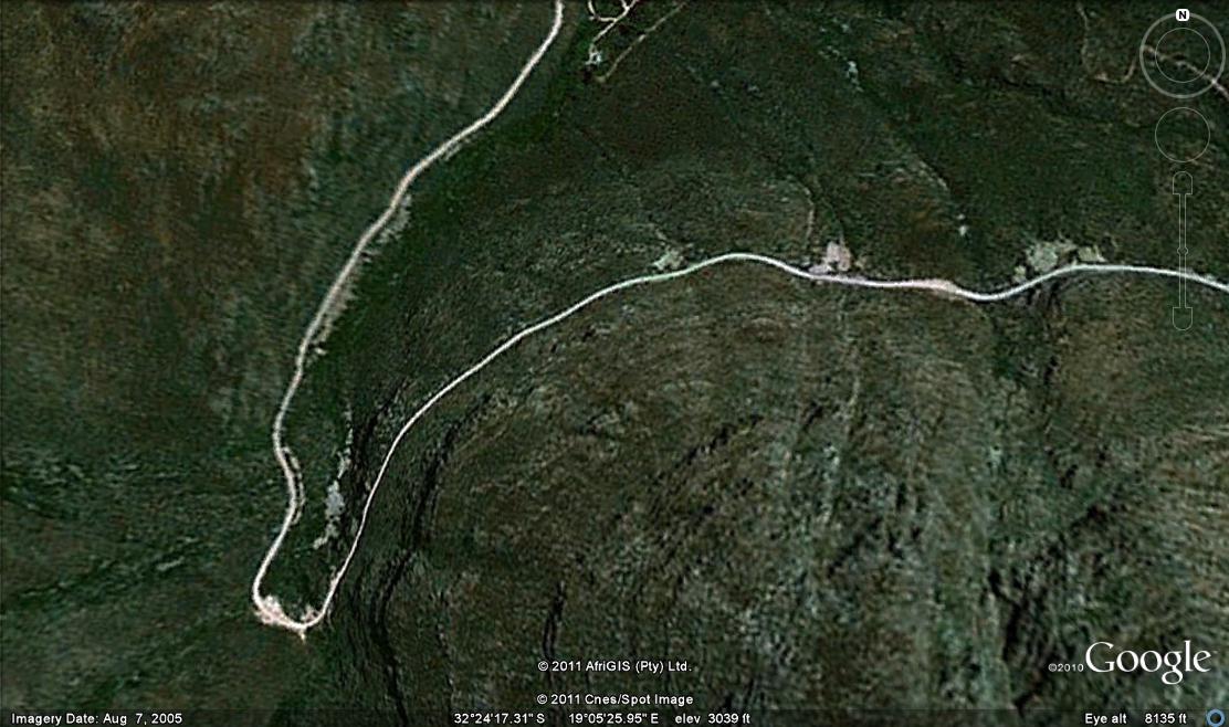
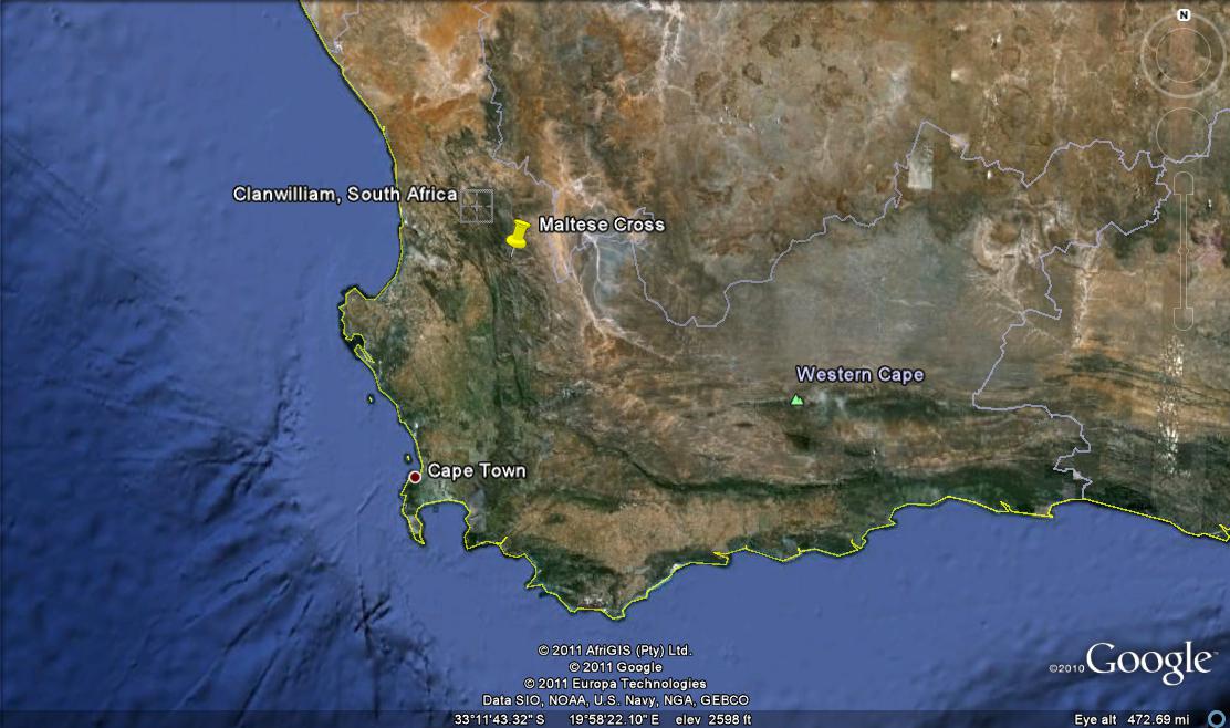
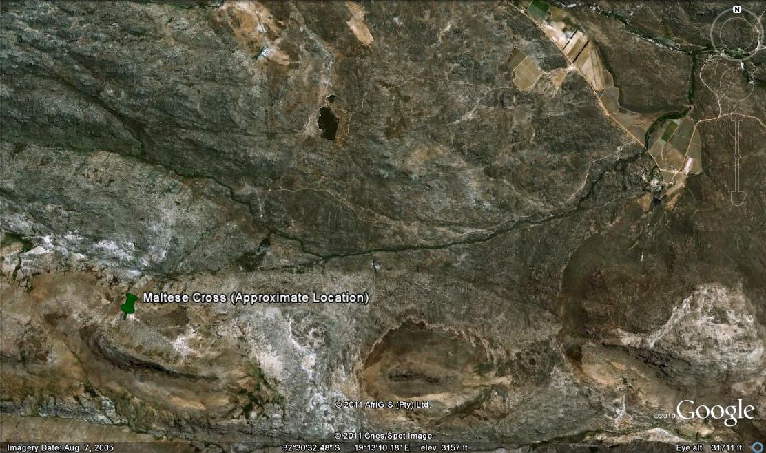
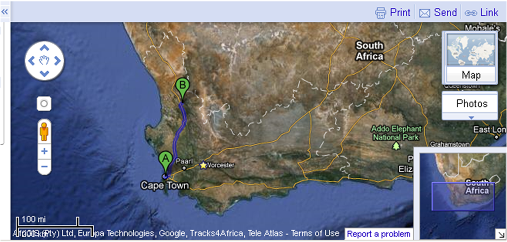
Here are a couple of maps giving you an idea of where the town of Clanwilliam (B) is relative to Cape Town (A):

The ~2-3 hour drive from Cape Town to Clanwilliam. Click map to enlarge.
A closer view of Clanwilliam. Traveller’s Rest is up the R364. Click map to enlarge.

And here are some pictures:

Khoisan Kitchen and the Brandewyn River, South Africa, May 2011.

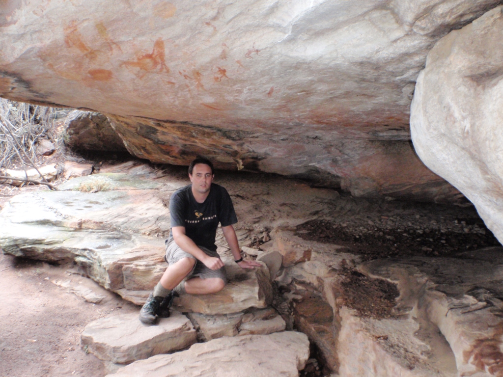
Chillin’ with some rock art, Sevilla Rock Art Trail, South Africa, May 2011.

I think this is a cat, but my fiance thinks it’s a baboon, and the guidebook thinks it’s a fox, Sevilla Rock Art Trail, South Africa, May 2011.

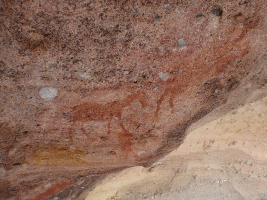
Monsters?, Sevilla Rock Art Trail, South Africa, May 2011.

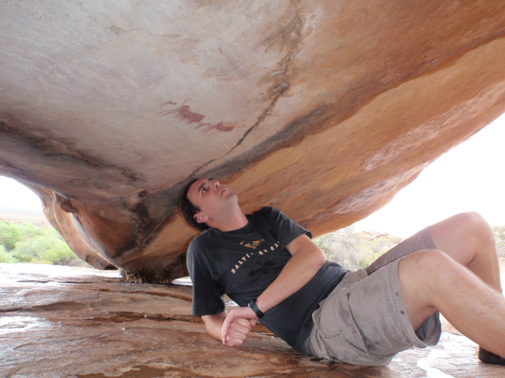
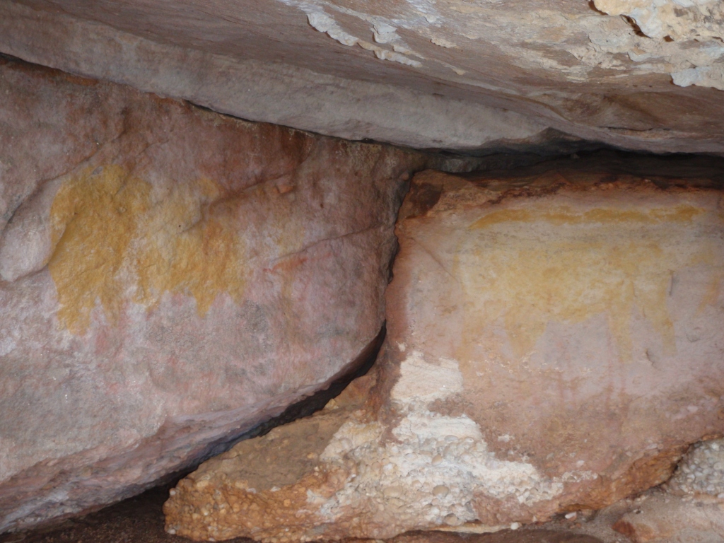
Many of the best paintings are found in caves and underneath boulders; perhaps these ones survived weathering best, Sevilla Rock Art Trail, South Africa, May 2011.

Looking for paintings under another overhang, Sevilla Rock Art Trail, South Africa, May 2011

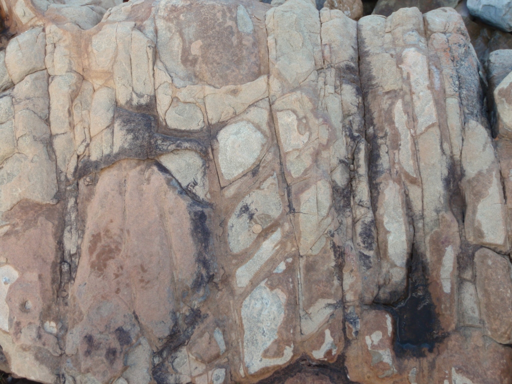
Coarse, pebbly sandstone— the canvas, Sevilla Rock Art Trail, South Africa, May 2011.

Buck of some sort?, Sevilla Rock Art Trail, South Africa, May 2011.

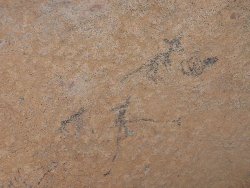
Black figures, Sevilla Rock Art Trail, South Africa, May 2011.

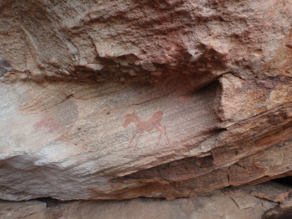
Baby zebra, Sevilla Rock Art Trail, South Africa, May 2011.

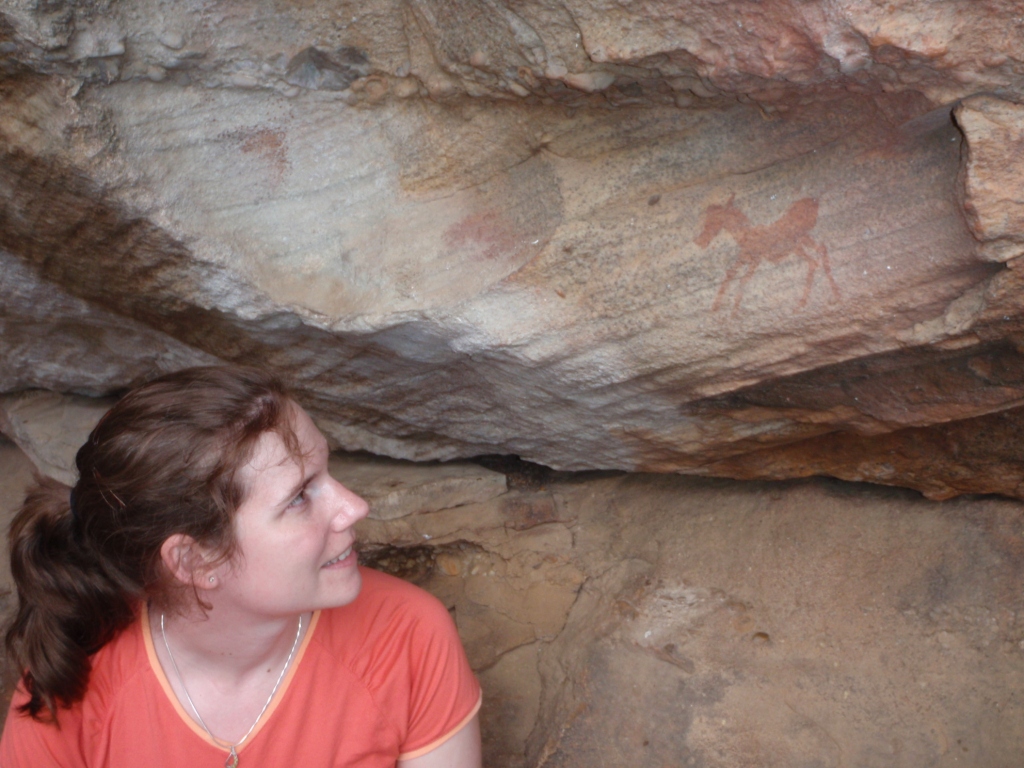
A closer look at the baby zebra, Sevilla Rock Art Trail, South Africa, May 2011.

Yet another look at the baby zebra (it’s so cute I think I need three pictures), Sevilla Rock Art Trail, South Africa, May 2011.

This overhang is covered in rock art, Sevilla Rock Art Trail, South Africa, May 2011.

A closer look at part of the overhang, Sevilla Rock Art Trail, South Africa, May 2011.

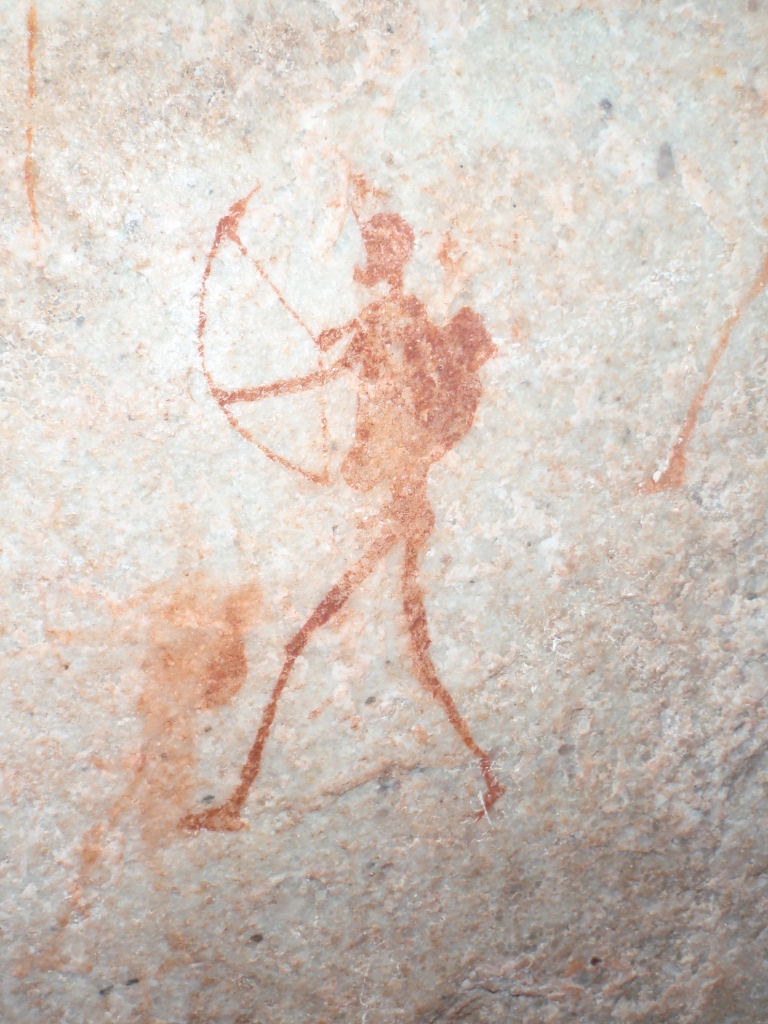
Archer, Sevilla Rock Art Trail, South Africa, May 2011.

Some well-endowed ladies, Sevilla Rock Art Trail, South Africa, May 2011.

Bringing home a feast, Sevilla Rock Art Trail, South Africa, May 2011.

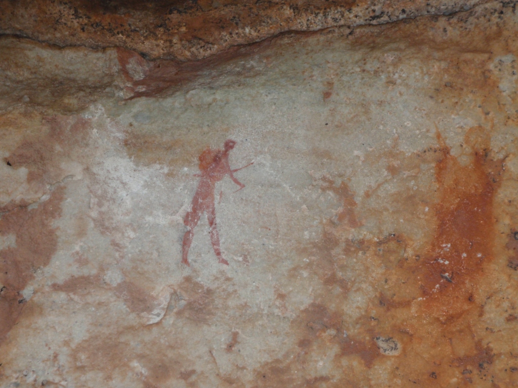
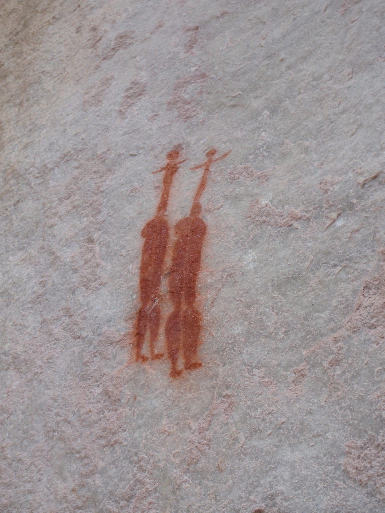
Travelling man, Sevilla Rock Art Trail, South Africa, May 2011.

Anteater?, Sevilla Rock Art Trail, South Africa, May 2011.
Hands, Sevilla Rock Art Trail, South Africa, May 2011.

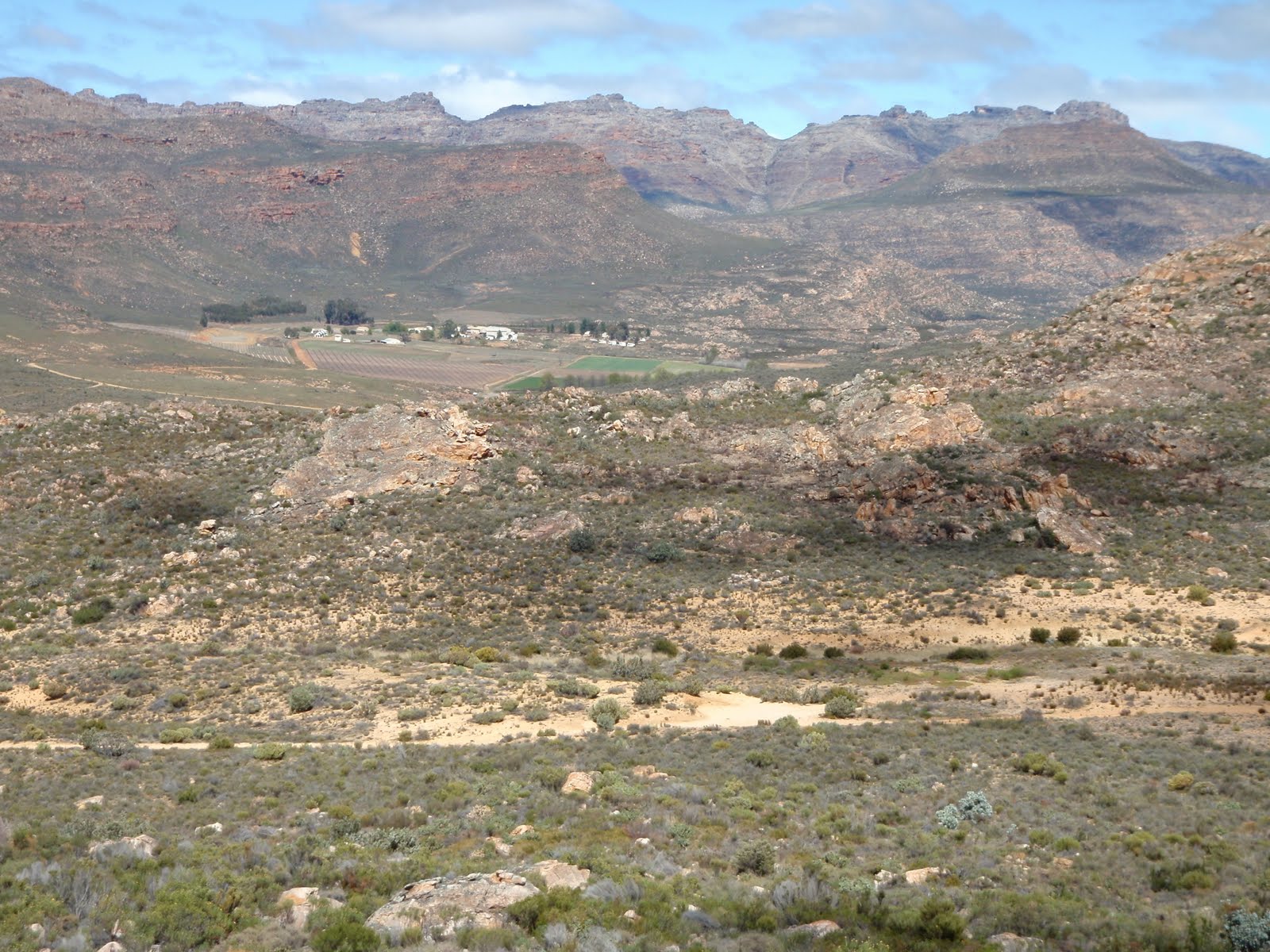
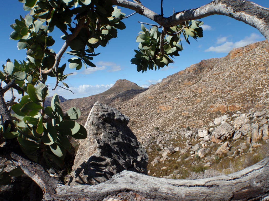
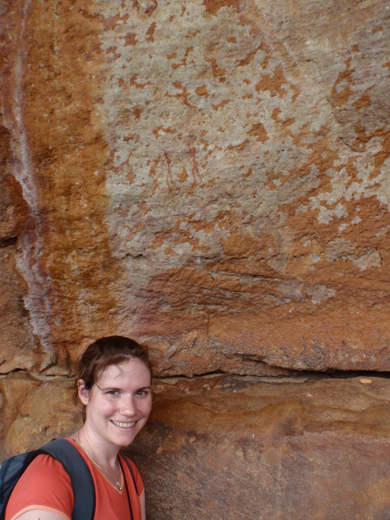
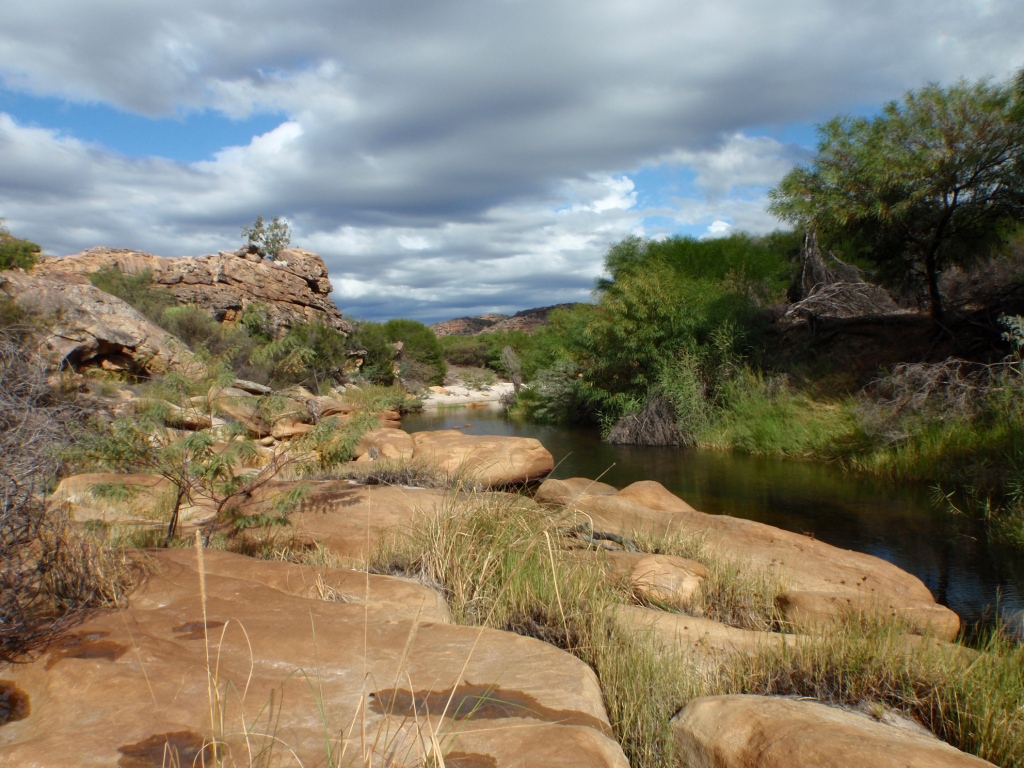
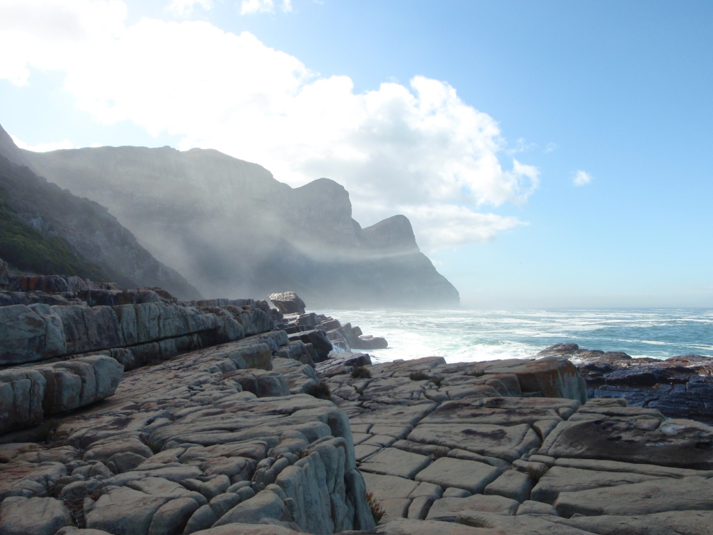
San landscape, Sevilla Rock Art Trail, South Africa, May 2011.

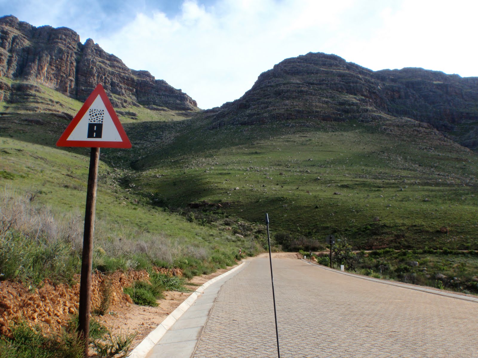
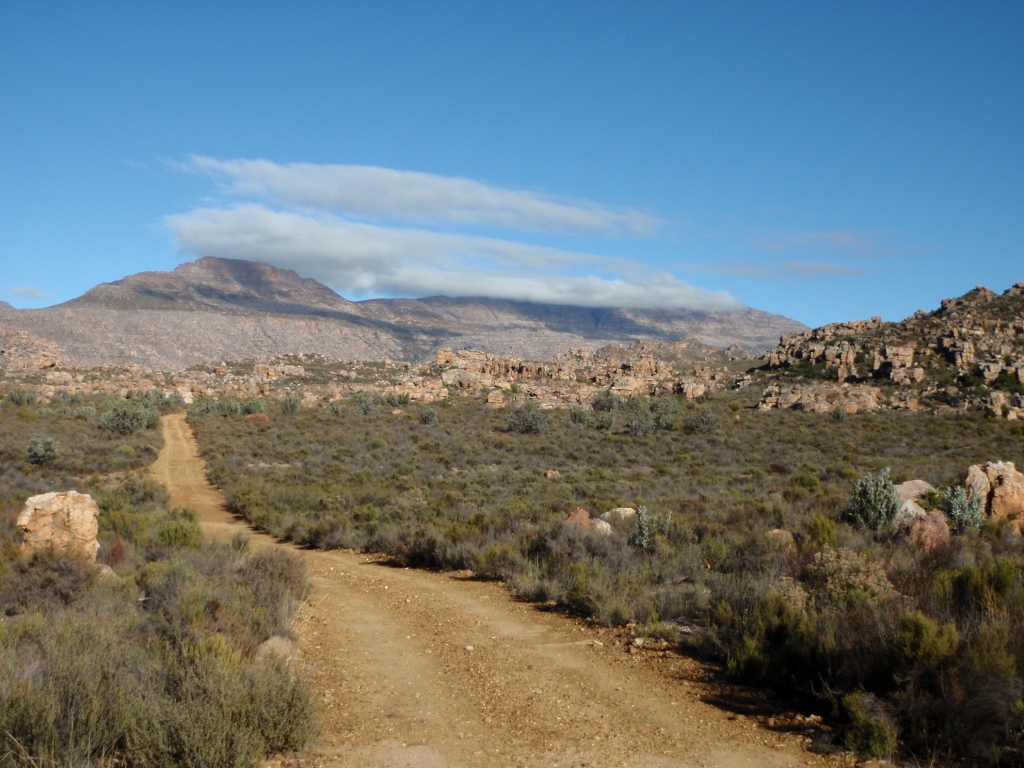
The trail, Sevilla Rock Art Trail, South Africa, May 2011.

Giraffe and man, Sevilla Rock Art Trail, South Africa, May 2011.

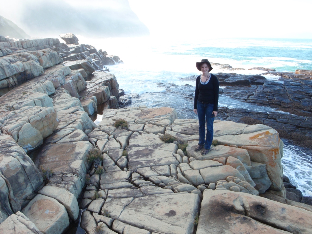
Posing with the giraffe painting (look carefully on the wall above me), Sevilla Rock Art Trail, South Africa, May 2011.

Elephant!, Sevilla Rock Art Trail, South Africa, May 2011.

Two elephants!, Sevilla Rock Art Trail, South Africa, May 2011.

Rainfall on a painting. The paintings stand out when wet, but you shouldn’t wet a painting to photograph it because this wears down the painting. Many paintings have been destroyed by early, eager photographers with bottles of water. Sevilla Rock Art Trail, South Africa, May 2011.

Cattle?, Sevilla Rock Art Trail, South Africa, May 2011.

More elephants?, Sevilla Rock Art Trail, South Africa, May 2011.

Two sexy ladies, Sevilla Rock Art Trail, South Africa, May 2011.

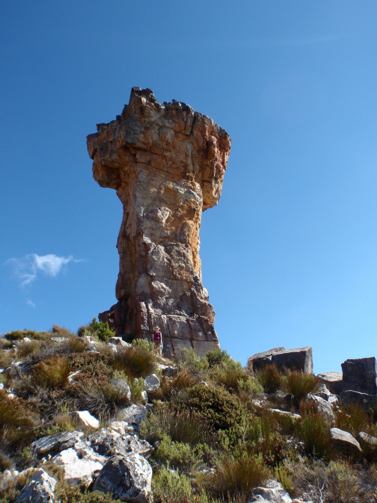
My fiance’s idea of a “shortcut” back to the Khoisan Kitchen, South Africa, May 2011.
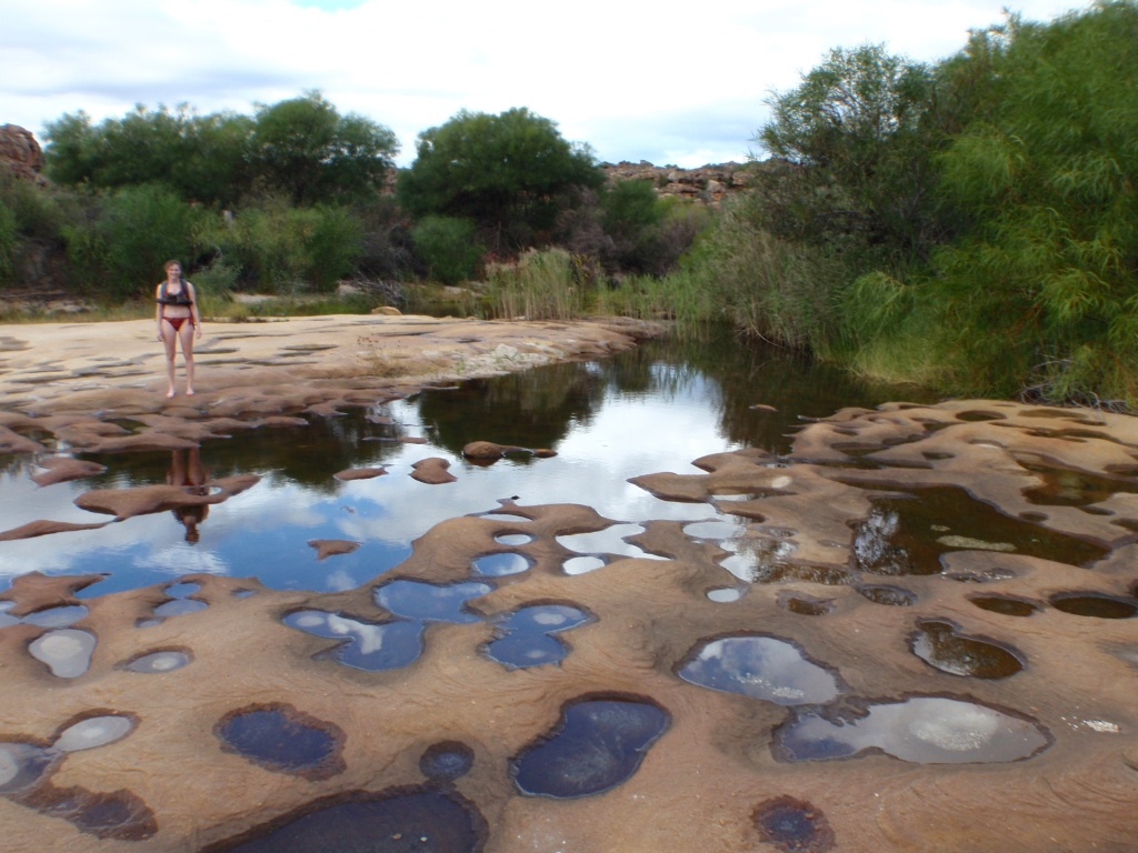
Me, less than thrilled with the “shortcut” but interested in the potholes, South Africa, May 2011.
More impressive potholes in sandstone, South Africa, May 2011.

Beautiful Brandewyn River, South Africa, May 2011.
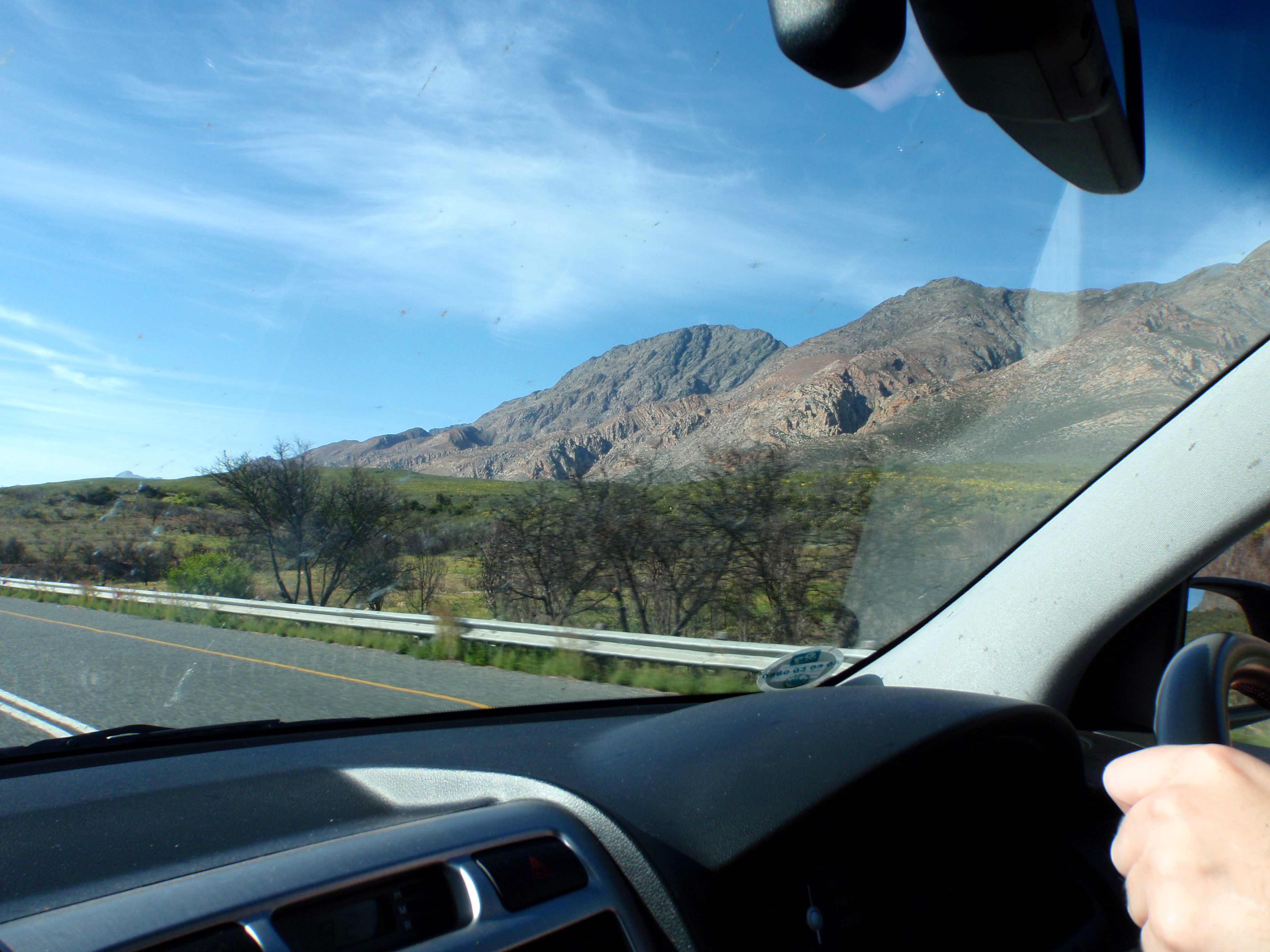
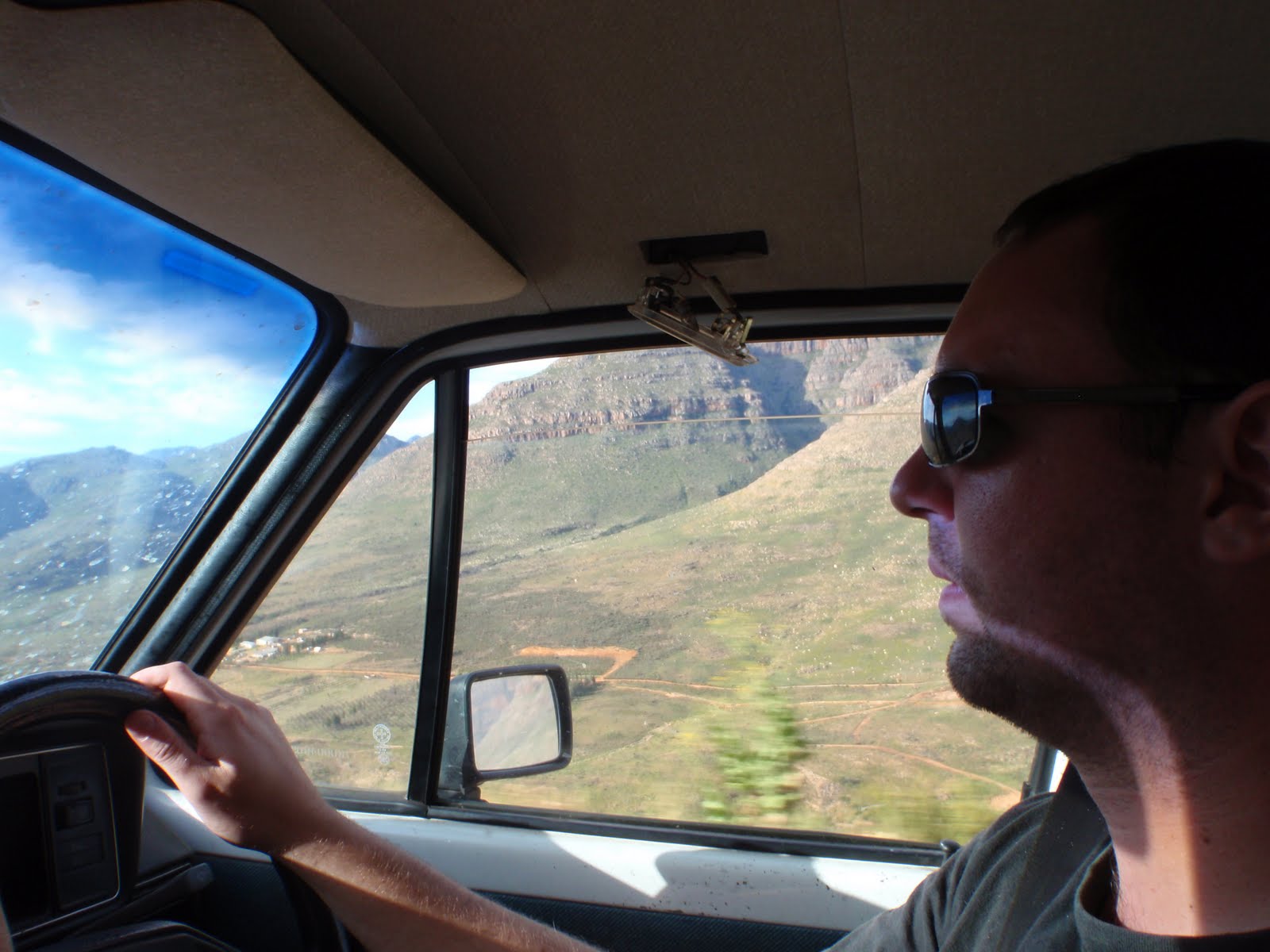
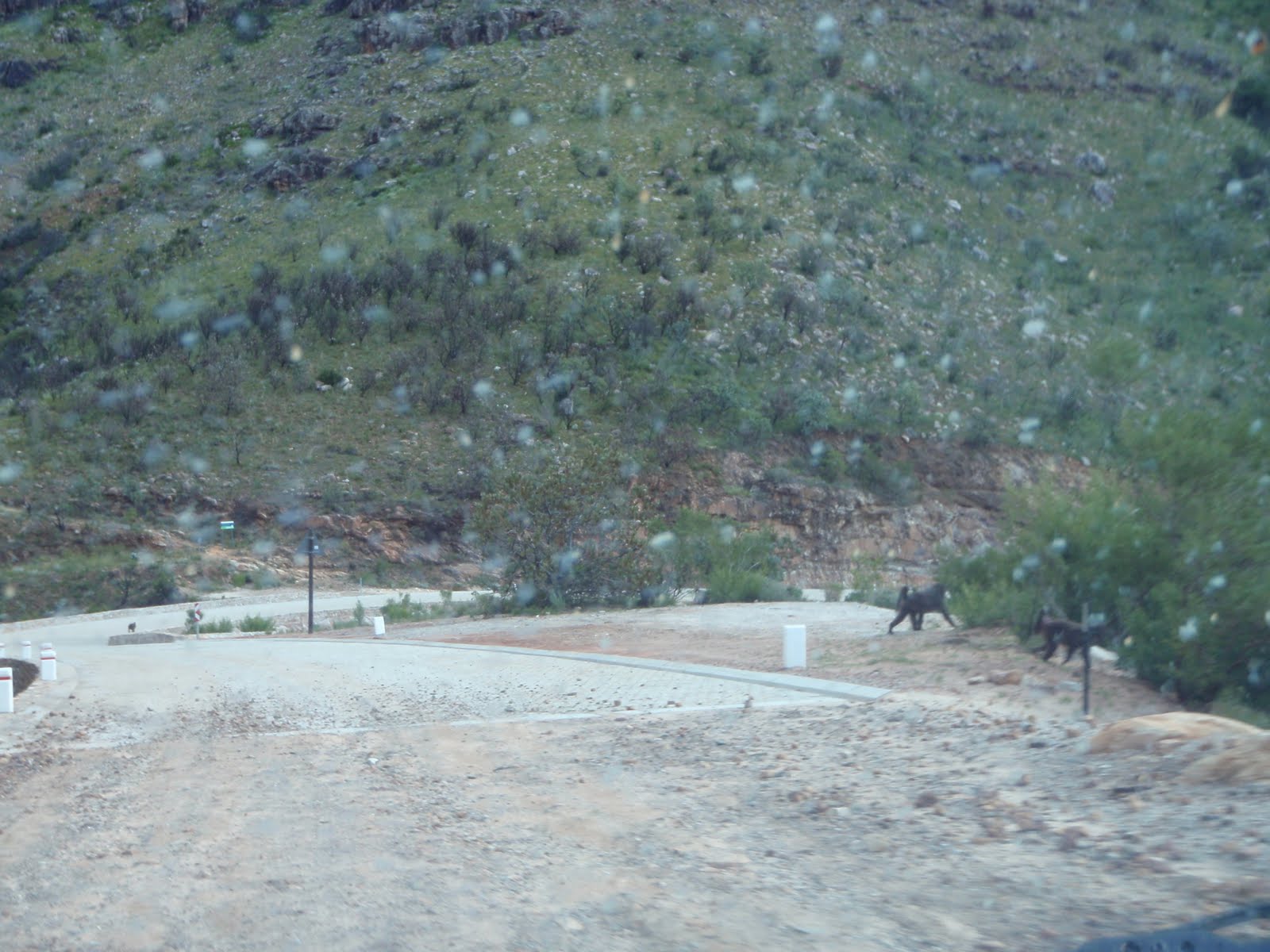
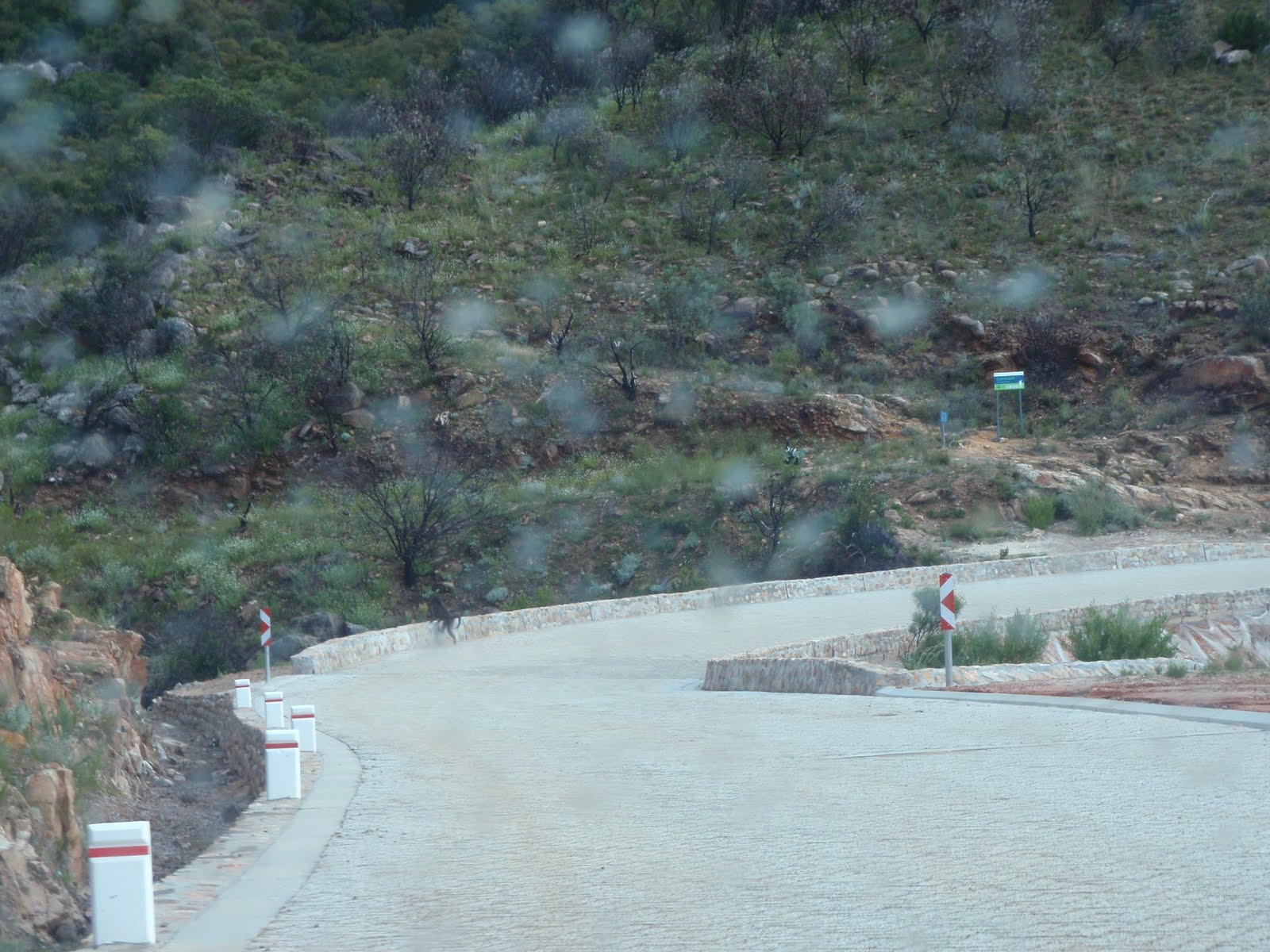
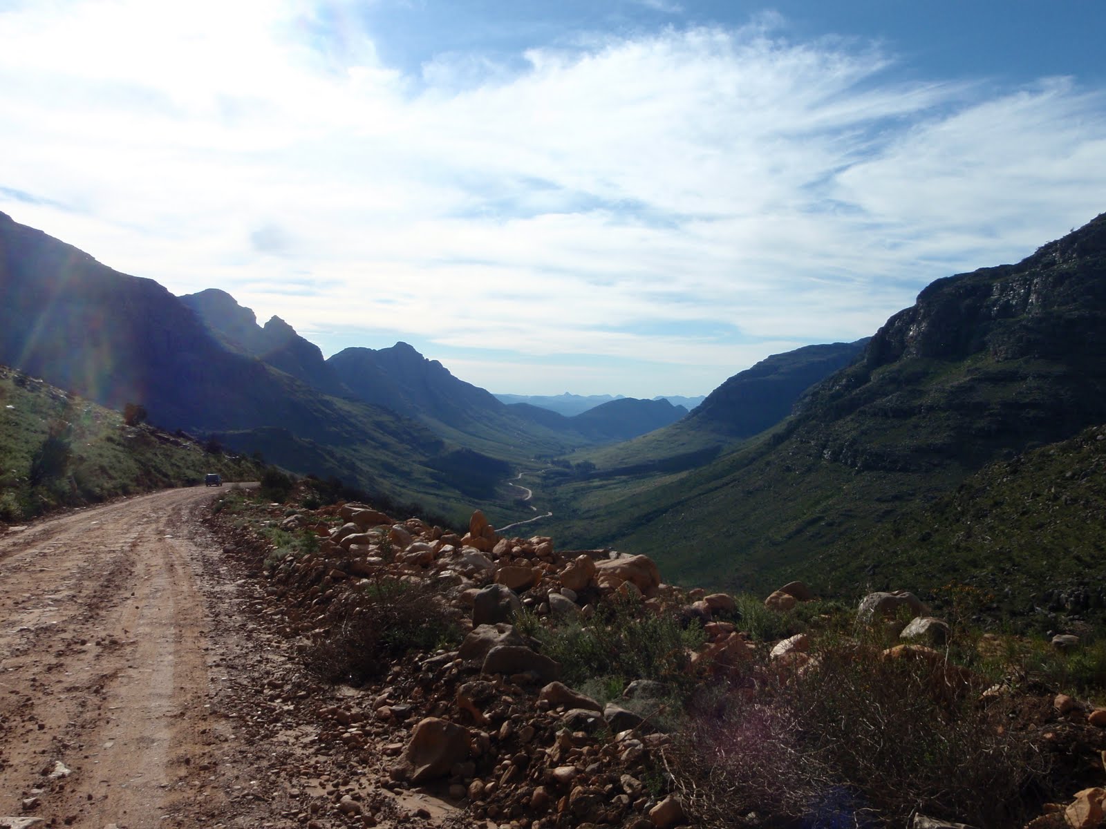
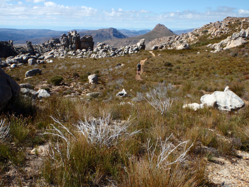
The view on the drive back to Citrusdal, South Africa, May 2011.

Interesting Sandstone Weathering at Cape Point

Gorgeous sandstone, Cape Point, South Africa, April 2011.

Back in January Callan Bentley over at Mountain Beltway posted these pictures of some rocks with interesting weathering patterns. In response, I posted pictures of some more rocks with similar weathering patterns.

A couple of days ago my fiance and I did a few hikes around Cape Point, South Africa. There is abundant sandstone all around the point– most of the sandstone around Cape Point and Cape Town is part of the Table Mountain Sandstone Group (TMG).

As we wandered around Cape Point, we noticed some interesting weathering features in the sandstone. Some of the weathering features are similar to the features Callan and I posted pictures of back in January.   Feel free to click on any of the pictures below for a larger version. In some of the pictures there is a 50c Rand coin (which is slightly larger than an American nickel) for scale.

Sandstone layers, Cape Point, South Africa, April 2011.
View from the lighthouse, Cape Point, South Africa, April 2011.
Lizard hanging out on some sandstone, Cape Point, South Africa, April 2011.
Sandstone boulder with interesting weathering, Cape Point, South Africa, April 2011.
Close-up of interesting sandstone weathering, Cape Point, South Africa, April 2011.
Venus Pools 1, Cape Point, South Africa, April 2011.
Sandstone weathering at Venus Pools 1, Cape Point, South Africa, April 2011.
Sandstone weathering at Venus Pools 2, Cape Point, South Africa, April 2011.
Venus Pools 2, Cape Point, South Africa, April 2011.
Venus Pools 3, Cape Point, South Africa, April 2011.