R/V Roger Revelle in port in Woods Hole, MA in July 2008.
I spent two months (early June – early August) aboard the R/V Roger Revelle during an expedition to the Ninetyeast Ridge in the Indian Ocean. Although the R/V Revelle is a Scripps Institution of Oceanography research vessel, during the summer of 2008 the ship spent some time in Woods Hole, MA on the dock owned by the Woods Hole Oceanographic Institution. I was very happy to see the ship and the crew again– many of the crew members were the same ones who were aboard during the Ninetyeast Ridge expedition. My boyfriend (now my husband; we met aboard the Revelle during the Ninetyeast Ridge expedition) and I threw the R/V Revelle a 4th of July party at my house in Woods Hole. The R/V Revelle staff kindly provided much of the food and drink since it was a little difficult for us to feed a hungry crew by ourselves. Oceanographic research vessels travel all over the world and spend time in many ports, so you never know when you might see them again!
Jackie (my now-husband) and I in front of the R/V Roger Revelle in July 2008. My hair is a bit of a mess from a bike helmet.A 4th of July BBQ for the Revelle crew & other friends.
All good evil geologists need a family cabin super sekrit lair. Most geologists prefer volcano lairs, but since there aren’t any volcanoes in New Hampshire, I’m making do (for now) with a lakeside lair. Once I return to my South African lair in a month or so, my geologist husband and I are going to start saving up for our volcanic island lair. Currently, I’m peacefully enjoying working very hard on some Star Trek watching, kayaking, knitting, and sunbathing world domination plotting at my lakeside geologist lair… somewhere in New Hampshire. I can’t tell you exactly where because if I do then my lair won’t be super sekrit anymore. Last weekend, my friend future empire co-leader Dana Hunter visited, and we enjoyed some geological excursions field campaigns and also spent some time watching Dr. Who planning our Geokittehs empire at the lakeside geologist lair. The view from the lair is very pretty, isn’t it?
If you haven’t already, you can read all about Dana’s holiday trip strategic planning mission:
Dana and I, in the middle of our georney to the Chesterfield Gorge.
I was having so much fun with fellow geoblogger Dana Hunter that I completely forgot to post my Monday geology picture yesterday. Better late than never, I suppose. Above is a picture of Dana and me at the Chesterfield Gorge. Be sure to follow my descriptions of our georneys. I’ve posted Part I and Part II already– more to come!
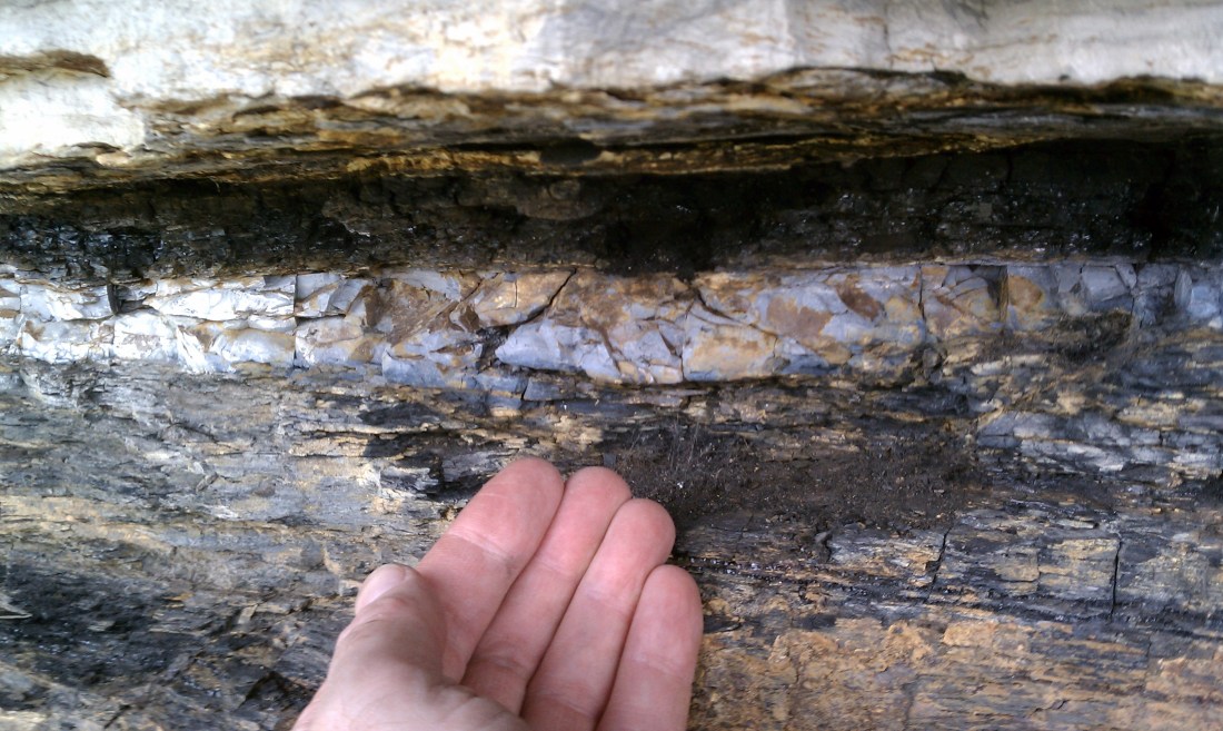
K-T boundary, with a famous astronomer's hand for scale and dramatic effect.The field area where Phil observed the K-T boundary.
This week’s geology picture was sent to me by my friend Phil Plait aka “The Bad Astronomer.” This week’s picture– two pictures, actually– shows the famous K-T Boundary.
Phil explains,
I’ve attached the K/T pic. It was taken in Trinidad Park in southern Colorado, where the boundary is very distinct.
It’s my hand in the 0731 picture. 🙂 0732 puts it in context. The rock above is limestone, and below is coal and other friables. The coal erodes away easily with rain and wind, so it forms that slope, which is murder to climb, like trying to swim uphill. The limestone is much tougher so it forms a cap. As the coal erodes back, eventually the limestone breaks and rolls down the hill. There were big chunks of it lining the base of the slope. All of this used to be underwater a few million years ago.
Thanks for sharing, Phil! I had a busy day with thesis revisions, so I’m posting this week’s Monday picture just in the nick of time… here on the east coast of the USA it’s a few minutes to midnight.
My friends Ray and Katie recently visited Racetrack Playa in Death Valley, and I’ve been drooling over the beautiful pictures of Racetrack Playa and its so-called “sailing stones” which they have been posting on Facebook. Ray and Katie have given me permission to share some of their Racetrack Playa pictures with you here on Georneys. Since I’m a little bit busy this week, I’ll just share one picture with you today. Hopefully, next week– if I’m not too exhausted and busy with thesis revisions– I’ll share some more pictures and even muse over some of the explanations for the mysterious “sailing stones.”
Two sailing stones on Racetrack Playa, Death Valley, California, April 2012. Photograph courtesy of my friends Ray and Katie.
Also note the spectacular mud cracks– perhaps we’ll muse a bit on those, too, in the future.
Ferromanganese crusts actually caused some trouble for our rock descriptions. Before we could identify many rocks, we had to chip or saw off the ferromanganese crusts. Actually, due to alteration we had to break or saw apart many rocks in order to expose fresher surfaces that were easier to identify.
A closer view of the boulder and crust, Ninetyeast Ridge, Indian Ocean, 2007.
I’m afraid that rock-breaking became somewhat of a competitive sport on the expedition. Well, I guess there isn’t much else to do (other than describe and sort rocks) on a two month expedition in the middle of the Indian Ocean.
My husband-to-be (on right) and our friend James... trying to impress me with their rock breaking skills. Ninetyeast Ridge, Indian Ocean, 2007.
For this week’s Monday Geology Picture, I thought I would share a picture of peridotite in thin section viewed under a microscope. This particular peridotite originates from the Samail Ophiolite, Sultanate of Oman, and is a weakly-deformed harzburgite that is ~40% serpentinized. You can see the fine network of serpentine veins throughout the sample. The brightly-colored patches are olivine and pyroxene minerals. I really enjoy looking at rocks in thin section– rocks can be so beautiful in thin section, particularly when viewed under cross-polarized light.
Serpentinized harzburgite in thin section, plane polarized light.1 mm scalebarSerpentinized harzburgite in thin section, cross polarized light. 1 mm scalebar.
Botryoidal ferromanganese crust dredged from the Ninetyeast Ridge, Indian Ocean, Summer 2007.
For this week’s geology picture, I thought I would share a picture of a neat botryoidal (grape-like texture) ferromanganese crust that was recovered during dredging along the Ninetyeast Ridge in the Indian Ocean in 2007. Ferromanganese crusts and nodules are commonly deposited in the ocean. They often form botryoidal shapes, such as the example above.
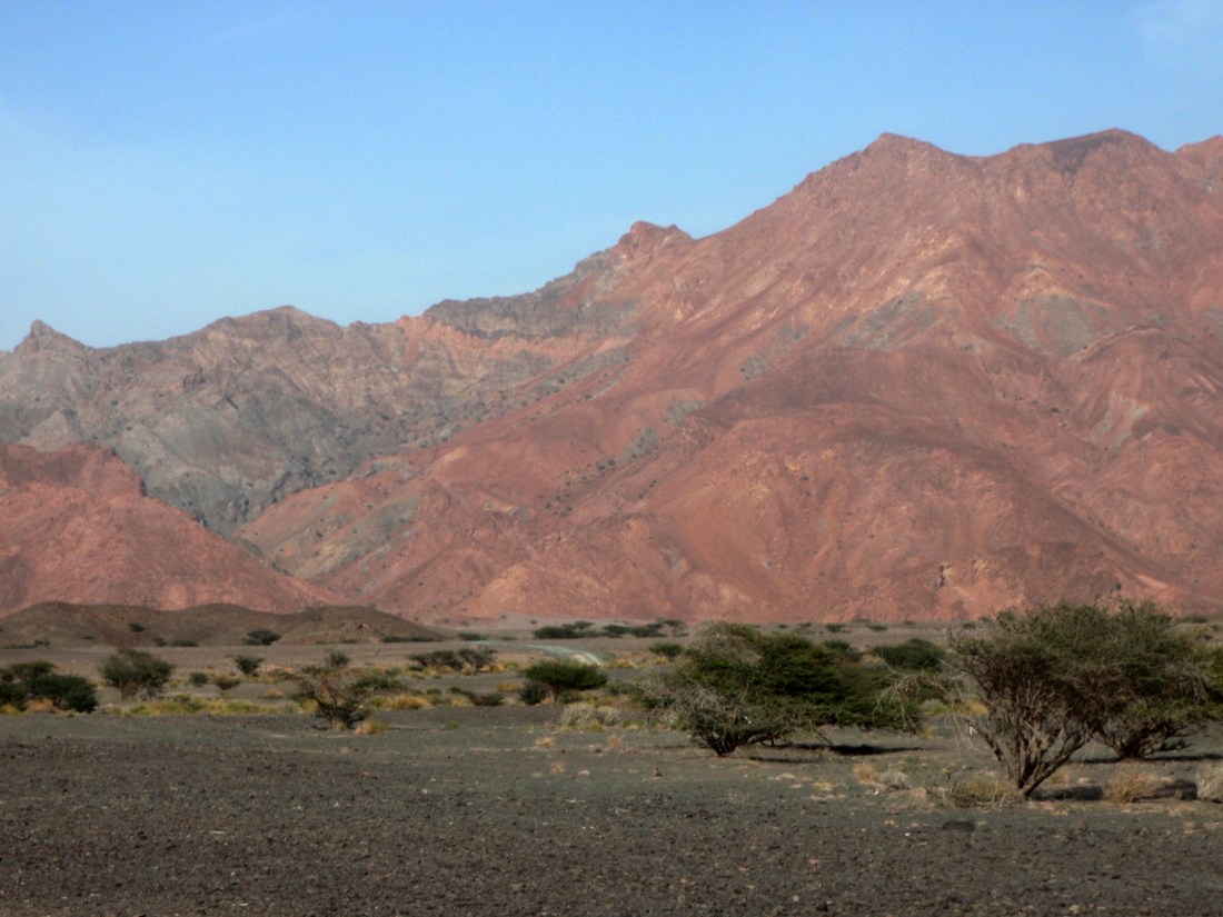
Listwanite hills in the Sultanate of Oman, January 2012. The reddish parts of the moutnain are listwanites while the grayish parts are less-altered peridotites.
Today I am going to share some pictures of listwanite (also sometimes spelled listvenite, listvanite, or listwaenite), an unusual rock type that I bet even some of the well-educated geologists who read this blog have never seen or even read about. I don’t even think there’s a wikipedia entry about listwanite. Perhaps I’ll write one after my thesis defense next month.
Listwanite forms when ultramafic rocks (most commonly mantle peridotites) are completely carbonated. The pyroxene and olivine minerals found in peridotite commonly alter to form carbonate and serpentine minerals. However, peridotites are usually not completely carbonated. Rather, they typically contain carbonate veins (primarily magnesite; also calcite, dolomite, and other carbonates). Complete carbonation of peridotite means that every single atom of magnesium and calcium as well as some of the iron atoms has combined with CO2 to form secondary carbonate minerals such a magnesite and calcite. The silica atoms in listwanite are found in quartz. Thus, liswanites consist of quartz (a rusty red color) and carbonate and also sometimes talc and Cr-muscovite (a mineral known as mariposite/fuchsite). Geologists are still studying how listwanites form, but they likely form through the interaction of CO2-rich fluids with peridotites at higher than ambient temperatures up to ~200 degrees Celsius. Structural controls (faults and fractures) permit the percolation of the CO2-rich fluids through peridotite, so the formation of listwanites is generally structurally controlled.
Listwanites are important rocks to study for a number of reasons. First of all, listwanites contain large amounts of CO2 which originated from fluids and which is now stored in solid mineral form. Recently, geologists and other scientists have been investigating the potential of storing CO2 in solid minerals (which are more stable than CO2 stored as a liquid or gas) through carbonation of mafic and ultramafic rocks (see, for example, this Nature Geoscience Progress Article by Matter and Kelemen, 2009). Mafic and ultramafic rocks uptake significant CO2 through their natural alteration processes (that’s what I study for my PhD, so expect more on this in the next year or so as I submit my papers for publication). However, the natural carbonation rates of these rocks are too slow to significantly offset anthropogenic CO2 emissions. Therefore, scientists are currently investigating if it is possible to geoengineer CO2 uptake in mafic and ultramafic rocks so that this CO2 uptake happens more quickly. This could be done, perhaps, by fracturing and heating and injection of CO2-rich fluids. This is already being tested in mafic basalts through the CarbFix Project in Iceland.
However, scientists and engineers still have plenty of work to do in order to figure out the right conditions and protocols for CO2 sequestration in mafic and ultramafic rocks. In order to learn about what conditions lead to complete carbonation of ultramafic rocks, scientists such as Peter Kelemen and Gregory Dipple (and their many grad students and collaborators) are working to learn more about listwanites to see if mother nature can provide some clues.
In addition to the recent interest in listwanites for carbon sequestration efforts, listwanites are also important because they are often associated with economic mineral deposits, particularly gold deposits.
So, now that I’ve explained what listwanites are and why they are important, here are some pictures of listwanites which I observed during my trip to Oman back in January. Listwanites are pretty neat rocks, aren’t they?
A closer view of a listwanite outcrop, with a hammer for scale. Sultanate of Oman, January 2012.Another view of listwanite up close. Sultanate of Oman, January 2012. More listwanite. Note the offsets in the carbonate veins. Sultanate of Oman, January 2012.Another piece of listwanite with offsets in carbonate veins. This sample is gray in color and thus perhaps not fully a listwanite. Sultanate of Oman, January 2012.
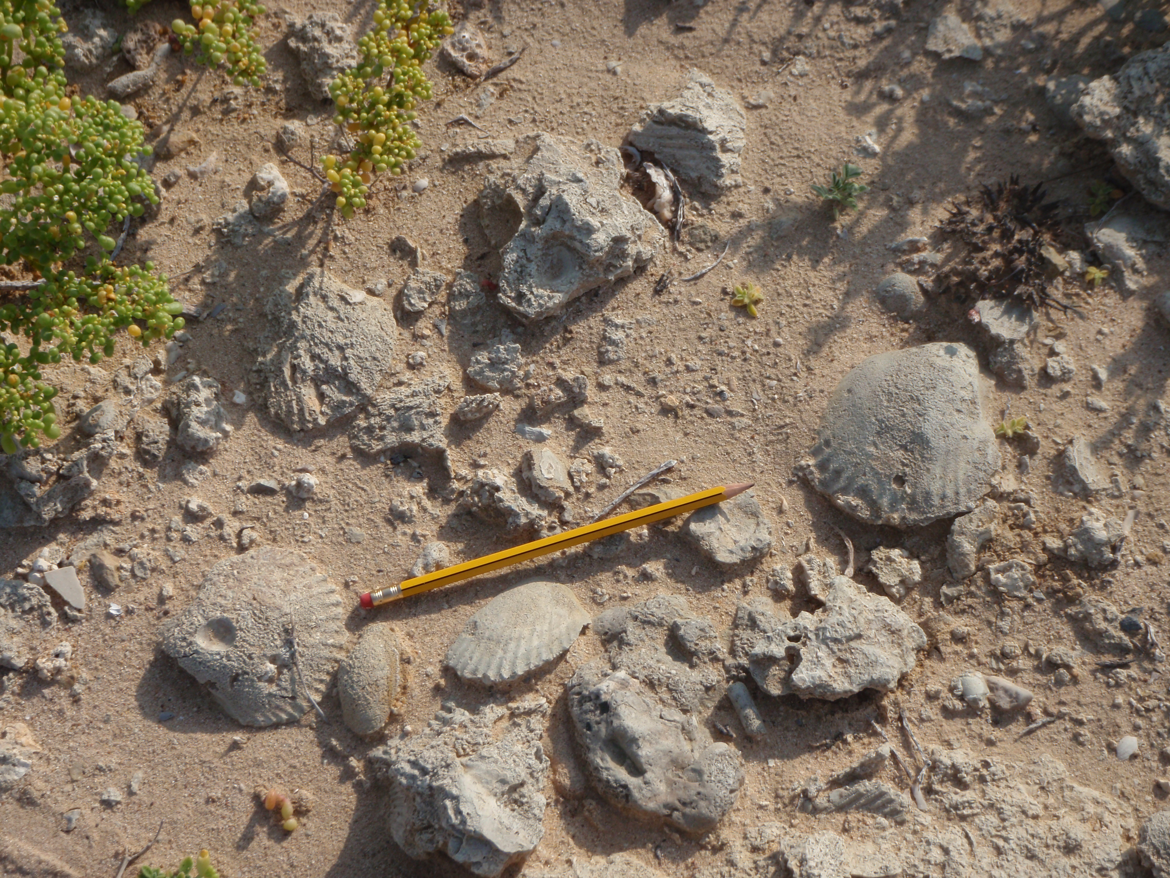
Fossil seashells #1 at Barr Al-Hikman, Oman, January 2012.
For this week’s Monday Geology Picture post, I thought I would share some more pictures from my trip in January to Barr Al-Hikman, Oman. A few weeks ago, I posted about some crabs and their traces at Barr Al-Hikman. This week I am sharing some pictures of some large, beautiful, fossilized seashells which we observed along one of the beaches at Barr Al-Hikman. I believe that these seashell fossils formed fairly recently. I think that the seashell species (or perhaps a close relative) still exists today in Omani waters. Also, some of the fossilized shells contain un-fossilized shell fragments.
Can anyone identify the seashell species and give me any more information about these beautiful fossils?
Below are a few more pictures of the seashell fossils. Note that the fossils form as both molds and casts. Also note the pencil for scale.
Fossil seashells #2 at Barr Al-Hikman, Oman, January 2012.Fossil seashells #3 at Barr Al-Hikman, Oman, January 2012.Fossil seashells #4 at Barr Al-Hikman, Oman, January 2012.Fossil seashells #5 at Barr Al-Hikman, Oman, January 2012.


