A helicopter flying through the canyon… giving an awe-inspiring sense of scale! Picture courtesy of Ray Hall.
In last week’s “Monday Geology Picture” post I featured the incredible Painted Wall of Black Canyon in Gunnison National Park in Colorado. Last week’s picture was taken by my friend Ray Hall. After my post, fellow geoblogger Ron Schott sent me a link to an impressive GigaPan that he took of Painted Wall. Well, last week I don’t think I quite appreciated the enormous scale of Painted Wall. I stated that the wall is over 2,000 feet tall, but I didn’t appreciate just how tall that really is.
Well, I think that this week’s picture helps to put the 2,000 foot wall into perspective. Ray sent me this follow-up shot that he took of a helicopter flying through Black Canyon near Painted Wall. Look how small the helicopter is compared with the wall! That’s one very tall cliff!
Geologists love putting things in pictures for scale. Normally, geologists use rock hammers or pencils or rulers or– at the largest– people for scale. It’s rare that they get to use a helicopter for scale, but a helicopter is a perfect scale marker for the impressively large Painted Wall.
Thanks again for sharing another picture of the canyon, Ray!
I convinced my Geokittehs co-author Dana Hunter to fly from Seattle to New Hampshire to visit me for a few days. I handed in the final version of my PhD thesis on Friday afternoon, and Dana arrived last night to help me celebrate. So far, we’ve been having a ball. You can expect several forthcoming posts about Dana’s visit, both here on Georneys and over at Dana’s blogs Rosetta Stones and En Tequila Es Verdad. For now, I thought I would share just a few pictures from the first full day of our adventures.
In this post, I’ll share some pictures from our visit to the dinosaur footprints, which were quite impressive. In the photos below, I’ve indicated the locations of the dinosaur footprints with green markers (glass beads from the dollar store) since the footprints are sometimes difficult to see.
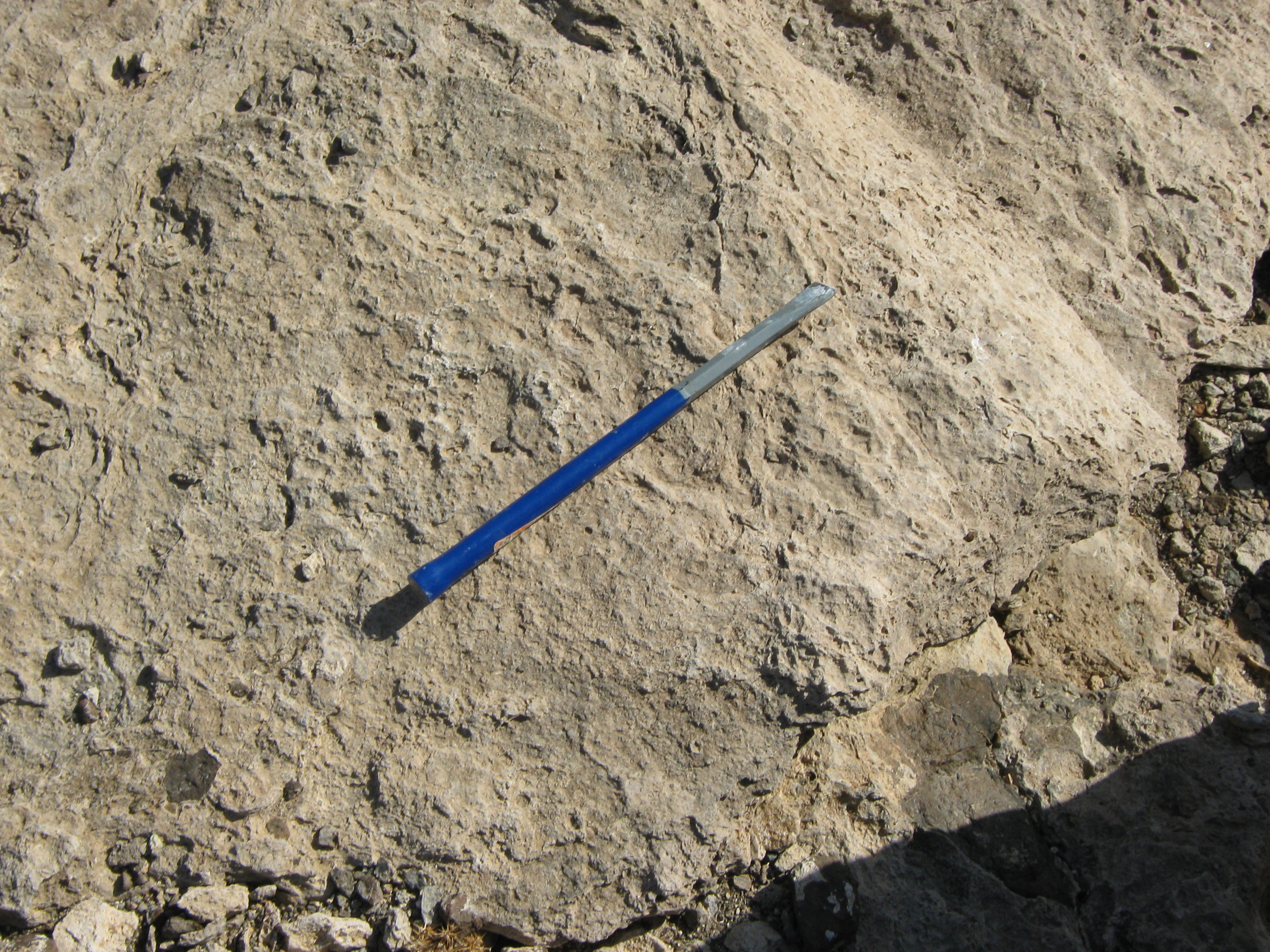
Dinosaur footrpint #1Dinosaur footprint, with my foot for scale. A trackway of footprints. If you look closely, you can see the green markers indicating the footprints.Footprints near ripple marks. More ripple marks.
Dana and I aren’t paleontologists, but we think we have some idea how the tracks were made. We think it went something like this:
A scientifically accurate reconstruction of the events leading to track formation (we are joking, obviously 🙂 )Yummy. Epic dinosaur-army battle.
Alternatively, the tracks could have been formed by a Danaraptor:
Researchers believe these prints were left by small groups of two-legged, carnivorous dinosaurs, up to 15’ tall. The entire Connecticut River Valley – which scientists believe was a sub-tropical swamp a “mere” 190 million years ago – has long been recognized for its wealth of prehistoric footprints.
The first dinosaur prints to be scientifically described are still here to be seen, preserved in sandstone* since this valley was a sub-tropical mix of wetlands and shallow lakes, 190 million years ago. The larger Eubrontes prints were likely made by ancestors of the great Tyrannosaurus rex, standing up to 15’ tall and 20’ long. You can see hundreds of fossils not only from the four distinct two-legged dinosaurs, but also stromatolites, fish, plants and other ancient beings. Finally, look for the 20+ dinosaurs trackways, which formed the basis for the novel theory that dinosaurs travelled in packs or groups.
*Note: I’m not convinced the rock is sandstone– it looked more like siltstone or mudstone to me. Can anyone confirm the rock type? When I have the time, I’ll track down some scientific references.
The dinosaur footprints are located along a beautiful section of the Connecticut River. After we had our fun looking at the tracks and doing our “scientific reconstructions,” we went down next to the river edge for awhile.
A pretty house along the CT River. On the tilted riverbank. Another view of the tilted rocks along the riverbank. Sedimentary, my dear Watson.
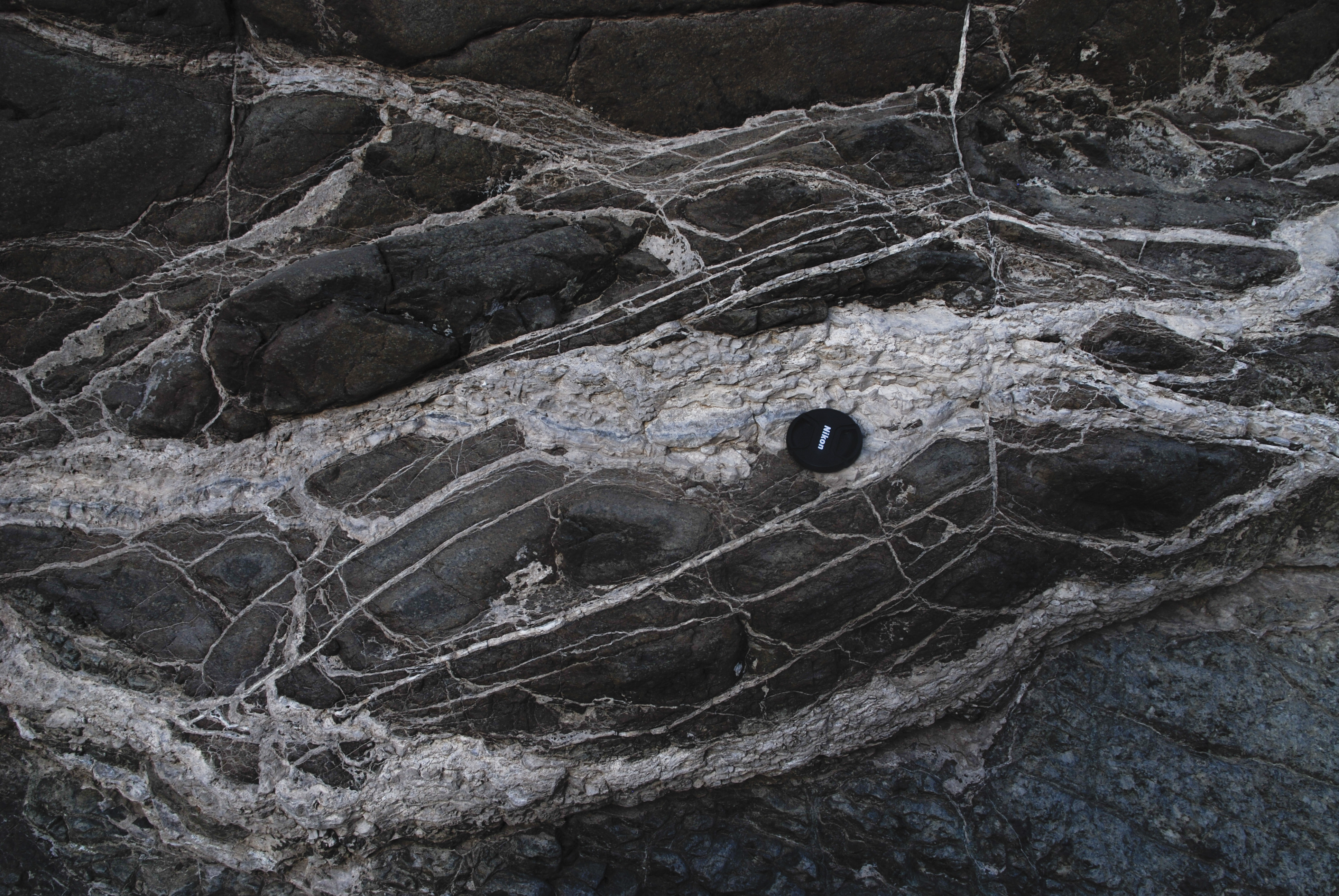
Lens Cap for scale on a carbonated peridotite outcrop in Oman, 2009.
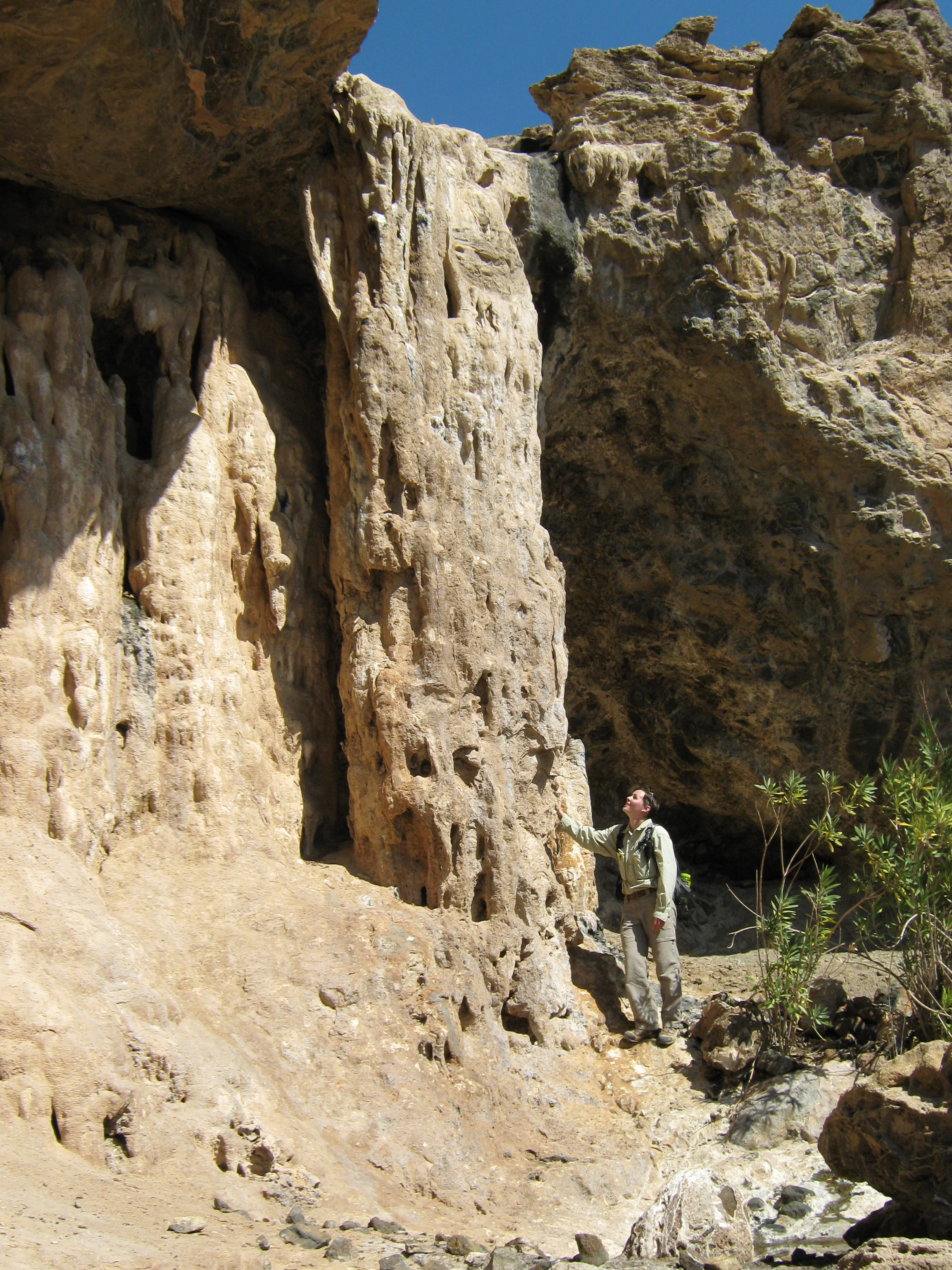
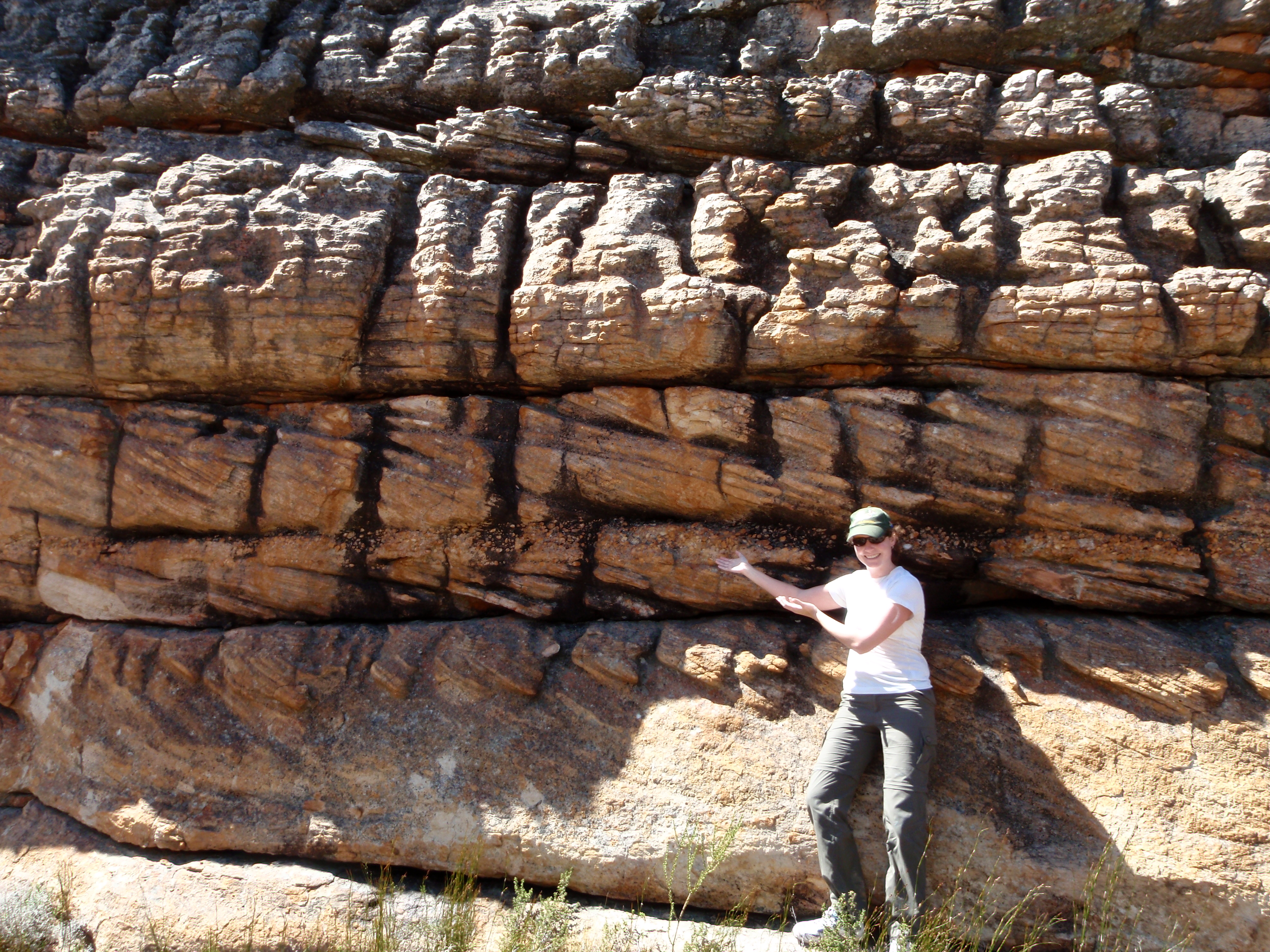
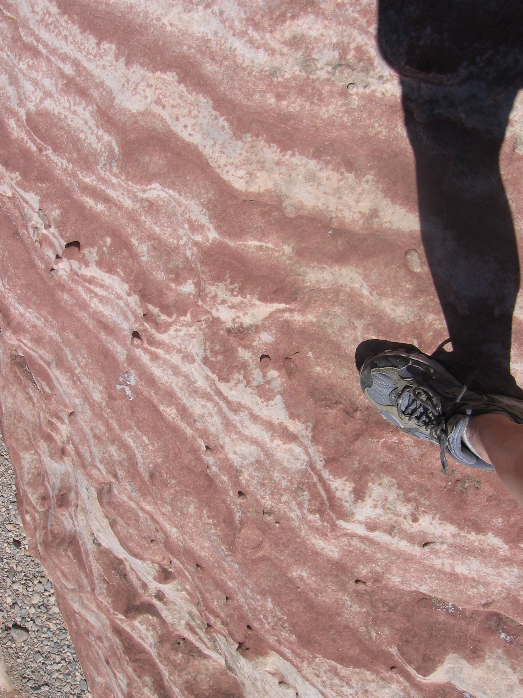
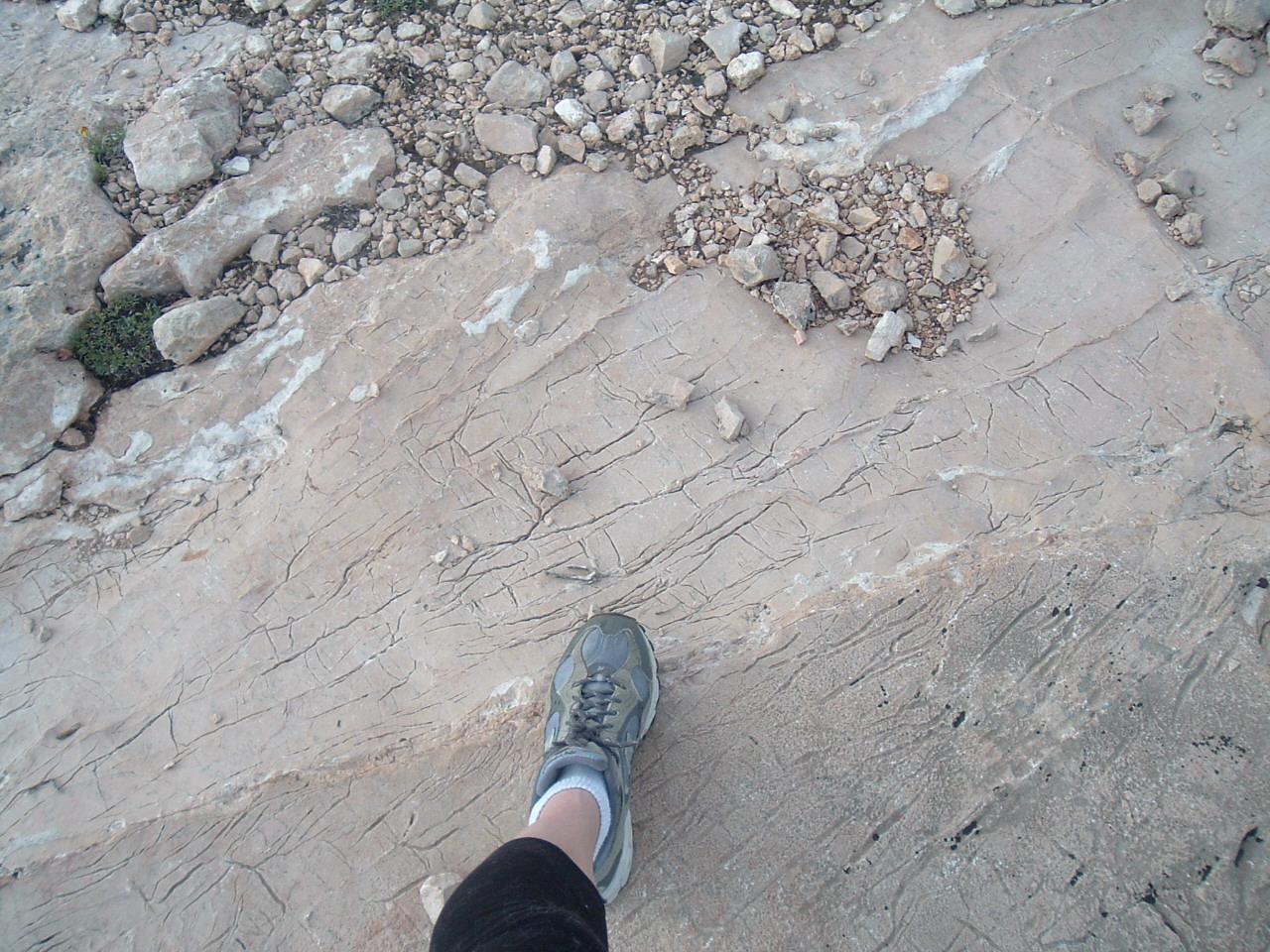
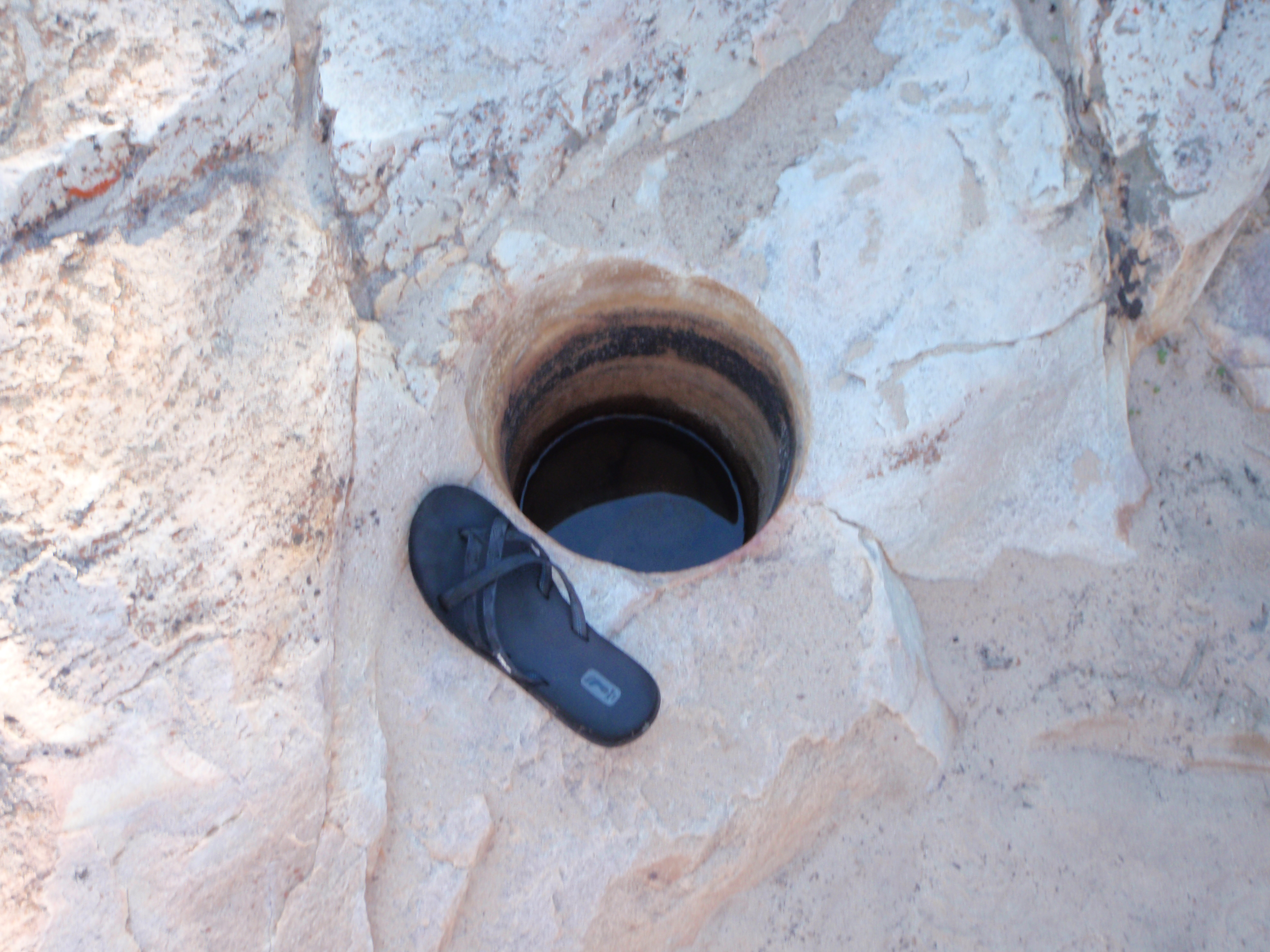
When geologists take photographs of rocks, they often include items to indicate scale. When I’m doing fieldwork, I generally use a ruler or a hammer to indicate scale. Sometimes, I use other items such as my field notebook or my camera lens cap. When I’m not doing fieldwork and I wander across some interesting rocks, I use anything available to indicate scale– from flip-flops to coins to my own hands and feet.
Below are a collection of scale pictures taken during my geological wanderings over the past several years. You can read some of my musings on scale in this older post of mine The Scale of Things.
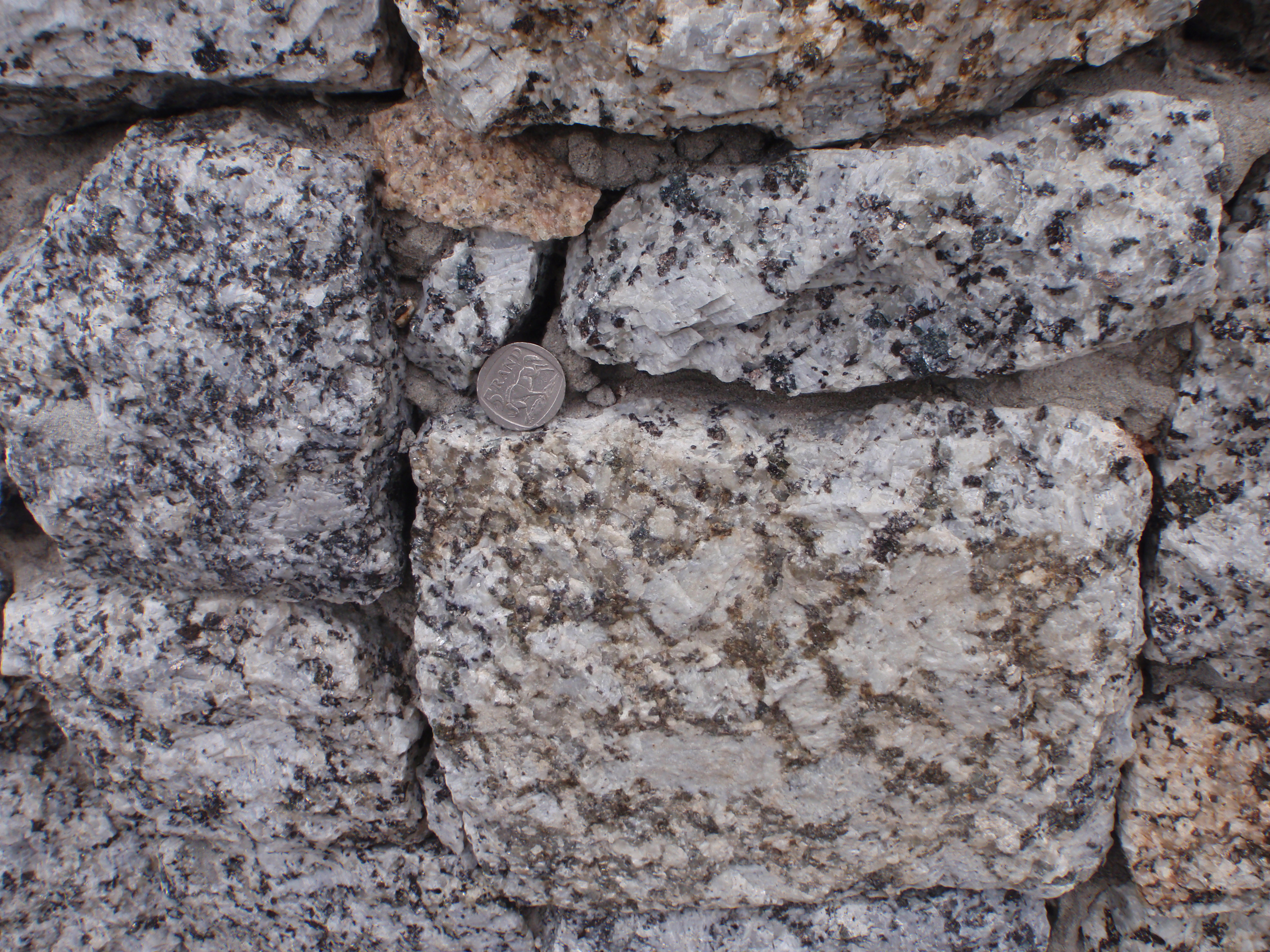
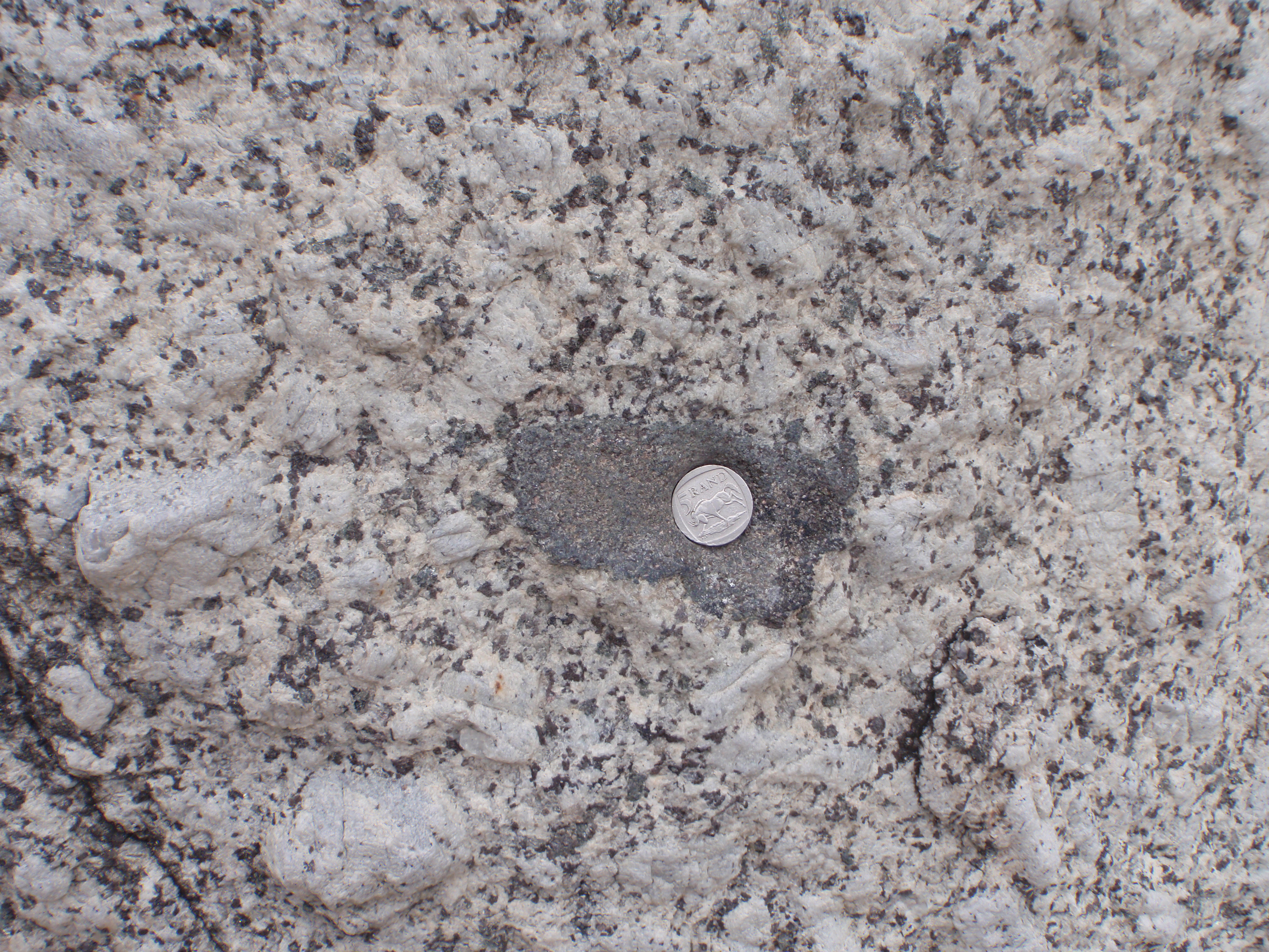
Hand for scale on a sedimentary outcrop showing filled-in burrows (trace fossils), South Africa, 2011.Ruler for scale on a manganese-covered basalt boulder, Indian Ocean, 2007.Coin for scale on a granite wall, South Africa, 2011. Coin for scale on a xenolith in granite, South Africa, 2011.Hand for scale holding granite saprolite, South Africa, 2011. Finger for scale on a loosely-consolidated sedimentary rock, South Africa, 2011. Chisel for scale on a travertine deposit, Oman, 2009. Geologist for scale next to a travertine pillar, Oman, 2009.Field notebook for scale on carbonated peridotite, Oman, 2009. Sharpie pen for scale next to a carbonate-serpentine vein in peridotite, Oman, 2009.Hammer for scale on top of a travertine formation, Oman, 2009.Bottle (trash found in stream) for scale in an alkaline streambed, Oman, 2009.Rite-in-the-Rain ruler for scale on carbonated peridotite, Oman, 2009.Geologist for scale in front of some sandstone cross-bedding, South Africa, 2010.Hand for sale next to some rock art hands on sandstone, South Africa, 2010.Foot for scale on sandstone, Red Rocks, Nevada, 2011.Foot for scale on limestone, Wyoming, 2011.Sunglasses for scale on sandstone, South Africa, 2009.Geologist for scale in front of sandstone cross-bedding, South Africa, 2009.Flip-flop for scale next to a pot hole, South Africa, 2011.