Chamarel Waterfall, Mauritius

Stunning Chamarel Waterfall, Mauritius.
Stunning Chamarel Waterfall.

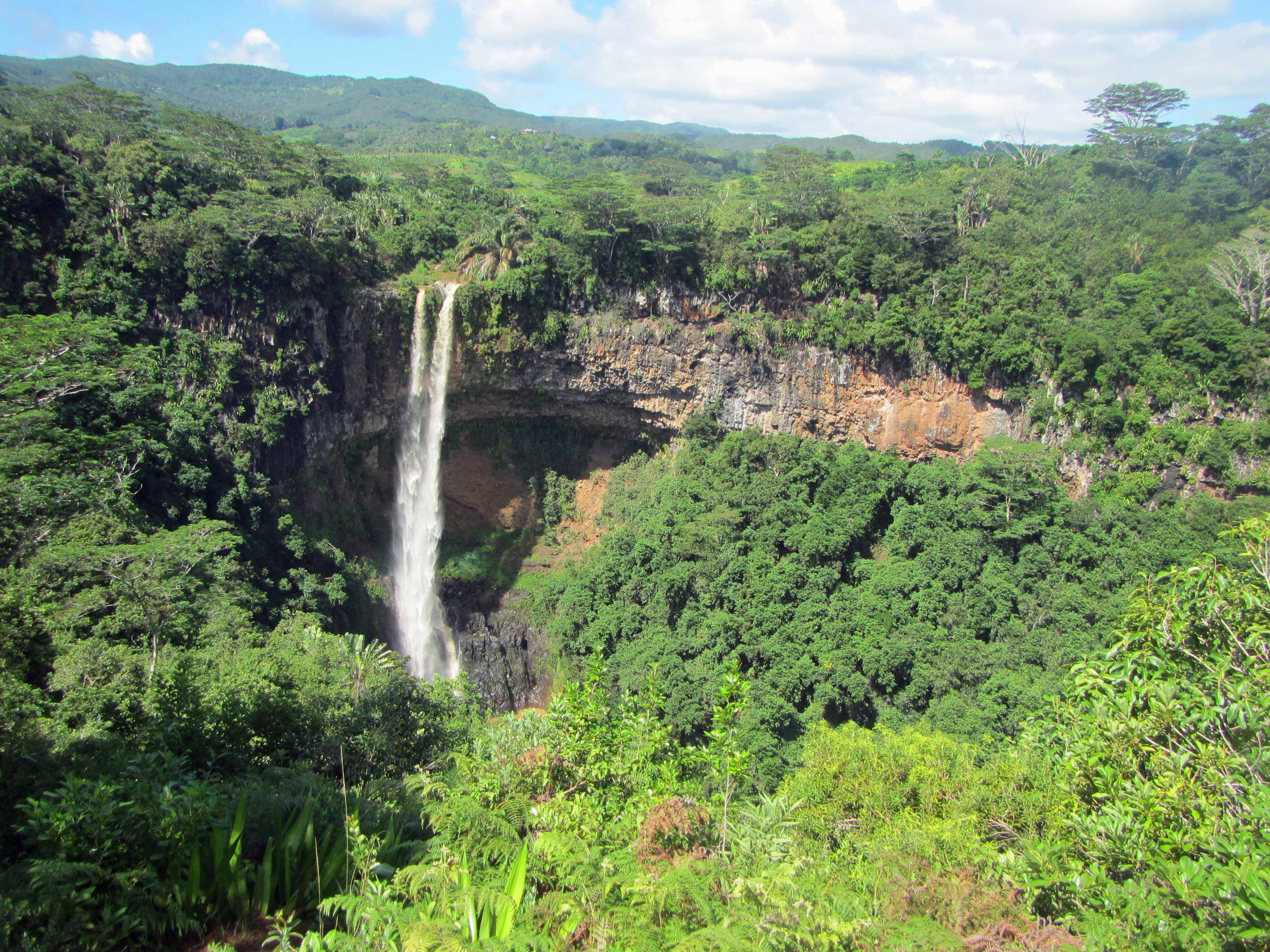
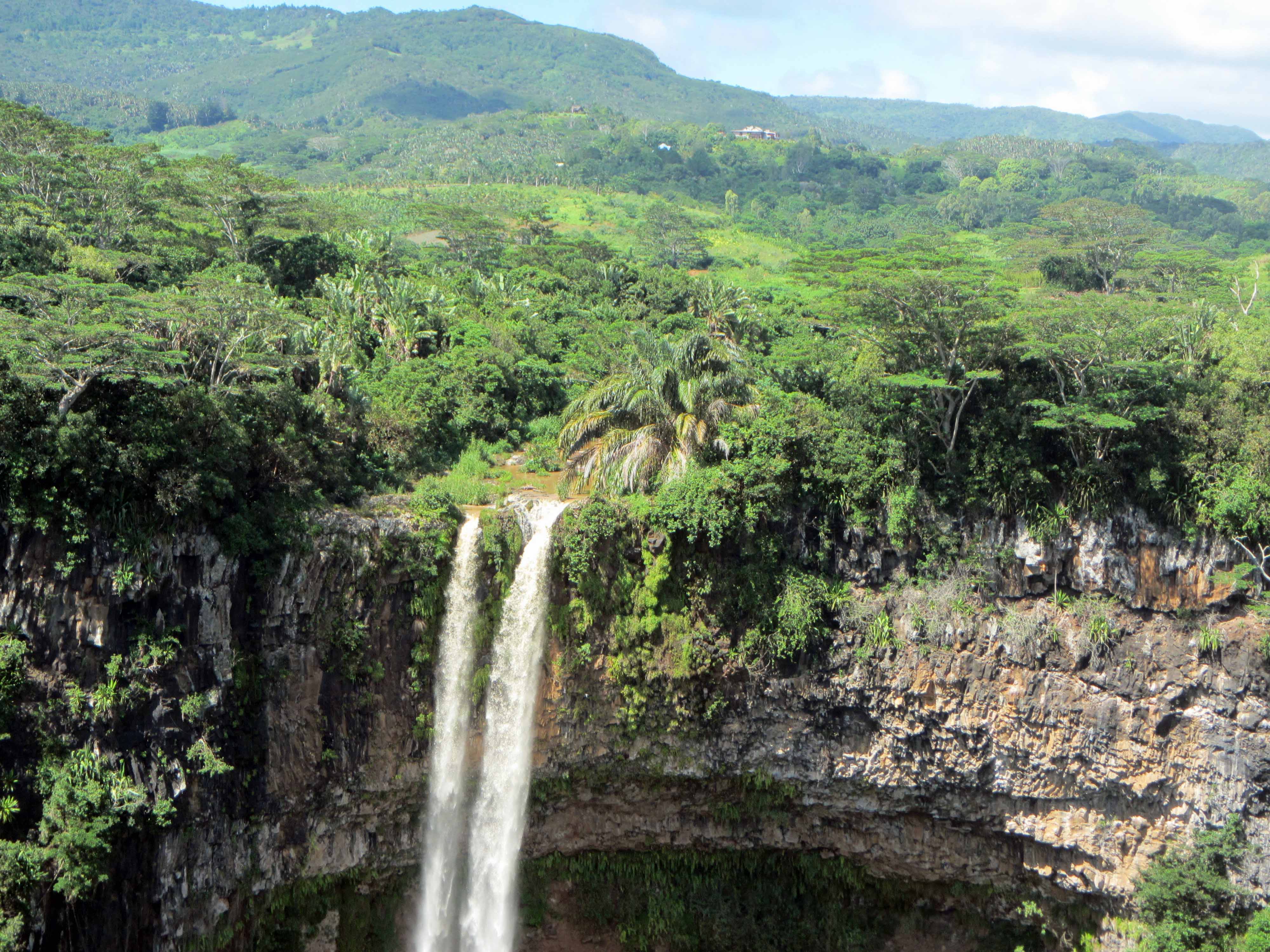
Today I’m continuing with sharing some pictures from my March 2014 trip to the volcanic island of Mauritius. You can see some of my previous posts on Mauritius here, here, and here. Mauritius is a tropical island, so in many places the lava rocks, particularly the older ones, are covered by thick green vegetation. However, there are some places where you can see the lavas well. One of those places is Chamarel, a popular tourist destination that consists of Chamarel Waterfall as well as a geologic attraction known as the Seven Coloured Earth— I’ll blog about the Seven Coloured Earth in another post. Today, I’d like to share some pictures of Chamarel Waterfall, a tall waterfall about the same height (~100 meters) as the Statue of Liberty. At the waterfall, two units of volcanic rocks are exposed. The first unit is approximately 8-10 million years in age and thus represents some of the oldest lavas of Mauritius. The second unit is approximately 1.7-3.5 million years in age.

Here’s an informational sign about the waterfall and the lavas:

Informational sign about the Chamarel Waterfall.
Informational sign about Chamarel Waterfall.
A closer view of the informational sign.

Here are a couple more pictures of the waterfall:

Waterfall... and lava flows!
Waterfall… and lava flows!
A closer view of the younger lava flow.

Stay tuned for more posts about Mauritius!

Water: Morganza Spillway Opened for First Time Since 1973

Saturday afternoon the U.S. Army Corps of Engineers opened part of the Morganza spillway— a flood control structure in Louisiana along the Mississippi River– for the first time since 1973 (and for the just the second time since the spillway was constructed in the 1950s). The spillway was opened yesterday to help mitigate severe flooding in the Mississippi River system. Just one floodgate was opened. As needed, additional floodgates of the spillway will be opened. The opening of the spillway diverts floodwaters from the cities of Baton Rogue and New Orleans. Hopefully, the opening of the spillway will spare those two cities from severe flooding. However, the opening of the spillway means that much of low-lying, rural, south-central Louisiana will be flooded. Large parts of Louisiana have already been evacuated. The floodgates will need to remain open for weeks until the river levels drop.

The impact of the flooding on Louisiana is going to be extensive: crops drowned, homes destroyed, people displaced, communities thoroughly soaked. I imagine many communities will take years to dry out, rebuild, and recover, even if the floodwaters recede in a few weeks time.

I suppose Louisiana had no choice but to open the floodgate. The rain just kept falling. The U.S. Army Corps of Engineers can only work to minimize the damage caused by the flooding by strategically diverting the water to less-populated areas. The flooding along the Mississippi is a potent reminder for all of us of the immense power of rivers and of the hazards of living close to and trying to control a large river.

Here is an impressive video showing the opening of the single floodgate today:

Video taken from YouTube.