LASI V: Xeno-Pumice– Mysterious Floating Rocks of the Canary Islands

Note: Dr. Steffi Burchardt, a senior lecturer in Structural Geology at Uppsala University in Sweden, presented a talk, “Xeno-pumice erupted offshore El Hierro, Canary Islands: A tale of stoped blocks in magma chambers?” at the LASI V workshop in Port Elizabeth, South Africa in October 2012. The article below is based on this talk and also an interview with Dr. Burchardt. Over a few weeks, I am highlighting some of the research that was presented at the LASI V workshop. This is the second post in that series.

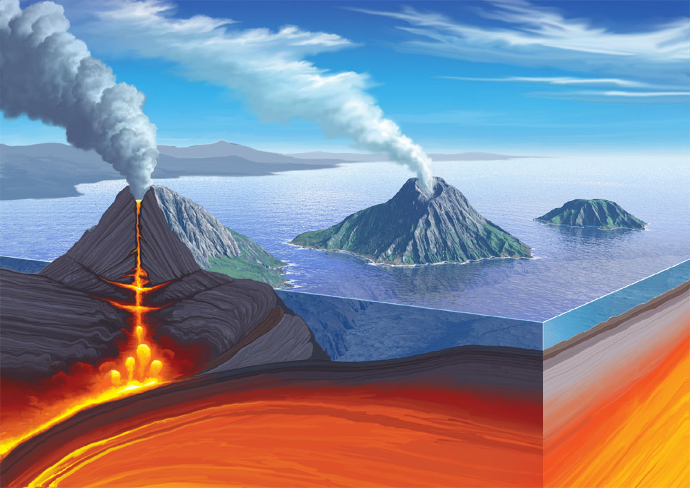
Following a period of intense seismic activity, on October 10th, 2011 a submarine eruption began approximately 1 kilometer off the coast of El Hierro, the youngest and westernmost island in the Canary Islands, which is a group of volcanic islands believed to have been formed through hotspot volcanism. The eruption was evident from the unusual conditions on the sea surface: the sea bubbled, like a Jacuzzi, and was stained green. The large green stain was easily observable from space. In the midst of these strange conditions, some highly unusual rocks were erupted. For several days after the sea started bubbling, strange floating rocks were observed and collected off the coast of La Restinga, the closest town to the undersea eruption. These floating stones were generally tens of centimeters in size and resembled lava bombs in shape. The outsides of these floating rocks consisted of basanite , a rock type commonly observed in the Canary Islands and other volcanic ocean islands. Basanites don’t generally float. However, these basanite shells floated because their insides were filled with a white to light grey, pumice-like material. Pumice is a highly vesicular rock, which means that it is a rock full of voids or bubbles, which make the rock light enough to float on water.

Figure showing the green stain on the sea during the early days of the 2011 El Hierro eruption. Figure from Troll et al., 2012.
A restingolite bomb with a basanite crust and a white, pumice-like interior. Photo courtesy of Dr. Steffi Burchardt.

While the pumice-like centers explained why the rocks floated, they also raised a multitude of questions and triggered some heated debates amongst geologists. This is because pumice is not commonly produced in the Canary Islands* or in other oceanic island hotspot environments, such as Hawaii and Iceland. The lavas erupted at oceanic island hotspots are generally mafic, low viscosity lavas such as basalts (and basanites). Viscosity is, in essence, a measure of how resistant lava is to flowing. The less viscous a lava, the more likely that lava is to flow. Therefore, low viscosity lavas such as basalts tend to flow easily and also tend to regularly release volatiles such as water and carbon dioxide. Therefore, the pressures in these lavas remain relatively low, and violent eruptions are uncommon. Pumice is most commonly produced during eruptions of felsic, highly viscous, volatile-rich lavas, which are found in environments such as island arcs, not oceanic island hotspots. The voids or bubbles in pumice represent places where volatiles have been rapidly released due to a pressure change, often during a violent eruption.

So, what was pumice-like material doing in an oceanic island eruption? A number of theories were put forward to try to explain the floating rocks that were erupted off of La Restinga. Some scientists thought the pumice-like material represented juvenile, highly silicic, highly viscous magma (such as rhyolite), which is very explosive. Other scientists proposed that the pumice-like material represented re-melted magmatic material, altered volcanic rock, or reheated hyaloclastite or zeolite from the slopes of El Hierro. Mysterious in origin, the floating stones were called “restingolites” after the nearby town of La Restinga.

After extensive analysis, a group of scientists (Troll et al., 2012) proposed an alternative hypothesis to explain the pumice-like material found in the restingolites. Based on the material’s high silica content, lack of igneous trace element signatures, and high oxygen isotope values as well as the presence of remnant quartz, jasper, carbonate, and wollastonite, Troll et al. concluded that the pumice-like material in the restingolites in fact represented xenolithic material from pre-island sedimentary layers that were picked up and heated by ascending magma, which caused the layers to partially melt and bubble. Looking like pumice and originating as xenoliths, Troll et al. dubbed the restingolites “xeno-pumice”.

Dr. Burchardt elaborates, “Xeno-pumice is definitely not an established term. We have coined it for the first time in the case of El Hierro eruption. The name comes from adding the preface ‘xeno-‘, which means foreign, to ‘pumice’. We used this term because the floating rocks of El Hierro present the characteristics of pumice, but they are actually not pumice in origin; they are actually xenoliths. We found out, based on mineralogy and also the fact that they contain detrital sand grains and fossils, that they are actually not magmatic in origin but rather that they are xenoliths from the sedimentary layers that underlay the Canary Islands. So, they are older than the volcanism. When the magma was rising, it stagnated at this level and interacted with the sedimentary rocks, sandstone and minor carbonate, and the magmas transported the xenoliths up with them to the ocean floor, where they were erupted. But in the process of the ascent of these xenoliths, they were subject to heat from the magma, so they started to melt. Since they contain a lot of water, this water started to boil and formed bubbles. The end product was something that looked like a pumice: lots of bubbles surrounded by a glassy matrix.”

Schematic from Troll et al. 2012 illustrating how the El Hierro restingolites may have formed.

Even though xeno-pumice was not a known rock type before the 2011 El Hierro eruption, Dr. Burchardt and her colleagues think that xeno-pumice may actually be a common—if not commonly recognized—rock type in other parts of the world.

Dr. Burchardt explains, “The El Hierro eruption was a very fortuitous circumstance for our work because my colleagues and I had been working on similar rocks from volcanoes worldwide, but that they were not previously recognized as xeno-pumice. The El Hierro eruption was therefore some kind of a breakthrough for our research in this field, and there will be a whole series of papers dealing with xeno-pumice from different parts of the world.”

By November, the xeno-pumice rocks were no longer being erupted, and worries that a dangerous, explosive eruption could occur at El Hierro abated. The identification of the restingolites as xeno-pumice was also good news for the hazard risk at El Hierro.

Dr. Burchardt explains, “It was good news that these xenoliths are sedimentary in origin because it means that there is no rhyolitic magma beneath the island, which means that a big explosive eruption isn’t likely.”

While the xeno-pumice rocks do not carry the message that an explosive eruption is likely to occur at El Hierro, they do carry other important messages from the deep. The unusual xeno-pumice rocks observed erupting at El Hierro in 2011 can provide much direct information about the interaction of magma and oceanic sediments and also may indicate that recycling of oceanic sediments into magma is an important process at ocean islands. Further study of xeno-pumice from the Canary Islands—and also from other parts of the world—will go a long way towards helping geologists better understand how volcanic eruptions at ocean islands interact with oceanic crust and sediments as they make their way to the surface.


*Update: Commentor Siim Sepp points out that intermediate composition pumice is found on the Canary Islands, most notably on the island of Tenerife. This is a very good point. I have perhaps oversimplified the explanation– pumice can be found at volcanic ocean islands under certain conditions. Thanks for pointing this out, Siim!

Reference:

Troll, V.R., Klügel, A., Longpré, M.-A., Burchardt, S., Deegan, F. M., Carracedo, J. C., Wiesmaier, S., Kuepper, U., Dahren, B., Blythe, L. S., Hansteen, T., Freda, C., Budd, D., Jolis, E. M., Jonsson, E., Meade, F. C., Harris, C., Berg, S. E., Macini, L.,  Polacci, M., and Pedroza, K. 2012. Floating stones off El Hierro, Canary Islands: xenoliths of pre-island sedimentary origin in the early products of the October 2011 eruption. Solid Earth, Vol. 3: 97-110.

LASI V: Dr. Volcano in the Cave of Crystals, Naica, Mexico

Note: Dr. Dougal Jerram—aka “Dr. Volcano”— presented a talk, “When Shallow Intrusions Make Silver Mines—A Journey into Superman’s Cave, Naica, Mexico” at the LASI V workshop in Port Elizabeth, South Africa in October 2012. The article below is based on this talk and also an interview with Dr. Volcano. Over the next few weeks, I will be highlighting some of the research that was presented at the LASI V workshop. This is the first post in that series.

Dr. Volcano in Ethiopia during shooting for the BBC (http://www.dougalearth.com/media.php).

The title of this blog post, “Dr. Volcano in the Cave of Crystals”, may sound like the title of a comic book or a science fiction story, but I can assure you that both Dr. Volcano and the Cave of Crystals are very much real. I had the pleasure of meeting Dr. Volcano and hearing about his visit to the Cave of Crystals at the LASI V workshop back in October 2012.

Dr. Volcano is also known as Dr. Dougal Jerram, who in June 2011 left his academic position at Durham University to set up DougalEARTH Ltd. and embark on an exciting new career as an independent geological consultant, researcher, and also a media consultant, becoming involved in science outreach and popular science entertainment. On his website DougalEARTH, Dr. Jerram states that he is, “aiming to make science more accessible to the general public and promoting our understanding of the planet.” In his science outreach and media work, Dr. Jerram is known as “Dr. Volcano.” The title is certainly appropriate since he has published dozens of scientific research articles about volcanoes and has also penned two books about volcanoes, The Field Description of Igneous Rocks (with Nick Petford, 2011) and Introducing Volcanology: A Guide to Hot Rocks (also 2011). For his scientific outreach and media work, Dr. Volcano has appeared on television programs for stations such as the BBC, The History Channel, and National Geographic.

The Channel 9 News Team in the Cave of Crystals. Picture courtesy of Andy Taylor.

As part of his media work, Dr. Volcano had the extraordinary opportunity to visit a place in Naica, Mexico known as Cueva de los Cristales or the Cave of Crystals (http://en.wikipedia.org/wiki/Cave_of_the_Crystals) in the Fall of 2011. Dr. Volcano visited the cave as part of a news team for a 60 Minutes documentary for Channel 9 News, Australia. The cave is also known as the Giant Crystal Cave and Superman’s Cave, since it resembles the Arctic home of the comic book character Superman. Located about 1000 feet (about 300 meters) below the Earth’s surface, the cave contains gigantic crystals of selenite (gypsum, CaSO4•2H2O) that are some of the largest known crystals on Earth. The largest crystals in the cave are nearly 40 feet (12 meters) tall!

The Cave of Crystals was first discovered in 2000 by miners who were excavating a new tunnel for the silver, zinc, and lead mine owned by the Industrias Peñoles mining company. Previously, a similar cave known as Cueva de las Espadas or the Cave of Swords was discovered in 1910. This cave is also located at Naica but at a shallower depth of about 400 feet (about 120 meters). However, the selenite crystals in the Cave of Swords are smaller, with a maximum size of about 6 feet (2 meters). In addition, many of the crystals from the Cave of Swords have been removed from the cave and transported to other places, such as museums.

A map of the Naica mine showing the locations of the Cave of Swords and the Cave of Crystals. Figure taken from Garcia-Ruiz et al. (2007).

Dr. Volcano explains, “We had the very lucky opportunity to go into the Naica caves in Mexico. These caves are very special because they have—arguably—the largest crystals on the planet. These crystals are gypsum, which is calcium sulphate (dihydrate). We were able to get into these caves after two years of negotiation with the Mexican mine and the government there.”

Prior to mining, the Cave of Crystals was underwater. The cave is only exposed because the mining company has pumped water away, lowering the groundwater level so that mining can proceed deeper. Naturally, the groundwater level is about -110 meters. Once pumping stops, the Cave of Crystals will again fill with groundwater. And not just any groundwater. The cave will fill with very hot groundwater since the Earth is quite warm at 300 meters depth. Research (e.g. Ruiz-Garcia et al., 2007) suggests that the enormous selenite crystals found in the Cave of Crystals likely formed in low-salinity fluids that were at a temperature of approximately 54 degrees Celsius. The selenite crystals grew very slowly over hundreds of thousands of years, enabling the crystals to reach their enormous sizes.

While no longer filled with hot fluid, the Cave of Crystals nevertheless remains an inhospitable environment for humans. Temperatures in the cave are 45 to 50 degrees Celsius, and the humidity ranges from 90 to 100%. While the mining shafts are cooled for the workers, the Cave of Crystals is not cooled, which helps preserve the giant selenite crystals. Visiting the Cave of Crystals is therefore no easy feat.

Dr. Volcano describes, “You go inside the cave, and you’re in temperatures of around 50 degrees Celsius, and the humidity is around 100%. One of the biggest problems when you go into an environment like that is that your body is unable to cope with that environment, and you effectively start dying the minute you enter the cave.”

In such an extreme environment, humans can only survive unaided for a few minutes.

Dr. Volcano elaborates, “The biggest problem you have is that when your body temperature is the lowest temperature in the cave, everything that your body does to try to cool itself doesn’t work. It tries to sweat, but the sweat doesn’t evaporate because there’s 100% humidity, so there’s no cooling from evaporation. You breathe in air, but the air is hotter than your internal body, so it starts heating up your body. You start to pant, like a dog, which is a natural reaction to try to cool yourself, but as a result you end up heating the interior of your body more quickly. We found that after 9 minutes in the cave without any sort of protection, our body temperatures rose to 39.5 degrees Celsius, which is quite dangerous. We had an Australian medic with us (David Rosengren), and he said that if your body temperature goes over 40 degrees Celsius, you could very rapidly deteriorate and even die.”

Fortunately, the Channel 9 news team came prepared.

Dr. Volcano explains, “We had a kind of solution, which we called ‘Formula 1 Geology.’ We used the same sort of suit that people in extreme sports, such as Formula 1 racing, use in environments where they can get very hot very quickly. It’s a close-to-the-body suit with piping inside that pumps cold water around the body. You wear a backpack with ice water, and an electric pump moves that cold water around the suit. With the suit, we could safely stay in the cave for about 25-30 minutes. Ultimately, if other people could refill the backpacks with more ice cold water, people could possibly stay in the cave much longer.”

As difficult as it is for humans to explore the Cave of Crystals at present, if mining ever stops at the Naica mine then it may become impossible to visit the cave since it will again fill with hot fluid.

Dr. Volcano wonders, “The giant crystal caves are only exposed because man is pumping the groundwater out. The biggest dilemma that we have for this natural wonder of the earth is: if the mining stops, then in principle the water level will rise again, and the Naica caves will be underwater again. I pose to the general public: what should be done—if anything—to save the Naica caves?”

I wonder that, too. It may be that the unique and remarkable Cave of Crystals will only be accessible for a brief time, only as long as the Naica mine remains in business.

Links and References:

DougalEARTH

The 60 Minutes Channel 9 News Documentary on the Cave of Crystals

Naica Project

Garcia-Ruiz, J.M., Villasuso, R., Ayora, C., Canals, A., and Otalora, F. 2007. Formation of natural gypsum megacrystals in Naica, Mexico. Geology, Vol. 35, No. 4: 327-330.

Why are there Earthquakes and Volcanoes in Japan? In Response to: Magnitude 8.9 Earthquake & Tsunami in Japan

For those of you who have not yet heard, there has recently been an enormous Magnitude 8.9 earthquake and an accompanying tsunami in Japan. There are currently tsunami warnings for the Pacific, so if you live on the West coast of the US or anywhere in the Pacific Ocean, please be cautious. The USGS (US Geological Survey) tsunami warning for the US can be found here.

Below is a map of estimated tsunami travel times. CNN has converted these to Pacific Standard Time estimates.

Estimated tsunami travel times. Figure taken from NOAA here. Click to view larger. Note there is an error in this figure: the star is in the wrong place. The earthquake actually occurred farther north, where the waves originate.

My fellow geobloggers are currently doing a great job of covering the recent news of the Japan earthquake. Callan Bentley over at Mountain Beltway has a good summary of earthquake coverage.

Here are a few more geoblogs & websites discussing the Japanese earthquake. I’ll update this list as I find more good sites:

Geoblogs:
Mountain Beltway
Dan’s Wild Science Journal
Paleoseismicity
Geotripper
Highly Allochthonous

Other Websites:
USGS
NOAA’s West Coast and Alaska Tsunami Warning Center
NOAA’s Pacific Tsunami Warning Center

Since I have quite a few non-geologist readers, I thought I would quickly discuss why Japan is such an earthshaking place with so many earthquakes, tsunamis, and volcanoes. While the gigantic 8.9 magnitude earthquake is impressive even for Japan, this is a part of the planet where geologists expect large and frequent earthquakes. Historically, there has been quite a bit of earthshaking in the area of Japan where the recent, enormous earthquake originated.

Here are a few historical maps from the USGS showing seismicity (aka earthshaking) in the area where the recent Japan earthquake originated. The location of the recent earthquake is given as an orange star:


Figure taken from USGS here. Click to view larger.


Figure taken from USGS here. Click to view larger.

The first figure shows that there have been many large (greater than magnitude 7)  and shallow (meaning more destructive at Earth’s surface) earthquakes in this area of Japan since 1900. The second figure shows that there has been quite a bit of earthshaking- both small and large- in this area of Japan since 1990.

Why is there so much earthshaking in Japan? Simply put, there is so much earthshaking in Japan because the Japanese islands are part of a volcanic island arc.  As a quick reminder for those of you who are a little rusty on Geology 101, a volcanic island arc is a place where volcanoes are produced above a subduction zone. A subduction zone is a place where one tectonic plate is going underneath (aka subducting) another tectonic plate.

Here are a couple of images showing subduction:

Volcanic island arc & subduction zone. Figure taken from here. Click to view larger.
Artistic (not quite scientifically accurate but very pretty) depiction of an island arc & subduction zone. Image taken from here. Click to view larger.

When an oceanic plate subducts underneath a continental plate, this produces volcanism on the continent, such as the volcanism that occurs in the Western US in the Cascades. When an oceanic plate subducts underneath another oceanic plate, a volcanic island arc is formed. There is no land originally, but a chain of island arcs builds up as volcanism develops above the subduction zone.

Here is a figure showing that Japan is part of a greater subduction zone called the Pacific “Ring of Fire”:

Plate boundaries, subduction zones, and volcanoes in the Pacific “Ring of Fire.” Figure taken from here. Click to view larger.

But why is there volcanism above a subduction zone? Well, this relates to a fundamental concept in geology- why do rocks melt?

A common misconception is that rocks melt because they are heated. Actually, most of the time rocks do not melt because they become hotter. Think about it- the interior of the Earth is very hot, much hotter than the shallow Earth where melts feeding volcanoes are generated. Yet, the interior of the Earth is pretty much all solid, except for the outer core. The reason that the interior of the Earth is not all melted, even though it is very hot, is because there is also an enormous amount of pressure in the interior of the Earth. So, when thinking about whether or not a rock will become molten, you need to think about both temperature and pressure.

Most rocks on Earth actually melt because of a sudden change in pressure. Geologists often talk about fancy shmancy “adiabatic decompression melting” occurring at mid-ocean ridges. To translate this into everyday language, “adiabatic decompression melting” just means that melting occurs because rock is moved quickly upward in the Earth. Rocks tend to lose heat very slowly, so if they are brought upwards quickly enough they won’t have time to cool down. They remain hot, but because they are brought up to a more shallow part of the Earth, they have less confining pressure and are able to melt. To breakdown the previous phrase: adiabatic = no heat loss, decompression = less pressure, and melting = solid to liquid.

So, at mid-ocean ridges- places where tectonic plates move apart and rocks are able to move upwards quickly- rocks melt because of adiabatic decompression melting. Now that you understand what that means, you have a great science phrase to impress your friends with at that next party.

But what about subduction zones, places where plates converge? The mantle melts at subduction zones because of the addition of volatiles, such as water and carbon dioxide. It turns out, if you add water, carbon dioxide, or another volatile to a rock, it will melt at a much lower temperature than normal. To put it simply, the large volatiles sort of interrupt the normal chemical bonds in the rock and make it easier to break apart that rock and turn it from solid to liquid. At a subduction zone, a plate (usually an oceanic plate) is going deep into the Earth. When this plate subducts, it brings volatiles with it into the mantle– for instance, water stored in deep-sea sediments. When the subducting plate is heated as it plunges into the hot, deep mantle, these volatiles are released and travel upwards since they are buoyant. The volatiles lower the melting temperature of the rock above the subducting plate and this rock melts, forming volcanoes above the subduction zone.

The wonderful diagram below (from Wikipedia Commons) explains how melts are produced in the Earth. The geotherm is the rate at which the temperature changes with depth in the Earth. The solidus is the line below which the mantle is solid. Above this line, the mantle starts to melt. When the geotherm crosses the solidus, melts are produced.

In the normal case, the solidus and the geotherm do not cross and no melting (and thus no volcanism) is produced. When plates diverge, mantle material rises and decompresses- the mantle melts because it encounters a lower pressure. When plates converge and subduction occurs, the subducting plate releases volatiles (such as water and carbon dioxide) and these volatiles lower the solidus temperature and the mantle melts. At hotspots, the geotherm is higher (by about 100-200 degrees C) and melting is able to occur.


Excellent diagram showing the three ways that melts are produced on Earth. Click to view larger. From Wikipedia Commons here.

Finally, why do earthquakes occur at subduction zones such as Japan? Well, any place where tectonic plates move past one another will occasionally experience earthshaking. Earthquakes occur where plates move apart (such as at mid-ocean ridges), slide past each other (such as at the San Andreas fault), or converge and subduct (such as at Japan). The movement of the plates- especially if sudden- has the potential to create very large earthquakes. Something that is unique about subduction plate boundaries (relative to convergent and transform- or sliding- plate boundaries) is that there can be very deep earthquakes.

Here is a comparison of earthquakes and tectonic plate boundaries:

Worldwide earthquake distribution. Figure from Tasa Graphics. Click to view larger.
Worldwide Plate Boundaries. Figure from Tasa Graphics. The little triangles indicate a subduction zone boundary. Click to view larger.

Notice how deep earthquakes occur at subduction zones:

Worldwide distribution of earthquake depth. Figure from Tasa Graphics. Click to view larger.
Depth of earthquakes at a subduction zone. Figure taken from here. Click to view larger.

Finally, below is a figure showing why Japan is an especially tumultuous region of plate convergence. Near the recent earthquake location, three tectonic plates are interacting! The interaction of these three plates makes large earthquakes, such as the recent 8.9 magnitude one, a likely occurrence.

Three tectonic plates in Japan. Figure taken from here. Click to view larger.