Sutherland Sky: Part VI – Dwyka Diamictite

Dwyka diamictite can be recognised from a distance by its typical "tombstone" appearance during weathering.
Dwyka diamictite can be recognised from a distance by its typical “tombstone” appearance, which forms during weathering.

At long last, I’m finishing up my series of posts about my October 2013 visit to the small town of Sutherland in South Africa’s Northern Cape province. Sutherland is home to a South African Astronomical Observatory (SAAO) research station that contains many telescopes, including the Southern African Large Telescope (SALT). You can read Part I of this series here, Part II of this series here, Part III of this series here, Part IV of this series here, and Part V of this series here. In my previous posts, I blogged about the astronomical observatory. In the last couple of posts, I’d like to blog about some of the geology that I observed on the drive from Cape Town to Sutherland. 

On the drive to Sutherland, we stopped at some fantastic roadcut exposures of Dwyka Group glacial sedimentary rock. Specifically, we stopped to look at some Dwyka diamictite, a term used to describe a poorly sorted sedimentary rock, commonly one deposited by a glacier. Dwyka glacial sediments are often referred to as “Dwyka tillite”. However, tillite is a specific term that refers to poorly-sorted sediments deposited directly underneath a glacier. Since there is evidence that many of the Dwyka glacial sediments were deposited in a glaciomarine environment, the term “Dwyka diamictite” is more accurate… and also has pleasing alliteration! Dwyka diamictite is Carboniferous in age and was left behind by a large glacier that covered southern Gondwana. Thus, Dwyka diamictite can be found on several continents and provides evidence that the supercontinent of Gondwana once existed.

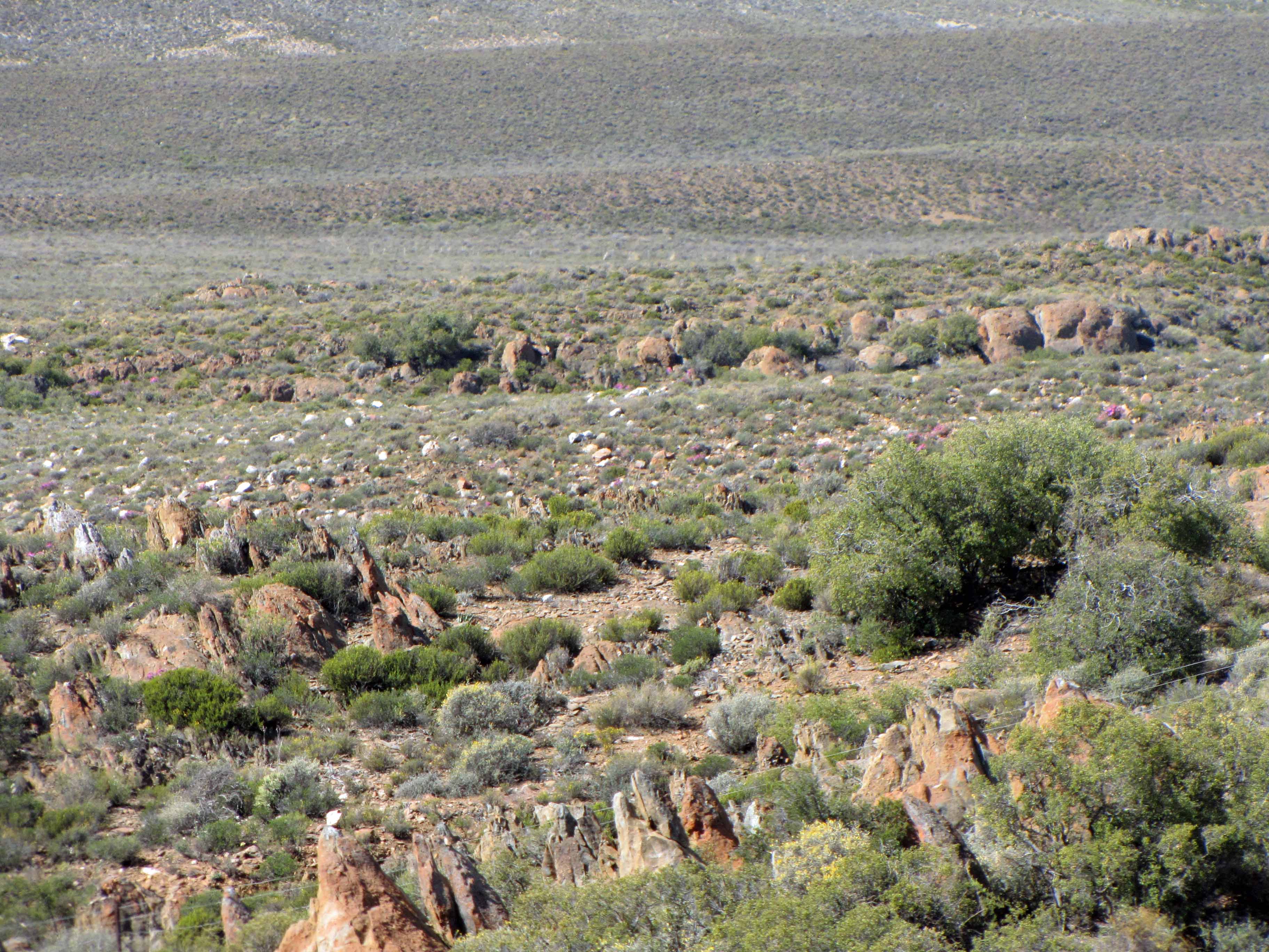
Dwyka diamictite can easily be recognized from a distance by its distinctive “tombstone” appearance:

More "tombstone" weathering of Dwyka diamictite.
More “tombstone” weathering of Dwyka diamictite.

For some reason (perhaps one of my geomorphologist readers knows why?), the Dwyka tends to weather into “tombstone” shapes.

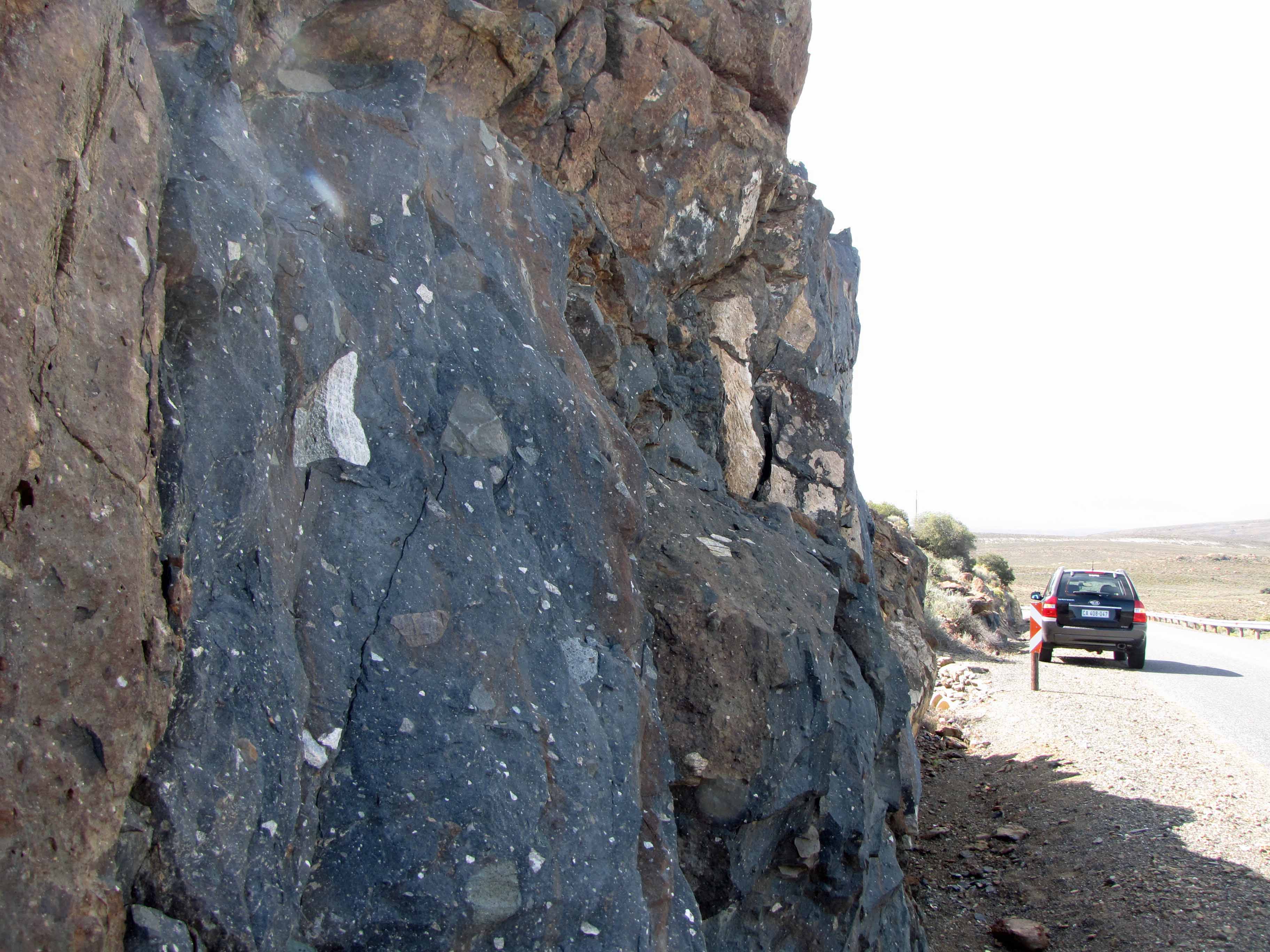
Dwyka diamictite is generally is covered in a reddish-brown oxidation rim. A fresh surface of Dwyka consists of a dark gray matrix (finer-grained glacial sediment) that contains clasts of all sizes, shapes, and rock types.

Here’s a look at a fresh roadcut surface of Dwyka diamictite:

Dwyka diamictite roadcut, with car for scale.
Dwyka diamictite roadcut, with 4×4 for scale.
Another view of the Dwyka diamictite outcrop.

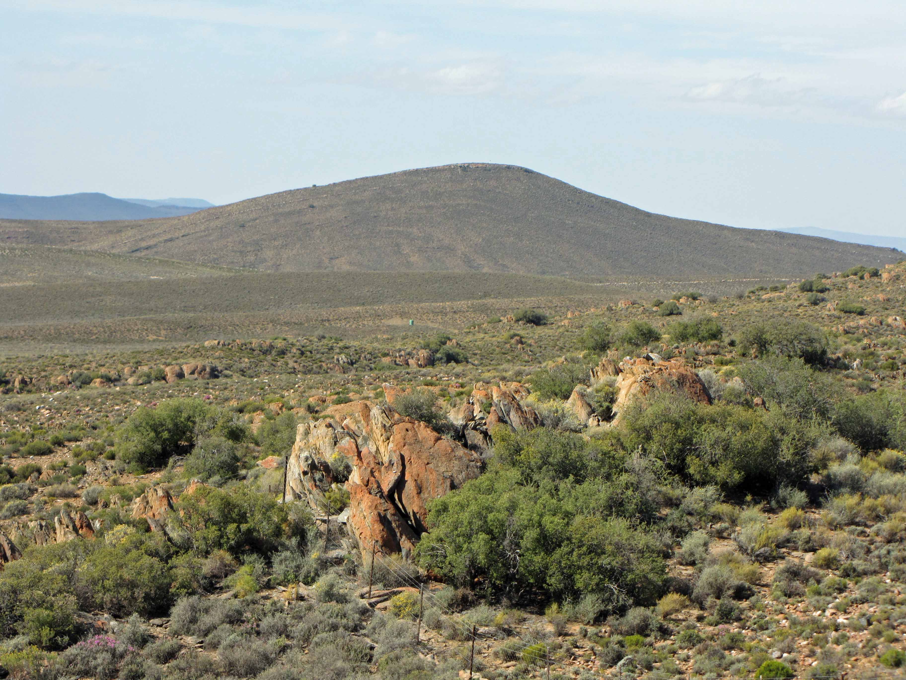
I was really excited to take a look at such a beautiful roadcut of Dwyka diamictite:

Look! Dwyka diamictite!
Posing with Dwyka diamictite.
After several “Vanna White” shots, my husband made me take a “calmer” picture with the Dwyka diamictite outcrop.

Here are some pictures of some of the interesting clasts I saw in the Dwyka diamictite outcrop:

Dwyka diamictite clasts #1.
Dwyka diamictite clasts #2.
Dwyka diamictite clasts #3.
Dwyka diamictite clasts #4.
Dwyka diamictite clasts #5. That black and white clast is worth a closer look.
Dwyka diamictite clasts #6.

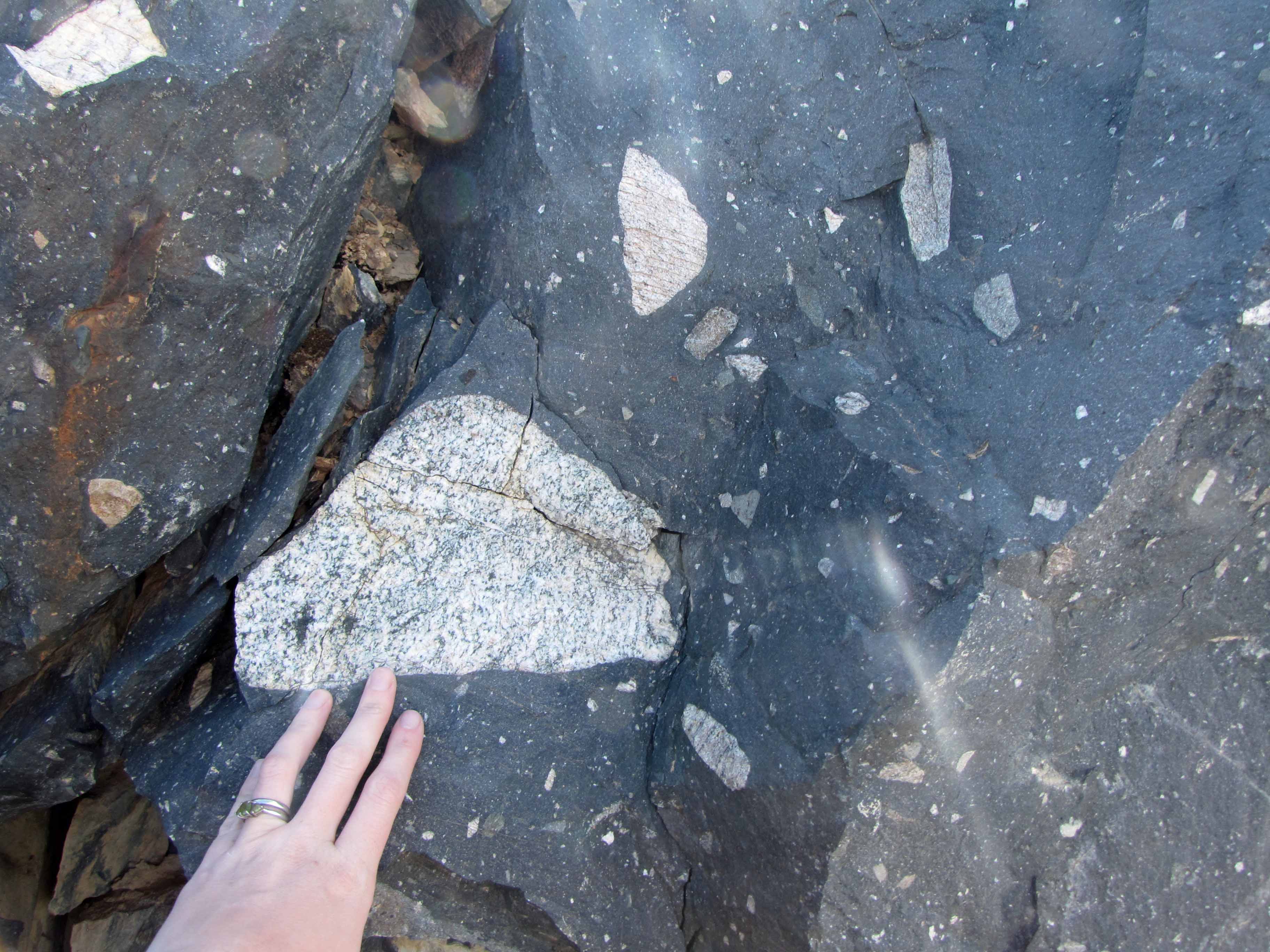
How many of the above clasts can you identify? I see some igneous rocks, some sedimentary rocks, some metamorphic rocks… all sorts of rocks!

Well, that’s all for this “Sutherland Sky” post. Next I’ll share some pictures of some rocks I saw as we drove through the Cape Fold Belt on our way from Cape Town to Sutherland.

Monday Geology Picture(s): Seychelles Miscellany

Seychelles Sunset. Picture courtesy of Nia and Patrick.

For this week’s Monday Geology Picture post, I thought I would share a few last pictures from the recent holiday visit of my friends Nia and Patrick to the Seychelles. These pictures have definitely inspired me to have my own Seychelles holiday one day! Beautiful beaches, warm weather, and fascinating geology– what a perfect vacation destination!

Flora #1. Picture courtesy of Nia and Patrick.
Flora #2. Picture courtesy of Nia and Patrick.
Seychelles from above #1. Picture courtesy of Nia and Patrick.
Seychelles from above #2. Picture courtesy of Nia and Patrick.
Seychelles from above #3. Picture courtesy of Nia and Patrick.
More Gondwana granites. Picture courtesy of Nia and Patrick.
A beautiful hotel room view. Picture courtesy of Nia and Patrick.

Monday Geology Picture(s): More Gondwana Granites in the Seychelles

Granites and a sailboat make for a perfect vacation view. Picture courtesy of Nia and Patrick.

Last week I shared some pictures of Gondwana granites that were taken by my good friends Nia and Patrick on their recent holiday to the Seychelles. This week I thought I’d share a couple more pictures of Seychelles granites. Enjoy!

Another gorgeous beach shot... with more granite! Picture courtesy of Nia and Patrick.

Monday Geology Picture(s): Gondwana Granites

A granite island! Picture courtesy of Nia and Patrick.

My good friends Nia and Patrick recently went on holiday in the Seychelles, an archipelago nation consisting of 115 islands. The Seychelles are located north of Madagascar. Along with Mauritius and Zanzibar, the Seychelles are a popular tropical vacation destination for South Africans.

Geologically, the Seychelles are very interesting. There are two types of islands in the Seychelles: young coral islands and older islands made of granite. There are approximately 40 granite islands in the “Inner Island” area, which is where the vast majority of the Seychelles population is located. The Seychelles islands are part of the Mascarene Plateau. The approximately 700 million year old granites found on some of the Seychelles islands (and on the northern Mascarene Plateau) are a fragment of the ancient supercontinent Gondwana. Pretty amazing, huh?

Over the next few weeks, I’ll be sharing some of Nia and Patrick’s Seychelles pictures for my “Monday Geology Picture” posts. I hope you enjoy seeing little fragments of Gondwana! The pictures in this post were all taken on the island of La Digue.

A closer view of some of the interesting granite weathering. Picture courtesy of Nia and Patrick.
More granite! Picture courtesy of Nia and Patrick.

Geology Word of the Week: G is for Gondwana

Gondwana reconstruction. Image from Wikipedia Commons.

This week we are at the letter G… I immediately thought of one of my favorite geology words: Gondwana!

def. Gondwana:
Gondwana is an ancient geological supercontinent that was comprised of modern-day Antarctica, South America, Africa, Australia, New Zealand, India, and Arabia. Gondwana first formed ~500 million years ago and later joined with the supercontinent Laurasia, that was comprised of modern-day North America, Europe, and Asia, to form a super-supercontinent named Pangea. Subsequently, Pangea began breaking up ~175 million years ago. The first stage of that separation was rifting of Laurasia from Gondwana. Eventually, all of the modern-day continents formed and gradually moved (over the past ~175 million years) into their present positions.

I love thinking about past supercontinents and super-supercontinents. Think about how different the planet must have looked: one massive continent and one massive ocean only. Imagine trekking across that massive continent or trying to sail across that massive ocean– which was called Panthalassia, by the way. What great names: Pangea and Panthalassia. Imagine how much easier geography class must have been back then (purely hypothetically, that is, since there were no humans). No memorizing the 7 continents and various oceans in primary school. Just one land and one ocean to remember.

Pangea is not the only supercontinent in Earth’s history, just the most recent one. Geologists believe that there have been several cycles of supercontinents forming and breaking up. Of course, the further back one goes in geologic time the sparser the evidence (much is destroyed in cycles of continents forming and breaking up), so much less is known about these earlier supercontinents. However, geologists have given them very cool-sounding names: Pannotia, Rodinia, Columbia, Kenorland, Ur, and Vaalbara.

There are many neat animations on the web showing the formation and break-up of Pangea and other past supercontinents. Here is one animation I like.