Geology Word of the Week: N is for Nabkha

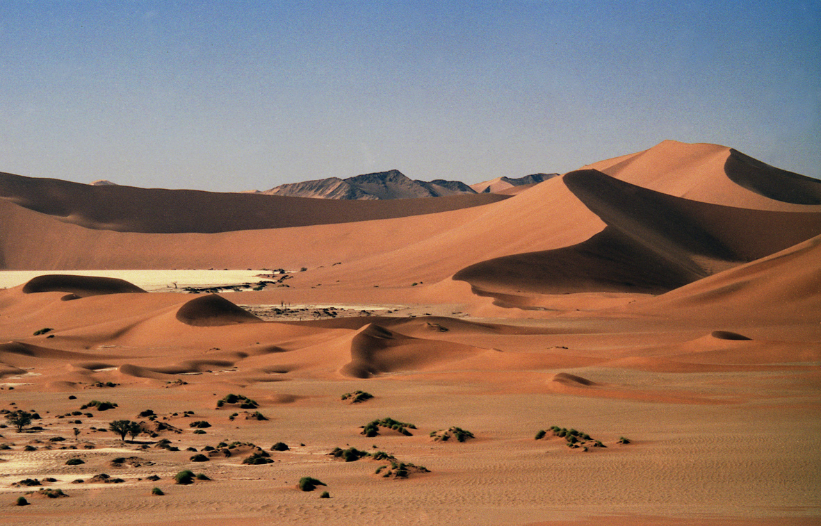
Nabkhas in front of sand dunes in Namibia. Photo courtesy of Michael Welland and used with permission.

def. Nabkha:
1. A mound-like accumulation of wind-blown sediment, usually sand, collected within and behind, and stabilized by, vegetation (definition modified from Khalaf et al., 1995 and Keary, 1996).
2. One of several words of Arabic origin that is used to describe sand features.

The Eskimos having an unusually large number of words for snow may be an urban legend, but perhaps the Arabs have an unusually large number of words for sand.

Actually, probably not. My simple Goodword English-Arabic dictionary lists just one word for sand,  رمل (raml), while my very comprehensive Al-Mawrid English-Arabic dictionary, which is a good three inches thick with very small print, again only gives رمل (raml). The other definitions given in this more comprehensive dictionary are variations on this one word, such as turba ramliyyah, “sandy dirt” or “sandy dust”; shaTi ramly “sandy beach”;  and raml as-sa’ah ramliyyah, “hourglass sand.”

Curious about how many words for sand there might be in Arabic, I tried to google the answer. I found this answerbag question, with an answer that is labeled “great” and “professionally researched.” This “professional” answer says that there are six Arabic nouns for the English word sand. However, I became a little suspicious when I noticed that the reference listed in the answer is Google Translate. Don’t get me wrong– I love Google Translate and use it all the time. However, I decided to double-check the translation. Also, I wanted to know the other five words in Arabic for sand.

When you type “sand” into Google Translate, the following list of Arabic words shows up:

English-to-Arabic translation of “sand” on Google Translate. Click to view larger.

When the Google Translate result showed up, however, I was disappointed. Again, there is just one word for sand in Arabic. For those of you who don’t know Arabic, let me explain why. I’ll just explain the nouns:

1. raml- this is the word for sand we already know.
2. saHra- this is actually the Arabic word for desert. The English word “Sahara” comes from this word.
3. ‘azm- this word actually translates to “determination” or “resolution.” I assume this word refers to slang usage of the word sand in English as a word to indicate determination or courage. For example, “She had more sand in her than any girl I ever see; in my opinion she was just full of sand.” (Mark Twain) or “After surviving two advisor changes, Evelyn showed she had the sand to survive her PhD.”
4. raml as-sa’ah ramliyyah- hourglass sand.
5. a-laun a-ramlee- the color of sand.
6. shaja’a- this word translates to “courage” or “bravery.” This relates to the third word.

I can only assume that whoever wrote the answer to the answerbag question did not speak Arabic. From my dictionaries and Google Translate, I determine that there is only one word in Arabic for (geologic) sand: raml. However, I am not a native speaker of Arabic. Perhaps there are additional colloquial words for sand. If you are a native Arabic-speaker and read this blog post, please feel free to comment below or email me with any additional words for sand you might know. I would love to hear from you. For now, however, I have to conclude that the Arabs having an unusually large number of words for sand is as much of an urban legend as the Eskimos having an unusually large number of words for snow. 

If you think about it, in English we actually have a large number of words to describe both snowy and sandy things. In addition to the word snow, we have words such as ice, icicle, powder, pack, frost, blizzard, flurry, slush, sleet, freezing rain, and wintry mix. Similarly, in addition to the word sand, we have words such as dust, dirt, grit, soil, soot, sediment, and gravel. Perhaps these words do not describe sand in a geologic sense, but they certainly work as everyday substitutes or specifiers. As an interesting aside, Arabic has one word ثلخ (thalj) that is used for both snow and ice.

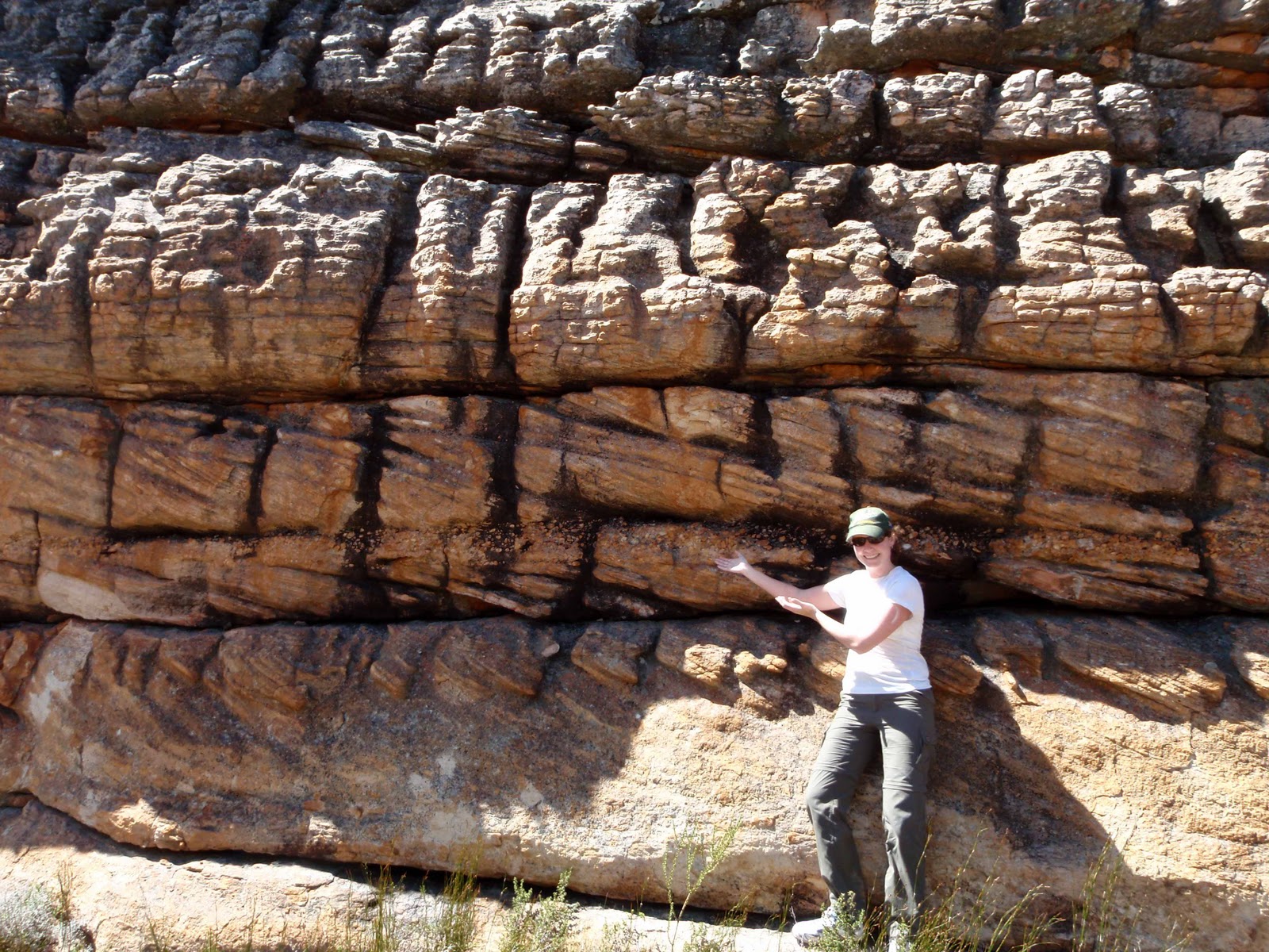
I started thinking about Arabic words for sand when I was leafing through my geological dictionary looking for an interesting geology word starting with the letter N. For those of you who haven’t noticed, for my weekly geology words I have been working my way steadily through the alphabet, from A is for Alluvium to M is for Magma. This week I am at the letter N. Browsing my dictionary, I came across the word “nebkha.”

I was very excited to discover the geology word “nebkha” or– more properly transliterating from the Arabic– “nabkha” for two reasons. First, this word exactly describes some sand structures that I noticed last month at Nobska Beach here in Woods Hole. When I observed these features, I didn’t know the word nabkha, so I just called them sand structures. Now I know that these structures are small nabkhas, which are mounds of sand which accumulate around and which are stabalized by vegetation, in this case small plants growing out of the beach. Several other terms are used to describe similar sand-vegetation features. For example: bush-mound, shrub-coppice dune, knob dune, and phytogenetic hillock (Khalaf et al., 1995). However, I think that nabkha is the most comprehensive word and also the prettiest.

Picture of a Nabkha in Kuwait. From Khalaf et al. (1995).

The second reason I was excited about discovering the word nabkha is that I immediately thought the word sounded Arabic in origin. I have a somewhat unusual background (for a non-Arab American, anyway) in that I double majored in Earth Science and Arabic for my undergraduate degree. My Arabic is rusty these days, but I can read basic Arabic well enough. I immediately tried to look up nabkha in my trusty Hans Wehr Arabic-English dictionary. This is hands-down the best Arabic-English dictionary out there. Thus, I was surprised and somewhat disappointed when I could not find the word نبخة (nabkha) in Hans Wehr. However, I did find the word نبكة (nabka), which translates to “hill” or “hillock.” I had never heard this word before. The word that I know for hill in Arabic is تل (tall). Exhausting my own resources, I decided to write to my old Arabic professor for help.

My professor responded swiftly and thoroughly. He managed to find both the words “nabka” and “nabkha” in Lisan al-Arab (The Tongue of the Arabs), the Medieval dictionary of the Arab lexicographer Ibn Manzur. He also explained that both the words nabka and nabkha are antiquated and not often used in modern Arabic speech.

In my professor’s words:

“About the word ‘nabka’, Hans Wehr reproduces his definition from the medieval dictionary Lisan al-Arab. The Lisan gives its meaning as a hill but specifies that this hill is shaped like a cone, with a pointed top. Other meanings listed in the Lisan are: (1) an elevation, (2) sand hill with pointed tops, (3) small hill.

As for its usage, it is not commonly used; it is used in medieval texts and also infrequently by modern writers who use medieval or ‘classical’ style of writing. They often explain it to modern readers. In the following article [available here; also see image below] on the city of Kashgar in Western China, the writer mentions in the beginning of the third paragraph:

‘The city was built in the middle of an oasis with abundant shades and on a nabka (murtafa3) min al-ard’

[Note: ‘min al-ard’ translates to ‘from the Earth.’ The number 3 is frequently used to denote a letter in Arabic that we don’t have in English. This is a sort of guttural “a” sound that is sometimes written “a’a.”]

Notice how either the author or an editor adds the explanation (murtafa3/elevation) in brackets; otherwise, most readers would not know what it is.

Regarding ‘nabkha,’ Lisan also lists it but without mentioning any relation of it to nabka–this is not uncommon in Lisan. It gives as one of its meanings: “an elevated land”. Also, “sand,” “earth that is not sand”.  The compiler of Lisan died in 1311. Since then, nabkha continued to be used, albeit in a limited, mostly academic context.”

A line from this encyclopedia entry showing how in modern Arabic writing the word “nabka” is usually explained by another word in parentheses.

Considering that the words “nabka” and “nabkha” have very similar meanings (perhaps they are related?) and seem to express an elevation or hill of some sort, I thought it very likely that the geology word nabkha was taken from Arabic. Perhaps a foreign geologist familiar with classical Arabic decided to borrow an antiquated word for hill to describe a desert feature. Alternatively, perhaps some modern Arabs call vegetated sand mounds nabkhas and brought the term into geology.

I shed some further light on the matter when I discovered this paper by Khalaf et al. (1995) on nabkhas in Kuwait.

They explain:

“Nabka or nabkha is an Arabic word denoting a small sandy hillock. It was used in Arabic literature before Islam, more than 14 centuries ago (Ibn Manzur, undated). Gautier & Chudeau (1909) used the same term for a mound-like accumulation of wind-driven sediments around vegetation.”

Note that the authors of this paper refer to Ibn Manzur and thus also looked up the word in Lisan al-Arab! The Gautier & Chudeau reference is in French. If anyone can find me a copy and help me translate the French, I would be most grateful. I’m curious to know if and why these French-speaking geologists chose an Arabic word to describe vegetated sand features.

Nabkha is certainly not the only word describing sand and sand features that has been taken from Arabic. Some other words I thought of are:

Seif– A long, narrow sand dune or chain of sand dunes. The word سيف (seif) means “sword” in Arabic.
Erg– Sand sea or sand dune. I think this is an English simplification of the Arabic word غرد (gurd), which translates to “dune” or “shifting dune” in Hans Wehr. However, this site says erg comes from the word عرق (‘arq), which means artery or vein. 
Haboob– An intense sandstorm. هبوب (haboob) means “strong wind or gale” according to Hans Wehr.
Zibar- a made-up Arabic-sounding word?
Rebdou- a large nebkha. I think this word also comes from Arabic.

References:

Various Arabic dictionaries, mentioned above.

Keary, Philip. 1996. Dictionary of Geology. London: Penguin Books. 

Khalaf et al. 1995. Sedimentological and morphological characteristics of some nabkha deposits in the northern coastal plain of Kuwait, Arabia. Journal of Arid Environments, vol. 29:267-292

Gautier, E. F. & Chudeau, R. 1909. Missions au Sahara, 1: Sahara Algerien. Paris: Armand Colin.

Acknowledgements:
Thanks very much to Hussein, the best Arabic professor in the world.

Thanks very much to Michael Welland, author of the book Sand: The Never-Ending Story, for providing the picture of Namibian nabkhas.

Geology Word of the Week: M is for Magma

Glowing lava in Hawaii. Image taken from Wikipedia Commons here.

def. Magma
1. Molten (liquid) rock below the Earth’s surface. Often contains volatiles, crystals, and small fragments of solid rock.
2. Not a synonym for lava, which is what you call magma after it has been erupted or extruded onto the Earth’s surface.
3. A favorite word of evil scientists, at least in Hollywood movies.

When non-geologists (and perhaps some beginner geologists) think about magma, there are two common mistakes that I have observed.

The first mistake is confusing magma with lava or treating the two words as synonyms. This is understandable as magma and lava are similar. Both are hot, molten rock. Both can contain volatiles (dissolved gases), crystals (that form as the molten rock cools), and fragments of solid rock (often picked up from the surrounding solid rock). However, magma specifically refers to molten rock located beneath the Earth’s surface while lava specifically refers to molten rock at the Earth’s surface.

Non-geologists might think it silly to have two words to describe molten rock. Perhaps this is true. Perhaps we should call all molten rock magma or lava or even coin a new word– I propose “molta”– that encompasses all types of molten rock. However, I’d argue that having two words to distinguish between molten rock below and above Earth’s surface makes sense. Having two words allows geologists to be specific. For example, in my previous post on komatiite rocks, I was able to say that komatiite rocks formed from lava that cooled. When I said that there is clear evidence that komatiites cooled from lava, geologists immediately understood that this meant these rocks formed at Earth’s surface. This is significant because komatiite rocks have a composition that is normally found deep within the Earth, not at Earth’s surface.There are also some differences between magma and lava. For instance, lava usually contains fewer volatiles (gases) than magma because these escape to the atmosphere.

Science is often intimidating and inaccessible to non-scientists because of all the vocabulary. When you become a scientist, you almost have to learn to speak a new language. While all of the vocabulary can be overwhelming until you learn it, science vocabulary exists for good reason. Science is all about being specific, about describing, quantifying, and– ultimately– understanding a part of the universe. Having a specialized, organized vocabulary allows precise classification. This vocabulary allows scientists to talk to each other and to compare finds and observations from different parts of the planet and universe.

One reason I write the geology word of the week is to explain and celebrate some of the remarkable vocabulary that geologists have developed to describe and classify their rocks. I love geology words. I love talking geology. But I realize that when I talk geology many of  my non-geologist friends are left in the dark. My best friend is an ocean engineer, so I have had to teach her some geology vocabulary over the years. She’s taught me some engineering vocabulary, and now we can talk– with relative ease– with each other about our research. Maybe on this blog I can teach some other people some geology words– and also teach myself some new geology words!

Of course, sometimes scientific vocabulary is a little too complex, even for scientists. For instance, there are thousands upon thousands of different names for rocks. The exact same type of rock might have a dozen different names. This is partly because rocks were independently “discovered” in different places and given different names. A rock might be called by one name in one country and by another name in another country. Rock and mineral names have been standardized internationally in relatively recent times, and continued standardization is an ongoing process. Unfortunately, the standard system of rock names isn’t perfect. Some of the complex names that remain are relics of the time before standardization and really should be replaced by simpler, more logical names. Furthermore, not all geologists stick to the standard names, at least not all the time. Some geologists prefer old names that have been “thrown out” and still use them, at least informally amongst each other. To really speak geology, you have to know  not only the standard names but also many of the non-standard names that are favored by some geologists.

Complex scientific vocabulary also causes problems when scientists want to talk to non-scientists or even to scientists in other scientific disciplines. I speak geology (or at least geochemistry, a dialect of geology), but I don’t speak biology. I also don’t speak physics or astronomy or proper chemistry, though I do know many words in these languages. If I need to collaborate with a physicist or a biologist, I first need to find a common scientific language. Scientists, myself included, often struggle to translate their science into plain English. I believe that it is very important for the general public to understand science and for scientists from different disciplines to be able to talk to each other. I’m not sure the best way to overcome the vocabulary problem, but I don’t think that throwing out all of the vocabulary is the answer. Personally, I don’t see a problem with using some jargon (maybe more when talking to other scientists and less in popular science writing) as long as you explain the terms you are using.

Anyway, I am rambling (which is okay since this is a blog), so let me now continue on to the second common mistake about magma. I think that many people (or at least the people who write bad geology movies) imagine the Earth as being full of magma. They imagine that the interior of the Earth is mostly molten rock or, as Dr. Evil of the “Austin Powers” movies would say, “liquid hot MAGMA.” This is far from the truth. Most of the Earth is actually solid, not liquid. Only one Earth layer (the outer core) is liquid. The Earth’s crust, mantle, and inner core are primarily solid. There is actually only a very small amount of molten rock compared to the amount of solid rock. Even the Earth’s asthenosphere (see last week’s word of the week if you don’t know what this is) is a solid, albeit it tar-like solid that moves very slowly over time. Molten rock only exists in small amounts in Earth’s crust and mantle. Furthermore, while there are some large bodies of magma in magma chambers and channels, much magma actually exists as tiny amounts in tiny pore spaces, not in well-defined magma chambers.

I think that understanding the words magma and lava is important because these words are so commonly used in popular science articles and even in every day life. Jessica Ball over at Magma Cum Laude wrote a great post awhile back about common mistakes made when reporting on volcanic eruptions. One of the mistakes she mentioned is that reporters often confuse magma and lava when writing about volcanoes. However, Jessica thinks it is important for reporters to use these (and other) terms accurately. I agree. Throw out jargon if you must, but don’t misuse scientific terms.

As a lighthearted example of the misuse of the word magma, I would argue that one of my favorite toys is misnamed. “Magmar” is a Rock Lords toy. The Rock Lords are similar to the more-popular Transformers toys except rather than being robots they are “powerful living rocks.” The Rock Lords toys were made in the 1980s, and I had a few of them as a child. Magmar is the leader of the evil Rock Lords. However, since Magmar exists on the surface of the Earth he should really be called “Lavar” or perhaps– since he is a rock– “Basaltar.” I didn’t appreciate Magmar’s misnomer when I was a child, but I do now as an adult geologist.

Magmar. Image taken from here.

Geology Word of the Week: L is for Lithosphere

Mantle Hills, Oman, January 2009.

def. Lithosphere:
1. The cool, outer layer of the Earth that deforms in a brittle manner.
2. Although often mistaken for the crust, a layer of the Earth that actually consists of both the crust and part of the upper mantle.

Last week I blogged about the notorious PhD general or qualifying exam. A common question that comes up in the general knowledge section of the geology exam is:

“What is the lithosphere?”

Or sometimes:

“What is the difference between the lithosphere and the crust?”

Or sometimes, if the committee members want to trick the student:

“Where in the lithosphere is the MOHO located?”

The lithosphere is a fundamental, but somewhat confusing, concept in geology. The lithosphere is sometimes mistaken for the crust, even by some geology students. However, the lithosphere and the crust are not the same. This is because the lithosphere is defined by physical properties while the crust is defined by chemical (or compositional) properties. The lithosphere consists of the crust AND part of the upper mantle.

When I think about the lithosphere, I think about two sets of words:

Lithosphere and Asthenosphere

and

Crust and Mantle

The lithosphere and the asthenosphere are layers of the Earth which are defined by physical properties. Specifically, the lithosphere consists of “the crust and upper mantle (viscosity >10^21 Pa s) which deforms in a brittle fashion when subjected to a stress of ~100 MPa (Keary, 1996)” while the asthenosphere is “a mechanically weak layer of the mantle immediately beneath the lithosphere, corresponding to the depth range within the Earth where the melting temperature is most closely approached (Keary, 1996).”

In a nutshell: when stressed, the lithosphere breaks but the asthenosphere flows. Basically, the lithosphere is the cool, rigid, outer shell of the Earth that breaks (deforms in a brittle fashion) when stressed. All of Earth’s crust deforms in a brittle fashion. Part of the upper mantle also deforms in a brittle fashion. Thus, both the crust and part of the upper mantle comprise the lithosphere. The asthenosphere, on the other hand, is hot and soft enough to flow (very slowly) rather than break when stressed. The asthenosphere is a solid, but it moves very slowly, like honey or tar.

The lithosphere and asthenosphere make plate tectonics possible. The lithosphere breaks up into tectonic plates, which slowly move over the tar-like asthenosphere.

The depth of the lithosphere-asthenosphere transition varies widely throughout the Earth as it is dependent on the thermal regime. The lithosphere may extend only 2 or 3 kilometers beneath young, hot, thin oceanic crust. However, beneath old, cool, thick continental crust, the lithosphere may be as thick as 250 or even 500 kilometers. Under some very old, very cold, very thick continental cratons, the asthenosphere  may not exist at all.

The crust and the mantle, on the other hand, are layers of the Earth which are defined by chemical (or compositional) properties. Specifically, the crust consists of less-dense crustal rocks (e.g. granites, basalts, gabbros) while the mantle consists of denser rocks (mainly peridotite). Oceanic crust is thin (less than 10 kilometers) while continental crust can be much thicker (70 kilometers or more).

Geologists have actually never directly observed the crust-mantle boundary. No one has drilled a hole deep enough to reach the crust-mantle boundary.  The deepest hole ever drilled on Earth is the Kola Superdeep Borehole, which reached about 12 kilometers in depth. However, because this hole was drilled into thick continental crust, the hole came nowhere near the crust-mantle boundary. I believe that the deepest hole ever drilled in oceanic crust is this approximately 2 kilometer deep hole off the coast of New Zealand. However, since this hole was drilled on the thick, sediment-covered continental shelf, I don’t think this hole came anywhere close to the mantle.  However, other holes in other pats of the oceanic crust have almost– but not quite– reached the elusive mantle.

As far as I know, no hole in either continental or oceanic crust has reached the crust-mantle boundary. Geologists haven’t even managed to drill through the thin (5-10 kilometers) thick oceanic crust to reach the mantle. Really, geologists have only scratched the surface of the planet. They haven’t even directly observed the mantle! The only places where scientists have been able to “see” the crust-mantle boundary are the rare places, such as in Oman, where ocean crust and part of the underlying  mantle has been uplifted onto land through natural tectonic processes.

Since geologists cannot directly observe the crust-mantle boundary (or, for that matter, the lithosphere-asthenosphere boundary), the boundary is defined by geophysical observations. The crust-mantle boundary is called the Mohorovicic Discontinuity or the MOHO for short. The MOHO is a place where seismic P-waves suddenly increase in velocity, presumably because they are able to travel faster through the denser mantle rocks.

So, for those geology students about to take a test or a PhD qualifying exam, remember:

The lithosphere is NOT the same as the crust. Rather, the lithosphere is comprised of both crust and upper mantle.

The MOHO is NOT the lithosphere-asthenosphere boundary. Rather, the MOHO is the crust-mantle boundary.

Reference:
Keary, Philip. 1996. Dictionary of Geology. London: Penguin Books.

Geology Word of the Week: K is for Komatiite

Komati River, South Africa. Image from Wikipedia here.

def. Komatiite:
1. An ultramafic, volcanic rock that is primarily composed of the minerals pyroxene and olivine.
2. A very unusual and rare volcanic rock type that is not produced today. Most komatiite lavas were produced in the Archean (approximately 2.5 to 3.8 billion years ago).
3. A rock type whose hotly– and wetly– debated origin sometimes galvanizes geologists to shouting matches, fist fights, and drinking contests.

Komatiites are ultramafic volcanic rocks. An ultramafic rock is a rock that has very low silicon (SiO2), sodium (NaO), and potassium (K2O) and very high and iron (FeO)  and magnesium (MgO) content, generally greater than 18 weight percent MgO*. For comparison, mafic basalts have about 7 weight percent MgO and felsic rhyolites have less than 1 weight percent MgO.

For those of you who are not used to thinking about mafic verses felsic rocks, let me try to explain the terms simply. A mafic rock is basically a dense, dark-colored rock that is more “primitive” or closer to the composition of the Earth’s mantle. A felsic rock is a less dense, lighter-colored rock that is “more evolved” or less close to the composition of Earth’s mantle. Mafic lavas, such as basalt, are generally produced through fairly high degree melting (about 10-20%) of the mantle. Felsic lavas, such as rhyolite, are produced through lower degrees of mantle melting and/or melting of continental and oceanic crust. Mafic rocks are enriched in heavier elements, such as magnesium and iron, and are depleted in lighter elements, such as silicon (SiO2) and sodium (NaO).

Table of igneous rock types, ranging from ultramafic to felsic. Taken from Wikipedia here. Click on the table to view a larger version.

An ultramafic rock is ultra depleted in silicon and other “felsic” elements and is also ultra enriched in magnesium and other “mafic” elements. Ultramafic rocks are primarily found in Earth’s mantle. Since the mantle represents about 84% of the Earth’s volume, most of the Earth is actually ultramafic. Although not quite correct, you can think about the mafic, intermediate, and felsic rocks that primarily comprise Earth’s crust as the light froth that floated to the Earth’s surface. Most of the Earth is comprised of denser ultramafic rocks– primarily my favorite rock peridotite. Most of the Earth is made of peridotite, which is primarily comprised of the iron and magnesium-rich minerals olivine and pyroxene.

Structure of the Earth. Image taken from here.

Although ultramafic rock makes up most of the Earth, geologists rarely find ultramafic rocks on Earth’s thin crust. This is because when the Earth’s mantle melts to produce magmas, it does not melt 100%. Rather, it generally melts between about 5% and 20%. This partial melting fractionates elements and has the effect of making the melt more felsic in composition than the ultramafic mantle. For instance, at mid-ocean ridges, 10% to 20% melting of ultramafic mantle produces mafic basaltic magmas. Some felsic lavas are actually melts of mafic or intermediate rocks. Whenever you partially melt a rock, it generally becomes more felsic in composition.
 
Understand all this so far? I know that I am putting a large amount of geology terminology in this week’s word of the week. In addition to komatiite, I am also trying to explain the geology words felsic, mafic, and ultramafic and the concept of partial melting. I realize this may be a bit much for my non-geology readers. I promise to return in future weeks to these words and concepts, but for now just try to understand the basics. The reason that I want you to have a basic understanding of these words and concepts is because this will help you to understand why komatiites are so remarkable and rare.

So, we’ve established that when the ultramfic mantle melts today, it generally melts no more than about 20%. This degree of melting produces mafic melts. These magmas make their way to the surface and, if they make it all the way to the surface, they erupt as lavas that eventually cool into mafic volcanic rocks. Today, the most primitive lavas that erupt are mafic basalts. No one has ever observed ultramafic lavas erupt; there are no places on the Earth today where ultramafic lavas are produced.

Before I continue, let me define another pair of geology words: volcanic verses plutonic. A volcanic rock is a rock that forms from the quick cooling of subaerial lavas. Since volcanic rocks cool quickly, they have textures that reflect this quick cooling. A plutonic rock, on the other hand, is a rock that forms from slower, deeper cooling in a place where magmas accumulate, such as a magma chamber. One final set of geology words: magma verses lava. A magma is what you call a melt before it reaches Earth’s surface. When magmas erupt subaerially, they are called lavas. Hopefully, I am done defining geology words now. For all the geologists who read my blog, I apologize for the review. I just want to make sure all my readers are up-to-speed with the terminology I’m using.

Back to the komatiites. Komatiites are ultramafic lavas. Now that you are familiar with the terms ultramafic and lava, you hopefully appreciate how amazing and befuddling komatiites are for geologists who, again, have never observed ultramafic lavas erupting. Komatiites are fairly rare rocks, but they are found throughout the world in places such as Canada and South Africa. Most komatiites were formed billions of years ago in the Archean (approximately 2.5 to 3.8 billion years ago). The youngest komatiites on Gorgona Island, Columbia were formed 90 million years ago, but these very young komatiites are anomalous. Almost all komatiites are billions of years old.

Komatiites were first described in the early 20th century in publications by the geological surveys of Zimbabwe, Canada, and Australia (Middlemost, pg. 101). The first chemical analysis of a komatiite was presented in 1928 in the Southern Rhodesia (now Zimbabwe) Geological Survey Bulletin (Macgregor, 1928). Early studies of komatiites noticed their unusual compositions but did not understand the full implications of these rocks. Remember that plate tectonics and the understanding that Earth’s mantle is composed of ultramafic peridotite were not fully realized until later in the 1960s and 1970s. In the late 1960s the Viljoen brothers described an incredible exposure of komatiite near the Komati River in South Africa (Viljoen and Viljoen, 1969). As you might guess, the Viljoen brothers named komatiites  after the Komati River**.

After the Viljoen brothers study, geologists began to realize the implications of these unusual rocks. They realized that komatiites formed from ultramafic lavas, and they realized that komatiite lavas are not produced today and, furthermore, could not be produced today. Geologists also quickly realized that most komatiite lavas are incredibly ancient, billions of years old. The anomalously young komatiite lavas on Gorgona Island were not discovered by geologists until 1979 (Echeverria, 1980). Komatiites were loosely defined as a rock type until the early 1980s when Arndt and Nisbet (1982) defined komatiites as rocks that:

1. Have a mineral assemblage or chemical composition that indicates an ultramafic composition
and
2. Have structures and/or textures that indicate a volcanic (extrusive) origin.

That is, they are ultramafic rocks that erupted as lavas. But how is this possible? And why aren’t komatiites produced today? Well, geologists have argued about the origin of komatiite lavas since komatiites were first discovered. Geologists agree that ultramafic lavas can only be produced when the ultramafic mantle is able to melt to a greater extent. The degree of mantle melting required to produce komatiite melts is about 50% to 60%, which is far greater than the maximum of about 20% that the mantle melts today. What geologists do not agree on is what conditions led to this much higher degree of mantle melting. There are two hotly– and wetly– debated possibilities.

The first possibility is that the mantle was hotter back in the Archean, when most komatiites were produced. If the mantle used to be hotter back in the Archean, much higher degrees of mantle melting would be possible. The mantle– indeed the entire Earth– was much hotter back in the Archean because of higher amounts of radioactive elements (which have now decayed) and other sources of heat that have now dissipated. However, to form the many komatiites the mantle needed to be hotter by about 500 degrees Celsius, which is a big difference. Also, not all lavas that were produced in the Archean were ultramafic– there were also plenty of mafic basalts produced. So, if the mantle were much hotter, why would komatiite lavas only be produced in certain places?  This leads many geologists to challenge the hot mantle theory for the origin of komatiites.

The second possibility is that the mantle was wet and less hot. Wet rocks– that is, rocks with a large amount of water and other volatiles in them– melt at lower temperatures than dry rocks. So, if the mantle were wetter back in the Archean, it would produce higher degrees of melt even if mantle temperatures were not much higher than today. For instance, some authors propose that mantle temperatures higher by only 100 degrees Celsius or so could produce komatiites in wet subduction zone environments (e.g. Grove and Parman, 2004).

The origin of komatiite lavas is a passionately debated topic in geology. Back when I was a first year graduate student, an older student told me that he purposely didn’t work on komatiites (which his advisor famously studied) because he didn’t want to work on such a controversial rock. I laughed at the comment and wondered how a rock could be controversial. Then, he told me stories about geologists passionately debating their opinions on komatiites. At one conference, scientists started yelling at each other and nearly broke out into a fist fight. Certainly, the passion of komatiite researchers shines through in their papers, which makes them entertaining to read. When studying komatiites, I guess you have to join “team wet” or “team dry.” If you want to read a review of the komatiite debate, an excellent paper (though I have to warn you that this paper comes from “team wet”) is the Grove and Parman (2004) reference below.

You might be wondering how geologists know that komatiites were erupted as subaerial lavas. How do geologists know that these rocks aren’t just plutonic ultramafic rocks that were exposed through uplift or erosion? The answer is that komatiites have textural and structural characteristics that indicate that they formed from lava. For instance, komatiite lavas are particularly known for their beautiful spinifex textures. Spinifex*** is a texture created by elongated olivine crystals that form when olivine cools extremely quickly, a sure sign that komatiites formed from subaerial lavas. I leave you with these beautiful pictures of spinifex texture in komatiite.

Spinifex texture in komatiite. Image taken from here.

*For those of you who are not familiar with the convention, major elements in rocks are always reported as oxides (combinations of an element with oxygen). Oxygen is actually the most common element in rocks and binds with the other elements, so this convention makes sense for rocks. However, those who are not used to thinking about geochemistry and petrology may find this convention a little confusing at first. Don’t worry– after awhile you become accustomed to it. So, if you continue reading my blog, you’ll be an oxide expert in no time!

**As a quick etymological aside, komati comes from the Swati word “inkomati,” which means cow. So, komatiite means “cow rock.”

***Here’s a list of the geology terms I’ve introduced in this post: komatiite, mafic, felsic, ultramafic, mantle melting, volcanic, plutonic, magma, lava, mantle, crust, peridotite, spinifex.

References:

Arndt, N. T. and Nisbet, E. G. (editors) 1982. Komatiites. London: George Allen & Unwin.  

Echeverria, L.M., 1980. Tertiary or Mesozoic komatiites from Gorgona island, Colombia: Field relations and geochemistry. Contributions to Mineralogy and Petrology, vol. 73: 253–266.

Francis, P. and Oppenheimer, C. 2004. Volcanoes. New York: Oxford University Press, 35-36.

Grove, T. L. and Parman, S.W. 2004. Thermal evolution of the Earth as recorded by komatiites. Earth and Planetary Science Letters, vol. 219: 173-187.

Hall, Anthony. 1987. Igneous Petrology. Essex: Longman Scientific & Technical, 341-342.

Kamenetsky, V. S., Gurenko, A. A., and Kerr, A. C. 2010. Composition and temperature of komatiite melts from Gorgona Island, Colombia, constrained from olivine-hosted melt inclusions. Geology, vol. 38, no. 11: 1003-1006. 

Macgregor, A. M. 1928. The geology of the country around the Lonely Mine, Bubi District. Southern Rhodesia Geological Survey Bulletin, vol. 11.

Middlemost, Eric. 1985. Magmas and Magmatic Rocks. Essex: Longman Scientific & Technical, 100-101, 183-185.

Viljoen, M. J. and Viljoen, R. P. 1969. Evidence for the existence of a mobile extrusive peridotitic magma from the Komati Formation of the Onverwacht Group. Geological Society of South Africa, Special Publication, no. 2: 87-112.

Geology Word of the Week: J is for Jurassic

An artist’s vision of Sauropods and Iguanodons during the late Jurassic. Image taken from Wikipedia Commons here.

def. Jurassic
1. A geologic period spanning from approximately 200 to 145 million years ago. 
2. A cool adjective to use in everyday life to describe something or someone ancient and/or gargantuan. For example, “My Jurassic professor doesn’t even know how to use a computer. He does all of his lectures in chalk on the blackboard!” and, “Wow, this is a Jurassic portion of french fries! Please help me eat these.”
3. A time period when the following dinosaurs were NOT alive: T-Rex,Velociraptors, and Triceratops, the dinosaur stars of the movie “Jurassic Park.” Dinosaurs that WERE alive during the Jurassic period include Sauropods such as Apatosaurus and Brachiosaurus, Theropods such as Allosaurus and Megalosaurus, and –one of my favorite dinosaurs–Iguanodons.

Jurassic Park movie poster. Image taken from Wikipedia.

The movie “Jurassic Park” came out when I was nine years old. For many years, I would visit  my grandmother in South Carolina for two weeks during the summer. My grandmother would spoil me during those two weeks. She would take me horseback riding, buy me toys and junk food, and take me to swim in her neighbor’s pool. She would also sometimes take me to see movies that my parents thought were “too scary” for me. The summer I was nine, my grandmother took me to see “Jurassic Park.” I was so scared that I had trouble sleeping for several nights. In the night I would hear scratching noises (probably my grandmother’s dogs), and I would imagine there were Velociraptors circling my bedroom window. The Velociraptor kitchen scene still spooks me as an adult.

You can watch a video clip of the Velociraptor kitchen scene here.

As a kid the movie “Jurassic Park” scared me to death, but I absolutely loved that movie. I asked for “Jurassic Park” plastic dinosaurs for Christmas, and I used my allowance to buy “Jurassic Park” trading cards. I collected the full set of cards, which are somewhere in my parents’ attic and probably worth a small fortune on ebay. Or maybe not. I imagine dinosaur cards don’t hold quite the same value as baseball cards.

As a young girl interested in science, I was particularly drawn to the female characters in “Jurassic Park”: Dr. Ellie Sattler and young computer whiz Lex. These two females are smart, athletic, and able to keep up with the boys– and more– in the movie. And, of course, they are very pretty in a windswept scientist sort of way. One of my favorite scenes in the movie is when Dr. Sattler sticks her hands in a big pile of Triceratops dung. I thought to myself, as a 9 year old, that I wanted to that kind of a scientist when I grew up– the kind that sticks her hands deep in the Triceratops poop.

Although I am not a paleontologist or even a biologist, I hope that I have become the kind of female scientist who “sticks her hands in the Triceratops poop.” That is, a confident female scientist who is not afraid of a little (or a lot) of dirt.

Dr. Ellie Sattler and the sick Triceratops. Image taken from here.

You can watch the Triceratops poop clip here. The giant Triceratops poop pile is towards the end of the clip.

Alas, as I became older I realized that the movie “Jurassic Park” is riddled with scientific mistakes– and not just the whole crazy premise that dinosaurs can be made from ancient mosquitoes preserved in amber. The Michael Crichton book is somewhat more accurate but still has mistakes. I won’t go into all of the mistakes here, but you can read about the movie’s many inaccuracies here and here.

I’ll just go into a few of the “Jurassic Park” inaccuracies here. One of the inaccuracies is, sadly, that the pile of triceratops poop is far too large. Based on coprolites, dinosaur poop was likely smaller than the giant piles portrayed in the movie. So, I guess if I’m ever stuck on a crazy dinosaur theme park island and have to figure out why a dinosaur is sick, I won’t have to stick my hands in quite such a large poop pile. Also, Velociraptors were smaller than portrayed in the movie and were feathered. T-Rex probably could see you, even if you stayed perfectly still. Dilophosaurus (the poisonous spitting dinosaur)  was larger and probably did not have a cool frill. There is also no evidence that Dilophosaurus had any sort of poison spit.

The less-scary but more realistic feathered Velociraptor. Image taken from Wikipedia Commons here.

Despite now knowing the inaccuracies of the frill and the poison spit, I still really like the Dilophosaurus toy I had as a child. I used to make him (her?) spit at my younger sister when she tried to enter my room or when she was annoying me. Sorry about that, sis. By the way, this toy makes a delightfully horrible screeching sound when you move the Dilophosaurus’s front arm.

Dilophosaurus toy, like the one I had as a kid. Image taken from here.
Dilophosaurus in Jurassic Park. Image taken from here.

The biggest mistake in the movie and book? The name of the park. Many of the dinosaurs portrayed in the movie were not alive during the Jurassic period at all. T-Rex, Velociraptors and Triceratops, for instance, all lived during the later Cretaceous period. So, the park should probably have been named “Cretaceous Park” not “Jurassic Park.”

Geology Word of the Week: I is for Ichnite

Fossil dinosaur footprint, Wyoming, Fall 2005.

def. Ichnite:
A fossilized footprint.

An ichnite is a type of trace fossil, which is a fossil that preserves evidence of biological activity but which is not part of an organism’s body. Examples of trace fossils are footprints (ichnites), burrows, and root cavities. Coprolites and other fossilized bodily excretions are also often considered trace fossils.

Footprints are everywhere. Just today, I went for a walk along a Cape Cod beach and there were footprints all over the beach. Footprints are rarely preserved as fossils, but when they are preserved the resulting ichnites can be spectacular. What kid- or grown-up- doesn’t find dinosaur footprints fascinating? Dinosaur (and other) ichnites are also very important for learning about how ancient animals moved.

Footprints on a Cape Cod beach, December 2010.
More footprints on a Cape Cod beach, December 2010.

During my undergraduate field camp, we did an exercise where we had to figure out how quickly various dinosaurs moved based on fossilized footprint trails. Using the size of the footprint and the distance between the footprints, you can estimate approximate dinosaur speeds. In field camp we did this for various tracks in Wyoming and Utah. Then, we ran as fast as we could and calculated our own speeds to see if any of us could outrun certain carnivorous dinosaurs. In most cases, we were slower than dinosaurs and would be a likely lunch for any dinosaurs brought back to life Jurassic Park style. Below are a few pictures I took during my undergraduate field camp of some dinosaur ichnites.The footprint fossils are a little difficult to make out from a distance, so we marked them with brightly-colored poker chips.

Fossilized dinosaur footprints, Wyoming, Fall 2005.

I have to say, though, that my favorite type of ichnite is the preserved footprints of ancient man, such as the famous Laetoli footprints in Tanzania. The Laetoli footprints (see pictures below) are 3.6 million years old and were made when Austrolopithecus afarensis walked through volcanic ash. Notice that there are actually two sets of footprints- one smaller, one larger- of two Austrolopithecus afarensis walking side-by-side, perhaps a mother and child or a man and a woman. These footprints show that very early man walked in a very similar way to modern man… even 3.6 million years ago!

Laetoli footprints, Tanzania. Image taken from here.
Laetoli footprint, Tanzania. Image taken from here.

Geology Word of the Week: H is for Hotspot

Travertine forming at a hotspring, Yellowstone hotspot, Fall 2005.

 def. Hotspot:
1. A place where you can obtain internet in order to write your geology blog.
2. A thermal anomaly within Earth’s mantle, generally consisting of a hot, rising plume of mantle material that generates volcanism- or increased volcanism- on Earth’s surface.

Hotspots are aptly named- they are spots of the Earth that are hot. They are spots because they are limited in area- no more than a few hundred kilometers in diameter at the largest. They are hot because their temperature is hotter (generally by 100-200 degrees C) than the ambient, surrounding mantle.

Although they produce volcanism in Earth’s crust, hotspots are really features of Earth’s mantle. Hotspots are likely- at least in the case of the largest ones such as Hawaii and Iceland- plumes of hot, rising material that originate in the lower mantle, perhaps even as deep as the core-mantle boundary. Hotspots are almost stationary features in the mantle. There is evidence that hotspots can drift extremely slowly in the mantle, but hotspots are essentially stationary relative to the faster-moving tectonic plates.

As a tectonic plate moves over a mantle hotspot, a chain of volcanoes is produced. The most famous of these chains is the Hawaiian Islands & Emperor Seamounts in the Pacific Ocean. These islands and seamounts are age progressive. The youngest island, Hawaii, is volcanically active and is where the crust is currently located over the hotspot. As the crust moves, another island will eventually form- in fact, one is forming underwater now, and it is named Loihi! Behind the main island of Hawaii, there are other, older islands that are not currently volcanically active. Beyond the islands, there is a long chain of underwater seamounts- these seamounts used to be subaerial islands but because of subsidence and erosion they are now underwater hotspot remnants.

The Hawaiian-Emperor hotspot trail. Image from Wikipedia Commons.
The Hawaiian Hotspot. Image from Tasa Graphics.

Hotspots occur all over the Earth- they can produce volcanism both on oceanic crust and on continental crust. Famous hotspots include Hawaii, Iceland, Yellowstone, Afar, Reunion, Ninetyeast Ridge-Kerguelen, Galapagos, and the Azores. One interesting aspect of many hotspots is that they produce volcanism in the middle of tectonic plates. Volcanism generally occurs at plate boundaries, not in the middle of plates such as in the case of Hawaii. A quick look at the location of tectonic plates and the location of worldwide volcanism (see maps below) shows that this is true- hotspots are, indeed, places of anomalous volcanism.

Some hotspots do occur at plate boundaries. Iceland is the most well-known example of this and is located along the divergent plate boundary of the Mid-Atlantic Ridge. Plate boundaries (at least divergent and convergent/subducting ones) generally produce volcanism. When a hotspot is located along a plate boundary, more volcanism is produced. In the case of Iceland, so much volcanism is produced that the mid-ocean ridge is actually exposed subaerially. Iceland is the only place in the world where you can go and walk along an active mid-ocean ridge. You can actually walk the ocean floor (well, sort of… technically it is a subaerial island) in Iceland!

Tectonic Plates. Image from USGS, taken from Wikipedia Commons.
Global Map of Volcanoes. From the Global Volcanism Program website.

You can explore locations of volcanoes on the Global Volcanism Program website here

Hotspots are capable of generating enormous amounts of lava and volcanism. When hotspot plumes first form, they are thought to produce large flood basalts. For instance, the Deccan Flood basalts (associated with the Reunion hotspot), the Kerguelen flood basalts (associated with the Heard Island & Ninetyeast Ridge hotspot), and the Columbia River flood basalts (associated with the current Yellowstone hotspot) are all gigantic volumes of basaltic lava that is thought to have been produced when a hotspot plume “head” first reached the Earth’s surface. After this initial outpouring of basalt, the hotspot plume “tail” is thought to then produce a more steady, smaller amount of lava that creates a chain of volcanoes.

Plume head and tail. Image from Tasa Graphics.

Even plume “tails” can generate enormous amounts of volcanism. For instance, Mauna Kea on the island of Hawaii is only about 1 million years old but is actually (measured from the seafloor) the tallest mountain on Earth.

So, we’ve established that hotspots are spots of hot that produce volcanism. But why does being hot produce volcanism? This may sound like a simple question but, most of the time, lava- or melted rock- is not produced through heating. Think about it- the crust and upper mantle (where melts are produced) is actually colder than the lower Earth. So as mantle material rises, it generally becomes colder- not warmer. The wonderful diagram below (from Wikipedia Commons) explains how melts are produced in the Earth. The geotherm is the rate at which the temperature changes with depth in the Earth. The solidus is the line below which the mantle is solid. Above this line, the mantle starts to melt. When the geotherm crosses the solidus, melts are produced.

In the normal case, the solidus and the geotherm do not cross and no melting (and thus no volcanism) is produced. When plate diverge, mantle material rises and decompresses- the mantle melts because it encounters a lower pressure. When plate converge and subduction occurs, the subducting plate releases volatiles (such as water and carbon dioxide) and these volatiles lower the solidus temperature and the mantle melts. At hotspots, the geotherm is higher (by about 100-200 degrees C) and melting is able to occur.

Excellent diagram showing the three ways that melts are produced on Earth. Click on image for a larger view. From Wikipedia Commons here.

Hotspots were first postulated in 1963 by  J. Tuzo Wilson. Wilson (or J.T. as I like to call him) proposed that chains of volcanic islands could be produced as tectonic plates moved across a deep thermal anomaly within the Earth. Since J.T., hundreds (thousands?) of geologists have studied hotspots and tried to understand them. We have come a long way in understanding hotspots, but there is still debate and still much that is unknown.

One thing we know is that the simple Hawaiian model does not work everywhere. Not all anomalous (i.e. not at a plate boundary) volcanoes are produced because of a thermal anomaly. Some may be produced because of compositional anomalies in the mantle- pieces of mantle that are easier to melt than the “normal” mantle. Even Hawaii is somewhat anomalous- there is no clear flood basalt associated with Hawaii. So, what happened to the plume head? Were flood basalts produced? If so, where did they go?

Clearly, we still have much to learn about our mantle and about the nature of hotspot volcanism. There is even a minority group of scientists who believe that mantle plumes do not exist at all. There is a great website called Do Mantle Plumes Exist? where scientists on both sides of the plume debate engage in conversation. I think that the plume deniers take things a little too far- it’s clear that the well-known hotspots such as Iceland, Hawaii, and Yellowstone are produced by long-lived, deep, mantle plumes. Geophysics has even allowed us to image these amazing plumes. The plume deniers do have some excellent points, however. Not all “hotspot” or “anomalous”  volcanism can be explained by mantle plumes. I think that it is important to listen to these plume deniers and their criticisms. Because good science is about discussion and refinement of ideas based on evidence.

Image of the Iceland plume. Taken from here.

Geology Word of the Week: G is for Gondwana

Gondwana reconstruction. Image from Wikipedia Commons.

This week we are at the letter G… I immediately thought of one of my favorite geology words: Gondwana!

def. Gondwana:
Gondwana is an ancient geological supercontinent that was comprised of modern-day Antarctica, South America, Africa, Australia, New Zealand, India, and Arabia. Gondwana first formed ~500 million years ago and later joined with the supercontinent Laurasia, that was comprised of modern-day North America, Europe, and Asia, to form a super-supercontinent named Pangea. Subsequently, Pangea began breaking up ~175 million years ago. The first stage of that separation was rifting of Laurasia from Gondwana. Eventually, all of the modern-day continents formed and gradually moved (over the past ~175 million years) into their present positions.

I love thinking about past supercontinents and super-supercontinents. Think about how different the planet must have looked: one massive continent and one massive ocean only. Imagine trekking across that massive continent or trying to sail across that massive ocean– which was called Panthalassia, by the way. What great names: Pangea and Panthalassia. Imagine how much easier geography class must have been back then (purely hypothetically, that is, since there were no humans). No memorizing the 7 continents and various oceans in primary school. Just one land and one ocean to remember.

Pangea is not the only supercontinent in Earth’s history, just the most recent one. Geologists believe that there have been several cycles of supercontinents forming and breaking up. Of course, the further back one goes in geologic time the sparser the evidence (much is destroyed in cycles of continents forming and breaking up), so much less is known about these earlier supercontinents. However, geologists have given them very cool-sounding names: Pannotia, Rodinia, Columbia, Kenorland, Ur, and Vaalbara.

There are many neat animations on the web showing the formation and break-up of Pangea and other past supercontinents. Here is one animation I like.

Geology Word of the Week: F is for Fabric

Poikilitic texture. Image from About.com (Geology).
def. Fabric:
The arrangement of the elements (minerals, textures, fossils, layers) that make up that rock. The fabric of a rock is basically the pattern of the rock.

In geology, like in many scientific and non-scientific specialties, everyday words often take on new meanings. Everyday words such as fault, joint, layer, reef, slip, mantle, blast, cauldron, dip, strike, exposure, and many others have specific meanings in geology. These meanings are often vaguely related to their more conventional meanings, but not always.

For example, take the word “reef”. This word has two definitions, both of which are geologic in nature. The more conventional definition of reef is a strip of rocks, sand, and/or coral that rises near the surface of water. This is a place you go snorkeling or scuba diving to look at pretty fishes and other biological-thingies (hey, I know rocks, not animals). However, another definition of the word reef in geology is a vein of rock (or ore) that is rich in a particular element or mineral. One of the most common ways to use reef in this context is to refer to the reefs of gold-rich ore located in South Africa.

My geologist fiance (who now works for a South African-based gold company) taught me this second definition of reef several years ago when we first started dating. He thought I was an idiot for not knowing the definition already, but he was too polite to say so at the time. Before I figured out the second definition, we had a very confusing conversation that went something like this:

Future fiance: “So, I think we’re going to visit some reefs for our honours geology field trip.” Note that he’s South African so he always speaks in “ou”s.

Me: “Oh, that’s great- so will you be staying along the coast then?”

Future fiance, sounding slightly befuddled: “What? No- we won’t be along the coast. We’ll be inland, near Joburg.”

Me: “Oh. I see- they’re fossil reefs. I didn’t realize there were fossil reefs inland. How old are they?”

Future fiance, talking slowly as if to a child: “Why, Precambrian of course. Most of the reefs in South Africa are Precambrian.” For the non-geologists, Precambrian is very old- older than 542 million years.

Me: “Wait… Precambrian? How can reefs be preserved that long?”

Future fiance, now clearly thinking me an idiot: “Well, most of the reefs are that old.”

Me: “So, wait, do these reefs record paleo-sealevel? They can’t be Precambrian.”

Future fiance: “Sea level? What? These are gold reefs.”

Me, utterly confused: “Gold reefs?”

You get the idea… shortly after this, I figured out that there is a second definition of the word reef. I should have known this, but then again it is a much more common word to teach in a South African geology class than in an American geology class.

Anyway, this week’s Geology Word of the Week is actually not “reef” (primarily because I’m at the letter F this week) but rather “fabric”. This is a word that has a conventional meaning and a geologic meaning. In geology, fabric refers to the arrangement of the elements (minerals, textures, fossils, layers) that make up that rock. The fabric of a rock is basically the pattern of the rock.

There are hundreds of words describing specific rock fabrics. This is not so different, I suppose, from the dozens (maybe hundreds?) of words used to describe fabrics in a conventional sense. We have words such as plaid, striped, paisley, gingham, and checked to describe conventional fabrics. Geologists have words such as euhedral, perthite, ophitic, holocrystalline, poikilitic, glomeroporphyritic, cross-bedding, lenticular beds, flame structure, foliation, and- a favorite of mine- schistosity to describe rock fabrics. These words are more complex-sounding and esoteric than words such as gingham, but the idea is the same. These geologic words describe rock patterns just as the conventional words describe cloth (or fabric) patterns.

Below are a few more pictures of rock fabric. I won’t explain all of these fabric names in this post, but perhaps some of these fabric words will become future Geology Words of the Week!

Braided stream cross-bedding, South Africa, September 2010.
Cross-bedding in sand dunes, South Africa, December 2009.
Schistosity and porphyritic texture in thin section. Image from wikipedia commons.
Perthite fabric in feldspar. Image from wikipedia commons.
Brightly-colored perthite in feldspar (in thin section, microscope image). Image from wikipedia commons.

Geology Word of the Week: E is for Eustasy

Ocean meets land, Western Cape, South Africa, March 2009.

def. Eustasy:
A global change in sea level. The key word in the definition is global— eustasy is not used to refer to local variations in sea level. Rather, a eustatic change in sea level occurs when there is a global change in (a.) the total amount of water in the oceans and/or (b.) the total volume of the ocean basins.

Changes in the total amount of water in the oceans are most often related to glacial-interglacial cycles. Or, to put it more simply, to hot-cold cycles. When the planet is hotter, there is more liquid water in the oceans. When the planet is colder, there is more solid water stored on land as glaciers and ice sheets. There is also more ice stored as ice sheets covering parts of the ocean. When the planet is hotter and there is more liquid water, global sea level rises. When the planet is colder and there is less liquid water, sea level drops.

Motions of Earth’s tectonic plates can also affect sea level. Movement of the plates over millions of years changes the shape of the ocean basins. Although plate tectonic changes (millions of years) occur more slowly than glacial-interglacial cycles (thousands of years), tectonic motion nonetheless can have a big influence on global sea level. When the plates are arranged in such a way that the oceans are wider, sea level will be lower. When the plates are arranged in such a way that the oceans are narrower, sea level will be higher.

In addition to eustatic changes in global sea level, there are also local changes in sea level. Local sea level changes are caused by regional factors, such as local tectonic uplift/depression, gravity, ocean temperature, and ocean currents. For example, sea level in Iceland (one of my favorite geologic locales) dropped significantly at the end of the last ice age ~13,000-10,000 years ago. During the last ice age (or glacial period), sea level in Iceland was higher by ~50-60 meters. This is because during the last glacial period, Iceland truly was Iceland… the entire island was covered by a thick ice sheet, at least 1km thick and possibly as thick as 2km. The ice sheet even extended beyond the island to the edge of the continental shelf. The large mass of the ice sheet depressed Iceland downwards, raising local sea level. When the ice sheet rapidly melted ~13,000 years ago, Iceland rebounded. That is, the land started rising upwards again. This caused local sea level to drop. Note that this drop is sea level has to be attributed to local rebound. This is because eustatic sea level was rising as ice melted in Iceland and all over the world.

A simple way to think about eustatic sea level is to think of an ocean like a giant bathtub. When there’s more water, the water level in the bathtub is higher everywhere. When there’s less water, the water level in the bathtub is lower everywhere. Now, extent this metaphor a little. I’ve already explained that plate tectonic movements can change the shape of the ocean basins. So, maybe think of the bathtub as a crazy Alice in Wonderland bathtub that changes shape and size with time. You should also think about the bathtub walls, which are bumpy. These higher-mass bumps have a gravitational influence on the water. The bathwater is attracted to these higher masses. This is true in your bathtub at home, but the effect is so small it’s negligible. On a larger scale in the ocean, the effect is measurable and significant. The surface of the oceans is not level– and not just because of waves and tides and such. The surface of the ocean is bumpy, and these bumps match topography. This is one way we can tell the topography of the ocean floor… from outer space! Satellites actually measure the height of the ocean and infer topography from this. Where the water is higher, the underlying topography is higher. Finally, I encourage you to think outside the bathtub. Just as the bumps on the surface of the bathtub have an influence on the water, so does everything surrounding the bathtub. The continents and the ice sheets also influence the water. Again, the water is attracted to higher masses.

Pretty cool, huh? But why do we care about this, unless we’re interested in seafloor topography? We care because gravity may actually play a role in sea level rise as a result of anthropogenic global warming. Jerry Mitrovica, a geophysicist at the University of Toronto, warns that if you take gravity into account, sea level does not rise evenly as a result of global warming. Rather, sea level may rise more than expected some places on the planet and may actually fall elsewhere. This means that sea level rise may be more catastrophic than previously realized for certain regions.

I worry over global warming and eustasy. Unfortunately, I am also lazy. Even after drinking a cup of tea out of my global warming mug, I usually drive the 5 minutes to work rather than walk or bike. I am lazy other ways, too– I waste paper, I don’t recycle everything, I drink far too many beverages in wasteful cans, I forget to turn lights off sometimes, and I sometimes buy bottled water. But I am proud to be working as an Earth Scientist, striving to better understand how the planet works. There are many scientists working hard (myself included) trying to figure out how we might be able to geo-engineer– or at least better understand– the planet so that we can mitigate global warming and sea level rise.

Many of us are lazy. Fortunately, we are also smart and we also have science. I’m going to go fill my global warming mug with another cup of tea and then I’m going to go back to picking carbonate crystals for several hours. Because maybe, just maybe, my research will help us understand a little more about the planet and maybe, just maybe, these little carbon dioxide-storing crystals can help us geo-engineer a way out of global warming and eustatic sea level rise. Not from my research alone. But maybe my little piece of research can help, in some little way. And maybe, just maybe, working hard at science will make up (just a little) for my laziness in other aspects of my life. Or maybe not. But at least my little piece of research will help us understand our planet just a little bit better.